
It was now day three (Sunday 30th October 2022) of our Tasmania trip. Our intentions for the day were to travel from Devonport to Launceston. Our two nights in Devonport had gone very quickly.
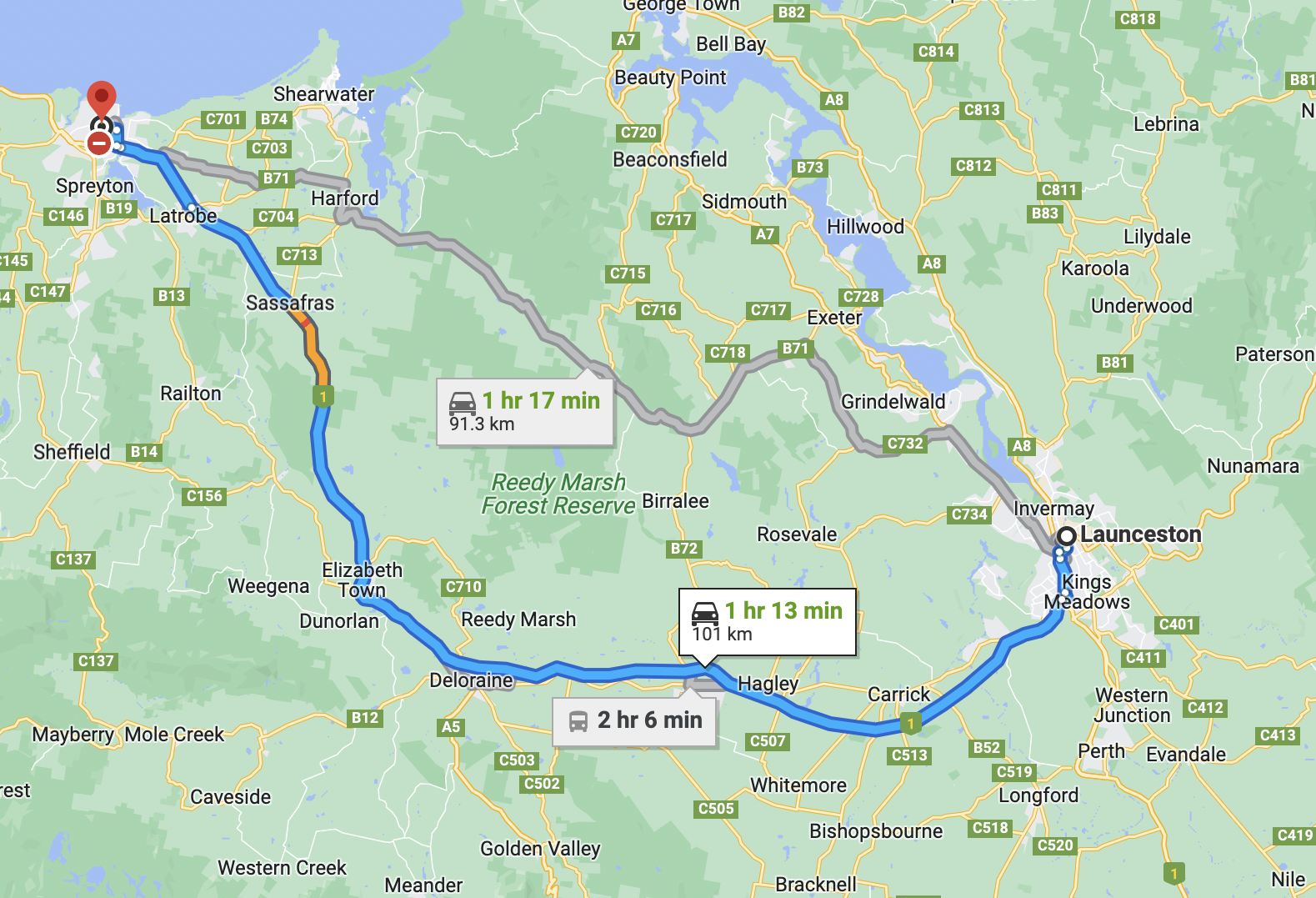
Above:- Map showing our route between Devonport and Launceston. Map c/o Google maps
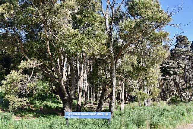
After breakfast we headed to the Don Heads Conservation Area VKFF-2903 for a park activation for the World Wide Flora Fauna (WWFF) program. The park is located to the west of Devonport and follows the coastline to Lillico Beach.
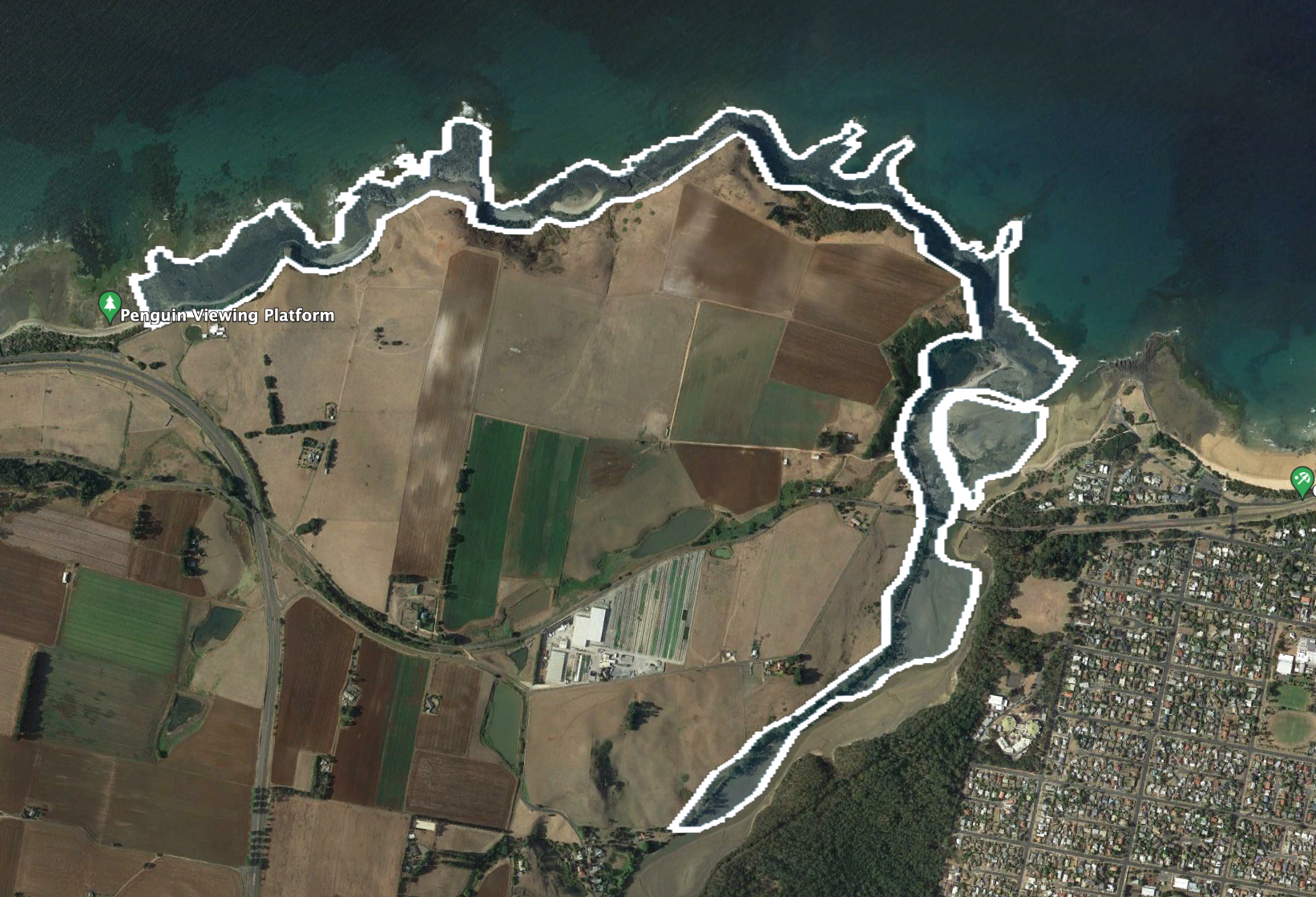
Above:- An aerial view of the Don Heads Conservation Area. Image c/o Google Earth.
The park takes its name from the small village of Don, just to the west of Devonport. The exact origin of the name Don for the town is unclear. One belief is that it was named after the River Don in South Yorkshire, England, by Henry Hellyer, surveyor for the Van Diemen’s Land Company. Hellyer passed through the area in 1826. A number of the Company’s pioneer settlers were from villages on the River Don in the United Kingdom.
Another possibility is that it was named after the River Don in Aberdeenshire, Scotland. The River Don in Tasmania flows through the locality of Aberdeen, near Spreyton, which was named by Scottish settlers. They may have named the river after Scotland’s River Don which flows through Aberdeenshire, Scotland.
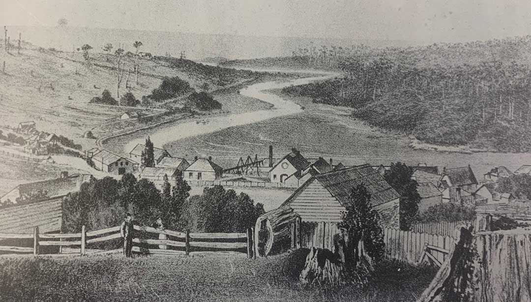
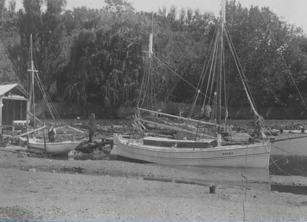
Above:- A view of Don, c. 1880. Image c/o Our Tasmania.
The original inhabitants of the Don Heads area were the Punnilerpanner aboriginal people. The first documented visit by Europeans was in January 1829 when Lieutenant Governor Sir George Arthur and Surveyor General George Frankland and their team swan their horses behind a whale boat across the mouth of the Don River.
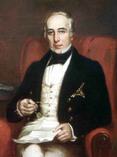
Above:- Sir George Arthur (left) and George Frankland (right). Images c/o Wikipedia and nre.tas.gov.au
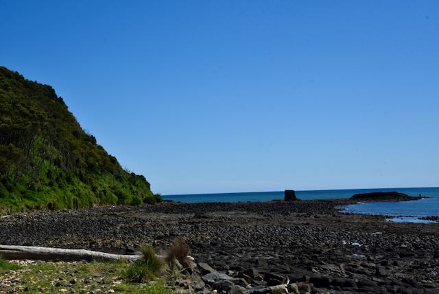
Don Heads is a rocky headland which is peppered with columnar basalt rocks along the shore. Basalt flows created the unusual coastal landforms that can be found at Don Heads.
The Don Heads area supports a wide variety of birdlife including a significant colonies of Little Penguins and Short tailed Shearwaters. The Shearwaters breed on Bass Strait islands and fly as far north as Siberia during their winter migration.


As we entered the park via Don Heads Road, we stopped briefly to view the memorial cairn for Thomas Drew and his wife. They are buried beside each other near the cairn. Drew died at Don Heads in 1857, while his wife Charlotte died in 1853

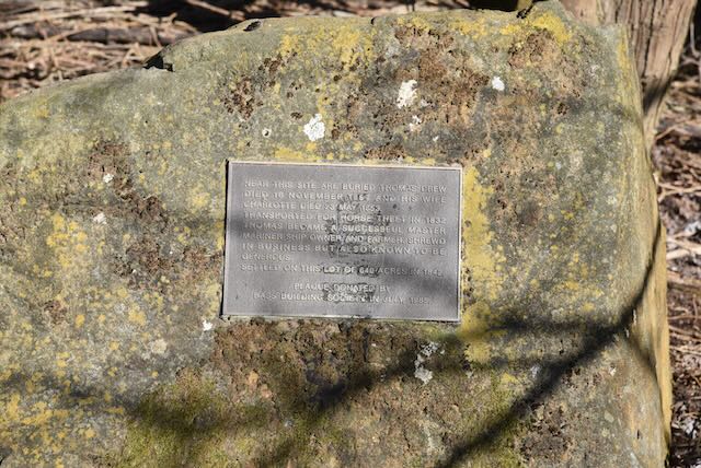
Drew was transported to Van Dieman’s :and in 1832 for horse theft. He became a successful Master Mariner ship owner and farmer. He was known to be shrewd in business but also known to be generous. Thomas and his wife Charlotte initially leaded 640 acres of land at Don Heads. In 1842 he purchased the land at a price of £384. The property was known as Sea View Farm. It is reported that he took up the land without it being put up for auction, as a result of recognition of his services in connection with the capture of bushrangers Joseph Broomfield and Josiah Hodgkins.
Drew also commenced a ferry service across the Don River charging one shilling a head. He built a house which stood on a hill overlooking the ocean. He owned two boats, ‘Water witch’ and ‘Charlotte’.
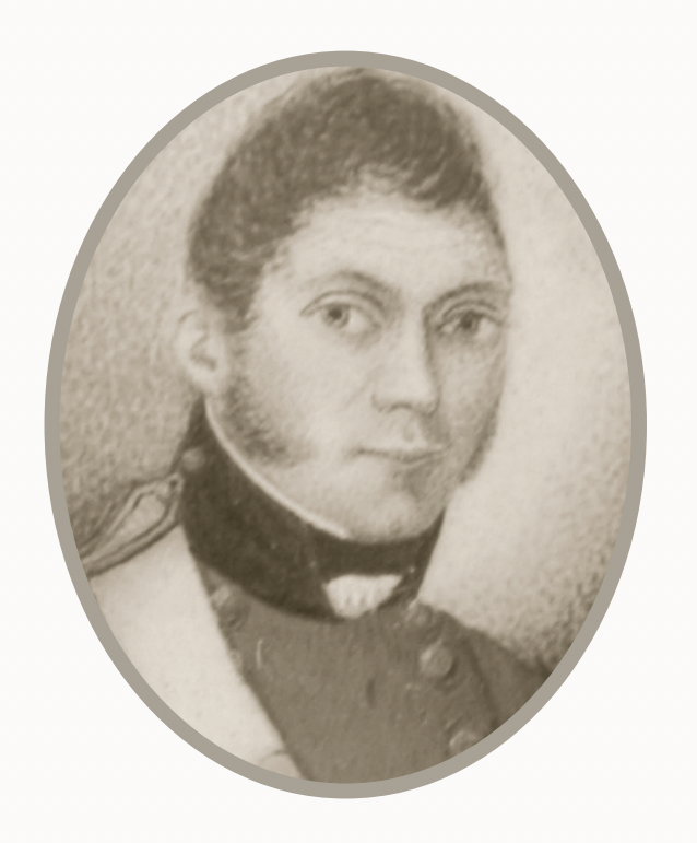
Above:- Thomas Drew and his boats. Image c/o Good Old Devonport Facebook page.
Before European settlement, the Don Heads area was heavily covered in thick forests which comprised of large eucalypts and other native species with a dense undergrowth. Drew employed convicts to clear his land. The timber from the felled trees was split into palings and shingles and was transported to wharves which were located on the western point of the Don River Mouth/ They were carted there by bullock and horse drawn carts and then shipped across Bass Strait for construction of the township of Melbourne.
In 1853 a saw mill was constructed By Edwin Cummings, on the left bank of the Don River. The logs were transported to the mill by a wooden tramway. The swan timber was then transported by barge to sailing vessels.
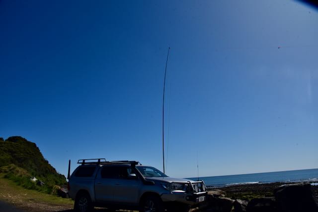
We drove to the end of Don Heads Road where there is a carpark adjacent to the Don River and Bass Strait.

Above:- An aerial view of the park showing our operating spot. Image c/o Google maps.
We ran out the 20/40/80m linked dipole for this activation and used the Yaesu FT857d in the vehicle.
Initially it was very quiet and we were the only ones in the carpark, but then other people started to arrive to go for bush walks, fish off the rocks, and another guy with his remote control 4WD.

Between the two os us we made a total of 58 QSOs in about an hour of being in the park. This included six Park to Park contacts, with VK2YAK, VK4YAK, and VK2OKR in the Coolah Tops National Park.
Marija worked the following stations on 40m SSB:-
- VK2IO
- VK4TJ
- VK5AV
- VK4NH
- VK4DXA
- VK2MET
- VK1AO
- VK3SQ
- VK5HS
- VK2EXA
- VK2PKT
- VK2OKR/p (Coolah Tops National Park VKFF-0111)
- VK2YAK/p (Coolah Tops National Park VKFF-0111)
- VK4YAK/p (Coolah Tops National Park VKFF-0111)
I worked the following stations on 40m SSB:-
- VK2IO
- VK4TJ
- VK5AV
- VK4NH
- VK4DXA
- VK2MET
- VK1AO
- VK3SQ
- VK5HS
- VK2EXA
- VK2PKT
- VK3PF/m
- VK3BYD/m
- VK2YAK/p (Coolah Tops National Park VKFF-0111)
- VK4YAK/p (Coolah Tops National Park VKFF-0111)
- VK2OKR/p (Coolah Tops National Park VKFF-0111)
- VK3VIN
- VK5CZ
- VK4KLA
- VK1DI
- VK3APJ
- VK3BBB
- VK2CCP
- VK4EKA
- VK3MTT
- VK3AHR
- VK3SMW
- VK3GSR
- VK2DA
- VK1DA
- VK5AYL
- VK5KLV
- VK3GJG
- VK5HW
- ZL3RIK
- ZL3YB
- VK2VH
- VK4AAC
I worked the following stations on 20m SSB:-
- VK2VW
- VK2HFI
- VK4TJ
- VK4NH
- VK4DXA
- VK4JT
References.
- Devonport, 2022, <https://www.devonport.tas.gov.au/park-recreation/don-heads/>, viewed 10th December 2022.
- Good Old Devonport Facebook page, 2022
- Our Tasmania, 2022, <https://www.ourtasmania.com.au/northwest/don-about.html>, viewed 10th December 2022.
- Trove, 2022, The North West Post, Wed 24 March 1915.
