
It was day twelve (Monday 7th November 2022) of our Tasmania holiday and we had planned a trip to Bruny Island.
We drove south out of Hobart on the Channel Highway to the little town of Kettering, about 32 km south of Hobart. This is where you catch the ferry to Bruny Island.
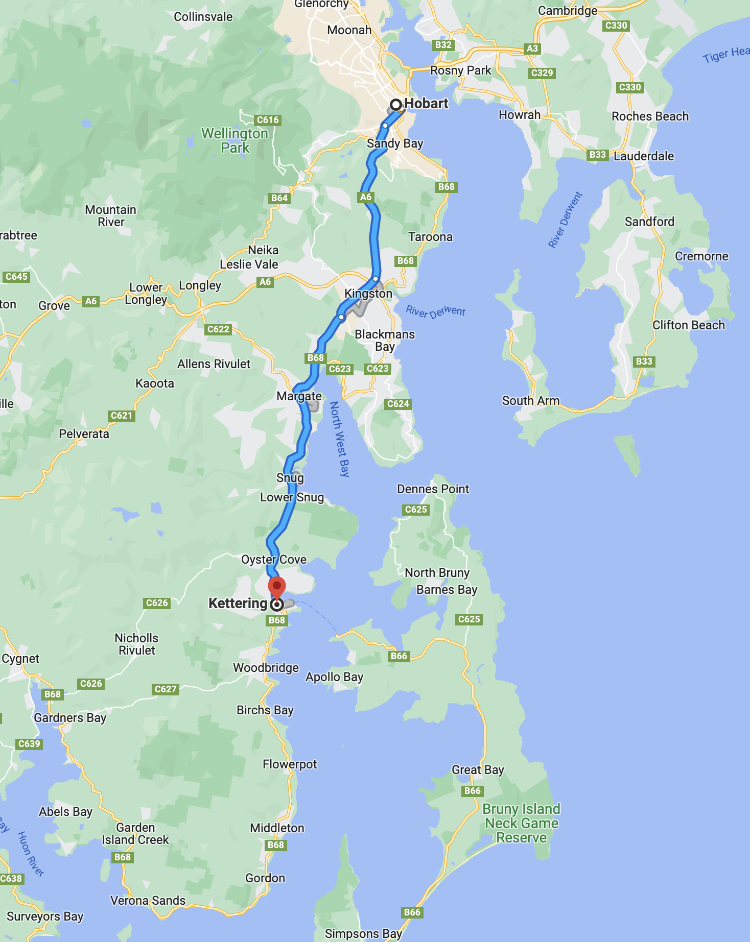
Above:- Map showing our route from Hobart to Kettering. Map c/o Google maps.
The area where Kettering is now located was explored by Antoine Bruni D’Entrecasteaux in 1792. He was a French naval officer, explorer, and colonial governor . By the early 1800s the Kettering area had been settled by European timber cutters, whalers, and sealers.
A dark piece of Australian history lies near Kettering. In 1847, just north of Kettering in Oyster Cove, the last Tasmanian Aboriginal settlement was established. In the years leading up to 1847, indigeneous people from around Van Dieman’s Land had been rounded up and isolated at Settlement Point on Flinders Island in Bass Strait. It was known as Wybalenna, meaning “Black Man’s House.
In 1847, the remaining 44 aboriginal people were taken to a former convict settlement at Oyster Bay. This was following a campaign by the aboriginal population against their Commandant, Henry Jeanneret. It included a petition to Queen Victoria,
Eight years later in 1855, only 16 remained. And by 1869, the sole remaining aboriginal person was Truganini. She died in 1876.
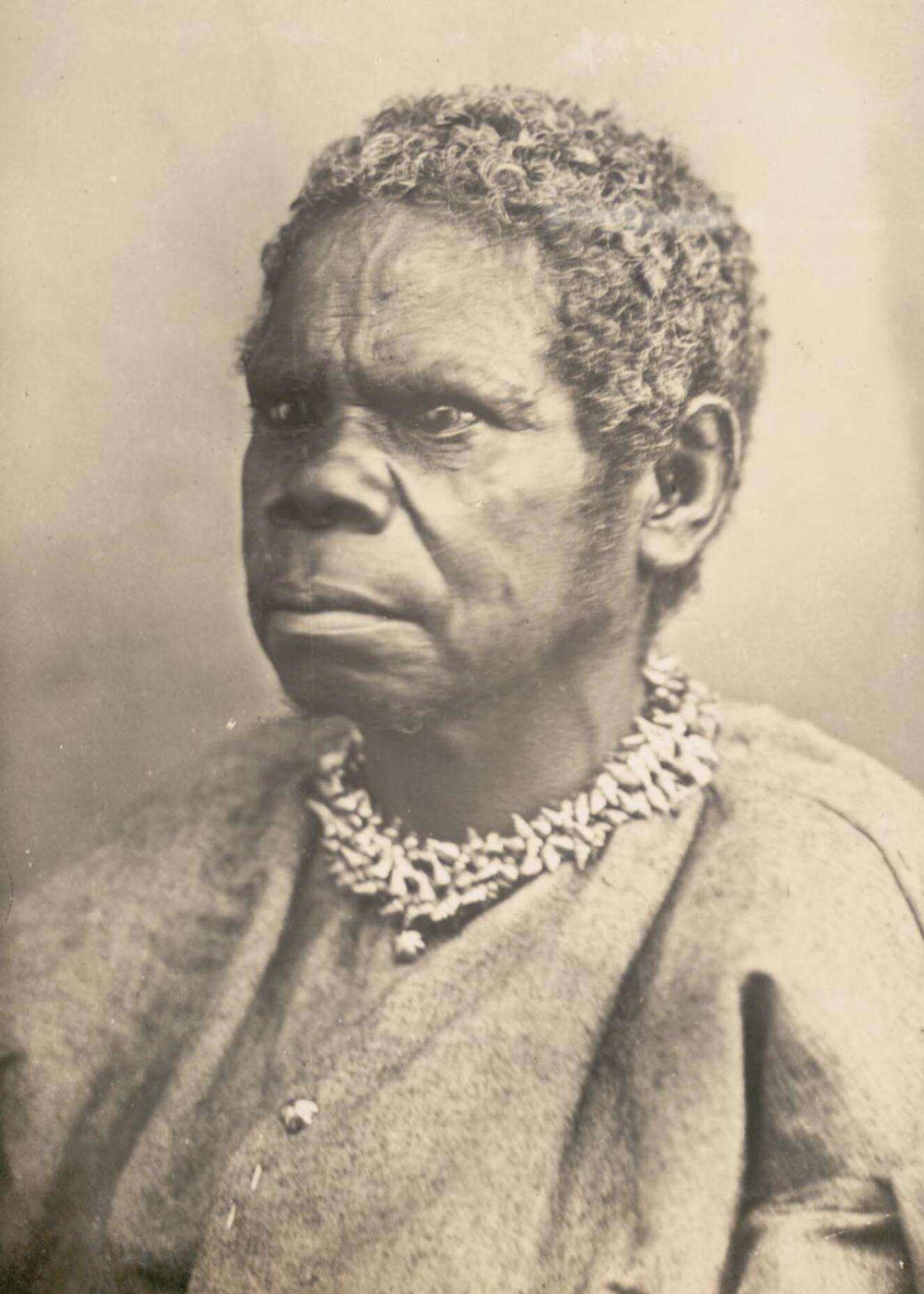
Above:- Truganini. Image c/o Wikipedia.
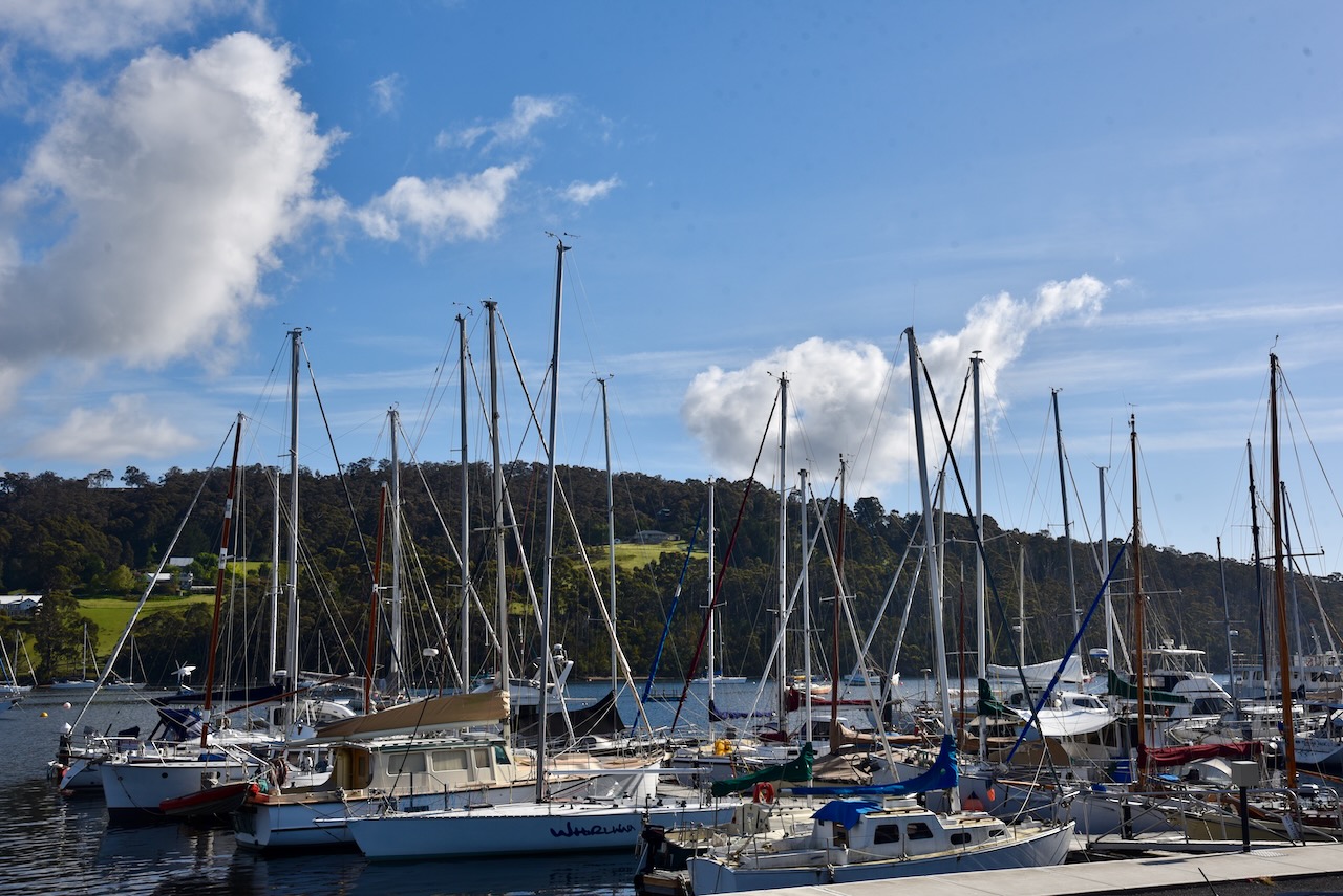
Today the Kettering area is renowned for its apple, cherry, and pear orchards. Kettering is also popular with fishers. There are two major marinas at Kettering.
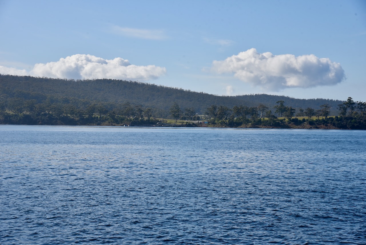
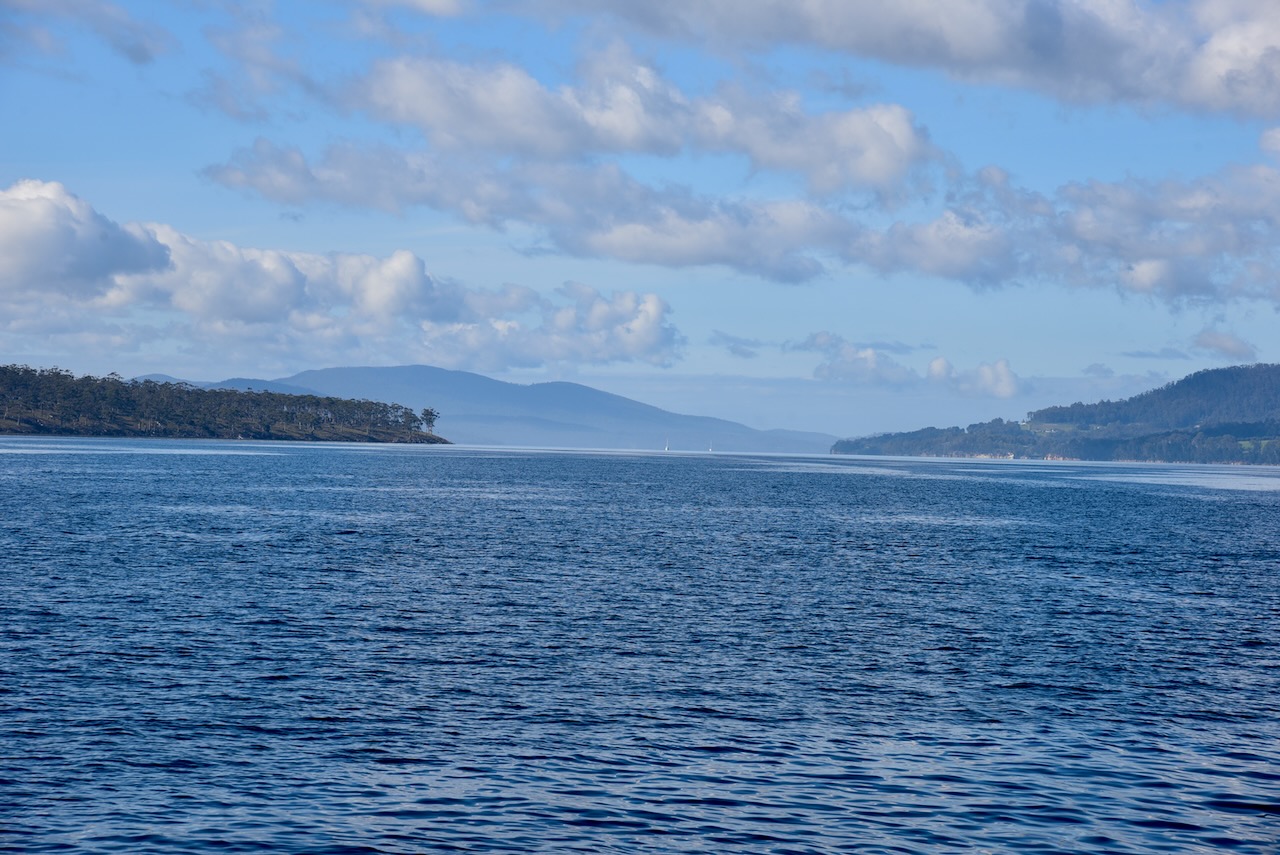
It is only a short journey from the mainland across to Bruny Island.
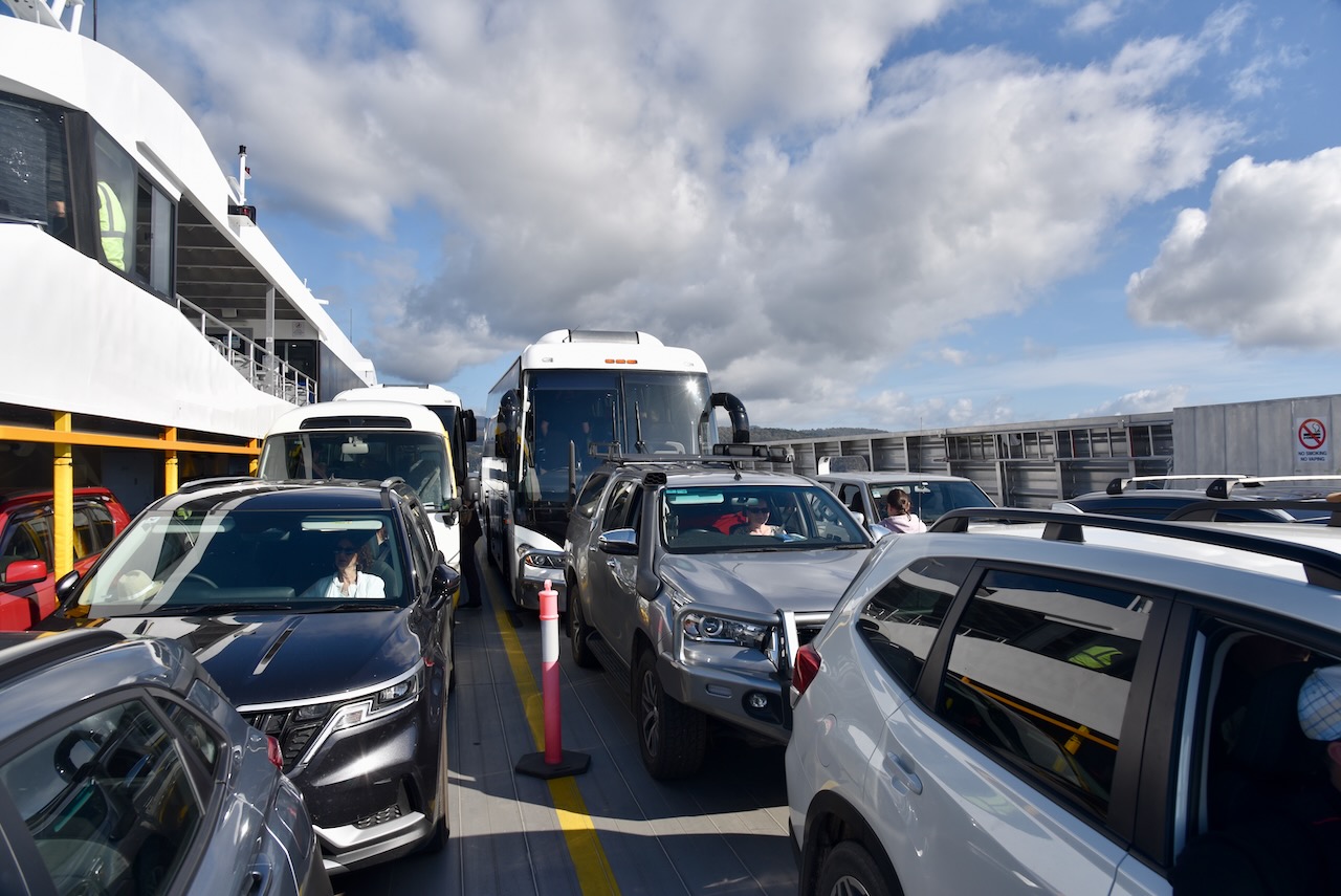
It was a beautiful sunny day and we enjoyed some amazing views as we crossed the D’Entrecasteaux Channel to Bruny Island.
Bruny Island is 362 square kilometres in size and is about 50 kilometres in length. Its traditional Aboriginal name is lunawanna-allonah. Bruny Island is two land masses: North Bruny and South Bruny, which are joined by a long narrow sandy isthmus referred to as “The Neck’.
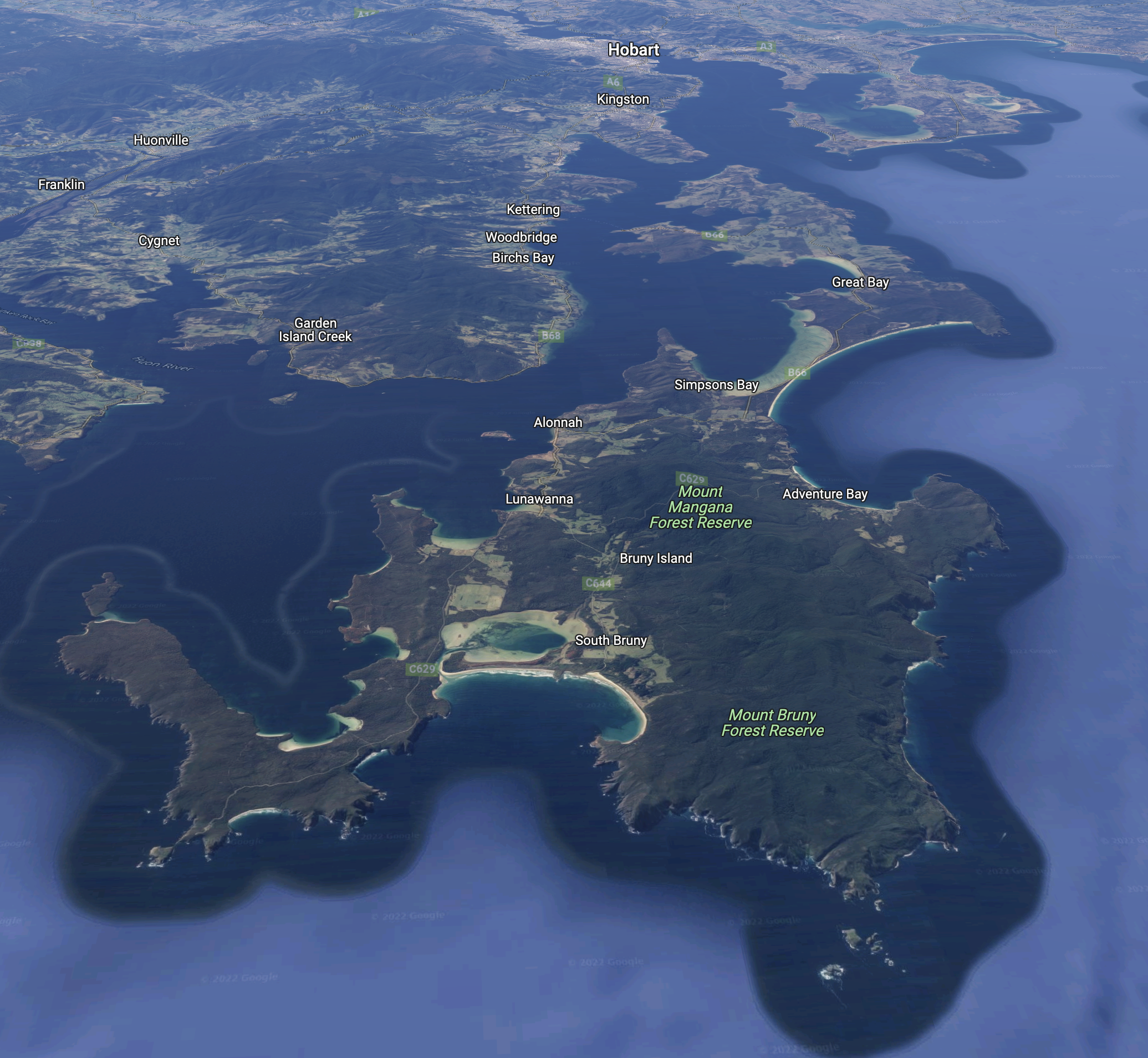
Above:- an aerial view of Bruny Island looking north towards Hobart. Image c/o Google maps.
Bruny Island was originally inhabited by aboriginal people prior to the arrival of the Europeans. The firt recorded European explorer to land on Bruny Island was Tobias Furneaux in 1773. He landed at Adventure Bay, named after his ship. In 1642 Dutch seafarer, merchant, and explorer Abel Tasman had attempted to land in the vicinity of Adventure Bay but was unsuccessful.er 1642.
Above:- Captain Tobias Furneaux. Image c/o Wikipedia.
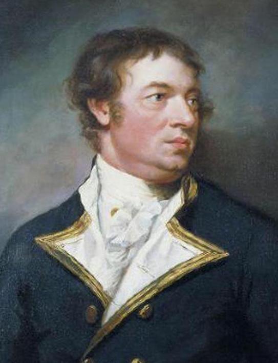
Bruny Island was named in honour of French explorer Antoine Bruni d’Entrecasteaux. He explored the Channel regio and discovered it to be an island in 1792. Up un til 1918, Bruny Island was known as Bruni Island until 1918. The spelling was then changed to Bruny.
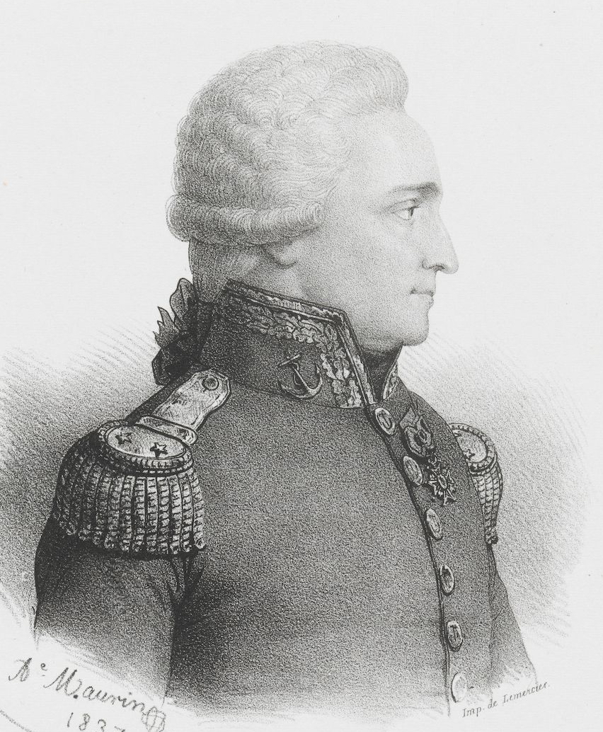
Above:- Antoine Bruni d’Entrecasteaux. Image c/o Wikipedia.
Below is a video with drone footage of Bruny Island.
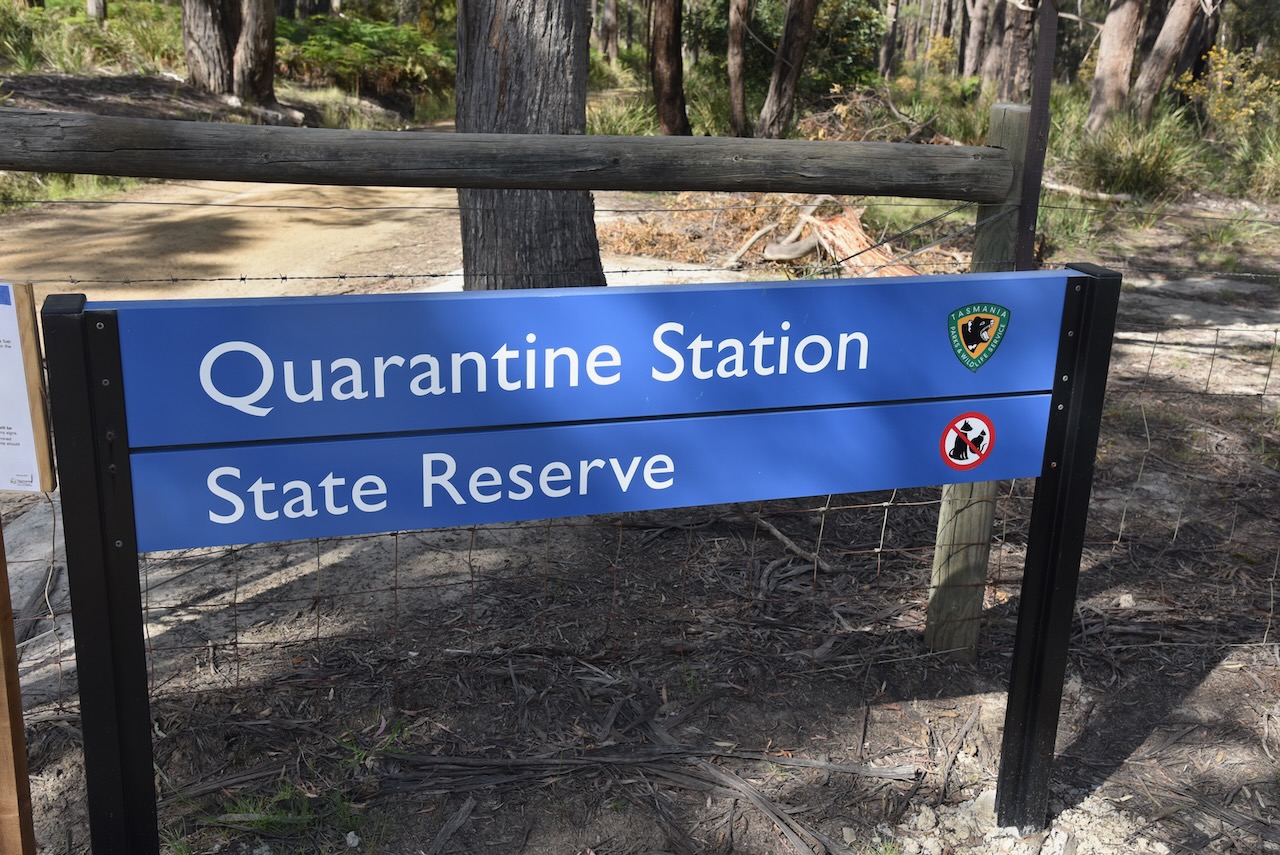
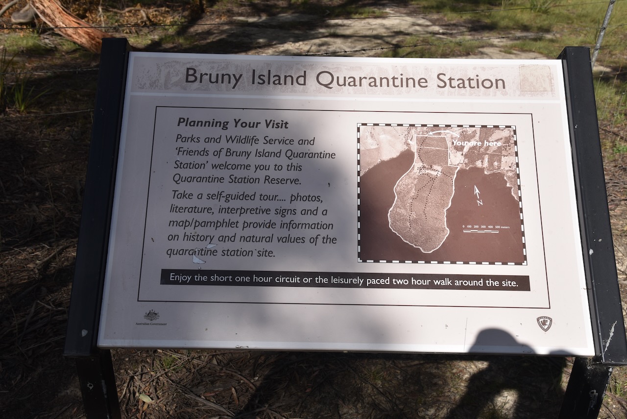
After our arrival on the island we decided to head to Quarantine Station State Reserve VKFF-1823 for a park activation for the World Wide Flora Fauna (WWFF) program. Bruny Island also qualifies for the Islands On The Air (IOTA) program as OC-233.
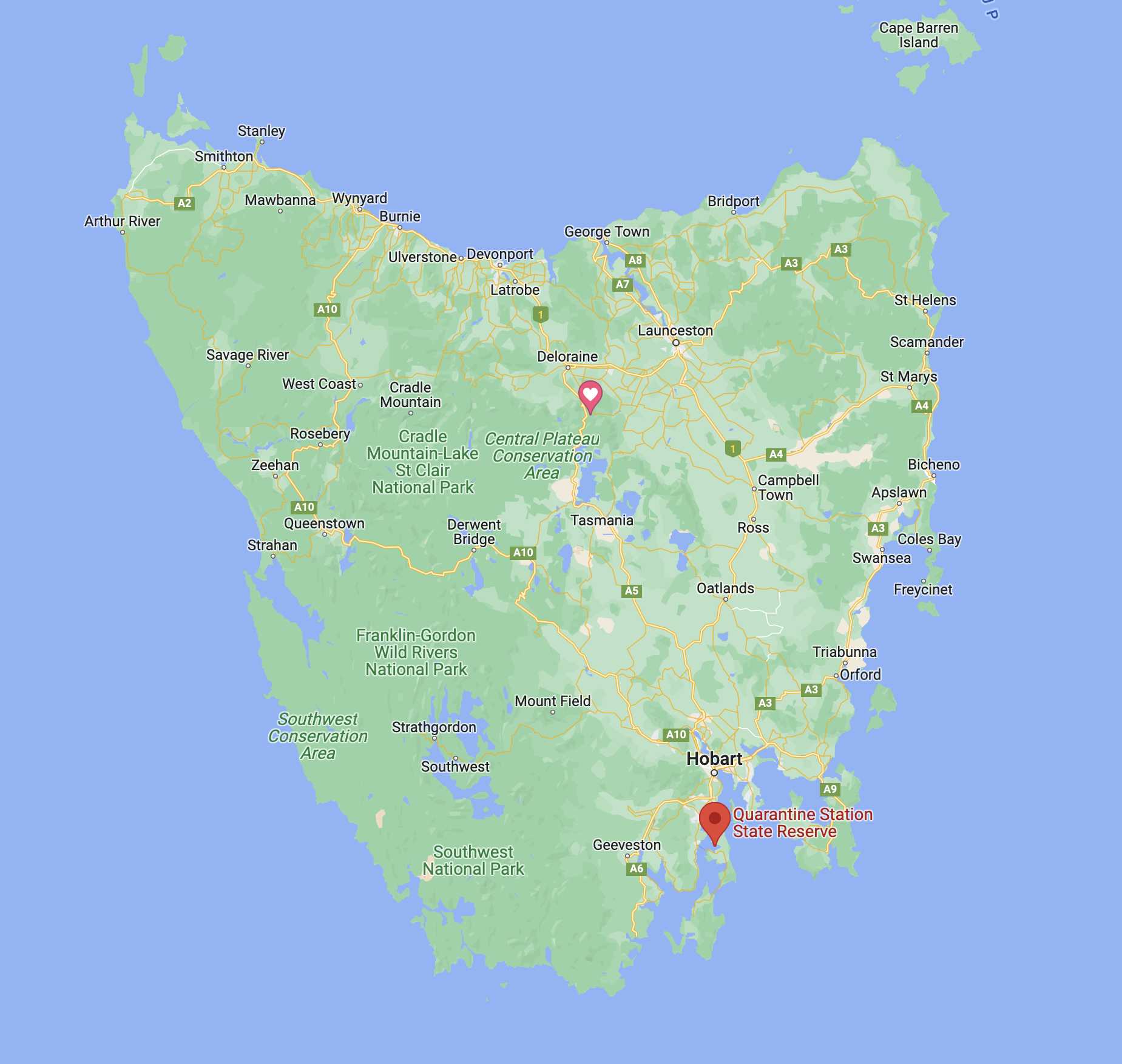
Above:- Map of Tasmania showing the location of the Quarantine Station State Reserve. Map c/o Google maps.
The Quarantine Station State Reserve is located at Barnes Bay on North Bruny Island. It was proclaimed as a State Reserve in 2003, and is 320 acres in size.
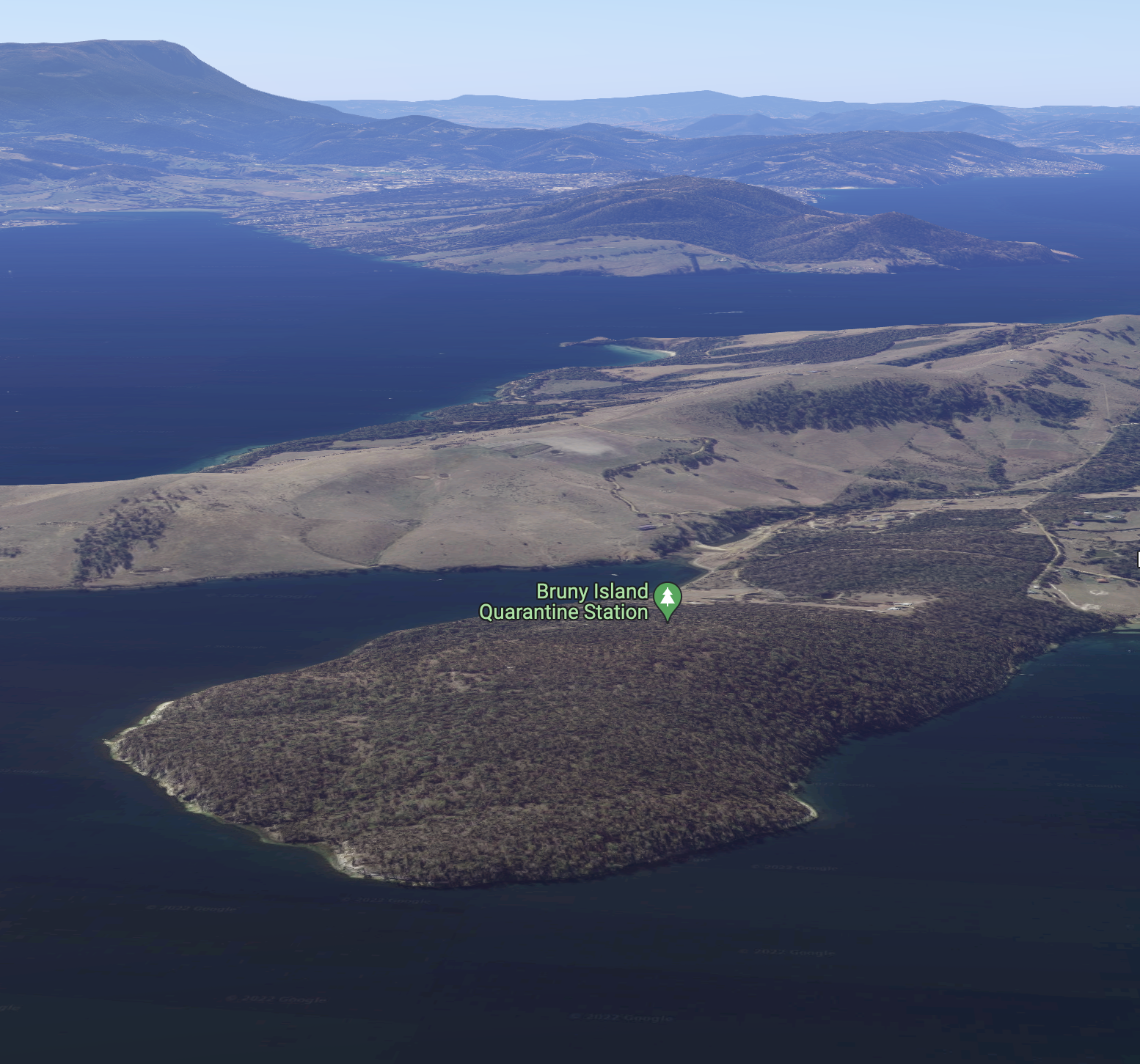
Above:- An aerial shot of Quarantine Station State Reserve. Image c/o Google maps
We arrived at the park entrance on Killora Road a little early. The park had not yet opened and the gate was padlocked. We waited a short time until the park ranger came down to open the gate.
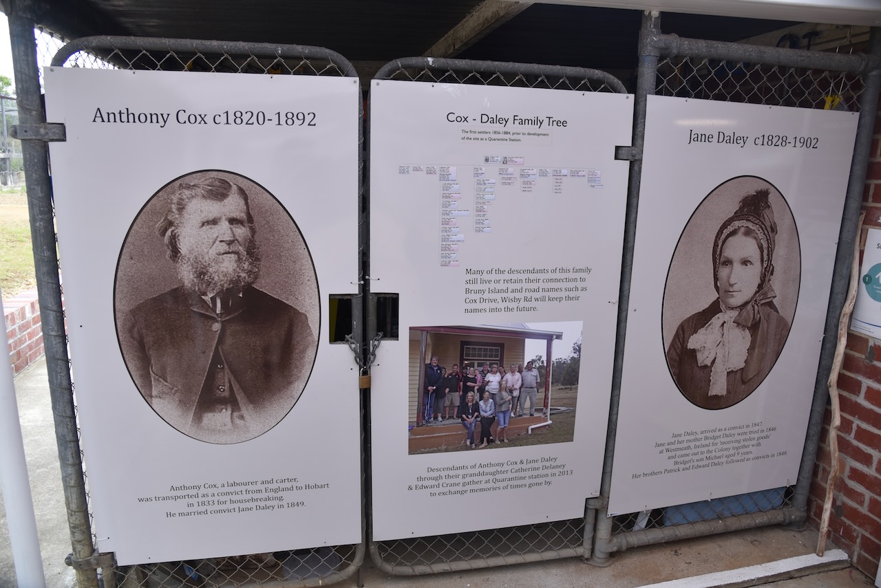
Prior to the area becoming a quarantine station, it was occupied by a former convict and his family. In 1833, Anthony Cox was convicted of housebreaking in England. He was transported from England to Van Dieman’s Land. In May 1849 he was granted a conditional pardon and soon after he married Jane Daly, also a convict.
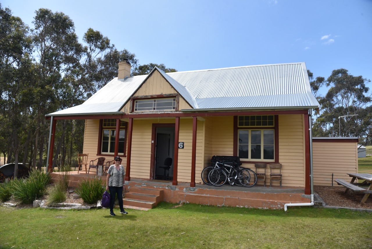
Due to him being a former convict of “good conduct and disposition to industry”, he received a 19-acre parcel of land from the government. This was on the site which would later become the quarantine station. He built Shelwood Cottage on his parcel of land.
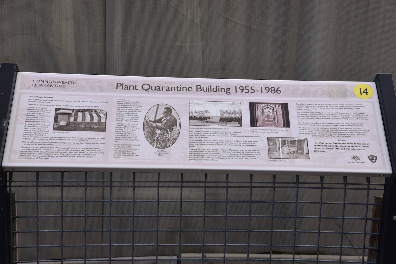
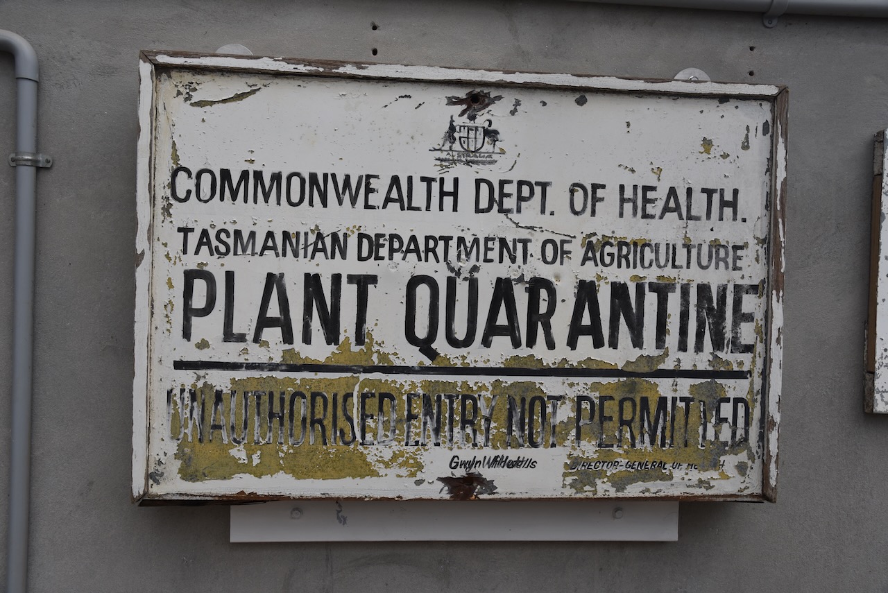
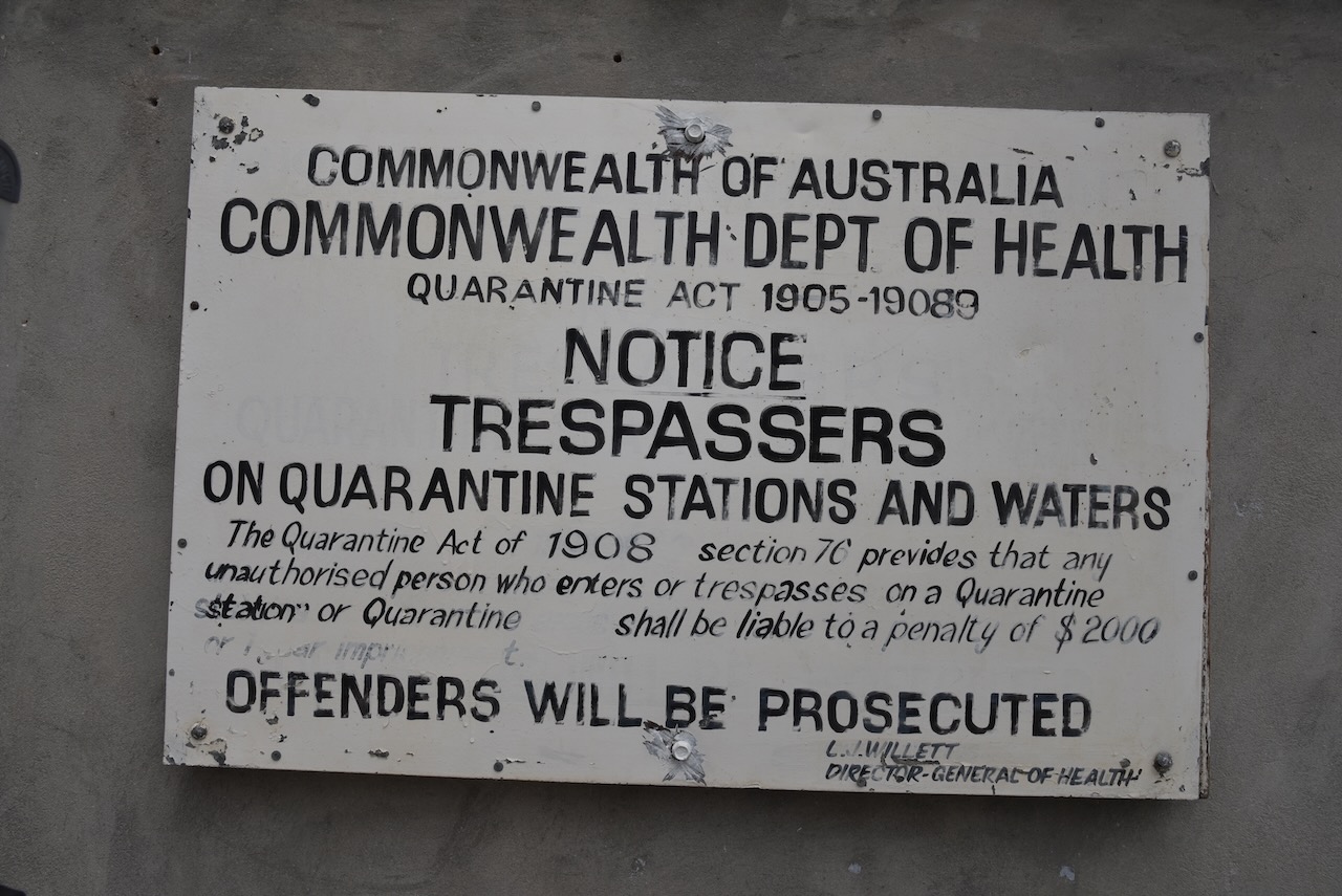
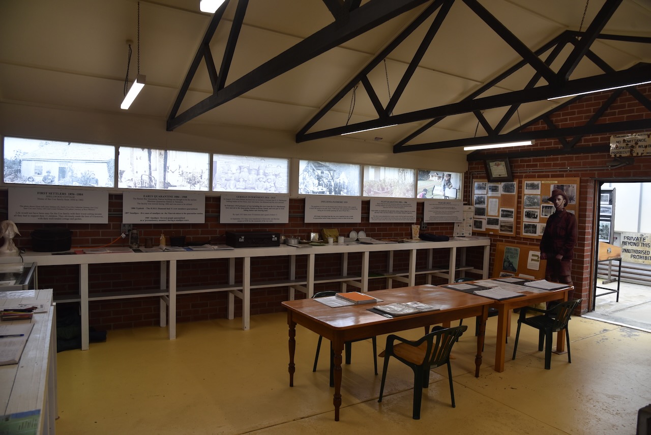
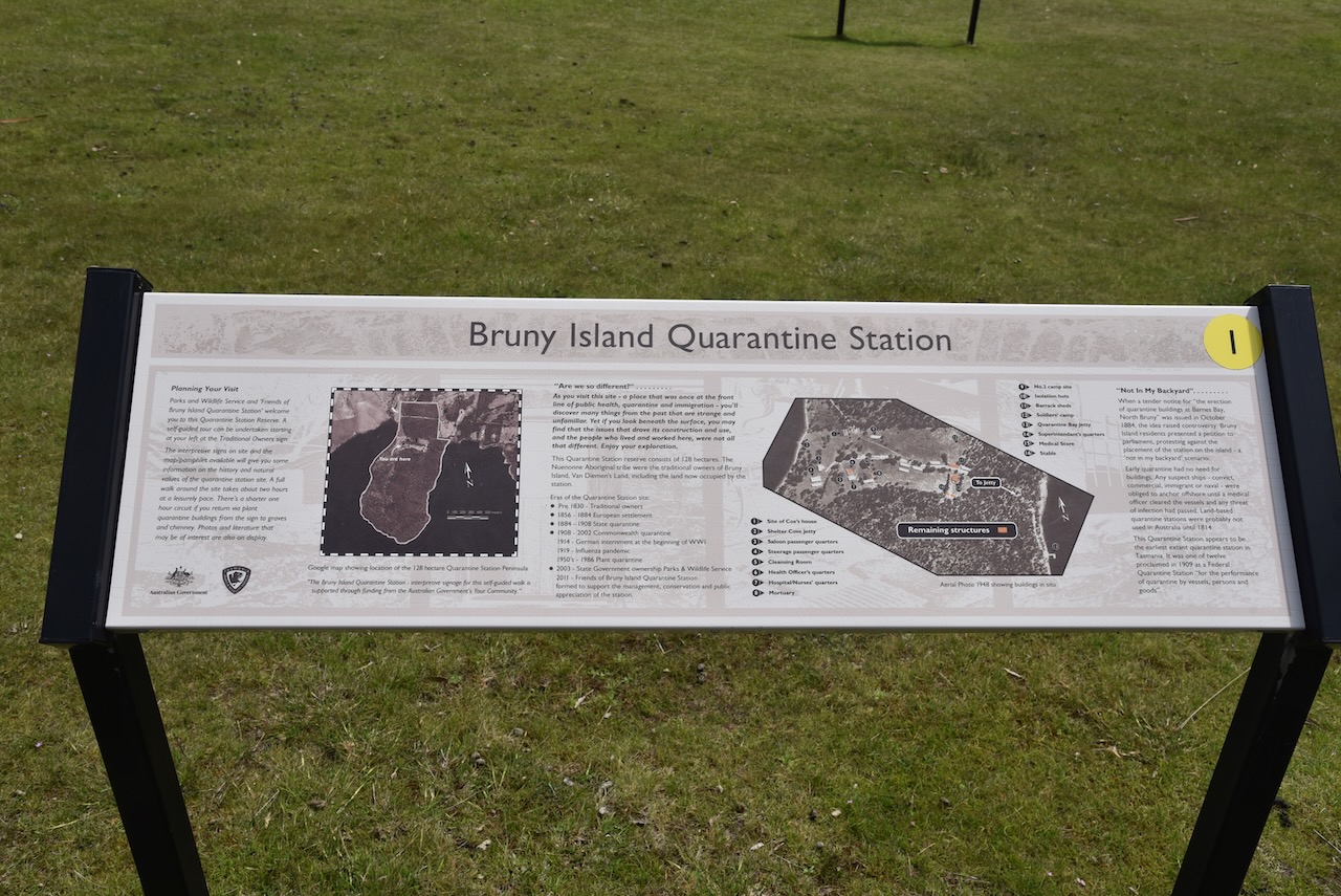
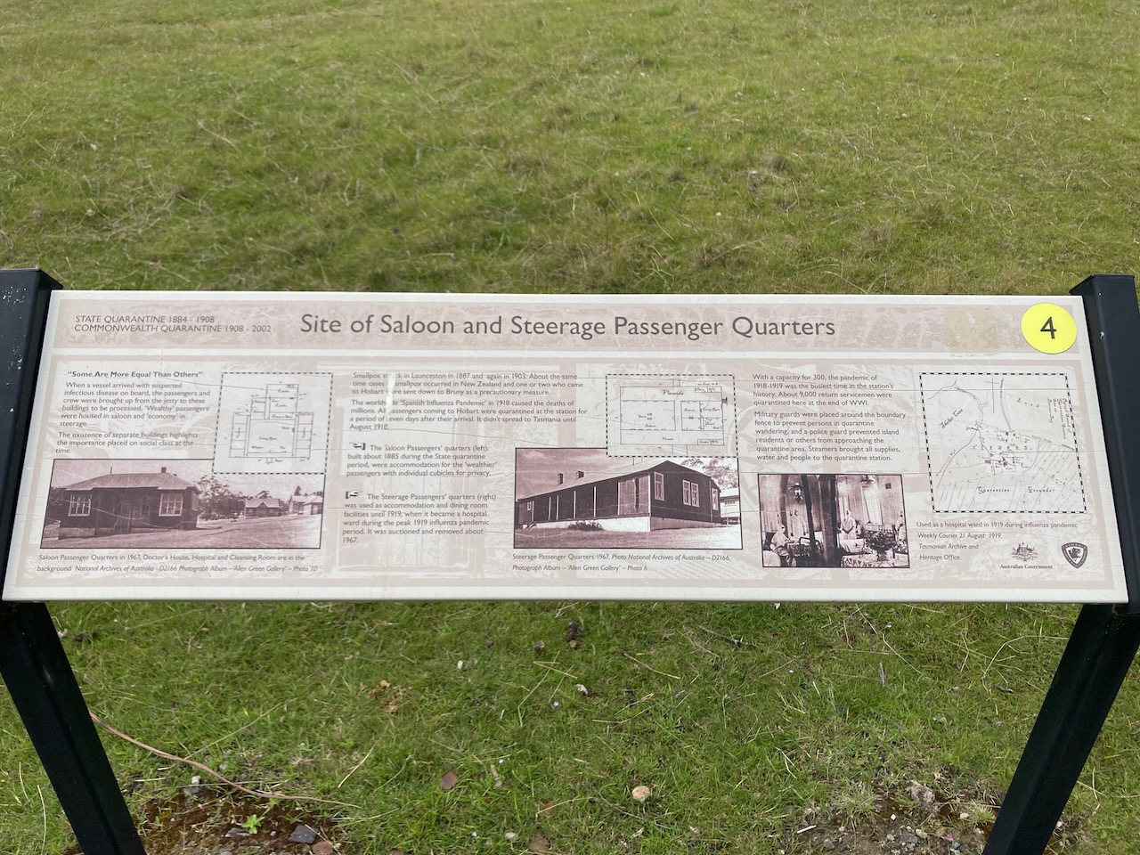
From 1884 to 1904 a State quarantine operated on the site. Between 1908 to 2002 it became a Commonwealth quarantine station ‘for the performance of quarantine by vessels, persons, and goods’.
During the First World War, German internment took place at the station. “Enemy subjects” in Tasmania were interned at Quarantine Station. They were put to work felling timber and clearing land. By April 1915 there were 70 internees, watched by about 15 guards.
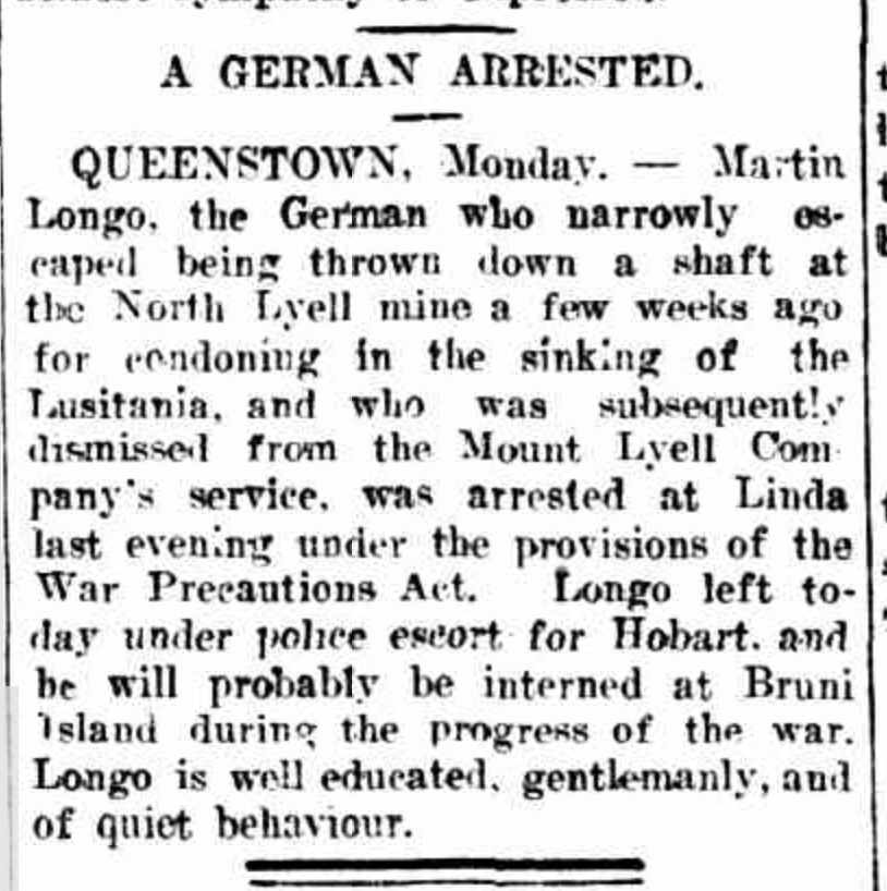
Above:- Article from the Daily Telegraph, Launceston, Tue 1 Jun 1915. Image c/o Trove.
Due to the worldwide outbreak of the Spanish influenza pandemic in 1918, it was necessary to quarantine Australian troops returning home from the First World War. Over 9,000 Australian troops passed through the station between February 1919 to August 1919.
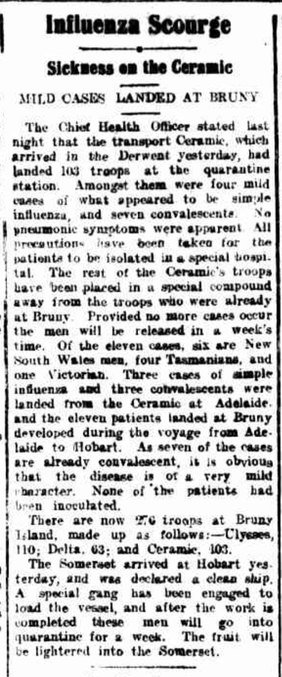
Above:- Article from the Examiner, Launceston, Wed 12 Mar 1919. Image c/o Trove.
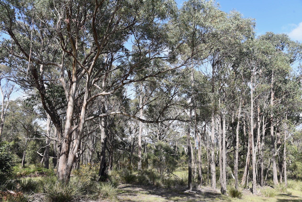
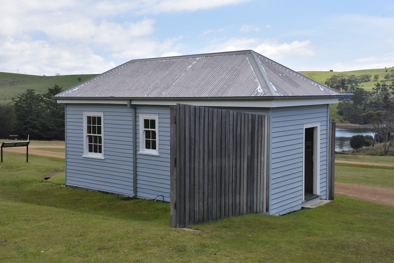
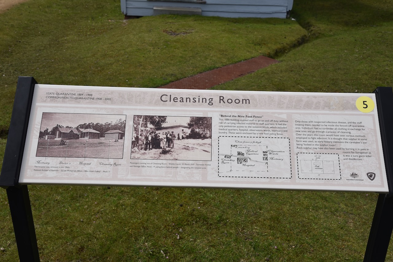
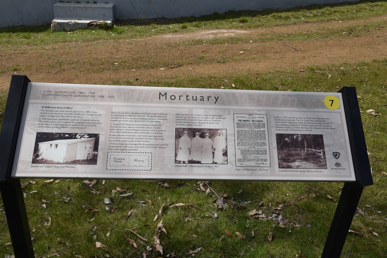
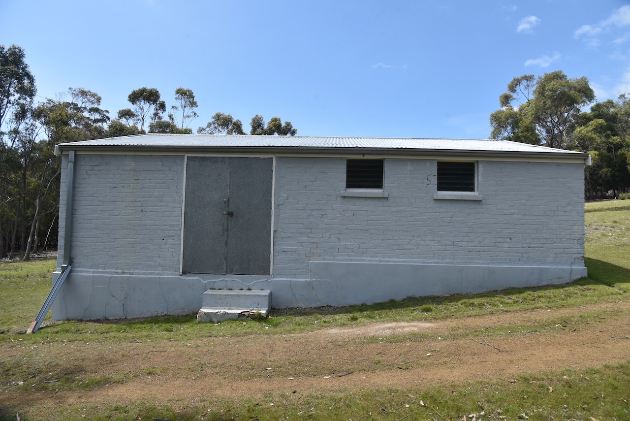
Many of the quarantine buildings remain at the Quarantine Station and there are numerous interpretive signs explaining the history of the site.
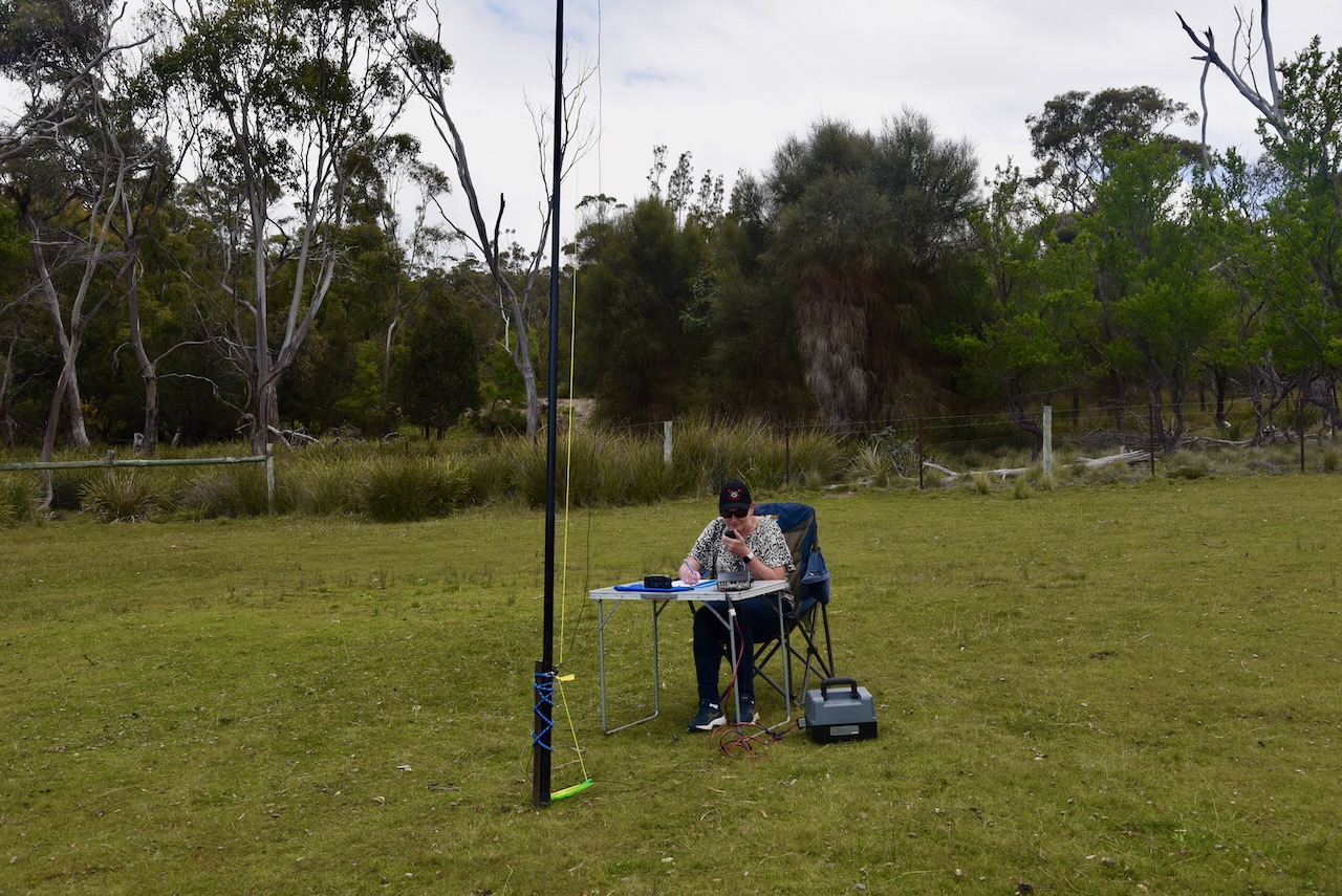
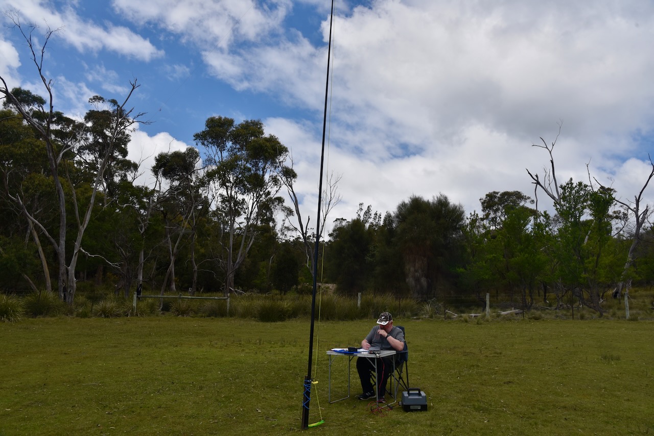
Prior to setting up we spoke with the park rangers who were extremely friendly. We set up on a lawned area adjacent to the visitors carpark.
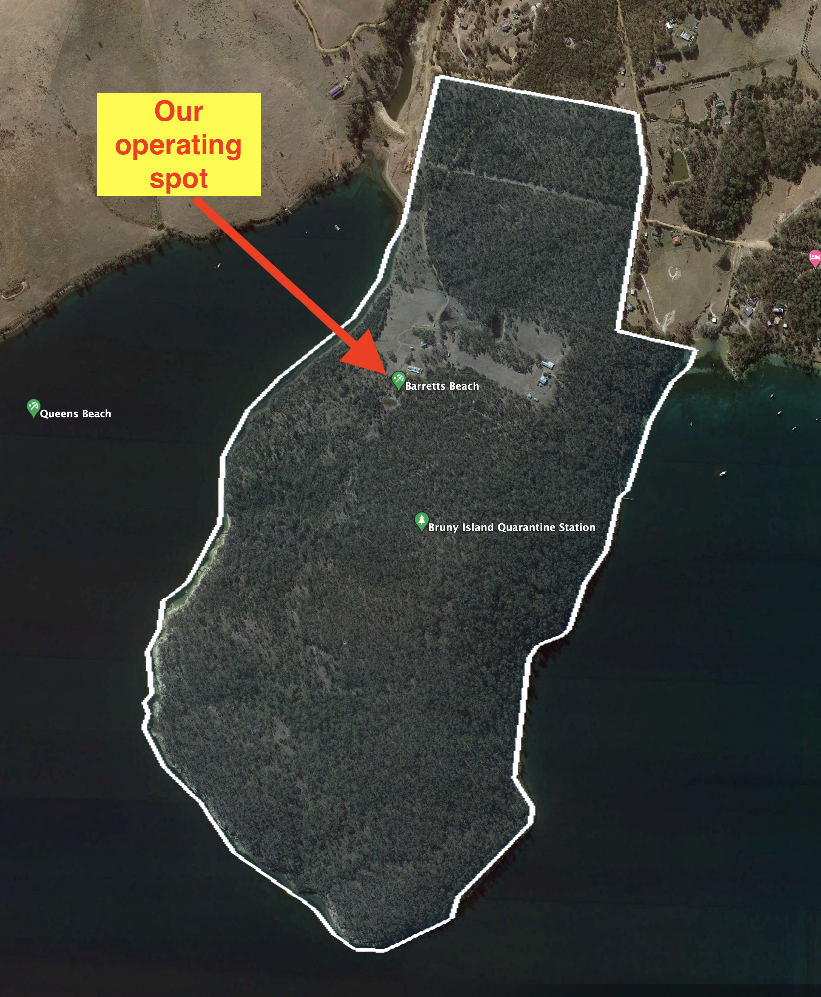
Above:- an aerial view of the park showing our operating spot. Image c/o Google Earth.
We ran the Yaesu FT-857, 40 watts, and the 20/40/80m linked dipole for this activation.
We had set up about 30 minutes prior to the UTC rollover, so we used that to advantage. Contacts prior to and after the UTC rollover count towards the 44 QSOs required to qualify the park for the global WWFF program.
Both Marija and I qualified the park for the VKFF program, with 10 QSOs. I pushed on and made 45 QSOs, qualifying the park for the global WWFF program. Conditions on the 40m band were quite good, but sadly I only made one contact on the 20m band with John VK4TJ.
It was good to get a Park to Park contact with VK2HQ/p at Bomaderry Creek Regional Park VKFF-1779.
Marija made the following QSOs on 40m SSB:-
- VK2HQ/p (Bomaderry Creek Regional Park VKFF-1779)
- VK3PF
- VK2IO
- VK3SQ’VK3VIN
- VK3AMO
- VK2MET
- VK1AO
- VK3AWA
- VK2HHA
- VK3CMC
I made the following QSOs on 40m SSB before the UTC rollover:-
- VK2HQ/p (Bomaderry Creek Regional Park VKFF-1779)
- VK3PF
- VK2IO
- VK3SQ
- VK3VIN
- VK3AMO
- VK2MET
- VK1AO
- VK3AWA
- VK2HHA
- VK3CMC
- VK3UAO
- VK3GMC
- VK5BJE
- VK4KLA
- VK5MRS
- VK3MKE
- VK3BBB
- VK2CCP
- VK2EXA
- VK2ABT
- VK2VAR
- VK2HRX
I worked the following stations on 40m SSB after the UTC rollover:-
- VK2VAR
- VK2EXA
- VK3UH
- VK2IO
- VK3PF
- VK3MKE
- VK3AWO
- VK3GRX
- VK3TPM
- VK3ZSC
- VK3PT
- VK3MCA
- VK3DW/p
- VK3SQ
- VK3AHR
- VK3ARK/p
- VK3UAO
- VK2MET
- VK1AO
- VK2NP
- VK7AN
I worked the following station on 20m SSB:-
- VK4TJ
References.
- BBC, 2022, <https://www.bbc.com/travel/article/20200505-tasmanias-ruggedly-beautiful-quarantine-site>, viewed 29th December 2022.
- Bruny Island Community Association, 2022, <https://www.bica.org.au/biqshistory>, viewed 29th December 2022.
- Wikipedia, 2022, <https://en.wikipedia.org/wiki/Kettering,_Tasmania>, viewed 29th December 2022.
- Wikipedia, 2022, <https://en.wikipedia.org/wiki/Bruny_Island>, viewed 29th December 2022.
- Wikipedia, 2022, <https://en.wikipedia.org/wiki/Antoine_Bruni_d%27Entrecasteaux>, viewed 29th December 2022.
- Wikipedia, 2022, <https://en.wikipedia.org/wiki/Flinders_Island>, viewed 29th December 2022.
