
Day eight (Friday 23rd November 2018) had arrived. It was time to leave Marysville and head to Sorrento on the Mornington Peninsula. We had about a 164 km drive ahead of us.
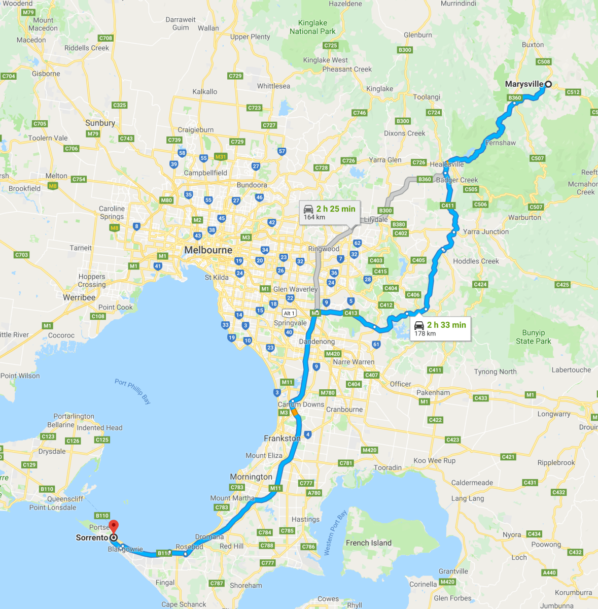
Above:- Map showing our intended travel route from Marysville to Sorrento. Map courtesy of google maps
It was breakfast again at Fragas Cafe at Marysville, and then on the road, heading south west out of Marysville on the Marysville Road and then the Maroondah Highway. We soon entered the Yarra Ranges National Park, passing through spectactular rainforest.


We decided to stop briefly at the Fernshaw Picnic area and do some activating from the car. Sadly it was too wet to operate from the car, so I ran the Icom IC-7000 from the Toyota Hi Lux with the Codan 9350. Not the set up I would have liked, but I didn’t have any other option, it was just too wet.
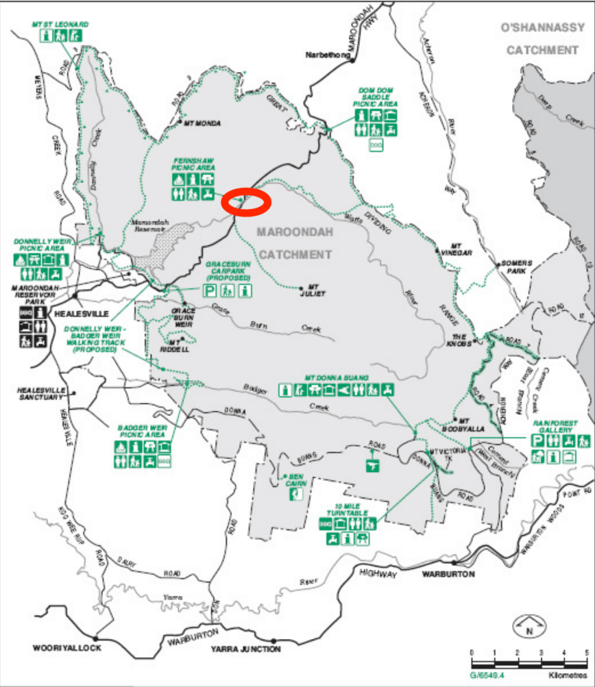
Above:- Map of the Maroondah section of the Yarra Ranges National Park, showing our operating spot. Image courtesy of Parks Victoria.
The weather was a real shame, as this was a beautiful picnic area, with a number of picnic tables scattered throughout a European garden area. There were a number of information boards here, some of which had seen better days with the effects of weather and graffiti.
This area was a popular rest point for miners travelling along the Yarra Track to the Woods Point goldfields, and was known as Watts. It eventually developed into the township of Fernshaw by the mid 1800’s. The meaning of the word Fernshaw is believed to be from an old English word ‘shaw’, meaning a grove, thicket or wood. Hence, Fernshaw, means a thicket of ferns.


The area was settled by timber-sploitters, road markers, fruit growers and teamsters and surveyed in 1865. By the 1870’s the forest was reserved for water catchment and further applications for saw milling was declined. In 1871 the Fernshaw Rural School was established to support 29 students. By the period 1870’s to 1880’s, Fernshaw’s magnificent scenery had made it Victoria’s most popular tourist destination. ver an 8 day period in 1885, Cob and Co. Coaches carried a total of 1,064 people on the Healesville-Marysville route. On the 17th day of May 1890 a closing down sale for the village of Fernshaw was held. Buyers were given 14 days to remove their purchases, with the remnants burnt.


I started calling CQ on 7.144 and it wasn’t long before Andy VK5LA came back to me call with a strong 5/9 signal from the Riverland of South Australia. Andy kindly placed a spot up for me on parksnpeaks. Next in the log was Rod VK7FRJG, followed by Peter VK2KNV and Liz VK2XSE who were mobile.
I logged a total of 11 stations on 7.144 before the callers dried up, so I tuned across the band and joined the 10am Smoko Net on 7.105. I there logged 3 stations, but unfortunately net control was having difficulty in hearing me.
It had just clicked over the UTC rollover, so I headed back up to 7.144 and called CQ again, logging 5 stations. I then moved down to 3.610 on the 80m band where I logged Peter VK3PF/VK3KAI. I now had sufficient stations in the log to qualify the park, and it was time again to hit the road and head into Healesville.


I worked the following stations on 40m SSB before the UTC rollover:-
- VK5LA
- VK7FRJG
- VK2KNV/m
- VK2XSE/m
- VK2GKA
- VK5FMWW
- VK2YW
- VK2XXM
- VK4TJ
- VK4/AC8WN
- VK4/VE6XT
- VK5FUZZ
- VK5IS
- VK5FIVE
I worked the following stations after the UTC rollover:-
- VK5HS
- VK2IO
- VI2WG50
- VK2XSE/m
- VK2KNV/m
I worked the following stations on 80m SSB:-
- VK3PF
- VK3KAI
References.
Parks Victoria, 2018, <https://parkweb.vic.gov.au/explore/parks/yarra-ranges-national-park/things-to-do/fernshaw-picnic-area>, viewed 17th December 2018
