
After leaving Price, Marija and I drove south along the Yorke Highway for about 21 km and we soon reached the town of Ardrossan, where we planned on activating the Ardrossan silo VK-ARN5 for the Silos On The Air (SiOTA) program..
Ardrossan is about 153 km (by road) from the city of Adelaide, and is located on the eastern coast of the Yorke Peninsula.

Above:- Map showing the location of Ardrossan. Map c/o Google maps.
Prior to European occupation, the area around Ardrossan was occupied by the Narungaa aboriginal people. The Narungaa people comprised four distinct clans on the Gurranda (the Yorke Peninsula. They being the Kurnara in the north, Dilpa in the south, Wari in the west, and Windarra in the east.
The town of Ardrossan was proclaimed on the 13th day of November 1873. It was named by South Australian Governor Sir James Fergusson (b. 1832. d. 1907) in honour of a seaport in Ayrshire, Scotland. Ardrossan is derived from the Celtic words ardross – ‘high’ and rosan – ‘cape’. The town was chosen due to its potential for shipping infrastructure which allowed wheat farmers to ship their produce across Gulf St Vincent to Port Adelaide.

Above:- Governor Sir James Fergusson. Image c/o Wikipedia.
The area was originally known as ‘Clay Gully’ or ‘Parara’. Parara was the name of a property taken up in 1852 by William Sharples. Parara was a Narungaa aboriginal word meaning ‘middle’. The Parara homestead was situated about 3 km south of Ardrossan.
On the 19th day of June 1873, the Hundred of Cunningham was proclaimed, and surveying of the land commenced. By 1878 Ardrossan township had six houses, a post office, a flour mill, a Methodist church, a hotel, and a school which had 53 pupils.
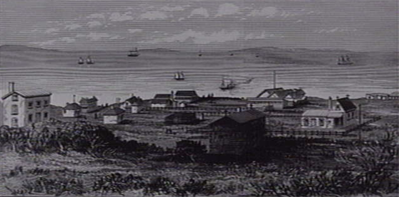
Above:- Ardrossan, c. 1879. Image c/o State Library of Victoria.
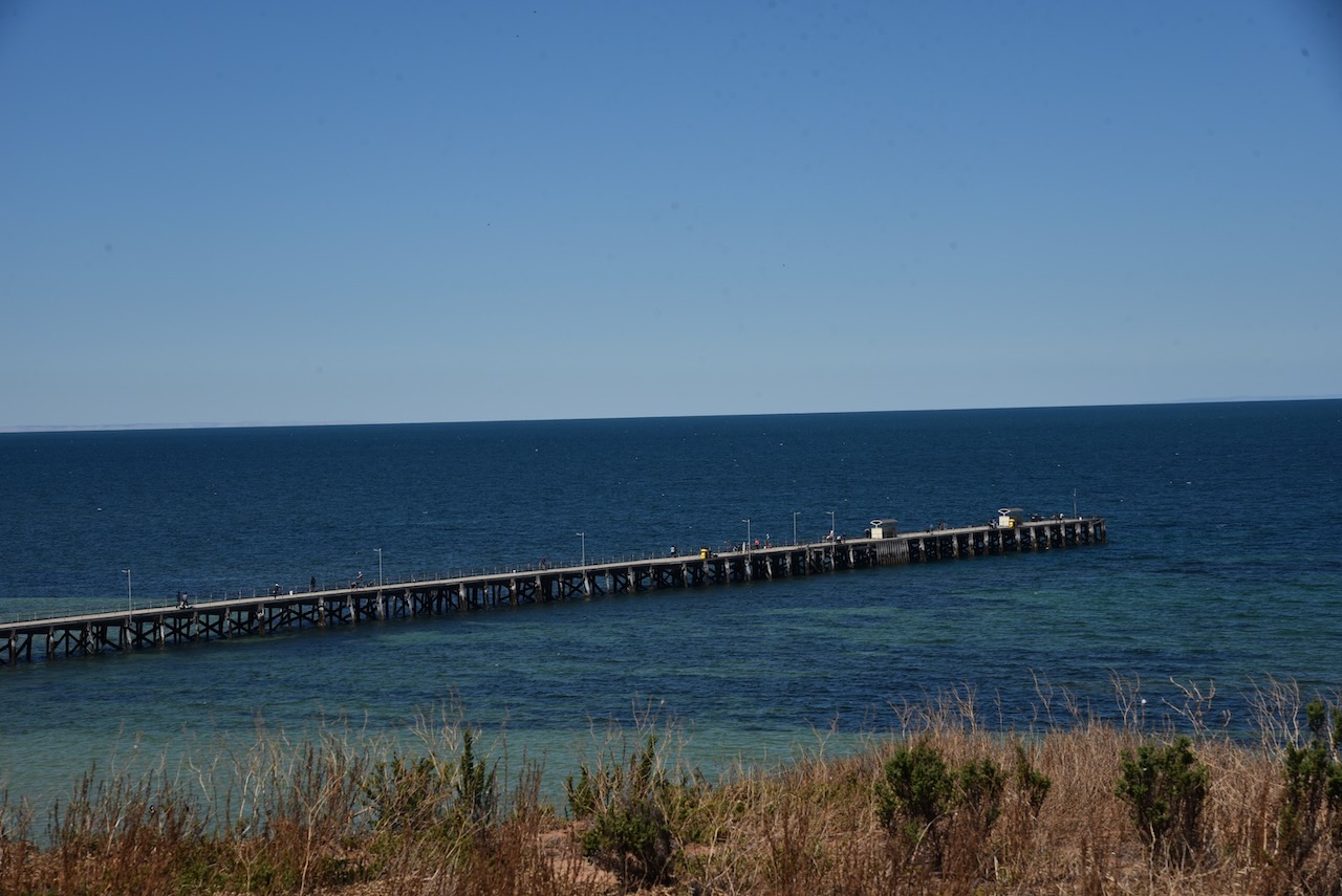
In 1874 the residents of Ardrossan petitioned the South Australian government for a jetty. The jetty was completed in 1877, and was subsequently extended to better accommodate the larger steamships and windjammers used to export grain overseas.
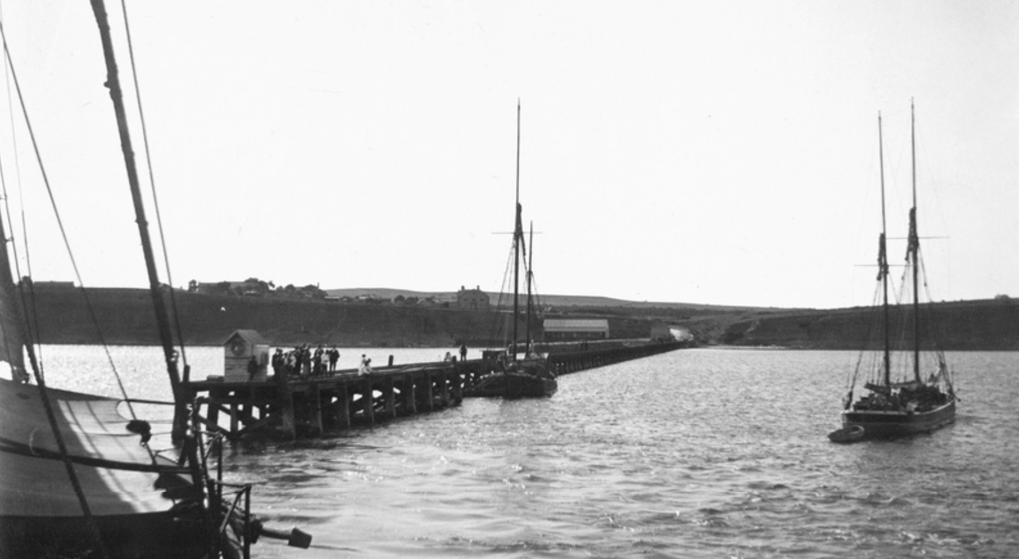
Above:- the Ardrossan jetty, c. 1903. Image c/o State Library SA.
In 1880 at Ardrossan, Richard Bowyer Smith (b. 1837. d. 1919) and Clarence Herbert Smith (b. 155. d. 1901) invented the stump jump plough.
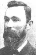
Above:- Clarence Herbert Smith. Image c/o Wikipedia.
This special plough solved the particular problem of preparing mallee lands for cultivation. At one time about fourteen ploughs were manufactured each week.
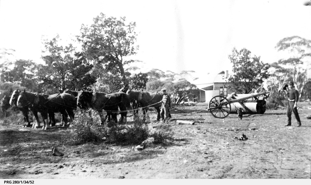
Above:- A stump jump plough in use, c. 1922. Image c/o State Library SA.
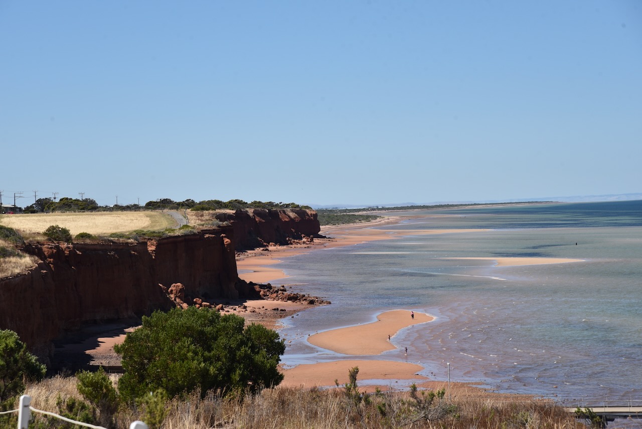
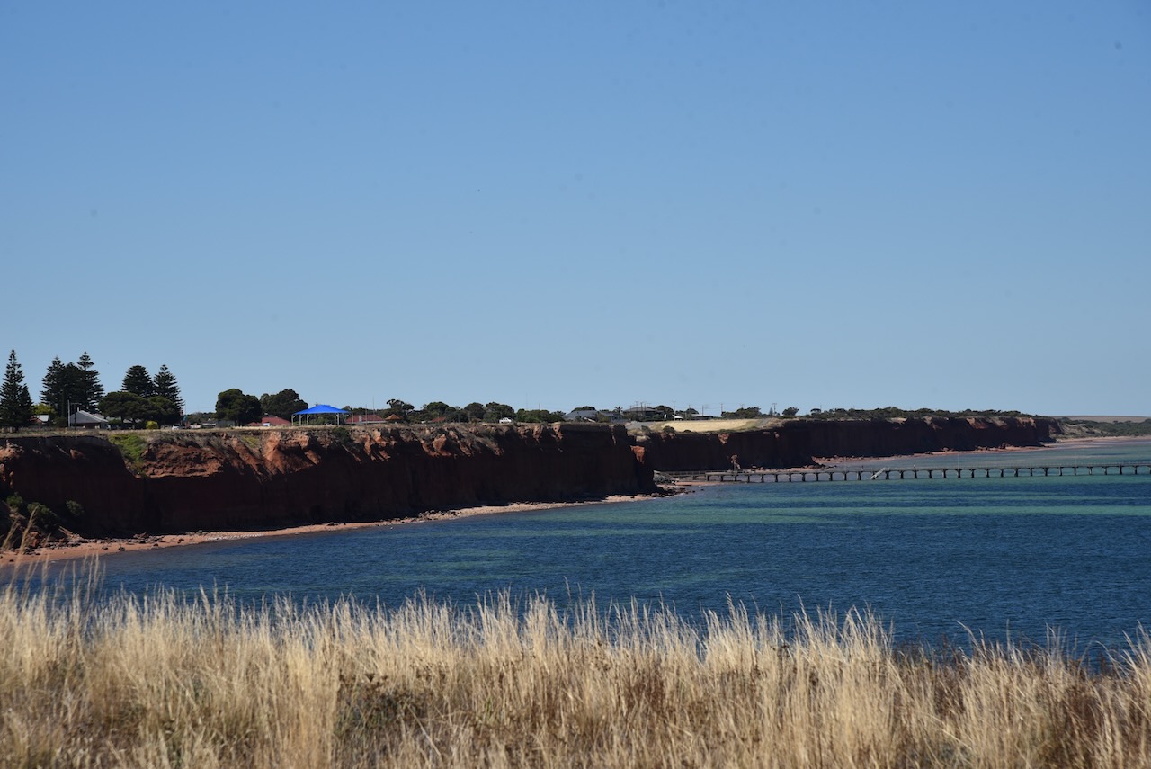
Ardrossan has a population of about 1,269 people and is a popular destination for holidaymakers. Ardrossan is well known for its coastal cliffs of red clay and its deepwater shipping port.


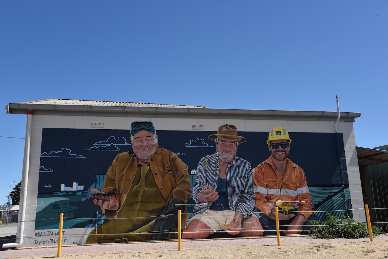


At the top of First Street (Ardrossan’s main street), there is a small park and playground. From here you can view the Ardrossan silos and get your photo taken at the ‘Hell from Arrdrossan’ sign.

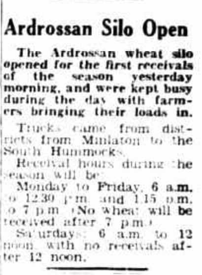
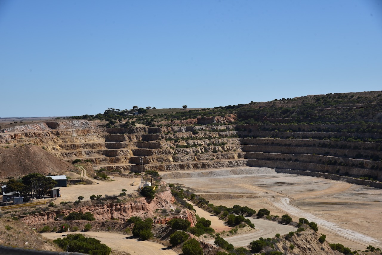
In the 1950s a large open-cut fine-grade dolomite mine was opened by Broken Hill Proprietary Ltd (BHP) at Ardrossan for use at its Whyalla steelworks and Port Kembla in New South Wales. BHP applied to the South Australian State Government for the construction of a crushing plant, hetty, and conveyor belt facility at Ardrossan. The SA Government gave permission on the proviso that that conveyor and jetty also be made available for the shipment of wheat and barley from the Yorke Peninsula region and salt from the salt mines at Price.
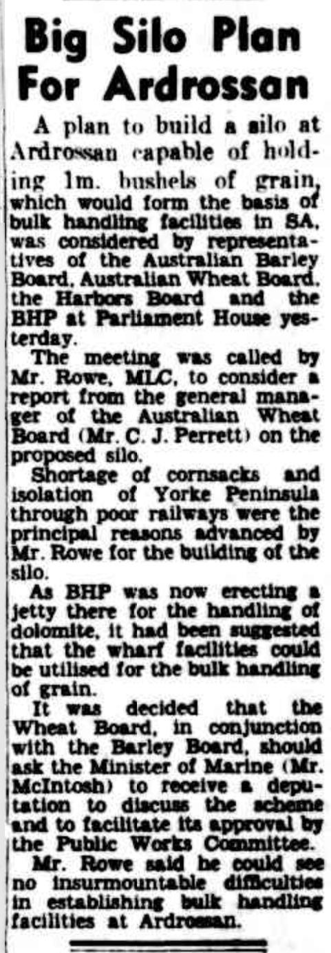
Above:- Article from The Advertiser, Wed 28 Jun 1950. Image c/o Trove.
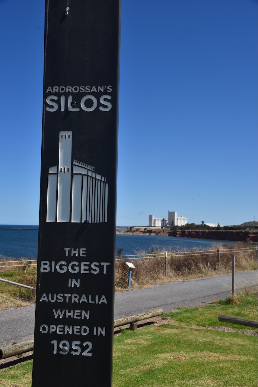
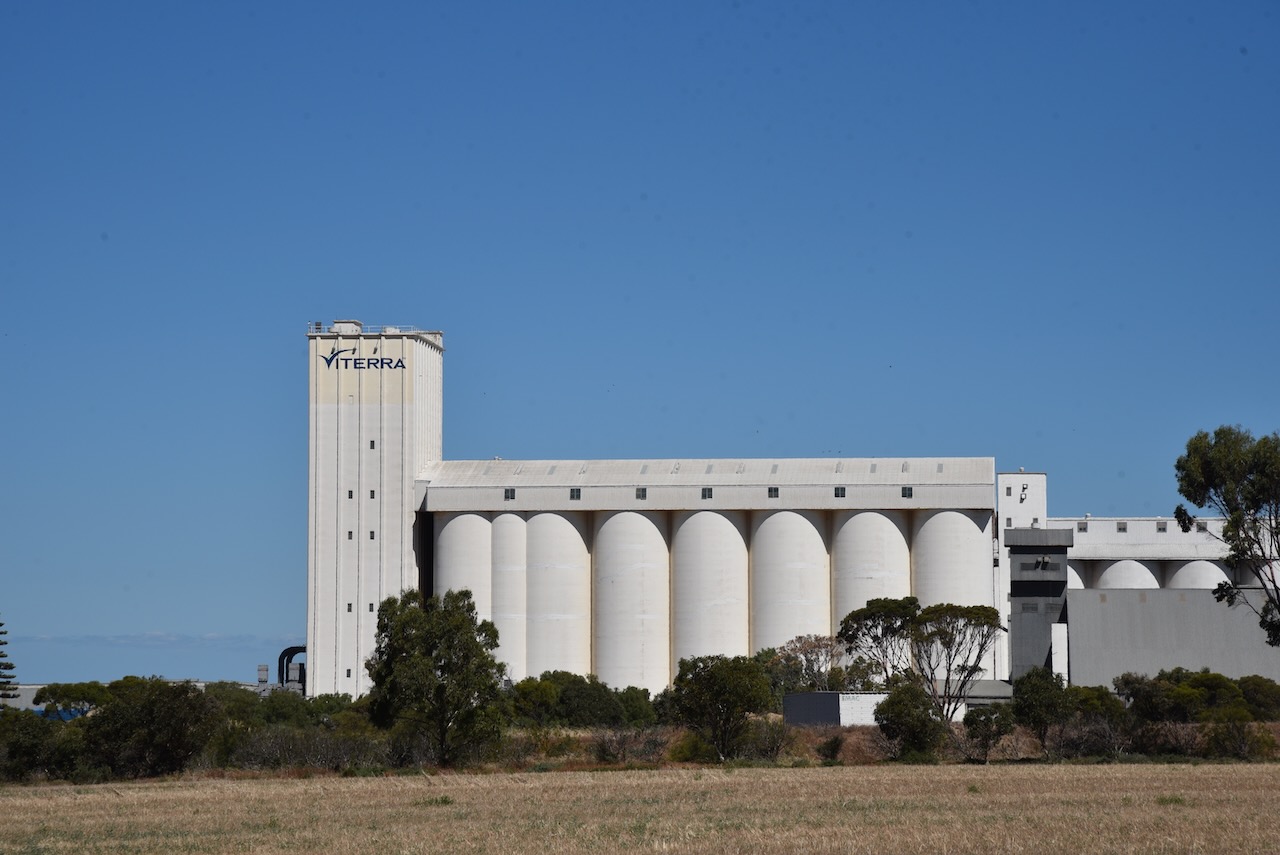
Construction commenced and this included grain silos and bulk handling facilities. The new jetty was constructed several kilometres south of the old jetty. The first shipment using these facilities was on 21 January 1953. The bulk handling facilities at Ardrossan were the first in South Australia and are now the third largest in South Australia. When the Ardrossan silos were first opened in 1952, they were the largest silos in Australia.
Above:- Article from The Pioneer, Yorketown, Fri 4 Dec 1953. Image c/o Trove.
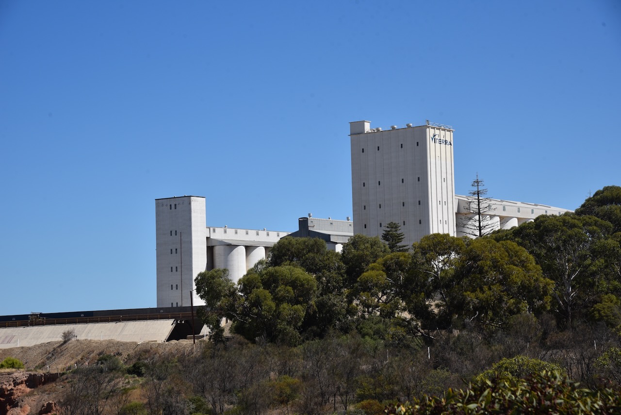
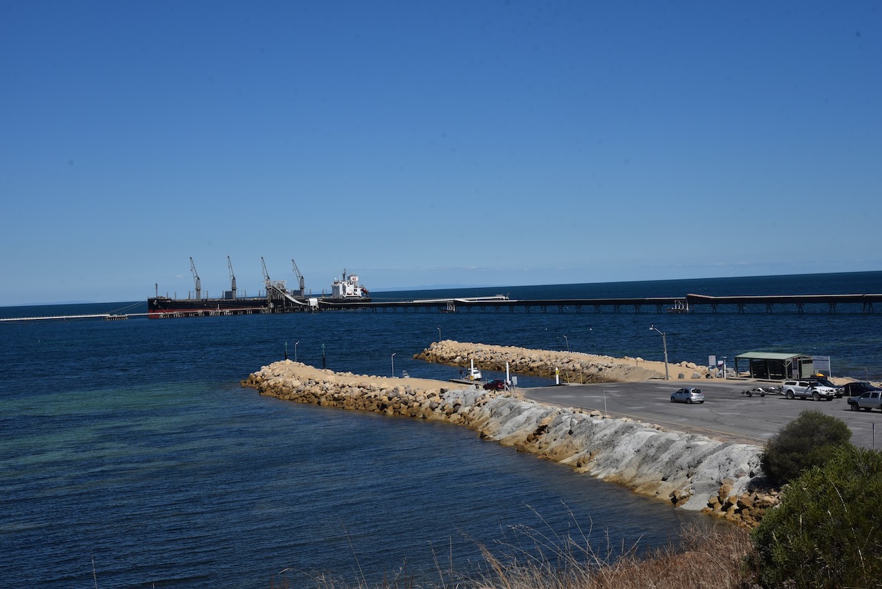
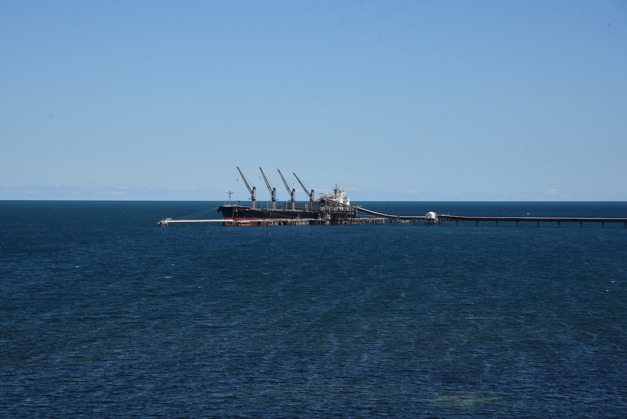
The jetty adjacent to the silos currently services ships loading dolomite, grain and salt from the salt pans at Price. The jetty is 931 metres long with a ‘T’ head. The grain elevator tower is 74 metres and is the largest in the state. The conveyor belt can load 2,400 tonnes of dolomite, 900 tonnes of grain or 750 tonnes of salt per hour.


Marija and I operated from near the Ardrossan boat ramp within the 1km activation zone. We operated from the vehicle, using the Icom IC-7000,100 watts, and the Codan 9350 self tuning antenna.
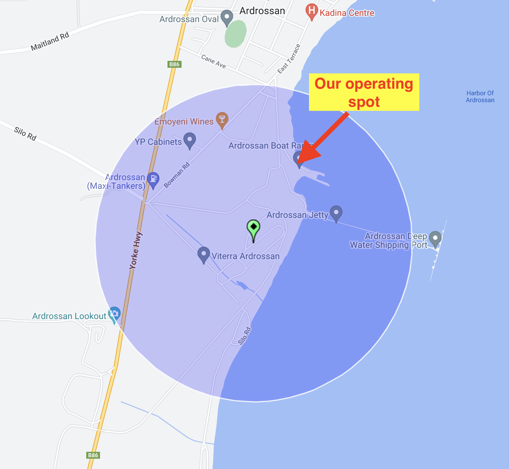
Above:- The activation zone at the Ardrossan silo, showing our operating spot. Image c/o SiOTA website.
Marija and I made a total of 36 contacts on 40m SSB and 20m SSB.
Marija worked the following stations on 40m SSB:-
- VK1AO
- VK2MET
- VK3PF/m
- VK5HS
- VK5FANA
- VK3TUN/p (SOTA VK3/ VC-018)
Marija worked the following stations on 20m SSB:-
- VK2NP
- VK2IO
- VK5HS
- VK4SYD
- VK5MRD
- VK7XX
- VK2YES
- VK6NTE
- VK4SMA
- VK2EG/p
- VK2IJS
- VK3OAK
I worked the following stations on 40m SSB:-
- VK1AO
- VK2MET
- VK3PF/m
- VK5HS
- VK5FANA
- VK5DW
- VK3OHM
- VK5GY
- VK3GJG
- VK3TUN/p (SOTA VK3/ VC-018)
- VK5TN
- VK3OAK
- VK2VH
- VK4AAC
- VK2YK
- VK5NM
- VK5KVA
I worked the following station on 20m SSB:-
- VK5HS
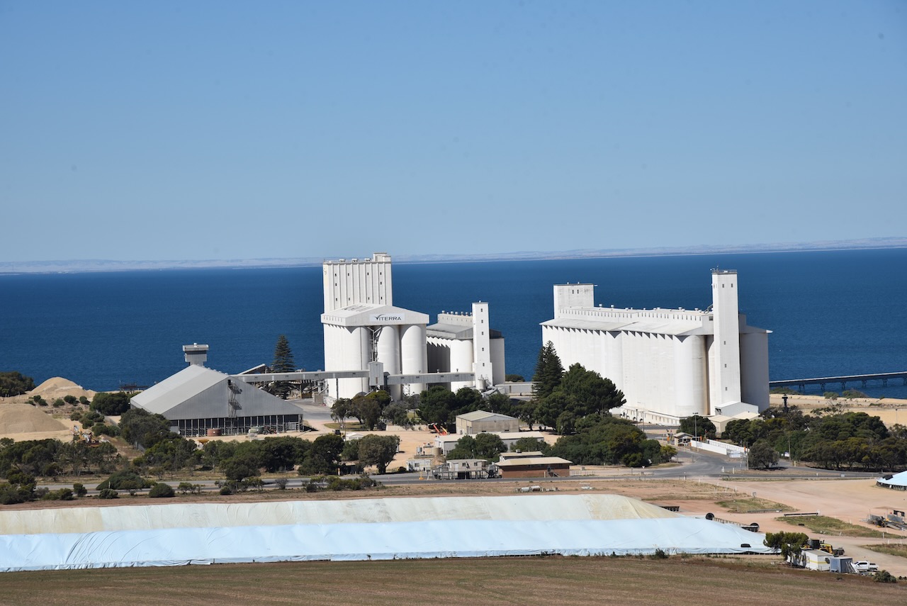
At the conclusion of the silo activation, we drove up to the Ardrossan lookout where we enjoyed some brilliant views of the silo, the town of Ardrossan, and the coastline. There are also some good views of the mine.


References.
- A Compendium of the Places Names of South Australia, <https://published.collections.slsa.sa.gov.au/placenamesofsouthaustralia/>, viewed 22nd February 2023.
- State Library SA, 2023, <https://www.samemory.sa.gov.au/site/page.cfm?u=1221>, viewed 22nd February 2023.
- Wikipedia, 2023, <https://en.wikipedia.org/wiki/Sir_James_Fergusson,_6th_Baronet>, viewed 22nd February 2023.
- Wikipedia, 2023, <https://en.wikipedia.org/wiki/Stump-jump_plough>, viewed 22nd February 2023.
- Wikipedia, 2023, <https://en.wikipedia.org/wiki/Ardrossan,_South_Australia>, viewed 22nd February 2023.
