Saddleworth silo VK-SDH5

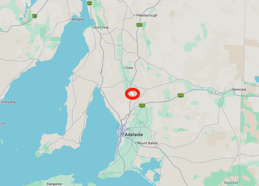
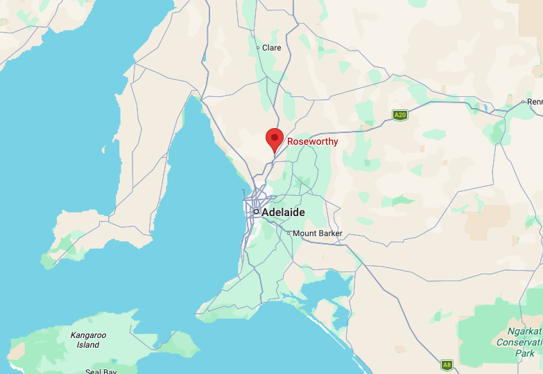
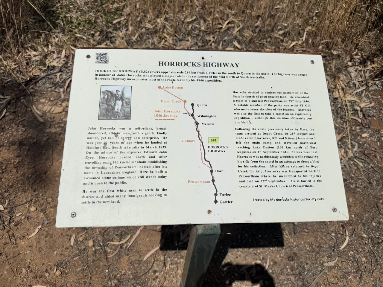
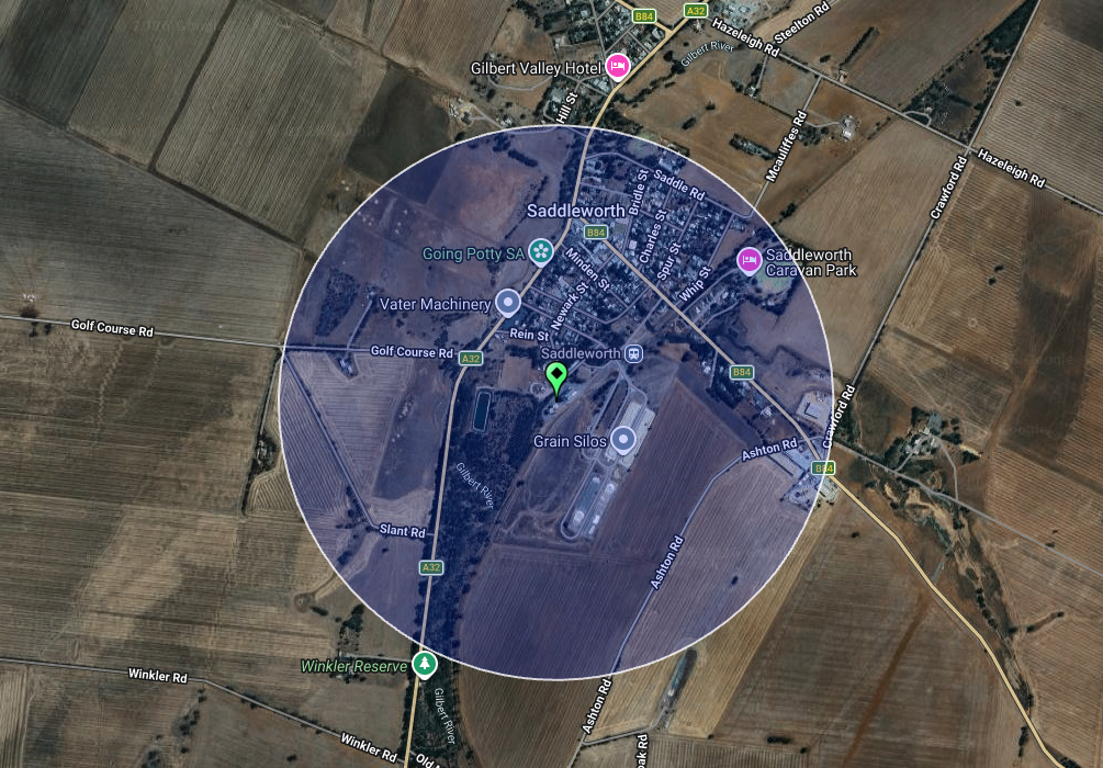
After leaving Clare on Thursday, the 18th day of December 2025, I decided to head to Saddleworth for a quick silo activation. Saddleworth is located about 112 km north of Adelaide.

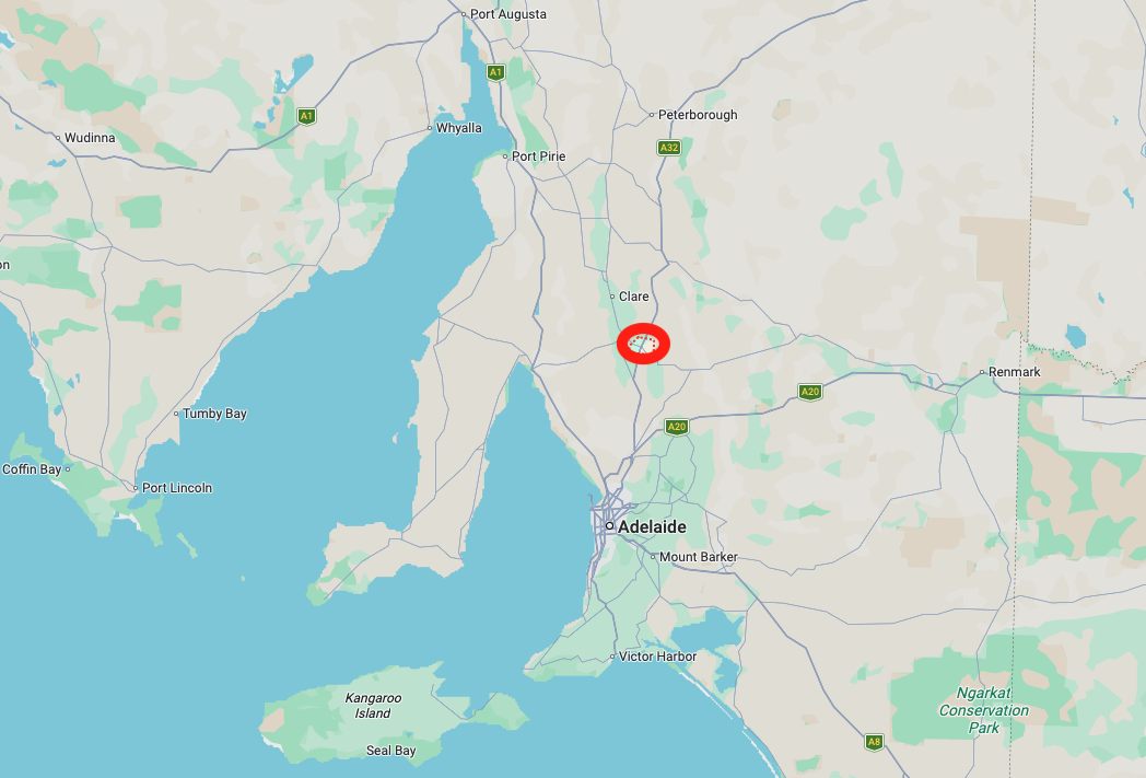
Above: Map showing the location of Saddleworth, S.A. Map c/o Google Maps

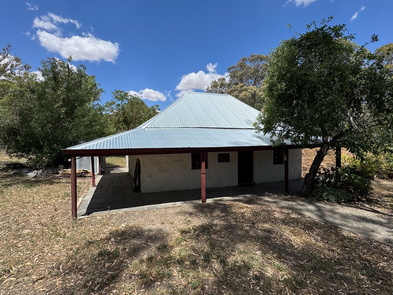
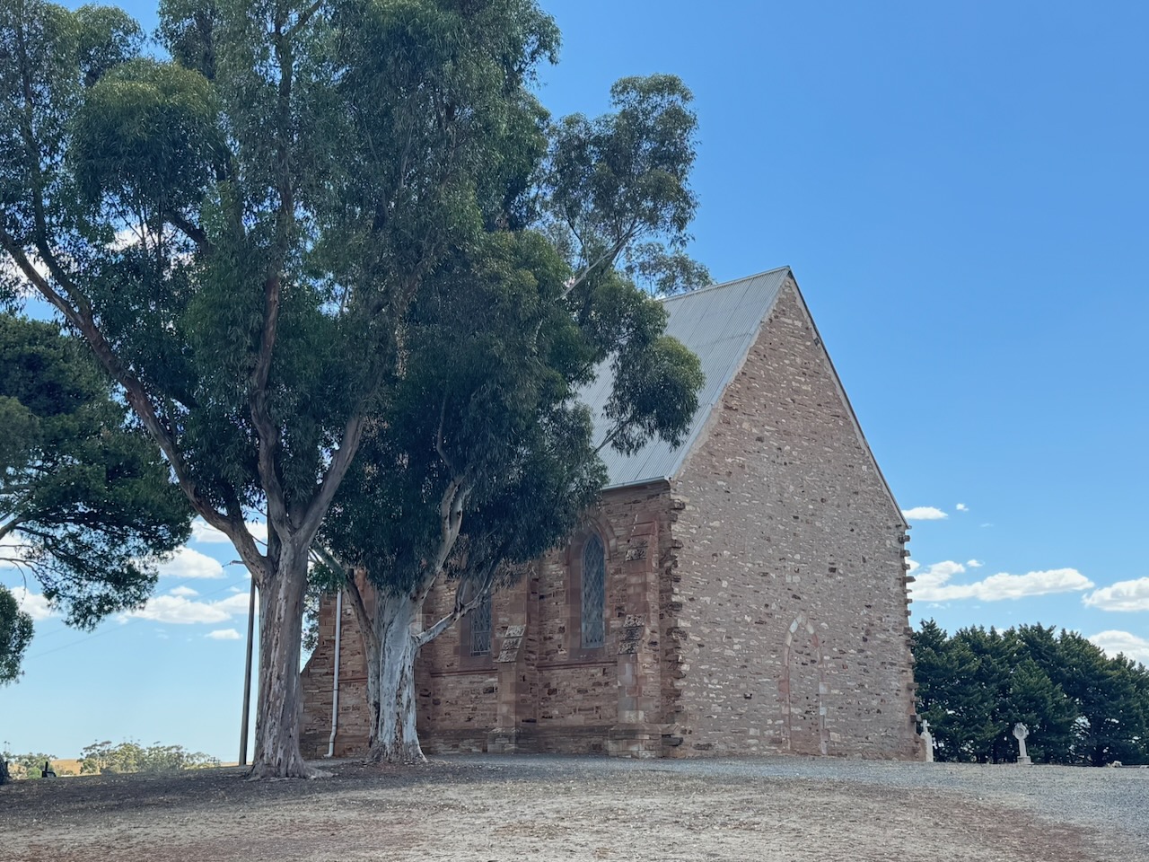
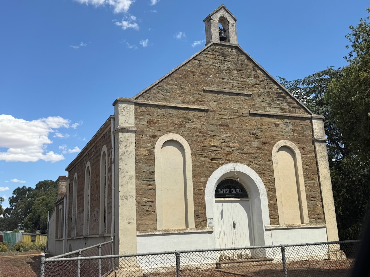
I headed south out of Clare on the Horrocks Highway and stopped at John Horrocks’ cottage at Penwortham, south of Clare. The Pioneer Cottage is the oldest stone building in South Australia, north of Gawler. It was built by the pastoralist and explorer John Ainsworth Horrocks shortly after he arrived in South Australia at the age of 21.

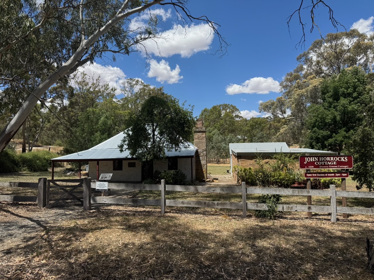
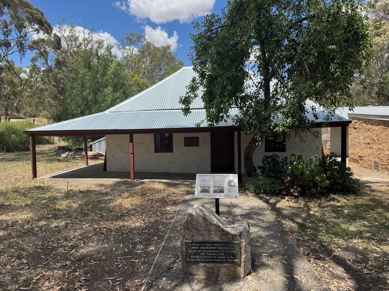
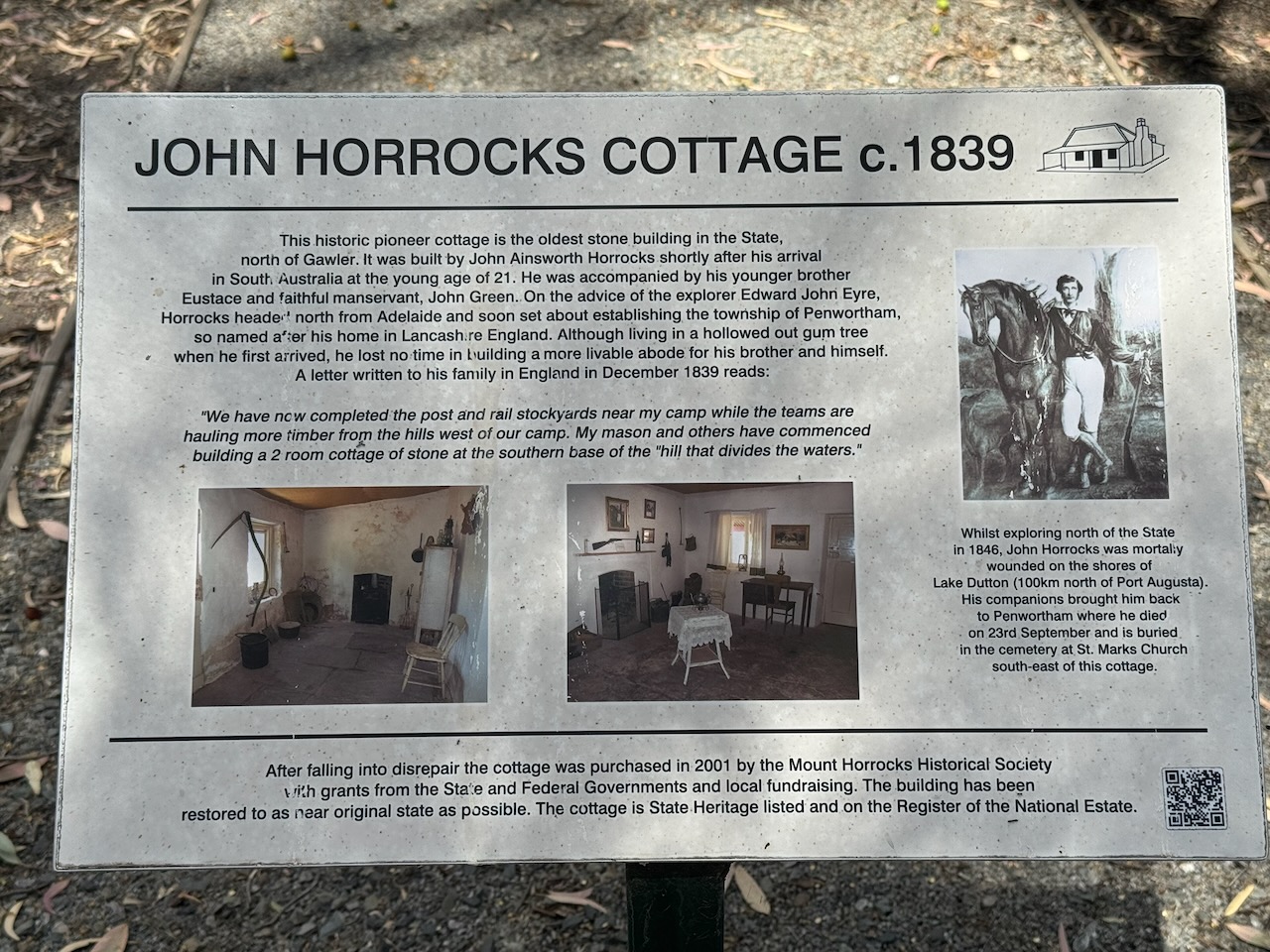
John Ainsworth Horrocks was born on the 22nd day of March 1818 at Penwortham Lodge, near Preston, Lancashire, England. In 1839, aged 21, he arrived with his 16-year-old brother Eustace in the new colony of South Australia. They established the village of Penwortham, south of Clare. John Horrocks returned to England in 1842 following his father’s death. and returned to Australia in 1844. (Wikipedia 2025)

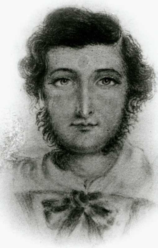
Above: John Ainsworth Horrocks. Image c/o Wikipedia

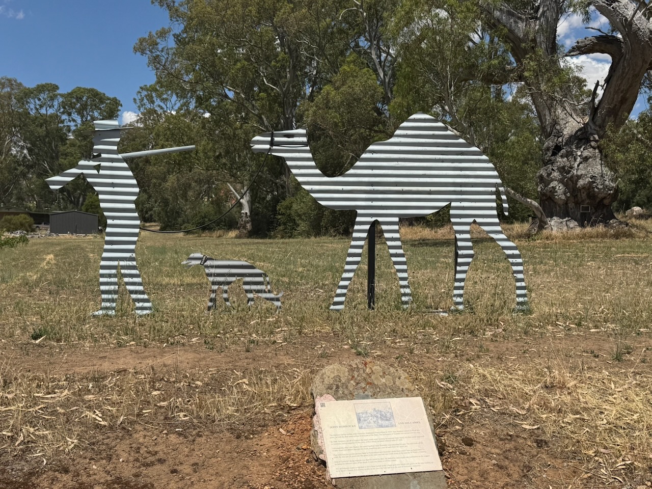
On the 29th day of July 1846, Horrocks led an exploratory expedition into the far north-west of South Australia. His 2nd in charge was John Henry Theakston. Artist and botanist, Samuel Thomas Gill was an unpaid volunteer. There were also several hired men, including Bernard Kilcoy as a cook and driver, a goatherd, Jimmy Moorhouse, who was a young Aboriginal man employed at Penwortham Station. (Wikipedia 2025)

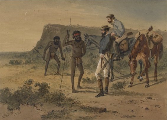
Above: Horrocks’ encounter with Aboriginals during the expedition. Image c/o Wikipedia

On the 1st day of September 1846, on the shores of Lake Dutton, about 100 km north of Port Augusta, Horrocks was accidentally shot whilst reloading his firearm. One barrel of the gun was tripped by the packload of a camel known as Harry whilst it was kneeling. Harry was the first camel to arrive in Australia. Horrocks was severely wounded, losing the middle finger of his right hand and a row of teeth from his upper right jaw. The expedition was cancelled, and the party returned to Penwortham, where Horrocks died from his wounds on the 23rd day of September 1846. (Wikipedia 2025)

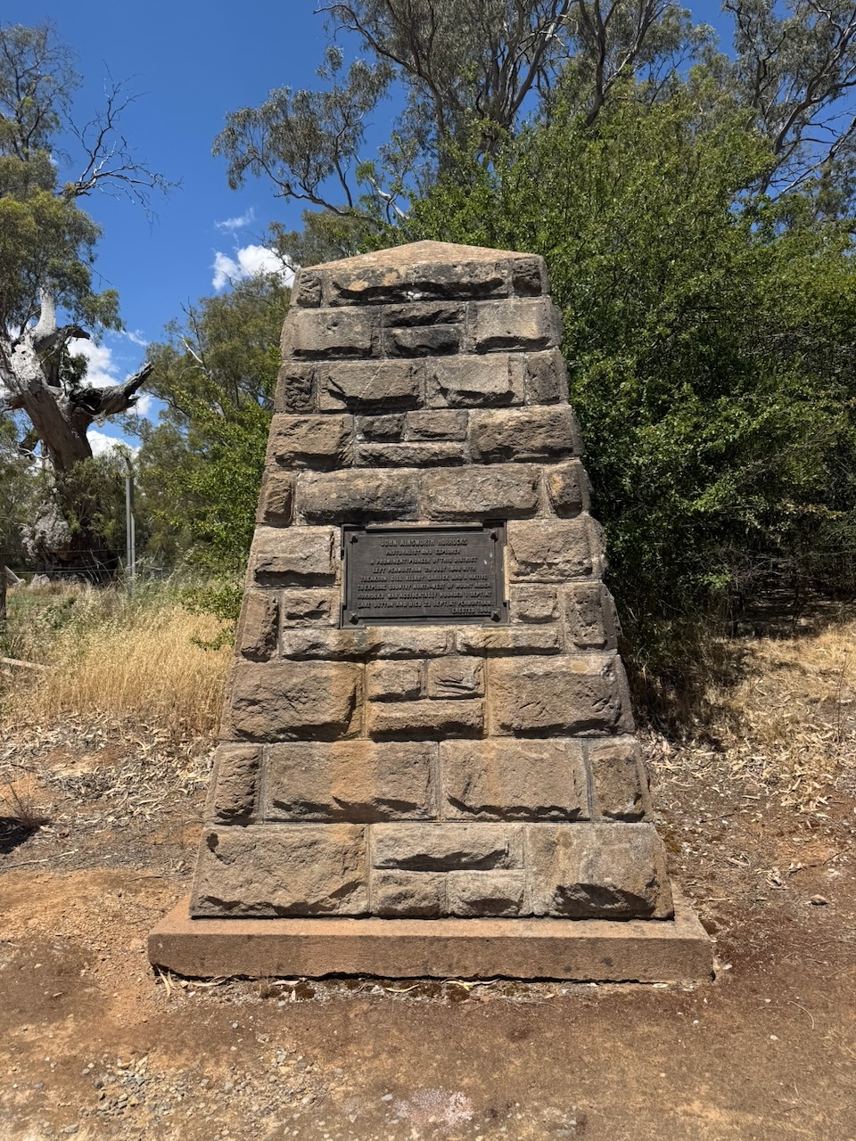
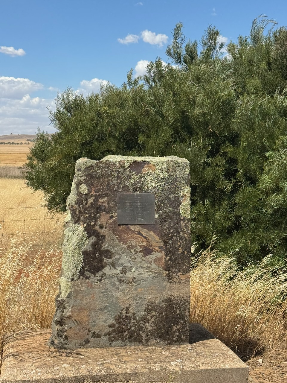
A little further south is a monument to Horrocks.

Saddleworth was named after Saddleworth Lodge pastoral station, which was named after a civil parish in Yorkshire, England. The town of Saddleworth was established as one of several settlements on the road to the mining town of Burra. (Wikipedia 2021)

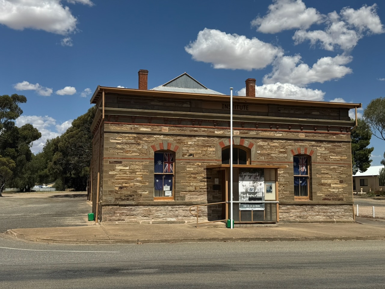
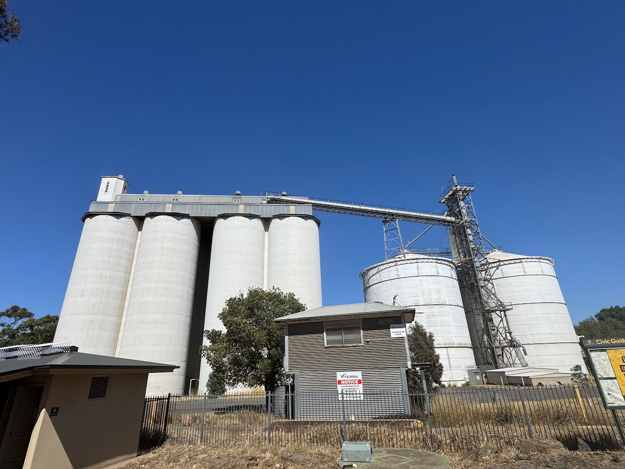
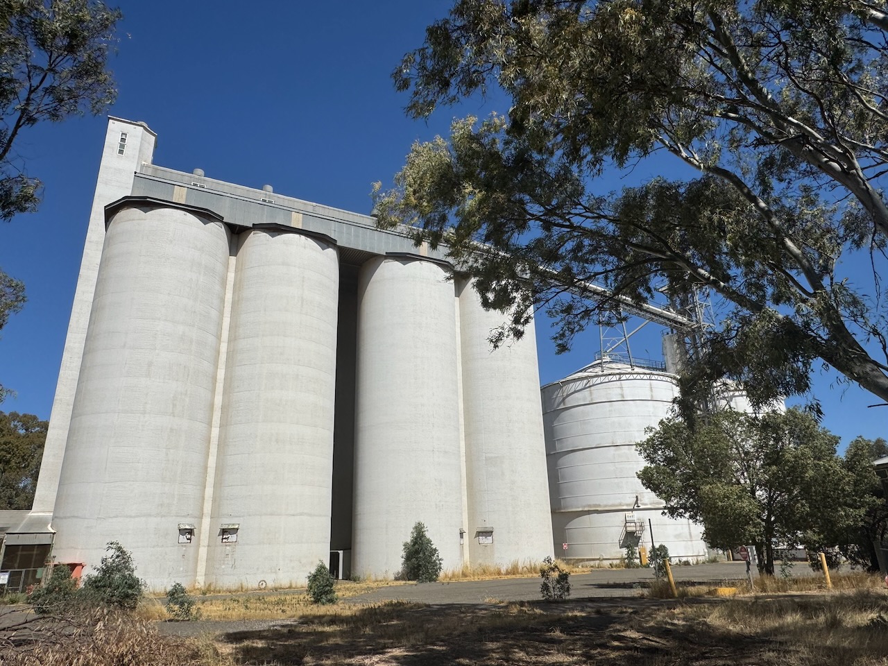
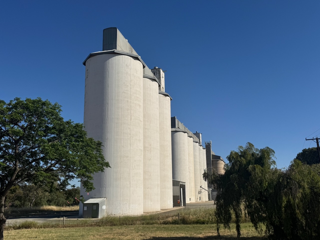
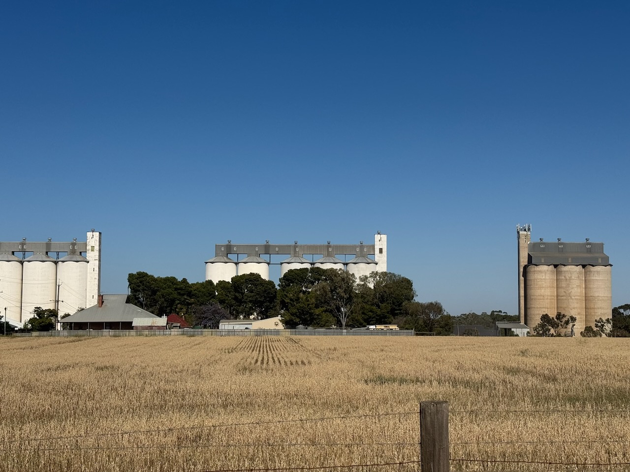
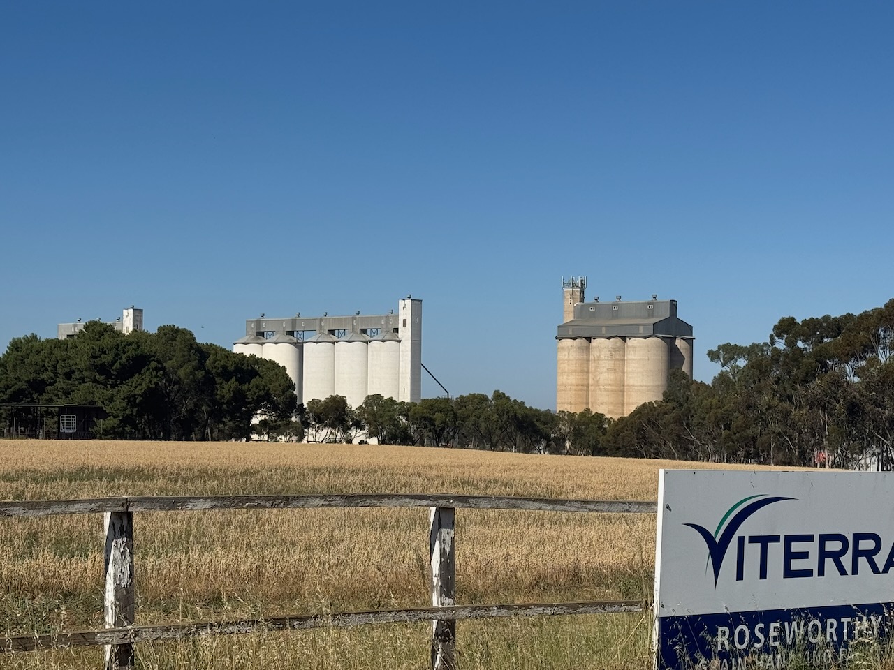
The Saddleworth silos are located on Girth Street and are operated by Viterra.

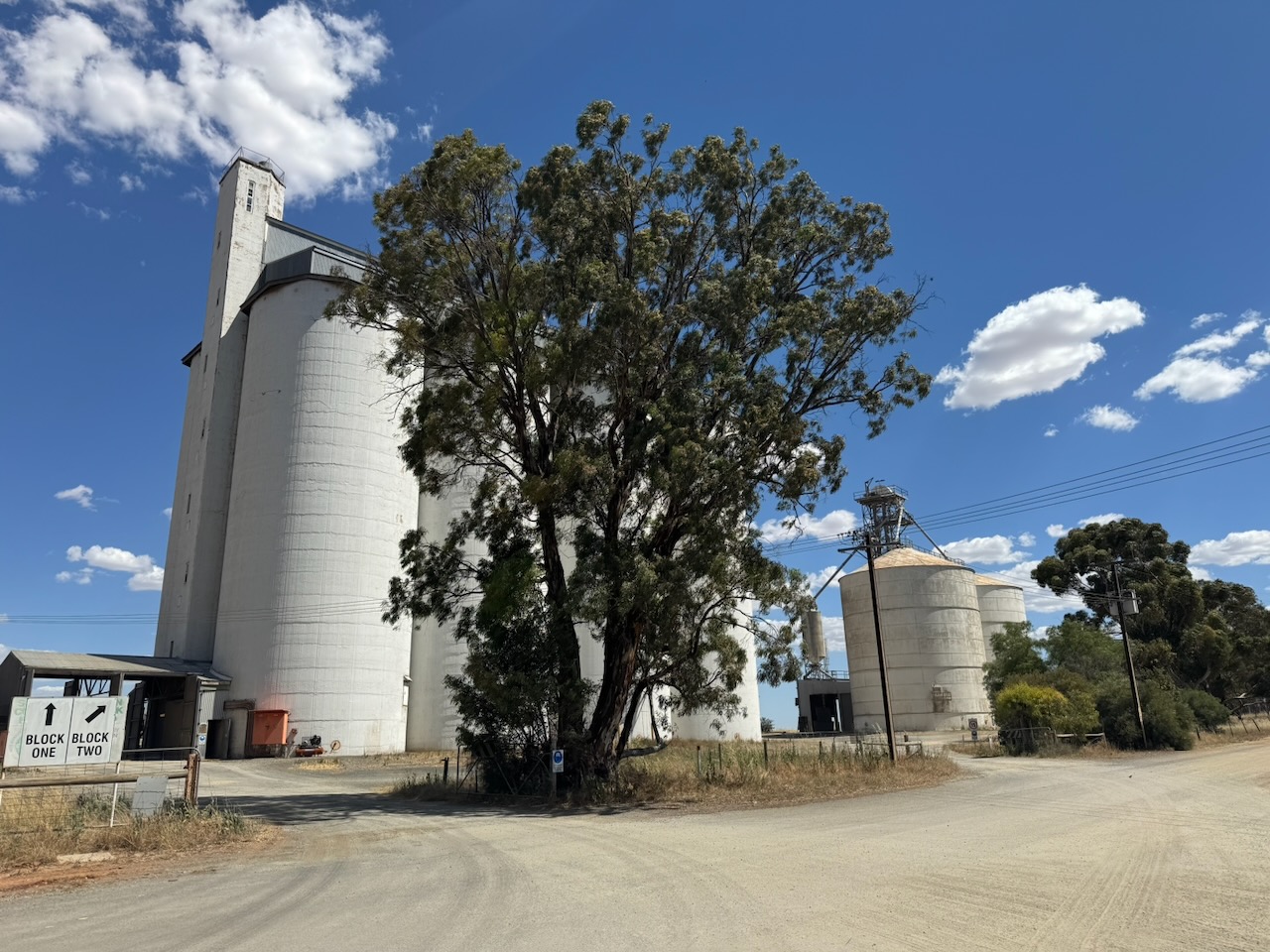
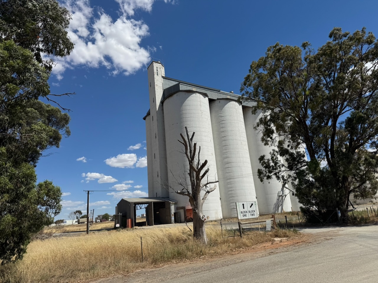
I parked on Girth Street and operated from the 4WD, running the Icom IC-7000, 100 watts, and the Codan 9350 antenna with the 1.5 metre stainless steel whip.

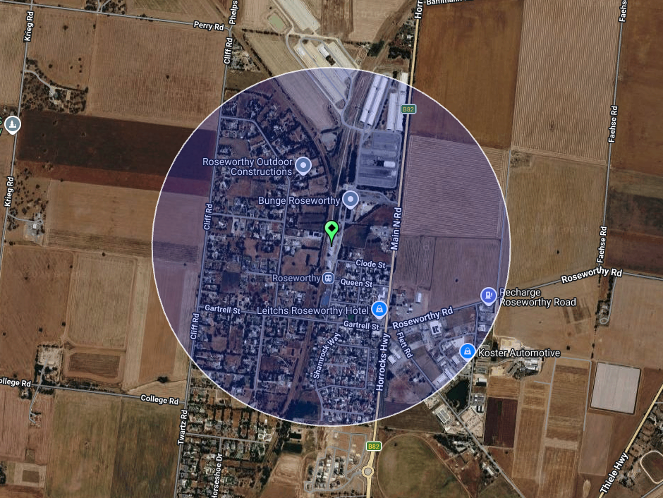
Above: the activation zone at Saddleworth silo. Image c/o SiOTA website

I worked the following stations on 40m SSB:-

  1. VK5MAZ
  2. VK3PF
  3. VK3FTOM
  4. VK3CLD
  5. VK5WU

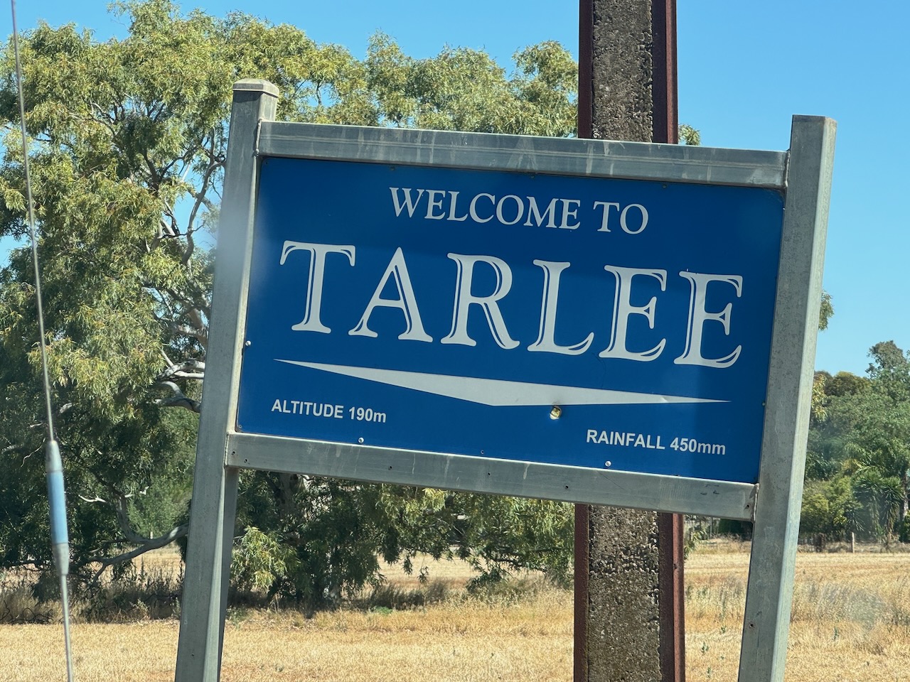
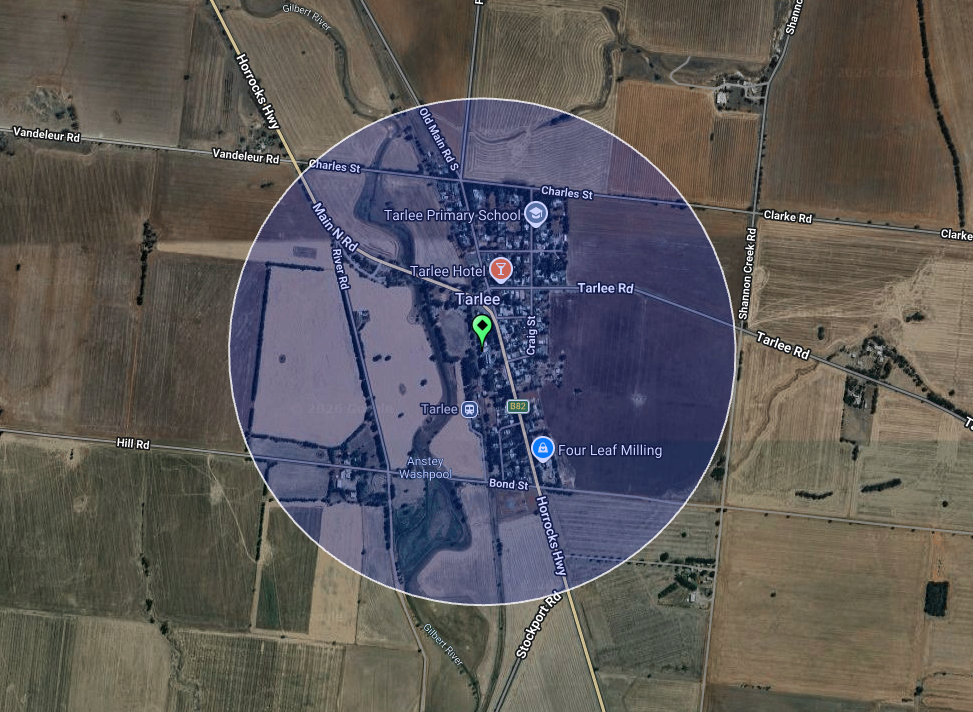
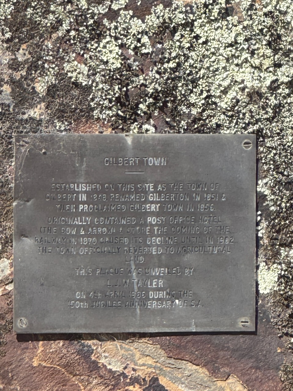
After the activation, I continued south on the Horrocks Highway, stopping at the monument for the former site of Gilbert Town, just north of Tarlee. The town was established in 1848 and was originally known as Gilbert. It was renamed Gilberton in 1851, and then in 1856 was proclaimed Gilber Town. The town once had a Post Office, the Bow & Arrow Hotel, and a store. The coming of the railway in 1870 caused the town’s decline, until 1902, when the town was officially reverted to agricultural land.

I continued on to home on the Fleurie Peninsula. It had been a very enjoyable day out and about.

References.

  1. Wikipedia Contributors (2025). John Ainsworth Horrocks. Wikipedia.‌
  2. Wikipedia. (2021). Saddleworth. [online] Available at: https://en.wikipedia.org/wiki/Saddleworth. [Accessed 26 Apr. 2026]‌

Tarlee silo VK-TRE5

My second silo activation for Thursday, the 18th day of December 2025, was the Tarlee silo VK-TRE5. Tarlee is about 88 km north of Adelaide in the lower Mid North of South Australia.

Above: Map showing the location of Tarlee. Map c/o Google Maps

Tarlee is believed to derive from Tralee in Ireland. The town is located about 8km south of Giles Corner, where the Barrier Highway to Broken Hill diverges from the Horrocks Highway to the beautiful Clare Valley. (Wikipedia 2025)

In June 1867, it was announced that the town of Tarlee was ready for sale by auction. It was to occur at Forrester’s Hotel at Gilberton. The locality was described as ‘most desirable, being the very nucleus of the whole of the lines of Northern traffic from the populous and important districts of Clare, Auburn, Mintaro, Port Wakefield and Saddleworth.‘ (Trove 2026) (Wikipedia 2025)

Above: article from the South Australian Weekly Chronicle, Sat 15 Jun 1867. Image c/o Trove

There is an excellent visitor information bay adjacent to the silos with a detailed history of the district. The info bay is named in honour of Frank Gorey, who worked at the Tarlee silos for 15 years. (UBC 2023)

On display at the info bay is a sculpture which includes an Armstrong Siddeley Cheetah aero engine from an Avro Anson aircraft. Such an aircraft crashed in a field near Tarlee in 1943.

The Tarlee silos are located on the western side of the Horrocks Highway opposite the visitor info bay.

I parked the 4WD in the visitor bay and operated from the vehicle, running the Icom IC-7000, 100 watts, and the Codan 9350 antenna with the 1.5 metre stainless steel whip.

Above: the activation zone at the Tarlee silos. Image c/o SiOTA website

I made just 3 contacts, which was a combination of poor band conditions and being short of time.

I worked the following stations on 40m SSB:-

  1. VK5MAZ
  2. VK5WU
  3. VK3PF

I then headed off to Clare and enjoyed a very enjoyable BBQ lunch with the boys from the Mid North, the Clare Valley, and the Riverland.

References.

  1. Nla.gov.au. (2026). Making sure you’re not a bot! [online] Available at: https://trove.nla.gov.au/newspaper/article/91266289 [Accessed 26 Apr. 2026].
  2. UBC Web Design (2023). World War Two Memorial | Monument Australia. [online] Monumentaustralia.org. Available at: https://www.monumentaustralia.org/themes/conflict/ww2/display/119896-world-war-two-memorial/photo/2 [Accessed 26 Apr. 2026].
  3. ‌Wikipedia Contributors (2025). Tarlee, South Australia. Wikipedia.‌

Roseworthy silo VK-RSY5

On Thursday, the 18th day of December 2025, I headed up to Clare to the home of Andrew VK5BL, for a Christmas lunch with a group of amateurs from the Clare Valley and the Mid North.

On the way, I activated two silos for the Silos On The Air (SiOTA) program. The first was Roseworthy silo VK-RSY5. Roseworthy is about 58 km north of Adelaide, and about 10 km north of Gawler.

Above: Map showing the location of Roseworthy. Map c/o Google Maps

The first known European to visit the area was in December 1837, when the Surveyor General travelled through the district. In 1855, William and Grace Gartrell purchased land in the Hundred of Mudla Wirra. Mudla Wirra are Aboriginal words meaning ‘implement’ and ‘forest.’ Following William’s death in 1863, Grace subdivided the land and named it Roseworthy after a village in Cornwall. Roseworthy is derived from Roswartha, meaning Meadow Heath. (Light Country n.d.) (Wikipedia 2015)

In 1881, the South Australian Government purchased land to establish an experimental farm in the Roseworthy district. Two years later, in 1883, the Roseworthy Agricultural College was established. It was the first of its kind in Australia and continues to operate to this day. (Light Country n.d.)

The Roseworthy silos are located on Railway Terrace. They are operated by Viterra and are part of a large grain facility of both storage silos and bunkers for grain that is grown in the region, and then conveyed to Port Adelaide. (Wikipedia 2015)

I parked on Cliff Road and operated from the 4WD, running the Icom IC-7000, 100 watts, and the Codan 9350 antenna with the 1.5 metre stainless steel whip.

Above: the activation zone at the Roseworthy silos. Image c/o SiOTA website

I worked the following stations on 40m SSB:-

  1. VK3VRL
  2. VK2NP
  3. VK2IO/P (VKFF-3045)
  4. VK1AO
  5. VK2MET
  6. VK3PF
  7. VK2MOE
  8. VK1MO
  9. VK5WU
  10. VK5MAZ
  11. VK3TRS

References.

  1. Light Country. (n.d.). Roseworthy | Light Country, South Australia. [online] Available at: https://www.lightcountry.com.au/roseworthy. [Accessed 26 Apr. 2026]
  2. ‌Wikipedia Contributors (2015). Roseworthy. Wikipedia.‌