Mylor Conservation Park

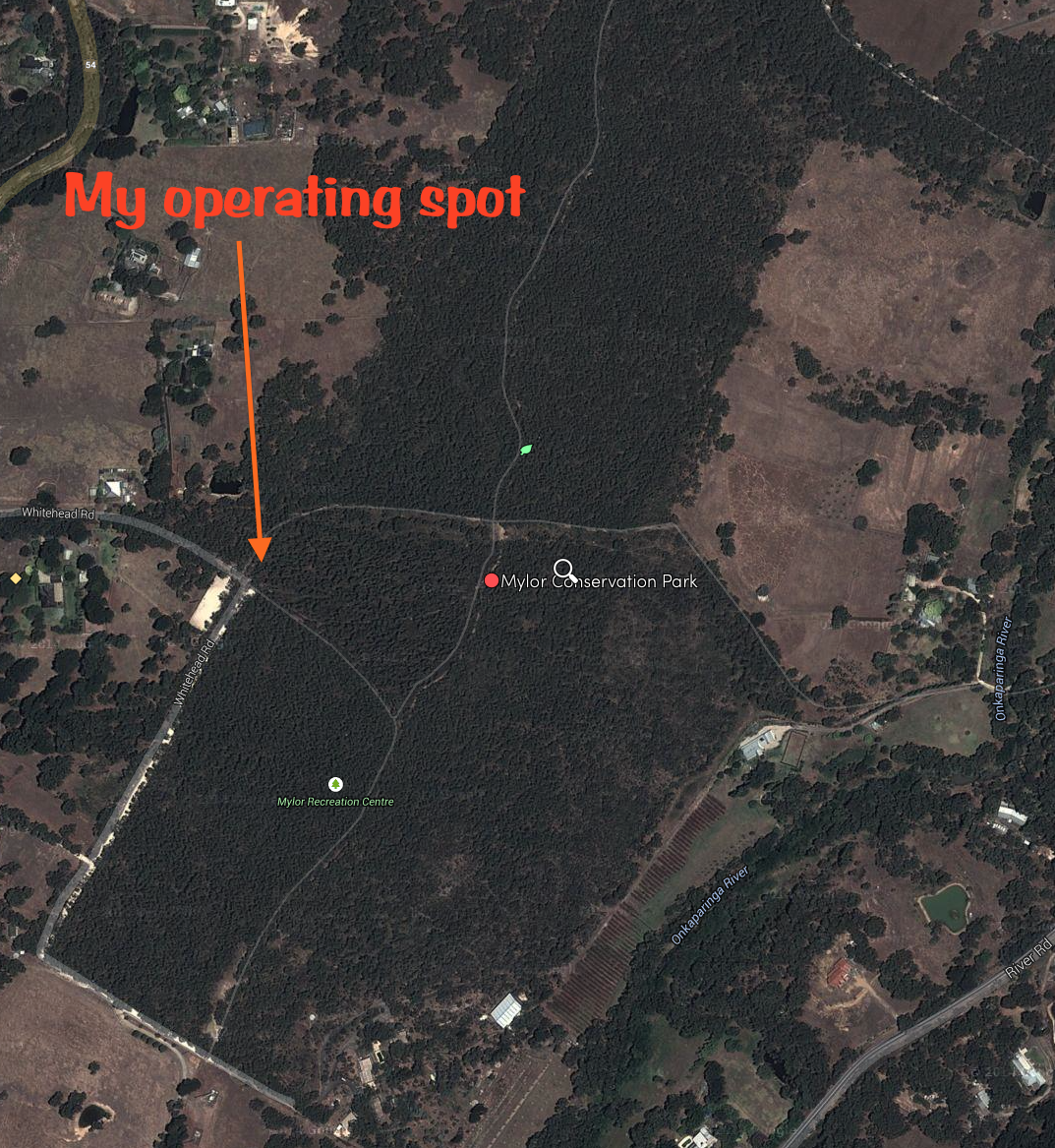
Yesterday afternoon I headed out to the Mylor Conservation Park (CP), which is just a short distance from home.  The afternoon was just too beautiful to be sitting at home.  Not a cloud in the clear blue sky and a temperature of 21 deg C.  I had activated Mylor Conservation Park in September last year, so this was another 1 point to add to my activator tally.
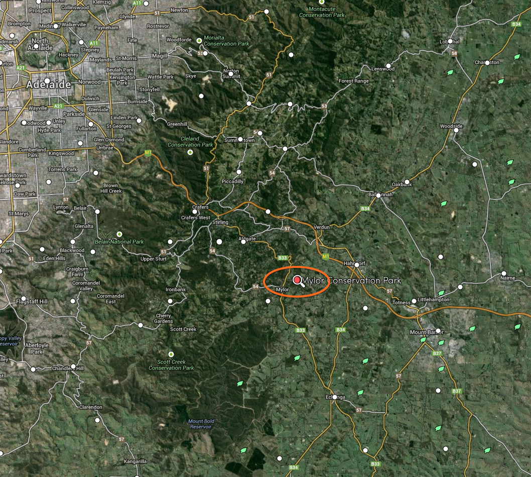
Screenshot 2014-09-14 10.57.40

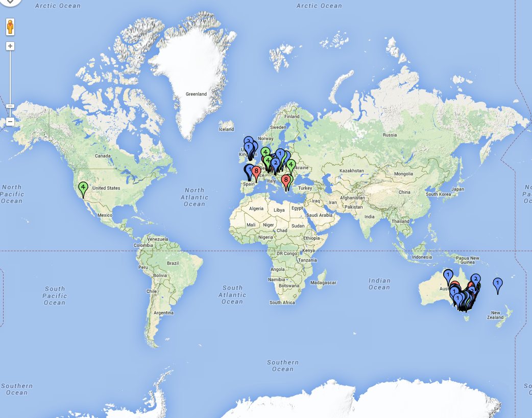
Photo/map courtesy of mapcarta.com

Screenshot 2014-09-14 10.57.14

Photo/map courtesy of mapcarta.com

It is a beautiful drive from my home to the park.  I travelled through the little town of Echunga, where I lived a number of years ago, and then on towards Mylor along the Strathalbyn Road.  The countryside is lush and green, a contrast to the aerial photographs above.  I then drove in to the little town of Mylor, which has a population of less than 1,000 people.

Mylor is sometimes referred to on some maps as Warrakilla Hill.  During the 1800’s, ‘Warrakilla’ was the name given by George Woodroffe Goyder to his estate and homestead in the vicinity.   Goyder was South Australia’s Surveyor-General and it was he who suggested some relatively flat ground in the area as a town site.  This was at a time when service centres were needed to support the new workingmen’s blocks.  Mylor was proclaimed in 1891 by Acting Governor Sir James Boucaut, who named it after his Cornish birthplace.
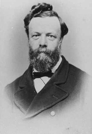
George_Woodroffe_Goyder

Above: – Surveyor General Goyder.  Photo courtesy of wikipedia.

The village of Mylor was effectively a replacement for a little community which had informally developed on a property named Rockford.  Mylor thus gained instant substance as established businesses transferred to the new location and it quickly provided supplies and services.  Some settlers formed a co-operative store, while others handled anything from bread to bookmaking.  This co-operative store still stands today.

Some churches and a school were subsequently established, but not a hotel.  A fact that remains to this day.  The nearest hotel is at either Echunga or Bridgewater.  So no watering stop for me!  Apparently every attempt to establish a hotel in the area during the late 1800’s was frowned upon by the temperance-minded Methodists.
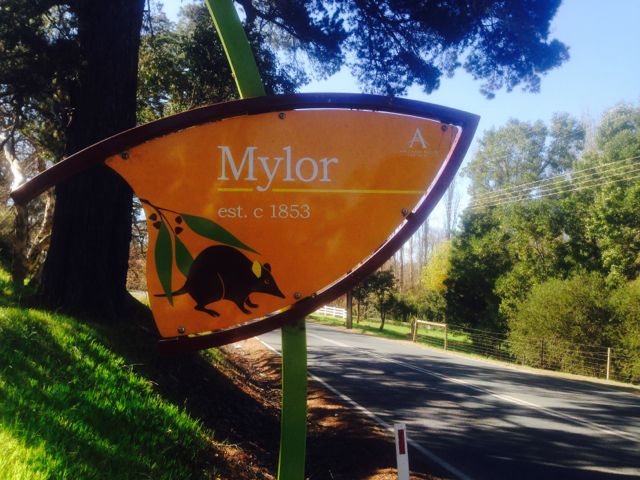
IMG_1504

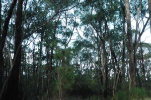
Mylor CP is located about 15 km south east of Adelaide and contains remnant bushland of the Mount Lofty Ranges.  Most of the surrounding land has been cleared for residential and agricultural use.  A section of the famous Heysen trail runs through the park, and two fully laden bushwalkers walked passed my location whilst I was operating.
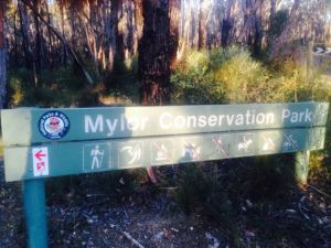
IMG_1515

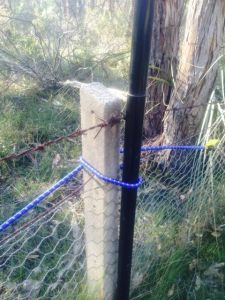
I set up in the same spot as last year, which was at the end of Whitehead Road, which runs off the Strathalbyn Road. There is a small car park here and it is a short walk of just a few metres to the entrance gate to the park. Again, as per last year, I used the boundary fence as a securing point for my 7 metre squid pole and 40m/20m linked dipole.
IMG_1508

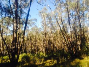
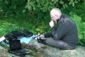
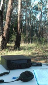
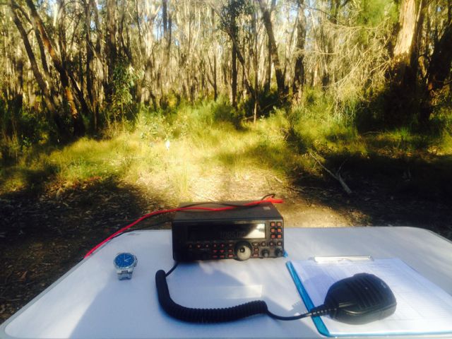
I set up my fold up table and deck chair just off the path which runs alongside the western boundary of the park.  There are beautiful shady gums here, so I was out of the afternoon sun.  As per my recent park activations, I operated with the Yaesu FT-450 and ran about 60 watts output power.  The power source was my 44 amp hour power pack.
IMG_1505

IMG_1506

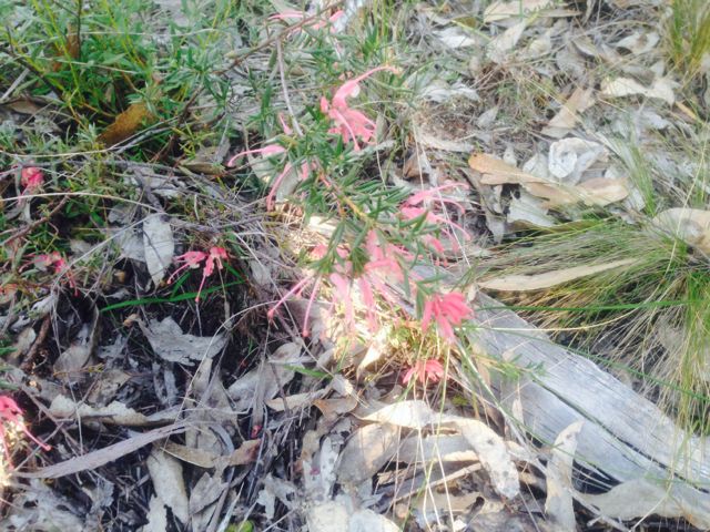
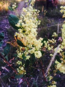
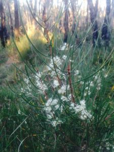
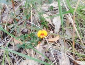
As we are going into warmer weather, many of the native plants were in flower, including the grevillias and wattle.  But the warm weather, also meant snakes.  The park si well known for its Eastern brown snakes, so I kept an ever vigilant watch.  Fortunately none were seen.
IMG_1509

IMG_1510

IMG_1512

IMG_1518

IMG_1519

Prior to putting out a CQ call, I tuned across the band and found Tony VK3CAT who was portable on a Summits on the Air (SOTA) peak, Mount Donna Buang, VK3/ VC-002.  Tony had a very good 5/9 signal coming into the Adelaide Hills.  After working Tony, I ventured up to 7.095 which was the frequency I had posted on the VK5 Parks Yahoo group, I would activate from.  But it was in use, so I moved down to 7.085 and started calling CQ.  It wasn’t long before the steady flow of park ‘hunters’ commenced.

First taker was Barry VK5BW, just up the road at Bridgewater.  Barry’s signal almost knocked the FT-450 off the table.  This was followed by Brian VK5FMID down in the South-East, who also had a strong 5/9 signal.  I was then pleasantly surprised to get a call from Gordon VK5GY who was operating portable from the Cox Scrub Conservation Park.  Gordon also had a good strong 5/9 signal.  It was great to get a ‘park to park’ contact in the log.

The signals on 40m were excellent.  Almost all stations that I worked were well over the S9 mark.  Some in fact were reaching 30 db – 40 db over strength 9.  The noise floor within this park is non existent, so I was even able to hear some very weak signals including Bob VK5FO and Ray VK5RR, who were both mobile.

After working a number of stations on 40m, I ventured over to 20m but found that the Worked All Europe contest was in full swing, so I did not hear many European stations calling anything but ‘CQ Contest’.  However I did find Nardo EC1DD who was portable on SOTA peak, Gabineira, EA1/PO-015.  I called a number of times, before getting through to him.  I was competing with a lot of European SOTA chasers and lots of QRM from the contesters.  Nardo was 5/5 and I received a 5/9 signal report.  I kept tuning across the band, hoping to find a station wanting to work some DX, and stumbled across Jo LX/PA9JO, amongst the contesters.

Marija and I were heading out for tea, so it was time to pack up and head home so I didn’t get into strife.  But whilst I was taking down the linked dipole, the i-phone bleated and I saw that Scott, VK2SWD was on a SOTA peak in New South Wales, VK2/ SM-053.  I couldn’t help myself.  Despite the squid pole being lowered and the dipole being very close to the ground, I put back in the crocodile clips for 40m and gave Scott a call and managed to get him in the log.  Matt VK1MA asked me to QSY up 5, and I had my last QSO with Matt before going QRT.

So after about 2 hours in the park, I had a total of 49 QSO’s in the log, with the majority of those being on 40m SSB.  A fun afternoon in the sun.  Thanks to everyone that called in.

The following stations were worked:-

VK3CAT/p (SOTA), VK5BW, VK5FMID, VK5GY/p (Cox Scub CP), VK5NIG, VK2NEO/m, VK5VRB, VK5GJ, VK5TR, VK3FQSO, VK5ZAR, VK5NJ, VK5FTCT, VK3AXF, VK5HCF, VK5LY, VK1NAM, VK3PI, VK1EM/m, VK7TW/p, VK5FTVR, VK3OB, VK5FTRG, VK2FV, VK5FBAC, VK5TN, VK5XY, VK5RR/m, VK2HHA, VK3XP, VK3MCX, VK5FGRY, VK7FMPR, VK5VH, VK5AW, VK2LAW, VK4XAC, VK3FIAN, VK5HS, VK3JP, VK3ARR, VK2NNN, VK5FO/m, VK3MRG, VK5WG, EC1DD/p (SOTA), LX/PA9JO, VK2SWD/p (SOTA), and VK1MA.


References

Mylor Tourism Information Section, 2014, viewed 14th September 2014, <http://www.adhills.com.au/tourism/towns/mylor/&gt;

National Parks South Australia, 2014, viewed 14th September 2014, <http://www.environment.sa.gov.au/parks/Find_a_Park/Browse_by_region/Adelaide_Hills/Mylor_Conservation_Park&gt;

German Mountain Activity Group

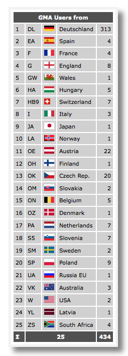
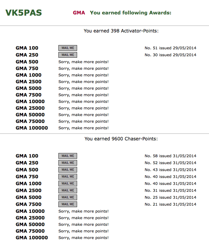
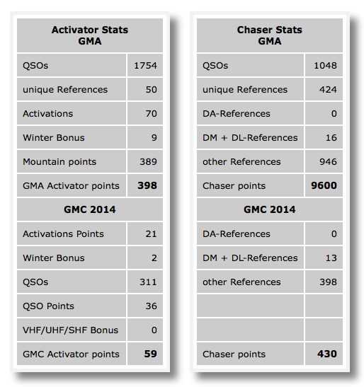
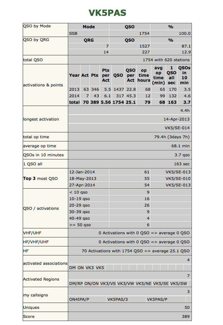
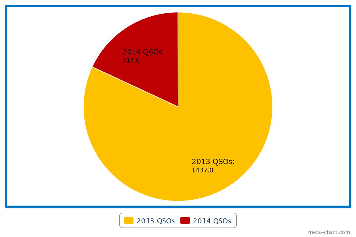
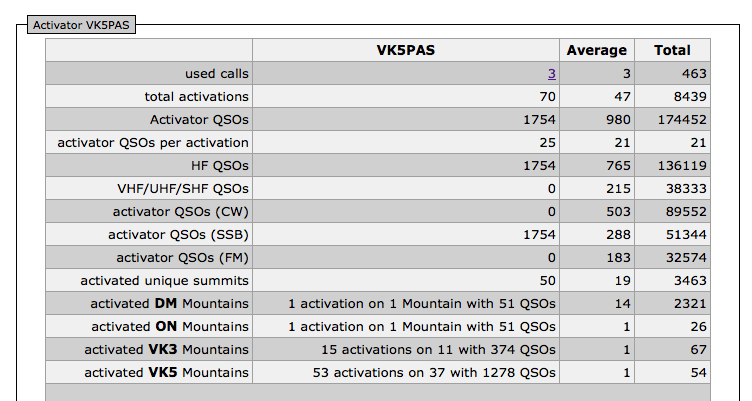
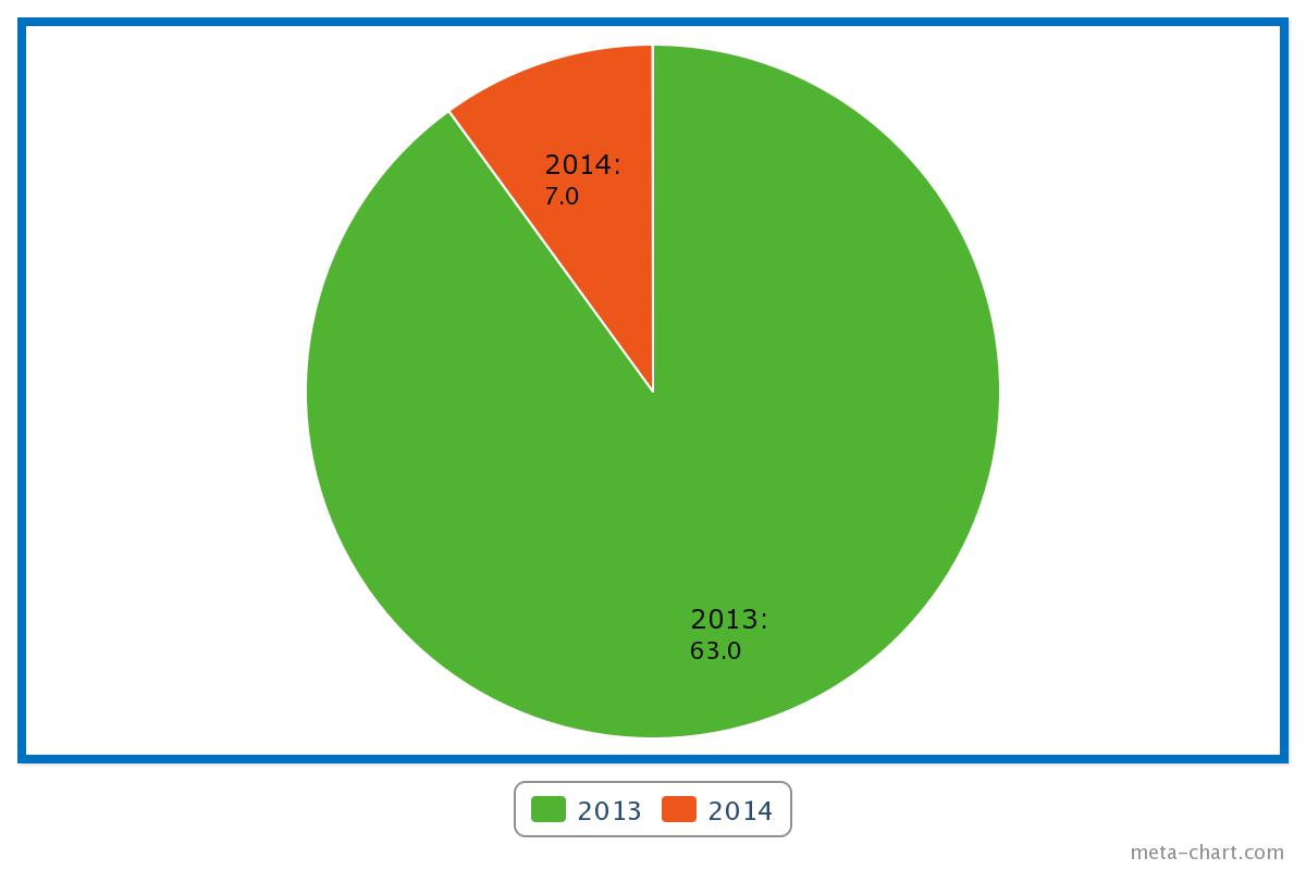
This post is a reminder of the German Mountain Activity Group (GMA), which I have mentioned previously on my site.  The GMA group is dedicated to amateurs who enjoy outdoor operation.  The GMA also offer a number of award certificates which are well worth applying for.  The GMA website can be located at….. http://www.cqgma.eu gma_title-009 There are currently 434 amateurs registered on GMA.  But there are only three from Australia: myself, Nick VK3ANL, and I am unsure of the other? Screenshot 2014-09-14 20.00.12 Mountain award (MA) certificates are offered to both activators and chasers.  There is also the Mountain Challenge (MC).  The GMA Mountain award commenced on 1st April, 2012, so only contacts on or after that date count towards the award.  You can apply for the GMA award certificates online, and also keep track of your award certificate progress on the GMA website. Screenshot 2014-09-12 23.19.26 The GMA points scoring system is different to the SOTA scoring system.  In GMA a summit is definable when it is 100 metres or higher. Each full height of 100 metres is awarded a point. Examples: 120 metres = 1 point, 700 metres = 7 points, 1299 metres = 12 points. For the GMA program, I am currently sitting on 398 activator points, and 9,600 chaser points.  I need a further 102 points to obtain the 500 point Activator certificate, and a further 400 points for the 10,000 point Chaser certificate. On the GMA website you can view a GMA ‘Honour Roll’ in 2 formats: Activation by Points, and Activation by QSO.  I am currently in 53rd position for the Activation by points, and 32nd position for the Activation by QSO. There is also a Region hoppers list.  Nick VK3ANL features on this list and is in 15th position with 11 different regions activated.  I have activated a total of 7 different regions. There is another really neat feature, where you can click on ‘act. Summits‘ in the left hand column.  This will take you to the Adventure Radio mapping site, and show you on a world map, where your SOTA activations have been. Screenshot 2014-09-13 10.24.55 To get started, simply upload your Summits on the Air (SOTA) logs to the GMA site.  Once having done this, you can view some very interesting statistics relating to your SOTA activations and SOTA chasing.  Many of those statistics are not able to be viewed on the SOTA website. Tonight I rechecked my SOTA statistics on the GMA site and found that I have undertaken a total of 70 SOTA activations.  However, I checked the SOTA database, and 10 of those are double ups.  In other words, they are activations that overlap the UTC rollover.  Prior to the instructions from the SOTA MT, I was submitting 2 logs for activations involving the UTC rollover. Screenshot 2014-09-13 12.04.20 Screenshot 2014-09-12 19.13.33Activator. I have not been active at all with SOTA activations during 2014.  In fact I’ve had just 7 activations this year, compared to 63 activations last year in 2013.  My lack of activity hasn’t been for a lack of desire.  I’ve just been so busy at work and had other commitments, that my mountain top activities have been curtailed. pieChart_jpg I have accumulated a total of 1,754 QSO’s during those activations (1,437 in 2013, and 317 in 2014).  All my QSO’s have been on HF.  I’ve never had a VHF/UHF contact.  I have activated summits with Ian VK5CZ who has operated on those bands, but I’ve never taken hold of the VHF/UHF gear.  And all of my contacts have been SSB, despite some strong encouragement from Ian VK5CZ to have a go at CW.  Of the 1,754 contacts, 1,527 of those (87.1 %) have been on 7mhz on the 40 metre band, whilst 227 contacts (12.9 %) have been on 14mhz on the 20 metre band. pieChart_jpg My total operation time is 79.4 hours (3 days and 7 hours) with an average operating time of 68.1 minutes.  I can’t believe I’ve dedicated all that time.  Perhaps if I asked my wife, she would say, ‘yes you have!‘.  Marija has accompanied me on many activations.  What is interesting, is that the average number of QSOs per activation is up from 22.8 in 2013, to 45.3 in 2014.  Perhaps a testament to the popularity of the SOTA program in Australia. The most QSO’s have come from 2 activations at Mount Gawler VK5/ SE-013, otherwise known as Mount Nigel (VK5NIG), and 1 activation at Tothill Range VK5/ SE-010 in the mid north of South Australia.  On 12th January 2014, I activated Mount Gawler and obtained a total of 61 contacts.  And I reactivated Mount Gawler on 27th April 2014 and obtained 54 contacts.  My one and only activation of Tothill Range was on the 18th May 2013, when I obtained a total of 55 contacts.  I was only new to SOTA at that time and I recall working quite a bit of DX from the summit with my meagre 5 watts. Screenshot 2014-09-12 21.29.21 During my short SOTA life, I have activated from four associations:
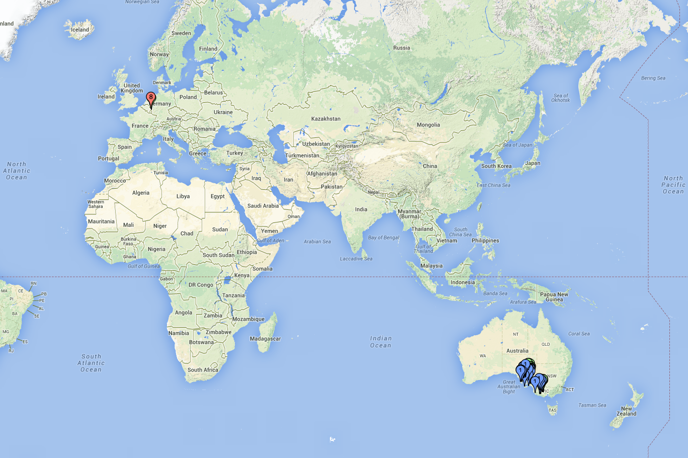
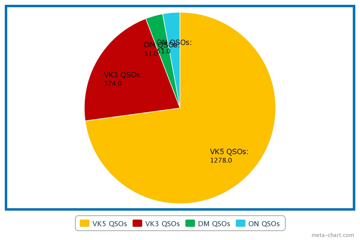
  1. Germany – Low Mountains DM
  2. Belgium ON
  3. Victoria VK3
  4. South Australia VK5.

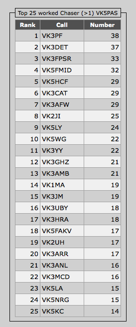
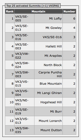
So I am just 1 association off reaching the SOTA Bronze Mountain Hunter certificate.  I was fortunate to activate a German summit and a Belgium summit during my recent trip to Europe.  Many thanks to my good mates Marnix OP7M and Eddy ON6ZV.  I managed 51 contacts from each of those summits, which were also in World Wide Flora and Fauna (WWFF) areas.  In 2013 I journeyed over to Victoria and activated 11 summits with a total of 374 contacts. I have activated a total of 50 unique SOTA peaks around the world. pieChart_jpg My most regular activated summit is Mount Lofty, VK5/ SE-005.  Not surprising, considering Mount Lofty is just 15 km to the west of my home.  This is followed by Mount Gawler, VK5/ SE-013, which is also close to my home.  Mount Gawler is inaccurately recorded as Mount Gowley with GMA. Screenshot 2014-09-12 21.27.49 My most regular chaser is Peter VK3PF with 38 contacts, closely followed by Ernie VK3DET with 37 contacts, and then Peter VK3FPSR with 33 contacts.  Brian VK5FMID comes in at number four, followed by Col VK5HCF.  A total of 620 different operators have made contact with me whilst I have been on a summit.

Screenshot 2014-09-12 21.40.21

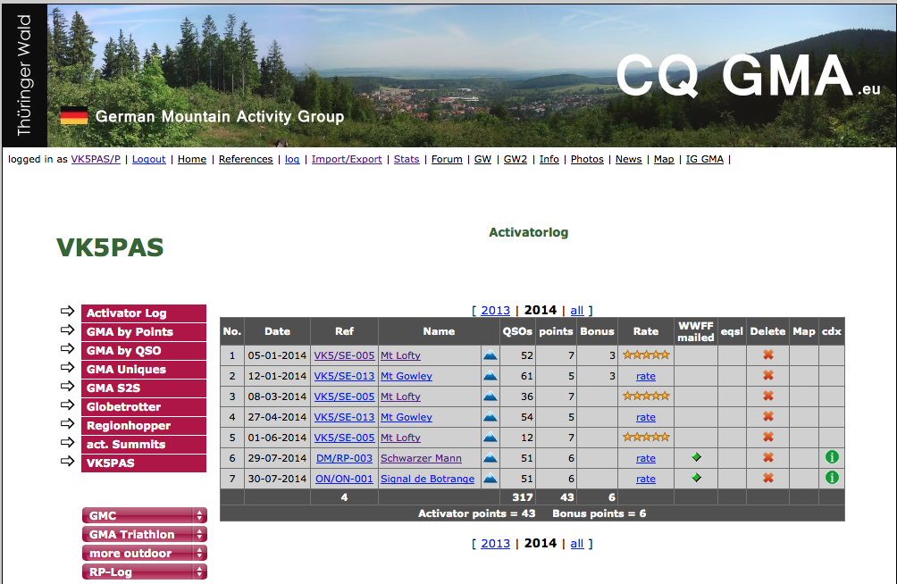
Once you have logged in to the GMA site, and you click on ‘Activator Log’ in the left hand column, you can view your activator progress.  You can either select specific years or all of your activator history.  There is a ‘Rate’ column where you can rate a summit for its access, etc.  There is also a ‘WWFF mailed’ column.  Here, with the click of a button, you can mail your log to the relevant World Wide Flora and Fauna (WWFF) co-ordinator, should your SOTA activation have been within a WWFF area.

You can see from the image below, that as I have previously mentioned, the GMA points system is different to that of SOTA.  Mount Lofty for example, is worth 7 GMA points, but only 4 SOTA points.  Bonus points are issued for activations ‘during the months of November, December, January and February’.  Each activation is awarded an additional 3 winter bonus points.  Clearly these months are not winter months in Australia.  It is our spring time and summer time.  I have pointed this out to the GMA organisers.  However, remember, GMA was originally for German activations.  Just like the issue with the SOTA Database not considering us down here in Australia with the UTC roll over issues we have all experienced.

Screenshot 2014-09-13 09.51.25

In the colin marked ‘Rate’, you are able to rate a summit.  Ratings are from 1 + bad to 5 + excellent.  The rating involves ease of access, noise levels, etc.

The green ‘i’ icon in the ‘cdx’ column indicates that there is information available from the DK0WCY aurora beacon during the time of the specified activation.  This information includes the SFI, and the A and K indexes.

By clicking on the ‘red’ diamond in the ‘WWFF mailed’ column, your log will be automatically sent to the relevant WWFF co-ordinator, should our activation have been in a WWFF area.

Chaser.

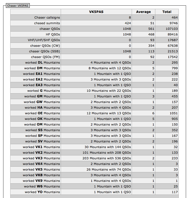
Unfortunately, my chaser statistics do not match with those recored on the SOTA database.  The SOTA database shows that I have worked a total of 467 unique summits.  However the GMA database shows that I have chased a total of 424 unique summits.  I will follow this up with the GMA co-ordinators as there have been prior issues with data that has been entered via GMA.

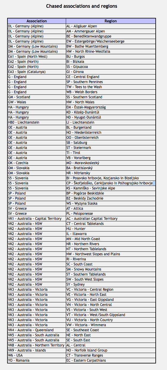
Thanks to the many keen European and United Kingdom activators who are now listening for Australian SOTA chasers, I have worked the following DXCC entities:

  1. Germany
  2. Spain
  3. England
  4. Scotland
  5. Wales
  6. Hungary
  7. Austria
  8. Czech Republic
  9. Slovakia
  10. Slovenia
  11. Poland
  12. Greece
  13. Australia
  14. Norfolk Island
  15. United States
  16. Romania

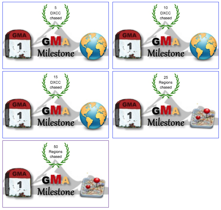
GMA also record your personal milestones: DXCC’s chased, Regions chased, Region hopper, and Globetrotter (you need 5 DXCC’s activated to qualify for this). Screenshot 2014-09-13 09.02.08

Screenshot 2014-09-12 21.25.55

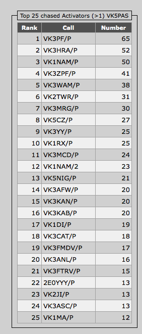
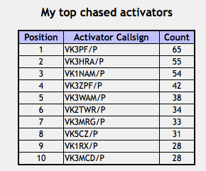
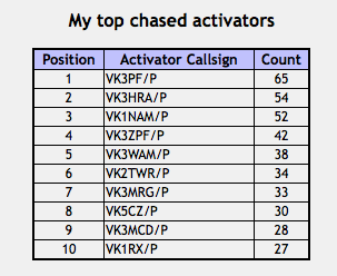
Peter VK3PF is well known as a very keen SOTA and parks activator.  And this is reflected in my Top 25 chased Activators.  Peter is ranked number 1, appearing in my logbook 65 times, followed by parksnpeaks author Allen VK3HRA on 52.  In third place is another SOTA guru, Andrew VK1NAM on 50.

Screenshot 2014-09-12 21.53.32

The above figures differ slightly to the SOTA database (as shown below).  The GMA database does not show duplicates, e.g. a chaser working me twice on the same day.

Screenshot 2014-09-14 21.01.31

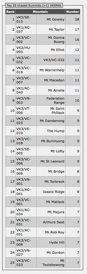
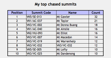
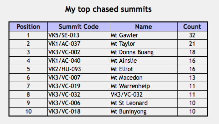
Thanks to a number of VK5’s, particularly Nigel VK5NIG, Mount Gawler VK5/ SE-013 is ranked number 1 in my Top 25 chased Summits.  Mount Gawler is situated in the foothills of the north eastern suburbs of Adelaide and is very easily accessible.  This is followed by Mount Taylor VK1/ AC-037, and in third place is Mount Donna Buang VK3/ VC-002.  These figures differ slightly to the SOTA database.  For example, the SOTA data base shows that I have worked Mount Gawler 32 times, not 28 as indicated by GMA.  However, the GMA database only shows the 28 QSO’s where I have worked the summit for GMA points.  The other 4 are dupes, e.g. worked this summit twice on the one day.

Screenshot 2014-09-12 21.54.02

 Here is the SOTA database figures…..

Screenshot 2014-09-14 21.01.29

As per the activator feature, you can click on ‘wkd Summits’ in the left hand column, and this will bring up the Adventure Radio site and it will show all your worked summits on a map.

Screenshot 2014-09-14 19.55.48So why not register for the GMA.  It is free and easy.  There are some very interesting statistics to be viewed.  And you can earn yourself some more ‘wallpaper for the shack.

Logging pedestrian and bicycle mobile stations

I know that there has been previous discussion on the SOTA Australia Yahoo group as to what to sign when out portable, e.g. VK5PAS/p, or VK5PAS/3.  However, I thought I would share a small problem I’ve been experiencing with my electronic log and Clublog.

k10369564

I run the logging program MacLogger DX and upload my log automatically to Clublog.  I have been getting error messages back from Clublog regarding the pedestrian mobile and bicycle mobile stations that I have worked.  Some have been signing as /pm or /bm.  I have been recording them as /pm and /bm in my electronic log.   However, Clublog deciphers /pm as Indonesia, and deciphers /bm as China.

As a result of a post on the MacLogger DX Yahoo group, I received some very helpful responses.  The upshot is that I need to record pedestrian or bicycle mobile stations as /p and not /pm or /bm.  And simply place ‘pedestrian mobile’ or ‘bicycle mobile’ in the notes field of MacLogger DX.

Clublog accepts /m for mobile, /mm for maritime mobile, and /am for aircraft mobile.

Just for the information of anyone who uses MacLogger DX and Clublog.

Signal de Botrange ON/ON-001 and ONFF-001

On Wednesday 30th July, we headed back over the German/Belgium border, into Belgium and activated Summits on the Air (SOTA) peak Signal de Botrange ON/ON-001 and World Wide Flora and Fauna (WWFF) area Hautes Fagnes-Eifel ONFF-001.

It was about a 90 minute drive from Prum through the mountains back into Belgium.  The countryside was spectacular as we passed through a number of small villages.  It was hard to believe that this was summer, as the landscape was so green.

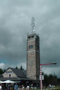
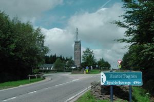
Signal de Botrange is the highest point in Belgium, climbing to 694 metres (2,277 feet).  It is worth a total of 8 SOTA points and is located at the top of a broad plateau, and a road crosses the summit, passing an adjacent cafe.

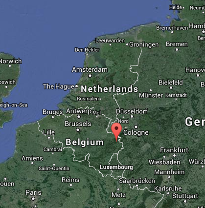
Screenshot 2014-09-09 13.41.34

Map courtesy of googlemaps.com

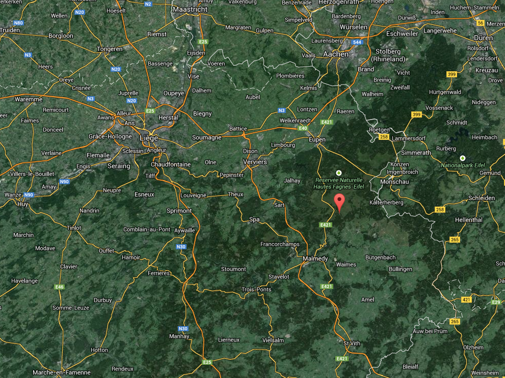
Screenshot 2014-09-09 13.44.26

Map courtesy of googlemaps.com

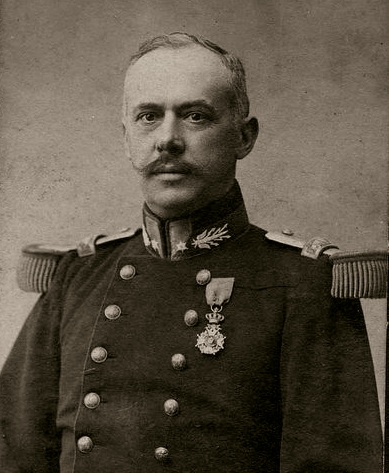
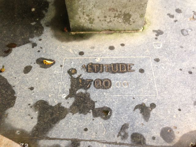
In 1923 a six metre high Baltia tower was built on the summit to allow visitors to reach an altitude of 700 metres.  The tower was named after Baron Herman Baltia, a Belgian military officer (1863-1938).  A stone tower was built in 1934 and this reaches 718 metres.

General_Baltia_Herman

Above: – Baron Herman Baltia.  Photo courtesy of wikipedia.

A meteorological station was located at the summit for many years, but in 1999, it was replaced by a nearby automatic station of the Royal Meteorological Institute of Belgium.  The summit experiences extreme temperatures and these are usually lower than at any other place in Belgium.  Fortunately on the day of our activation, the weather was overcast but fine.

IMGA0048_4

The summit is located within the Hautes Fagnes (High Fens) covers 12 municipalities of Belgium and was established in 1957.  It is the largest nature reserve in Belgium, with an area of 4,501.2 hectares (11,123 acres).  In winter, the area becomes Belgium’s premier cross country ski resorts.

IMGA0050_2

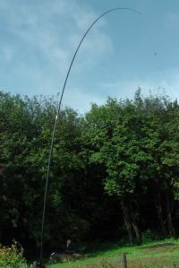
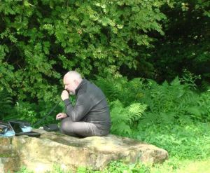
We operated from the edge of the carpark and attached Eddy’s end fed antenna to the 9 metre squid pole which in turn was attached to a nearby post.  Again for this activation we used the Kenwood TS-50.

IMGA0043_4

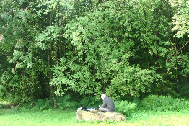
There was a nice large flat rock nearby which served well as an operating location.  As we were close by to the main carpark for the nature park, there was a lot of traffic.  I was surprised at how many visitors there were to the park, considering that it was a week day.  We certainly did attract some odd looks as people arrived and prepared to head off for a walk into the park.

IMGA0040_3

IMGA0047_4

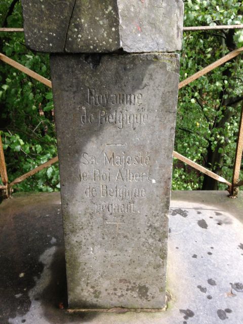
Whilst I was operating my tolerant wife Marija went for a walk along the boardwalk at the rear of the cafe, and took some photos of the 700 m marker.  The actual trig point is a short distance from here.

IMG_0435 IMG_0437 IMG_0438

I commenced on 40 metres and remained there for the duration of the activation.  My first contact was with Luciano I5FLN, and this was followed by a steady flow of callers from Europe and the United Kingdom.

Again, it was a little too late for propagation to Australia on 20 m.  We had enjoyed a bit of a sleep in at the hotel and a nice breakfast, so we had just missed the window for long path propagation into Australia on 20 metres.

IMGA0042_4

I managed three WWFF park to park contacts during the activation:

  • OK1FHI, OKFF-010
  • DL1ASF, DLFF-127
  • DG6LAU, DLFF-040

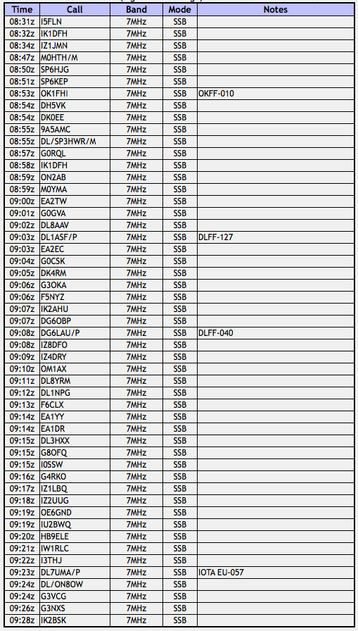
Fortunately there were no equipment issues during this activation.  Everything went very smooth.  After an hour of operating I ended up with 51 contacts.  All on 40m SSB.  The following countries were worked:-

  • Austria
  • Belgium
  • Croatia
  • Czech Republic
  • England
  • France
  • Germany
  • Italy
  • Poland
  • Slovakia
  • Spain

Screenshot 2014-09-09 14.52.22

Another very enjoyable activation.  My second in Europe.  It was time to hit the road again, and journey north through Belgium back home to Ghent in northern Belgium.

I would like to thank Marnix and Eddy for their time and effort in allowing me to activate the 2 summit/WWFF areas in Germany and Belgium.  It was a hug he amount of fun.

Schwarzer Mann, DM/ RP-003 and DLFF-047

I have just returned from 7 very enjoyable weeks in Europe.  Whilst there I had the honour to stay for a week with Marnix OP7M, his wife Martine, and their 16 year old son Goan.  I have spoken with Marnix many times on the radio, and also on Skype, but this was the first time we had met in person.  My wife Marija and I had a very enjoyable time at Marnix and Martine’s home, with plenty of laughs, good food, lots of stories, and our fair share of Belgium beer.  Whilst staying with Marnix, we also met Eddy ON6ZV and his wife Carine and their son.

Marnix knew I was a keen SOTA & parks activator, so the day after arriving, on 29th July, Marnix, Eddy , myself and Marija headed over the border into Germany for a SOTA and WWFF activation.  It wasn’t a short drive to get there.  In fact it was about a 3 hour drive to our destination near Prüm.  However, Marnix had told me that this was a beautiful area, and was well worth the drive and an opportunity to see the Belgium countryside.  Indeed it was.  He and Eddy also had plans to activate another summit / WWFF area on the way home the following day, in Belgium.

The chosen summit in Germany was Schwarzer Mann, DM/ RP-003, which is 697 metres (2,286 feet) above sea level and is worth 6 SOTA points.  Its grid square locator is JO30eg.  The summit is located in the German (Low Mountains) Association in the Rhineland-Palatinate Region.  It is located in the western part of the Eifel mountain range, which is known as Schnee Eifel (Snowy Eifel) and  is about 14 km from the little village of Prüm.  Schwarzer Mann means ‘Black Man”.  It is the highest peak in the Schnee Eifel and the third highest in the Eifel.  The summit was first activated by DL/ON6DSL/p on 24th December 2007, and has been activated a total of 42 times since.

Screenshot 2014-06-26 17.54.53

Map courtesy of sota.org.uk

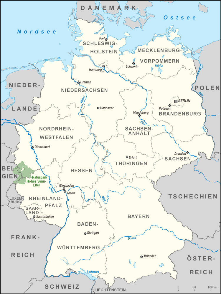
The summit is also located in World Wide Flora and Fauna area, DLFF-047, German-Belgian High Fens-Eifel Nature Park.  The area is known as Naturpark Hohes Venn-Eifel in German and is often called the North Eifel Nature Park (Naturpark Nord Eifel).  It is a cross border nature park with the German federal states of North Rhine-Westphalia and Rhineland-Palatinate, as well as the Belgian province of Liege.  The park comprises a total area of 2,485 km2.

Karte_Naturpark_Hohes_Venn-Eifel

Map courtesy of wikipedia.com

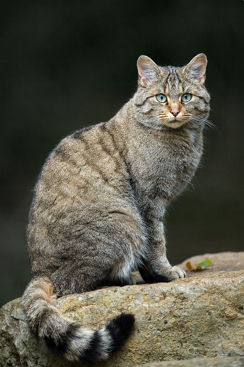
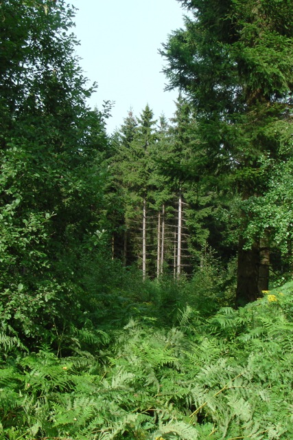
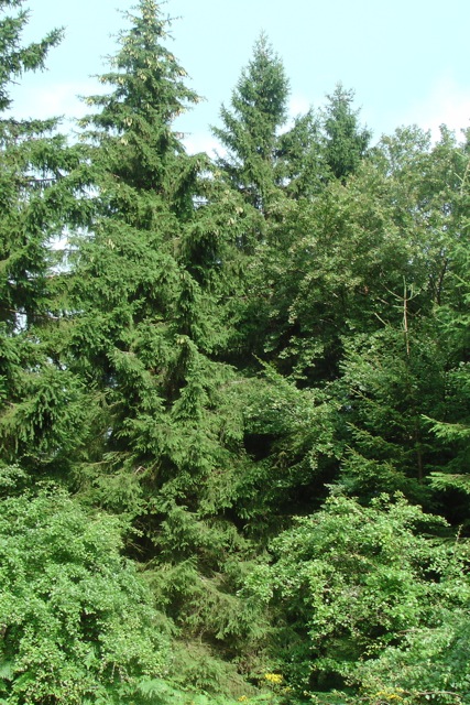
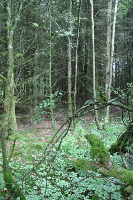
The areas surrounding Schwarzer Mann is a well developed hiking area and the largest skiing area in Rhineland-Palatinate.  The heavily wooded mountain side is covered mainly with spruce trees and is host to some rare wild animals including the wildcat, which sadly I didn’t see.  Or maybe that isn’t so bad!

Felis_silvestris_silvestris_Luc_Viatour

Image courtesy of wikipedia.com

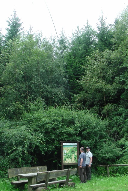
We set up just north of the summit off the L20 road which passes through the park.

IMGA0095_3

The vegetation here was very different to home.  Despite it being summer time, he forest was lush and green and very thick.  A stark contrast to the parks in South Australia during summer.  And not a single gum tree or kangaroo in sight!

IMGA0005_4 IMGA0006_4 IMGA0011_5

Because of reciprocal licensing issues, I was not able to operate under my own call sign.  Germany did offer the option of a 3 month temporary licence, so prior to leaving for Europe I applied for a German temporary operating licence, which would have allowed me restricted operating rights.  However, I had left my run a bit too late, and did not receive the documentation from DARC until I had left Australia.  But there was another option.  As I am a police officer, and Eddy is a police officer, we used the call sign of ON4IPA, which belongs to the International Police Association (IPA).  In fact, Eddy is the caretaker of that special call sign and the Chairman of the IPA in Belgium.  As I am a Detective here in South Australia, this was a really neat call sign to use.

on4ipa

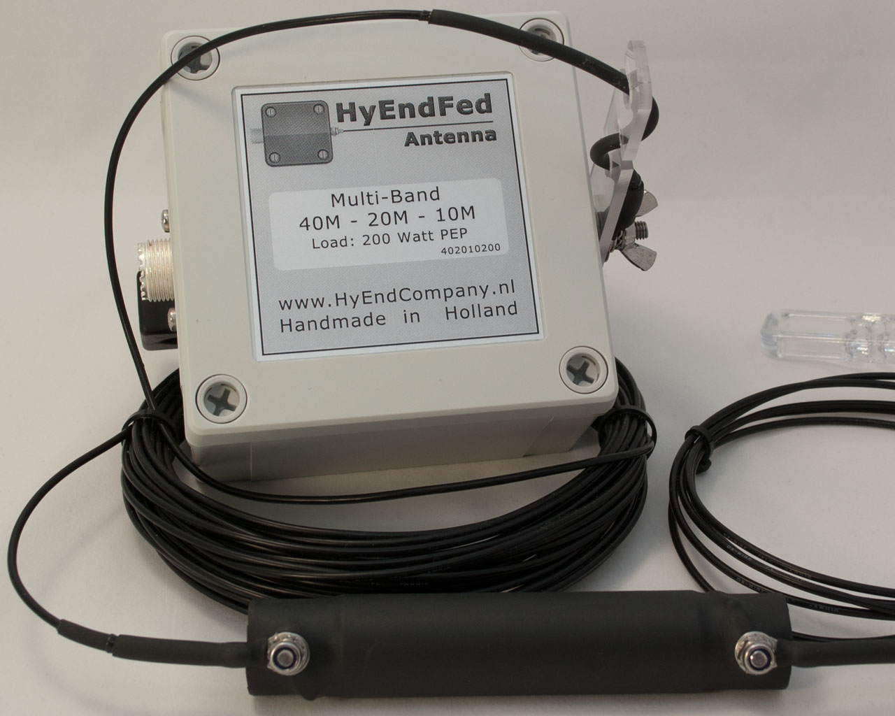
Our equipment was Eddy’s Kenwood TS50, and his ‘Hy End Fed’ half wave end fed antenna which we attached to the top of a 9 metre squid pole.  A very easy antenna to erect.  More information on this antenna can be found at…..

http://www.hyendcompany.nl/home

3b200pc

I initially started off on 20 metres on 14.244 and called CQ a number of times, with Eddy at my side doing the logging on the laptop.  But there were no takers.  I kept calling CQ for about 5 minutes, before being called by Vincenzo IZ5YHE and then Rudolf OM3CHR.  However their signals were extremely low and it was a struggle to make the contacts.  With a degree of frustration, we checked the antenna and it appeared ok.

I kept calling CQ for a few more minutes, but sadly there were no takers.  Now I was starting to get disappointed.  Perhaps band conditions on 20 m were not good?  So we QSY’d over to 40 metres where we tuned across the band and found the Commonwealth Games special event station, GA14CG.   Signals were still down despite being able to make the contact.  Something was clearly wrong.  Again we checked the antenna and it appeared all okay.

Again, I put out some CQ calls and no takers.  So this time we hooked up an LDG auto tuner, and found the VSWR to be very high.  After further checking we found an issue with one of the patch leads and replaced it. This solved the problem and we were back in business.  I breathed a sigh of relief.

IMGA0101_2

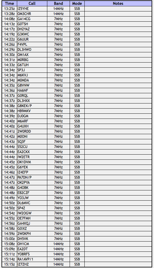
I then moved up the band a little to 7.144 and called CQ and this time I was greeted by a number of callers.  My first caller here was Keith G0TSH.  A steady flow of European and UK callers followed.  I worked a total of 43 stations before moving back to 20 m where I worked another 5 stations before handing the mic over to Eddy.

A number of the stations that I worked during the afternoon, recognised that I did not have a Belgian accent.  They must have been wondering why is an Aussie operating a Belgium call sign in Germany?  This included Manuel, EA2DT, who I have worked many times before whilst I’ve either been in a park or on a summit in Australia.  During the QSO Manual said; “One question.  Is you Paul, Victor Kilo 5 Papa Alpha Sierra.  Is you Paul, roger?'” Once I told Manuel that it was in fact me at the mic, he was very excited, as was I.

I ended up with a total of 51 contacts.  The majority of those being on 40 metres, and all from Europe and the United Kingdom.  The following countries were worked:-

  • Austria
  • Czech Republic
  • England
  • France
  • Germany
  • Hungary
  • Italy
  • Poland
  • Romania
  • Russia
  • Slovak Republic
  • Slovenia
  • Spain
  • Switzerland
  • Wales

Sadly it was the wrong time of the day for good propagation to Australia.

Screenshot 2014-09-09 14.54.18

As a result of this activation, I found that World Wide Flora and Fauna (WWFF) is extremely popular in Europe.  Many of the stations I worked were very keen on the WWFF reference number.  Who knows, maybe WWFF will kick off and become popular in Australia too.  It hasn’t been for the lack of trying!

After the activation we retired to our accommodation, which was the Hotel Zum Goldenen Stern in Prüm.  That night we enjoyed a very nice meal and a few good German beers.IMGA0018_4IMGA0019_5

IMGA0024_5IMGA0022_5

References.

Wikipedia, 2014, ‘Schwarzer Mann’, accessed 9th September 2014, <http://en.wikipedia.org/wiki/Schwarzer_Mann&gt;

Wikipedia, 2014, “High Fens-Eifel Nature Park’, accessed 9th September 2014, <http://en.wikipedia.org/wiki/High_Fens_–_Eifel_Nature_Park&gt;

parksnpeaks

Currently there are no phone apps similar to SOTA Goat or Rucksack radio, for park activations.  So park activators are relying on the goodwill of park hunters to let other people know that they are in a park.  As a result, activators and hunters are relying on other methods, such as setting up an SMS group (which I have done).  This is a great way to let fellow park hunters know that you have just worked a park activator.  I see that many park hunters have also been using the VK5 Parks Yahoo group or the WWFF Australia Yahoo group, and this is another good option.  The DX cluster can also be utilised.

However, a terrific tool that many people still do not appear to be using is the parksnpeaks site which has been developed by Allen VK3HRA.

parksnpeaks can be located at…..

http://www.parksnpeaks.org

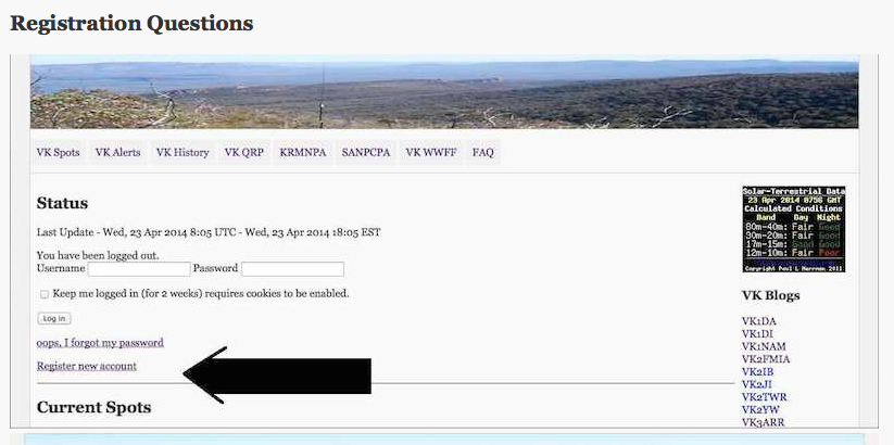
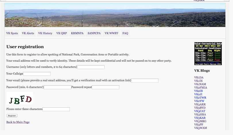
The parksnpeaks site is FREE to join.  Just simply register a new account.

Screenshot 2014-07-18 15.24.54

The required information includes:

  • username (your call sign is a good choice)
  • call sign (used to record alerts)
  • emial address
  • password (6 characters)

The ‘captcha’ feature is used to ensure that you are a ‘real’ person.

Screenshot 2014-07-18 15.25.55

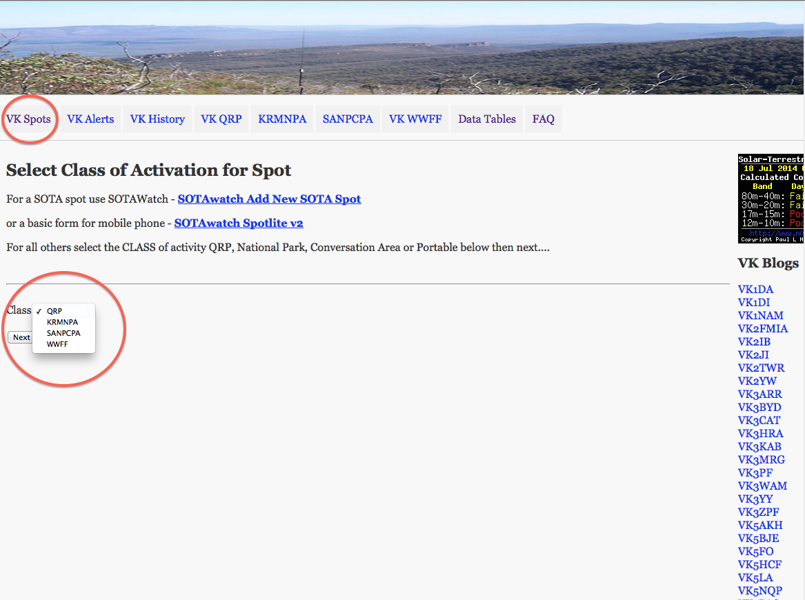
The parksnpeaks site has some excellent features.  It can be used to add VK activity including QRP operation, National Parks, Conservation Parks, or portable operation in general, whilst SOTA spots are added directly via SOTAWatch.

The parksnpeaks site offers:-

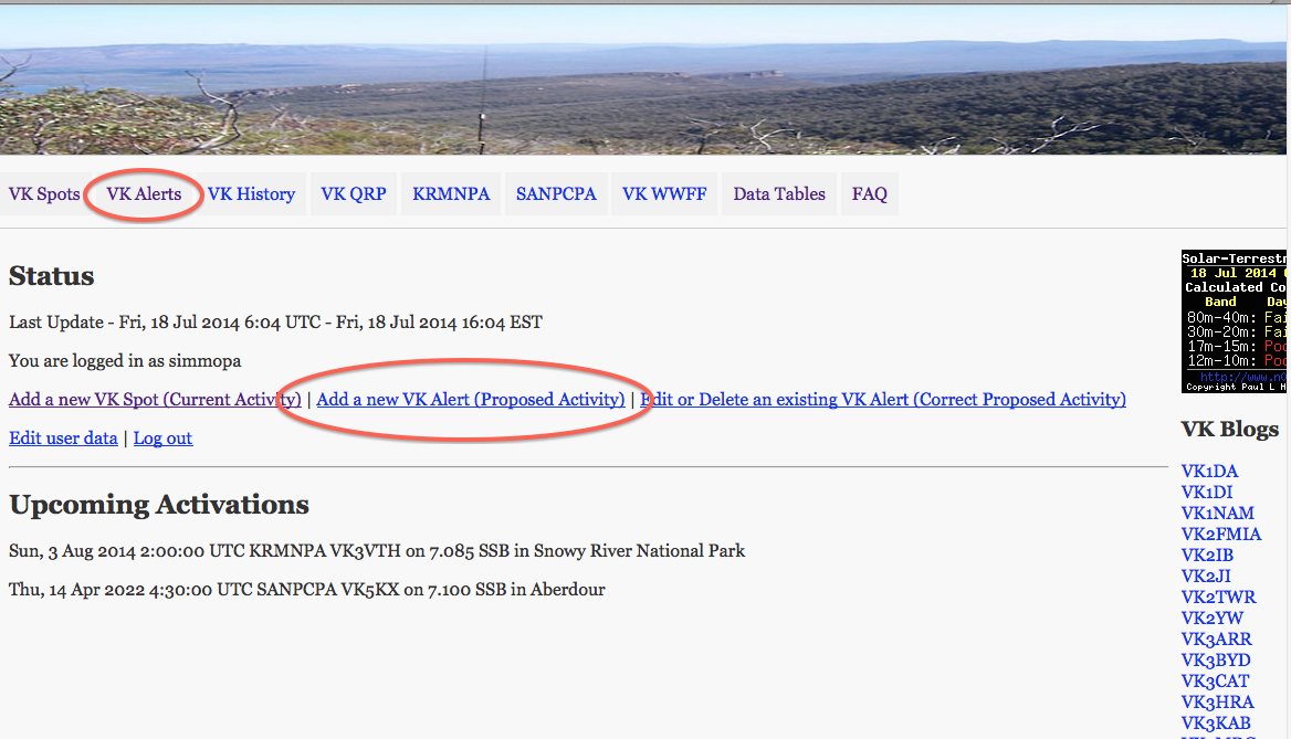
  • ‘spotting’ facilities

and

  • ‘alert’ facilities.

‘Spotting’ is where you can add details of stations you have worked or heard.  This allows you to share information with other amateurs.

Screenshot 2014-07-18 15.31.09

‘Alerting’ is where you can add details of your proposed activations, so people can see what your future plans are.

Screenshot 2014-07-18 15.34.30

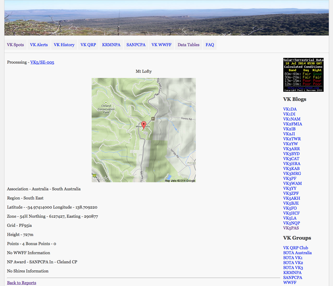
The ‘Data tables’ area offers some excellent information.  Allen, with the assistance of many others, has added a search facilty by summit ID to the parksnpeaks website.  If you look under the ‘data tables’ tab you will find a search box.  This search will provide you with:

  • basic SOTA peak information
  • grid location
  • VKFF id
  • relevant KRMNPA and/or SANPCPA National Park/Conservation Park information
  • Shire information (only VK3 at this stage).

Screenshot 2014-07-18 15.15.16

Also under the Data Tables tab you will find:-

  • WWFF list (a full list of all qualifying WWFF parks)
  • KRMNPA list (a full list of all qualifying KRMNPA parks)
  • SANPCPA list (a full list of all qualifying SANPCPA parks)
  • SOTA list
  • SOTA to NP Awards Lookup
  • SOTA to NP WWFF lookup
  • SOTA to Victorian LGA lookup.

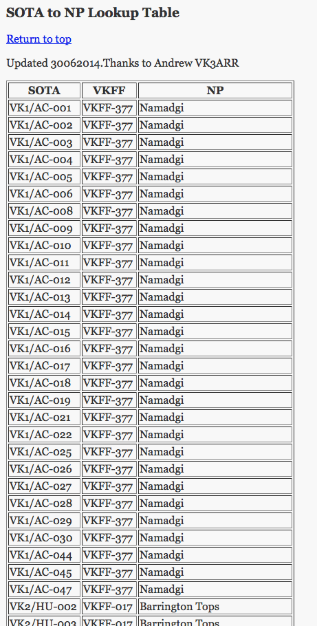
The SOTA to National Park lookup lists, marry up those SOTA summits which are located within a qualifying WWFF or KRMNPA National Park.  This is an excellent resource.

Screenshot 2014-07-18 15.45.58

So, PLEASE…..start using the parksnpeaks site.  A lot of work has gone into it.  I know that many park activators and hunters do use the site, and find it to be a terrific resource.


Kenneth Stirling Conservation Park

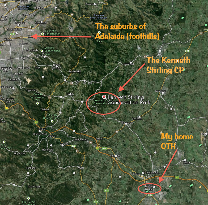
Last Sunday (6th July 2014), I headed out to activate the Kenneth Stirling Conservation Park, which is located near Carey Gully in the Mount Lofty Ranges ‘Adelaide Hills’.  It is just a short 19 km journey from home.  I last activated this park in May last year when I stayed til just after sunset, and worked some very interesting DX on 40m including New Zealand and Norfolk Island.

This park has a very interesting history and was named after Kenneth George Stirling.  For more information, please see my previous blog at…..

https://vk5pas.wordpress.com/2013/05/10/kenneth-stirling-conservation-park/

And the Australian Dictionary of Biography at…..

http://adb.anu.edu.au/biography/stirling-kenneth-george-11773

 Screenshot 2014-07-11 10.44.27

Map courtesy of mapcarta

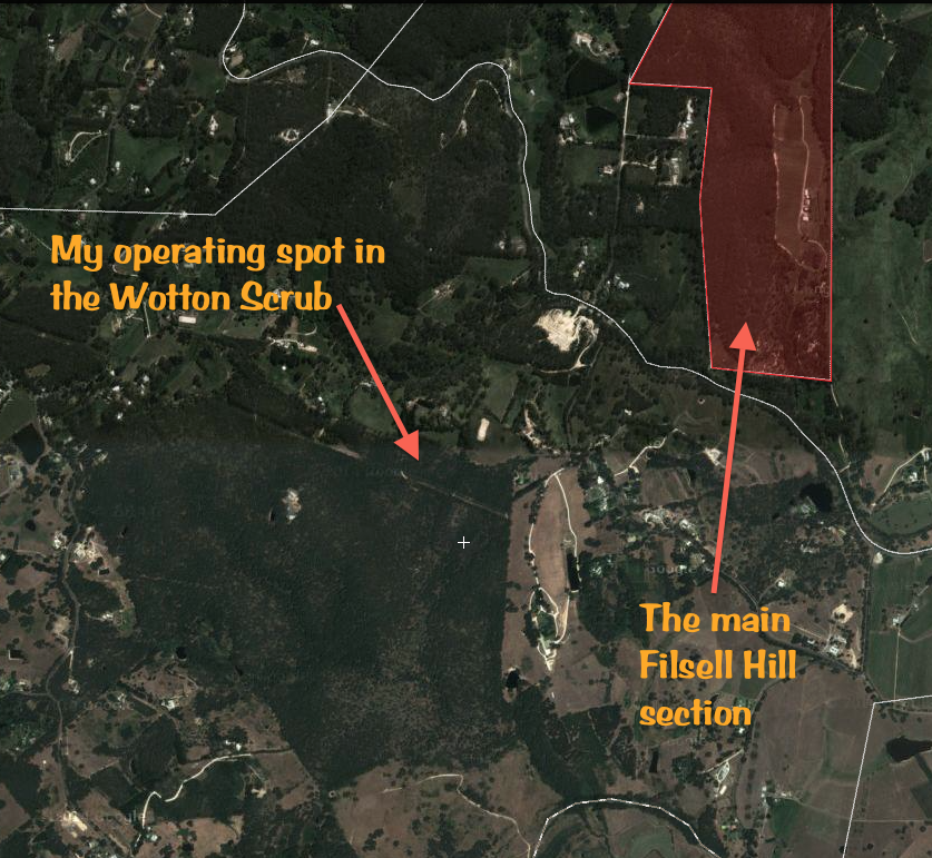
As per last year I activated the Wotton Scrub section of the park, just off Gum Flat Road.  This park consists of 4 separate pieces of scrub.  Some of the others seem a little more difficult to get to, so I played it safe, and activated Wotton Scrub.  Next time I’m going to try the other sections.  Filsell Hill, which is the largest of the four sections has limited access passing through private land to the park entrance.  Access into White Scrub and Burdett Scrub is limited, as there are no walking trails or vehicle tracks within the reserves.

Screenshot 2014-07-11 11.59.55

Map courtesy of wikimapia

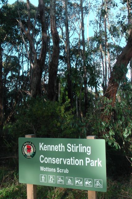
There is a carpark off Gum Flat Road with plenty of room for a number of vehicles.  From there it is just a matter of walking through the gate into the park.  There is a 4WD track at this location, but is is only accessible to official vehicular traffic such as DEWNR, CFS, etc.  In an event, the large gate is locked which prevents vehicle entry.

IMGA0005

I set up about 20 metres in from the gate.  There is plenty of room here to stretch out the legs of the dipole, following the 4WD track.  I tied the ends of the dipole off to some of the nearby gum trees and set up my fold up table and deck chair.  As per recent activations, I again used the Yaesu FT-450, and my linked dipole, and ran 40 watts.

IMGA0002

I started off on 40m on my promised frequency of 7.095 and my first contact was with Peter VK3PF who was running QRP 5 watts.  Peter had a very nice 5/9 signal coming into the park.  This was followed by Matt VK1MA/3 who was on SOTA peak Mount Dandenong VK3/ VC-025, which is also located in the Dandenong Ranges National Park.  So that was a bonus: a SOTA, KRMNPA, & WWFF contact.

Peter had told me that Rob VK2QR was on a summit and was up on 7.118, so I quickly QSYd up the band and worked Rob who was a beautiful 5/9 signal, as always!  Rob always has a great signal from his SOTA activations.  This time Rob was sitting on the top of Yanky Ned Hill, VK2/ SW-026 in the Bondo State Forest.

IMGA0001

After speaking with Rob, I QSYd back down to 7.095 but in that short period of time, the frequency had become busy, so I moved up slightly to 7.105, where my first taker was dedicated parks hunter, Tim VK5AV in Mount Gambier, with a beautiful 5/9 signal.  This was followed by a steady flow of callers from VK1, VK2, VK3, VK4, VK5, and VK7.  I was very surprised to be called by George VK4GSF at Toowoomba.  George runs low power and was a good 5/5 copy into Kenneth Stirling, and I received a 5/7 signal report back.  I also worked a handful of QRP operators including Peter VK3PF on 5 watts, Peter VK3TKK, and Col VK5HCF.  It was also good to get Nigel in the log, VK2PHA who was mobile, crossing the Hawkesbury River.

After operating on 40m for just a little over an hour, I headed up to 20m and managed to find a clear spot on 14.237.  After just a few CQ calls, I heard KJ6PNF come back to me.  But sadly, another very strong USA station came up just 1 kc away.  There is a group of VKs and USA fellas that come up on 20m every day on or around 14.240 and it was evident they were not going to move for anyone.  So that was the end of that.

I moved up to 14.245 and started calling CQ again and was greeted by Paul VK2HDX in Sydney, who was using a Magentic loop antenna, with a terrific 5/9 signal.  Paul was kind enough to spot me on the DX cluster, and as a result I worked a few Europeans: Slovenia, Italy, Switzerland, Belgium, Poland, Spain, Sweden, and Russia.  This included my old mate Marnix OP7M, who I will be staying with in a few weeks time during my trip to Europe.
The sun was starting to go down and it was getting a little chilly, so it was time to pack up and head for home.  Again, this was a very enjoyable afternoon in the Kenneth Stirling Conservation Park.  I and a total of 43 contacts in the log.

The following stations were worked on 40m SSB:-

Peter VK3PF; Matt VK1MA/3 (SOTA); Rob VK2QR/p (SOTA); Tim VK5AV; Rod VK5VRB; Les VK5KLV; Bernard VK3AMB; Brian VK5FMID; Richard VK5ZRY; Peter VK2MDZ; Peter VK3TKK; Ian VK5IS; George VK4GSF; Paul VK7CC; Arno VK5ZAR; Col VK5HCF; Tom VK5EE; Phil VK3BHR; Andrew VK1NAM; Tony VK3VTH/p; Albert VK3KLB; Ton y VK3CAT; Barry VK5BW; Hans VK5YX; Steve VK3JY/p; Nigel VK2PHA/m; Ron VK3VBC; and John VK5NJ.

The following stations were worked on 20m SSB:-

Paul VK2HDX; Albert S58AL; Max IK1GPG; IK7CMY; Vince HB9EVJ; Marnix OP7M; S52KM; SP5INQ; John ON7ZM; EA4DTV; SM7LPY; Alan VK4NAI; UA9LT; Ted VK6NTE; and Paul EA5/GM0OPK.

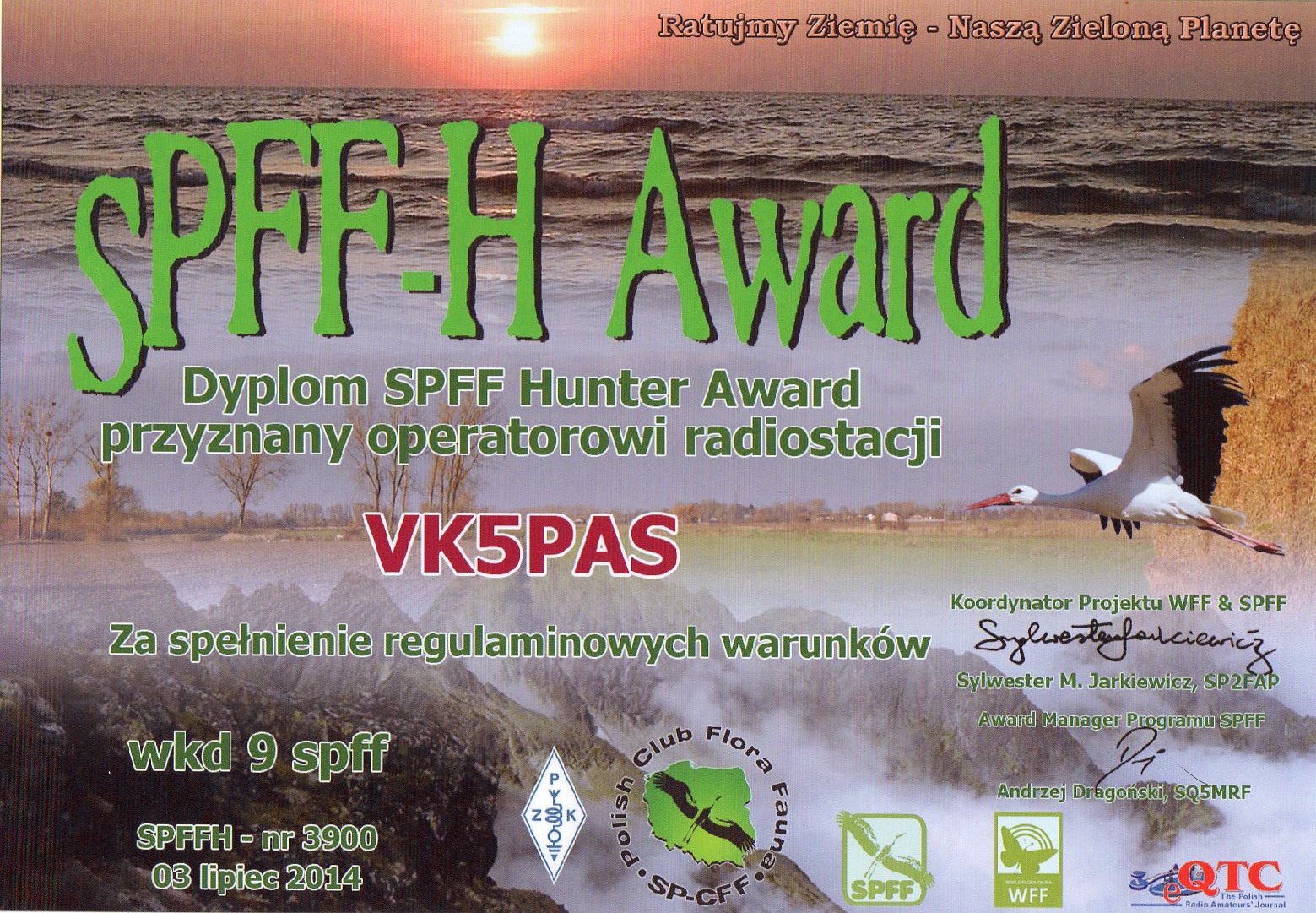
SPFF-H award

I received the following certificate today via e-mail after applying on line, on the WWFF LogSearch facility.  It is the SPFF-H Award, issued by the SPPFF-Polska Flora Fauna program.  It is another of the many National awards available in the World Wide Flora Fauna program.

The basic SPFF-H award is issued for communications with 3 different SPFF areas.  For each subsequent three SPFF areas, yields a higher class of award.

More information on the SPFF awards can be found at…..

http://spff.eham.pl/articles.php?article_id=13

SPFF-H Award305

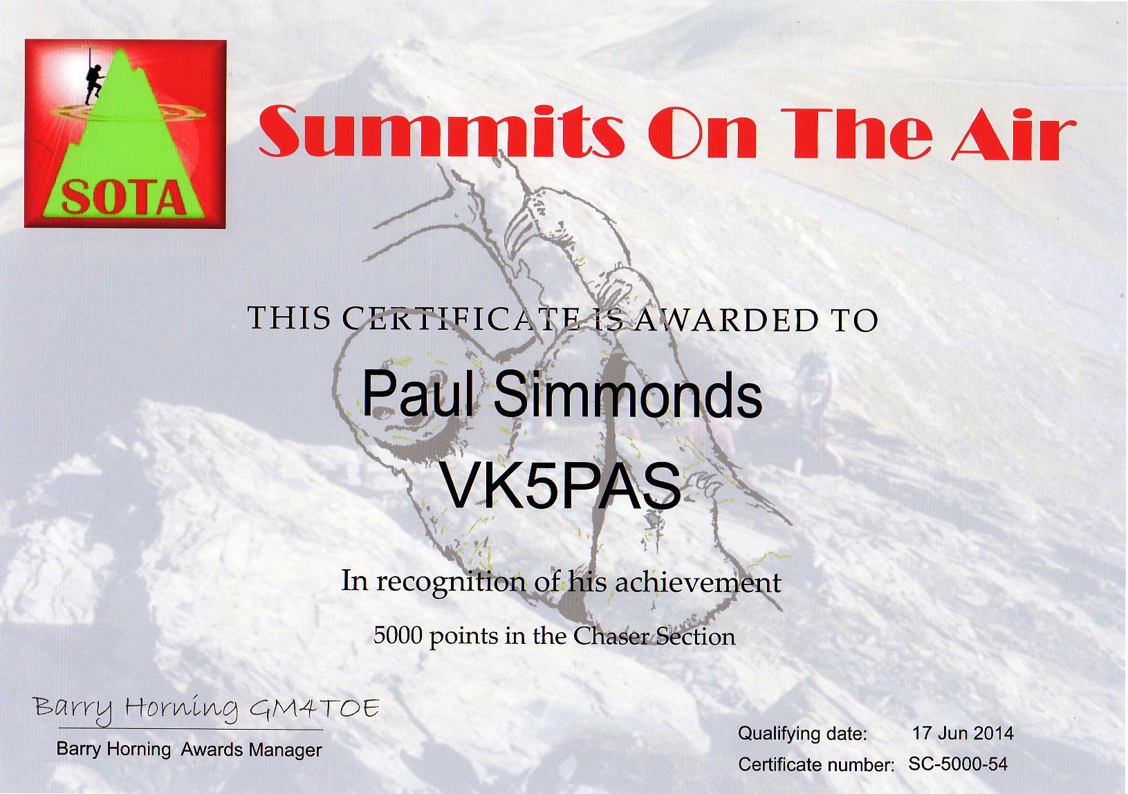
5000 point SOTA Chaser certificate

Thanks to some devoted Summits on the Air (SOTA) activators, back in June I went over the 5,000 point mark as a SOTA chaser.  I applied for my certificate a few weeks ago and it was sent through via email from the United Kingdom today.

SOTA 5000 Chaser304


It was interesting to check some of my statistics on the SOTA database.

My top chased summit was nearby Mount Gawler, VK5/ SE-013, mostly thanks to Mr. Mount Gawler himself, Nigel VK5NIG.

Screenshot 2014-07-03 18.15.44

My top chased activator was Peter VK3PF, followed by Allen VK3HRA, and then Andrew VK1NAM.  Not too many VK5s in there!

Screenshot 2014-07-03 18.16.18

And I have worked a total of 25 different associations and a total of 67 regions.  With many of those being in Europe.  I’ve just managed the one contact into the United States of America.

Screenshot 2014-07-03 18.17.19


Peakery

Just wanted to bring an interesting website to everyone’s attention.  It’s called ‘peakery’.  It can be located at…..

http://peakery.com

logo

The peakery website features over 330,000 peaks from around the globe.  You are able to find peaks by browsing lists, maps, and photos.  You can also use peakery to envision your next peak objective with photos, trip reports, statistics, 3D fly-arounds, and maps.  The 3D fly around feature is extremely good.

There are currently 10,820 peaks in Australia, that are recorded on peakery

On the site you can also log all of your summits.  Once you’ve returned safely from your summit, you can share your summit experience, by adding trip details, photos, route info, and information on who you went with.

Every peak that you summit earns you its summit badge.  As you climb more peaks, you rise up the ranks as shown on the Members page.

Screenshot 2014-06-28 20.40.01

Just as with WordPress, you can follow someone’s progress.

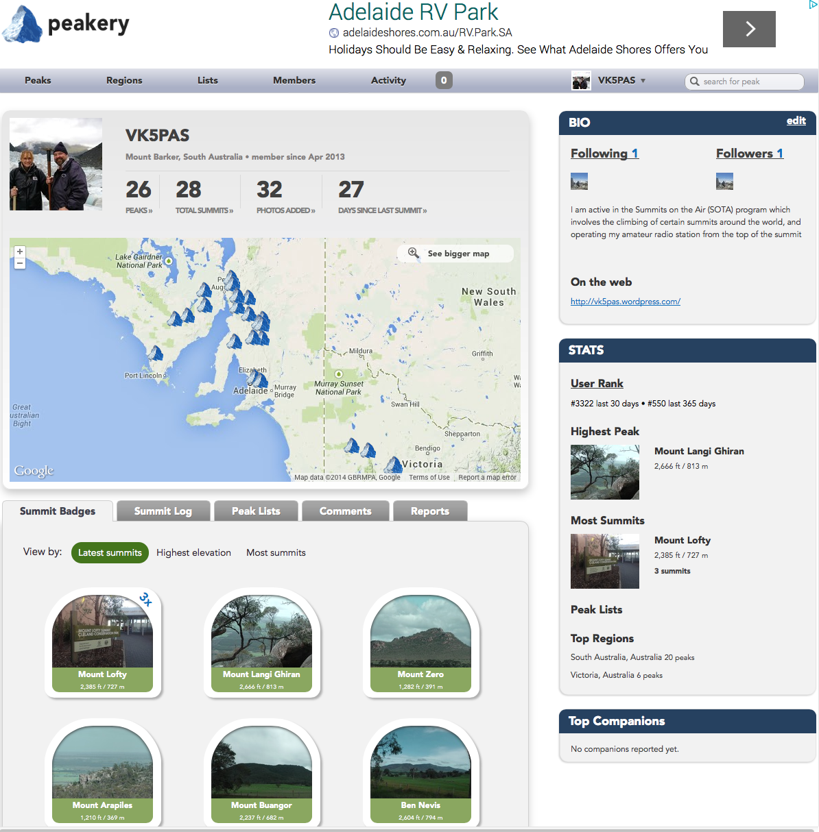
Your page will also show you some interesting facts such as your user rank, the highest peak that you have activated, and the top regions that you have climbed peaks in.

Peakery can also be found on Facebook…..

https://www.facebook.com/peakery

You can even download your own peakery Annual Report which documents your year in the mountains.  The Annual Report is a comprehensive summary including all of your claimed peaks and summit logs for a specific year.

annual_report

If a summit does not appear on the peakery list, you can add it to peakery.  Your addition will first go to the peakery moderator/s for their approval.  I should warn you, that not all will be included, even if they have the 150 metres of prominence as required with SOTA.  A total of 19 of the SOTA summits I have activated are not recorded on peakery, and at this stage have not been approved to be added?  This is about 40 % of my SOTA activations.

However, despite this, peakery is another tool that can be used when considering activating a peak as part of the Summits on the Air (SOTA) program.