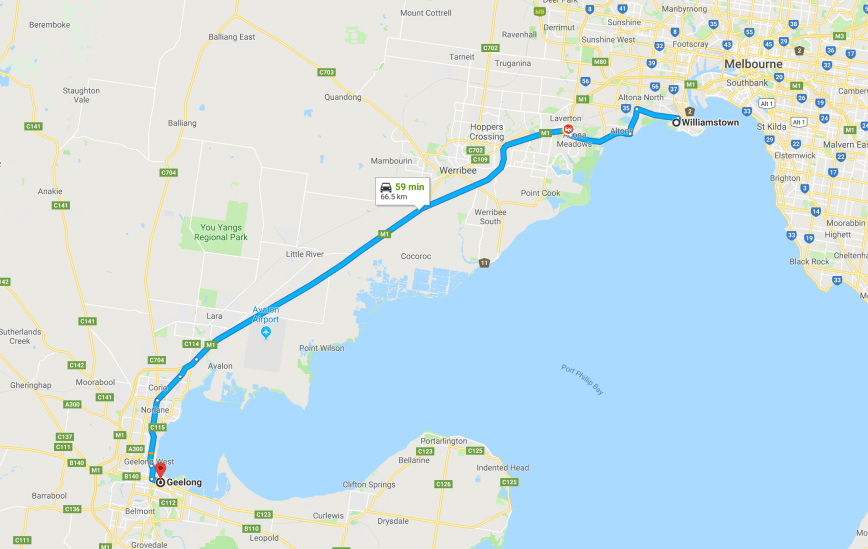
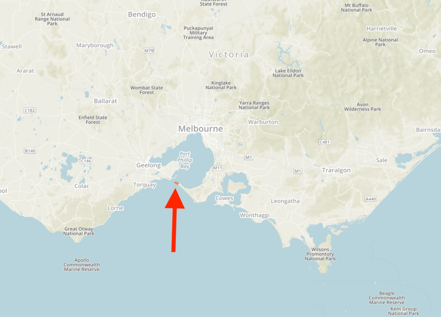
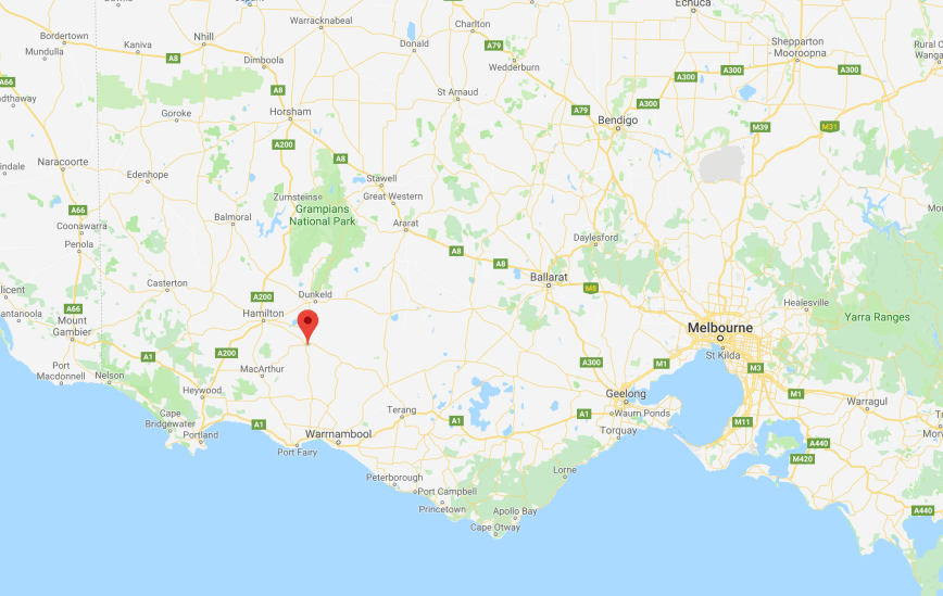
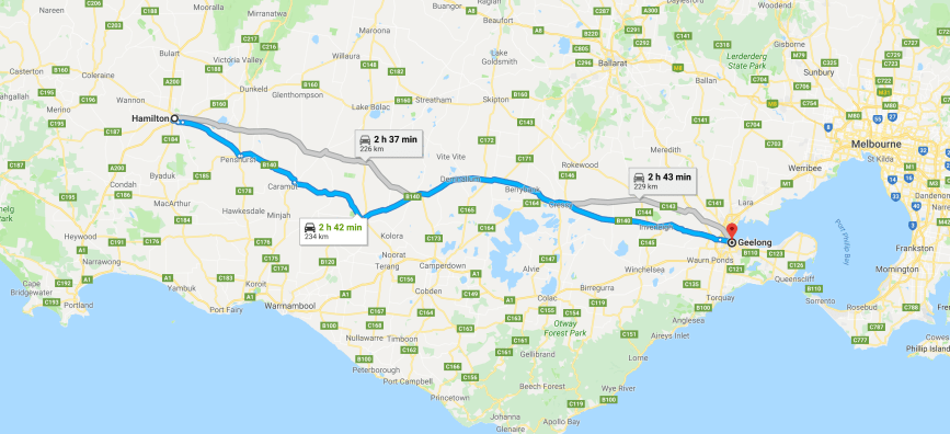
Day eleven (Monday 26th November 2018) was now upon us. Our three nights in Sorrento had absolutely flown by, and it was time for us to leave the Mornington Peninsula and travel to Williamstown on the south western side of Melbourne. We had around a 118 km drive ahead of us, and had planned to stay one night in Williamstown so we could catch up with some friends.
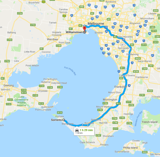
Above:- Map showing the route between Sorrento and Williamstown. Map courtesy of google maps.
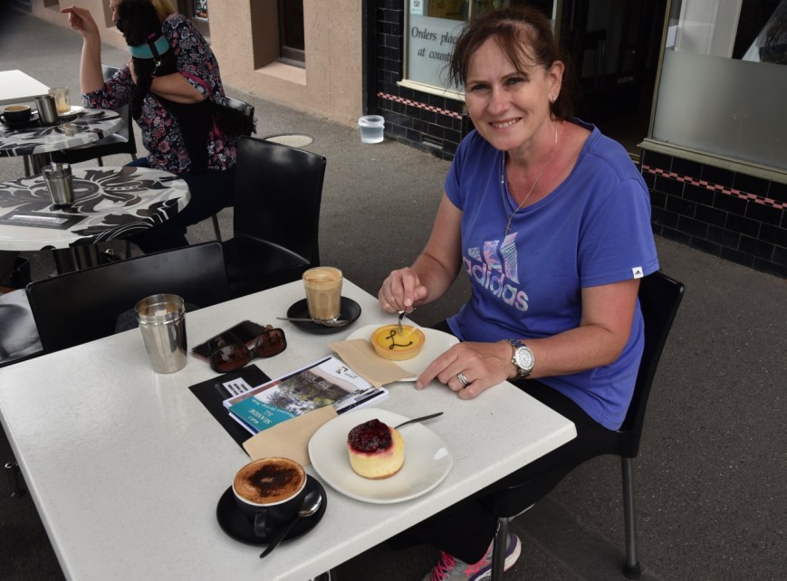
We kicked off the day by heading down the main street of Sorrento for a cooked breakfast at Mr. Sticksenbones. After breakfast we strolled down to ‘Just Fine Food’, as we were told by a friend that they produced a magnificent Vanilla slice. And I am partial to a Vanilla slice, so Marija did not have to twist my arm.
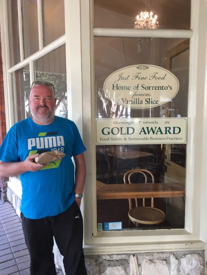
Above:- A very satisfied me at the Sorrento bakery.
We then headed down Point Nepean Road at Sorrento and stopped at the site of the 1803 Collins Settlement. It was here in October 1803, that the first British colonists landed seeking a suitable site to establish a settlement. The colony was short lived and relocated by the end of May 1804 to Van Dieman’s Land (Tasmania). It was a beautiful morning and there were some great views along the coast.

The Collins settlement site

Looking across the bay towards Mornington and Arthurs Seat
We travelled a short distance down the road to Sullivan Bay. It was here, at Sorrento in October 1803, that the first British colony was established thirty two years before Melbourne was founded. There are a number of information boards here telling you all about this very historic site.
In October 1803, two ships from England, HMS Calcutta and the Ocean, anchored in the sheltered waters of nearby Camerons Bight. On the 14th day of October, unloading of the ships commenced, with the settlers walking across the foreshore to Sullivan Bay. It became an open air gaol for 300 convicts, guarded by 50 marines and administered by 11 public servants. There were 55 free settlers. The demographics were 383 men, 38 women, 20 boys, and 16 girls.

Sullivan Bat
We also had a look at the Bicentennial Monument (1803-2003) which records details of the 1803 Collins Settlement, including the names of the Garrison members, the settlers, and the convicts.
There is an 1803 Settlement Centre here, but unfortunately it was closed. But out the front of the centre there are a number of information boards which detail the indigeneous and European history of the area.
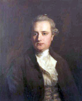
We then took a short walk to the JP Fawkner Lookout which overlooks the coast including Camerons Bight. Who was JP Fawkner? John Pascoe Fawkner was amongst the convict children to arrive at the Collins Settlement. He was just 11 years old, and had arrived with his convict father, his mother, and his young sister.
With the other Collins settlers, he and his family moved to Van Diemans Land in 1804, where he grew up. He was convicted for helping convicts escape during this time. He later married and became a businessman in Launceston. In 1835 he purchased the schooner Enterprise to cross Bass Strait and settle on the Yarra River. Fawkner became known as the ‘Father of Melbourne’. An amazing life of a man who had arrived in the colony as the son of a convict.

Above:- John Pascoe Fawkner. Image courtesy of wikipedia
Nearby are four grave sites of early settlers. The graves were moved to their present position a number of years ago due to a concern that erosion would result in their toppling into the bay. There were about 28 deaths amongst the settlers who arrived on the Calcutta and the Ocean. Drowning and scurvy were common causes of death, and it is believed that six convicts tried to escape and perished in the bush.
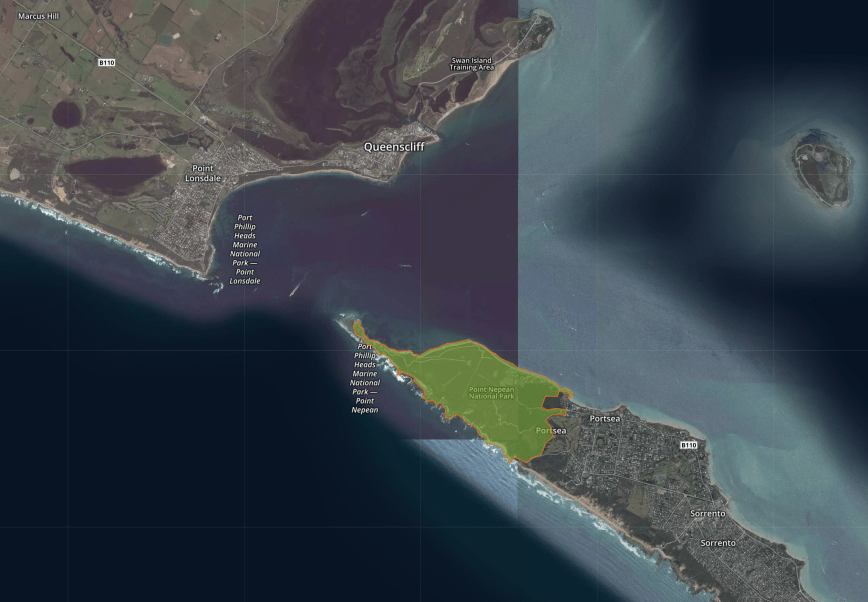
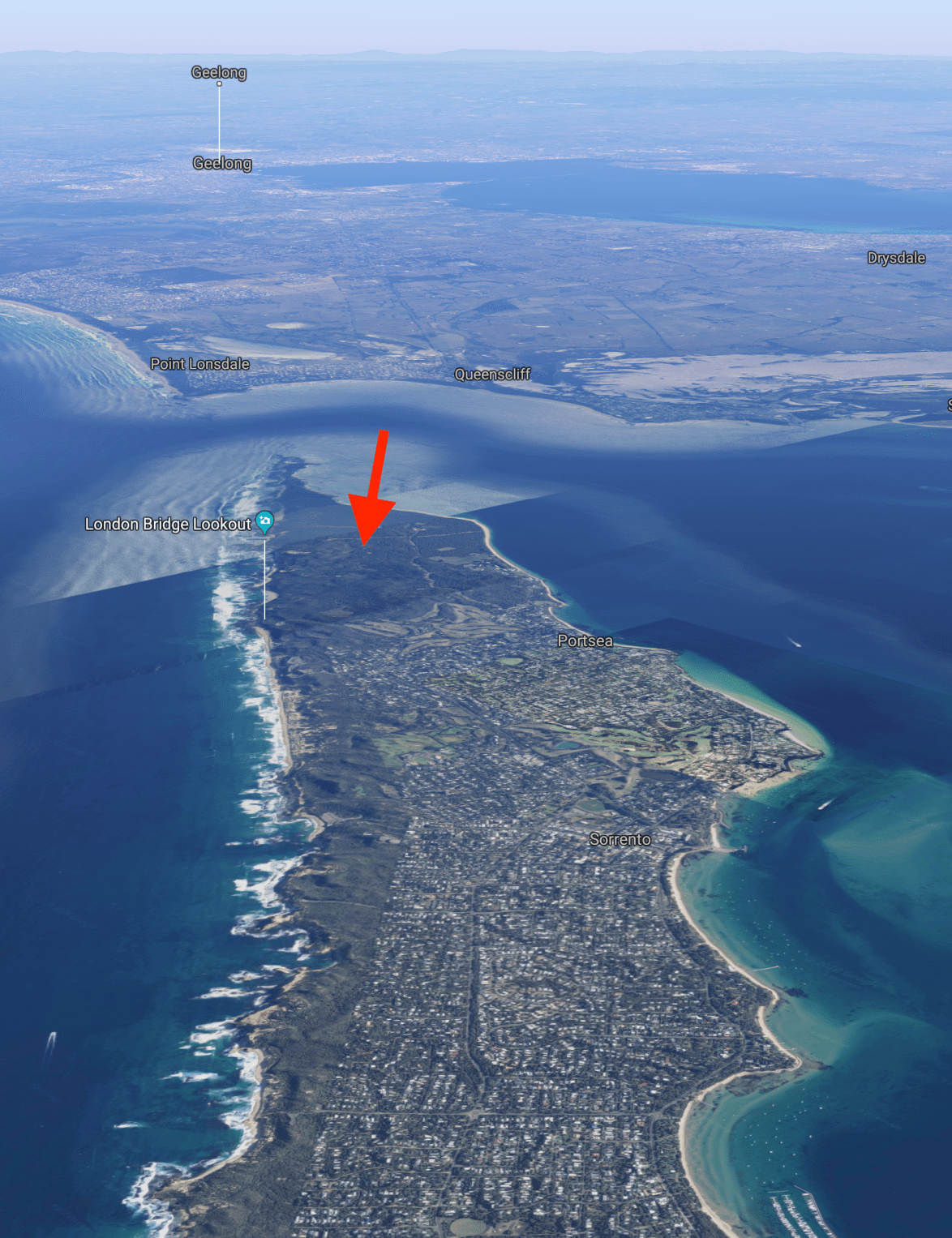
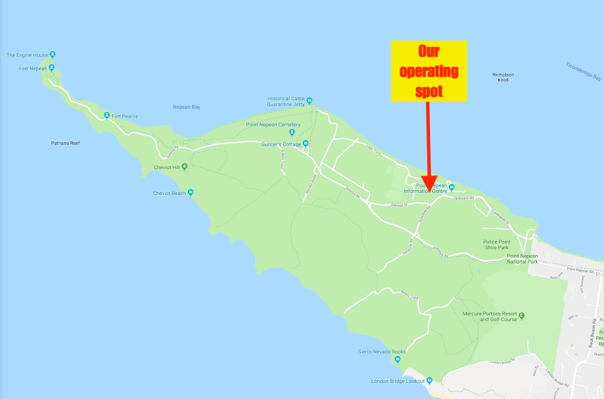
Marija and I were keen to head back out to the Point Nepean National Park to have a look at Fort Nepean, which we had not had time to do the day before.
Point Nepean is an unusual park in that visitors to the park can only go so far in their vehicle before reaching a locked gate. From that point, visitors either need to walk or ride out to Point Nepean, or catch a shuttle bus. Unfortunately for us, the shuttle bus was not going out to Point Nepean today due to asbestos work, and was only going to travel to Fort Pearce. Despite that, we jumped on the bus and within a few minutes we had reached Fort Pearce. It was a beautiful day after some wet weather in the preceding days, and Marija and I enjoyed some great views of the park and the coastline.
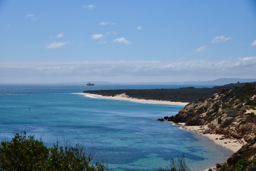
The northern coast of the park
Fort Pearce is a former defensive facility, and was part of a network of fortifications, commanded from Fort Queenscliff, protecting the narrow entrance to Port Phillip. The fortifications were constructed between 1910 and 1916. In 1911 two open concrete gun pits for Mk VII guns were constructed with a large underground magazine between the pits. During WW1 Royal Australian Garrison Artillery and Royal Australian Engineers were posted here.

A circular gun emplacement
During the First World War additional barracks were constructed at Fort Pearce and were named Pearce Barracks. Additional huts, a fuel store and a larger ablutions block were constructed at Pearce Barracks in 1939–1940.
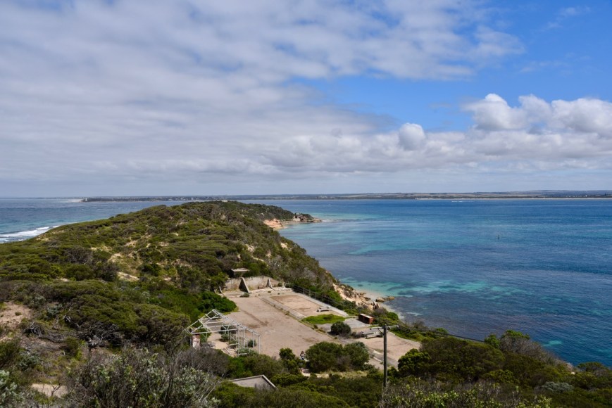
Looking north west towards Fort Nepean. The old Pearce Barracks are in the foreground.
The images below (courtesy of wikipedia) show Pearce Barracks in 1946, with Fort Nepean in the background, and ‘C’ Company 5th Battalion Volunteer Defence Corps at Cheviot Hill. Study the photo above with the black and white photo below of Pearce Barracks.

Pearce Barracks
Although we were still some distance away from Fort Nepean, we were still able to get a good view to the fort. Due to the asbestos works we could not get out there, so it will be a return trip to this park so we can explore Fort Nepean.
Above:- Looking towards Fort Nepean.

Above:- a view of the Engine House at Fort Nepean
Fortifications and barracks were built on Point Nepean from 1873 and gun batteries were installed in 1886. From 1911 the fort was manned by the newly renamed Royal Australian Garrison Artillery and the Royal Australian Engineers. With war in Europe looming, longer range 6 inch Mk VII guns replaced the 9.2 inch guns. Light anti-aircraft guns were deployed at the fort in 1939.
The photos below show Fort Nepean (courtesy of Wikipedia).

6 inch Mk VII gun in 1943

Searchlight in the former No.7 battery in 1933.

The 6 inch Mk VII gun, c. 1914

Fort Nepean in 1933
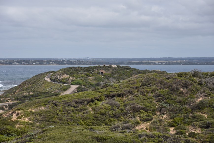
There were some terrific views here of the Point Nepean National Park and the coastline.
Fort Pearce was constructed in 1911 and once boasted two 6 inch Mark V11 guns which had a 12.5 km firing range. There are a number of old bunkers and buildings here to explore.
We then took a short stroll to Eagles Nest, which is the former site of Australia’s largest disappearing gun. Eagles Nest was built in 1889 and had a 10 inch breech loading gun, which was the largest hydro-pneumatic gun in Australia. Its prominent location allowed a 270 degree arc of fire. The gun had a range of 10,800 yards (9.9 kms) and a charge could penetrate armour up to 20.8 inches (53 cms) thick. When 6 inch Mark VII Guns were introduced to Point Nepean in about 1911, this gun emplacement was abandoned.
The views below from The Eagles Nest bunker give some idea of what it must have been like for the soldiers who manned their posts within the bunkers.
Referring to the Eagles Nest ugn, the Bendigo Advertiser on the 19th day of November 1889 stated:-
“The gun is the largest piece of ordnance in the colonies…..a full charge weighs 250 lbs of brown prismatic powder, and when a projectile of 500 lbs is added to this, our readers will know what’s the matter when they hear the gun go off”.
Extensive seaworks were undertaken more than 100 years ago to protected the fortifications., and some of those are still visible today.
Although we didn’t get out to Fort Nepean, there was still a lot to see and explore at Fort Pearce.
Marija then consulted the map and we decided to go for a ‘short’ walk to Cheviot Hill. The map and signs said it was just a short 800 metre walk. But that turned out to be totally incorrect, and in the hot sun we ended up enduring quite a walk up and down dale. But I need the exercise.
Along the way we observed numerous container ships entering into busy Port Phillip.
The views of the Bay and the park were quite brilliant along the path, with many of the local native plants also in flower.
We finally made it to Cheviot Hill. I suspect a few kilos lighter.

In hindsight, I’m glad we did the walk. We were rewarded with some magnificent views. At 54 metres above sea level, this is the highest point in the Point Nepean National Park.
Cheviot Hill gained its name after a disastrous shipwreck that took place on the 19th day of October 1887. The passenger steamer SS Cheviot was leaving Port Phillip at night during heavy seas, when its propellor broke and the ship was stranded on the coastal reef. Tragically 35 passengers and crew drowned, whilst 24 survived. Soldiers stationed at Fort Nepean assisted the Queenscliff lifeboat crew in rescuing the survivors.
In 1942, two gun emplacements, a Battery Observation Post, and a living quarters were built at Cheviot Hill, as vulnerability to air attack on the more exposed Fort Peace became apparent. Cheviot Hill’s emplacements were equipped with steel protective canopies and camouflage nets overhead.
We walked back down the hill and visited to the Point Nepean cemetery which was established in 1854. It replaced the Quarantine Station Cemetery after beach erosion had unearthed burials. The location of this cemetery was outside the boundary of the Quarantine Station so that visitors and local burials would not be subject to quarantine restrictions. The gravestones within the cemetery mark the resting places of quarantine deaths, early settlers, shipwreck victims, sailors and defence personnel. Up to 300 people are believed to be buried here.
This slideshow requires JavaScript.
We then took a short stroll to Gunners Cottage, which was originally located on the south side of Eagles Nest on the Bass Strait side of Defence Road. It was lived in and occupied by many people throughout the time that members of the Royal Australian Artillery were stationed at Fort Nepean. This included Ernest William Bird who lived in the cottage in 1933, along with his wife Victoria and their five children. He was the Army cook and stationed at Fort Nepean. His fifth child, Joy was the last born in the cottage.
We left the park, and visited Police Point Shire Park. It is named Police Point, as police were stationed here to enforce quarantine detention and serve the Southern Mornington Peninsula. It was an important part of the operation of the Point Nepean Quarantine Station, and later the Army Cadet School right up until 1988.
This slideshow requires JavaScript.
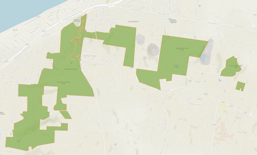
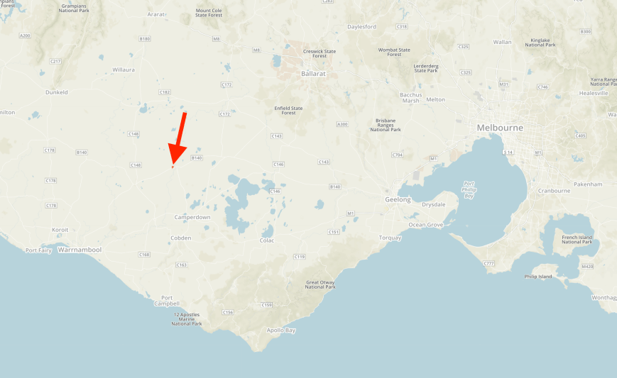
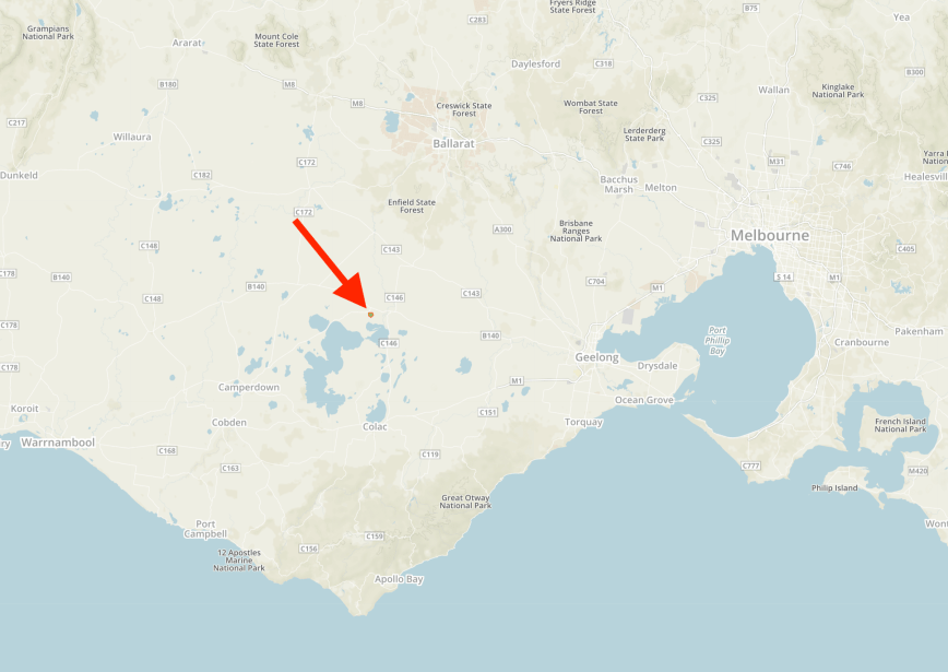
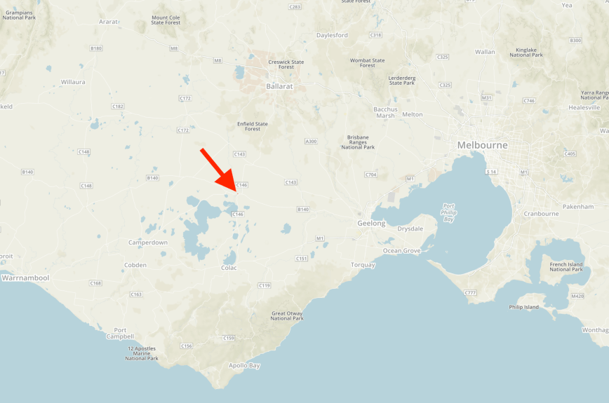
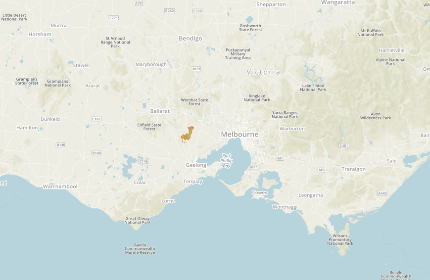
We then headed to the SOTA peak Arthurs Seat VK3/ VC-031 which is located within the Arthurs Seat State Park VKFF-0750. The summit/park is located about 89 km south of the city of Melbourne.

Above:- Map showing the location of Arthurs Seat on the Mornington Peninsula. Map courtesy of Open Topo maps.
The SOTA summit Arthurs Seat is 305 metres above sea level and is worth just 1 point for the Summits on the Air (SOTA) program. As it is in close proximity to Melbourne, and access is very easy, it is not surprising that the summit had been activated 55 times before out visit. It was first activated by Wayne VK3WAM in April 2012.
Lieutenant John Murray named the summit, Arthurs Seat, in February 1802. His journal dated Sunday February 14th 1802 read as follows…..
“…… Away to the eastward at the distance of 20 miles the land is mountainous, in particular there is one very high mountain which in the meantime I named Arthur’s Seat from its resemblance to a mountain of that name a few miles from Edinburgh….”
The summit was first climbed by Captain Matthew Flinders on 27th April 1802. His log noted:-
“The Bluff Mountain on the eastward I estimated at over 1000 feet high, and being near the waterside, possessed a favourable station for observation purposes. I ascend the hill and took an extensive set of bearings from the cleared place to be found on the north western bluff part of the hill.”
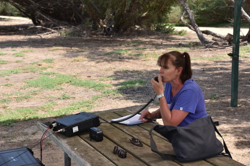
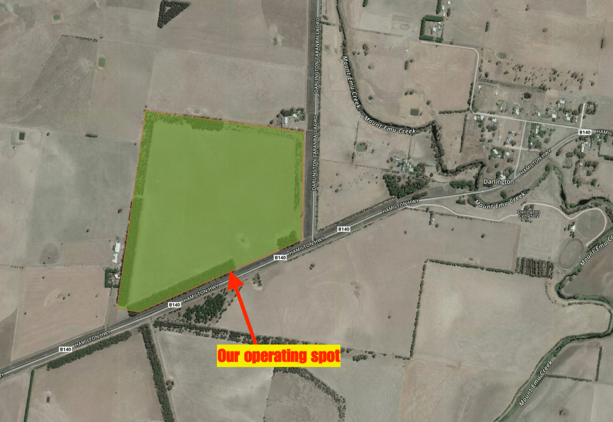
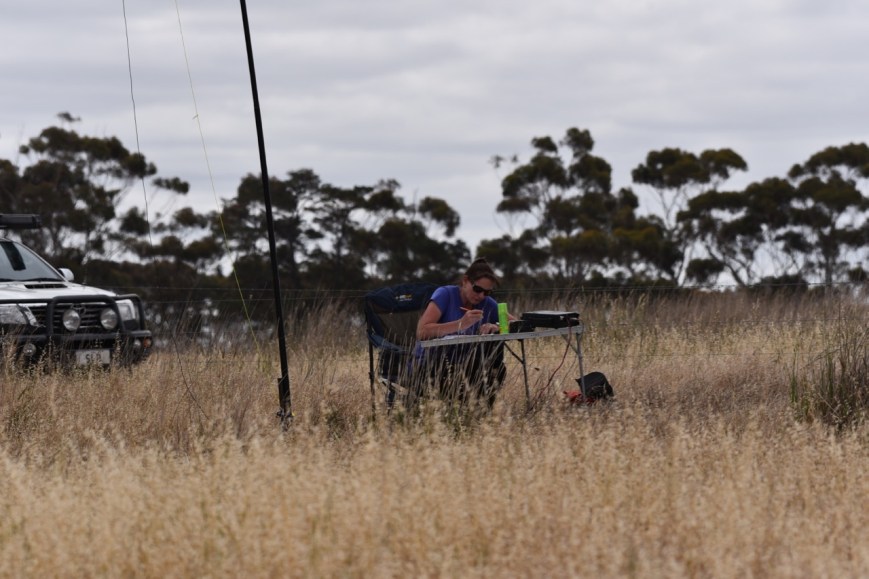
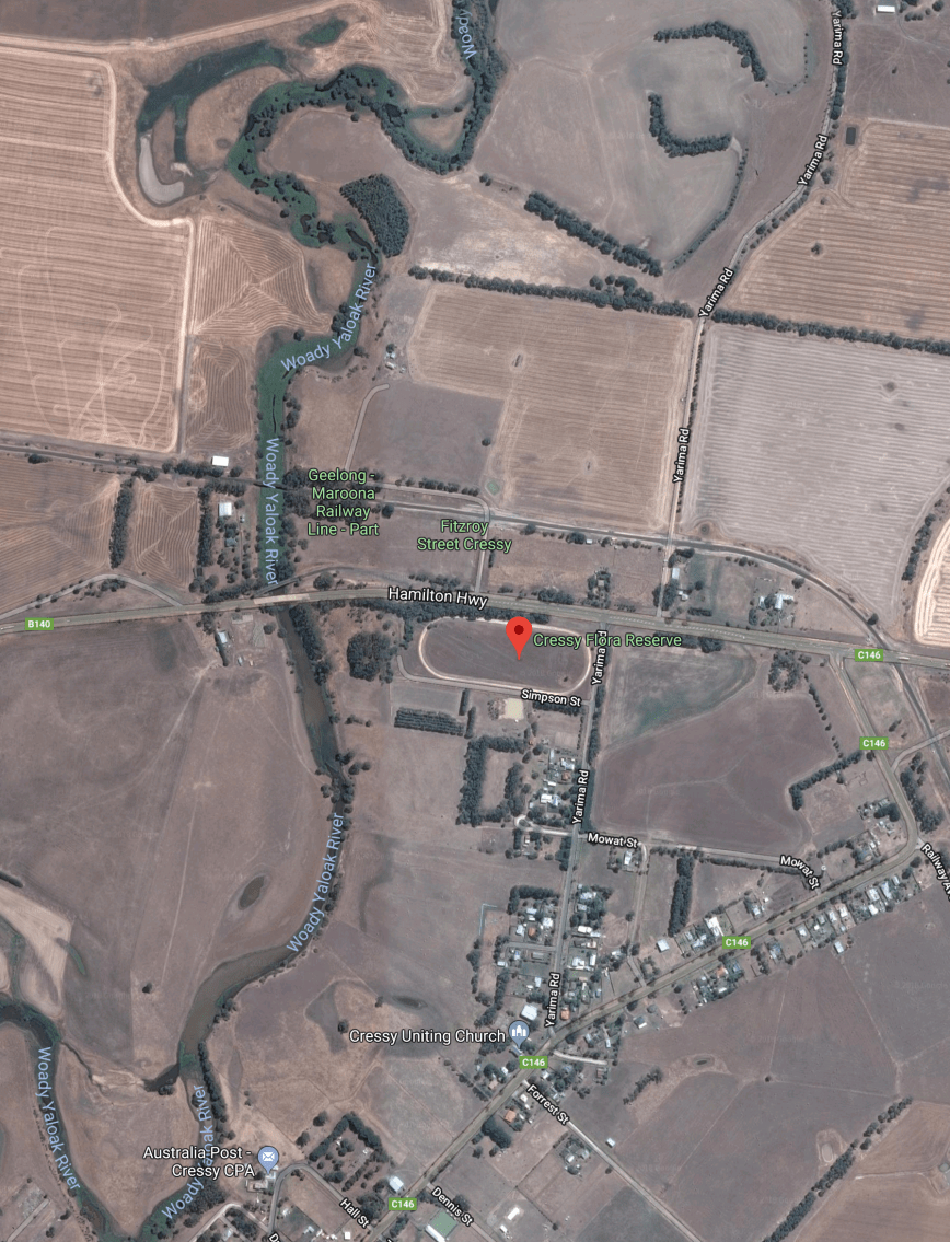
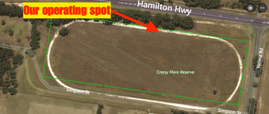
It was incredibly busy with tourists near the Arthurs Seat Eagle (cable car), which is what the maps from the SOTA site showed us to be the actual summit. So we drove a short distance down the road to Seawinds Gardens, which we were assured was within the activation zone, and also within the Arthurs Seat State Park.
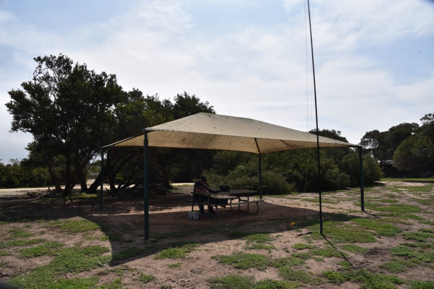
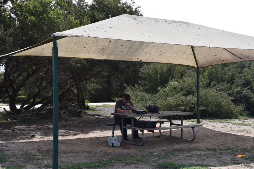
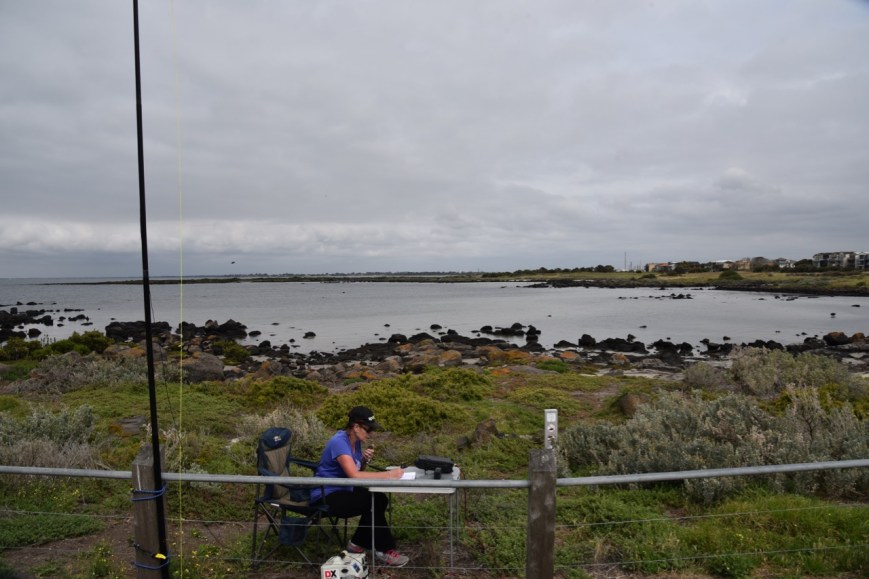
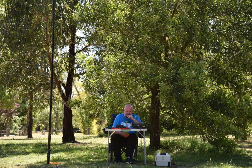
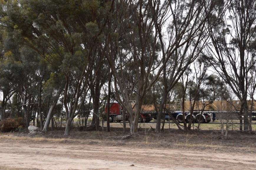
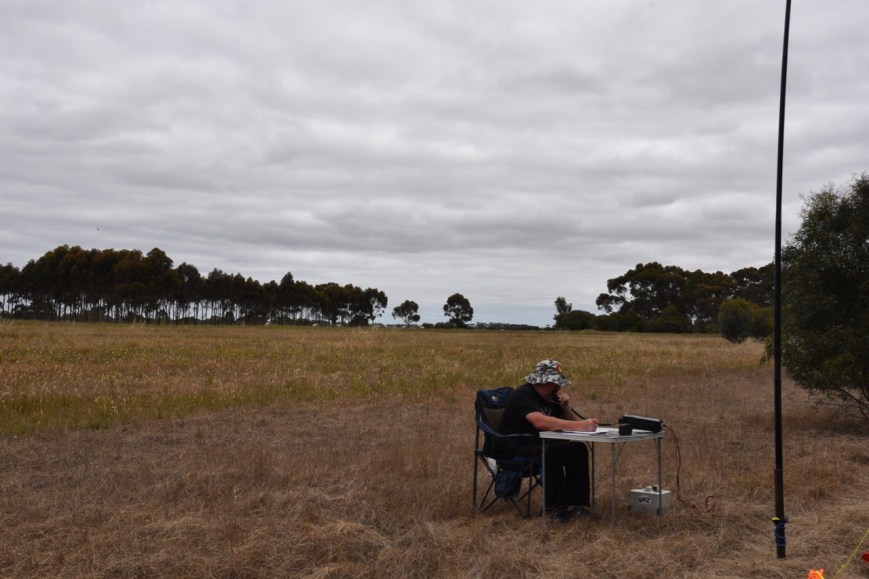
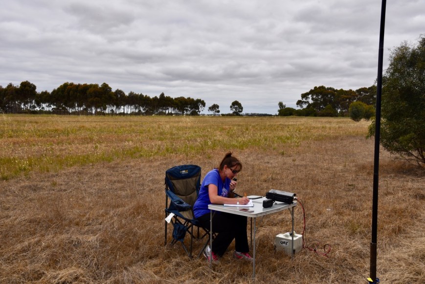
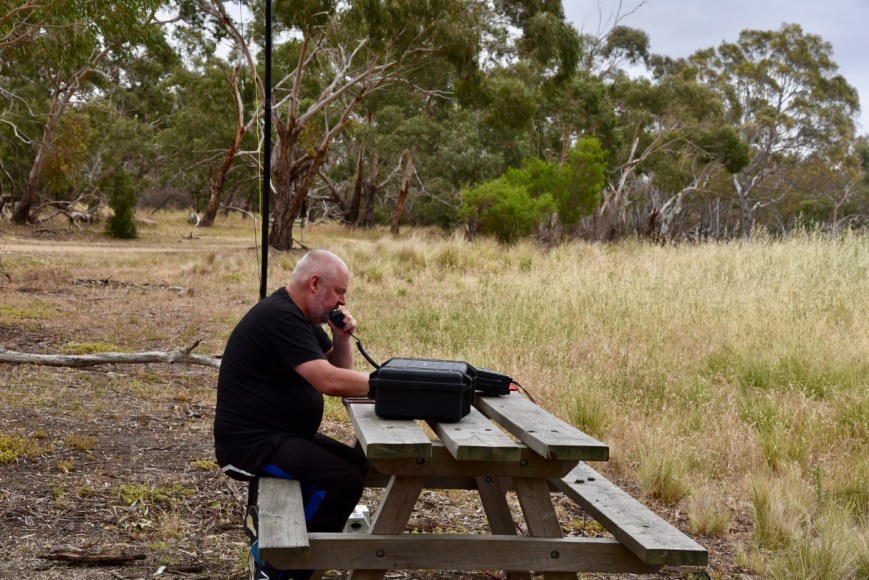
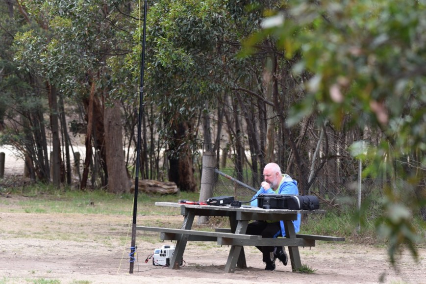
It was a warm day, so we set up underneath the shade of some trees. And as this was an easy drive up summit, we only had a short distance to walk, so we had the creature comforts of a chair and table.
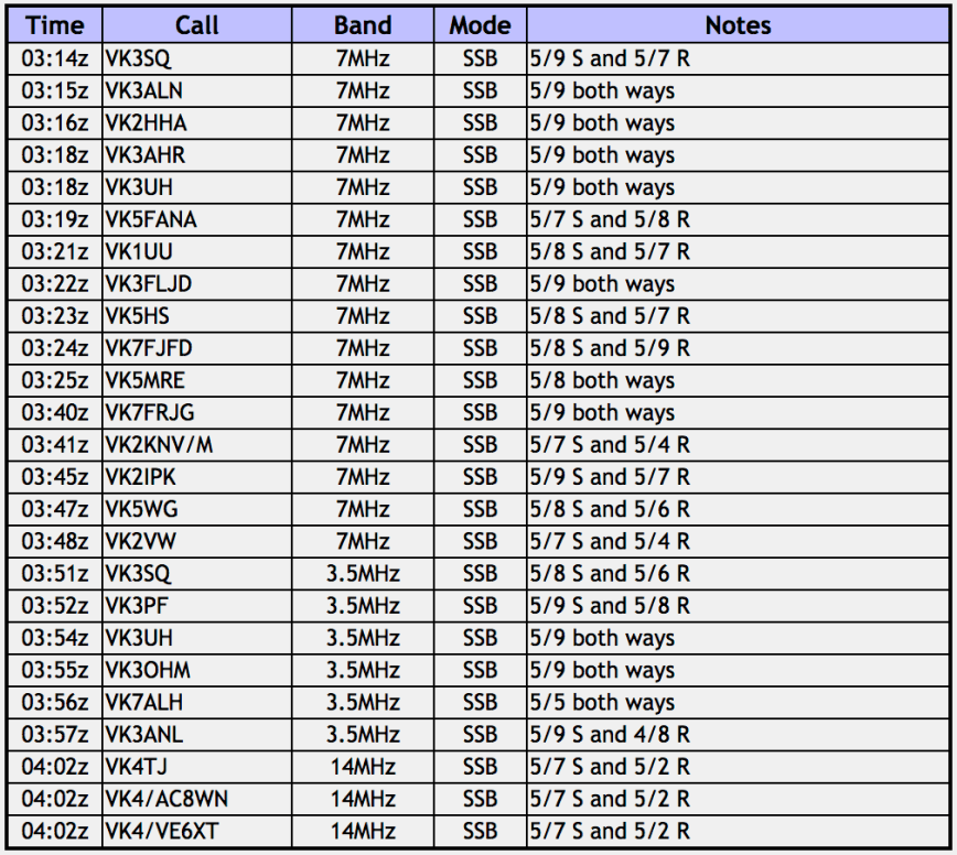
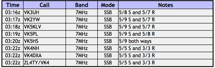
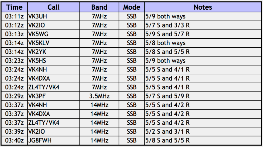
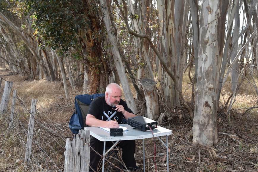
I started calling CQ on 7.144 and this was soon answered by Geoff VK3SQ, followed by Alan VK3ALN, Dennis VK2HHA and Ron VK3AHR. I had qualified the SOTA summit with 4 contacts. Now to get 10 to qualify the park for VKFF. Within 10 minutes of setting up and calling CQ, I had contact number ten in the log, a QSO with John VK7FJFD. I then logged Ron VK5MRE and decided to swap the mic with Marija so she could qualify the summit and the park.
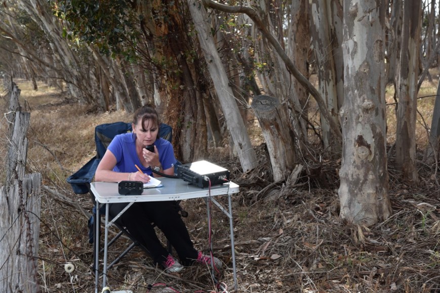
Marija’s first contact was with Geoff VK3SQ, followed by Ivan VK5HS, Ron VK3AHR, and then Ron VK5MRE. Marija had qualified the summit. Marija pushed on and soon had qualified the park for VKFF, with her tenth contact with Gerard VK2IO. After logging a further two stations, Rod VK7FRJG and Dennis VK2HHA, Marija handed the mic back to me.
I called CQ again on 7.144 and logged a further 5 stations from VK2, VK5, and VK7. I then moved down to 3.610 on the 80m band where I logged 6 stations from VK3 and VK7. To conclude the activatiton I called CQ on 14.310 on the 20m band. John VK4TJ, also using his other two calls was my only taker on that band. Sadly the Over The Horizon Radar was present again and was very strong.
So with 37 contacts in the log between the two of us, it was time to hit the road again and head off to Williamstown.
Marija worked the following stations:-
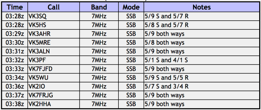
I worked the following stations:-
At the end of the activation we decided to head back to the main carpark near the Arthurs Seat Eagle. There is a monument here for the crew of a RAAF Beaufort aircraft which crashed into Arthurs Seat on the 12th day of July 1942, and the crew of a Avro Anson which crashed into the north western face of Arthurs Seat on 10th August 1938.
There is also a plaque to mark the bi-centenary of the birth of the explorer and navigator, Captan Matthew Flinders. He was born on the 16th day of March 1774.
We enjoyed the sensational views from the lookout and watched the Arthurs Seat Eagle cable cars travelling up and down the mountain.
We pondered for a short time as to whether to do the Arthurs Seat Eagle, and with some encouragement, Marija agreed that we would take a ride. Marija was a bit apprehensive at first, but once we were on board, all had calmed down.
We enjoyed a ride down the mountain and back up again, enjoying the absolutely magnificent views of the Mornington Peninsula.
On the way back down we stopped briefly at Murrays Lookout to admire the views of the Mornington Peninsula.
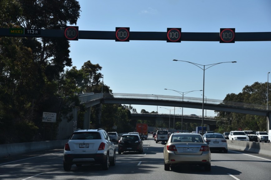
We then headed into Melbourne, and it didn’t take long for me to work out why I like visiting Melbourne, but could never live there. The traffic!
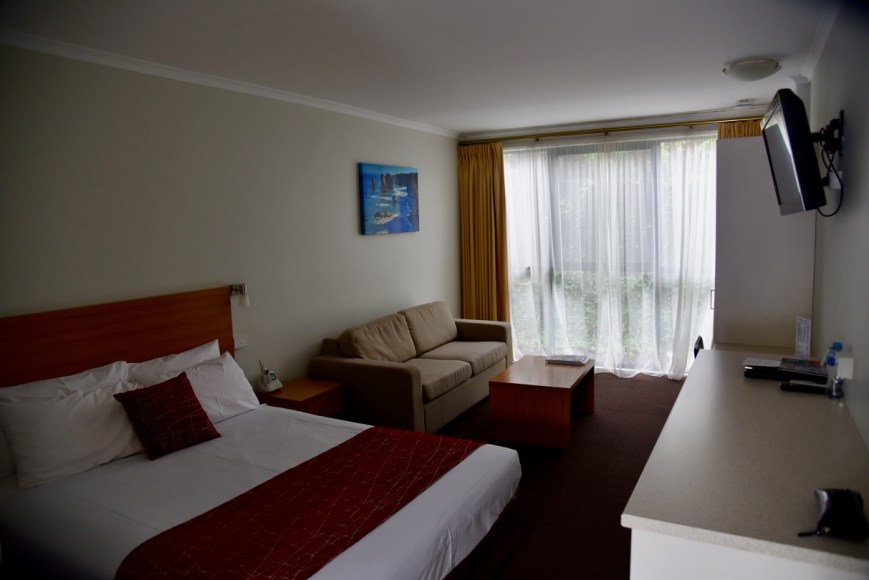
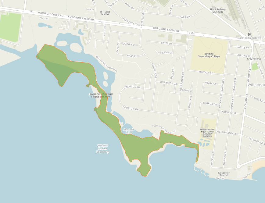
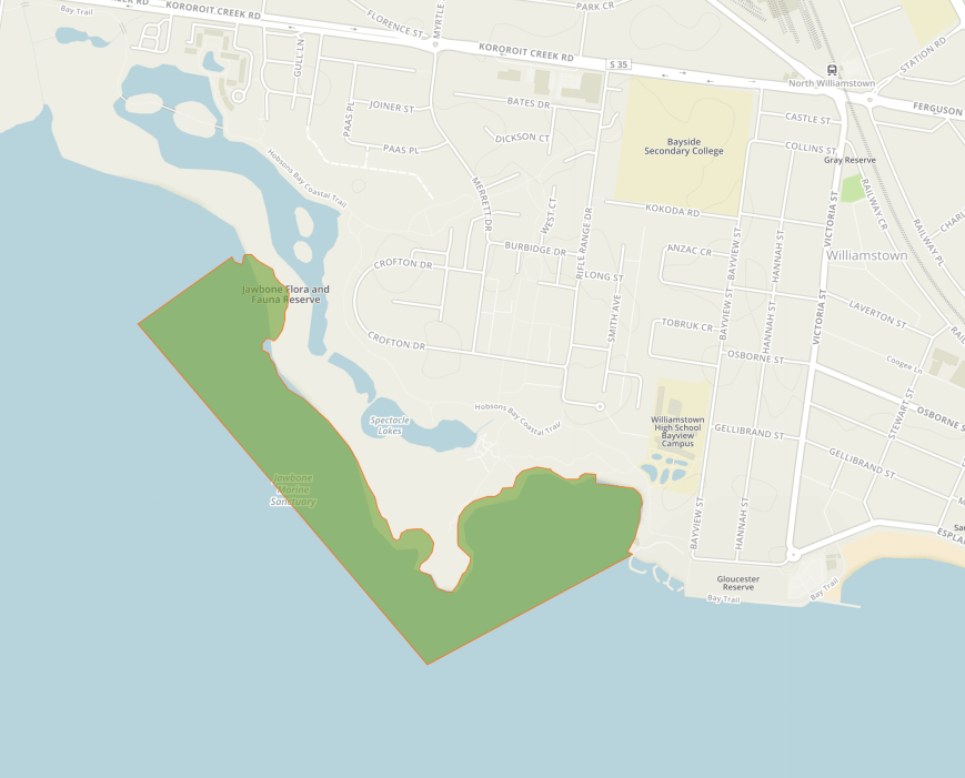
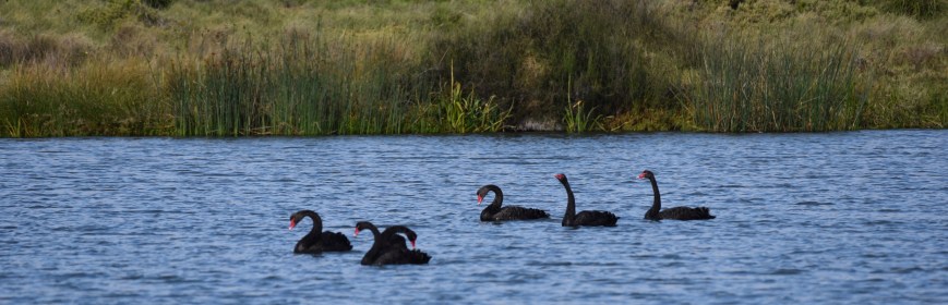
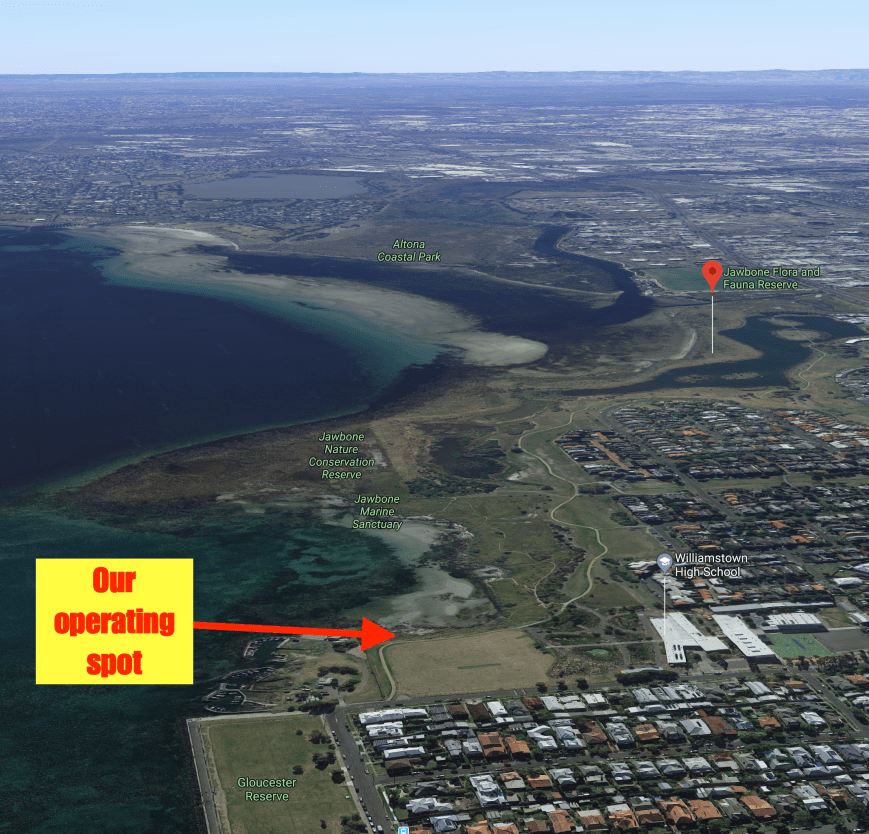
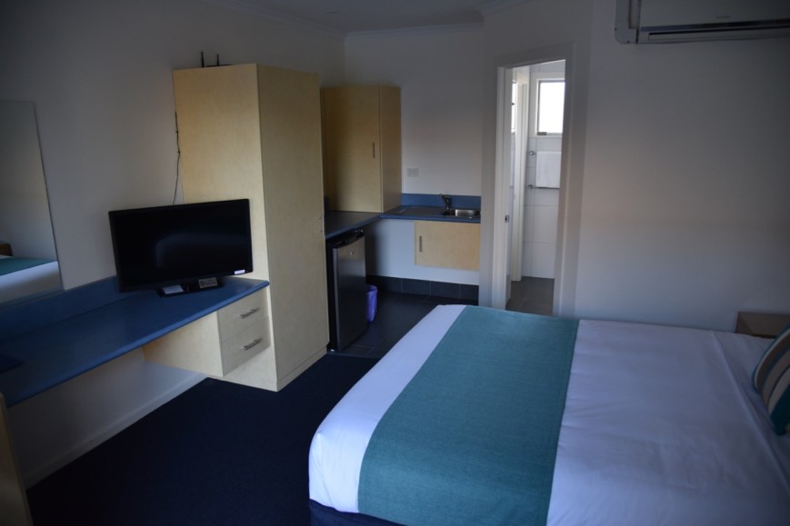
We safely negotiated the city traffic and soon reached our accomodation at the Quest Williamstown North on Koroit Creek Road. And what a bonus….it backed on the Jawbone Flora & Fauna Reserve which qualified for VKFF/WWFF.

Our room

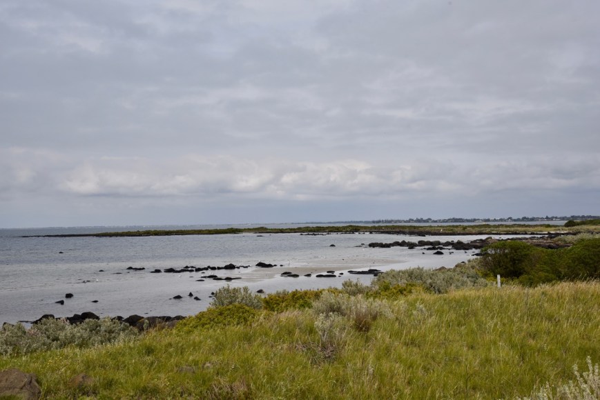
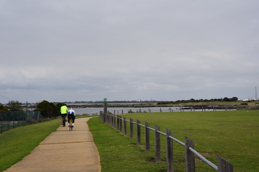
A view of the Jawbone Flora & Fauna Reserve from our back door.

Another view of the Reserve
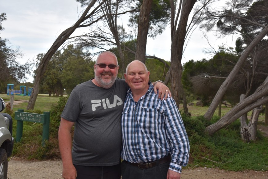
That night we dined in at the unit, spending a very enjoyable night with our friends Jacqui and Des.
References.
Summits on the Air, 2018, <https://www.sota.org.uk/Summit/VK3/VC-031>, viewed 18th December 2018
Wikipedia, 2018, <https://en.wikipedia.org/wiki/Fort_Pearce>, viewed 18th December 2018
Wikipedia, 2018, <https://en.wikipedia.org/wiki/Arthurs_Seat,_Victoria>, viewed 18th December 2018


")