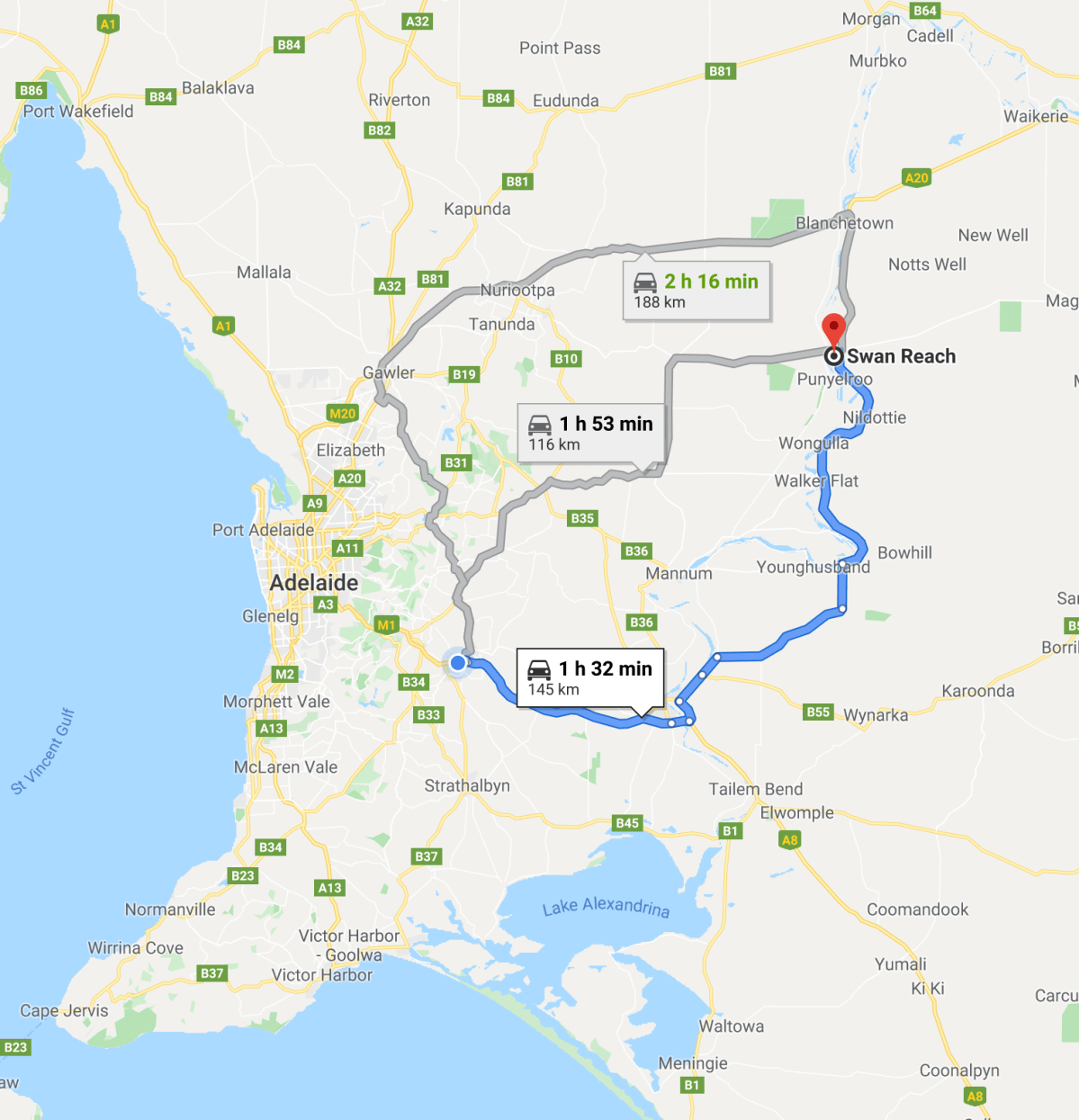
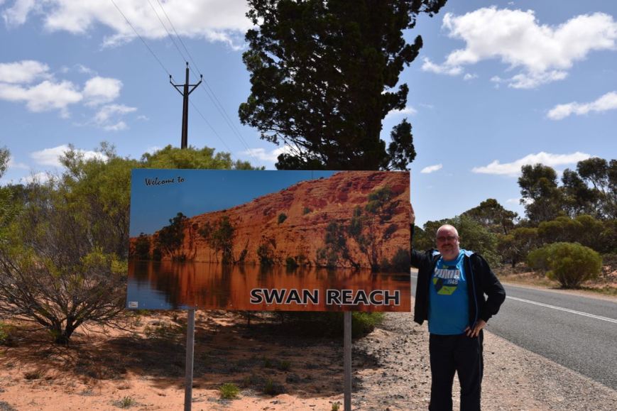
Yesterday (Saturday 26th October 2019) Marija and I travelled up to the Swan Reach area to take part in the 2019 VKFF Team Championship. We left home at about 10.00 a.m. local time and travelled the 145 km to Swan Reach which is located on the Murray River between Blanchetown and Mannum.
Our plans were to activate three parks: Swan Reach Conservation Park, Ridley Conservation Park, and Marne Valley Conservation Park. We had activated and qualified all three parks previously.
Our team name was ‘The Walky Talkies’.
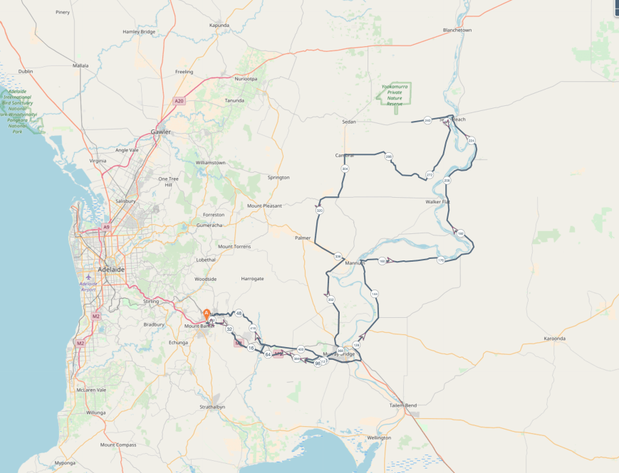
We travelled to Murray Bridge via the South Eastern Freeway and crossed the mighty Murray River on the Swanport Bridge. We then took the Burdett Road, north out of Murray Bridge. We then took Hunter Road and headed east into the Murray Mallee region of South Australia. Originally the Mallee region was covered in thick mallee scrub. From as early as the 1880s, large expanses of the mallee were cleared for agricultural development. It is estimated that about 80% of the land was cleared.
Our first stop for the morning was at Bow Hill, a little settlement located on the Murray River. It was named after the Hundred of Bow Hill which was proclaimed on the 4th day of May 1893 and named by Governor Kintore after a town in Scotland. Between 1911-1913 the town of Bow Hill had two blacksmith shops, a painter’s shop, a store, boarding house, a branch office of the Bank of Adelaide, and a wharf. The town’s population was 181.
Today, Bow Hill is a collection of shacks, a general store, a community club, and is a popular water skiing spot along the Murray River.

The Murray River at Bow Hill

Monument for explorer Captain Sturt
We continued along Hunter Road and then detoured into the little town of Purnong. The town was surveyed in 1911 and is named after an aboriginal word meaning ‘at the wide place’. We had a look at the original bell which was used to summon the ferry. This is the narrowest crossing on the Murray River. Potato and onion production is widespread in the Purnong area. Onions from Purnong are exported around the world.
We also travelled up to the lookout which affords magnificent views of the Murray River and the surrounding countryside.

original ferry bell

Ferry at Purnong

View from Purnong lookout
We then drove a little further along to Len Kroeehn’s Lookout which has some terrific views of the Murray River, the third-longest navigable river in the world. The lookout is named in honour of Leonhard Erwin Artjir ‘Len’ Kroehn.
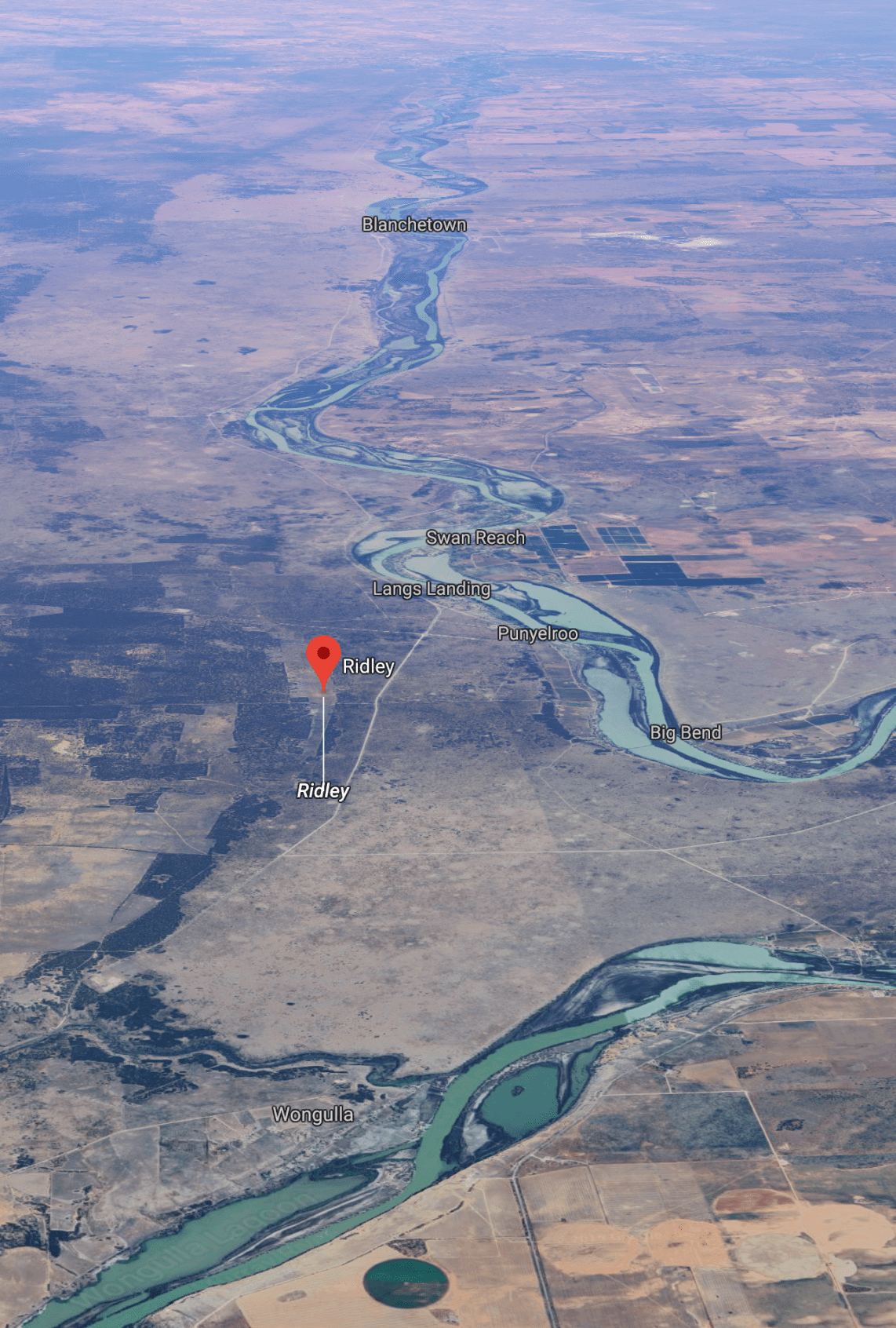
Our next stop was the little town of Nildottie which is located on the eastern side of the Murray River. The name is derived from an aboriginal word ‘ngurltartang’ which means ‘smoke signal hill’. There is a general store here and an old English wagon on display. The wagon was used by a local farmer, Alfred Gierke between 1909 and 1936.
Next was Big Bend Lookout which is located between Nildottie and Swan Reach. Here you can view some of the amazing cliffs along the Murray River. This is a popular nesting area for cockatoos and has the tallest cliffs and the longest single bend along the entire length of the Murray.
We soon reached the town of Swan Reach which was first settled in the 1850s and was originally the largest of five sheep and cattle stations in the area. In its heyday, Swan Reach was one of the first riverboat ports in South Australia and was a loading port for grain and wool. The town gained its name from the large number of black swans that once thrived in the area.
It was about 12.30 p.m. local time and our tummies were rumbling, so we stopped at the Swan Reach Hotel for a meal. Marija enjoyed her meal of salmon, whilst I had Kangaroo fillet. The hotel has a very interesting history. It was not a purpose-built hotel but was formed around the original Swan Reach homestead which was built in c. 1865. There are numerous historic photos and stories on display in the hotel.
After leaving the hotel we took a quick drive up to Graetz lookout which overlooks the Murray River and the area opposite known as Tenbury-Hunter Reserve.

Old Bank of Adelaide branch

The Murray River at Swan Reach

View of the river from Graetz lookout
We then drove down to the ferry. Whilst waiting for the ferry to return from the other side of the river we had a look at a stobie pole which shows the various flood levels. What is a stobie pole? It is a power line pole made of two steel joists held apart by a slab of concrete. It was invented by Adelaide Electric Supply Company engineer James Cyril Stobie.
The 1956 flood is considered the biggest flood in the recorded history of the Murray and described as “the greatest catastrophe in South Australia’s history, despite there being no lives lost. The flood involved the rising of waters in the Murray River and flooding of many towns in South Australia, New South Wales, and Victoria. The flood occurred due to higher than average rainfalls in Western Queensland and heavy rains in the proceeding three months in the Murray-Darling Basin. Some areas were flooded up to 100 km from the natural flow of the river. In South Australia, the flood water peaked in South Australia at Morgan at a height of 12.3 metres (40 feet)
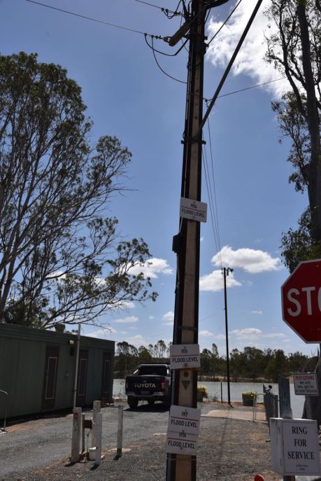
Above:- Stobie pole at Swan Reach showing the flood levels.
We boarded the ferry at Swan Reach and crossed over the Murray River, heading towards our first park of the day, the Swan Reach Conservation Park VKFF-0832.

The Murray River at Swan Reach
We then drove west along the Stott Highway (Angaston-Swan Reach Road) towards Sedan. The highway was named in 2008 in honour of Tom Cleave Stott, a long-time farmer and member of the South Australian State parliament.
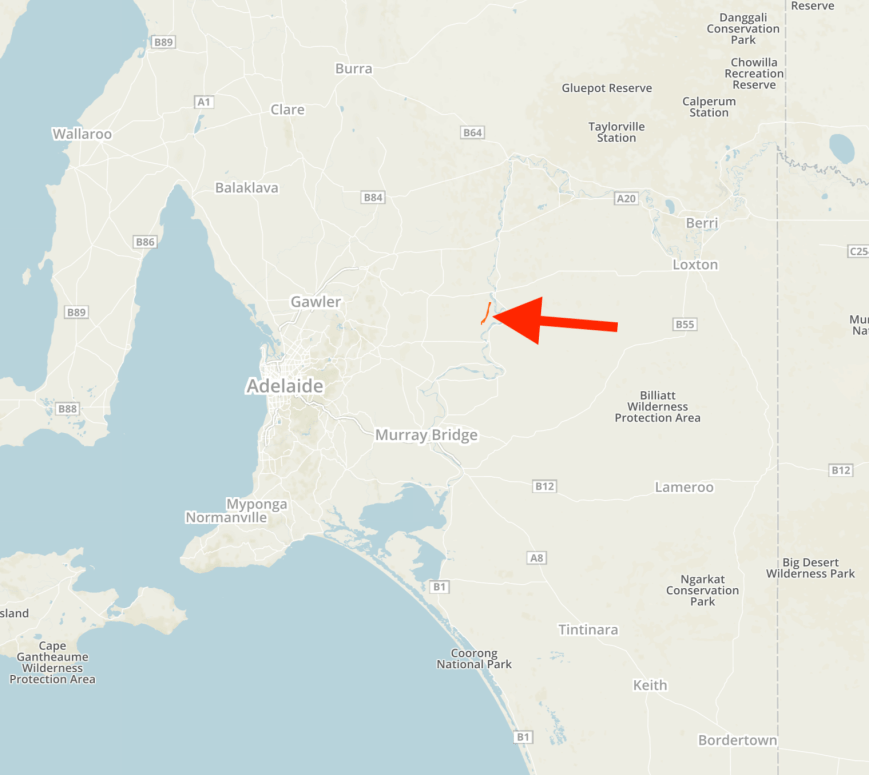
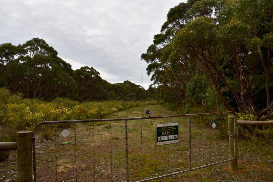
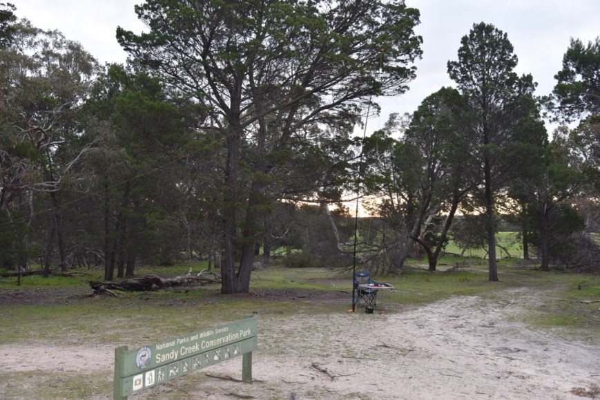
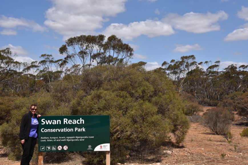
After travelling about 13 km along the Stott Highway we reached the Swan Reach Conservation Park.
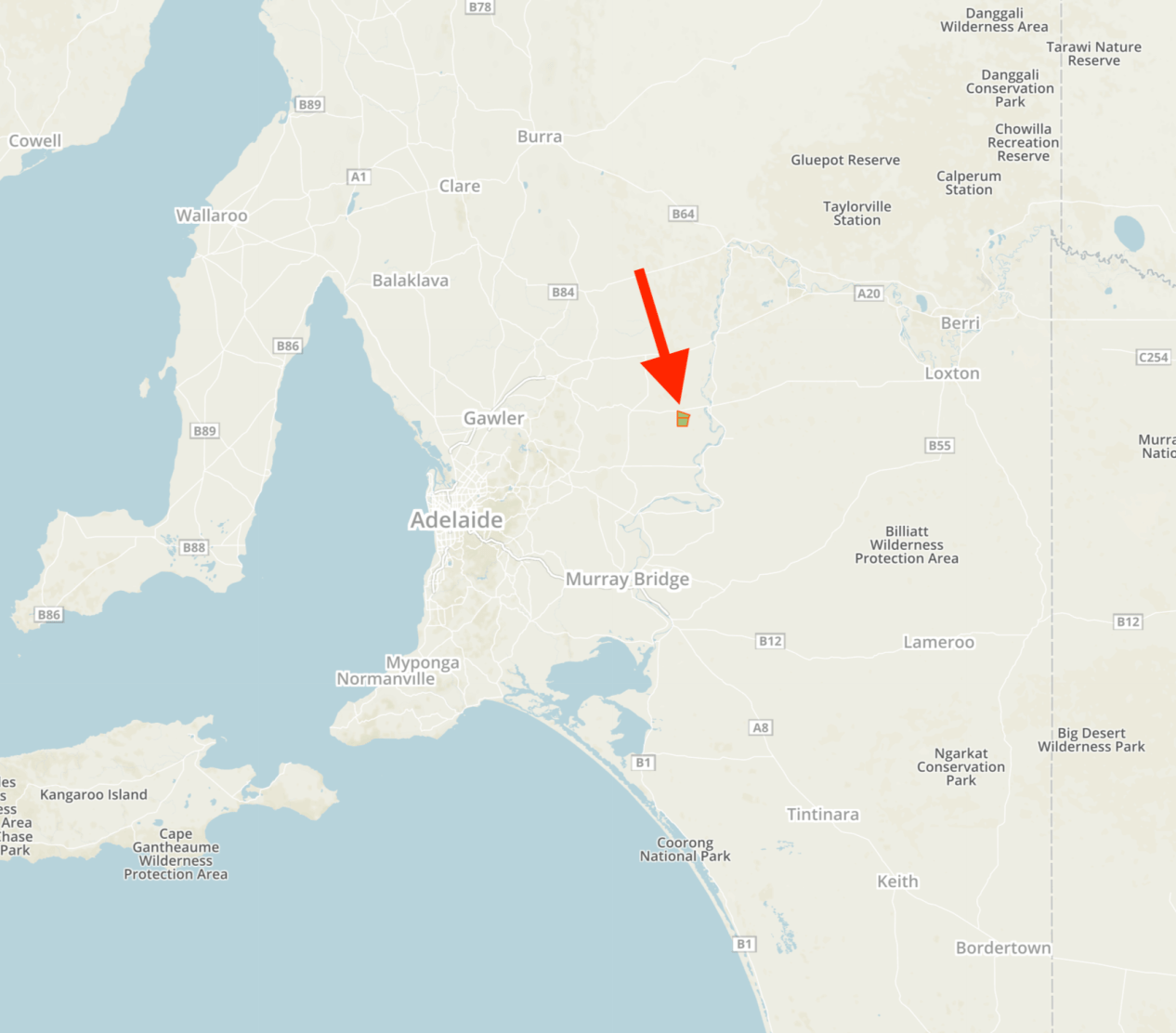
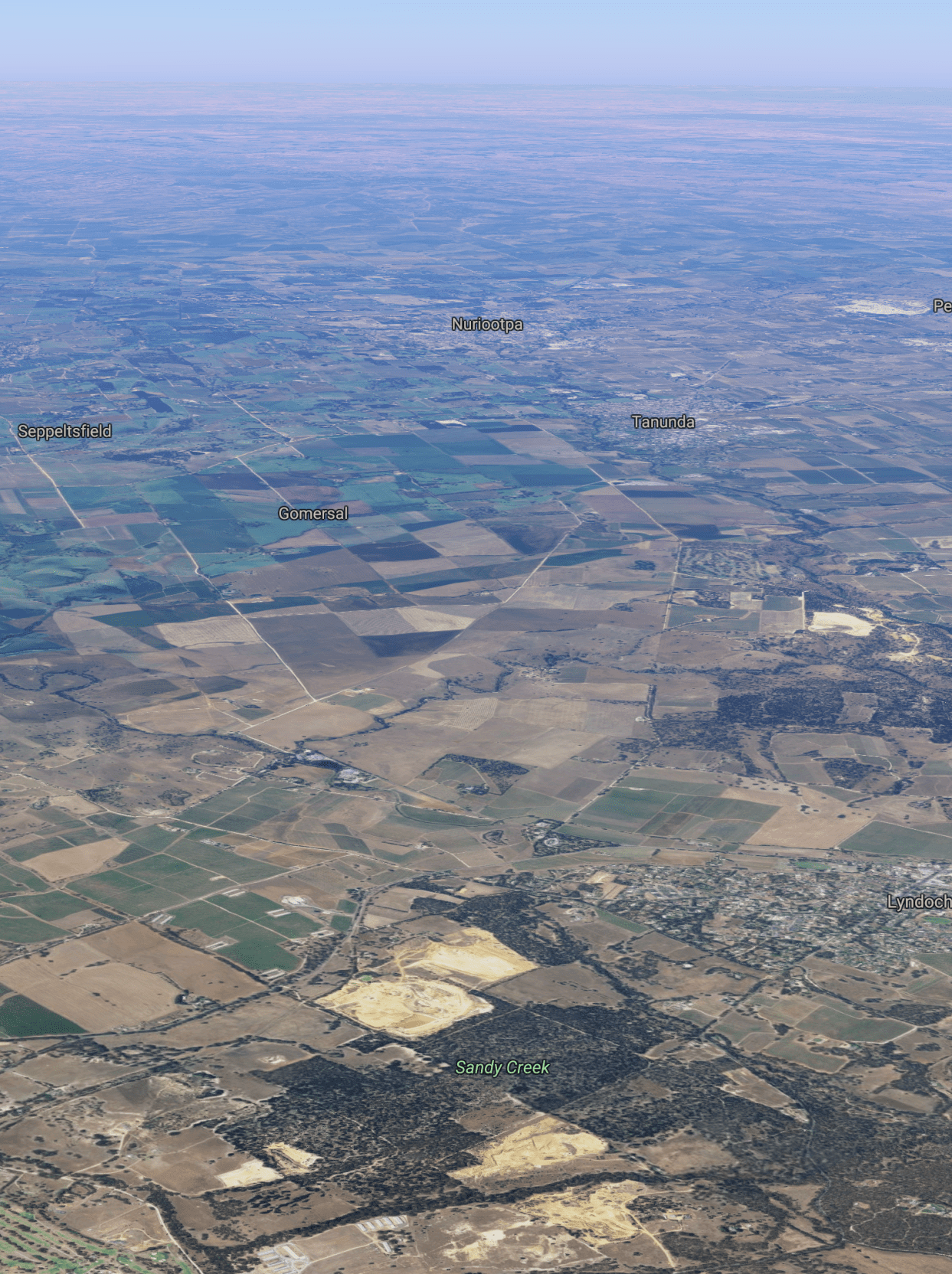
Above:- Map showing the location of the Swan Reach Conservation Park, northeast of Adelaide. Map courtesy of Protected Planet.
The Swan Reach Conservation Park is about 2,017 hectares in size, with the majority of the area being an open area of scrub of mallee box, red mallee, and yorrell. The remaining area comprises low woodland with false sandalwood and bullock bush over an understorey of spear-grass and ephemeral herbs.
A majority of the mallee scrub in the region has been cut for firewood, with the present vegetation being predominantly regrowth. Some areas were completely cleared and now exist as grassland.
On the 28th day of May 1970, an area of 874 hectares was proclaimed as the Swan Reach National Park. On the 27th day of April 1972, it was re-proclaimed as a Conservation Park. A further 1,021 hectares of land was added on the 16th day of May 1974. A further 122 hectares was added on the 25th day of January 1979.
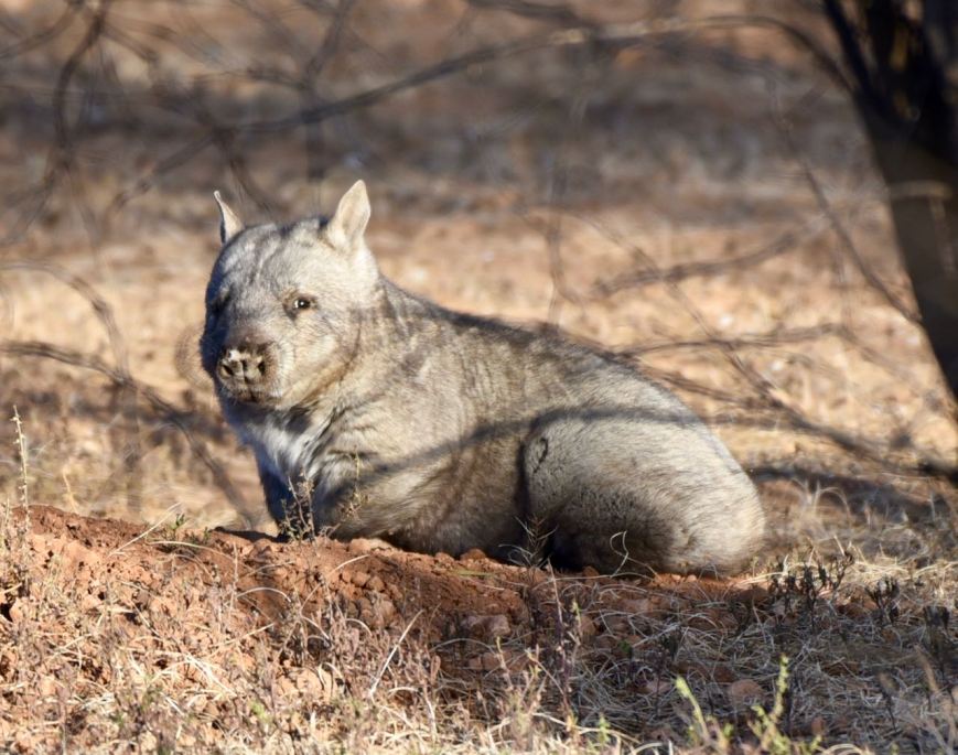
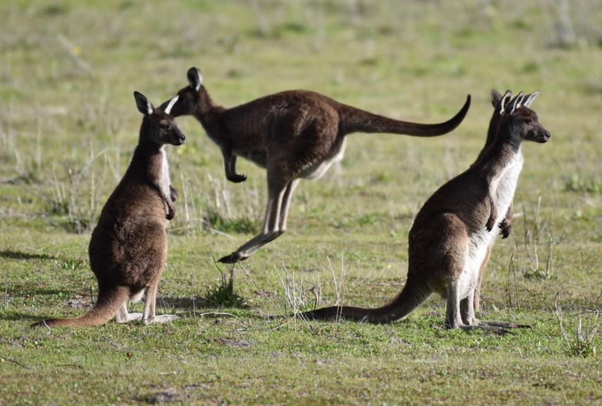
Various native animals can be found in the park including Western Grey kangaroo, Red kangaroo and the Southern hairy-nosed wombat. The elusive wombat was the primary reason for the proclamation of the park.
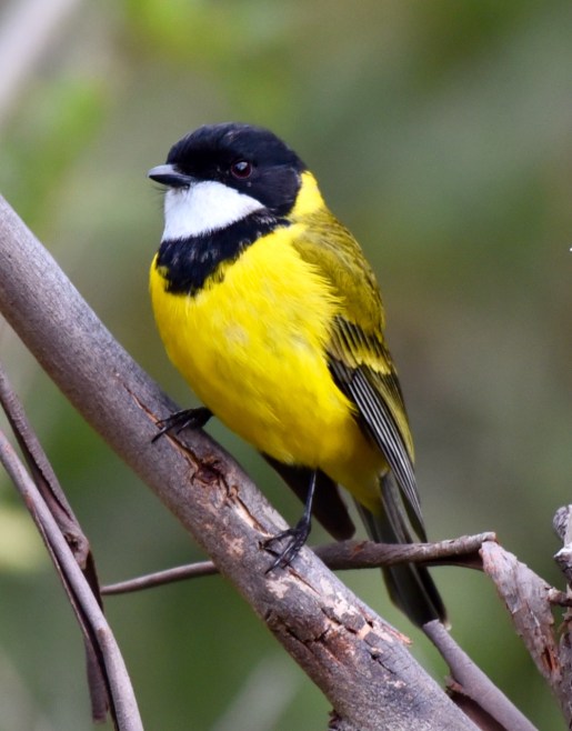
About 97 species of bird have been recorded in the park including Chestnut-rumped Thornbill, Southern Whiteface, Spiny-cheeked Honeyeater, Grey Shrike-thrush, Australian Magpie, Malleefowl, Little Eagle, Crested Pigeon, and Inland Thornbill.
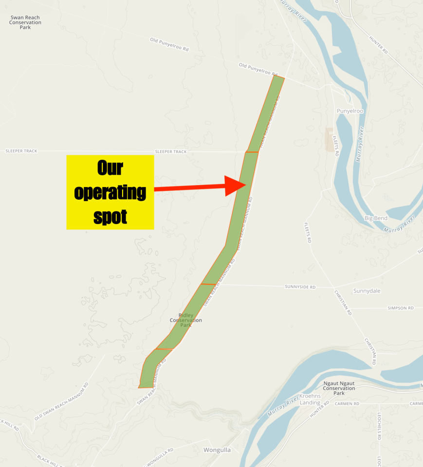
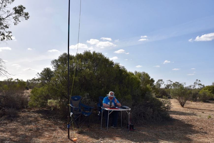
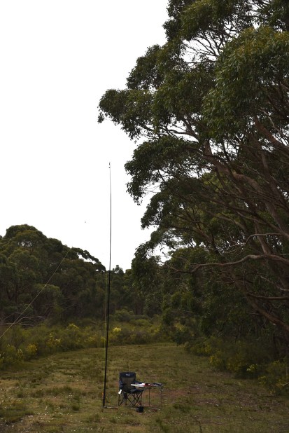
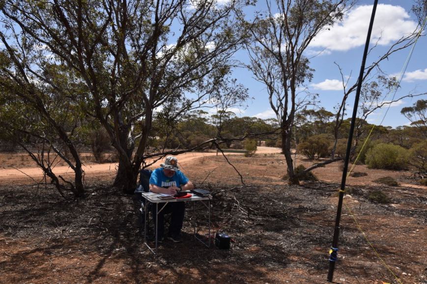
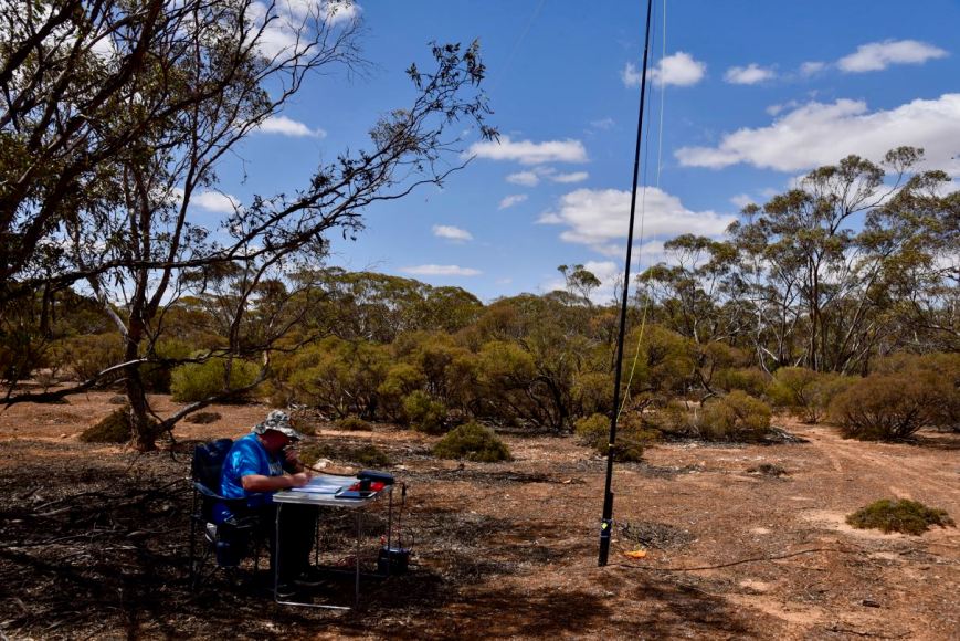
We entered the park via the Old Punyelroo Road which runs off the Stott Highway. It was a warm day, with the temperature being about 26-28 deg C, so we chose an operating spot underneath a tree. For this activation, we ran the Yaesu FT-857d and the 20/40/80m linked dipole supported on the 7-metre telescopic squid pole.
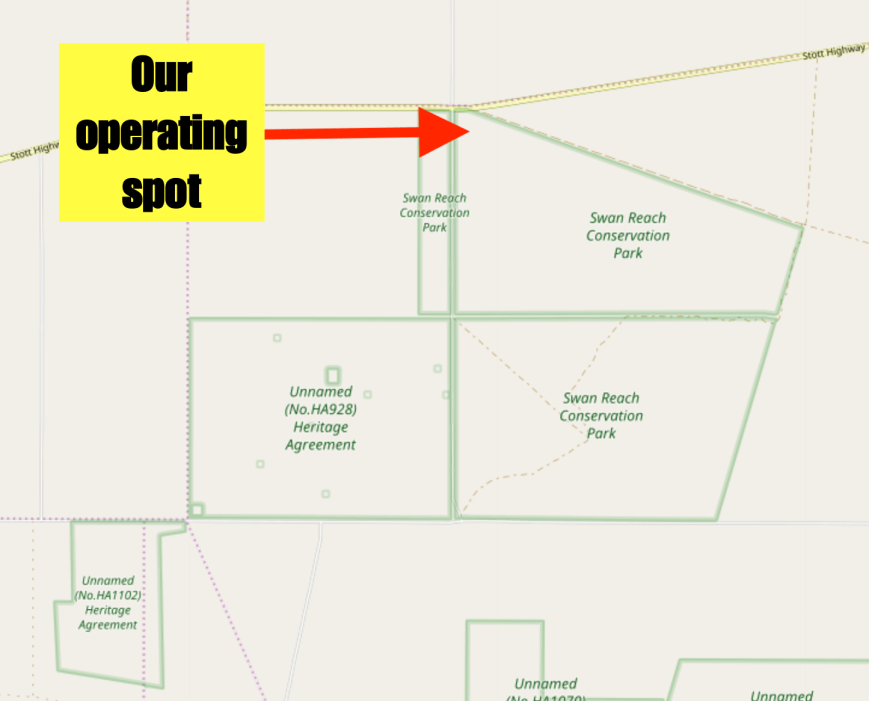
Above:- Map of the Swan Reach Conservation Park showing our operating spot. Map courtesy of Plot a route.
It was about 2.15 p.m. local time. I called CQ on 7.144 and this was answered by David VK3HAQ in Portland in south-western Victoria. This was followed by Nick VK3ZK, and then David VK5PL/p and Ian VK5CZ who were activating the Little Mount Crawford Native Forest Reserve VKFF-2884. David and Ian were taking part in the Team event. Their team name was ‘QRS Dot Dash’. Marija also logged David and Ian.
I logged a total of 15 stations before swapping the mic with Marija. This included two further Park to Park contacts with Mark VK4SMA/p and Murray VK4MWB/p who were activating the Moogerah Peaks National Park VKFF-0326. Mark and Murray were taking part in the Team Championship as ‘The VK4 WIPeouts'”. Marija also logged Mark and Murray.
Marija then called CQ and this was answered by Rob VK2VH, followed by David VK3HAQ, and Mark VK3PI. Mike VK6MB/5 then called in who was activating the Franklin Harbor Conservation Park VKFF-0807. Next was Gerard VK2IO/p who was in the Munmorah State Conservation Area VKFF-1361, and soon after Alan VK2MG who was also in the Munmorah State Conservation Area. Gerard and Alan were taking part in the Team Championship as the ‘QRParktivators”.
Marija had her eighth Park to Park contact in the log a few QSOs later. This time with Ade VK4SOE/p who was activating the Sundown National Park VKFF-0471. Marija now had 16 contacts in the log and callers had slowed, so we again swapped operating spots.
I called CQ on 7.144 and this was answered by Perrin VK3XPT/p who was mobile, followed by Jeff VK3PT who was also mobile. Deryck VK4FDJL/6 then called in from the Mount Frankland South National Park VKFF-0653. A few QSOs later I was called by Neil VK4HNS/2 who was in the Nightcap National Park VKFF-0389. This was followed by Rob VK4SYD/p and Scott VK4CZ/p who were in the Bunyaville Conservation Park VKFF-1493. Rob and Scott were competing in the Team Championship. Their team name was ‘The VK4midables”.
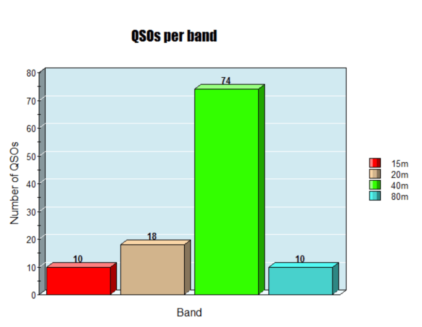
I logged a total of 32 stations on 40m before heading to the 80m band. First in the log there was Mike VK6MB/5 who was activating the Franklin Harbor Conservation Park VKFF-0807. Nev VK5WG then called in from the Mid North with a big signal, followed by Adrian VK5FANA. John VK5FLEA/p, Ian VK5CZ/p and David VK5PL/p then gave us a call from the Cromer Conservation Park VKFF-0779.
With 8 contacts in the log on 80m and callers having dried up, I moved back to 40m for some final CQ calls on 40m. I logged a further 8 stations on 40m from VK2 and VK3. Last in the log was Darrin VK2FAAY.
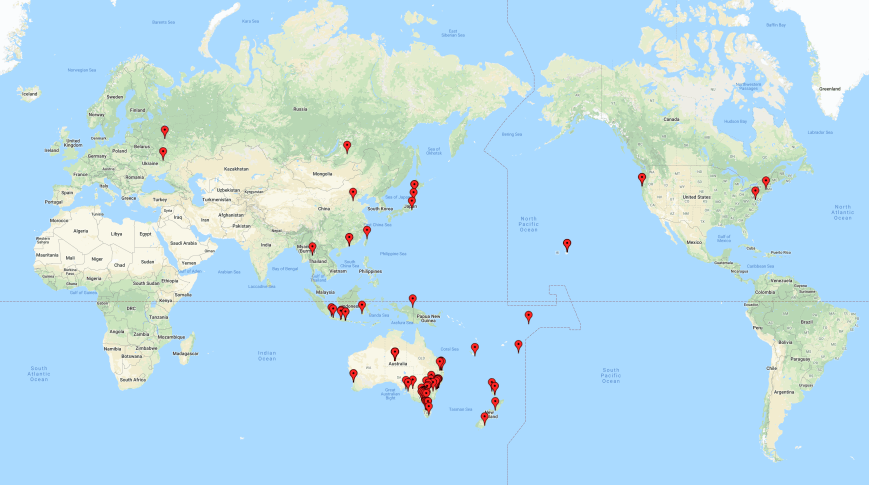
Between us, we had 71 contacts in the log from Swan Reach, including 31 Park to Park contacts. It was a good start to the 2019 VKFF Team Championship for us.
Marija worked the following stations on 80m SSB:-
- VK5CZ/p (Little Mount Crawford Native Forest Reserve VKFF-2884)
- VK5PL/p (Little Mount Crawford Native Forest Reserve VKFF-2884)
- VK4MWB/p (Moogerah Peaks National Park VKFF-0326)
- VK4SMA/p (Moogerah Peaks National Park VKFF-0326)
- VK2VH
- VK4AAC/2
- VK3HAQ
- VK3PI
- VK6MB/5 (Franklin Harbor Conservation Park VKFF-0807)
- VK2IO/p (Munmorah State Conservation Area VKFF-1361)
- VK3PT/m
- VK3MPR
- VK2MG/p (Munmorah State Conservation Area VKFF-1361)
- VK2XXM
- VK2PKT
- VK4SOE/p (Sundown National Park VKFF-0471)
- VK4HNS/2 (Nightcap National Park VKFF-0389)
- VK4SYD/p (Bunyaville Conservation Park VKFF-1493)
- VK4CZ/p (Bunyaville Conservation Park VKFF-1493)
Marija worked the following stations on 80m SSB:-
- VK6MB/5 (Franklin Harbor Conservation Park VKFF-0807)
- VK5FLEA/p (Cromer Conservation Park VKFF-0779)
- VK5PL/p (Cromer Conservation Park VKFF-0779)
- VK5CZ/p (Cromer Conservation Park VKFF-0779)
I worked the following stations on 40m SSB:-
- VK3HAQ
- VK3ZK
- VK5PL/p (Little Mount Crawford Native Forest Reserve VKFF-2884)
- VK5CZ/p (Little Mount Crawford Native Forest Reserve VKFF-2884)
- VK2VH
- VK4AAC/2
- VK7NWT
- VK3PF
- VK2LUV
- VK4SMA/p (Moogerah Peaks National Park VKFF-0326)
- VK4MWB/p (Moogerah Peaks National Park VKFF-0326)
- VK3SQ
- VK2PR
- VK3PI
- VK4JAZ
- VK6MB/5 (Franklin Harbor Conservation Park VKFF-0807)
- VK2IO/p (Munmorah State Conservation Area VKFF-1361)
- VK2MG/p (Munmorah State Conservation Area VKFF-1361)
- VK4SOE/p (Sundown National Park VKFF-0471)
- VK3XPT/m
- VK3PT/m
- VK4FDJL/6 (Mount Frankland South National Park VKFF-0653)
- VK3ZMD
- VK4HNS/2 (Nightcap National Park VKFF-0389)
- VK4SYD/p (Bunyaville Conservation Park VKFF-1493)
- VK4CZ/p (Bunyaville Conservation Park VKFF-1493)
- VK3CRG
- VK2PKT
- VK3NBL
- VK3FT
- VK7HCK
- VK7FJFD
- VK3ZLT
- VK3FCCK
- VK2LEE
- VK3FCMC
- VK2LX
- VK3MAB
- VK3ZPF
- VK2FAAY
I worked the following stations on 80m SSB:-
- VK6MB/5 (Franklin Harbor Conservation Park VKFF-0807)
- VK5WG
- VK5FANA
- VK5FLEA/p (Cromer Conservation Park VKFF-0779)
- VK5CZ/p (Cromer Conservation Park VKFF-0779)
- VK5PL/p (Cromer Conservation Park VKFF-0779)
- VK3HAQ
- VK5BJF
References.
Birds SA, 2019, <https://birdssa.asn.au/location/swan-reach-conservation-park/>, viewed 27th October 2019
Flinders Ranges Research, 2019, <https://www.southaustralianhistory.com.au/bowhill.htm>, viewed 27th October 2019.
Mid Murray Council, 2019, <https://www.mid-murray.sa.gov.au/page.aspx?u=927>, viewed 27th October 2019
Mid Murray Council, 2019, <https://www.mid-murray.sa.gov.au/page.aspx?u=925>, viewed 27th October 2019
National Parks and Wildlife Service South Australia, 2019, <https://www.parks.sa.gov.au/find-a-park/Browse_by_region/Murray_River/swan-reach-conservation-park>, viewed 27th October 2019
Wikipedia, 2019, <https://en.wikipedia.org/wiki/Murray_Mallee>, viewed 27th October 2019
Wikipedia, 2019, <https://en.wikipedia.org/wiki/Stobie_pole>, viewed 27th October 2019
Wikipedia, 2019, <https://en.wikipedia.org/wiki/Purnong,_South_Australia>, viewed 27th October 2019
Wikipedia, 2019, <https://en.wikipedia.org/wiki/Nildottie,_South_Australia>, viewed 27th October 2019
Wikipedia, 2019, <https://en.wikipedia.org/wiki/Swan_Reach,_South_Australia>, viewed 27th October 2019
Wikipedia, 2019, <https://en.wikipedia.org/wiki/1956_Murray_River_flood>, viewed 27th October 2019
Wikipedia, 2019, <https://en.wikipedia.org/wiki/Stott_Highway>, viewed 27th October 2019