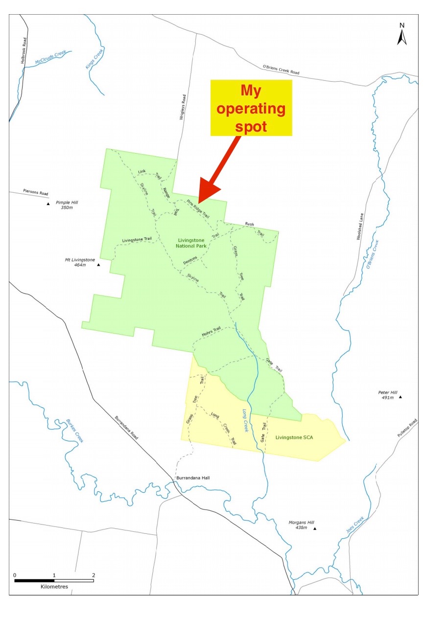
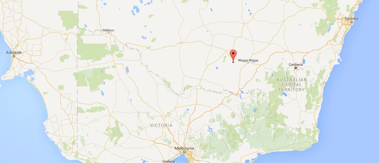
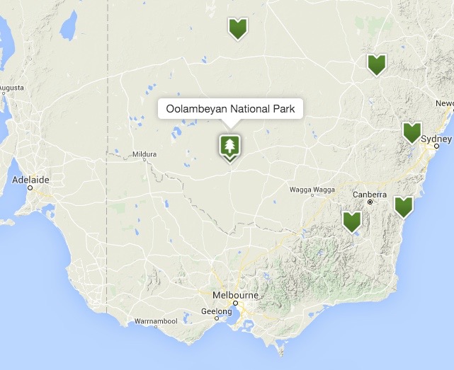
It was a bright and early start on Friday morning (23rd October 2015). I had a 480 km drive ahead of me to get to my intended destination of Wagga Wagga. So I hit the road early after a brief stop at the local bakery in Balranald for a coffee. I didn’t fancy the sachet coffee and the long life milk at the caravan park. I had one park activation planned for the day and that was the Oolambeyan National Park, VKFF-0403. And as far as wildlife and remoteness, this was to be the highlight of the trip for me.

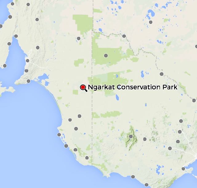
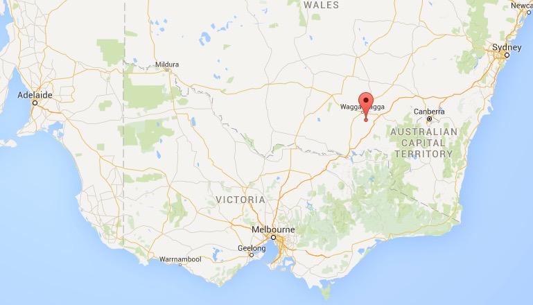
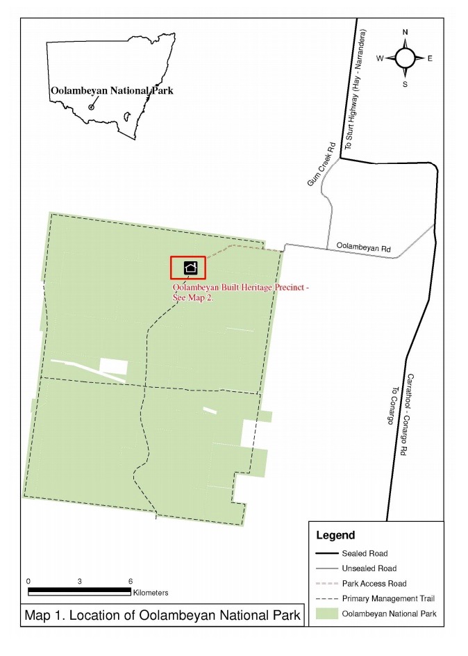
Above:- Map showing the location of the park.
I was on the road by about 6.30 a.m. NSW local time. I headed east along the Sturt Highway toward the town of Hay. This included a drive across the vast flat region of the Hay Plain, which is an ancient lake bed. Much of this drive is flat saltbush plain, with many thousands of hectares of grazing land, with just the occasional tree in sight.
To break up the drive I had HF going in the car. In the Toyota Hi Lux I use an Icom IC7000, with a Codan 9350 self tuning antenna mounted in the back tailgate. I tuned across 40m and found Tom 8P5A from Barbados on 7.068 calling CQ. I gave him a call as he was very strong and much to my surprise he came straight back to my first call and gave me a 5/9 signal report. I was very excited, as this was a new country for me from the mobile.
I then joined the Mid South Coast Amateur Radio Club Net on 7.065, being run by John VK2NJP who had a 5/9 plus signal into the mobile. The guys on the net kept me company as I crossed the first section of the Hay Plain.
Along the way I saw a trig point in the middle of nowhere on completely flat ground. No SOTA peak here! This is the Ti Tree Lake trig point and it is lcoated on a very lonely piece of the Sturt Highway between Balranald and Hay. And a little further up the road I noticed a crop duster out in the fields. I stopped for a brief photo opportunity and to admire some amazing flying.

The Ti Tree Lake trig point

Cropduster at work on the Hay Plain
I then found Troy VK4LCI mobile calling CQ on 7.120 with a good 5/5 signal. I also received a 5/5 signal back from Troy. Nice to work mobile to mobile.
I then drove into Hay where I made a short stop to stretch my legs. I had not been in Hay for many many years so I drove around the town for about 15 minutes admiring the many fantastic old buildings that can be located in Hay. Hay is the centre of a propsperous and productive agricultural district and has a population of around 2,400 people.

The old Hay Gaol, now a museum

The old Australian Joint Stock Bank, built 1864

The Hay Post office built in 1881

The main street of Hay

The Shearers Hall of Fame
Whilst in Hay I spoke with Mark, VK2VW on 7.115 (5/9 both ways). Mark has recently become an active WWFF park hunter, so I told him to keep an ear out for me at Oolambeyan. Before leaving Hay, Hauke, VK1HW mobile in Canberra also gave me a call (5/9 both ways).
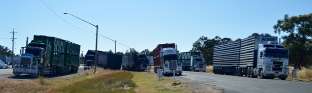
I snapped the photo below at one of the service stations in Hay. It shows a number of trucks, including B-doubles. What is a B-double? Essentially it consists of two trailers that are linked together by a fifth wheel.

I then left Hay and headed towards the town of Narrandera. Again to break up the drive I occasionally tuned across the 40m band. I found VK2MA on 7.104 and the Horsnby and District Amateur Radio Club Net. I booked in to the net for a chat as there were some particularly strong signals on the Net.
Along the way I noticed a lone grave, outside of Hay, on the Sturt Highway. I stopped for a brief look. It is the resting place of Charles Dunstan Thompson who died in September 1879 at nearby Burrabogie Station, aged just 30 years.
I continued east on the Sturt Highway until I reached Conargo Road near Carrathool. This is where I needed to turn to head towards Oolambeyan National Park. There is no sign here for the park. However, the junction is distinguishable by the Carrathool Grain Complex on one corner, and a woold producing complex on the other. This is about 64 km east of Hay.
After travelling south on Conargo Road, you will reach the junction with Gum Creek Road. I continued down Gum Creek Road which is a dirt road, but easily passable in a conventional vehicle. There are good signs indicating the way to the park from this point. You need to travel through some gates and grids.
On my way to the park I put out a call on 7.144, hoping that some of the park die hards might be listening, to let them know my progress. Sure enough my call was answered by Jeff VK5JK at Victor Harbour south of Adelaide with a magnificent 5/9 signal. This was followed by Col VK5HCF at Mount Gambier who was also 5/9, and then Rick VK4RF with a 5/5 signal. All were keen to work me upon my arrival at Oolambeyan National Park.
It wasn’t long before I was encountering a lot of wildlife. As it was still quite early the kangaroos and emus were quite active. And I don’t think I’ve ever seen so many eagles and hawks in the sky. It was amazing.
I then travelled along Oolambeyan Road which is also a dirt road. Another grid was required to be crossed. This road is not accessible after rain. And there are some sandy sections which can only be attempted in a 4WD.
And now the wildlife really appeared. It was amazing. Kangaroos everywhere, along with numerous emus. It was very slow going on the road.
I continued along Oolambeyan Road and found a small clearing in the scrub. It was shaping up to be a very hot day, so I chose a nice shady spot underneath a tree.
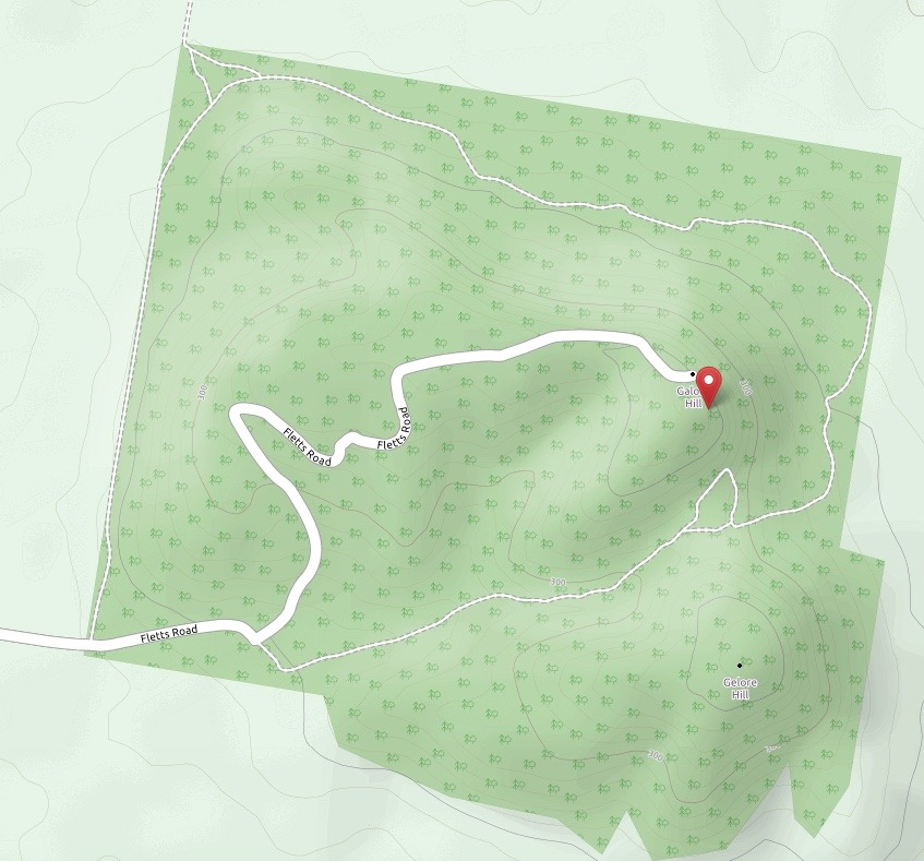
Oolambeyan National Park is 22,231 hectares in size and is located about 600 km west of Sydney. The name is believed to be based on the Wiradjuri aboriginal word ‘Wulambiyan’. ‘Wulam‘ means ‘to call or give voice to’, and ‘biyan‘ can be past tense for ‘always and continuous’. Hence it can be interpeted as ‘have always been calling’, the ‘voice of the wind calling in the trees’, or the ‘song of the wind passing through the trees’. This is linked to the aboriginal story that the voice of Dharramulan, one of Biamie’s sons, was put into the trees from which comes the sound of the bull roarer.
The park was once a merino stud property. It was purchased by the New South Wales Government in late 2001 and was subsequently gazetted as a National Park on the 25th October 2002. The park is located in the Riverina region of New South Wales which is the most poorly conserved bioregion in New South Wales, with less than 1% of its area protected within the NSW park system.
As I’ve already mentioned, the park is alive with wildlife including Red Kangaroos, Western Grey kangaroos, and Eastern Grey kangaroos. Numerous bird species can be found in the park including the endangered Plains-wanderer, which is a quail like, ground dwelling bird. It is estimated that only 3,100 of these birds remain in the wild.

I parked the 4WD and started walking towards the shade. Much to my surprise, I came across a small goanna at a puddle of water, getting a morning drink. I’m not sure who was more surprised…me, or the goanna.
As I was setting up I could see a 4WD ute approaching in the distance. I continued to set up my gear, and within a few minutes the 4WD had arrived. As it turned out it was the park ranger who lives in the homestead at the end of Oolambeyan Road in the park. He was a very friendly and obliging gentlemen. I explained to him why I was out here and all about the hobby of amateur radio. I told him of my experience with the goanna, and he warned me to be wary for Brown snakes as they were plentiful.
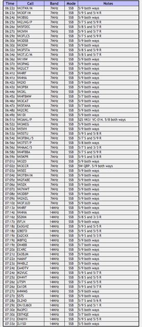
I was up and ready to go by 2355 UTC (8.55 a.m. NSW local time). I called CQ on my nominated 40m frequency of 7.144 and this was immediately answered by Col VK5HCF in the South East. Col had been patiently waiting there for me after out chat in the mobile. This was followed by the ever keen Amanda VK3FQSO and park stalwarts Mick VK3PMG and Rick VK4RF.
I was a warm morning, and I had dozens of fury onlookers, all of whom were also seeking the shade of trees. I even had the occasional Galah come in for a morning drink at the puddle of water. And I also had some unwelcome visitors in the form of flies. They were relentless and no form of spray seemed to work and keep them off me. In the end I had to resort to the use of my fly net hat.
Even though it was a working day, I still had a steady flow of callers and I was hopeful to reach the required 44 contacts to qualify the park for the World Wide Flora Fauna (WWFF) program. One of my contacts was with Ian VK5CZ who was also attending the get together in Wagga Wagga. Ian was mobile on the Sturt Highway between Balranald and Hay, not all that far from where I was operating from. I arranged to meet Ian and his wife Halima in Narrandera for lunch.
After working 36 stations on 7.144 I decided to give 20m a go. I lowered the squid pole and removed the links in the dipole and headed for 14.310. Unfortunately I could not spot myself as there was no mobile telephone coverage in this remote location. I called CQ a number of times and this was eventually answered by Rick VK4RF, who I also worked under his secondary call of VK4HA. But that was it. I had no further takers. I tuned across the 20m band and did not hear a single station. It was very very inactive.
So I headed back to 40m, hoping to pick up my final 5 contacts to qualify the park. My first taker after returning to 7.144 was Ian VK2IAN, following by Keith VK2PKT, Tom VK5AA, Mark VK7MK, and then Terry VK5TEL mobile near Victor Harbour south of Adelaide. I had qualified the park and I was very happy. A further 4 stations called me after Terry, all from VK3.
After a little under 2 hours in the park, I had a total of 48 contacts in the log. I
I packed up my gear and headed out of the park, enroute to Wagga Wagga. As I drove along the dirt roads out of the park, I took the photographs below of a hawk who had a distinct interest on something on the road ahead of me.
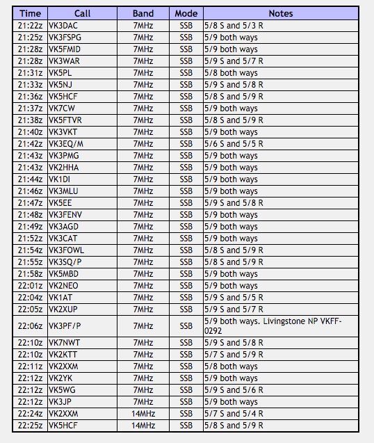
The following stations were worked on 40m SSB:-
- VK5HCF
- VK3FQSO
- VK3PMG
- VK4RF
- VK4HA
- VK5FANA
- VK4HNS/p
- VK3TKK
- VK4AAC/5
- VK2GKA
- VK3VBI
- VK5EE
- VK3GPm
- VK5FMID
- VK2MOR
- VK5JK
- VK3FINE
- VK5GJ
- VK5KLV
- VK5CZ/2
- VK2IO
- VK2VW
- VK5XGH
- VK5GI
- VK2MTC
- VK3DY
- VK5FFAA
- VK2XXM
- VK3FAPH
- VK5MBD
- VK5ZGY
- VK5NRG
- VK2YZS/m
- VK3MIJ
- VK2FABE
- VK2SB’
- VK5MAS
- VK2IAN
- VK2PKT
- VK5AA
- VK7MK
- VK5TEL/m
- VK3FARO
- VK3HRA
- VK3ALB
- VK3AUR
The following stations were worked on 20m SSB:-
- VK4RF
- VK4HA
References.
NSW Office of Environment and Heritage, <http://www.environment.nsw.gov.au/sop04/sop04cs4.htm>, viewed 4th November 2015.
NSW Office of Environment & Heritage, Draft Management Plan Oolambyean National Park, December 2012.
Wikipedia, 2015, <https://en.wikipedia.org/wiki/Hay,_New_South_Wales>, viewed 4th November 2015