
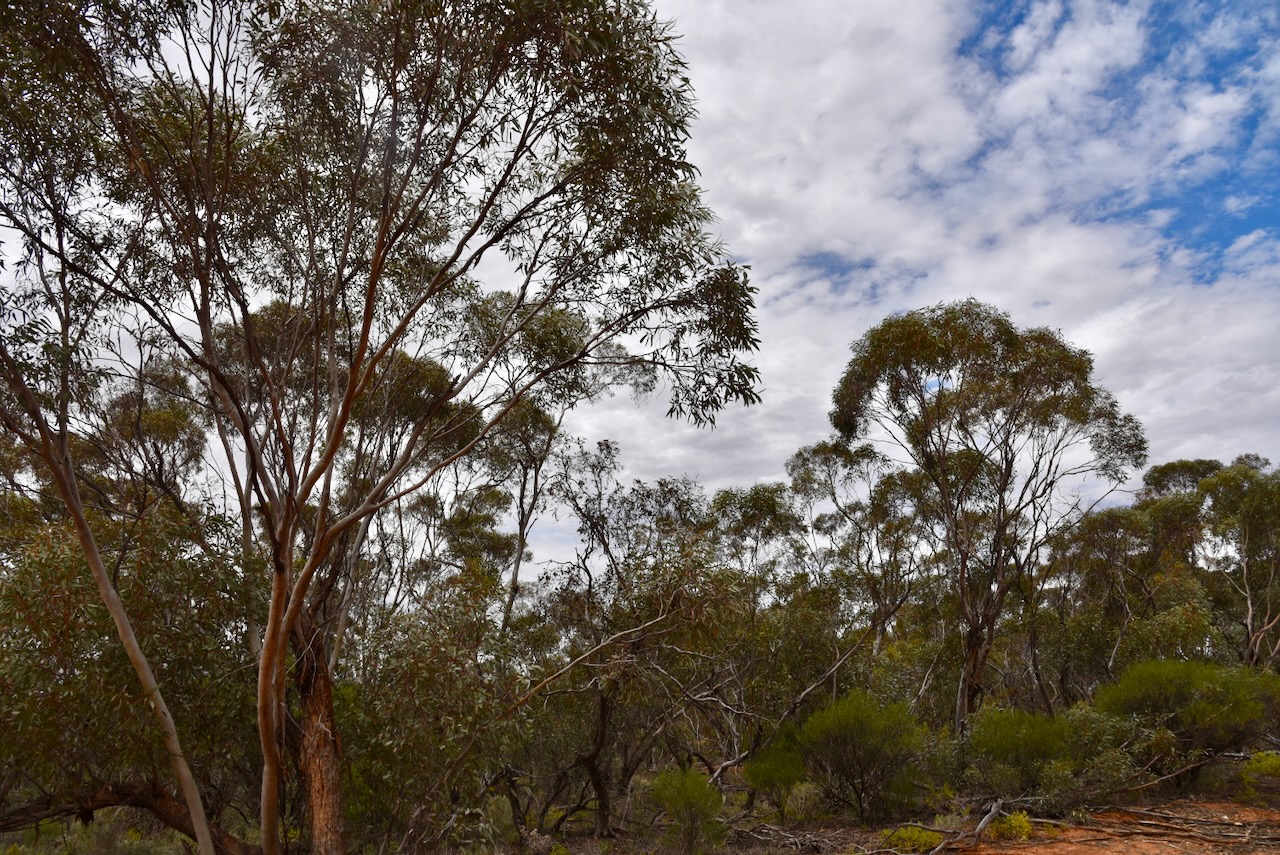
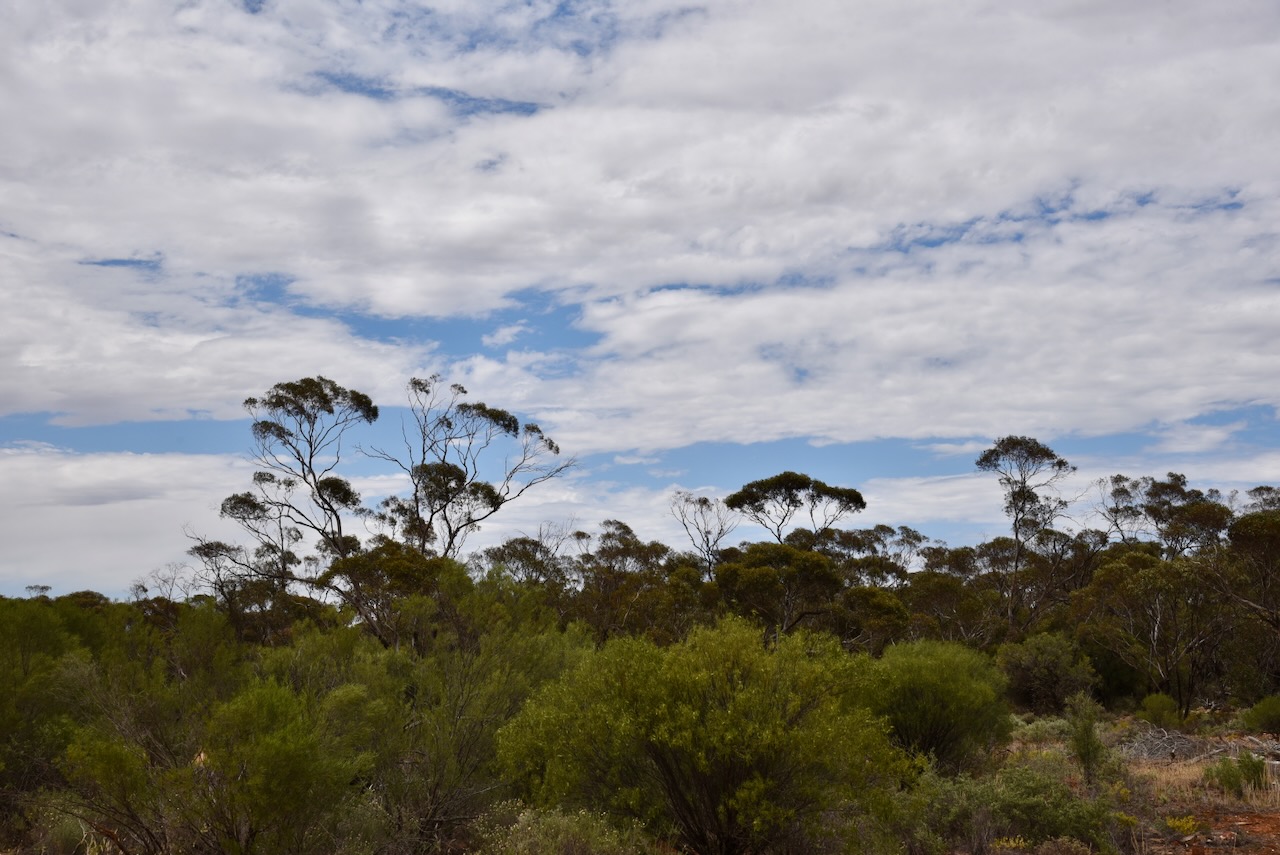
Our next activation for Friday, the 7th day of November 2025, was the Nyah Bushland Reserve VKFF-5680. The reserve is located about 30 km northwest of Swan Hill.
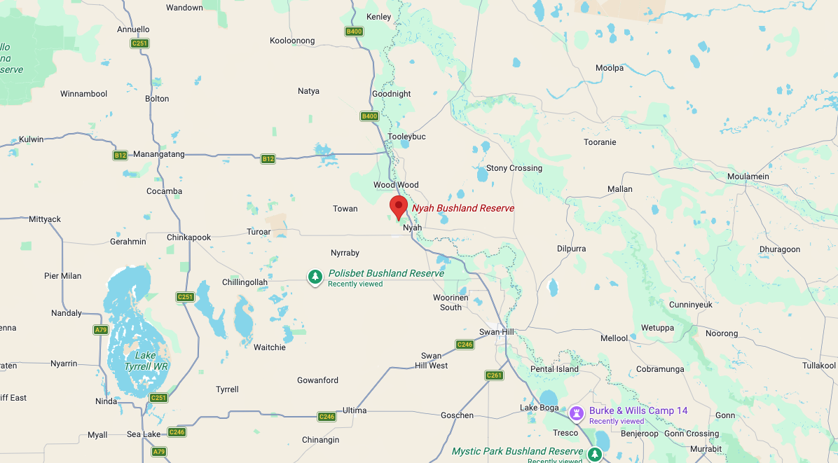
Above: Map showing the location of Nyah Bushland Reserve. Map c/o Google Maps
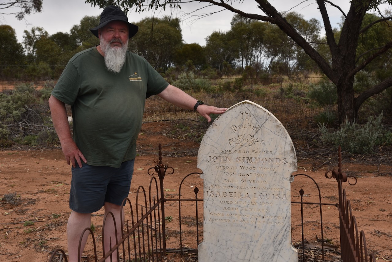
Prior to activating the park, Marija and I visited the Nyah Cemetery. I have several family members buried there, including my great-great-grandparents, John Simmonds and Isabella Simmonds, nee Thompson.
The Nyah Bushland Reserve is located on the northern side of Yarraby Road. It borders the Nyah West Golf Club and the Nyah Airport.

Above: the boundaries of Nyah Bushland Reserve. Image c/o Google Earth
It is believed that Nyah is derived from an Aboriginal word describing a bend in the Murray River. Nyah is located on the Murray Valley Highway in close proximity to the Murray River. Nyah West is located about 3 km to the southwest on Monash Avenue.
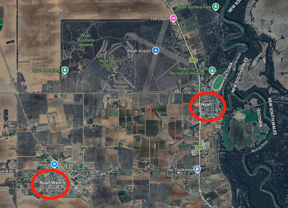
Above: An aerial view showing Nyah and Nyah West. Image c/o Google Maps
In 1892, the township of Taverner Community Village Settlement was established by Jim Thwaites as a utopian socialist community. On the 4th day of May 1894 the Post Office was opened, and it was known as Tyntynder. (Wikipedia 2024)
In 1896, the Nyah State School was established, with classes being first held in the town’s Top Hall. The school building was built in 1912. In 1915, the railway from Swan Hill was extended to the north, and it bypassed Nyah. As a result, Nyah West was developed. In 1915, the Nyah Railway Station School was opened. (Victorianplaces.com.au 2026) (Wikipedia 2024)
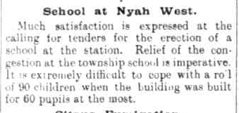
Above: article from the Swan Hill Guardian, Thu 17 Jun 1915. Image c/o Trove
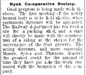
A fruit growers cooperative was also established, and during the 1920s, a packing shed was built at the railway siding. A hospital was also opened in the 1920s. In 1921, the population of Nyah West was 483, while the population of Nyah was 557. (Victorianplaces.com.au 2026)
Above: article from the Swan Hill Guardian, Mon 11 Oct 1915. Image c/o Trove
The Nyah Bushland Reserve is about 162 hectares in size and was established on the 1st day of May 1979. (Dcceew.gov.au 2025)
We accessed the park via a 4WD track running alongside the cemetery. Marija and I ran the Yaesu FT857, 40 watts, and the 20/40/80m linked dipole.
Marija worked the following stations on 40m SSB:-
- VK3MAP
- VK3PF
- VK3KAI
- VK3SQ
- VK3JT
- VK2BD
- VK3EME
- VK2VH
- VK4AAC
- VK2EXA
- VK3SX
- VK1AD
- VK1NAM
- VK2IO
- VK2GEZ
I worked the following stations on 40m SSB:-
- VK3MAP
- VK3PF
- VK3KAI
- VK3SQ
- VK3JT
- VK2BD
- VK3EME
- VK2VH
- VK4AAC
- VK2EXA
- VK3SX
- VK1AD
- VK1NAM
- VK2IO
- VK2GEZ
- VK3ZSC
- VK3DJC
- VK3WSG
- VK5MOS
- VK2MAB
- VK3CLD
- VK2DBF
- VK5QA
- VK3MGM
- VK3FFA
- VK5WY
- VK3MTT
- VK2VW
- VK2HFI
- VK2AKA
- VK2BUG
- VK5BRU/P
- VK5HS
- VK3BWS
- VK3FS/M
- VK3ATT/M
- VK7SKY
- VK5AAF
I worked the following stations on 40m AM:-
- VK5HS
- VK3PF
- VK3KAI
- VK2VH
- VK4AAC
- VK3BWS
- VK3SQ
- VK3JT
- VK2BD
References.
- Dcceew.gov.au. (2025). Collaborative Australian Protected Areas Database 2024 – DCCEEW. [online] Available at: https://www.dcceew.gov.au/environment/land/nrs/science/capad/2024. [Accessed 18 Apr. 2026]
- Victorianplaces.com.au. (2026). Nyah and Nyah West | Victorian Places. [online] Available at: https://www.victorianplaces.com.au/nyah-and-nyah-west [Accessed 18 Apr. 2026].
- Wikipedia Contributors (2024). Nyah. Wikipedia.
