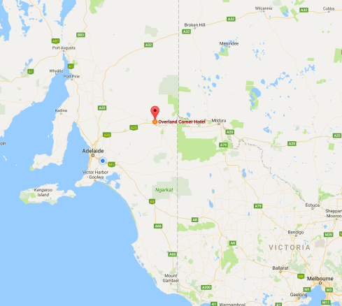
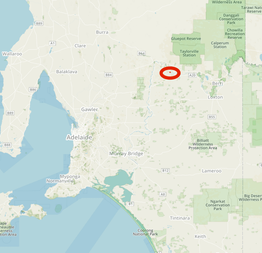
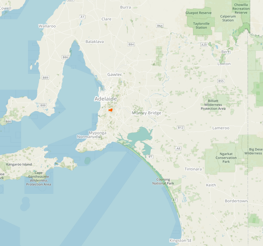
Marija and I had one planned park activation for Sunday (23rd April 2017). That being the Cooltong Conservation Park 5CP-046 & VKFF-0823 which is located about 257 km north east of Adelaide, and just a few km to the west of the town of Renmark.
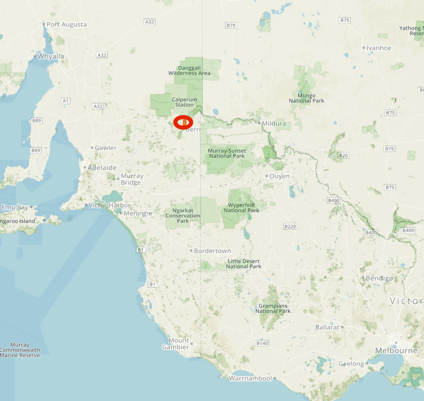
Map showing the location of the Cooltong Conservation in the Riverland region of South Australia. Map courtesy of Protected Planet.
Marija and I have activated this park previously, for both the VK5 National & Conservation Parks Award and the World Wide Flora Fauna (WWFF) program. We visited the park together back in April 2015 when Marija had made 15 contacts, qualifying the park for VKFF, but falling a bit short of the 44 QSOs required for the global WWFF program. So Marija was hoping to pick up a few more contacts to get over the 44 line.
https://vk5pas.org/2016/04/20/cooltong-conservation-park-5cp-046-and-vkff-0823/
And I had activated the park back in May 2015 and well and truly had qualified the park for both VKFF and WWFF.
https://vk5pas.org/2015/05/12/cooltong-conservation-park-vkff-823/
However, I had been given permission to use the special call of VK5WOW, issued to help celebrate the upcoming 2017 WIA AGM & Convention in Handorf.

We made an early start and had breakfast at the motel and then headed to the home of Ivan VK5HS. As it turned out my wife Marija and Ivan had secretly arranged to instal a BHI noise eliminating speaker in the Toyota Hi Lux. Many thanks to both Marija and Ivan. It is a really welcome addition to the vehicle. Peter VK5PE also popped around.
Whilst there we all worked Andrew VK1AD who was on SOTA summitBobbara Mountain VK2/ ST-044, and then John VK5BJE/3 who was portable in the Snowy River National Park VKFF-0455. And we also worked VK5WOW on the callback after the VK5 WIA Broadcast.
Marija and I then headed across the historic Paringa bridge into the little town of Paringa. The bridge was constructed in 1927 for the railway extension over the River Murray to Renmark. It is one of South Australia’s significant engineering monuments and is a State Heritage Place protected by the Heritage Places Act 1993.


We then headed out to Lock 5 which was built during the 1920’s to regulate the flow and the levels of the Murray River. There are a number of information boards here explaining how the lock was installed. You can also view the 80 ton barge, the Bunyip. Along the way we workd Nick VK3ANL who was activating SOTA peak Mount Torbreck VK3/ VN-001.


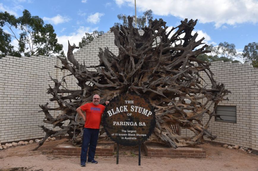
Our next stop was the Black Stump at Paringa, the largest of 11 known black stumps in Australia.
We then visited the Olivewood historic homestead and museum. This was the home of the Chaffey Bros, founders of Australia’s first irrigation settlement in Renmark in 1887. The old homestead is open for inspection and is furnished from this period.


The adjacent museum contains numerous early photos and memorabillia, including an amount of old radio gear.


We then called in to the Twenty Third Distillery in Renmark for some lunch….wood fire oven pizzas and a few cold Ciders.


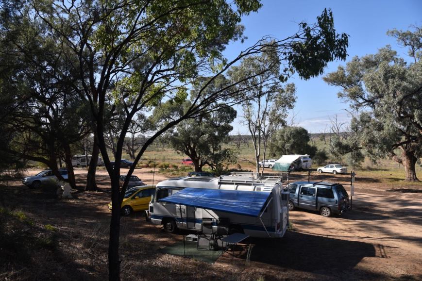
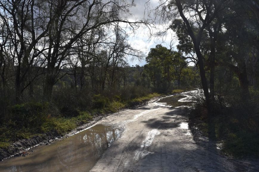
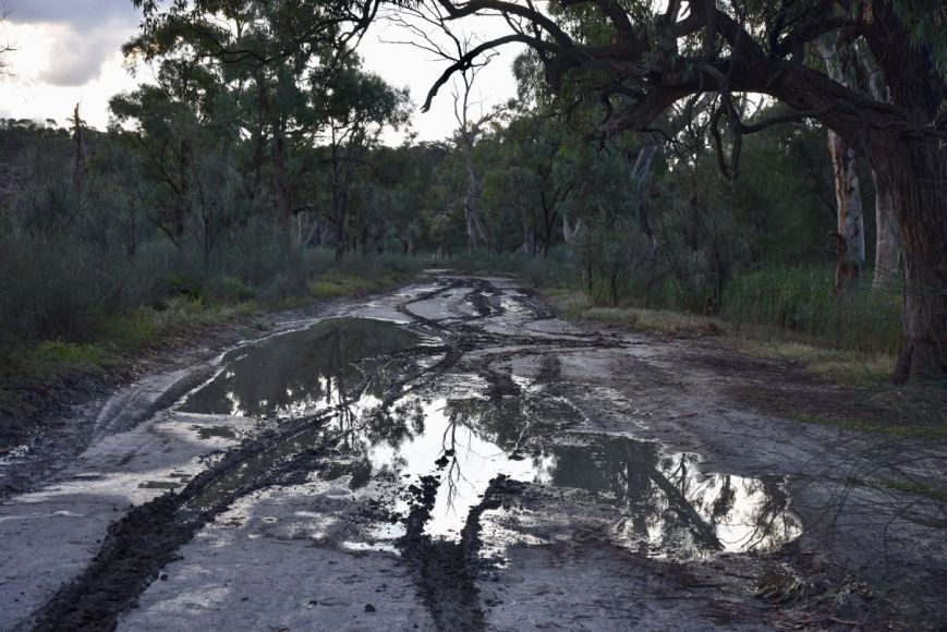
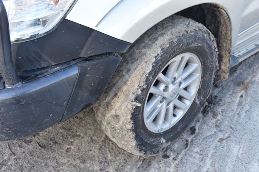
It was now approaching 1.30 p.m. local time and we headed out to the Cooltong Conservation Park. We accessed the park via Santos Road which runs off the Sturt Highway. There are no signs on the Highway indicating the park. But a few km up Santos Road we reached the park which is signposted.


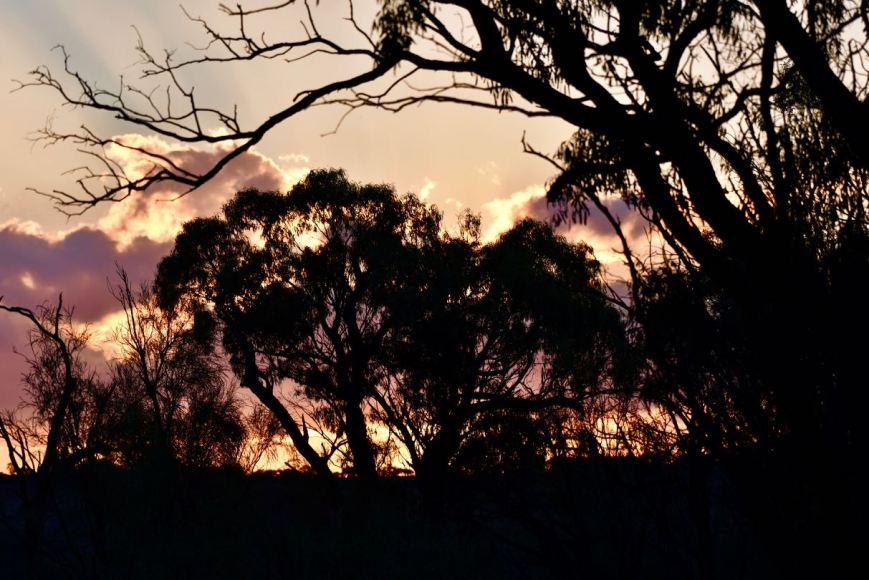
Cooltong Conservation Park was dedicated in 1993 and comprised 3,681 hectares of mallee vegetation. The name Cooltong is derived from a local aboriginal name meaning ‘lizard place’. A large number of native birds can be found in the park including the rarely seen Malleefowl.


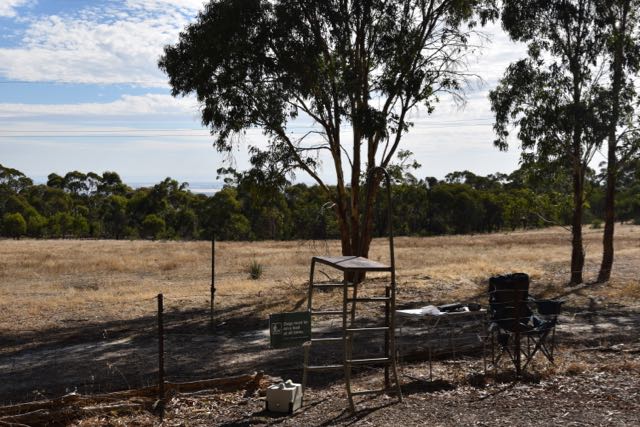
Marija and I drove a short distance in the park and found a clearing in amongst the scrub off Santos Road. It was a hot da7, 29 deg C, so we erected the awning on the Toyota Hi Lux and set up the deck chairs and fold up table underneath the awning. We ran the Yaesu FT-857d for this activation, initially set at 10 watts PEP for Marija, and then at 40 watts for me. The antenna was the 80/40/20m linked dipole supported on the 7m telescopic squid pole.
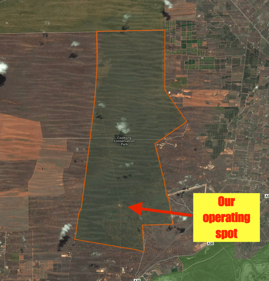
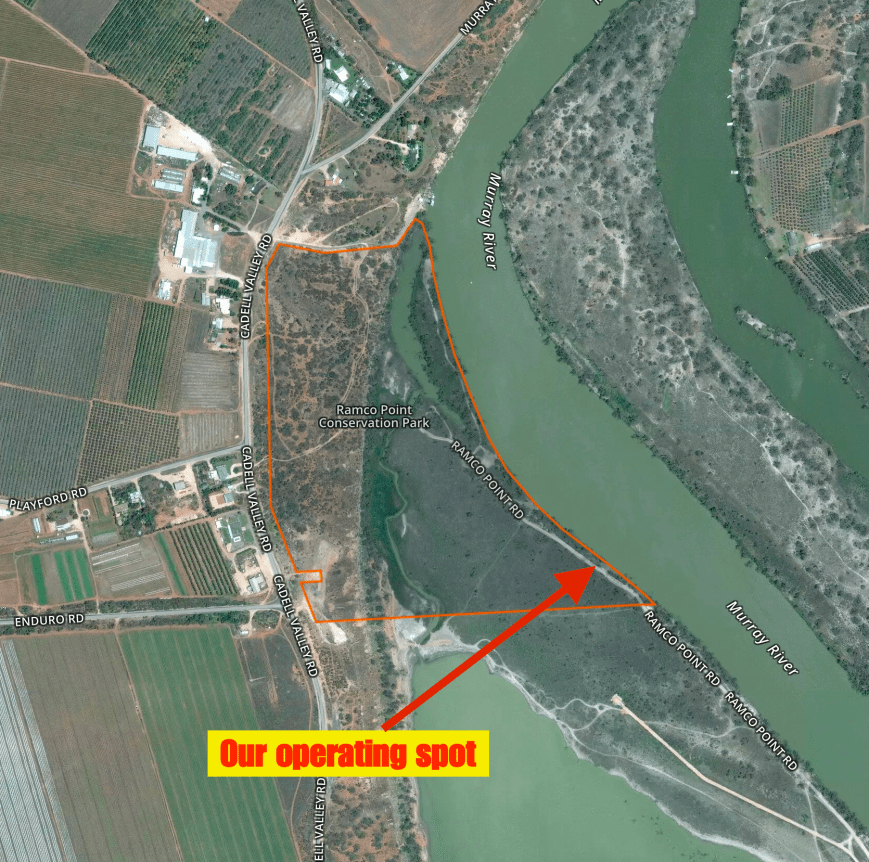
Aerial shot of the park showing our operating spot. Image courtesy of Protected Planet.
Marija started off first, with contact number one on 40m SSB being Mark VK5QI/m who was mobile on his way home from the Riverland. Mark is an active member of AREG and had taken part in the balloon launch the day previous. Contact number two for Marija was Jonathon VK7JON, followed by Damien VK3FRAB/p, Bruce VK3FBNG, and then Bill VK5MBD/p who was portable near Overland Corner. Contact number 7 was a Park to Park contact with Greg VK4VXX/2 who was activating the Mutawintji National Park VKFF-0374.
The band was in good shape and there were a lot of amateurs about due to it being the Easter weekend. Marija very soon had the required 29 contacts in the log (to add to her previous 15) to qualify the park for WWFF. The honour of contact 29 goes to Ian VK3VIN in Corio.
Marija worked a total of 66 stations on 40 from VK1, VK2, VK3, VK4, VK5, and VK7. This included further Park to Park contacts with John VK5BJE/3 who was portable in the Lake Tyers State Park VKFF-0761, David VK5HYZ/p in the Scott Creek Conservation Park VKFF-0788, Peter VK3PF/4 on SOTA peak VK4/ SE-043 in the D’Aguilar National Park VKFF-0129, Bill VK4FW/p in the Nour Nour National Park VKFF-0701, and Bill VK3CWF/p in the Brisbane Ranges National Park VKFF-0055.
Craig VK3CRG streamed Marija’s contacts via VK3RTV, Digital Amateur TV in Melbourne.
Marija swapped the mic with me, allowing me to log the Park activators.


It was my turn to jump on the mic and operate as VK5WOW. And WOW (sorry for the pun), what a pile up. I reached contact number 44 in just 30 minutes (Kevin VK2VKB). In around 1 hour & 20 minutes I had contact number 100 in the log (Ray VK3RW). I logged a total of 104 contacts on 40m with most contacts around Australia into VK1, VK2, VK3, VK4, VK5, and VK7. I logged 2 DX stations on 40m: Brian ZL2ASH in Wellington, New Zealand, and Vicente EA3GP in Tarragona, Spain. I made one Park to Park contact, and that was with Peter VK3PF/4 who was in the D’Aguilar National Park VKFF-0129.


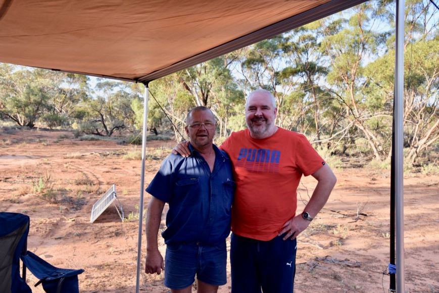
During my time on 40m, Shaun VK5FAKV called me. Shaun lives very close by to the park and I gave him directions on how to find me. I have spoken with Shaun many times on air, and it was a pleasure to meet him finally in person.
I then gave the 20m band a crack, but had very little success there. Long path propagation into Europe was non existant. I logged just 6 stations on 20m from VK2, VK4, VK6 and Japan.
I then moved back to 40m where I logged a further 20 stations from VK2, VK3, VK4, and VK6. This included a Park to Park with Bill VK4FW who was in the Nour Nour National Park VKFF-0701.
It was starting to get dark, 5.30 p.m. local time, and I decided to give the 80m band a shot. I called CQ on 3.610 and this was answered by Bernie VK4KX who had followed me down from 40. This was followed by Ivan VK5HS at nearby Renmark who was of course 5/9 +++. I worked a total of 19 stations on 80m from VK2, VK3, VK4, VK5, and VK7.
I decided to give 40m one last try, hoping to get some North American DX in the log. Sadly, this was not to happen. But I did log a further 12 stations from VK2, VK3, VK4, VK5, and VK6.
It was now 6.30 p.m. local time and it was time to pack up and head back into Renmark for a bite to eat. I had a total of 161 contacts in the VK5WOW log. Thanks to everyone who called, and I apologise to those who missed out in the pile up. Be patient and persistent and I am sure to work you.


At the end of the activation Marija and I enjoyed a very nice meal at the Renmark Club and it was then back to the motel room, for another early start in the morning.
Marija worked the following stations on 40m SSB:-
- VK5QI/m
- VK7JON
- VK3FRAB/p
- VK3FBNG
- VK5MBD/p
- VK3CGB
- VK4VXX/2 (Mutawintji National Park VKFF-0374)
- VK3YXC
- VK1AT/p
- VK5KLV
- VK5HS
- VK5PE
- VK7FOLK
- VK3FSPG
- VK3MPR
- VK2HPN/m
- VK5AYD
- VK7DW
- VK2NP
- VK2PDW
- VK2GAZ
- VK3FOWL
- VK3SQ
- VK2QK
- VK5WG
- VK2OD
- VK3TKK
- VK3AXF
- VK7AU
- VK3VIN
- VK3HKV
- VK5BJE/3 (Lake Tyers State Park VKFF-0761)
- VK3ZLD
- VK2LX
- VK5HYZ/p (Scott Creek Conservation Park VKFF-0788)
- VK3PF/4 (SOTA VK4/ SE-043 & D’Aguilar National Park VKFF-0129)
- VK3FPSR
- VK3FAJH
- VK3FLJD
- VK3FPHG
- VK5TR
- VK5AFZ
- VK2KYO
- VK3YSP
- VK5YL
- VK3CRG
- VK3PAT
- VK5MA/p
- VK4FW/p (Nour Nour National Park VKFF-0701)
- VK3CWF/p (Brisbane Ranges National Park VKFF-0055)
- VK3ZZS/p
- VK5FANA/m
- VK7NWT
- VK5IS
- VK5CP
- VK2HI
- VK5HEL
- VK3GGG
- VK3PMG
- VK5FMJC
- VK4RF
- VK4HA
- VK2GPT/p
- VK3TL
- VK3MIC
- VK3ZL
I worked the following stations (under VK5PAS) on 40m SSB:-
- VK4VXX/2 (Mutawintji National Park VKFF-0374)
- VK5BJE/3 (Lake Tyers State Park VKFF-0761)
- VK5HYZ/p (Scott Creek Conservation Park)
- VK3PF/4 (SOTA VK4/ SE-043 & D’Aguilar National Park VKFF-0129)
- VK4FW/p (Nour Nour National Park VKFF-0701)
- VK3CWF/p (Brisbane Ranges National Park VKFF-0055)
I worked the following stations (under VK5WOW) on 40m SSB:-
- VK3SQ
- VK3HSB
- VK3PF/4
- VK4RF
- VK4HA
- VK5MBD/p
- VK3FOWL
- VK5MA/p
- VK3TKK
- VK5NE
- VK3TL
- VK5WG
- VK2HOT
- VK3ZLD
- VK3PAT
- VK5HEL
- VK2LX
- VK3GYH/p
- VK5KLV
- VK2GAZ
- VK2FRKO
- VK3CRG
- VK2VW
- VK3FRAB/p
- VK3FPHG
- VK3YSP
- VK3SRC
- VK2EJW
- VK3YQS
- Vk5FANA/m
- VK7JON
- VK3BL
- VK7VZ/p
- VK3GGG
- VK3PMG
- VK5JK
- VK3VLY
- ZL2ASH
- VK3JM
- VK2PDW/m
- VK2NP
- VK3MNZ
- VK4HNS
- VK2VKB
- VK2SK
- VK2EXA
- VK7FOLK
- VK3ZPF
- VK3FADM/2
- VK2JXA/p
- VK3YSP/p
- VK4FFAB
- VK4BX
- VK4ARW
- VK3FAJH
- VK5DJW
- VK5ZGY/m
- VK2NSS
- VK2VOL
- VK5FAKV
- VK4QQ
- VK3PLP
- VK5PE
- VK3VIN
- VK3BSG
- VK7DW
- VK4VXX
- VK5WF
- VK3PI
- VK2IO/m
- VK4SMA
- VK1RZ
- VK7FEAT/m
- VK7AN
- VK3RU
- VK3TJS
- VK3MCK
- VK5KFB
- VK2ZQ
- VK2BMU
- VK5BC
- VK5NJ
- VK2UCT
- VK3FSPG
- VK3MPR
- VK2NWB
- VK4ND
- VK2YW
- VK3BGE
- VK5NAW
- EA3GP
- VK5HS
- VK3MAB
- VK5ZKU
- VK3FMPC
- VK7AU
- VK3ZD
- VK3MJR
- VK3ELH
- VK3RW
- VK3STU
- VK3MCD
- VK5YX
- VK3HBG
- VK2QQ
- VK3TJK
- VK2HHS
- VK4FW/p (VKFF-0701)
- VK2QK
- VK2HBT
- VK3UH
- VK3SOT
- VK4HHA
- VK3WAR
- VK2FSAV
- VK5FD/p
- VK6WC
- VK2SOL
- VK3SX
- VK3NLK
- VK3FMDC
- VK4DA
- VK2BTO
- VK4KX
- VK4GAZ
- VK3FEVT
- VK3AND
- VK3FLES
- VK4FSCC
- VK4FRAL/m
- VK6NU
- VK3LBW
- VK2TMC
- VK2SVN
- VK2WWV
- VK5FDEC
I worked the following stations (under VK5WOW) on 20m SSB:-
- VK4QQ
- VK2MI
- VK5BC
- JA1VRY
- VK2CMP
- VK6GLX
I worked the following stations (under VK5WOW) on 80m SSB:-
- VK4KX
- VK5HS
- VK3NLK
- VK4VCO/p
- VK5FANA
- VK5HYZ
- VK3STU
- VK5FD/p
- VK7JON
- VK5ATQ
- VK3GGG
- VK3PMG
- VK3VLY
- VK3SQ
- VK5MG
- VK4TJ
- VK3DQL
- VK5FMAZ/m
- VK2MTM
References.
Department of Environment and Natural Resources, 2011, ‘Parks of the Riverland’
Discover Murray, 2017, <http://www.murrayriver.com.au/paddleboats/river-boat-trail-renmark/>, viewed 27th April 2017
Renmark Paringa Visitor Information Centre, 2015, ‘Renmark, Paringa & Lyrup Visitor Guide’
Wikipedia, 2017, <https://en.wikipedia.org/wiki/Cooltong,_South_Australia>, viewed 27th April 2017