Wood Wood Nature Conservation Park VKFF-2490

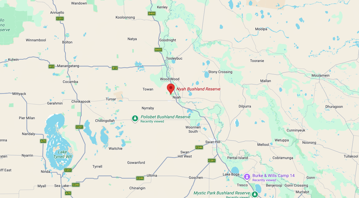
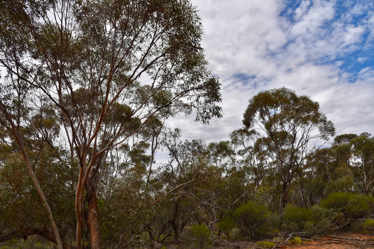
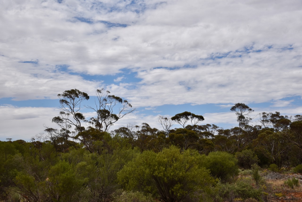
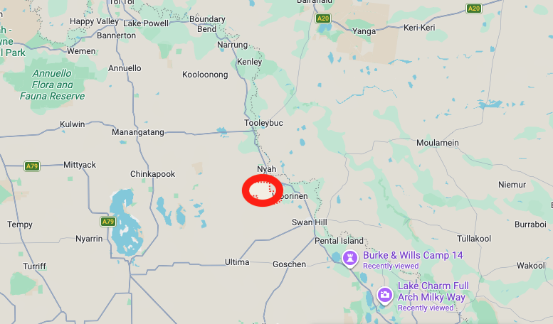
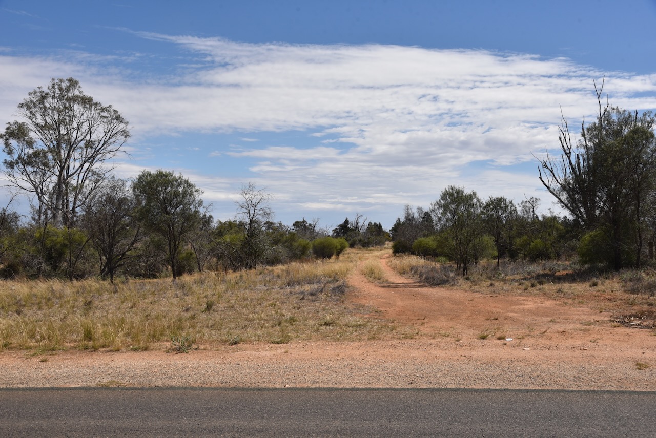
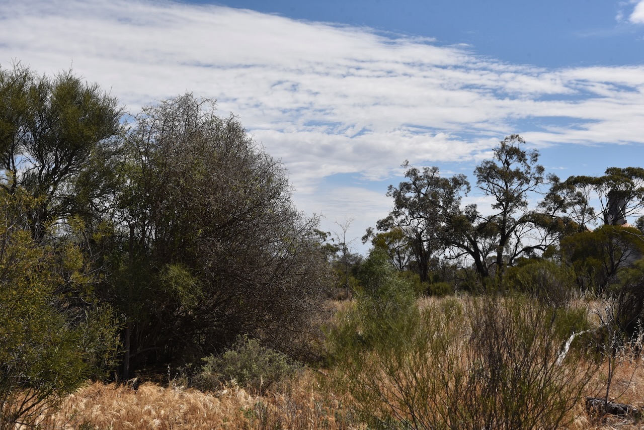
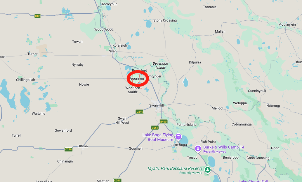
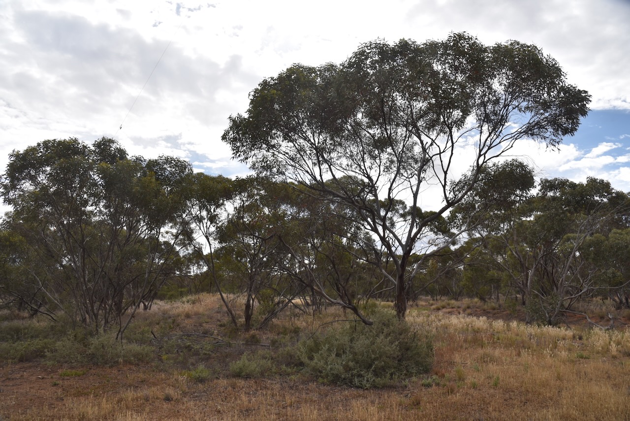
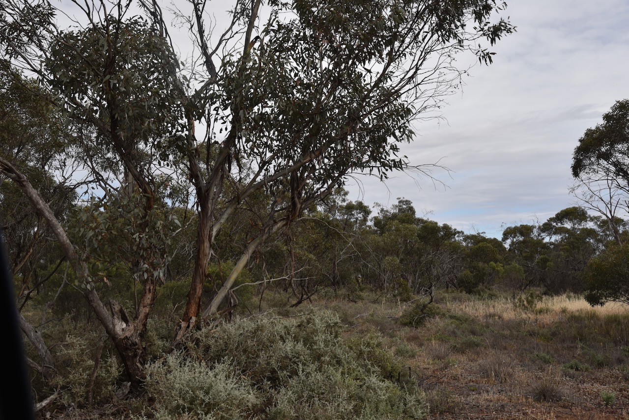
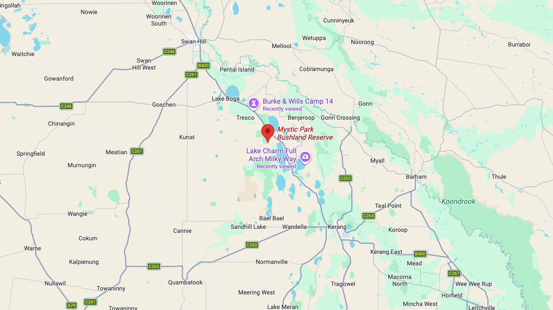
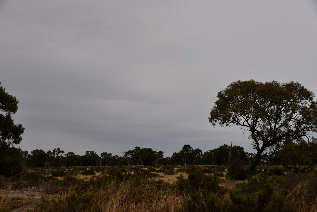
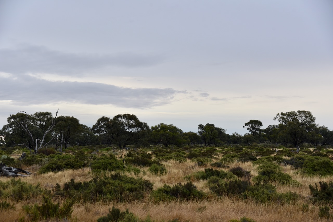
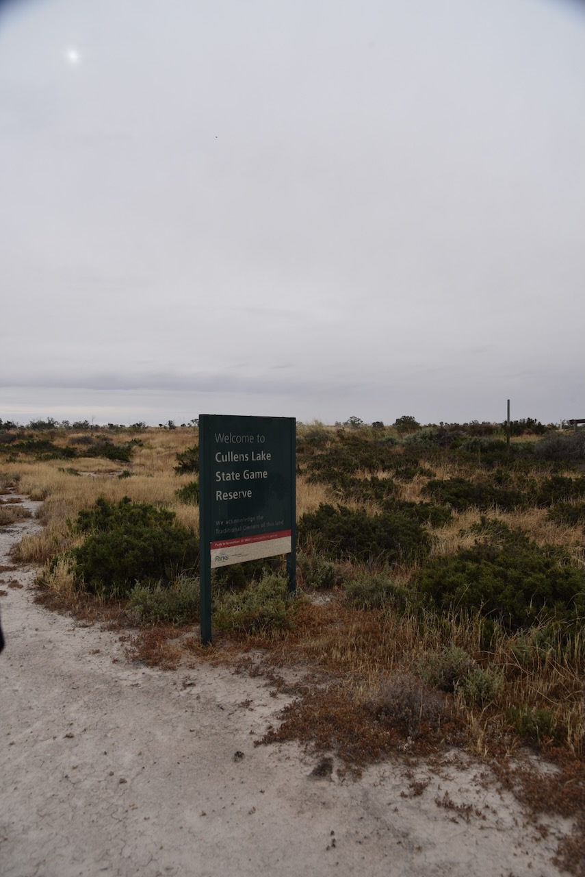
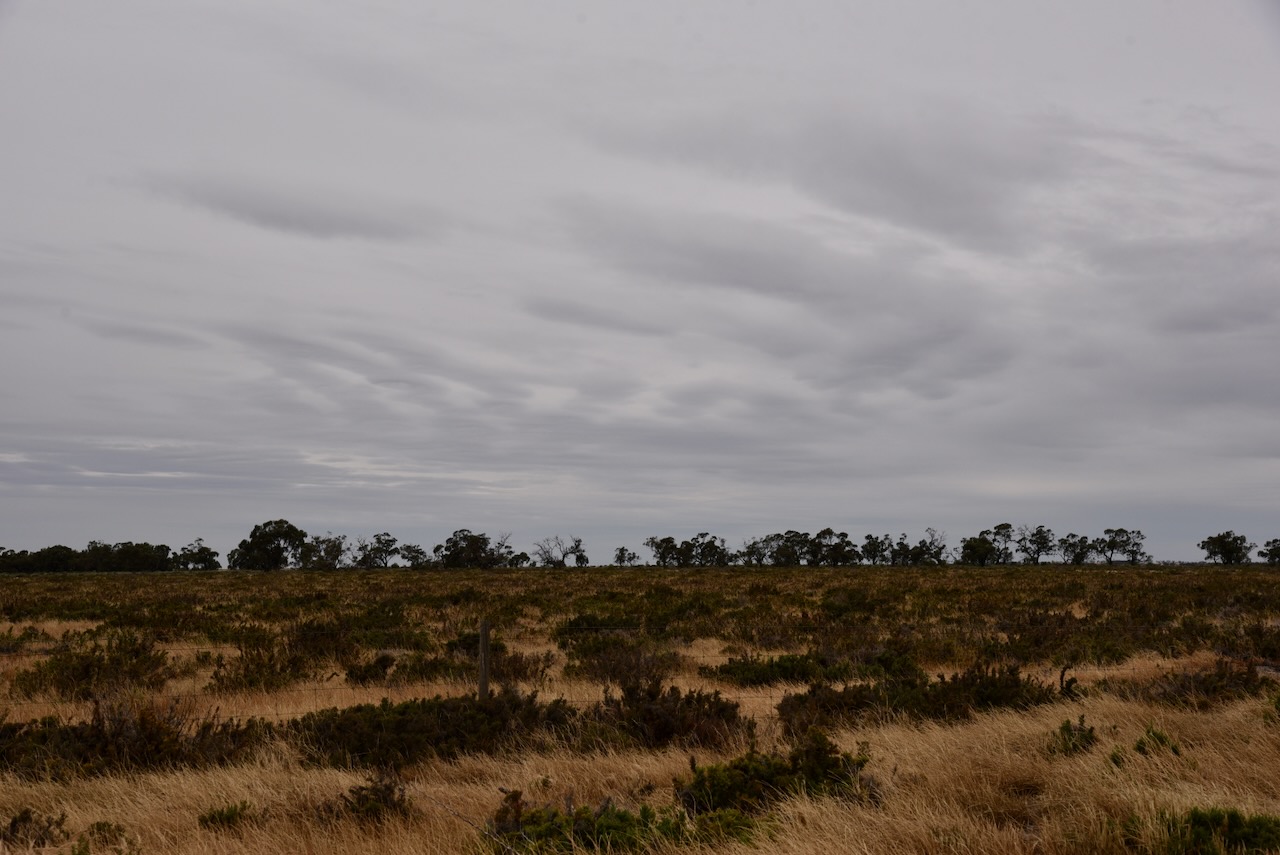
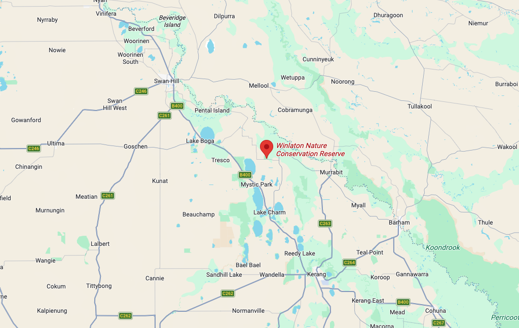
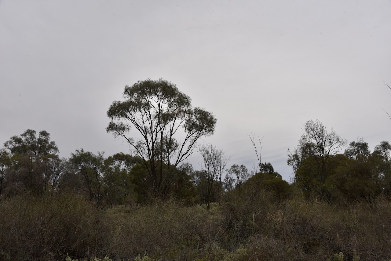
Marija and I were trying to activate as many parks as we could on Friday, the 7th day of November 2025, as we needed to head back home on Saturday after a very enjoyable time away. Our next activation was the Wood Wood Nature Conservation Reserve (NCR) VKFF-2490. The park is about 36 km northwest of Swan Hill.

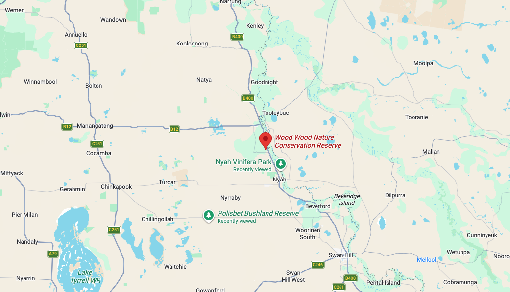
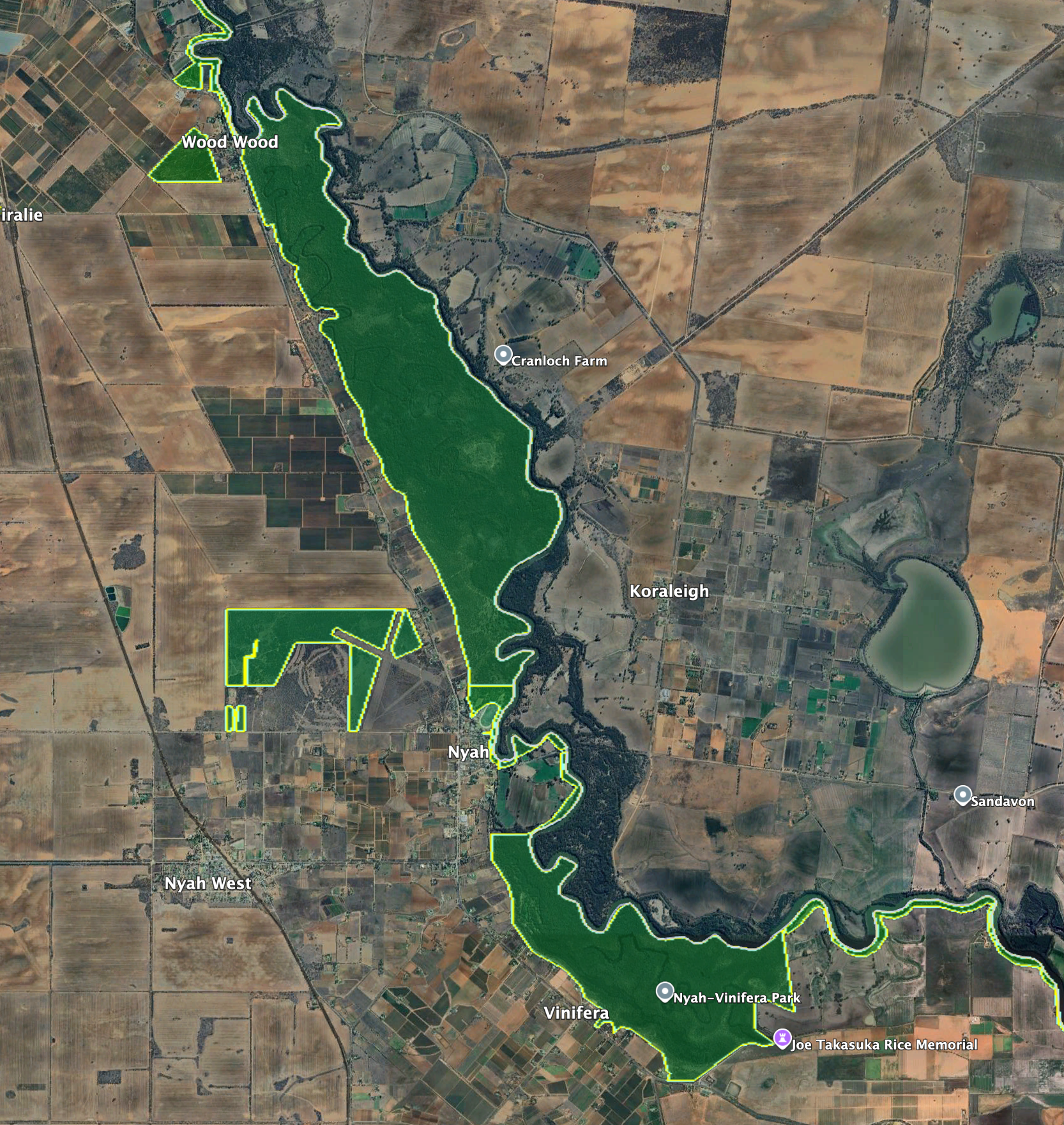
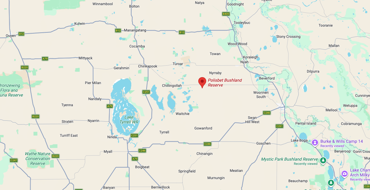
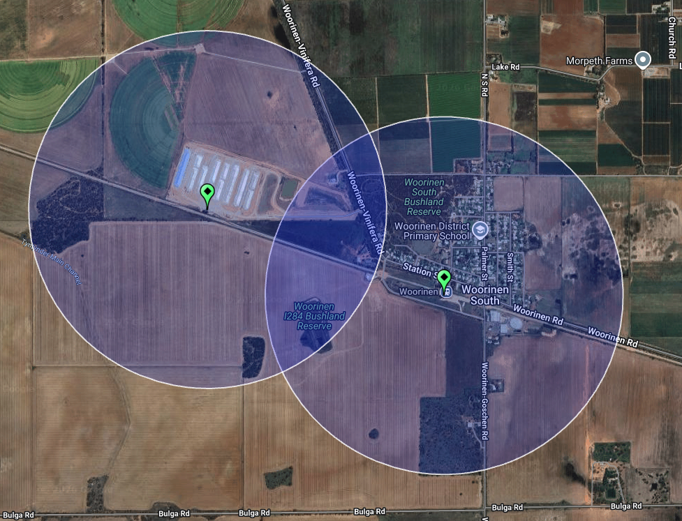
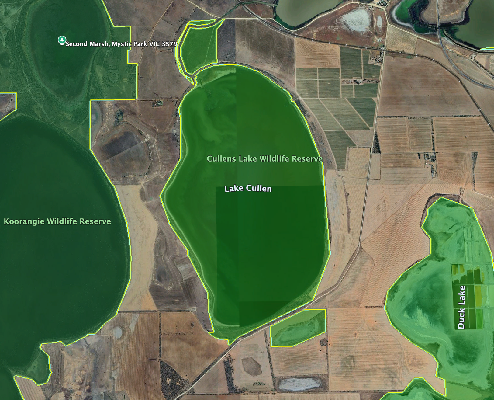
Above: Map showing the location of Wood Wood Nature Conservation Park. Map c/o Google Maps

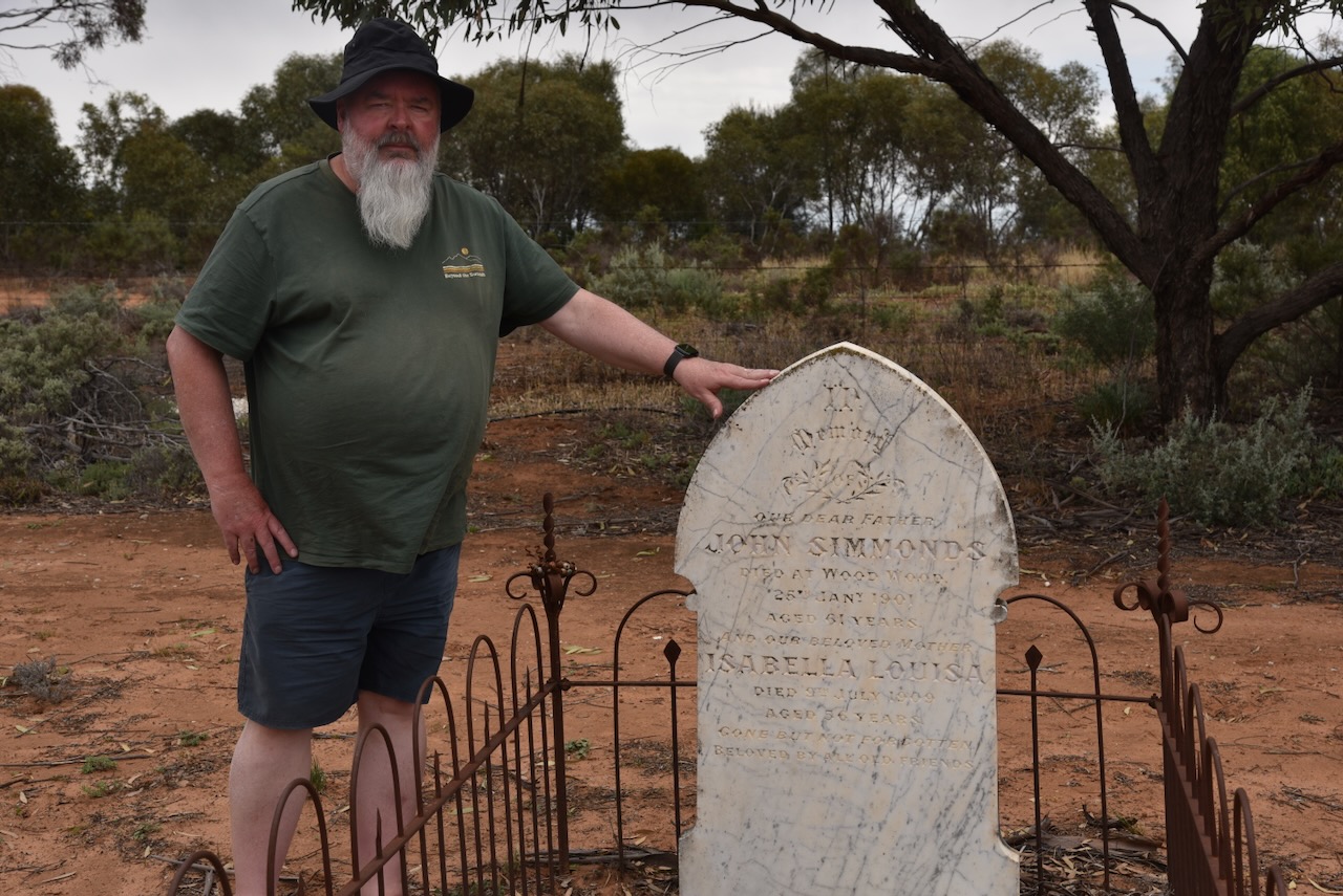
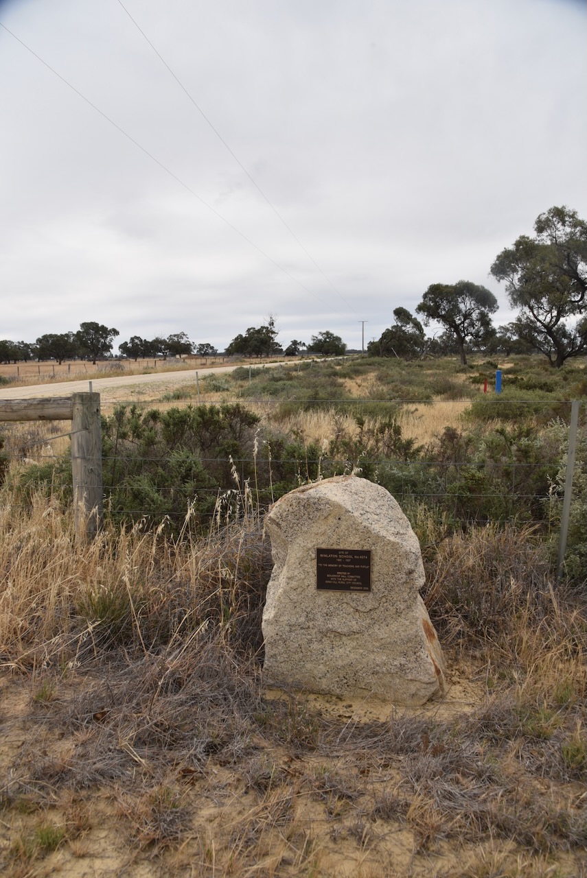
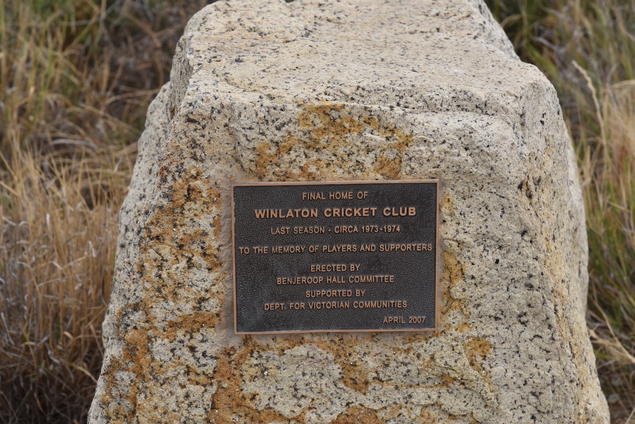
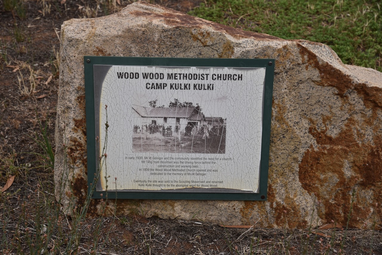
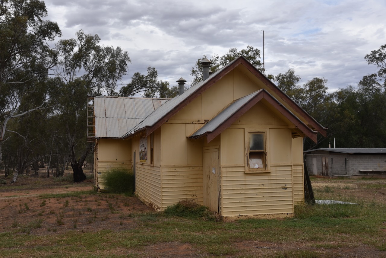
Wood Wood is believed to be derived from the Aboriginal words Kulki Kulki, meaning Wood Wood. The Wood Wood Post Office opened on the 17th day of December 1900 and closed in June 1987. In 1939, the Wood Wood Methodist Church was opened. It was dedicated to Mr W Gelinger, who was one of the members of the community who identified the need for a church. (Wikipedia 2026)

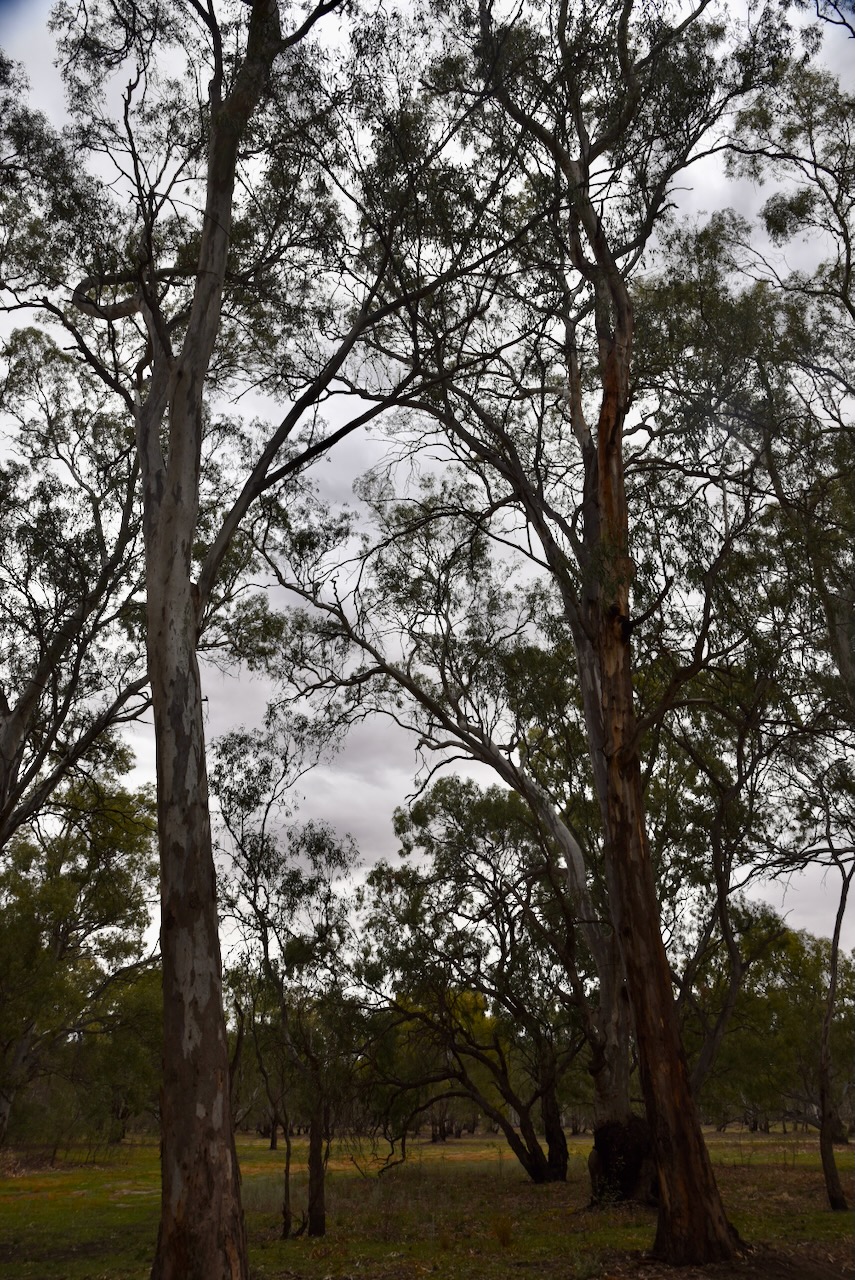
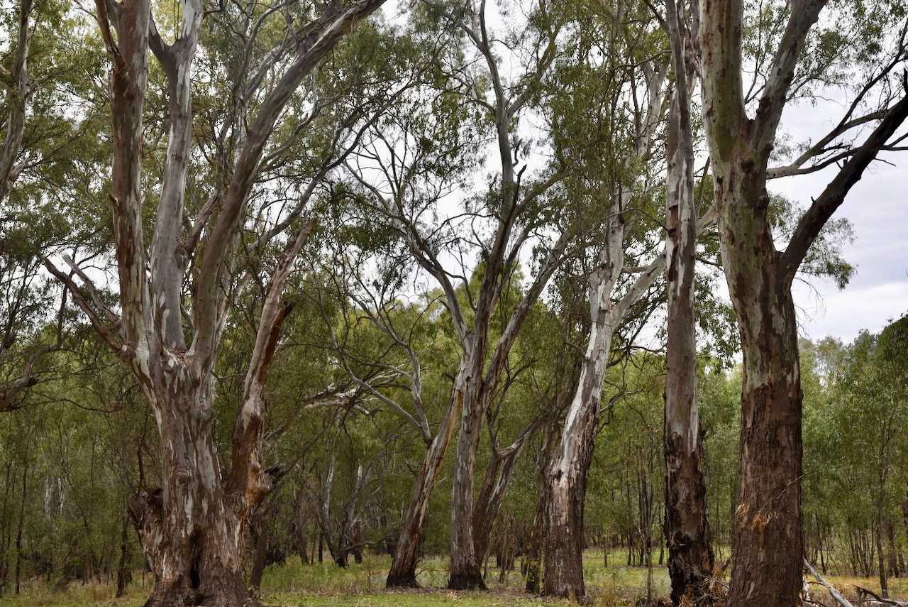
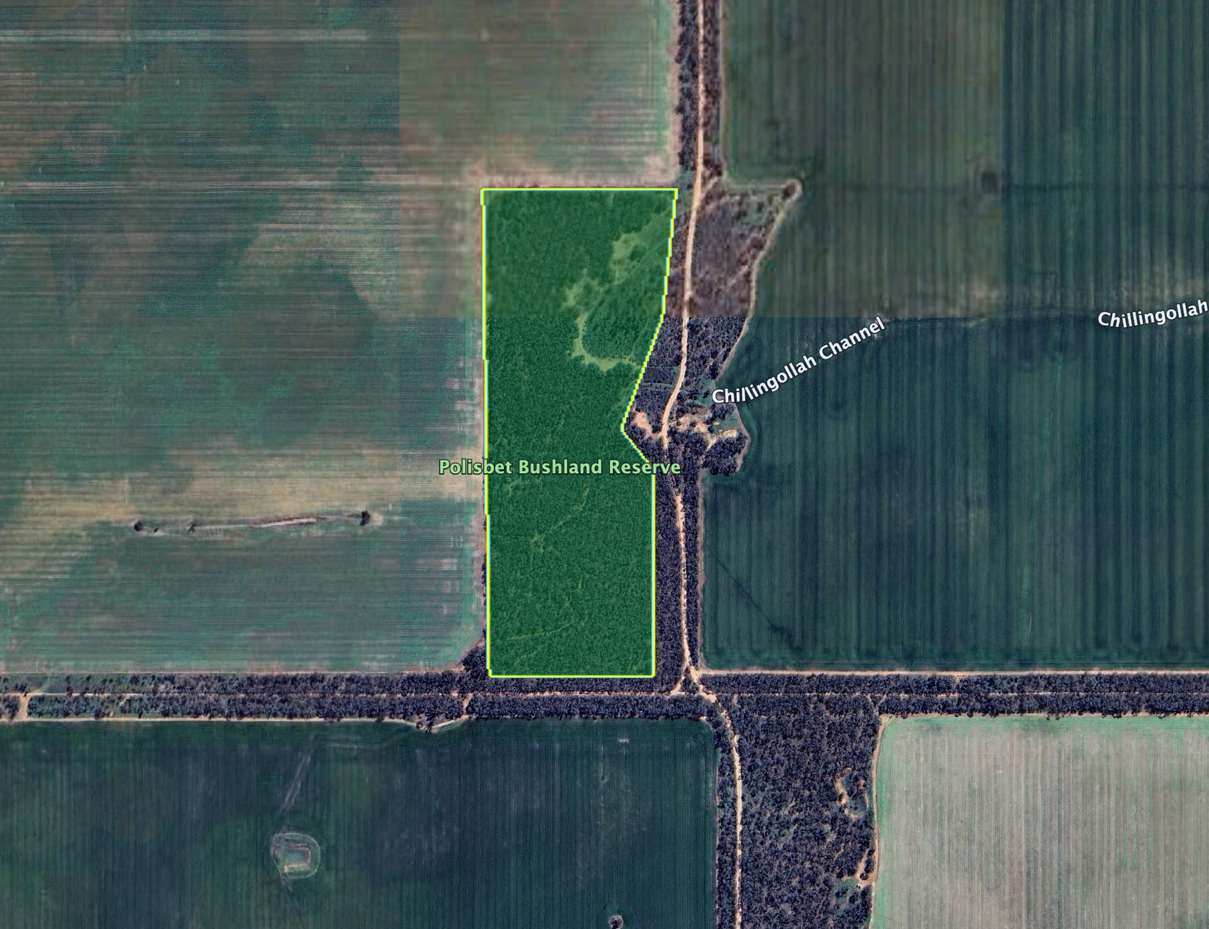
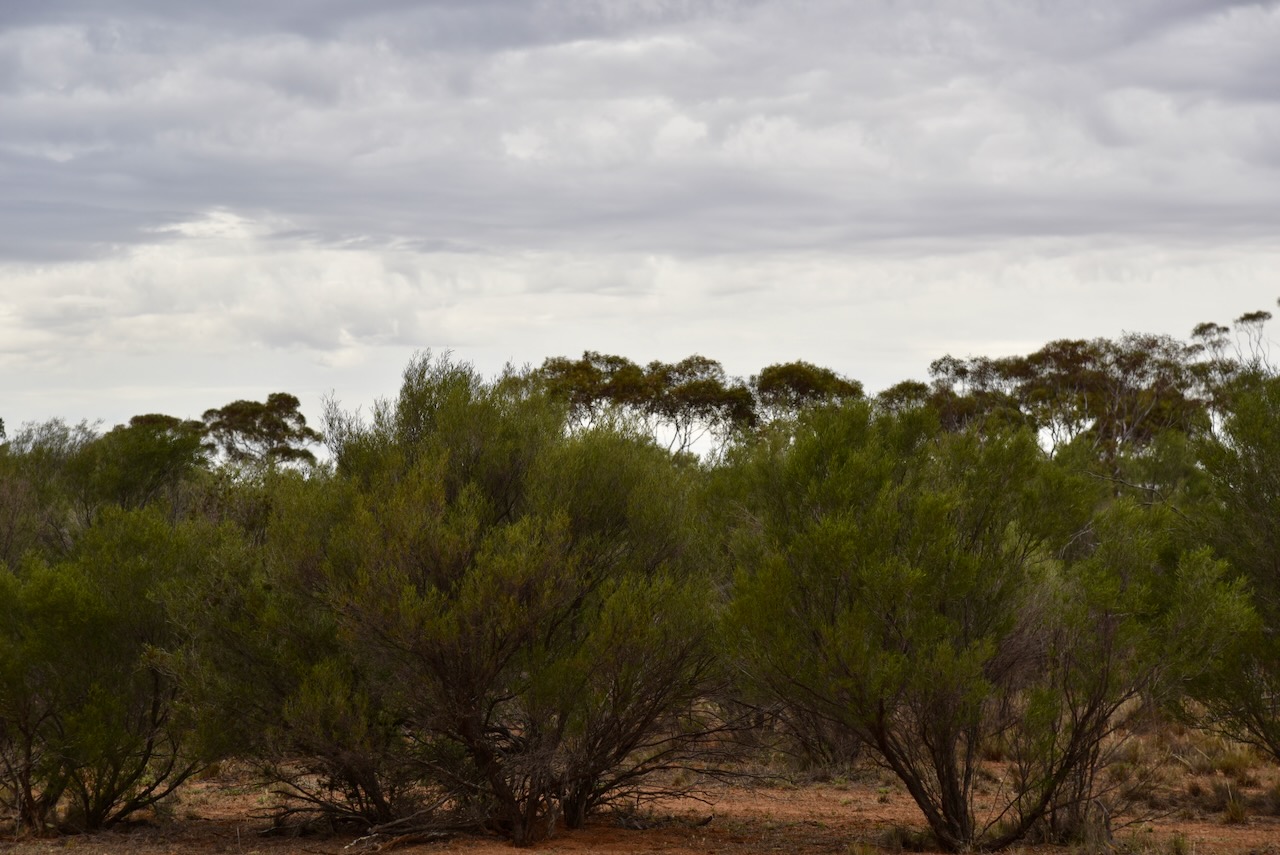
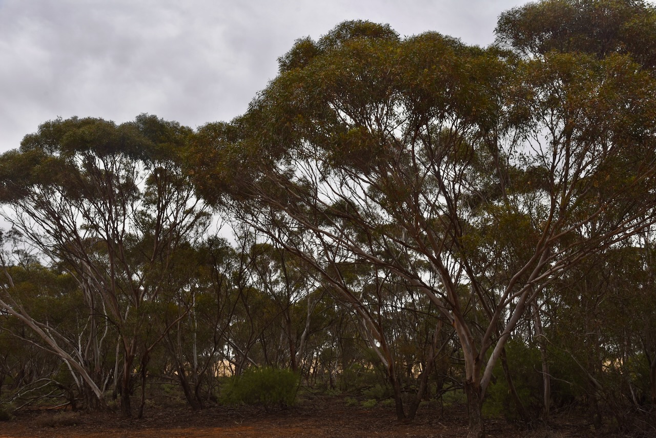
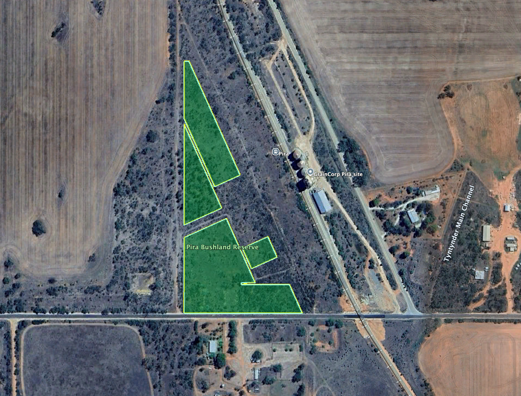
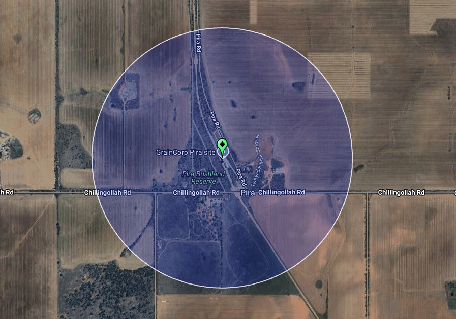
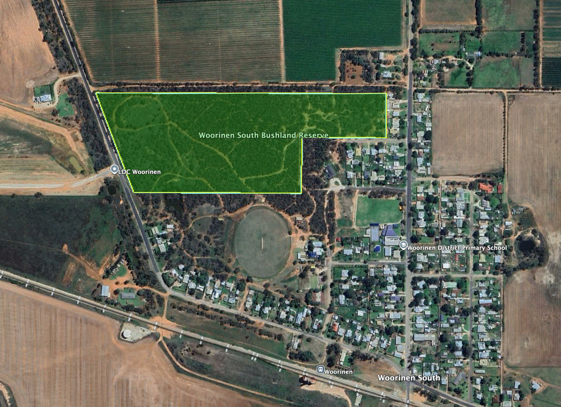
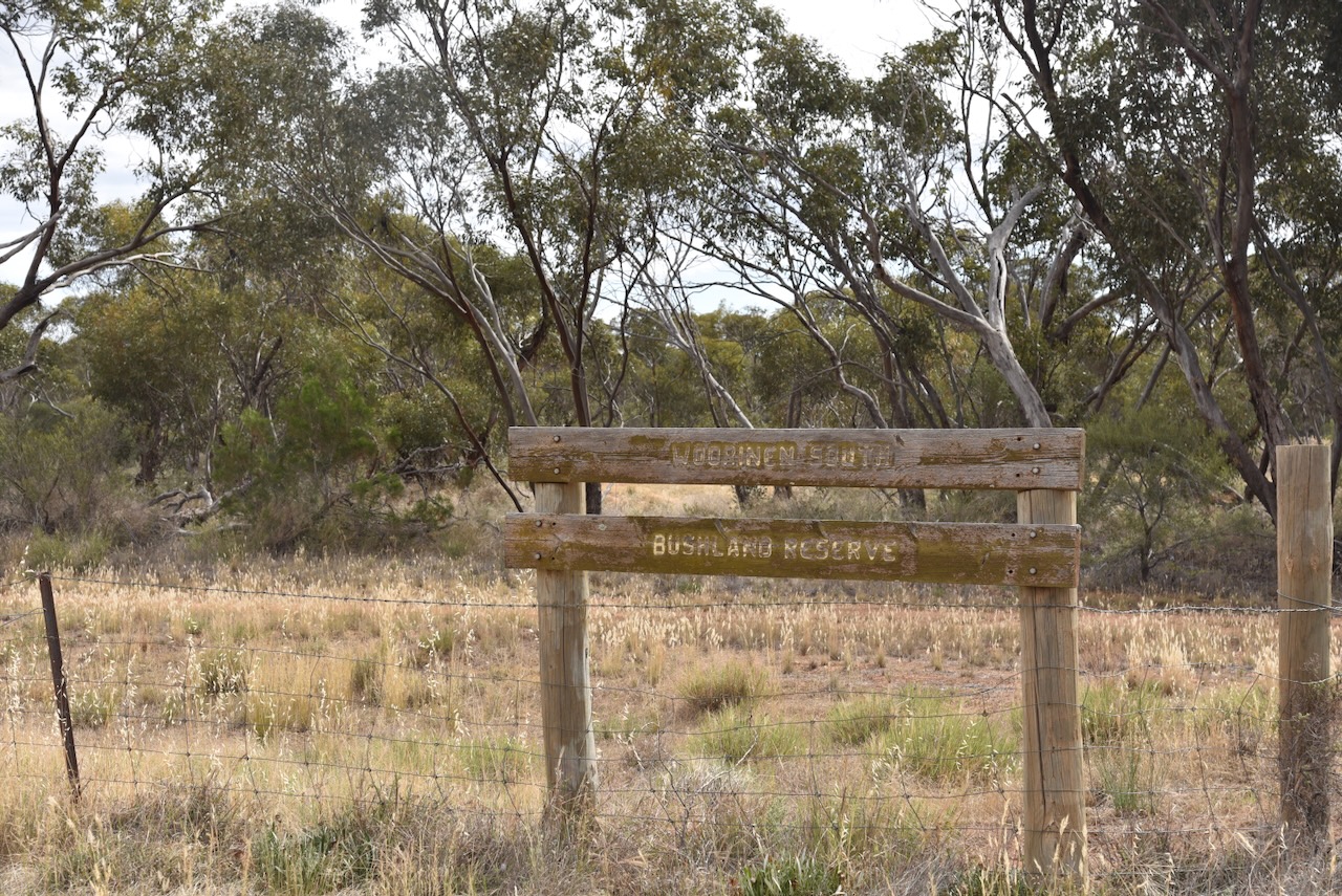
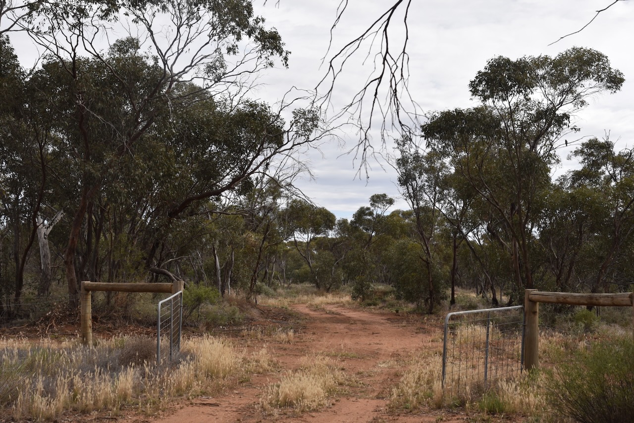
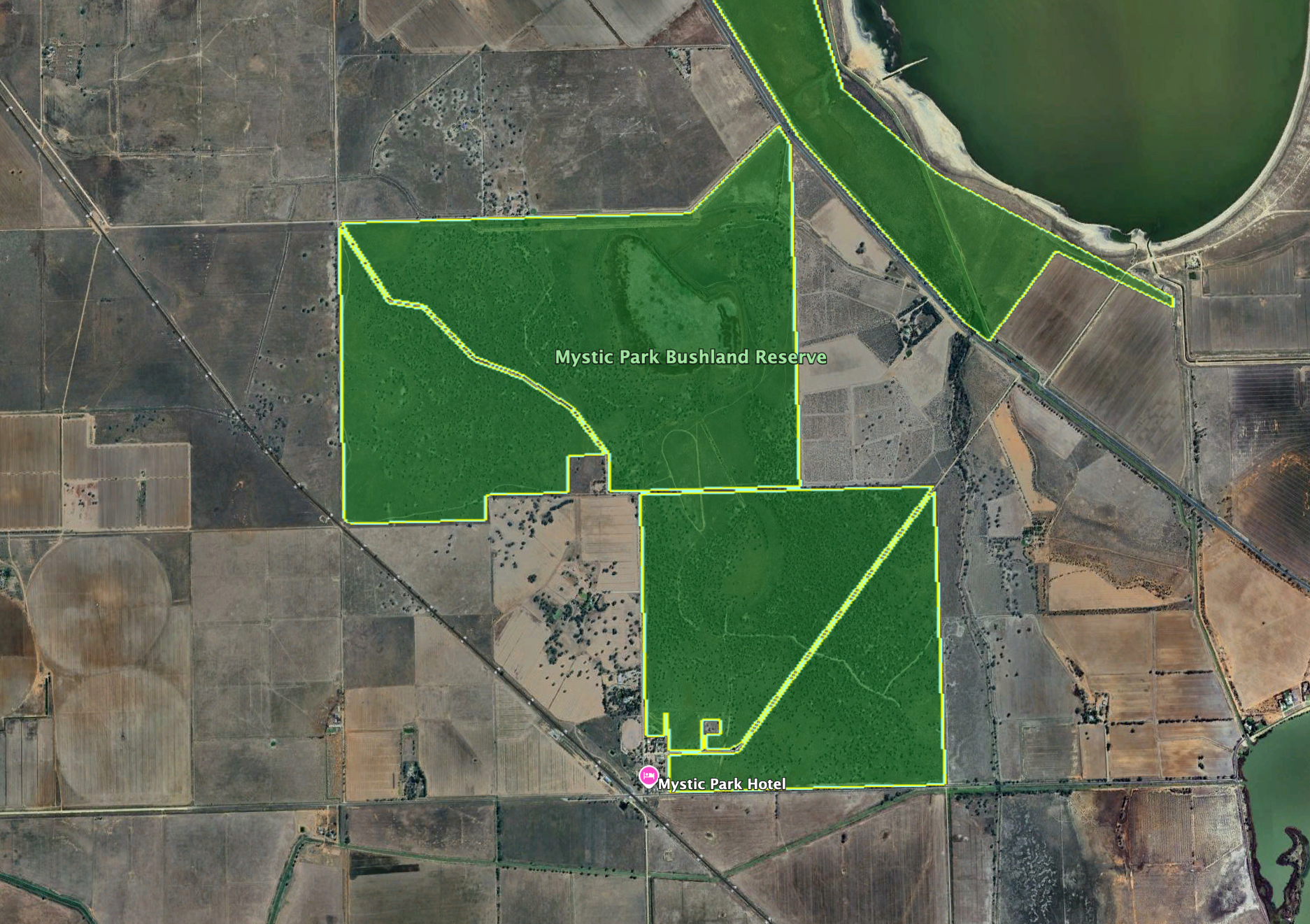
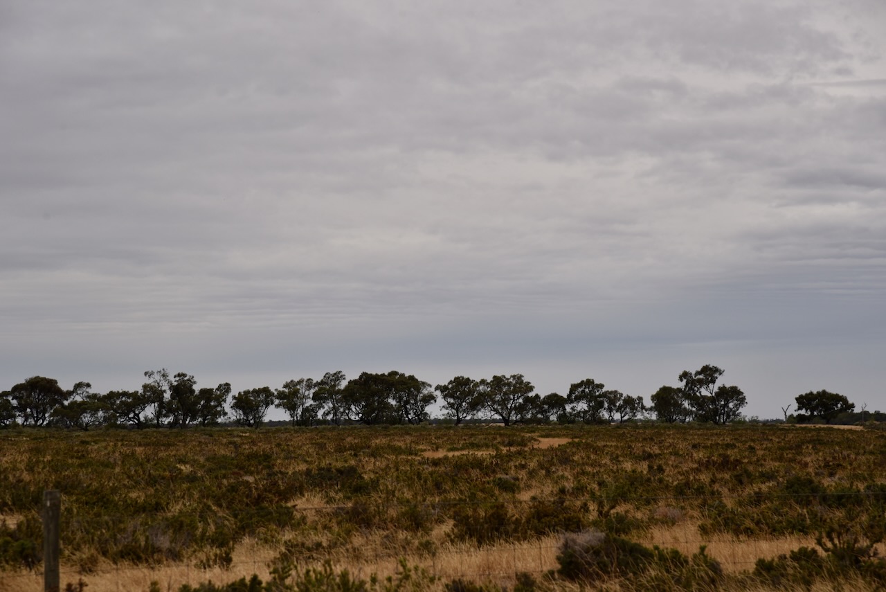
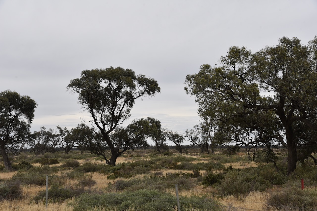
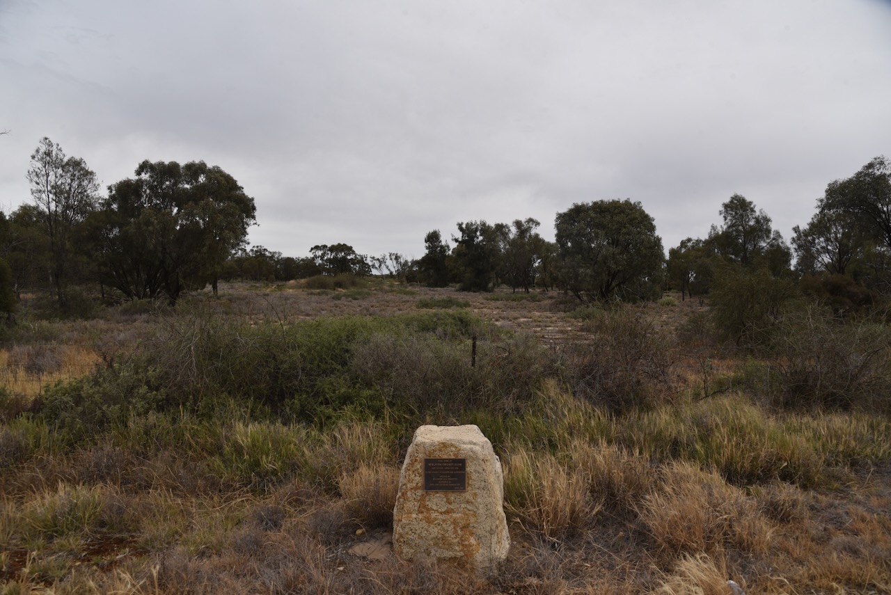
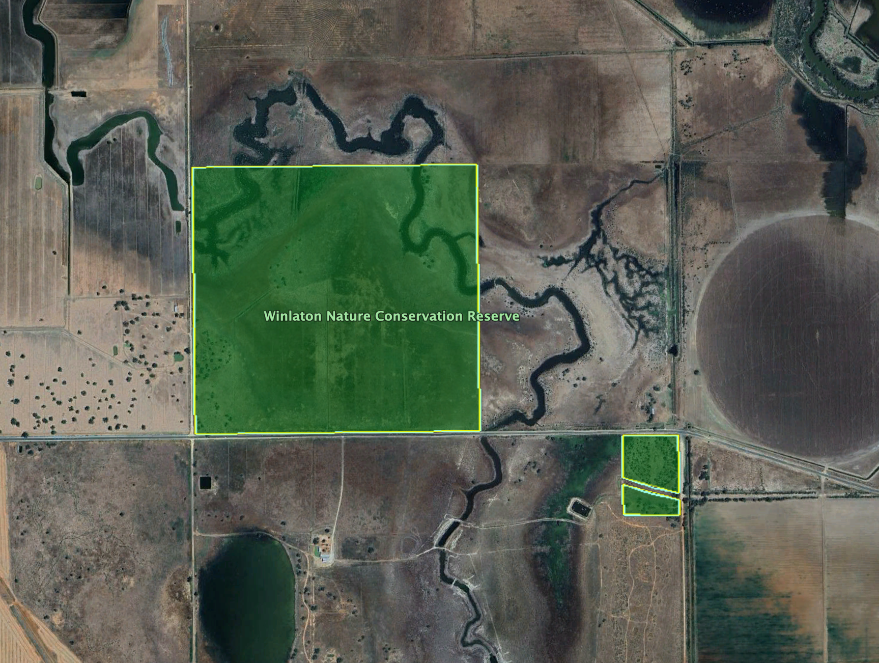
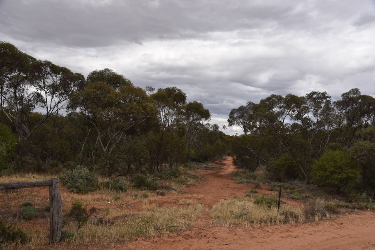
Wood Wood Nature Conservation Reserve is located on the northeast corner of Hodges Road and Algie Road.

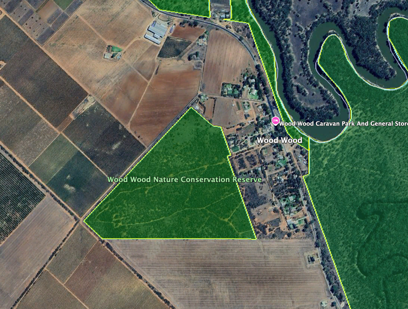
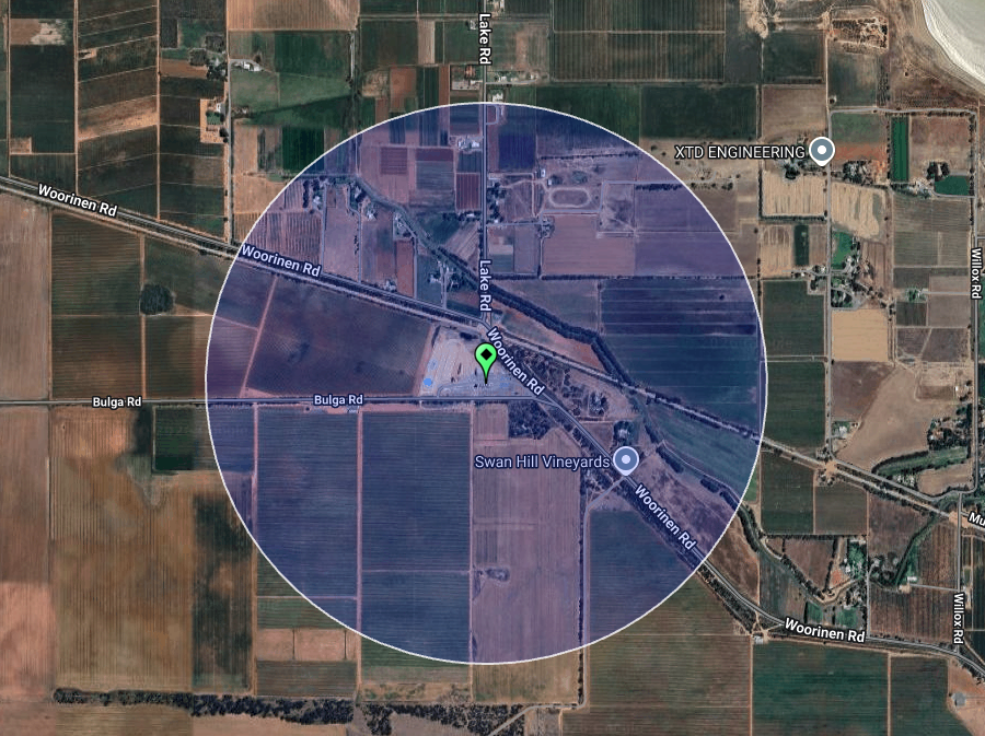
Above: the boundaries of Wood Wood NCR. Image c/o Google Earth

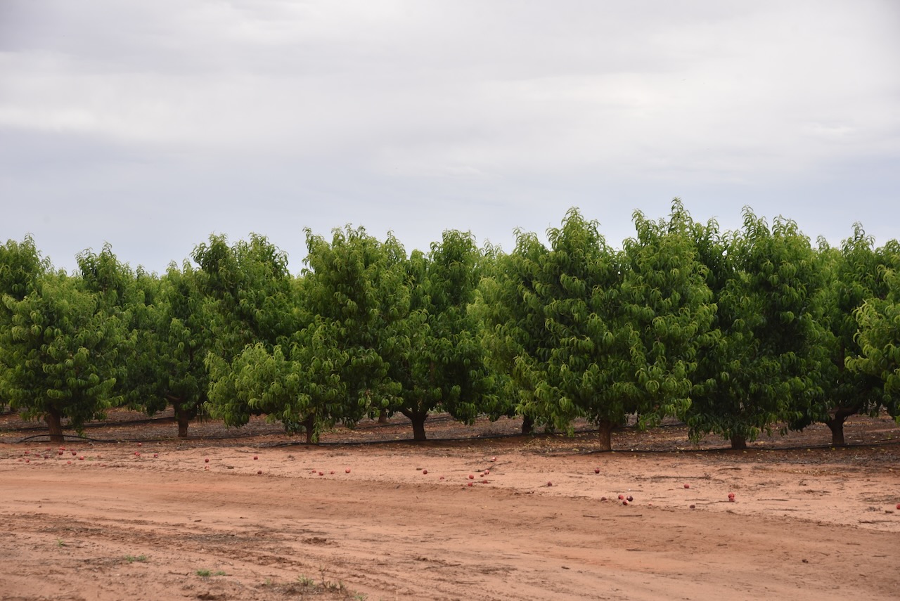
Adjacent to the park are orchards.

Wood Wood NCR is about 36 hectares in size and was established on the 1st day of May 1979. (Dcceew.gov.au 2025)

Marija and I ran the Yaesu FT857, 40 watts, and the 20/40/80m linked dipole.

During our activation, a local farmer visited us. We explained the hobby of amateur radio and he appeared to be very interested.

Marija worked the following stations on 40m SSB:-

  1. VK5HS
  2. VK3PF
  3. VK3KAI

Marija worked the following stations on 40m AM:-

  1. VK5HS
  2. VK3PF
  3. VK3KAI
  4. VK3EPL
  5. VK3DAC
  6. VK4FE/P
  7. VK5DW

I worked the following stations on 40m SSB:-

  1. VK5HS
  2. VK3PF
  3. VK3KAI
  4. VK3EPL
  5. VK3DAC
  6. VK4FE/P
  7. VK3DCQ
  8. VK5DW
  9. VK3ZSC
  10. VK2MAB
  11. VK4NH
  12. VK4DXA
  13. VK2NP
  14. VK2EXA
  15. VK3OAK
  16. VK3GUM
  17. VK2HAK
  18. VK3BCM
  19. VK5GY
  20. VK5CSS
  21. VK5CZ
  22. VK5XE
  23. VK3SX
  24. VK3MGM
  25. VK3FFA
  26. VK3CLD
  27. VK5QA
  28. VK2DBF
  29. VK2VW
  30. VK2HFI
  31. VK2AKA
  32. VK2BUG
  33. VK3WSG
  34. VK5ZHS
  35. VK4CPS
  36. VK3ZMD
  37. VK1DI
  38. VK2USH
  39. VK3HHE
  40. VK1FM
  41. VK2YK
  42. VK5GA

I worked the following stations on 40m AM:-

  1. VK5HS
  2. VK3PF
  3. VK3KAI
  4. VK3EPL
  5. VK3DAC
  6. VK4FE/P
  7. VK5DW

References.

  1. Dcceew.gov.au. (2025). Collaborative Australian Protected Areas Database 2024 – DCCEEW. [online] Available at: https://www.dcceew.gov.au/environment/land/nrs/science/capad/2024. [Accessed 18 Apr. 2026]‌
  2. Wikipedia Contributors (2026). Wood Wood. Wikipedia‌

Nyah Vinifera Park VKFF-3566

After leaving the Nyah Bushland Reserve on Friday, the 7th day of November 2025, Marija and I drove into Nyah and had lunch at the BP Truckstop. We then drove towards our next park activation, Nyah Vinifera Park VKFF-3566.

Above: Map showing the location of Nyah Vinifera Park. Map c/o Google Maps

Prior to activating the park, we visited the site of the PS Kookaburra, which lies beneath the Murray River. The vessel was built in 1911 in Goolwa, South Australia and was originally known as the Flo D barge. It was renamed the PS Kookaburra in 1918 when the engines were fitted. The Kookaburra was a popular hawking boat, a travelling store and offered settlers along the river a variety of goods.

In 1966, Lyell Bennett from Nyah purchased the Kookaburra and made the journey along the Murray River from Swan Reach to Nyah. Soon after arriving at her mooring at the old Nyah punt cutting, the Kookaburra sank.

We took a drive along the river and stopped to view some of the timber sculptures.

The mighty Murray River forms the State border for Victoria and New South Wales.

On River Street, we stopped to have a look at the wooden carvings of Arnold Lewis and William Lewis.

Arnold William Henry Lewis was born on the 12th day of February 1889 at Berwick, Victoria. He moved to Nyah in 1894 with his family when he was a young boy. When he left school, Arnold commenced working with his father William and brother in the blacksmith industry, carpentry, undertaking, wheelwrighting, timber milling, farming and clearing of mallee. Upon the pump station being built at Nyah, Arnold was one of the first landholders to purchase a small fruit block. He grew pie melons, sultana grape vines, oranges, apricots and cherry plums. In 1915, he married Susan Emma Willoughby. In 1923, he was appointed the Manager of Tandaco Packing Shed. Arnold was elected the President of the Nyah Scouts when they were formed in 1932. Arnold was a keen sportsman, gardener, and fisherman. Arnold died on the 10th day of March 1967 at Lake Boga, aged 78 years. (ancestry 2016)

Above: Arnold Lewis. Image c/o ancestry.com.au

William Henry Lewis was born on the 7th day of August 1859 in Somerset, England. He emigrated to Australia in 1865 and initially lived at Yankalilla, South Australia. He then moved to Gawler. In 1885, he married Lydia Alvina Eliza Caroline Chigwidden. Whilst living at Euroa, it is reputed that William was forced by Ned Kelly to construct the infamous suit of armour. William moved to Nyah in about 1889. He became a life Governor of the Swan Hill District Hospital and was active in the Church of England. William died on the 17th day of April 1926 at Nyah. He was 66 years old. (ancestry 2016)

Above: William Lewis and his wife, Lydia. Image c/o ancestry.com.au

Nyah Vinfera Park extends from the northern side of the town of Nyah to Wood Wood, and follows the Murray River.

Above: the boundaries of Nyah Vinifera Park. Image c/o Google Earth

Nyah Vinifera Park is about 1,372 hectares in size and was established on the 27th day of June 2010. The park features pristine red gum forest, billabongs and lagoons alongside the Murray River. The park contains Aboriginal canoe trees and middens. (Dcceew.gov.au 2025)

We accessed the park via a track off the Murray Valley Highway. We drove down to the edge of the river and set up. We ran the Yaesu FT857, 40 watts, and the 20/40/80m linked dipole.

Marija worked the following stations on 40m SSB:-

  1. VK2YK
  2. VK5GA
  3. VK2EXA
  4. VK3ZSC
  5. VK2VH
  6. VK4AAC
  7. VK3PF
  8. VK3KAI
  9. VK1AD
  10. VK1NAM
  11. VK2MAB
  12. VK3WSG

I worked the following stations on 40m SSB:-

  1. VK2YK
  2. VK5GA
  3. VK2EXA
  4. VK3ZSC
  5. VK2VH
  6. VK4AAC
  7. VK3PF
  8. VK3KAI
  9. VK1AD
  10. VK1NAM
  11. VK2MAB
  12. VK3WSG
  13. VK3MTT
  14. VK3VRL
  15. VK2HAK
  16. VK3DAC
  17. VK5WU
  18. VK3MGM
  19. VK3FFA
  20. VK5HS
  21. VK2IO
  22. VK2GEZ
  23. VK3EJ
  24. VK5DOC
  25. VK3IK/M
  26. VK4NH
  27. VK4DXA
  28. VK3CJN
  29. VK3QHU
  30. VK3MIJ
  31. VK1FM
  32. VK5CZ
  33. VK5XE
  34. VK2NP
  35. VK3PJT
  36. VK7EE
  37. VK5FB
  38. VK3UH
  39. VK2VMC
  40. VK5IS
  41. VK2XI/P
  42. VK4FAAP

I worked the following stations on 20m SSB:-

  1. VK4NH
  2. VK4DXA
  3. VK2VW
  4. VK2HFI
  5. VK2AKA
  6. VK2BUG
  7. VK6XL

References.

  1. Dcceew.gov.au. (2025). Collaborative Australian Protected Areas Database 2024 – DCCEEW. [online] Available at: https://www.dcceew.gov.au/environment/land/nrs/science/capad/2024. [Accessed 18 Apr. 2026]‌

Nyah Bushland Reserve VKFF-5680

Our next activation for Friday, the 7th day of November 2025, was the Nyah Bushland Reserve VKFF-5680. The reserve is located about 30 km northwest of Swan Hill.

Above: Map showing the location of Nyah Bushland Reserve. Map c/o Google Maps

Prior to activating the park, Marija and I visited the Nyah Cemetery. I have several family members buried there, including my great-great-grandparents, John Simmonds and Isabella Simmonds, nee Thompson.

The Nyah Bushland Reserve is located on the northern side of Yarraby Road. It borders the Nyah West Golf Club and the Nyah Airport.

Above: the boundaries of Nyah Bushland Reserve. Image c/o Google Earth

It is believed that Nyah is derived from an Aboriginal word describing a bend in the Murray River. Nyah is located on the Murray Valley Highway in close proximity to the Murray River. Nyah West is located about 3 km to the southwest on Monash Avenue.

Above: An aerial view showing Nyah and Nyah West. Image c/o Google Maps

In 1892, the township of Taverner Community Village Settlement was established by Jim Thwaites as a utopian socialist community. On the 4th day of May 1894 the Post Office was opened, and it was known as Tyntynder. (Wikipedia 2024)

In 1896, the Nyah State School was established, with classes being first held in the town’s Top Hall. The school building was built in 1912. In 1915, the railway from Swan Hill was extended to the north, and it bypassed Nyah. As a result, Nyah West was developed. In 1915, the Nyah Railway Station School was opened. (Victorianplaces.com.au 2026) (Wikipedia 2024)

Above: article from the Swan Hill Guardian, Thu 17 Jun 1915. Image c/o Trove

A fruit growers cooperative was also established, and during the 1920s, a packing shed was built at the railway siding. A hospital was also opened in the 1920s. In 1921, the population of Nyah West was 483, while the population of Nyah was 557. (Victorianplaces.com.au 2026)

Above: article from the Swan Hill Guardian, Mon 11 Oct 1915. Image c/o Trove

The Nyah Bushland Reserve is about 162 hectares in size and was established on the 1st day of May 1979. (Dcceew.gov.au 2025)

We accessed the park via a 4WD track running alongside the cemetery. Marija and I ran the Yaesu FT857, 40 watts, and the 20/40/80m linked dipole.

Marija worked the following stations on 40m SSB:-

  1. VK3MAP
  2. VK3PF
  3. VK3KAI
  4. VK3SQ
  5. VK3JT
  6. VK2BD
  7. VK3EME
  8. VK2VH
  9. VK4AAC
  10. VK2EXA
  11. VK3SX
  12. VK1AD
  13. VK1NAM
  14. VK2IO
  15. VK2GEZ

I worked the following stations on 40m SSB:-

  1. VK3MAP
  2. VK3PF
  3. VK3KAI
  4. VK3SQ
  5. VK3JT
  6. VK2BD
  7. VK3EME
  8. VK2VH
  9. VK4AAC
  10. VK2EXA
  11. VK3SX
  12. VK1AD
  13. VK1NAM
  14. VK2IO
  15. VK2GEZ
  16. VK3ZSC
  17. VK3DJC
  18. VK3WSG
  19. VK5MOS
  20. VK2MAB
  21. VK3CLD
  22. VK2DBF
  23. VK5QA
  24. VK3MGM
  25. VK3FFA
  26. VK5WY
  27. VK3MTT
  28. VK2VW
  29. VK2HFI
  30. VK2AKA
  31. VK2BUG
  32. VK5BRU/P
  33. VK5HS
  34. VK3BWS
  35. VK3FS/M
  36. VK3ATT/M
  37. VK7SKY
  38. VK5AAF

I worked the following stations on 40m AM:-

  1. VK5HS
  2. VK3PF
  3. VK3KAI
  4. VK2VH
  5. VK4AAC
  6. VK3BWS
  7. VK3SQ
  8. VK3JT
  9. VK2BD

References.

  1. Dcceew.gov.au. (2025). Collaborative Australian Protected Areas Database 2024 – DCCEEW. [online] Available at: https://www.dcceew.gov.au/environment/land/nrs/science/capad/2024. [Accessed 18 Apr. 2026]‌
  2. Victorianplaces.com.au. (2026). Nyah and Nyah West | Victorian Places. [online] Available at: https://www.victorianplaces.com.au/nyah-and-nyah-west [Accessed 18 Apr. 2026].‌
  3. Wikipedia Contributors (2024). Nyah. Wikipedia.‌

Poliset Bushland Reserve VKFF-5732

Our fourth activation for Friday, the 7th day of November 2025, was the Polisbet Bushland Reserve VKFF-5732. The reserve is located about 37 km northwest (by road) of Swan Hill in Victoria.

Above: Map showing the location of Polisbet Bushland Reserve. Map c/o Google Maps

The reserve is located on the northwest corner of Stratford Road and Morren Road.

The Polisbet State School No. 3786 opened in 1913. It briefly closed in 1926, then reopened in 1927. Enrolments at the school peaked in 1943. (Grokipedia 2026)

Above: item from the Quambatook Times, Wed 10 May 1916. Image c/o Trove

The reserve is about 22 hectares in size and was established on the 1st day of May 1979. (Dcceew.gov.au 2025)

This was an easy park to access, with a dirt track leading into the reserve. We ran the Yaesu FT857, 40 watts, and the 20/40/80m linked dipole.

Marija worked the following stations on 40m SSB:-

  1. VK3PF
  2. VK3KAI
  3. VK2VH
  4. VK4AAC
  5. VK3WSG
  6. VK2MAB
  7. VK3MIJ
  8. VK3DAC
  9. VK3EJ
  10. VK1AO
  11. VK2MET

I worked the following stations on 40m SSB:-

  1. VK3PF
  2. VK3KAI
  3. VK2VH
  4. VK4AAC
  5. VK3WSG
  6. VK2MAB
  7. VK3MIJ
  8. VK3DAC
  9. VK3EJ
  10. VK1AO
  11. VK2MET
  12. VK3MTT
  13. VK3CLD
  14. VK5QA
  15. VK2DBF
  16. VK2YK
  17. VK5GA
  18. VK3MGM
  19. VK3FFA
  20. VK2MOE
  21. VK1MO
  22. VK1CHW
  23. VK2CHW
  24. VK2VW
  25. VK2HFI
  26. VK2AKA
  27. VK2BUG
  28. VK3MCK
  29. VK5HS
  30. VK2IO
  31. VK2GEZ
  32. VK2EXA
  33. VK5BRU/P
  34. VK3TDK
  35. VK3NYC
  36. VK5AAF
  37. VK4CK/M
  38. VK3VRL
  39. VK2NP

I worked the following stations on 20m SSB:-

  1. VK2VW
  2. VK2HFI
  3. VK2AKA
  4. VK2BUG

I worked the following stations on 20m AM:-

  1. VK2VW
  2. VK2HFI
  3. VK2AKA
  4. VK2BUG

References.

  1. Dcceew.gov.au. (2025). Collaborative Australian Protected Areas Database 2024 – DCCEEW. [online] Available at: https://www.dcceew.gov.au/environment/land/nrs/science/capad/2024. [Accessed 18 Apr. 2026]‌
  2. Grokipedia. (2026). Polisbet. [online] Available at: https://grokipedia.com/page/polisbet [Accessed 18 Apr. 2026].‌

Pira Bushland Reserve VKFF-5725 and Pira silo VK-PRA3

Our next WWFF and SiOTA activation for Friday, the 7th day of November 2025, was the Pira Bushland Reserve VKFF-5725 and the Pira silo VK-PRA3. Pira is located about 20 km northwest of Swan Hill.

Above: Map showing the location of Pira, Victoria. Map c/o Google Maps

On the way, we stopped at Harvey’s Tank, which is named after Thomas Harvey, who was a shepherd who lived in the area in the 1860s. The tank is one of several natural Mallee soaks where the Wadi Wadi Aboriginal people created fresh water wells called Yallum by lining with clay and covering with brush. The tank is located on the stock route that connects New South Wales and Adelaide, South Australia and was opened by overlanders Hawden and Bonney in 1838. Harvey’s Tank was a popular swimming spot for local school children. It is one of the few tanks that retains the timber posts, which formerly supported the tank cover.

Pira is an Aboriginal word meaning club. The Pira Post Office opened on the 14th day of July 1924 and closed in 1975. (Blake 1977) (Wikipedia 2025)

The Pira GrainCorp silos are located alongside the railway line on the western side of Pira Road and just north of Chillingollah Road. Some suggest that Chillingollah takes its name from the Indian word Chillianwallah, which was the name of a battle fought in India in 1840 between British and Sikh troops. Others say it is an Aboriginal word meaning waterhole. (Blake 1977)

The reserve is split into 4 sections and is located on the northern side of Chillingollah Road.

Above: the boundaries of Pira Bushland Reserve. Image c/o Google Earth

The Pira Bushland Reserve is about 4 hectares in size and was established on the 8th day of May 1990. (Dcceew.gov.au 2025)

Nearby, you can view a monument for the Pira State School No. 4278, which opened in May 1926 and closed in December 1981.

Marija and I ran the Yaesu FT857, 40 watts, and the 20/40/80m linked dipole for this activation.

Above: the activation zone at the Pira silo. Image c/o SiOTA website

Marija worked the following stations on 40m SSB:-

  1. VK2YK
  2. VK5GA
  3. VK3PF
  4. VK3KAI
  5. VK2MAB
  6. VK5NJ
  7. VK1CHW
  8. VK2CHW
  9. VK2MOE
  10. VK1MO
  11. VK2IO
  12. VK2GEZ
  13. VK5DG/S (SOTA VK2/ CW-003)
  14. VK5ANB/P (SOTA VK2/ CW-003)
  15. VK3TUN/P (SOTA VK2/ CW-003)

I worked the following stations on 40m SSB;-

  1. VK2YK
  2. VK5GA
  3. VK3PF
  4. VK3KAI
  5. VK2MAB
  6. VK5NJ
  7. VK1CHW
  8. VK2CHW
  9. VK2MOE
  10. VK1MO
  11. VK2IO
  12. VK2GEZ
  13. VK2DHN
  14. VK5GY
  15. VK5CS
  16. VK3SMW
  17. VK3ZSC
  18. VK4CK
  19. VK3EJ
  20. VK3CEO
  21. VK1OZ
  22. VK2OZI
  23. VK1PW
  24. VK2APW
  25. VK5HS/M
  26. VK3CLD
  27. VK5QA
  28. VK2DBF
  29. VK2DA
  30. VK1DA
  31. VK3WSG
  32. VK2NP
  33. VK3SQ
  34. VK3JT
  35. VK2BD
  36. VK2VW
  37. VK2HFI
  38. VK2AKA
  39. VK2BUG
  40. VK5DG/S (SOTA VK2/ CW-003)
  41. VK5ANB/P (SOTA VK2/ CW-003)
  42. VK3TUN/P (SOTA VK2/ CW-003)
  43. VK2LEE
  44. VK5AAY

I worked the following stations on AM:-

  1. VK5GY
  2. VK5CS
  3. VK5NJ
  4. VK2DA
  5. VK1DA
  6. VK3PF
  7. VK3KAI

I worked the following stations on 20m SSB:-

  1. VK2VW
  2. VK2HFI
  3. VK2AKA
  4. VK2BUG
  5. VK2LEE

References.

  1. Blake; L, 1977, Place Names of Victoria
  2. Dcceew.gov.au. (2025). Collaborative Australian Protected Areas Database 2024 – DCCEEW. [online] Available at: https://www.dcceew.gov.au/environment/land/nrs/science/capad/2024. [Accessed 18 Apr. 2026]‌
  3. Wikipedia Contributors (2025). Pira. Wikipedia.‌

Woorinen South Bushland Reserve VKFF-6143 and Woorinen silo VK-WRN3 and Woorinen West silo VK-WRW3

Activation number two for Friday, the 7th day of November 2025, was a joint World Wide Flora Fauna (WWFF) and Silos On The Air (SiOTA) activation of the Woorinen South Bushland Reserve VKFF-6143, and the Woorinen silo VK-WRN3 and the Woorinen West silo VK-WRW3.

Above: Map showing the location of Woorinen. Map c/o Google Maps

After leaving the Woorinen East silo, Marija and I drove a short distance up Woorinen Road into the town of Woorinen South.

The Woorinen silo VK-WRN3 is located alongside the railway line on the southern side of Station Street.

The Woorinen West silo VK-WRW3 is also located alongside the railway line and on the western side of the Woorinen-Vinifera Road.

The Woorinen South Bushland Reserve VKFF-6143 is located on the northwestern edge of the town of Woorinen South.

Above: the boundaries of the Woorinen South Bushland Reserve. Image c/o Google Earth

The reserve is about 11 hectares in size and was established on the 8th day of May 1990. (Dcceew.gov.au 2025)

The reserve is easily accessible via the Woorinen-Vinifera Road. We parked in the reserve in the activation zone of the 2 silos. Marija and I ran our normal portable setup, comprising the Yaesu FT857, 40 watts, and the 20/40/80m linked dipole.

Above: the activation zone at the 2 silos. Image c/o SiOTA website

Marija worked the following stations on 40m SSB:-

  1. VK3PF
  2. VK3KAI
  3. VK2DA
  4. VK1DA
  5. VK4NH
  6. VK4DXA
  7. VK2NP
  8. VK3EJ
  9. VK3DAC
  10. VK2IO
  11. VK2VW
  12. VK2HFI
  13. VK2AKA
  14. VK2BUG
  15. VK5BRU
  16. VK2YAK
  17. VK4YAK

I worked the following stations on 40m SSB:-

  1. VK3PF
  2. VK3KAI
  3. VK2DA
  4. VK1DA
  5. VK4NH
  6. VK4DXA
  7. VK2NP
  8. VK3EJ
  9. VK3DAC
  10. VK2IO
  11. VK2VW
  12. VK2HFI
  13. VK2AKA
  14. VK2BUG
  15. VK5BRU
  16. VK2YAK
  17. VK4YAK
  18. VK3PMC
  19. VK5HS
  20. VK1OZ
  21. VK2OZI
  22. VK1PW
  23. VK2APW
  24. VK5CY
  25. VK5CS
  26. VK1AD
  27. VK1NAM
  28. VK3SQ
  29. VK3JT
  30. VK2BD
  31. VK2GEZ
  32. VK3FS
  33. VK3ATT
  34. VK3MRT
  35. VK3ZSC
  36. VK5IS
  37. VK2YK
  38. VK5GA
  39. VK3MAP
  40. VK4CK/M
  41. VK5AK/M

I worked the following stations on 40m AM:-

  1. VK5GY
  2. VK5CS
  3. VK3PF
  4. VK3KAI
  5. BK5HS
  6. VK2DA
  7. VK1DA
  8. VK2YK
  9. VK5GA
  10. VK1AD
  11. VK1NAM
  12. VK3FS
  13. VK3ATT
  14. VK3SQ
  15. VK3JT
  16. VK2BD
  17. VK5IS

References.

  1. Dcceew.gov.au. (2025). Collaborative Australian Protected Areas Database 2024 – DCCEEW. [online] Available at: https://www.dcceew.gov.au/environment/land/nrs/science/capad/2024. [Accessed 18 Apr. 2026]‌

Woorinen East silo VK-WRS3

Our first activation for Friday, the 7th day of November 2025, was the Woorinen East silo VK-WRS3. Woorinen is located about 15 km northwest of Swan Hill.

Above: Map showing the location of Woorinen. Map c/o Google Maps

Woorinen is believed to be an Aboriginal word meaning mouth. In 1913, the State Rivers and Water Supply Commission purchased 1,600 hectares of land to subdivide for orchards. In 1914, settlers took up farms, and in 1915, they built the Church of Christ, which was Woorinen’s first public building. The Woorinen R.S. Post Office opened on the 1st day of February 1915. It was renamed Woorinen on the 1st day of April 1919, and was closed on 24 September 1993. (Victorianplaces.com.au, 2026) (Wikipedia 2026)

Above: article from the Swan Hill Guardian, Thu 28 Oct 1915. Image c/o Trove

In 1915, the railway line from Swan Hill was extended and passed through Woorinen South. In 1916, The Swan Hill Guardian newspaper wrote the following about Worrinen:

“The settlement is now well worthy of a visit, as showing once again the possibilities of irrigation and the once despised mallee country. It requires no great stretch of imagination to foresee the time, perhaps fifty years hence, when, after full conservation of the water resources of the country have been made, the mallee country has become the garden of Australia, rivalling in production the vast areas devoted to fruitgrowing in California….” (Trove 2026)

In 1921, the Woorinen Fruitgrowers Association built a dried fruit packings shed and this continued to function until 1967. In 1917, a school at Woorinen Central was established. In 1922, a Methodist church was built and continued to be used until 1979. A public hall was built in 1919.

Woorinen had several sporting clubs, including a football club and a cricket club.

Above: Image from the Weekly Times, Wed 19 Nov 1952. Image c/o Trove

In 1925, a school was built at Woorinen North, and a school followed in 1930 at Woorinen South.

The Woorinen East silos are located on the corner of Woorinen Road and Bulga Road, alongside the Piangil railway line.

Marija and I parked on Bulga Road and operated from the 4WD. We ran the Icom IC-7000, 100 watts, and the Codan 9350 antenna with the 1.5 metre stainless steel whip.

Above: the activation zone at the Woorinen East silo. Image c/o SiOTA website

Marija worked the following stations on 40m SSB:-

  1. VK2IO
  2. VK3EJ
  3. VK2HBR
  4. VK3PF
  5. VK3UP/M
  6. VK4NH
  7. VK2VW
  8. VK2HFI
  9. VK2AKA
  10. VK2BUG

I worked the following stations on 40m SSB:-

  1. VK2IO
  2. VK3EJ
  3. VK2HBR
  4. VK3PF
  5. VK3UP/M
  6. VK4NH
  7. VK2VW
  8. VK2HFI
  9. VK2AKA
  10. VK2BUG
  11. VK5WY

References.

  1. Trove. (2026). WOORINEN. – Progress Association – Swan Hill Guardian and Lake Boga Advocate (Vic. : 1914 – 1918) – 11 Dec 1916. [online] Available at: https://trove.nla.gov.au/newspaper/article/92121003?searchTerm=woorinen%20hall [Accessed 17 Apr. 2026].
  2. ‌Victorianplaces.com.au. (2026). Woorinen and Woorinen South | Victorian Places. [online] Available at: https://www.victorianplaces.com.au/woorinen-and-woorinen-south [Accessed 17 Apr. 2026].
  3. ‌Wikipedia Contributors (2026). Woorinen. Wikipedia.‌

Mystic Park Bushland Reserve VKFF-5618

Our final activation for Thursday, the 6th day of November 2025, was Mystic Park Bushland Reserve VKFF-5618. The park is located about 17km southeast of Lake Boga.

Above: Map showing the location of Mystic Park Bushland Reserve. Map c/o Google Maps

We drove along the western side of Kangaroo Lake.

We crossed several irrigation channels.

Mystic Park Bushland Reserve is located on the western side of Murray Valley Highway. The southern boundary is Mystic Park E Road. The northern boundary is Bailey Road.

Above: the boundaries of Mystic Park Bushland Reserve. Image c/o Google Earth

The locality of Mystic Park takes its name from the Mystic Park Hotel, which was established in 1879 on the stagecoach run to Swan Hill. The publican had an affection for horse racing, and as there was a Mystic Park race track in Massachusetts, USA. In 1890, a railway station was opened on the Piangil Railway line. In 1893, a township was gazetted. In its heyday, it contained a church, a school, a mechanics institute and a football club. (Victorianplaces.com.au, 2026) (Wikipedia 2024)

Above: article from The Kerang Times, Fri 9 Jun 1893. Image c/o Trove

John Gorton was the Prime Minister of Australia from 1968 to 1971. He lived in Mystic Park for a significant portion of his life. (Wikipedia 2024)

Above: John Gorton. Image c/o Wikipedia

In April 1946, at Mystic Park Hall, Gorton delivered an address to a welcome-home gathering for returned soldiers. It was described by some as “Australia’s best unknown political speech.

I want you to forget it is I who am standing here. And I want you to see instead Bob Davey. And behind him I want you to see an army; regiment on regiment of young men, dead. They say to you, burning in tanks and aeroplanes, drowning in submarines, shattered and broken by high explosive shells, we gave the last full measure of devotion. We bought your freedom with our lives. So take this freedom. Guard it as we have guarded it, use it as we can no longer use it, and with it as a foundation, build. Build a world in which meanness and poverty, tyranny and hate, have no existence. If you see and hear these men behind me – do not fail them. (Wikipedia 2019)

Mystic Park Bushland Reserve is about 645 hectares in size and was established on the 8th day of May 1990. Sadly, we found that vandals had spray-painted graffiti on the park sign. (Dcceew.gov.au 2025)

We ran the Yaesu FT857, 40 watts, and the 20/40/80m linked dipole.

Marija worked the following stations on 40m SSB:-

  1. VK5NJ
  2. VK3PF/M
  3. VK3KAI/M
  4. VK4SMA
  5. VK2IO
  6. VK2GEZ
  7. VK5FANA
  8. VK4FODM
  9. VK3TDK
  10. VK3NYC

I worked the following stations on 40m SSB:-

  1. VK5NJ
  2. VK3PF/M
  3. VK3KAI/M
  4. VK4SMA
  5. VK2IO
  6. VK2GEZ
  7. VK5FANA
  8. VK4FODM
  9. VK3TDK
  10. VK3NYC
  11. VK4EMP
  12. VK4TI
  13. VK4GKO
  14. VK4QRZ
  15. VK4GAP
  16. VK2NP
  17. VK2EXA
  18. VK2BL
  19. VK2USH
  20. VK3KBC
  21. VK3NS
  22. VK2HAK
  23. VK3DAC
  24. VK3MIJ
  25. VK2VIC
  26. VK1VIC
  27. VK2GOY
  28. VK3APJ
  29. VK4CK
  30. VK1CHW
  31. VK3AIK
  32. VK2DA
  33. VK1DA
  34. VK3UH
  35. VK3JDO
  36. VK7KT
  37. VK3AIW

I worked the following stations on 40m AM:-

  1. VK3KBC
  2. VK3NS
  3. VK4CPS
  4. VK2USH
  5. VK2JPR
  6. VK3DAC
  7. VK2VIC
  8. VK1VIC
  9. VK2GOY
  10. VK4CK
  11. VK2CHW
  12. VK1CHW
  13. VK2HAK

Marija and I packed up and we headed back towards Swan Hill.

We stopped at the site of Burke and Wills Camp 14 on the Murray Valley Highway between Mystic Park and Lake Boga. It is one of 54 recognised camp sites between Melbourne and Coopers Creek during the ill-fated Burke and Wills expedition in 1860.

Below is an excellent video on the Burke and Wills expedition.

Marija and I then headed out for dinner. It had been a great day of activating.

References.

  1. Dcceew.gov.au. (2025). Collaborative Australian Protected Areas Database 2024 – DCCEEW. [online] Available at: https://www.dcceew.gov.au/environment/land/nrs/science/capad/2024. [Accessed 17 Apr. 2026]‌
  2. Victorianplaces.com.au. (2026). Mystic Park | Victorian Places. [online] Available at: https://www.victorianplaces.com.au/mystic-park [Accessed 17 Apr. 2026].
  3. ‌Wikipedia Contributors (2024). Mystic Park. Wikipedia.‌
  4. Wikipedia Contributors (2019). John Gorton. [online] Wikipedia. Available at: https://en.wikipedia.org/wiki/John_Gorton. [Accessed 17 Apr. 2026]‌

Cullens Lake Wildlife Reserve VKFF-4865

It was getting towards the end of Thursday, the 6th day of November 2025, but we still had some time to squeeze in a few more park activations for the World Wide Flora Fauna (WWFF) program.

Above: Map showing the location of Cullens Lake Wildlife Reserve. Map c/o Google Maps

Marija and I drove south along Benjeroop-Lake Charm Road into the little town of Lake Charm. The town is surrounded by a series of lakes: Lake Charm to the northeast, Salt Lake to the north, Racecourse Lake to the west, and Little Lake Charm to the south.

It is believed that Lake Charm takes its name from the Aboriginal word ‘charam’, meaning reed spear. However, other sources suggest that the lake was named after an Aboriginal Chief. Several of his tribal members were murdered in reprisal for the murder of two shepherds during the 1840s who worked on the Kerang Run. It was reported that one of the shepherds ran into the lake and he was speared to death. It was reported that the water around him was red with his blood. As a result, the lake was known as Murdering Lake and then changed to Lake Cham in honour of the Chief, and finally to Charm in 1876. (Trove 2026) (Victorianplaces.com.au, 2026)

In 1858, an Inn was established at Lake Charm, which was on the route for a mail and coach service between Kerang and Swan Hill. A store and post office were then opened. In 1879, a school was opened. (Victorianplaces.com.au, 2026)

We stopped in at the information display on Murray Valley Highway. It contains some excellent detail on the history of the Kerang Lakes, the flora and fauna of the region, and some information on Captain Albert Jacka V.C., M.C. and BAR.

We then drove the short distance to Lake Cullen. The reserve includes all of Lake Cullen and an area to the north of the lake.

Above: the boundaries of Cullens Lake Wildlife Reserve. Image c/o Google Earth

Cullen Lake is part of the Kerang Lake Ramsar site that consists of 23 individual wetlands.

The reserve is about 733 hectares in size and was established on the 8th day of May 1990. (Dcceew.gov.au 2025)

We ran the Yaesu FT857, 40 watts, and the 20/40/80m linked dipole for this activation.

Marija worked the following stations on 40m SSB:-

  1. VK1AC
  2. VK3PF
  3. VK3KAI
  4. VK3APJ
  5. VK5FANA
  6. VK2IO
  7. VK2GEZ
  8. VK2ZR
  9. VK2AZR
  10. VK3UH
  11. VK3WSG
  12. VK2YL

Marija worked the following stations on 20m SSB:-

  1. VK2IO
  2. VK2GEZ

I worked the following stations on 40m SSB:-

  1. VK1AC
  2. VK3PF
  3. VK3KAI
  4. VK3APJ
  5. VK5FANA
  6. VK2IO
  7. VK2GEZ
  8. VK2ZR
  9. VK2AZR
  10. VK3UH
  11. VK3WSG
  12. VK2MOE
  13. VK1MO
  14. VK2DA
  15. VK1DA
  16. VK2YL
  17. VK2EXA
  18. VK3KRL
  19. VK2NP
  20. VK3BWS
  21. VK2FALL
  22. VK2DXX
  23. VK2MAB
  24. VK5SGX
  25. VK3VPM
  26. VK2TH
  27. VK3MDC
  28. VK2VW
  29. VK2HFI
  30. VK2AKA
  31. VK2BUG
  32. VK3AIW
  33. VK2MJW
  34. VK5AYL

I worked the following stations on 40m AM:-

  1. VK2VW
  2. VK2HFI
  3. VK2AKA
  4. VK2BUG

I worked the following stations on 20m SSB:-

  1. VK2IO
  2. VK2GEZ
  3. VK2V2
  4. VK2HFI
  5. VK2AKA
  6. VK2BUG

References.

  1. Dcceew.gov.au. (2025). Collaborative Australian Protected Areas Database 2024 – DCCEEW. [online] Available at: https://www.dcceew.gov.au/environment/land/nrs/science/capad/2024. [Accessed 17 Apr. 2026]‌
  2. Trove. (2026). Early Days Of Settlemet. – REMINISCENCES OF OLD PIONEERS. – Kerang New Times (Vic. : 1901 – 1918) – 9 Nov 1909. [online] Available at: https://trove.nla.gov.au/newspaper/article/222447705?searchTerm=murdering%20lake [Accessed 17 Apr. 2026].
  3. ‌Victorianplaces.com.au. (2026). Lake Charm | Victorian Places. [online] Available at: https://www.victorianplaces.com.au/lake-charm [Accessed 17 Apr. 2026].‌

Winlaton Nature Conservation Reserve VKFF-2232

Our next park for Thursday, the 6th day of November 2025, was the Winlaton Nature Conservation Reserve VKFF-2232. It was just a short drive from our last park, the Tutchewop Wildlife Reserve.

Above: Map showing the location of Winlaton NCR. Map c/o Google Maps

On the way to the park, we stopped at the monument for the Winlaton School No. 4074, on the Benjeroop-Tresco Road. The school operated from 1922 to 1937.

Next stop was the monument for the final home of the Winlaton Cricket Club on the corner of Wells Road and Tresco Road. Its last season was c. 1973-1974.

The Winlaton NCR consists of 3 separate sections. The main section is on the northern side of Benjeroop-Tresco Road The other 2 sections are located on the southwestern corner of Benjeroop-Tresco Road and Wells Road.

Above: the boundaries of Winlaton NCR. Image c/o Google Earth

The reserve is about 86 hectares in size and was established on the 13th day of December 2004. (Dcceew.gov.au 2025)

We ran the Yaesu FT857, 40 watts, and the 20/40/80m linked dipole for this activation. Again, we had to wear our hats with the fly nets, such were the flies.

Marija worked the following stations on 40m SSB:-

  1. VK3PF
  2. VK2HAK
  3. VK3SQ
  4. VK2BD
  5. VK3JT
  6. VK2IO
  7. VK2GEZ
  8. VK2VW
  9. VK2HFI
  10. VK2AKA
  11. VK2BUG
  12. VK3ANL/P (VKFF-4639)
  13. VK2HBG/P (VKFF-2736)

I worked the following stations on 40m SSB:-

  1. VK3PF
  2. VK2HAK
  3. VK3SQ
  4. VK2BD
  5. VK3JT
  6. VK2IO
  7. VK2GEZ
  8. VK2VW
  9. VK2HFI
  10. VK2AKA
  11. VK2BUG
  12. VK3ANL/P (VKFF-4639)
  13. VK5FANA
  14. VK2MOE
  15. VK1MO
  16. VK2MAB
  17. VK2NP
  18. VK2HBG/P (VKFF-2736)
  19. VK3GJG
  20. VK2DHN
  21. VK1RX/2
  22. VK3FS/M
  23. VK3ATT/M
  24. VK5LA
  25. VK5KAW
  26. VK3WSG
  27. VK2XI/P
  28. VK5WU
  29. VK3SO
  30. VK3SFG
  31. VK2COS
  32. VK2DA
  33. VK1DA
  34. VK2ZR
  35. VK2AZR
  36. VK2YAK
  37. VK4YAK
  38. VK7AAE
  39. VK3APJ
  40. VK2EXA
  41. VK2KAD

I worked the following stations on 40m AM:-

  1. VK2ZR
  2. VK2AZR
  3. VK2HAK
  4. VK2DA
  5. VK1DA
  6. VK2MOE
  7. VK1MO
  8. VK2YAK
  9. VK4YAK

I worked the following stations on 20m SSB:-

  1. KG5CIK

References.

  1. ‌Dcceew.gov.au. (2025). Collaborative Australian Protected Areas Database 2024 – DCCEEW. [online] Available at: https://www.dcceew.gov.au/environment/land/nrs/science/capad/2024. [Accessed 17 Apr. 2026]‌