As I watched the weather on Friday afternoon (19th February 2016), it was not looking very promising for my planned activation of the Black Hill Conservation Park 5CP-022 and VKFF-0778. I was hoping to get out for the 5th Friday event for the VK5 National and Conservation Parks Award. Although it was not heavy rain, it was steady drizzle up here in the Adelaide Hills.
As it got closer to time for me to leave home, I put my sandshoes on and headed outside to start loading the 4WD. But it was still drizzling, so back inside I went, feeling rather frustrated. Off came the sand shoes and onto the web I went to check out the weather radar. It looked like the activation was going to have to be cancelled. I waited a further 10 minutes, with regular trips outside to see if the weather was clearing. But sadly it wasn’t. So I decided to take a risk and headed north west to the park, with the hope that the weather was a little clearer, closer to Adelaide.
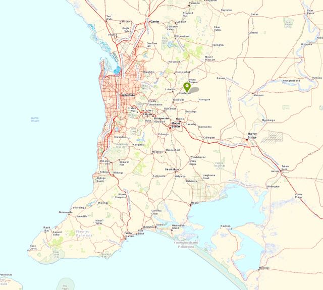
Black Hill Conservation Park is about 35 km to the north east of my home QTH, and is situated about 15 km to the north east of Adelaide.
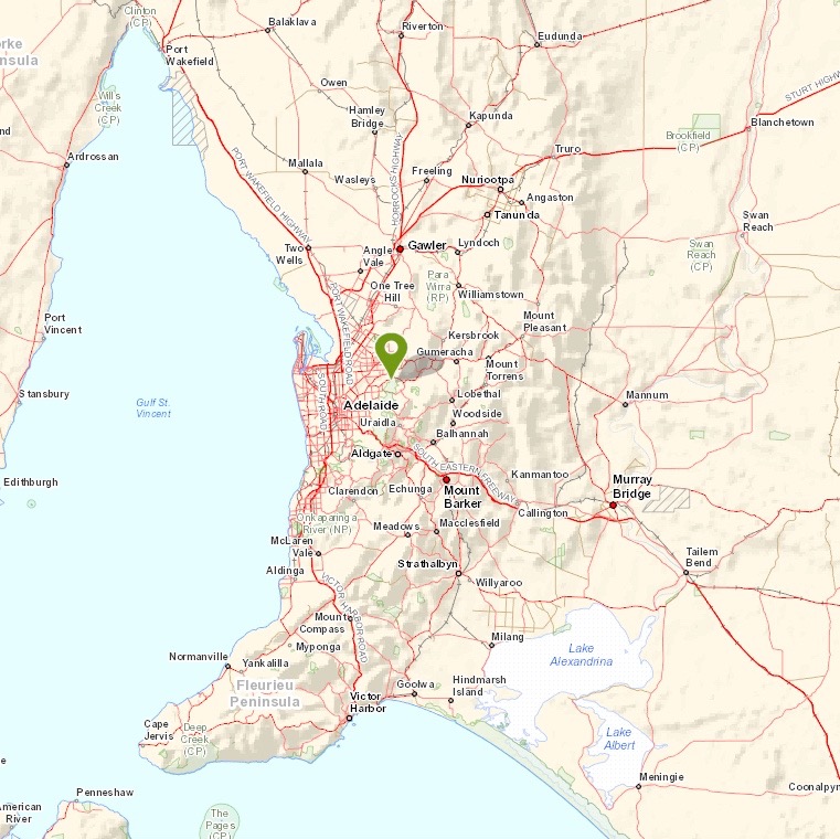
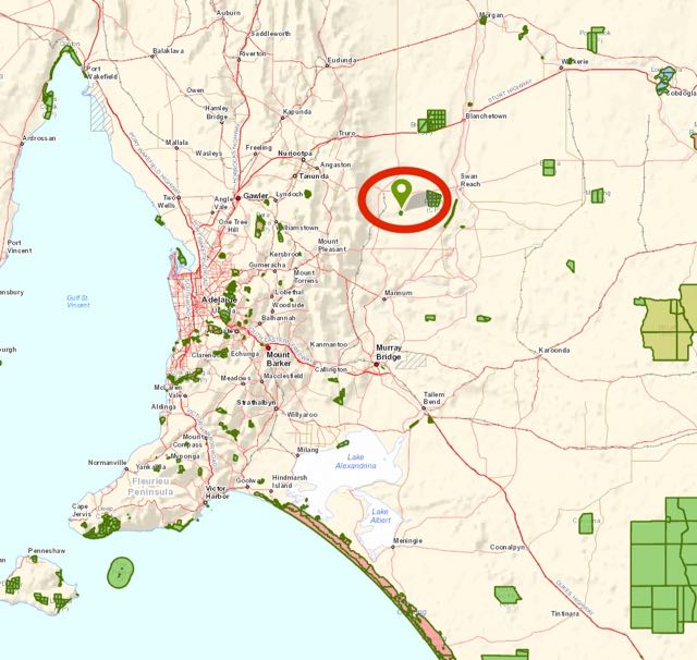
Above:- Map showing the location of the Black Hill Conservation Park in the Adelaide Hills. Image courtesy of Location SA Map Viewer.
As I travelled west along the South Eastern Freeway, it was looking less than promising. The rain was continuing to fall and the windscreen wipers were working overtime. I reachers Crafers and it was still dark and wet. I then travelled through the Piccadilly Valley and on to Summertown. Much to my surprise, as I got closer to the western fringe of the Mount Lofty Ranges ‘Adelaide Hills’ the weather started to clear. The sun was even coming out. Things were looking up.
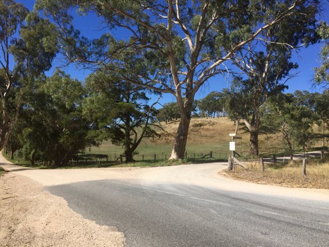
This is a beautiful drive through the Adelaide Hills, and there are some very nice views to be enjoyed from Marble Hill Road, and Montacute Road. This is very hilly terrain, and as I drove through the area, I wondered how some of the hills here were not on the list for the Summits on the Air (SOTA) program. Clearly they do not have the required prominence, but I will have to double check on that, as many look very prominent and steep.


Above:- Views through the trees out to the west, from Marble Hill Road.
Black Hill Conservation Park covers an area of around 684 hectares and is bounded by rugged ridges on the southern side of the park. A wide variety of native plants and animals are located in the park. Bushwalkers can enjoy an extensive network of walking trails. The park features low sheoaks which give Black Hill its name. The foliage of the sheoaks gradually matures to a dark rusty, almost black colour, as summer progresses. As you look from the Adelaide Plains, the hills appear to be black in colour.
I was brought up as a boy in the north eastern suburbs of Adelaide, not far from the park. I have plenty of fond memories of climbing up onto the roof of our home, and into my cubby house in the walnut tree, which afforded great views of the surrounding area, including the Black Hill Conservation Park.
The park has a number of nearby Conservation Parks, including Montacute CP, Horsnell Gully CP, Giles CP, Cudlee Creek CP, and Morialta Conservation Park which is situated directly opposite.
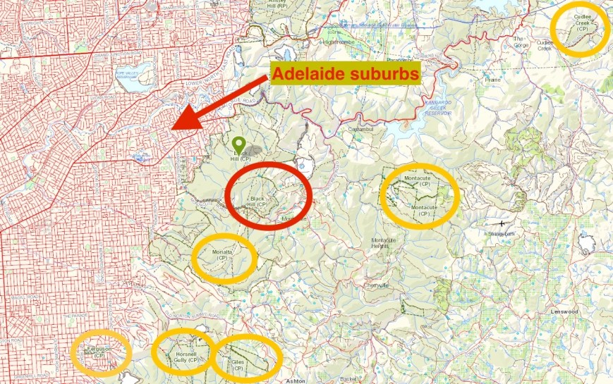
Above: Map showing the location of the Black Hill Conservation Park (marked with red circle) and various nearby Conservation Parks (marked with yellow circles). Image courtesy of Location SA Map Viewer.
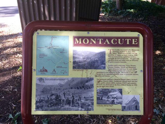
Just before reaching the park I passed through the little town of Montacute. Copper was discovered in the area way back in 1834 and a mine was soon set up. Sit John Baker, one of the mine’s financiers, named the area Montacute, after Montacute in Somerset in the UK, near his birthplace. A few years later, in 1846, gold was also discovered in the area.
I continued west on Montacute Road, disecting the Black Hill Conservation Park on my right (to the north), and Morialta Conservation Park to my left (to the south). I soon reached the park, which is well signposted.


There is a gate on the northern side of Montacute Road, but unfortunately it is the stock standard locked gate by the Department of Water and Natural Resources (DEWNR). There is a parking area on the other side of the gate, which cannot be accessed due to the locked gate.
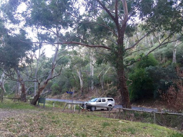
Above:- The 4WD parked at the locked gate on Montacute Road.
So your only options, are……. 1. not to stop and keep going (don’t visit the park….well at least at this point), or 2. park across the gate even though it says not to (which is what I did). There is absolutely nowhere to park on Montacute Road (way to dangerous to do so), and I figured I was going to very close to the gate anyway, so my vehicle could be moved in the event of an emergency. Not really sure why the gate is padlocked and access is prevented to the parking area, but I suspect the authorities have their own good reasons for doing so.


In any event, there is plenty of room here to stretch out an antenna. It was quite a cool afternoon, with the temperature being around 17 degrees C. But at least it wasn’t raining. There were no bushwalkers here this day, and the tranquility of the park was only broken by the occasional vehicle passing by on Montacute Road.
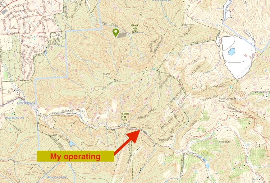
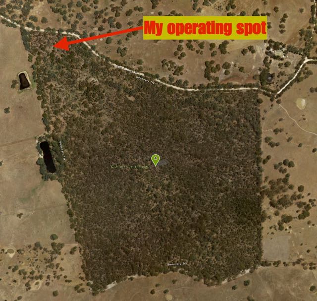
Above:- Map showing my operating spot in the Black Hill Conservation Park, just off Montacute Road. Image courtesy of Location SA Map Viewer.
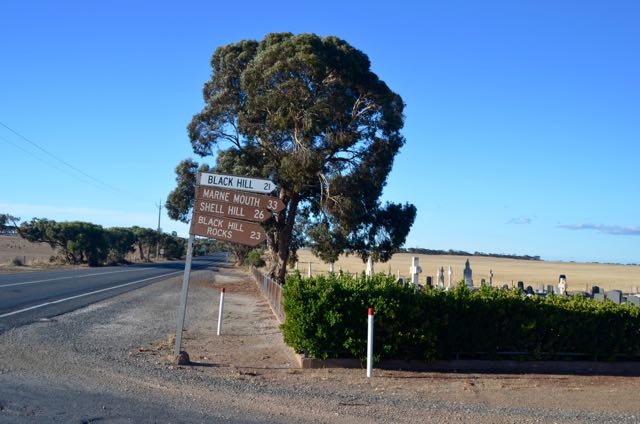
This is the start of one of the walking tracks through the park, the Orchard Track. The track connects to the Eagle Track, and also the Black Hill Track, which takes you up to the Black Hill Summit, at 467 metres. Unfortunately the summit does not qualify for SOTA.
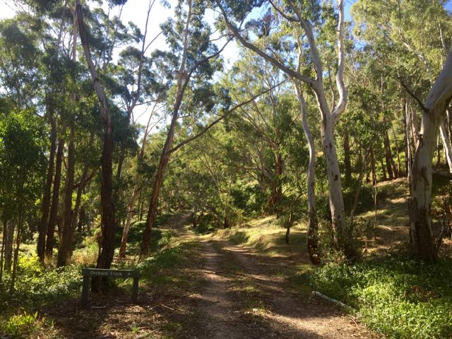
There is quite steep terrain at this location, on either side of Montacute Road, with a small creek following the roadway.
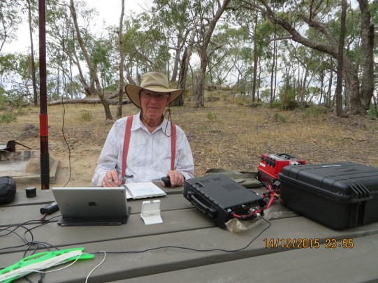
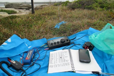
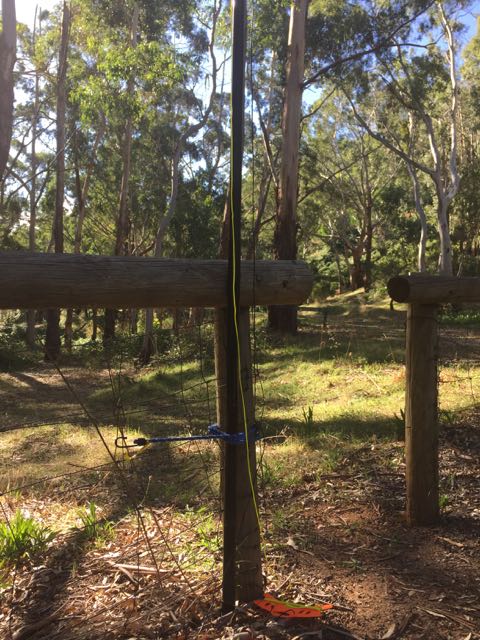
For this activation I ran the Yaesu FT-857d, 40 watts, and the 40m/20m linked dipole, which I supported on the 7 metre heavy duty squid pole. I used the permapine post and wire fence to secure the squid pole to, with the assistance of an octopus strap. I set up the fold up table and made myself comfortable in the deck chair.
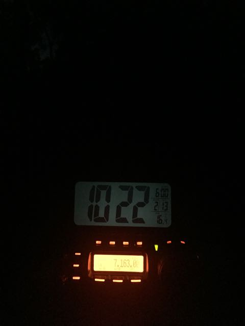
I was set up and ready go, spot by my alert time of 0700 UTC (5.30 p.m. South Australian local time). I headed to 7.144, my nominated operating frequency, and asked if the frequency was in use. My query was answered by Dennis VK2HHA, who had been sitting on the frequency waiting for me to come up. Dennis was a good 5/9 signal from Albury. Next up was Mick VK3PMG in western Victoria with a very strong signal, followed by Mark VK5QI who was mobile on South Road in Adelaide. Mark was struggling at times to hear me due to power line noise.
About seven contacts into the activation, whilst speaking with Rick VK4RF, I started to experience some QRM from Mike OE6MBG in Austria, who was calling CQ DX on the frequency. I tried to get through to Mike on a handful of calls, but he was not hearing my 40 watt signal from the dipole. Mike had no takers to his CQ DX calls, and then moved off frequency.
I then worked Ian VK1DI who was operating portable in the Lower Molonglo River Corridor Nature Reserve VKFF-0990 in the ACT. Ian had a beautiful strong 5/8 signal coming in to Black Hill, and was my first Park to Park contact for the activation.
About eight contacts later I was called by Peter VK3PF/p who was near Mount Hotham in the Alpine National Park. Peter was up in the Alpine region with a number of other SOTA enthusiasts for a SOTA gathering.


A few QSOs later I spoke with Cleeve VK2MOR who was mobile in Newcastle. I was then called by Julie VK3FOWL/p, operating portable from a school in Highett in Melbourne. Julie conducts practical amateur radio sessions in a number of schools in Victoria, promoting the hobby. Unfortunately, Julie had no students in the room at the time, but we agreed that she would call back once she did.
For more information check out………
https://www.amateurradio.com.au/news/libraries-expose-amateur-radio
I then spoke with Adam VK3AGD mobile on his way to join the SOTA crew at Mount Hotham, followed by Damein VK5FDEC running just 5 watts, and then Tim VK7NSE on Flinders Island, OC-261. Soon after I was called by Mike VK6MB in Western Australia, with a good 5/6 signal (4/5 for me). I was then called by Andrew VK1AD/3, Allen VK3ARH/p, Tony VK3CAT/p, and Ron VK3AFW/p, who were all portable in the Alpine National Park for the SOTA get together.
A few QSOs later, Julie VK3FOWL/p called back in. This time she had young Aneka in the room with her. I had a chat with Aneka and explained to her where I was set up. Unfortunately the contact was spoilt a little by some European QRM and some very close by VK’s.
I worked a further 6 stations and then headed to 20m, where I commenced calling CQ on 14.310. My first taker was Rick VK4RF/VK4HA, followed by Luciano I5FLN in Italy. Luciano was not his normal booming 5/9 and was struggling to hear me. This was not a good sign of things to come. Mike VK6MB was next up. He had followed me up from 40m, and on 20m was a solid 5/9 (5/9 received as well). I worked a further seven stations on 20m which included a handful of VK3’s, Greg VK8GM in Alice Springs, and Steve G0KIK. Steve was a good 5/7 signal to me, but was really struggling with my signal in the UK (3/3 received).
I then lowered the squid pole and put up the 15m dipole, and started calling CQ on 21.244. But after 5 minutes of CQ calls, there were no takers, so I re-erected the 20m/40m linked dipole, and I returned back to 7.144. I commenced calling CQ again and this was answered by Darren VK2NNN in Bondi.
I worked just 4 more stations which included Grant ZL2GD/p who was operating portable from the Victoria Forest Park in the South Island of New Zealand. Grant was running just 25 watts into an inverted vee antenna. Unfortunately, Victoria Forest Park does not currently qualify for WWFF.
It was now just after 8.00 p.m. local time, so I headed down to the 7130 DX Net, where I worked a total of 13 stations, including William FO5JV in French Polynesia, Greg NR6Q in California, and Mike VK3XL running just 2 watts double side band (5/3 both ways).
I packed up at around 9.00 p.m. local time, with a total of 73 contacts in the log. I joined the 7130 DX Net from the mobile on the way home.
The following stations were worked on 40m SSB:-
- VK2HHA
- VK3PMG
- VK5QI/m
- VK3MRH
- VK5KIK
- VK5KLV
- VK4RF
- VK4HA
- VK1DI/p (VKFF-0990)
- VK3KRH
- VK5PL
- VK5KPR
- VK5FANA
- VK1AT
- VK7AN
- VK5EE
- VK3PF/p (Alpine NP)
- VK3RU
- VK3WE
- VK2MOR/m
- VK3FOWL/p
- VK3AG/m
- VK5FDEC
- VK7NSE
- VK2NP
- VK3FAPH
- VK3FSPG
- VK6MB
- VK3FLCS
- VK1AD/3 (Alpine NP)
- VK3ARH/p (Alpine NP)
- VK3CAT/p (Alpine NP)
- VK3AFW/p (Alpine NP)
- VK3YW
- VK4FR/5
- VK2LEE
- VK3FBJA
- VK3FOWL/p
- VK5ZGY
- VK3ZZS/p
- VK5ATN
- VK5FCLK
- VK3HXT
- VK4FAAS
- VK2NNN
- VK5FDEC
- VK3MCK
- ZL2GD/p
- VK3ACT
- VK7ROY
- VK4FAAS
- VK3VIN
- VK4FFAB
- VK1MTS
- VK2LAW
- VK4FNQT
- VK7VEK
- VK5FUZZ
- FO5JV
- NR6Q
- VK3XL
- VK5MJ
The following stations were worked on 20m SSB:-
- VK4RF
- VK4HA
- I5FLN
- VK6MB
- VK3PMG
- VK3MCK
- VK3SIM
- VK8GM
- VK2LEE
- G0KIK
- VK3GTS