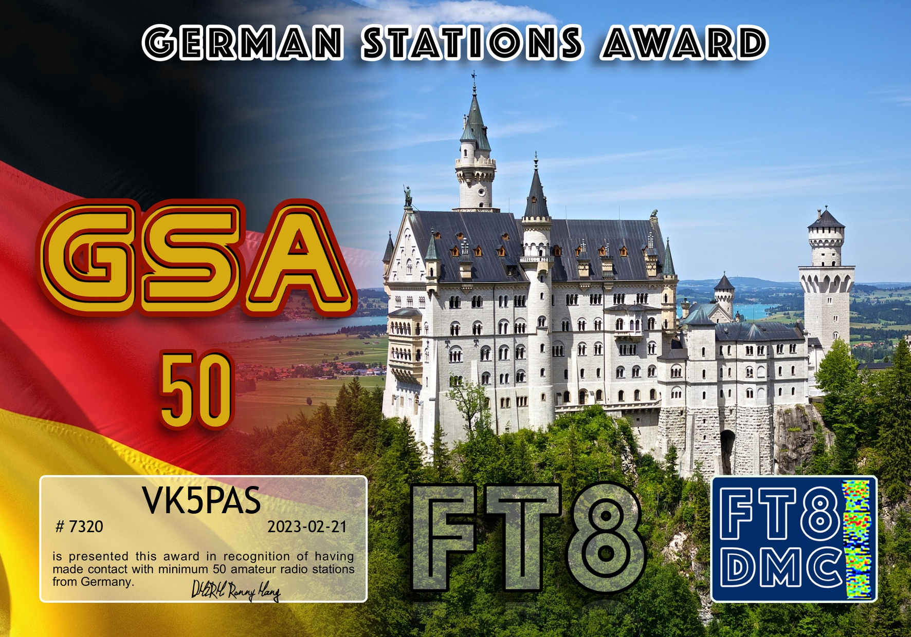
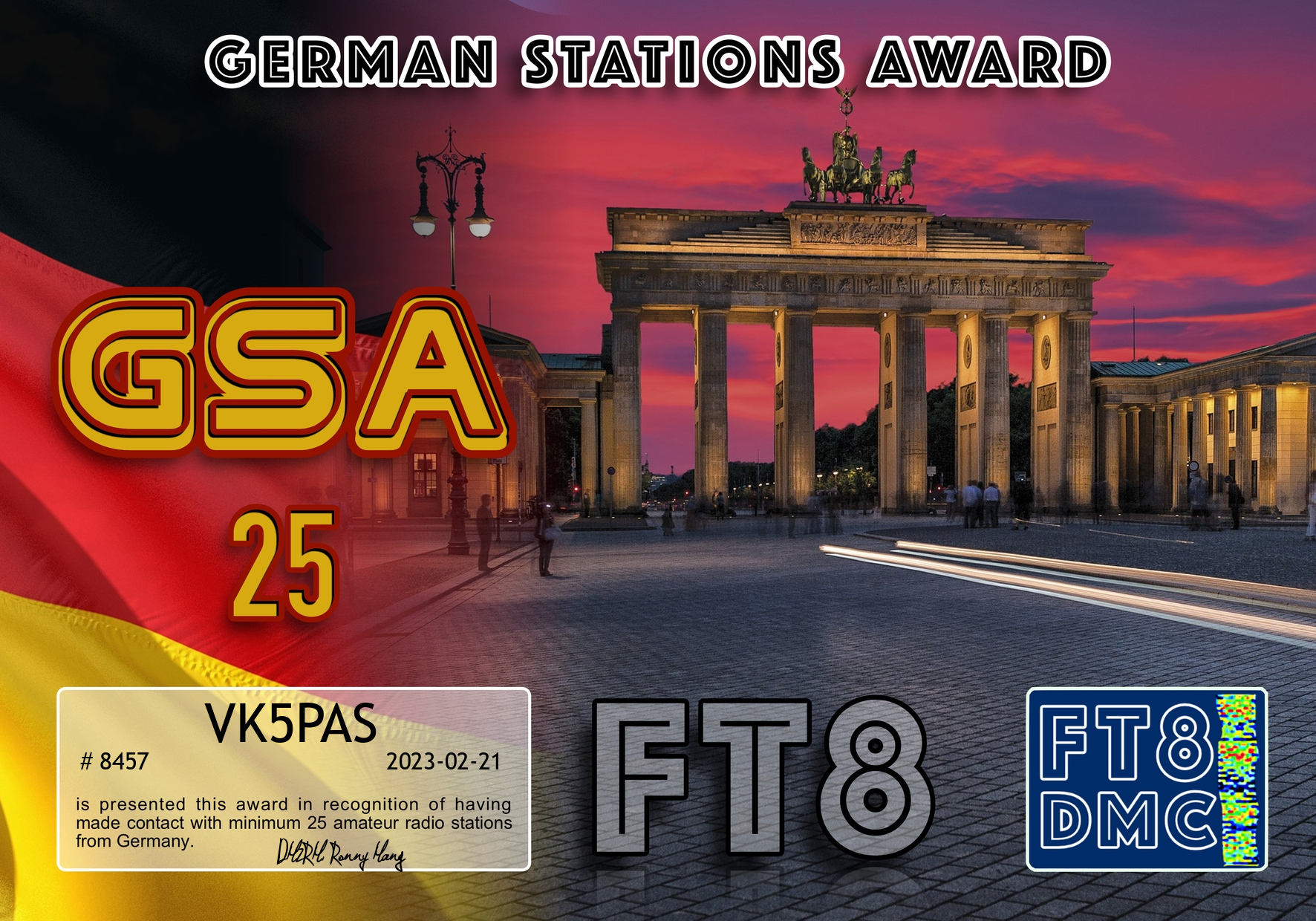
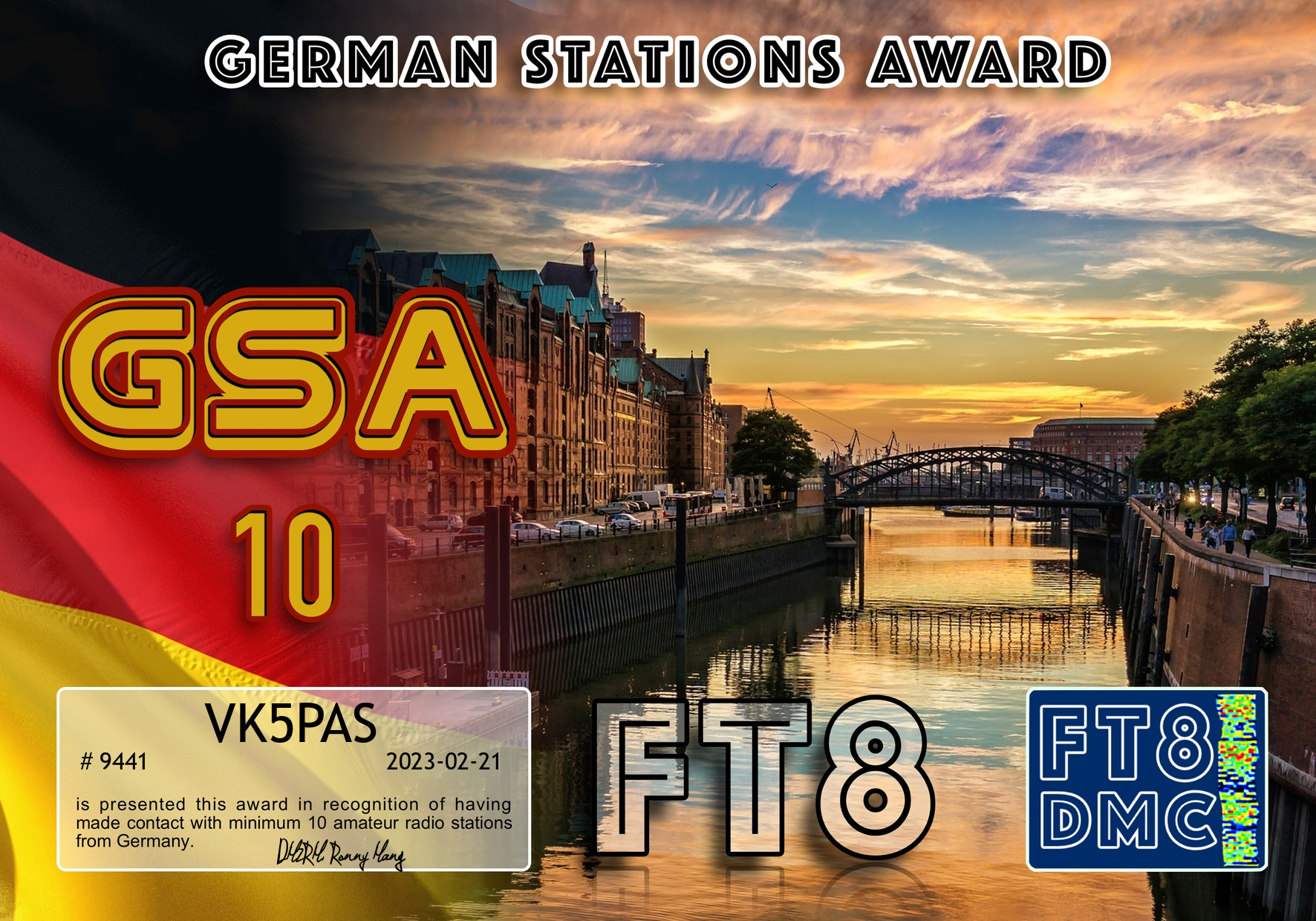
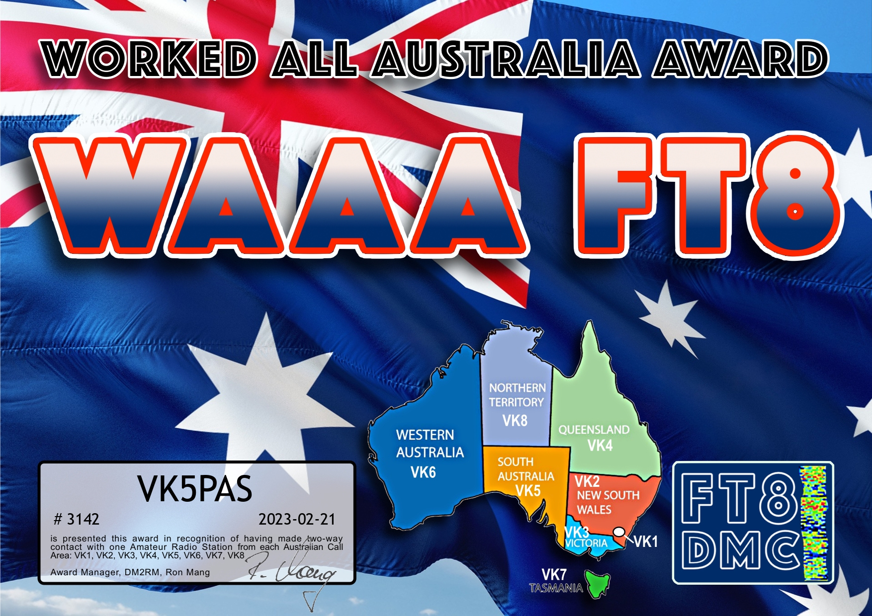
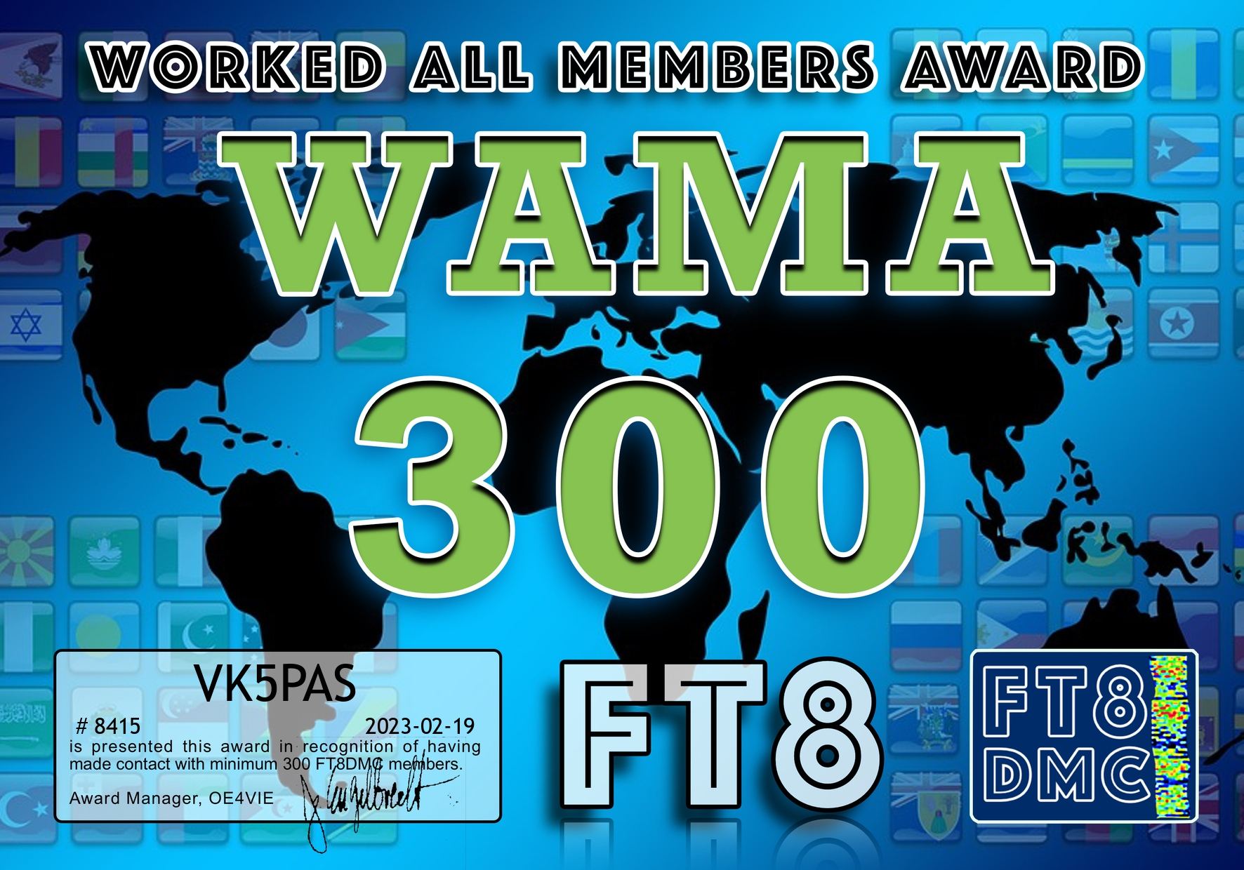
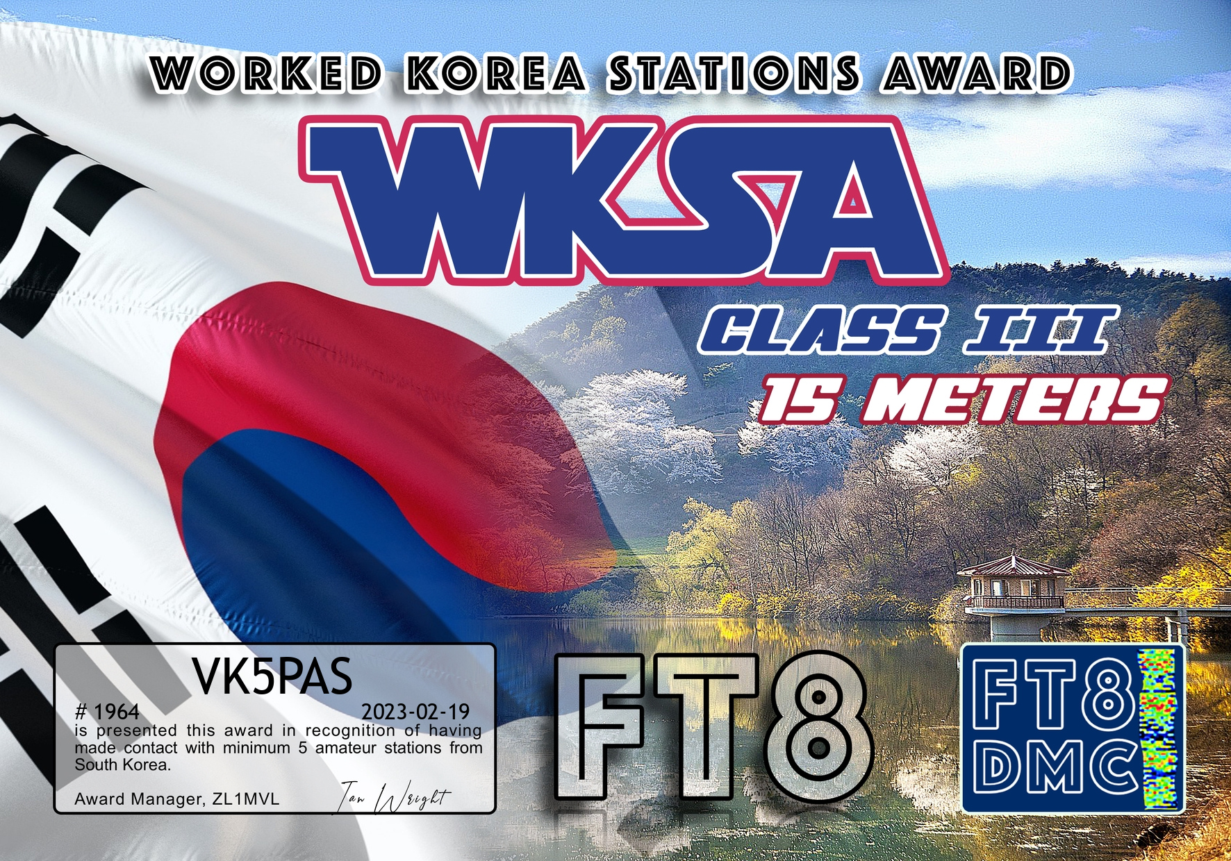
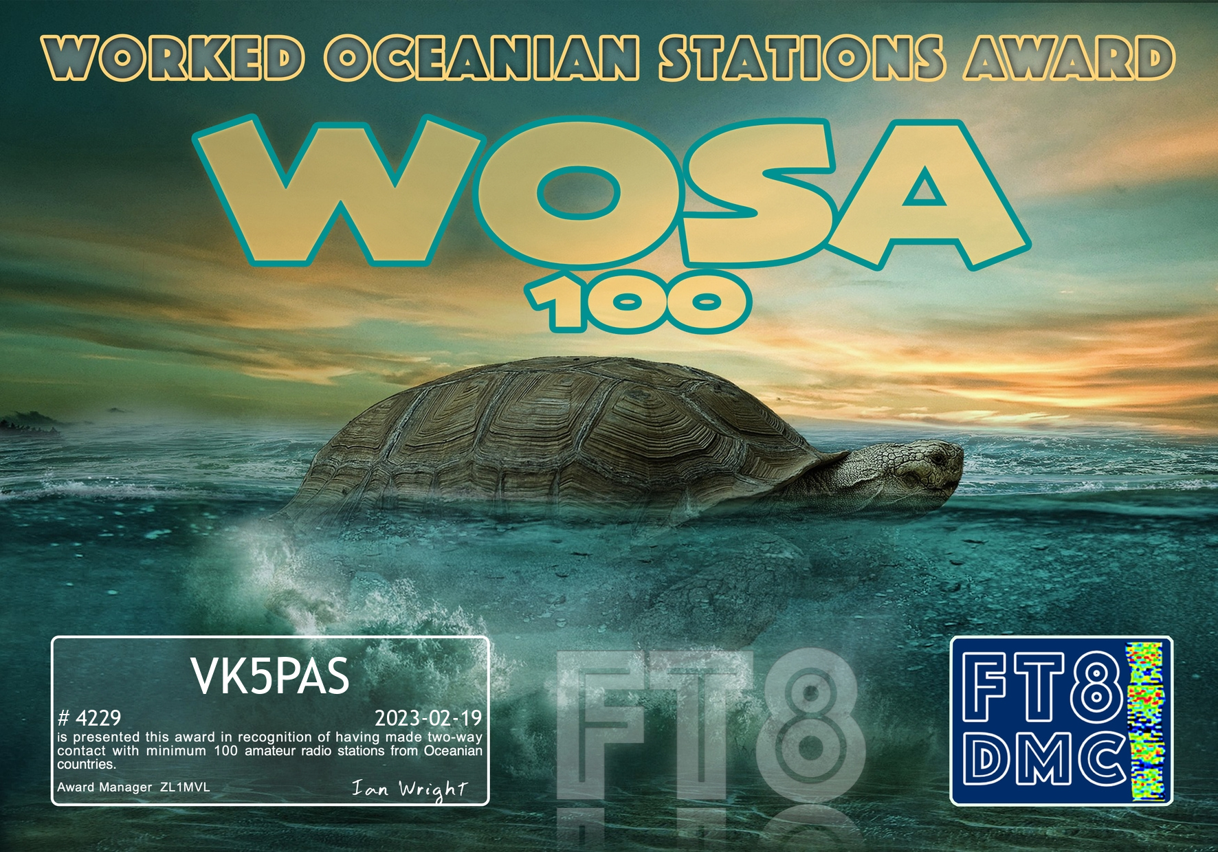
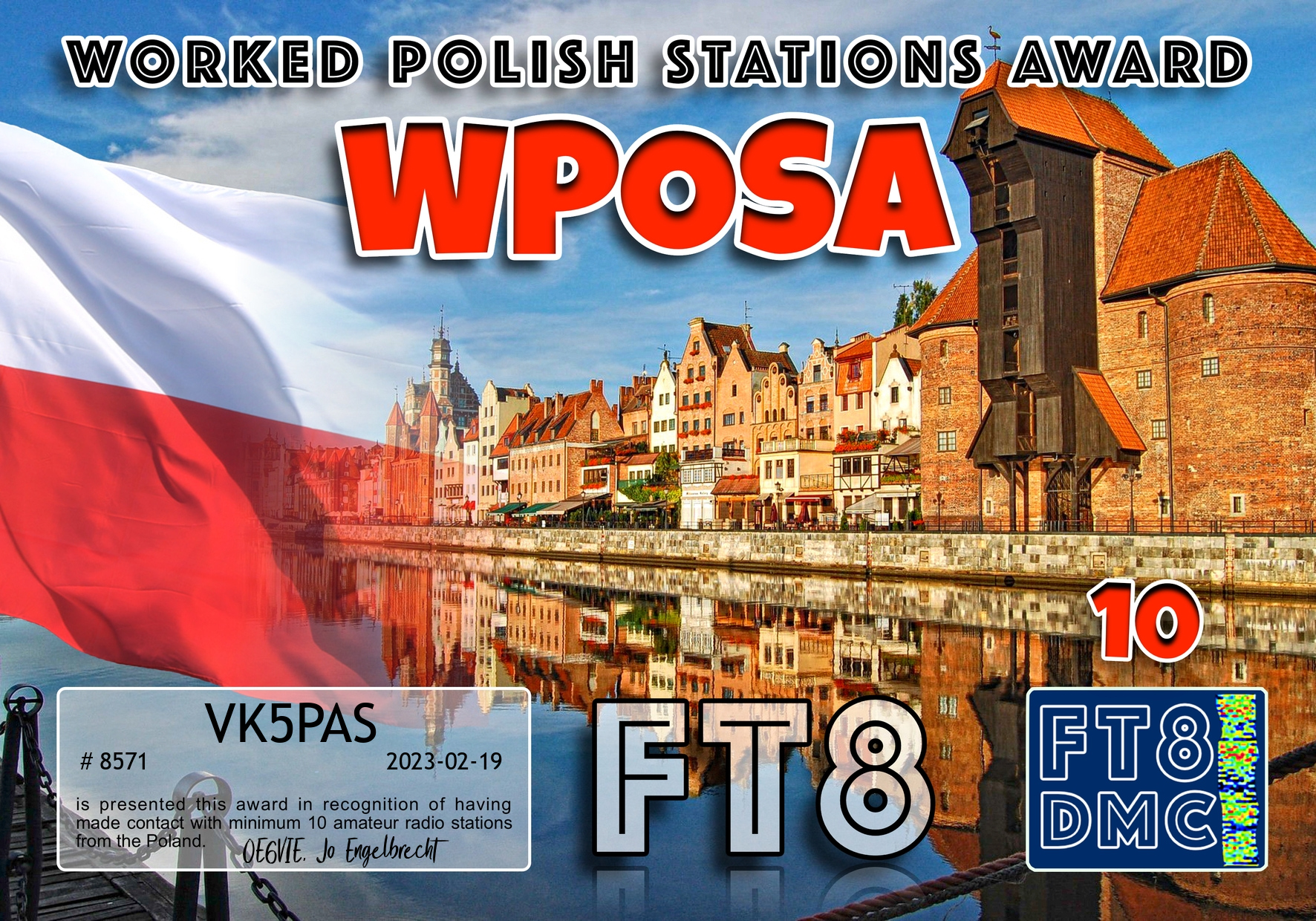
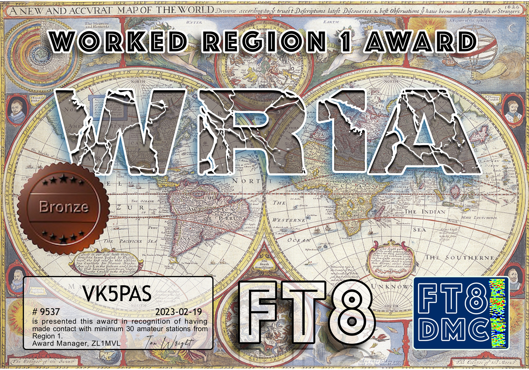
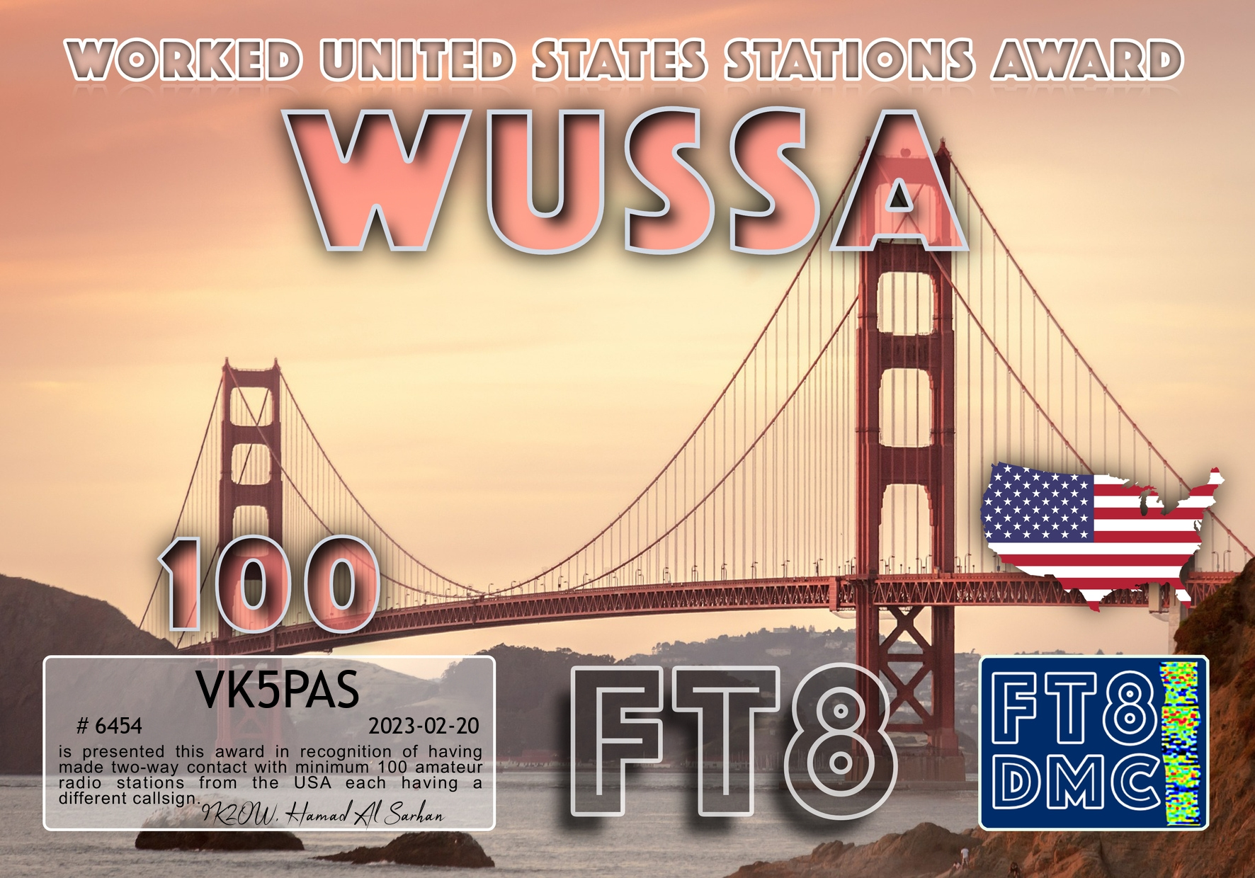
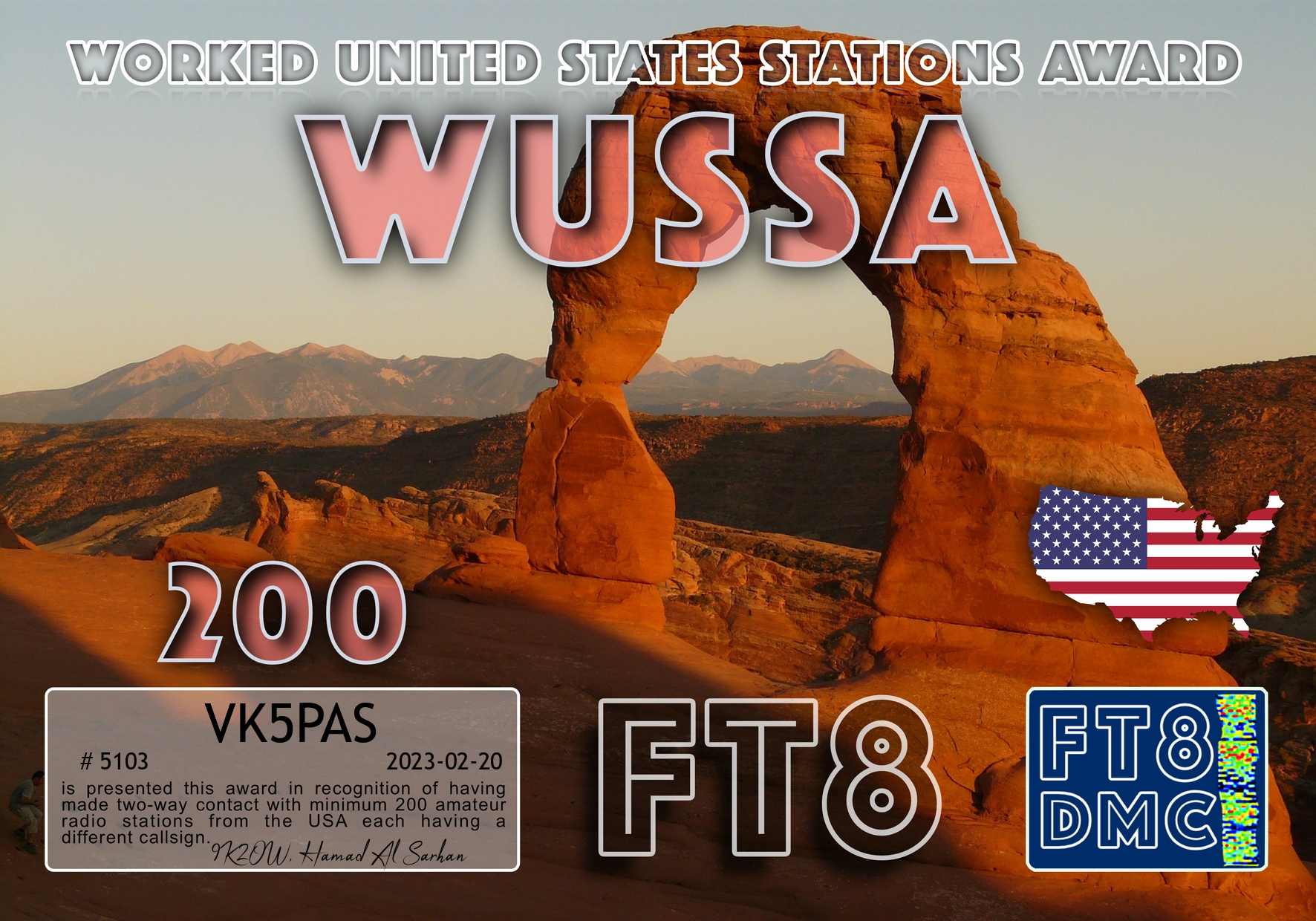
About 5 weeks ago I became set up for the digital mode FT8. Thanks to John VK5BJE for his assistance.
I joined the FT8 Digital Modes Club and I uploaded my log to Ultimate AAC, and I could not believe the number of award certificates that were sitting there waiting for me.
Thanks to Ian VK1DI and Keith VK2PKT for their guidance regarding UAAC.
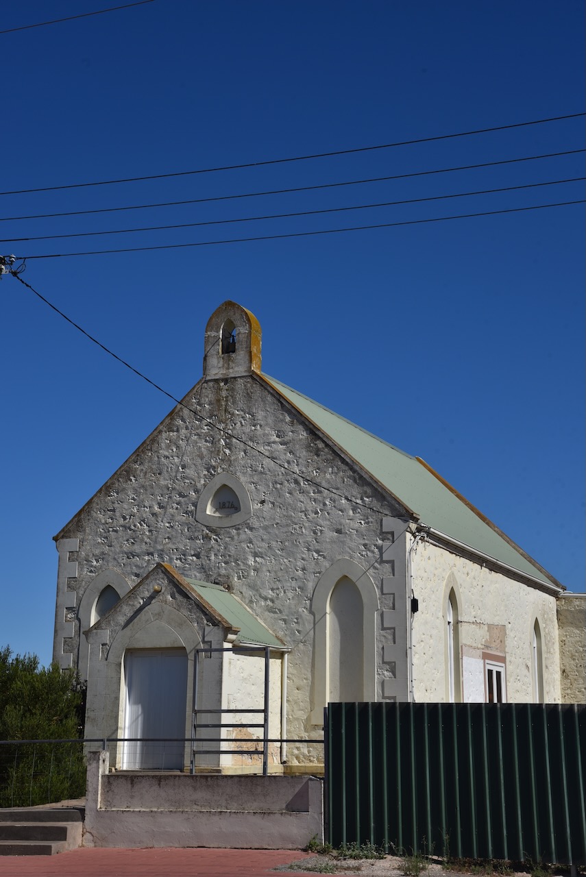
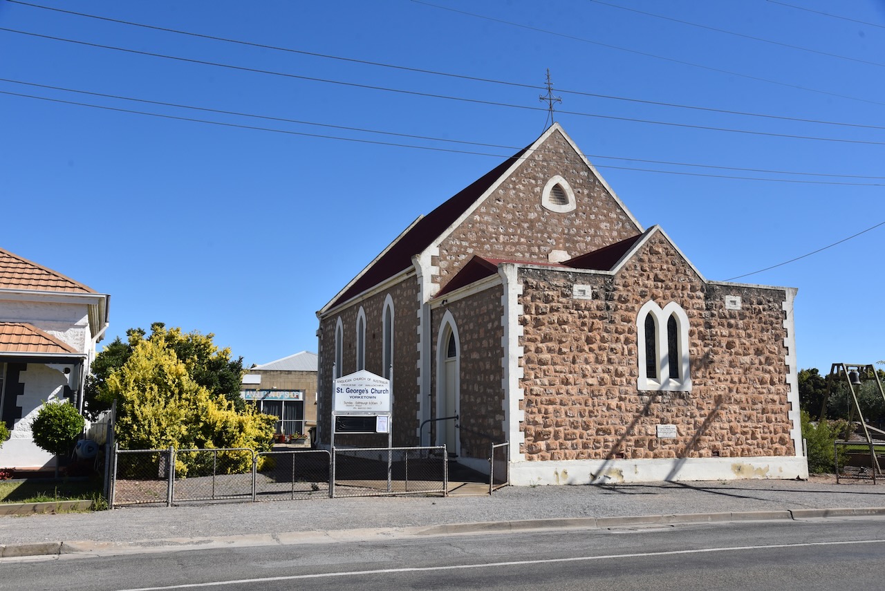
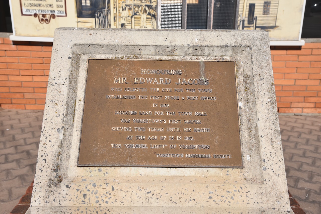
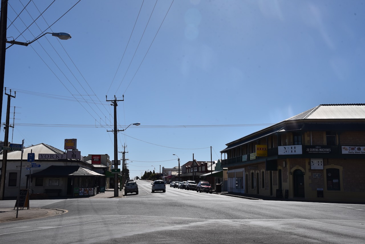
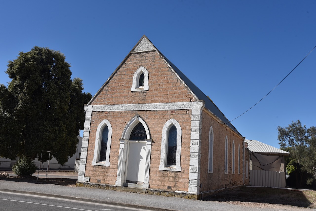
After leaving the Minlacowie Conservation Park (Monday 6th February 2023), we drove down to the town of Yorketown. We need to purchase some bottles of red wine for our trip to Troubridge Island.
Prior to European settlement, the aboriginal people called the area around Yorketown, karinja – kari meaning ‘emu’ and nja – ‘place’. The original plan of the town shows Yorke Town, but it was advertised as ‘The Town of Yorke’, taking its name from Yorke Peninsula.
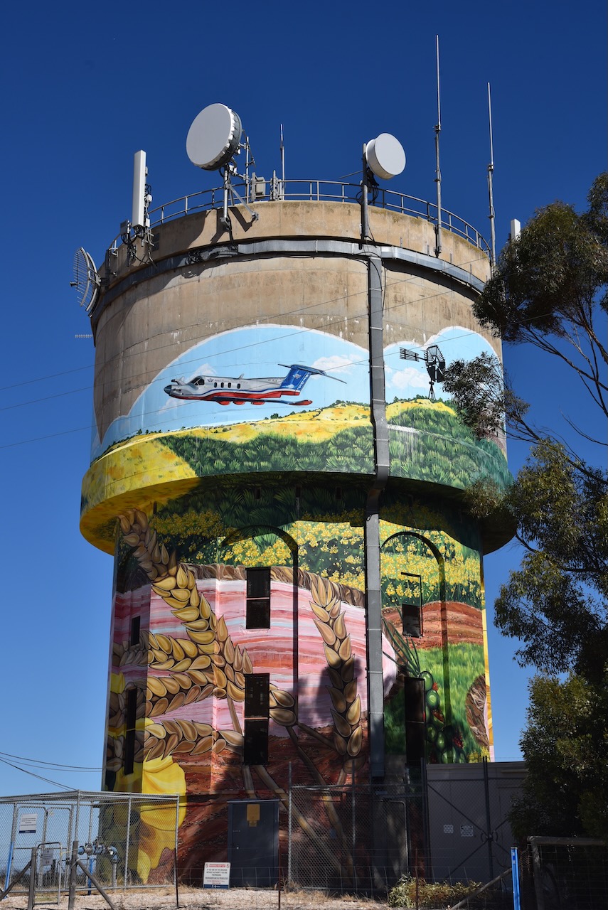
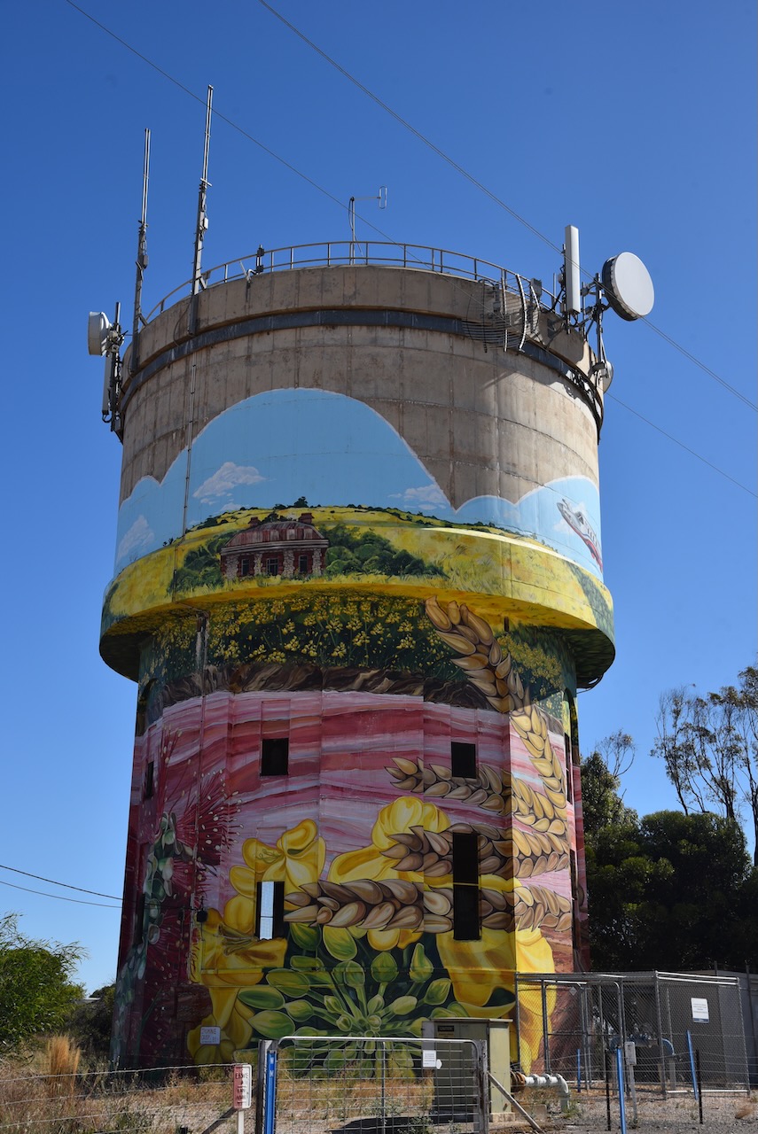
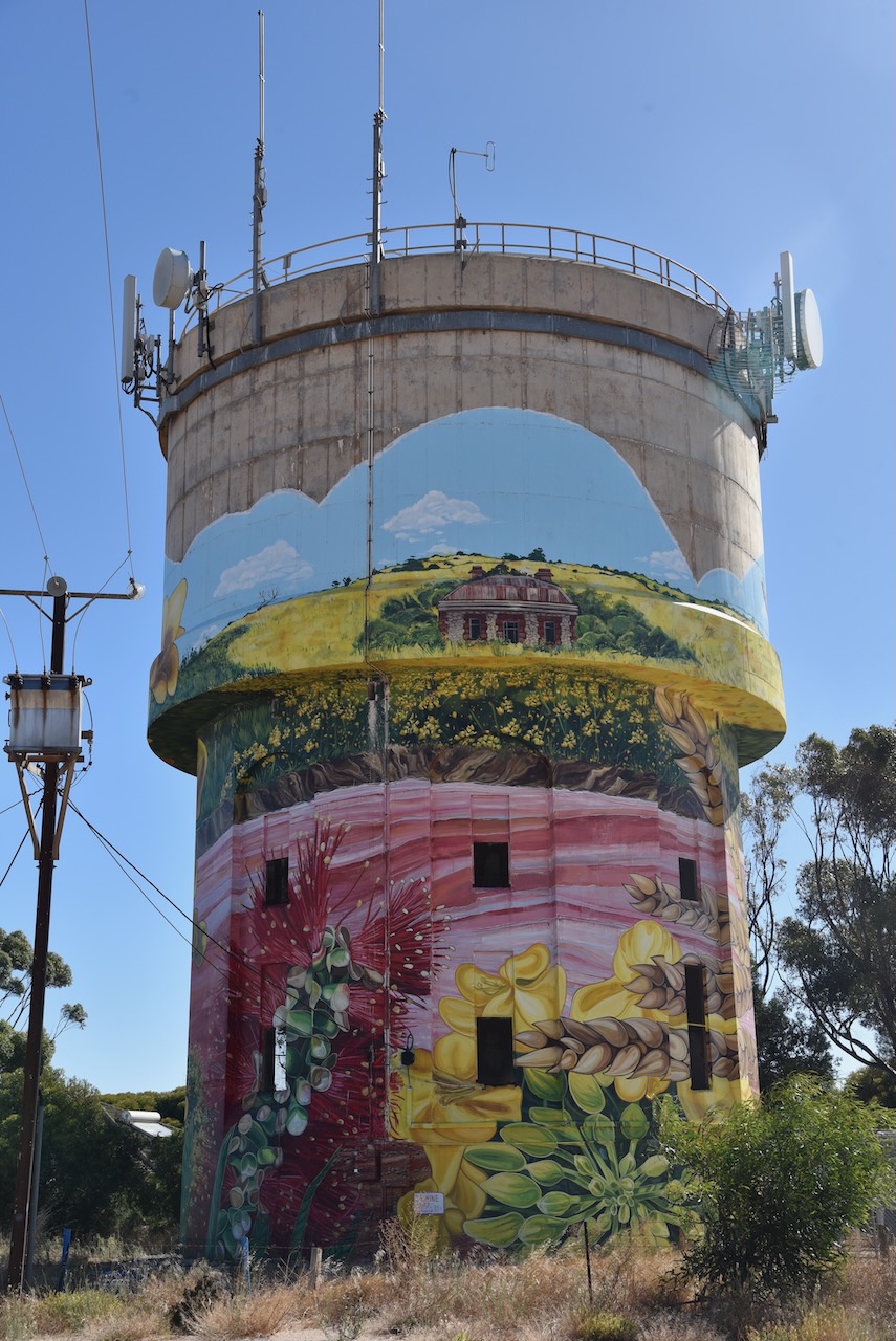
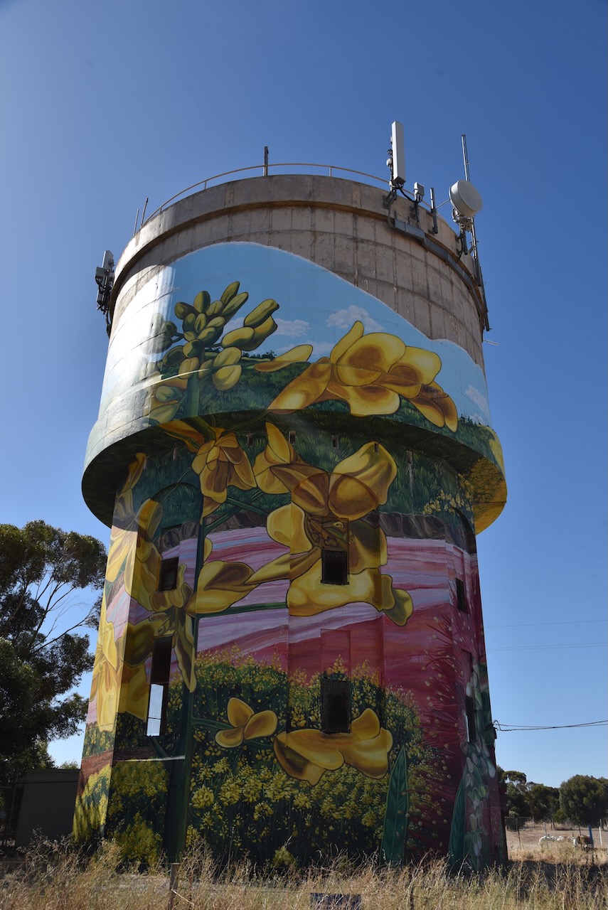
Whilst in Yorketown we visited the water tower mural which was painted by Jasmine Crisp in March 2021. The work took Crip a total of 37 days to complete. The mural includes the Royal Flying Doctor Service, canola crops, the pink lake and historic buildings.
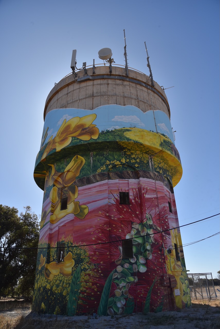
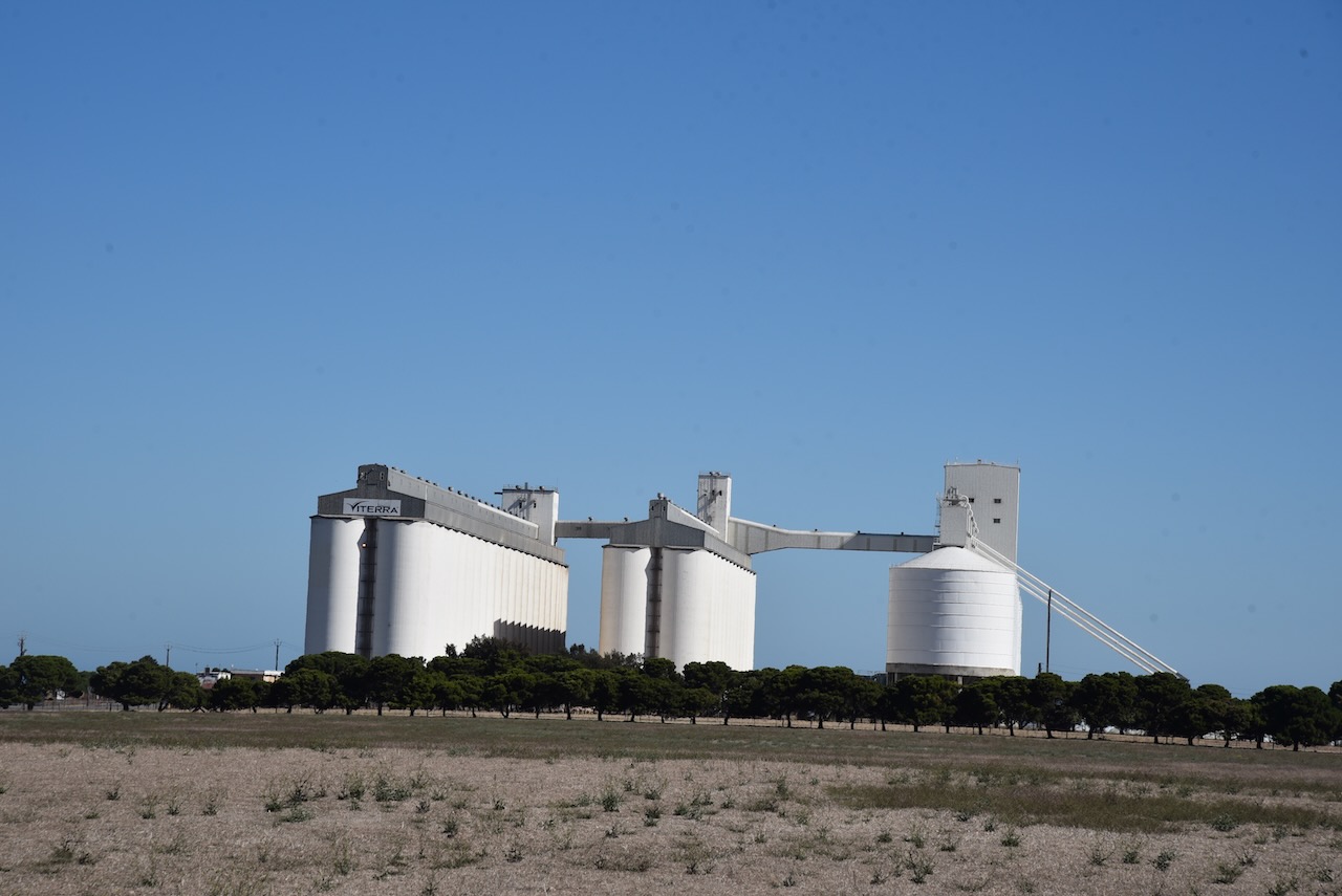
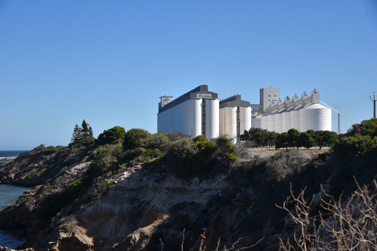
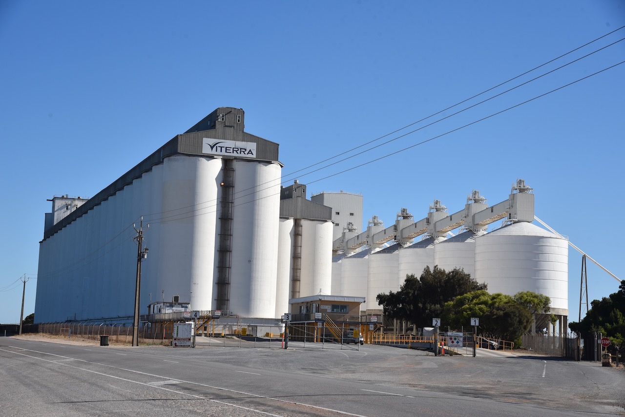
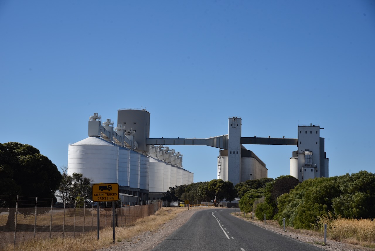
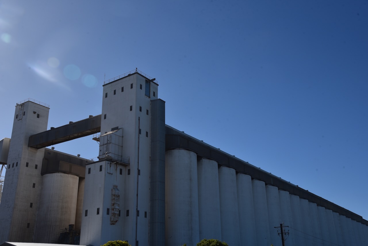
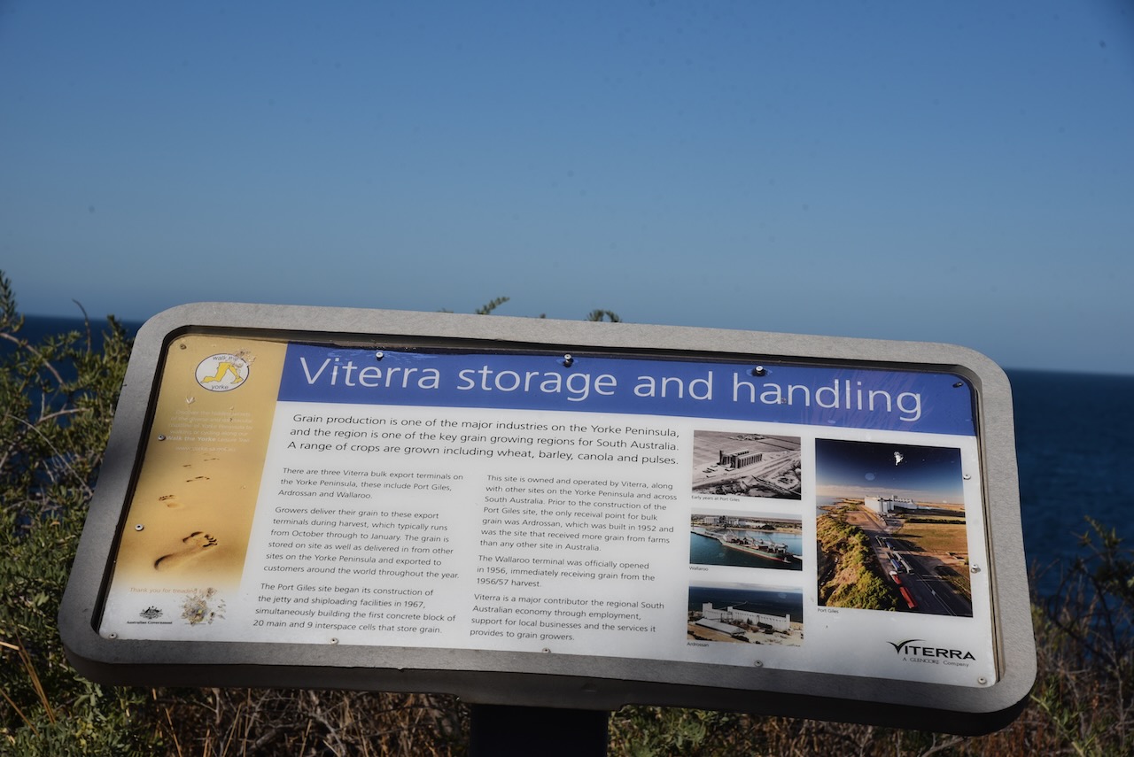
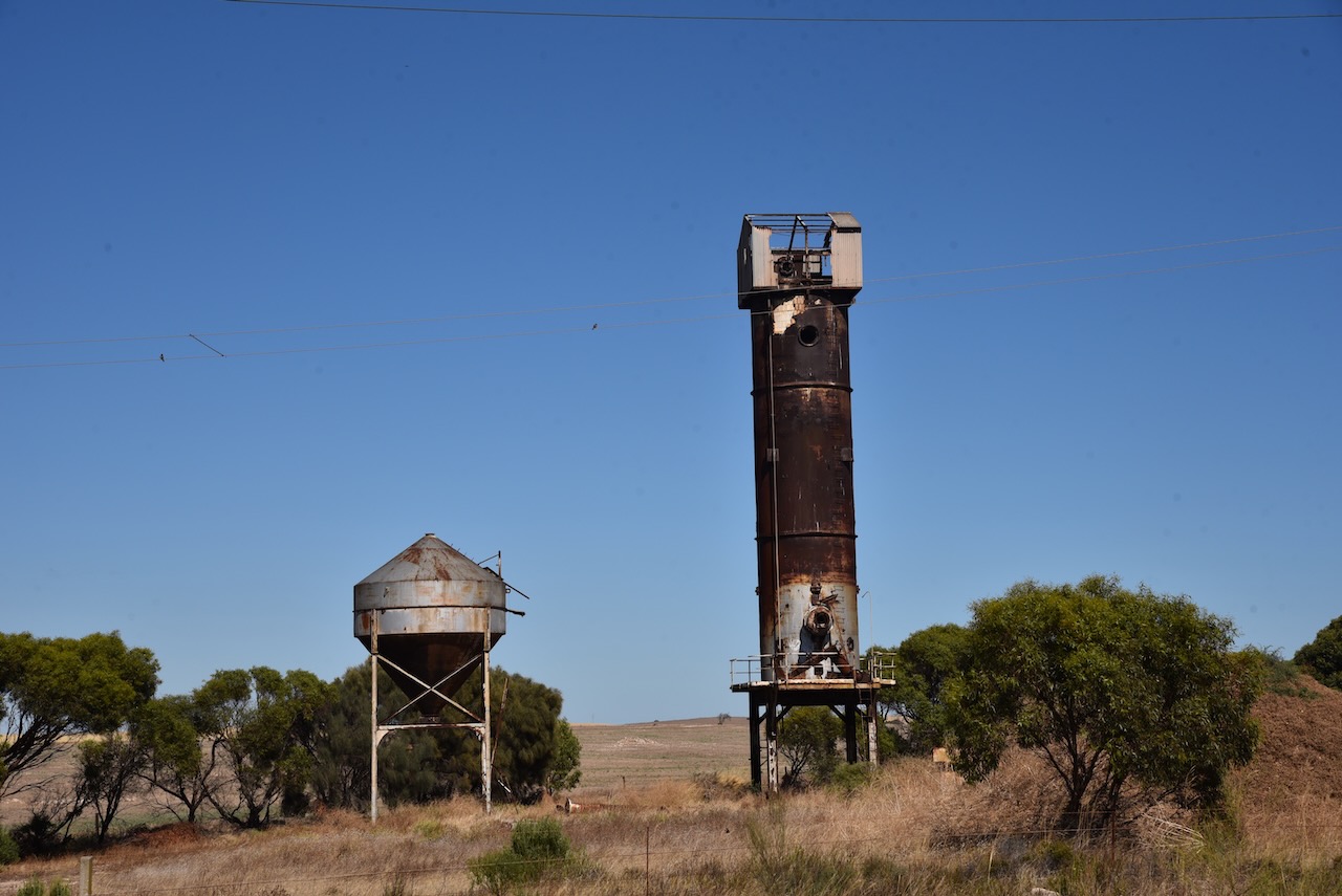
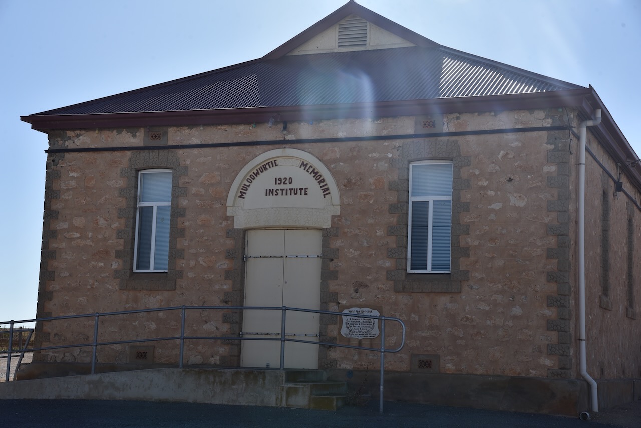
We then headed for Port Giles to activate the silo for the Silos On The Air (SiOTA) program.
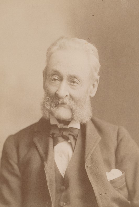
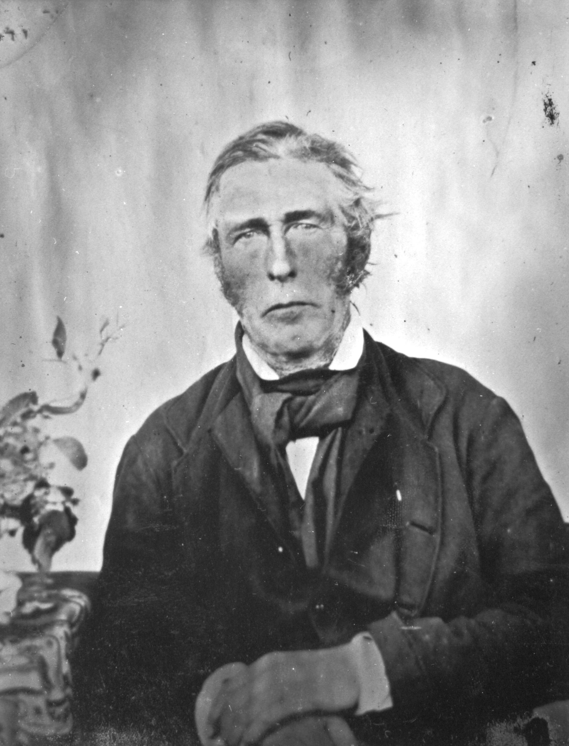
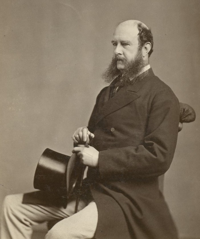
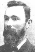
Port Giles was named after Thomas Giles (b. 1820. d. 1899), a partner with George Anstey in the Penton Vale sheep station. Giles was the third of 15 sons and 6 daughters of William Giles, the Colonial Manager of the South Australian Company.
Above:- Thomas Giles. Image c/o Wikipedia.
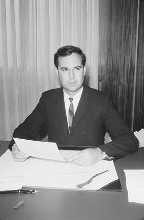
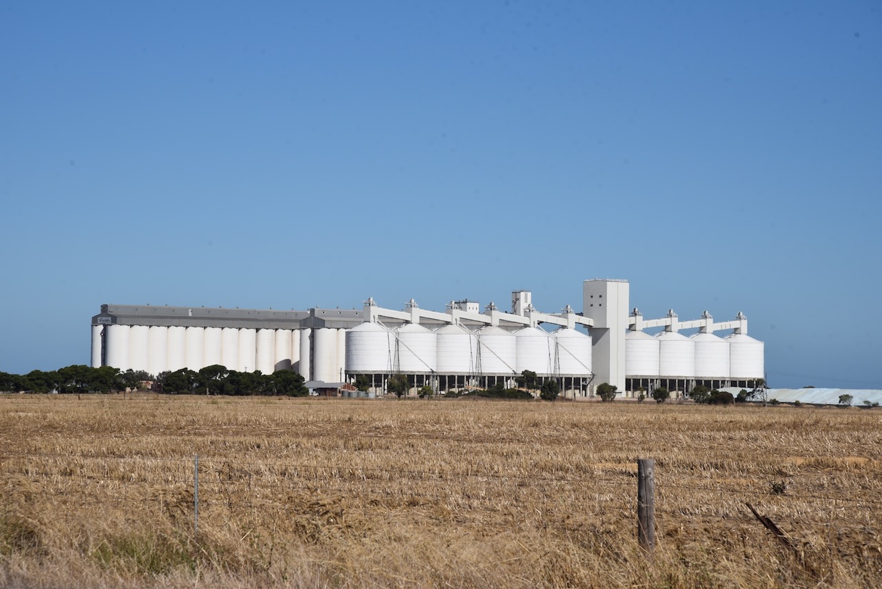
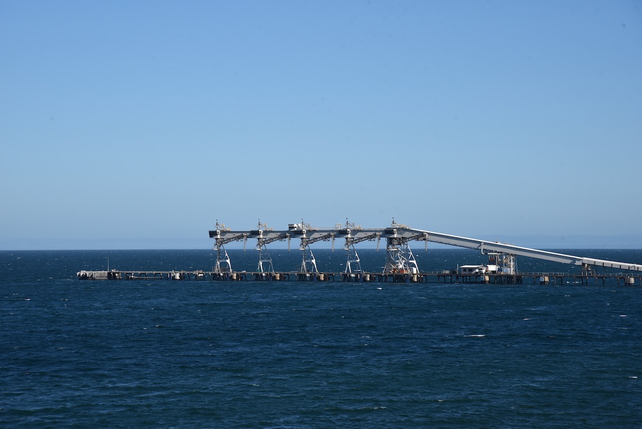
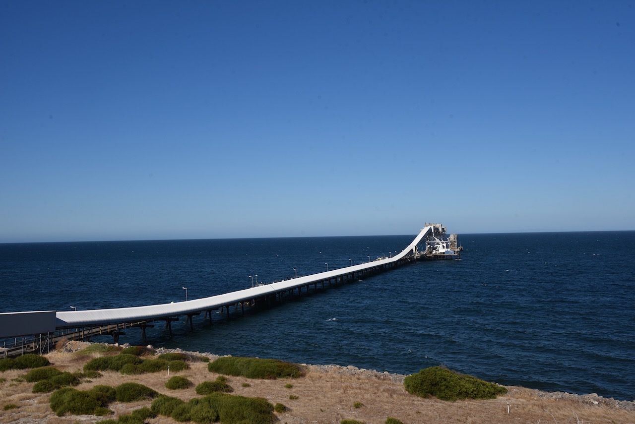
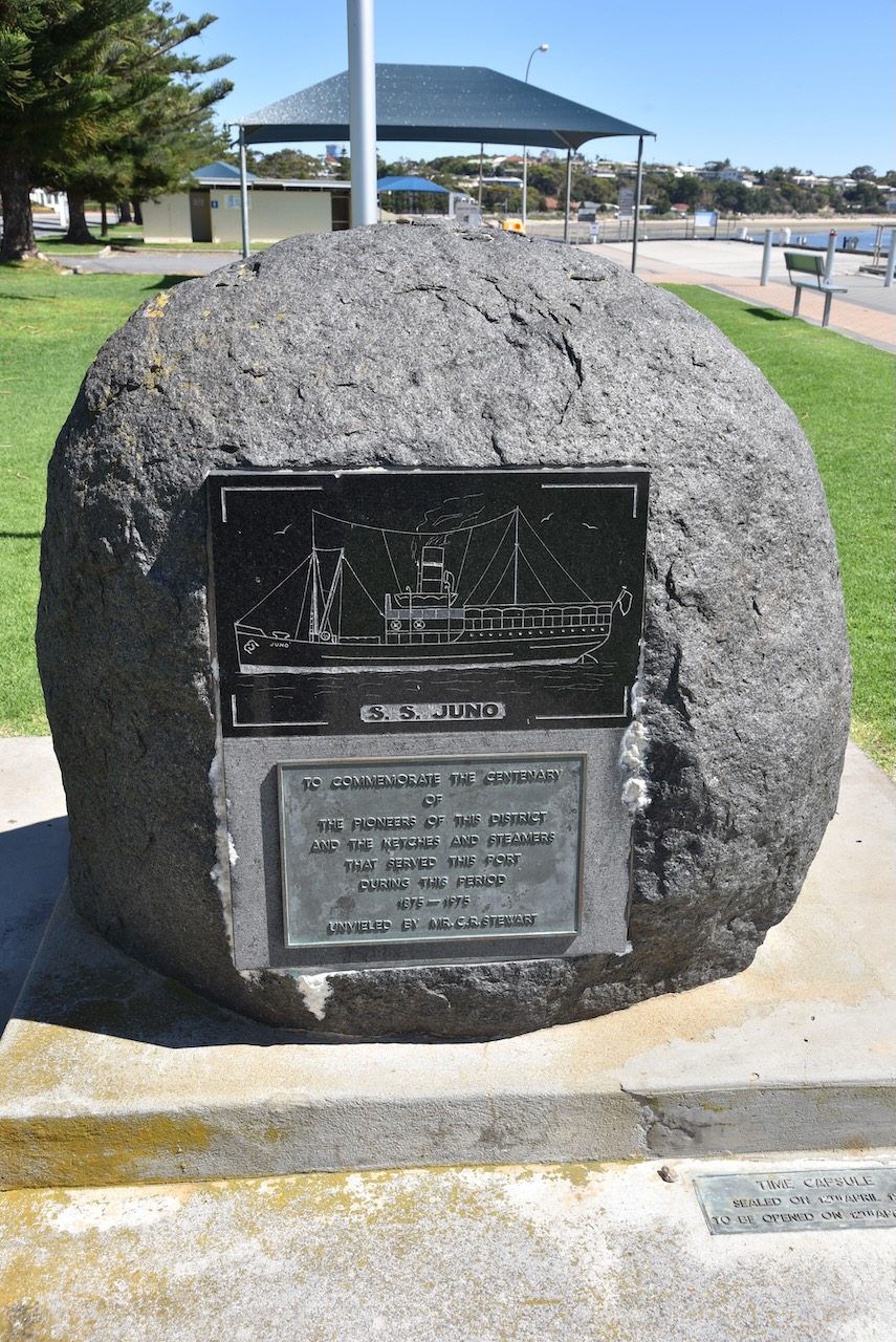
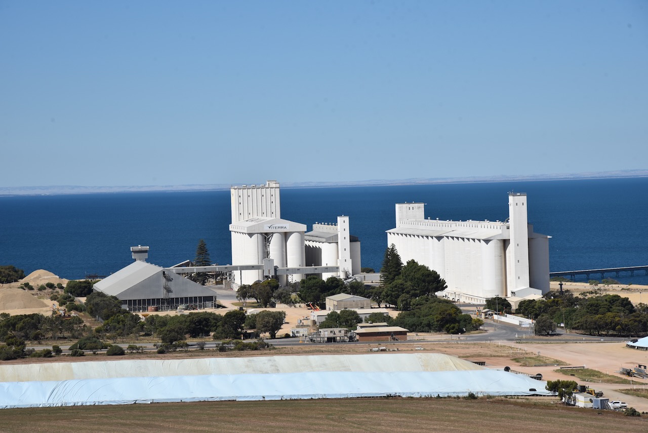
In 1967, construction of a deep sea jetty commenced at Port Giles and on the 23rd day of May 1970 was opened by the South Australian Premier, Hon. Steele Hall. The opening of the jetty and the large grains storage facility led to the closure of many of the smaller ports on the Yorke Peninsula.
Above:- Former SA Premier Steele Hall. Image c/o Wikipedia.
Port Giles was specifically constructed to be able to handle bulk grain and load it onto larger modern ships. Port Giles can handle Panamax-size ships or larger. Panamax is a term for the size limit of ships travelling through the Panama Canal. Many of the other Yorke Peninsula ports were not deep enough for larger ships, and they could only be serviced by small sketches and coastal steamships and could only handle grain in bags and not in bulk.
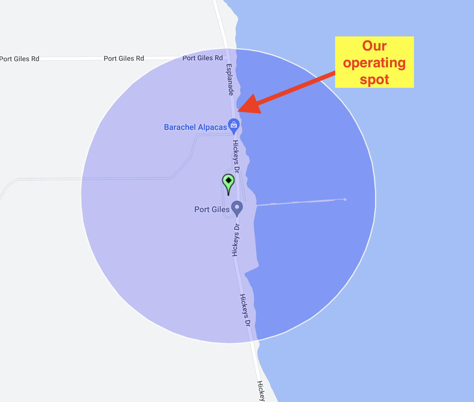
We operated from the 4WD on Hickey Drive, a short distance from the silos. We ran the Icom IC-7000, 100 watts, and the Codan antenna for this activation.
Marija worked the following stations on 40m SSB:-
VK1CHW/p (Black Mountain Nature Reserve VKFF-0834 & SOTA VK1/ AC-042)
VK5MOS
VK3PF
VK5FANA
VK5BJE
I worked the following stations on 40m SSB:-
VK1CHW/p (Black Mountain Nature Reserve VKFF-0834 & SOTA VK1/ AC-042)
VK5MOS
VK3PF
VK5FANA
VK5BJE
VK5HS
VK5FR
VK2YK
VK5GA
VK5LA
VK3LVH
VK2RO
VK5CZ
VK2NP
VK5GY
VK3GJG
VK5TN
VK3SMW
VK2IO
It was time for us to head back to Stansbury, where that night we met up with Ivan VK5HS, Andy VK5LA, Adam VK2YK, and Chris VK5TR, our other team members of VK5TIL and the Troubridge Island trip. We had a great night out and a meal at the Stansbury Hotel.
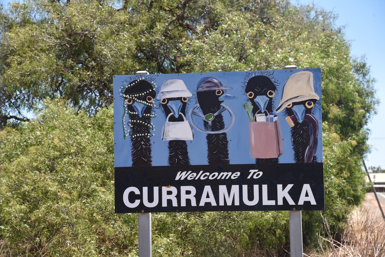
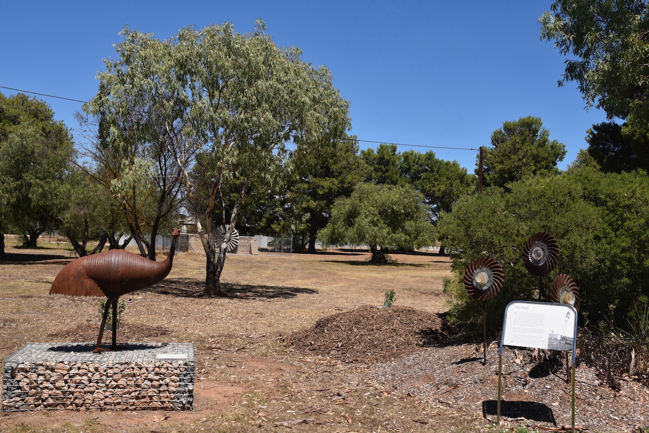
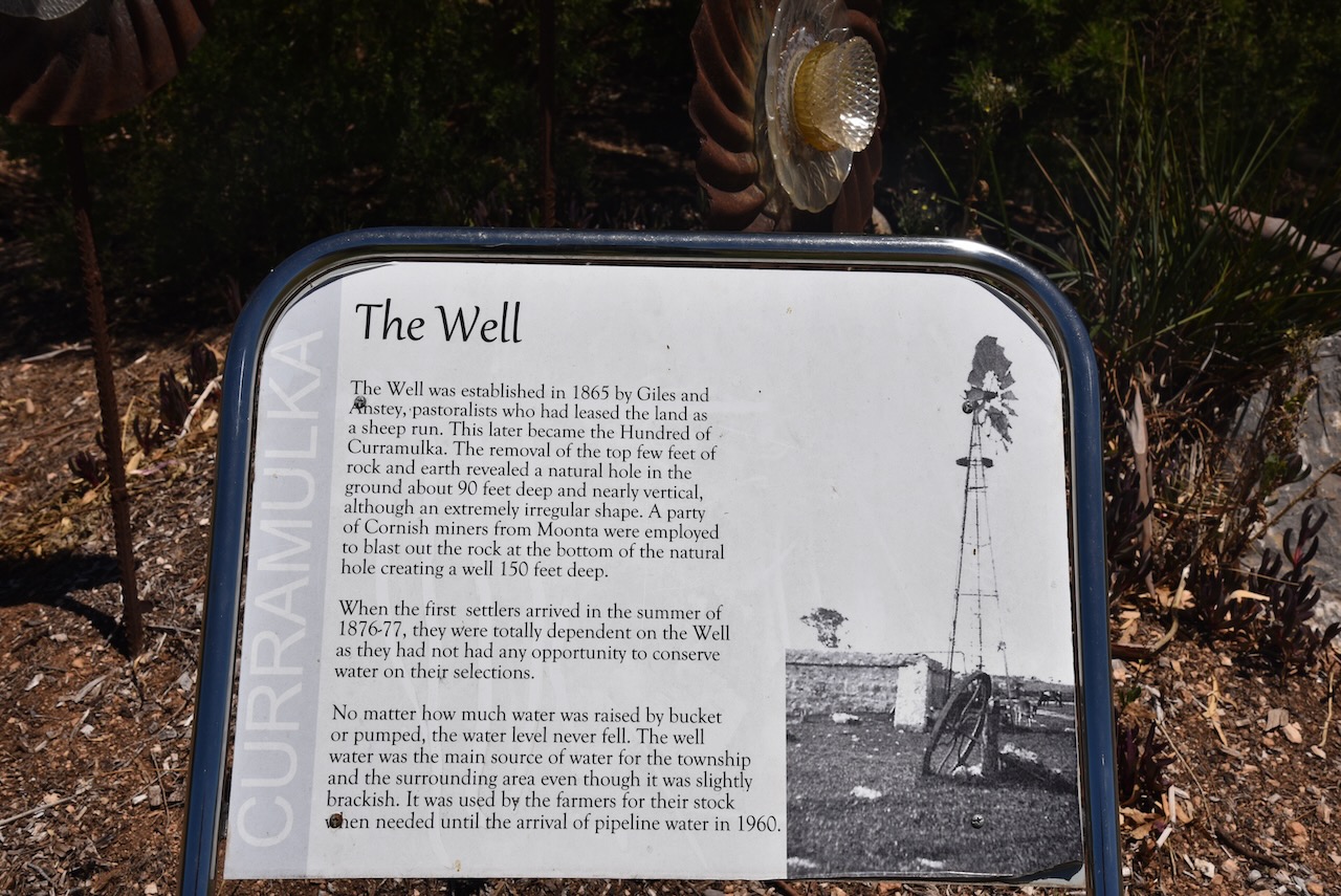
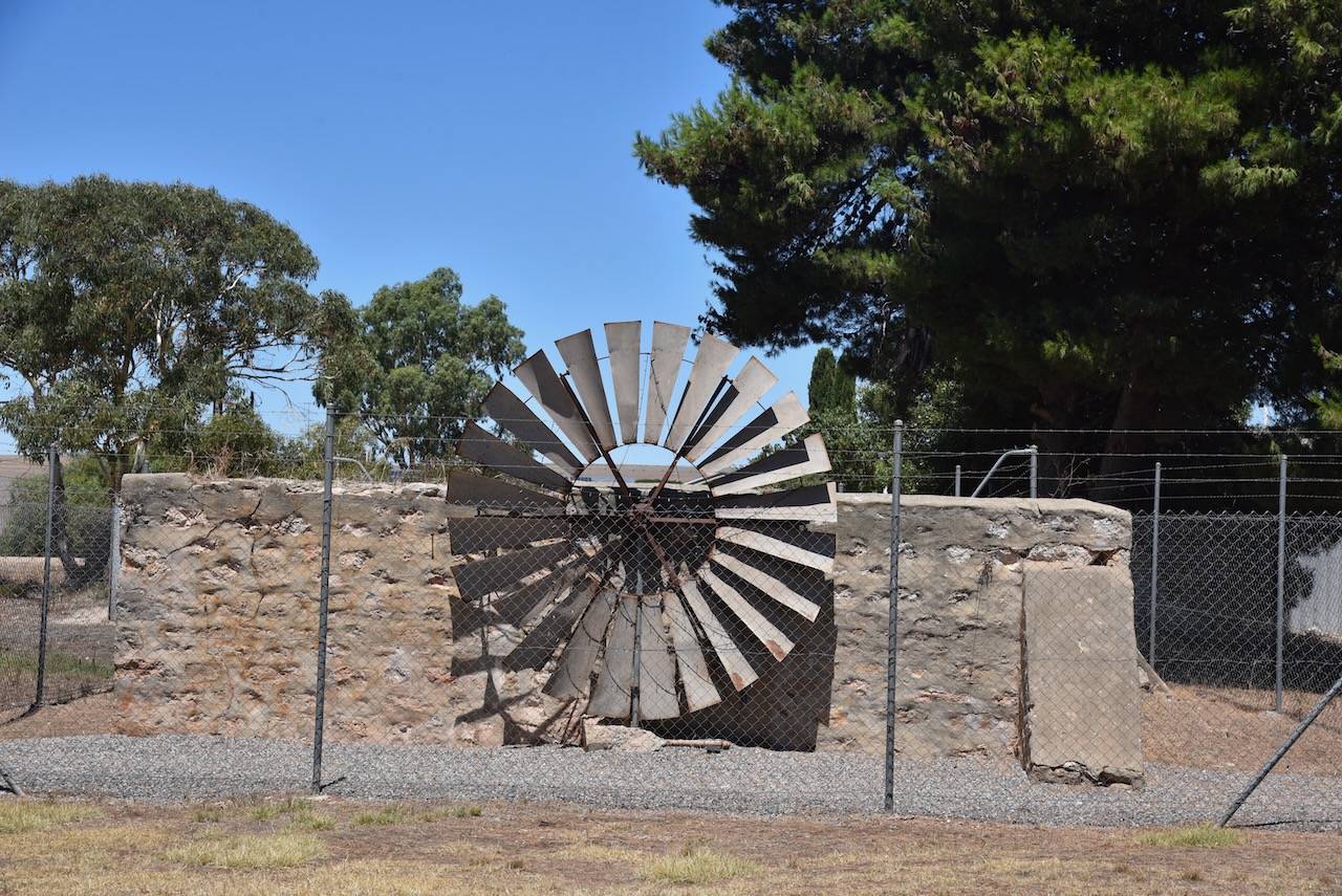
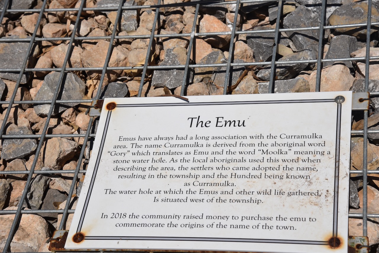
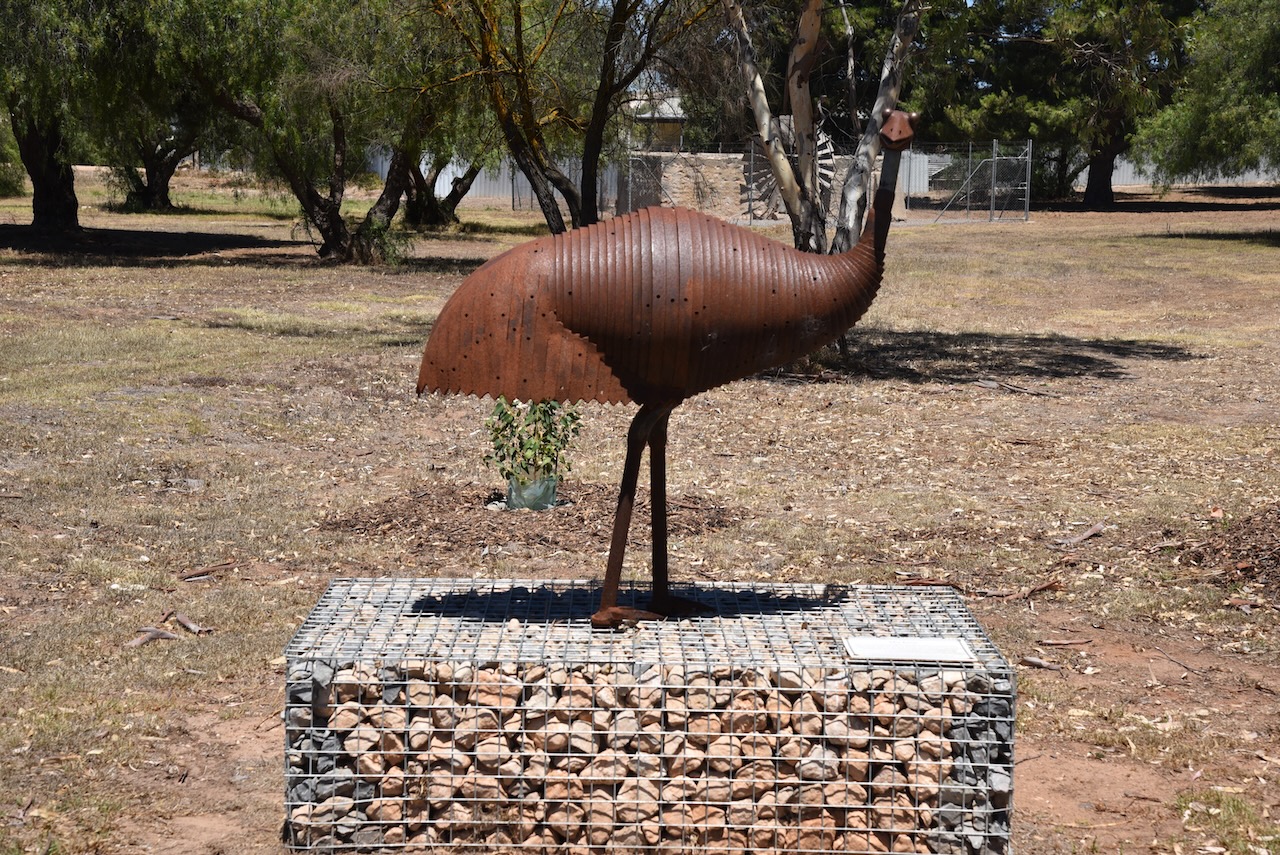
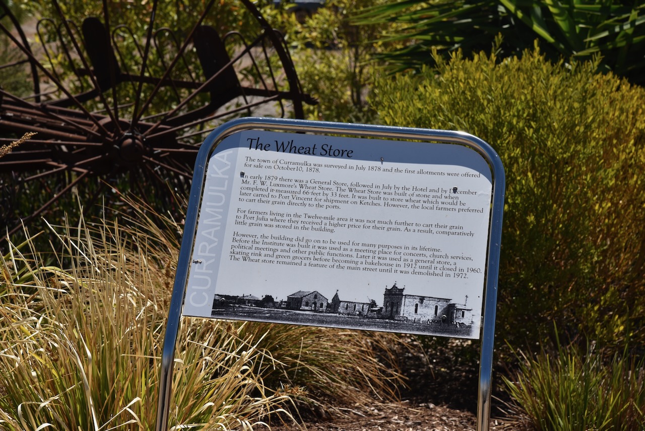
We left the Ramsay Way Conservation Park and drove north to the little town of Curramulka, one of the oldest towns on the Yorke Peninsula. The name Curramulkaka is derived from the Aboriginal word ‘curre’ meaning emu and ‘mulka’ meaning deep water. Emus drank in the area and this resulted in the name.
Close to Curramulka is an extensive chain of limestone caves that were first explored in 1850. A significant number of major extensions were discovered in 1984.
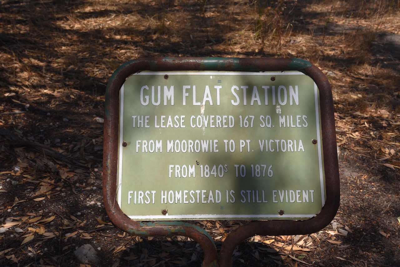
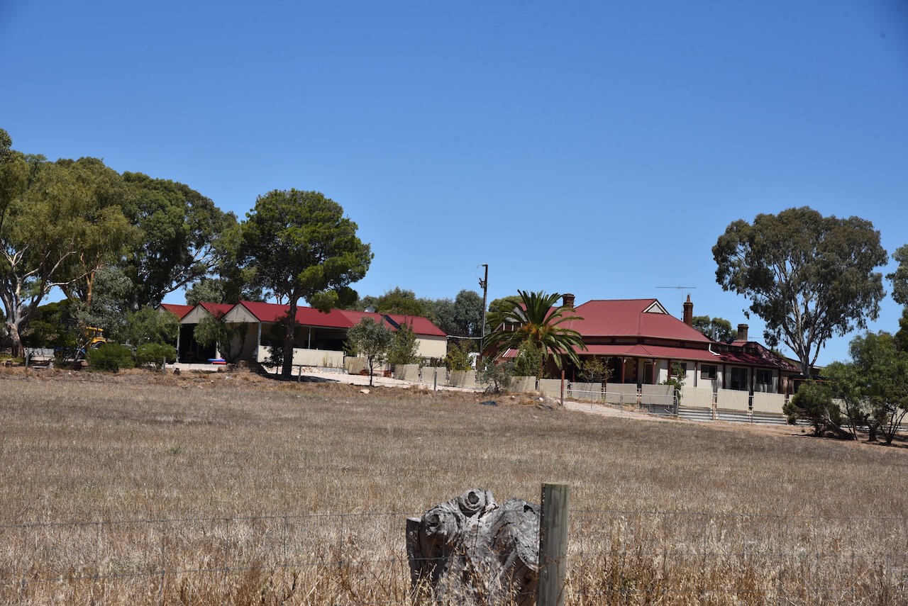
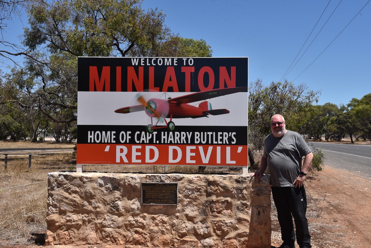
We then drove south on the Yorke Highway and into the town of Minlaton. The name is derived from the first syllable of Minlacowie and the Middle English word ton, meaning ‘town’. Land in the Minlaton area was first taken up by Thomas Giles in 1847 at ‘Gum Flat’, sometimes referred to as ‘Mount Rat’.
On the 3rd day of December 1874, J.W. Jones, surveyor, reported to the Surveyor-General:
‘Knowing the ground to be high enough and the almost certainty of finding fresh water on every allotment, I think the site suggested by Mr Cadet Surveyor Elder is as good, if not the best that could be found…’
The site was approved, and was surveyed by Giles Edward Strangways (b. 1819. d. 1906), and was proclaimed on the 15th day of June 1876.
Above:- Giles E. Strangways. Image c/o Wikipedia.
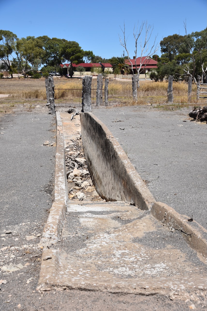
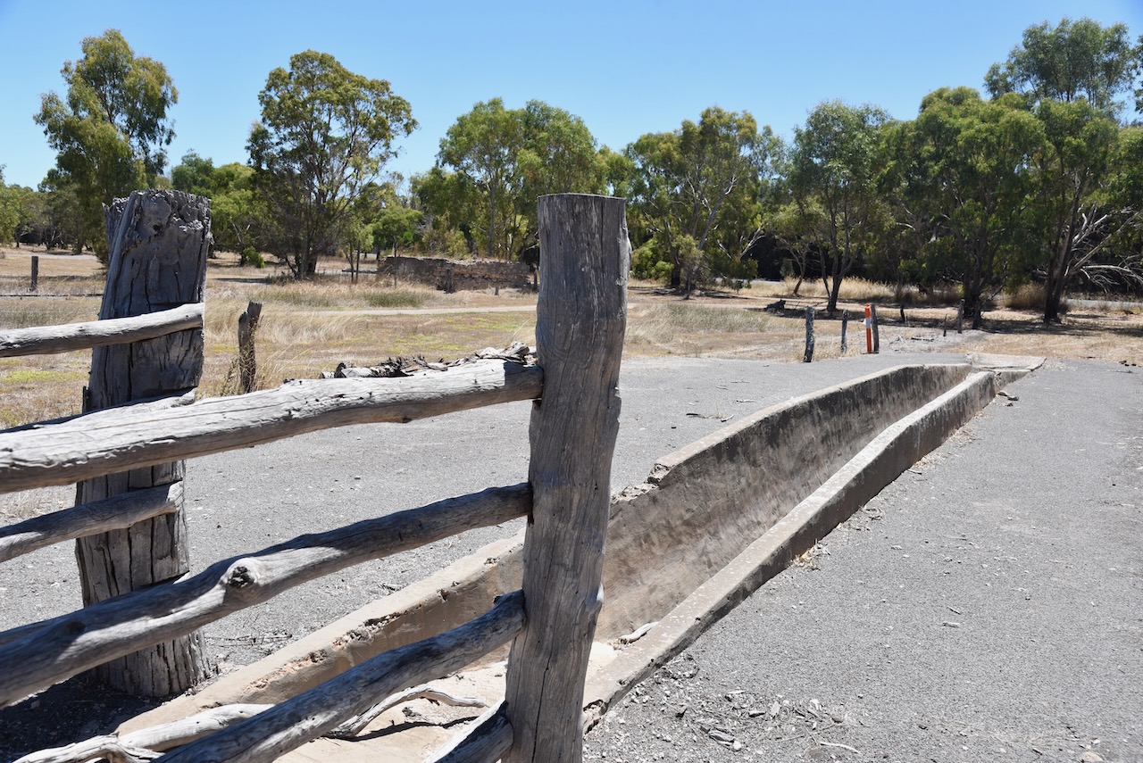
The old Gum Flat Station and a historic horse dip can be found on the outskirts of Minlaton.
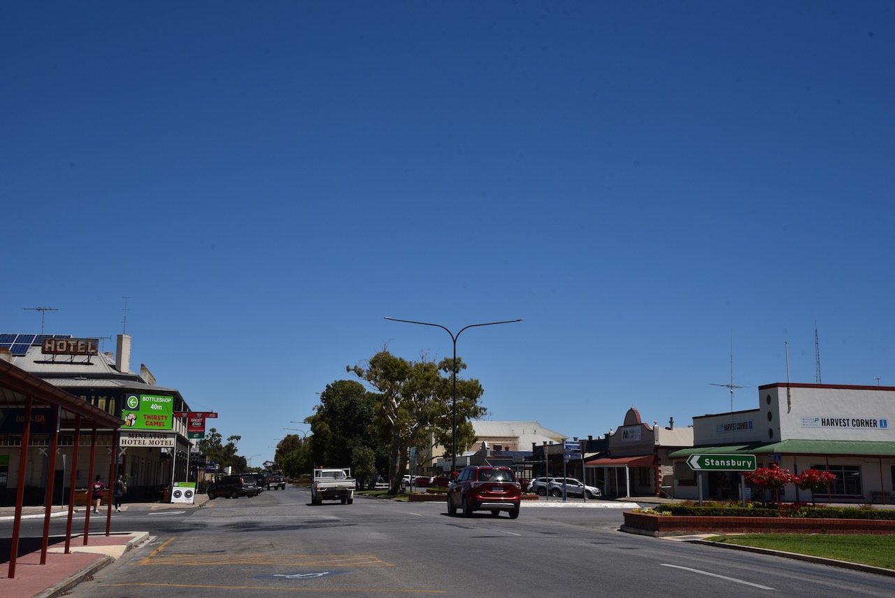
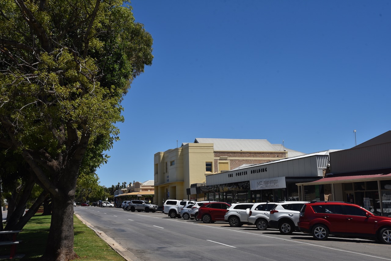
We stopped to get something to eat and a cup of coffee at Minlaton.
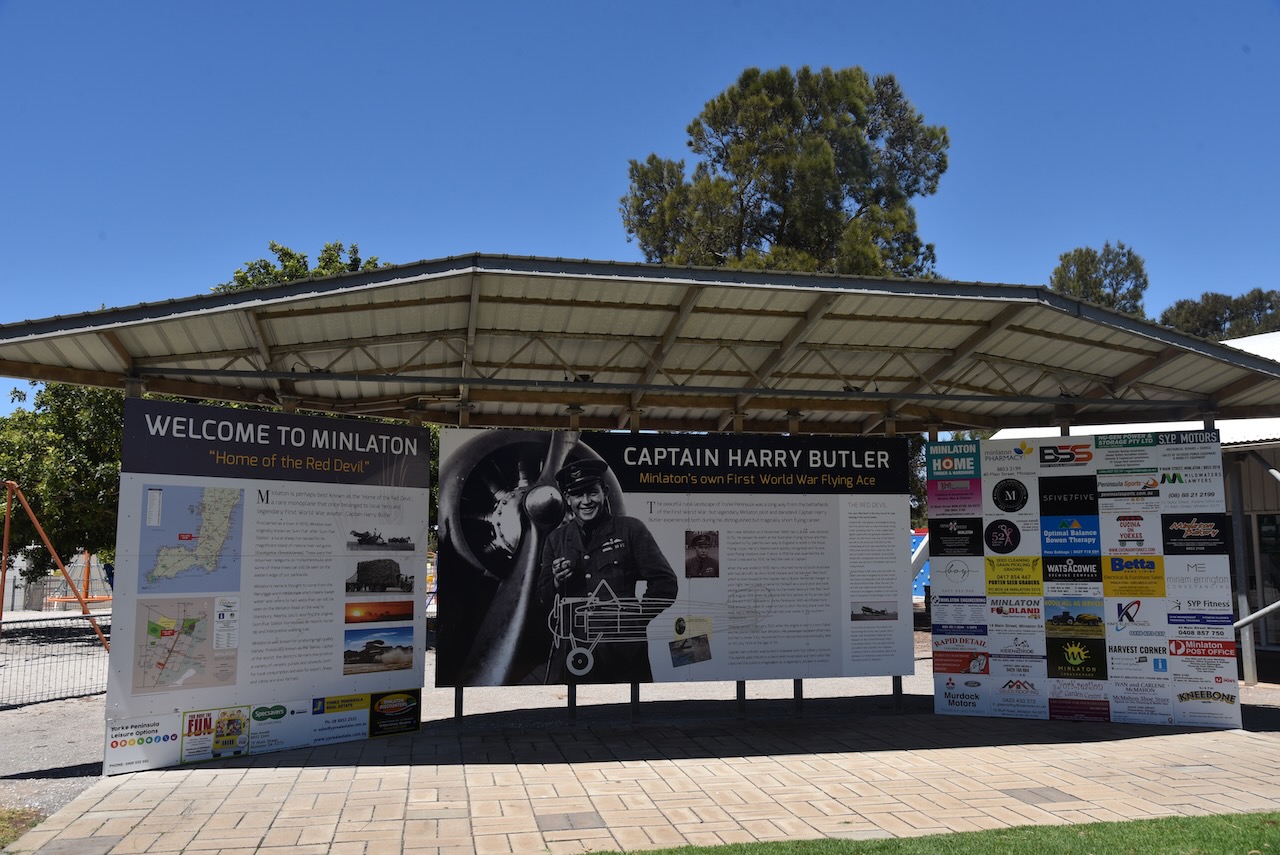
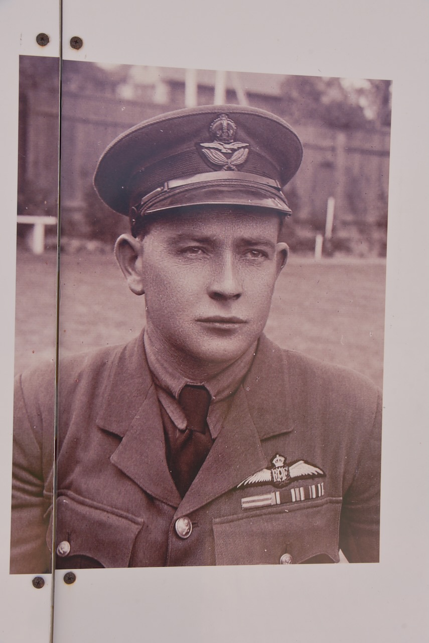
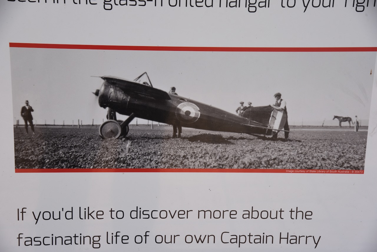
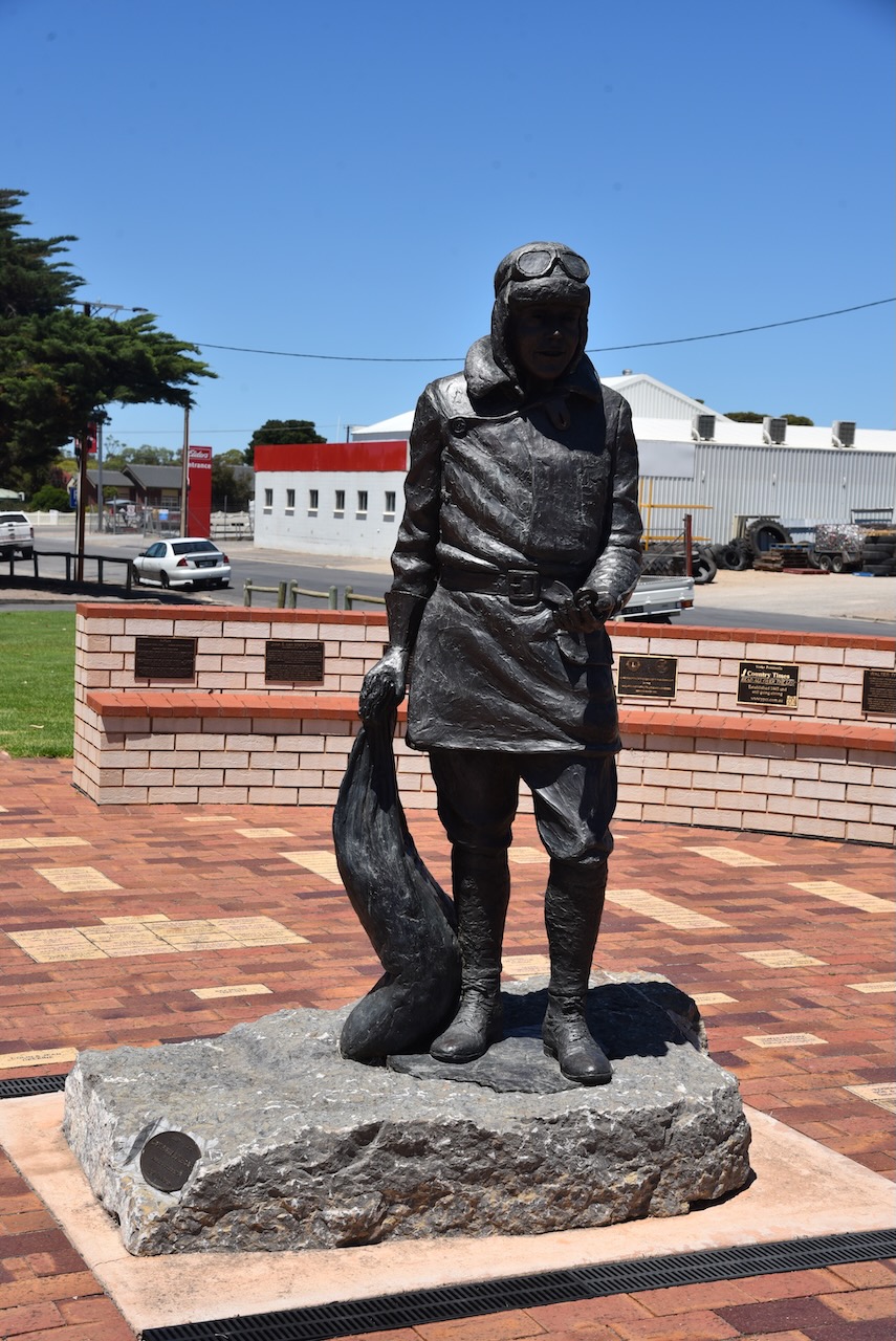
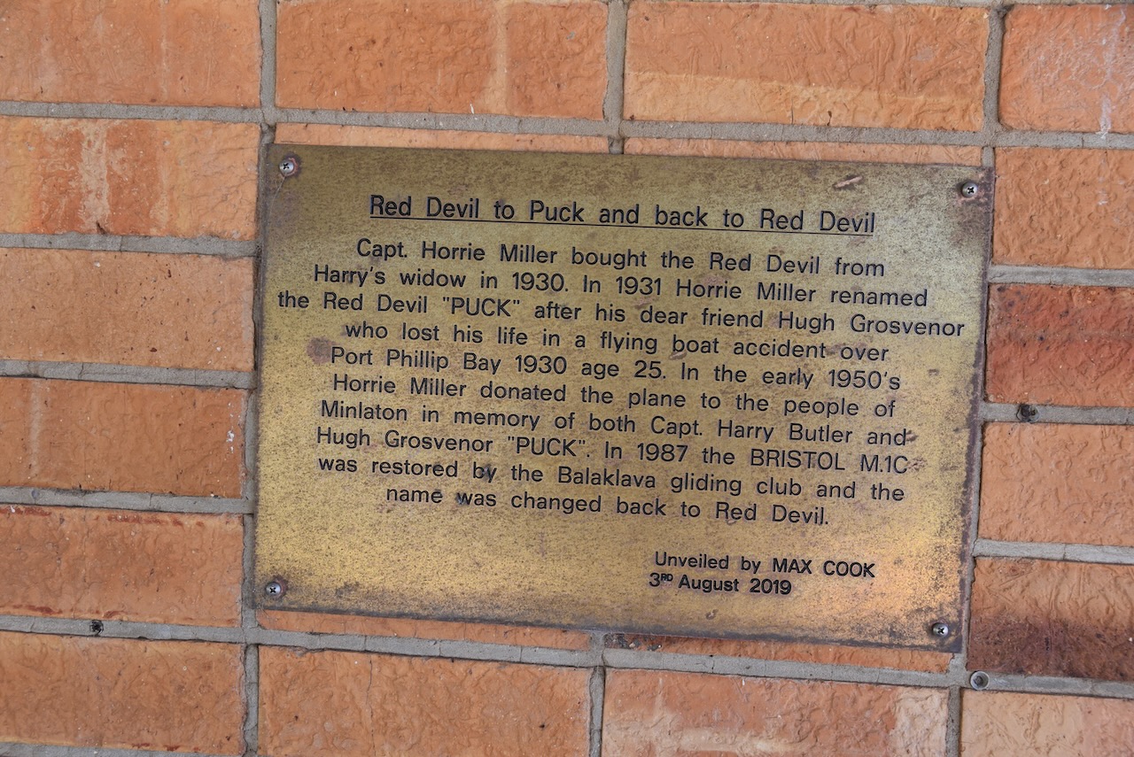
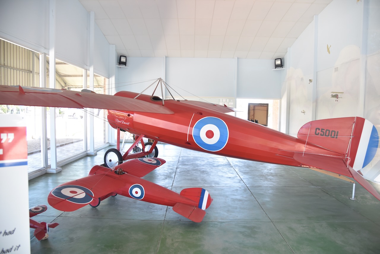
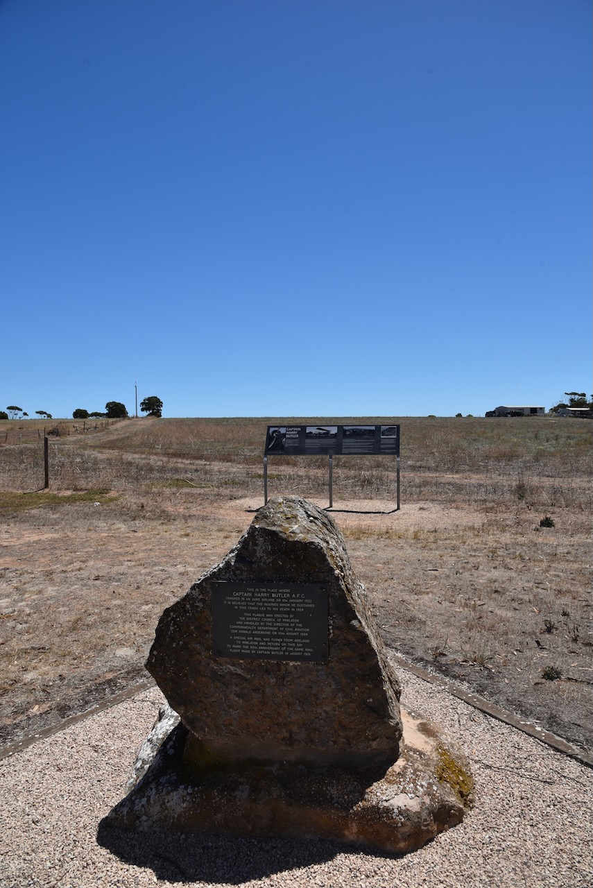
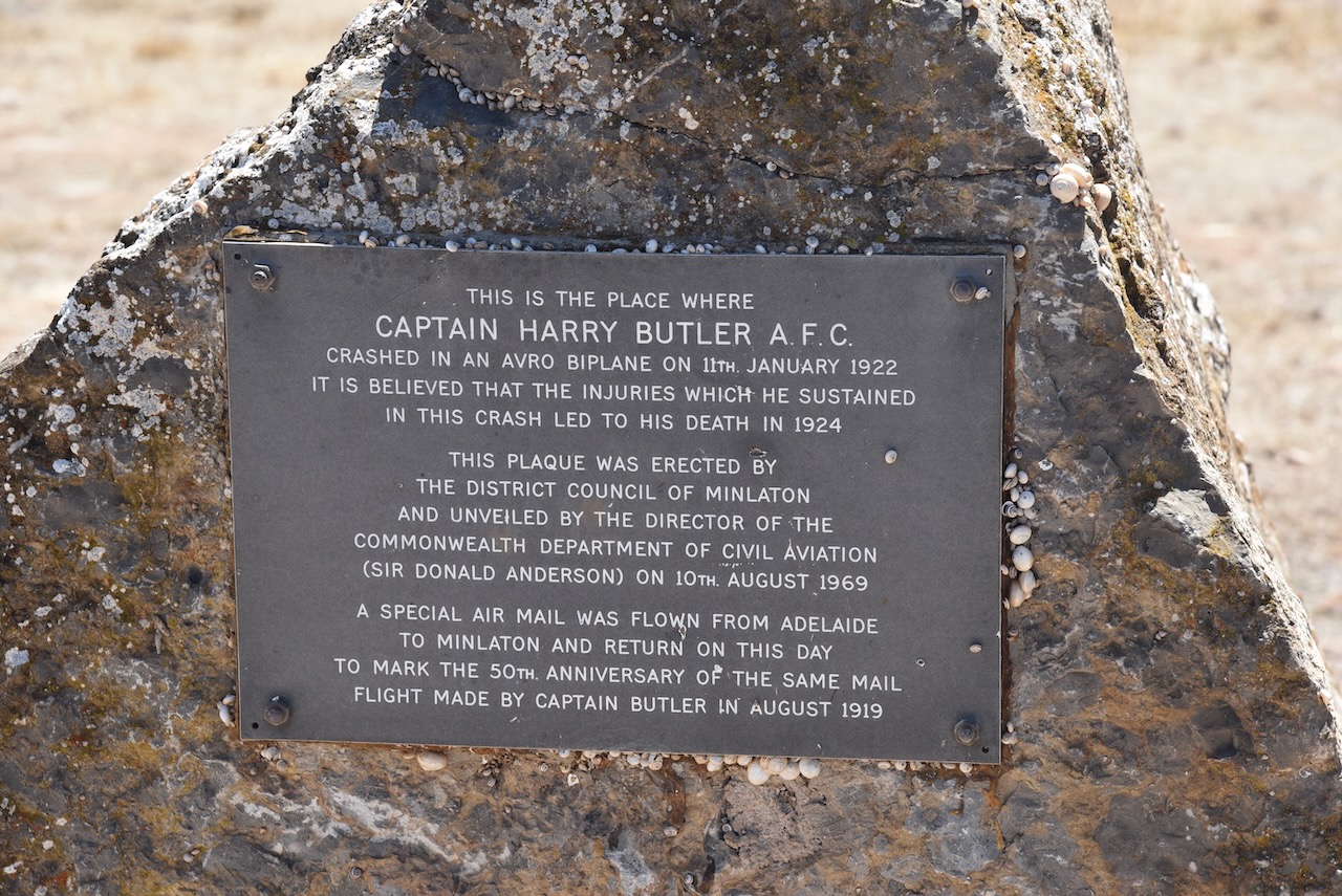
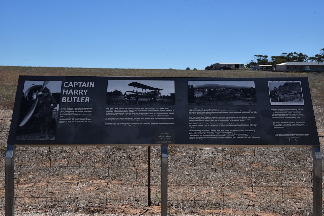
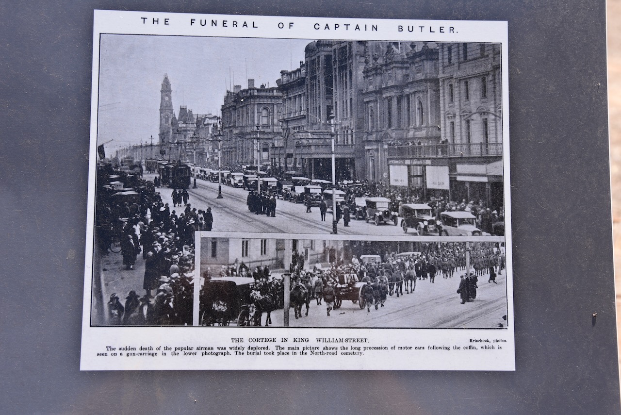
Minlaton is famous for Captain Harry Butler and his ‘Red Devil’ aircraft.
Henry John ‘Harry’ Butler (b. 1889. d. 1924) was a pioneer Australian aviator, and Captain and Chief Fight Instructor in the Royal Flying Corps during World War I. On the 6th day of August 1919, he flew an air mail run from Adelaide across Gulf St Vincent to Minlaton. This was the first over-water flight in the Southern Hemisphere carrying air mail and the first flight over a major body of water in the southern hemisphere.
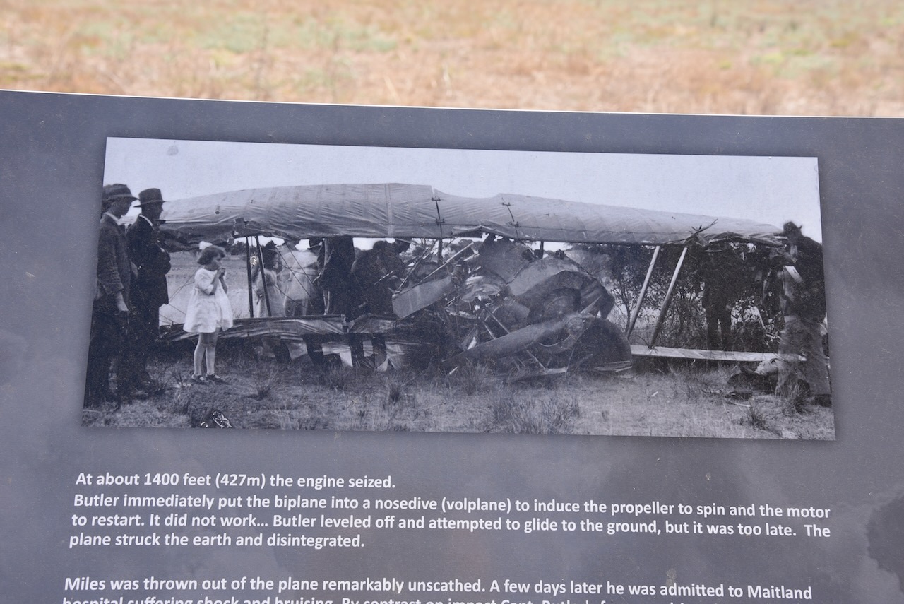
On the 11th day of January 1922, Harry Butler was seriously injured following the crash of his Avro biplane near Minlaton. Sadly, Butler died on the 30th day of July 1924 of an unexpected cerebral abscess which was believed to be related to the 1922 crash. On the outskirts of Minlaton, there is a memorial at the crash site.
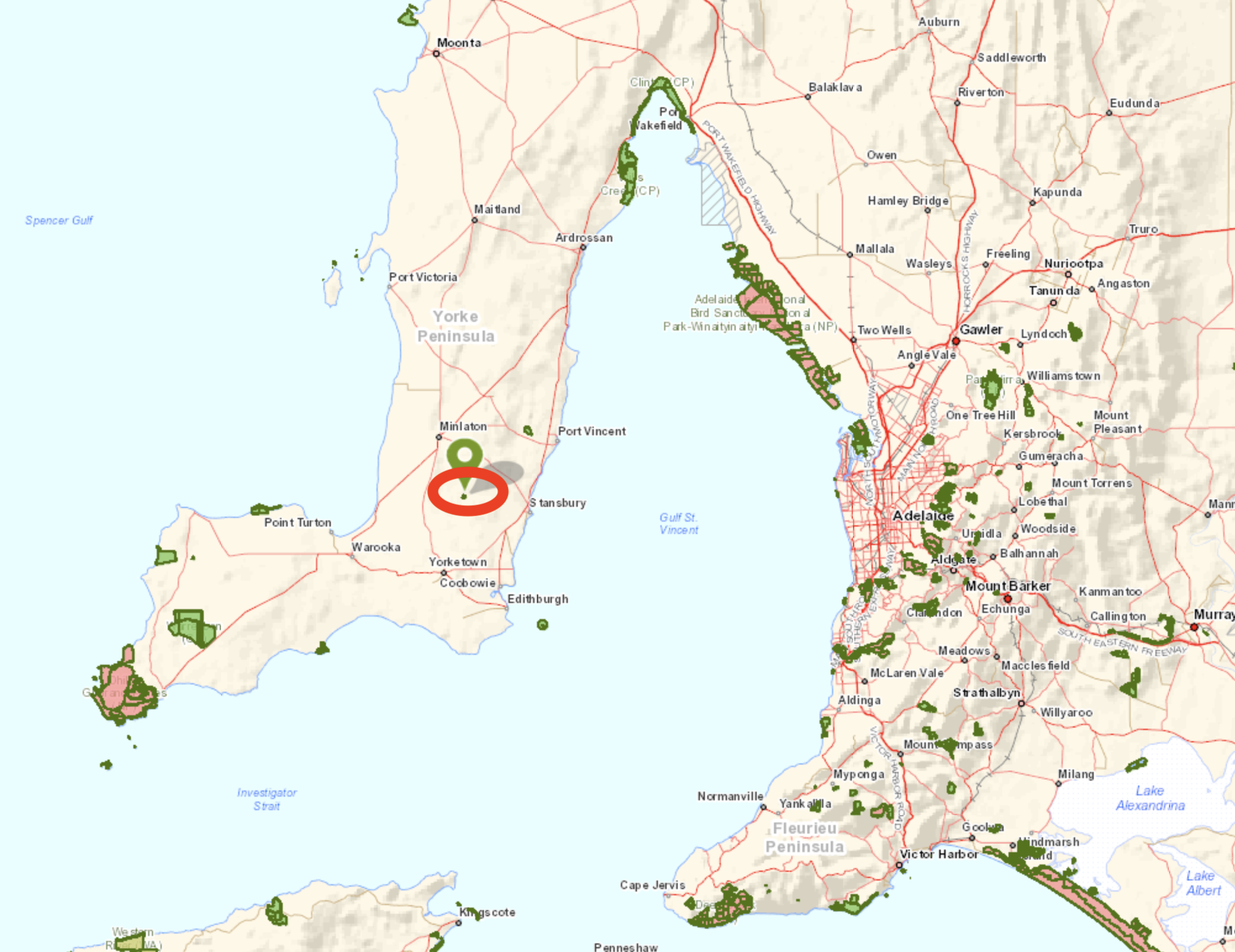
We left Minlaton and drove to our final park activation, the Minlacowie Conservation Park VKFF-0909. The park is about 20 km (by road) to the west of the town of Stansbury.
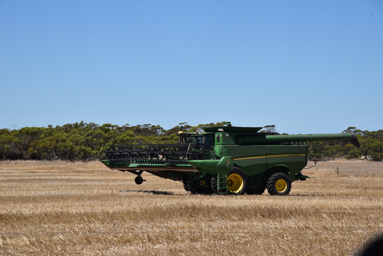
We took Cutline Road off Harry Butler Road and headed towards the park. This is wheat growing country and there were a number of farmers active in their paddocks.
Minlacowie is aboriginal for ‘two waters’. It is derived from either minala meaning ‘two’ and kawi meaning ‘water’ or minla-kawi meaning ‘freshwater well’.
On the 26th day of March 1874 the Hundred of Minlacowie, County of Fergusson, was proclaimed. On the 23rd day of November 1874, E.J. Elder, whilst surveying the area, reported to the Surveyor-General that he had selected ‘the best site and the nearest to good fresh water for the proposed new town of Gum Flat.’
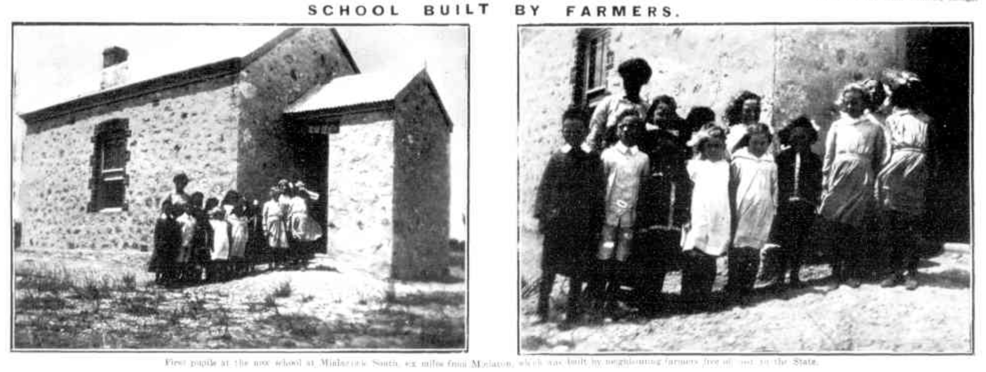
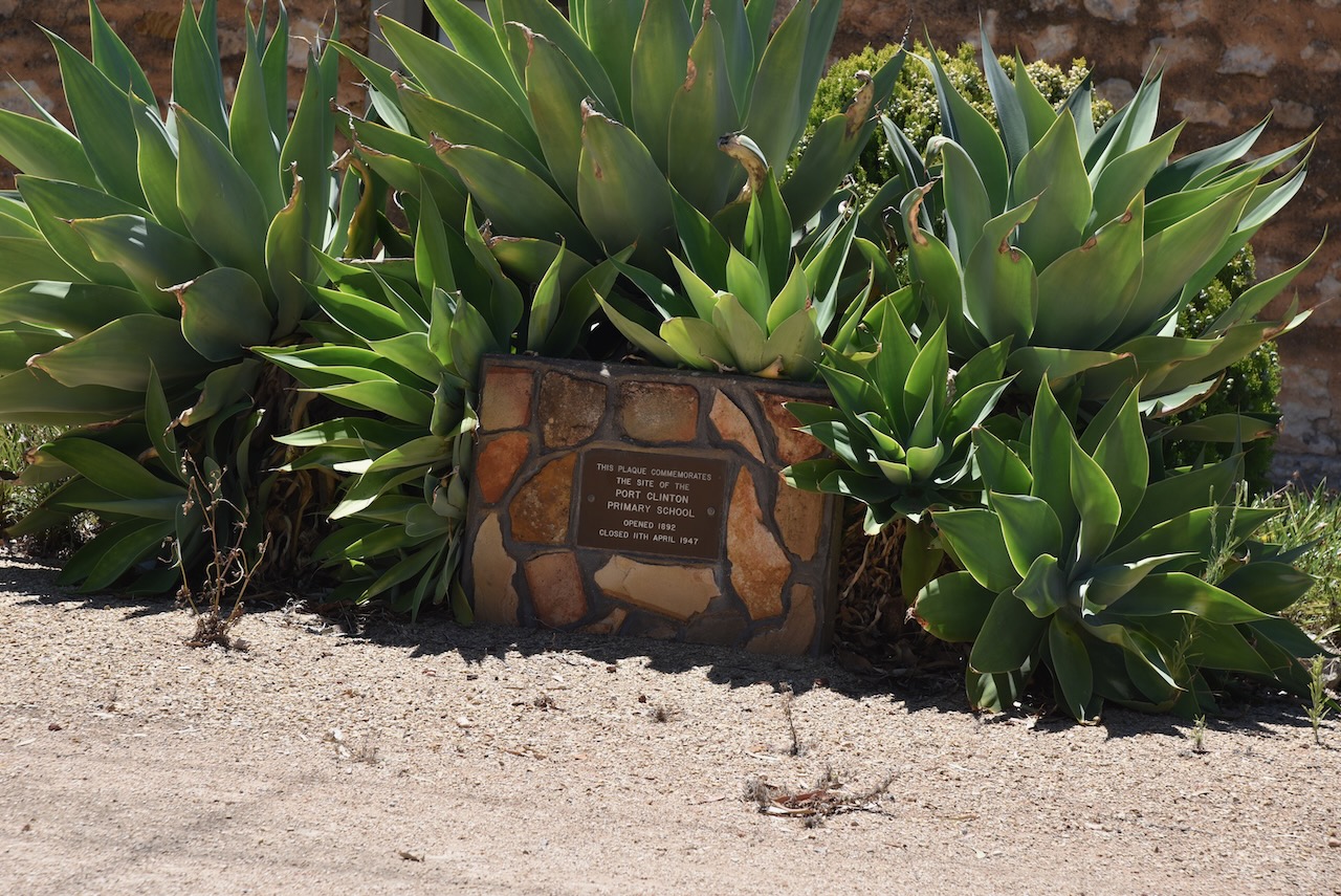
In 1875 the Minlacowie Post office opened. The Minlacowie School opened in 1877 and in 1922 it was renamed ‘Rocky Beach’. The Minlacowie South School was built by local farmers and was opened in 1901 and closed in 1941.
Above:- Article from the Observer, Sat 15 Feb 1913. Article c/o Trove.
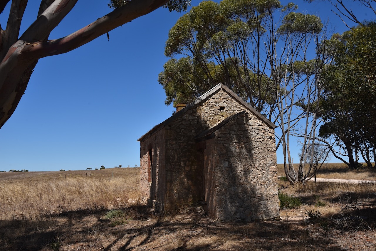
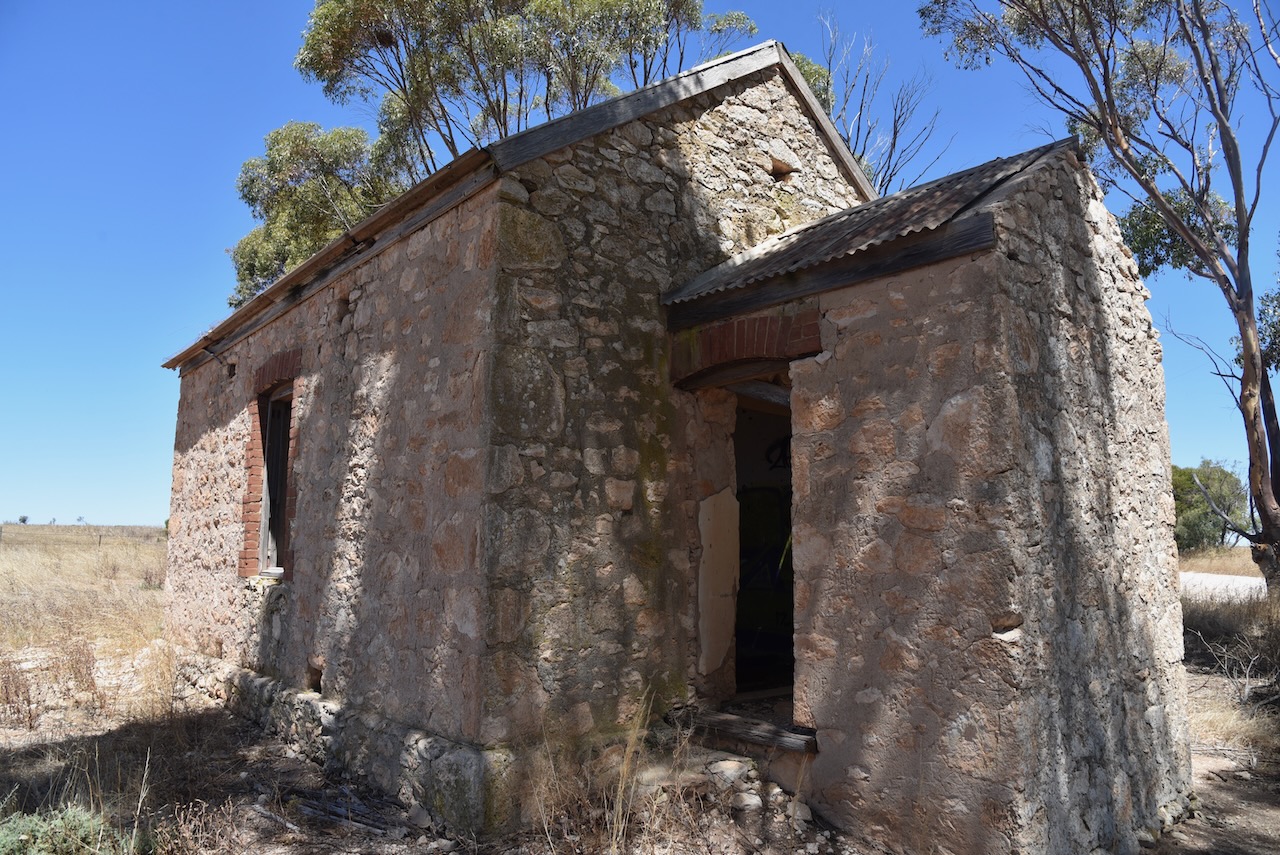
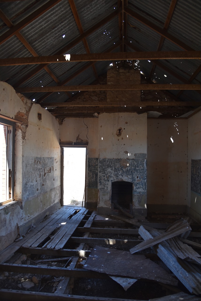
The ruins of the Minlacowie South School can be found at the crossroads of Harry Butler Road, Jacka Road, Rogers Road, and Bublacowie Road is the old Minlacowie school. Sadly it is neglected and in a state of disrepair.
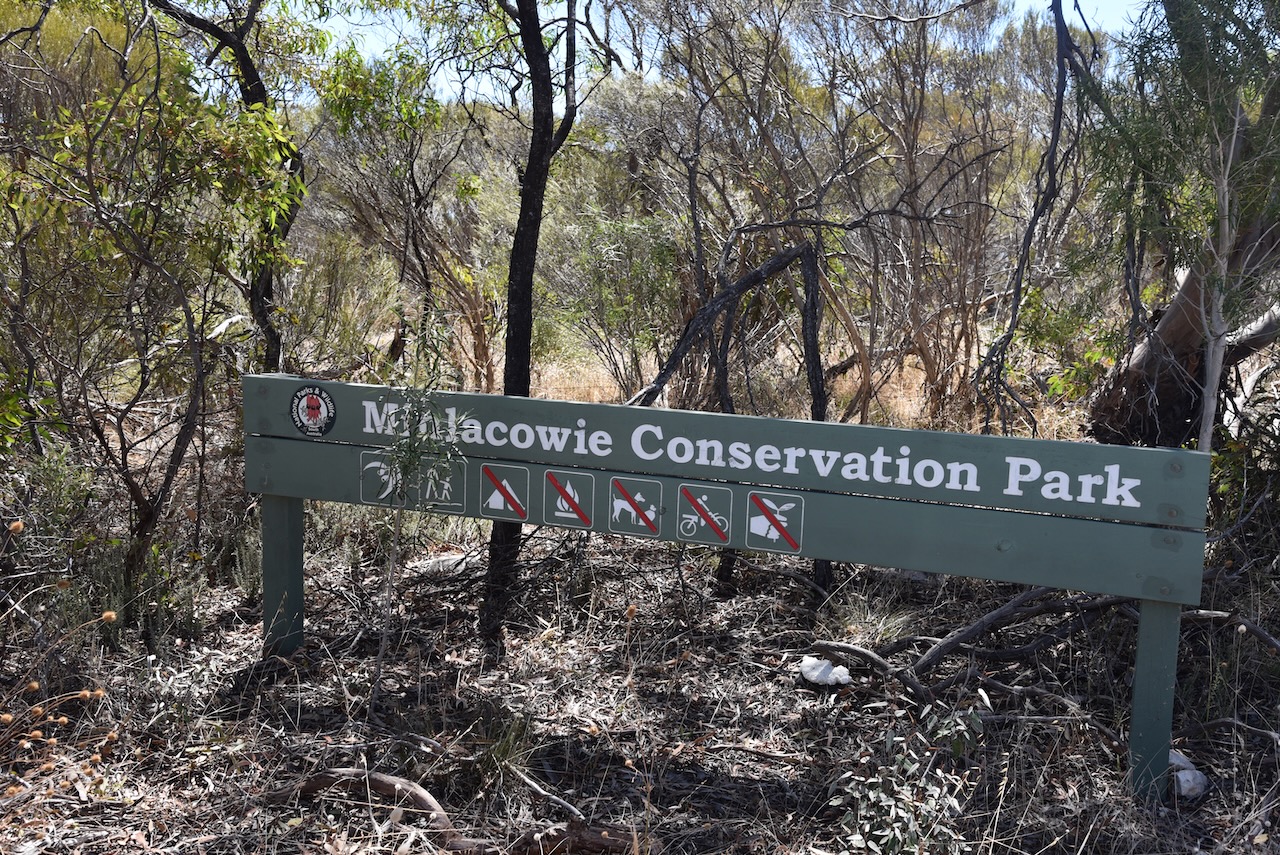
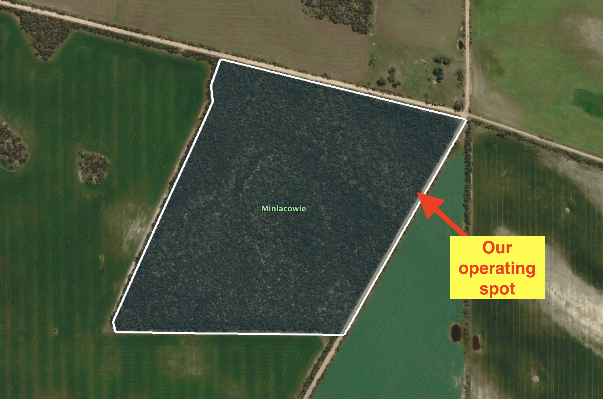
The Minlacowie Conservation Park is about 28 hectares in size and is located on the southwestern corner of Rogers Road and Savage Hut Road. It was gazetted on the 14 the day of February 2008.
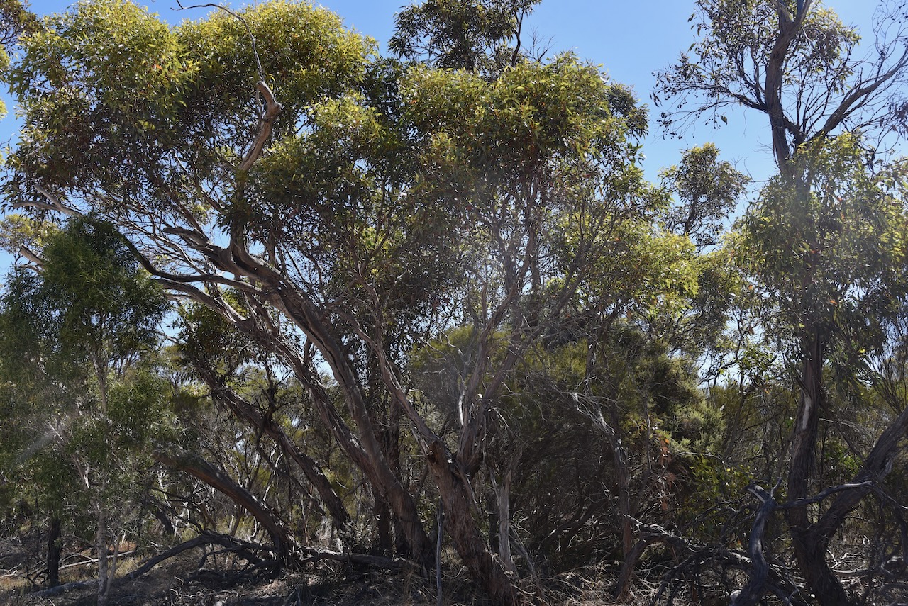
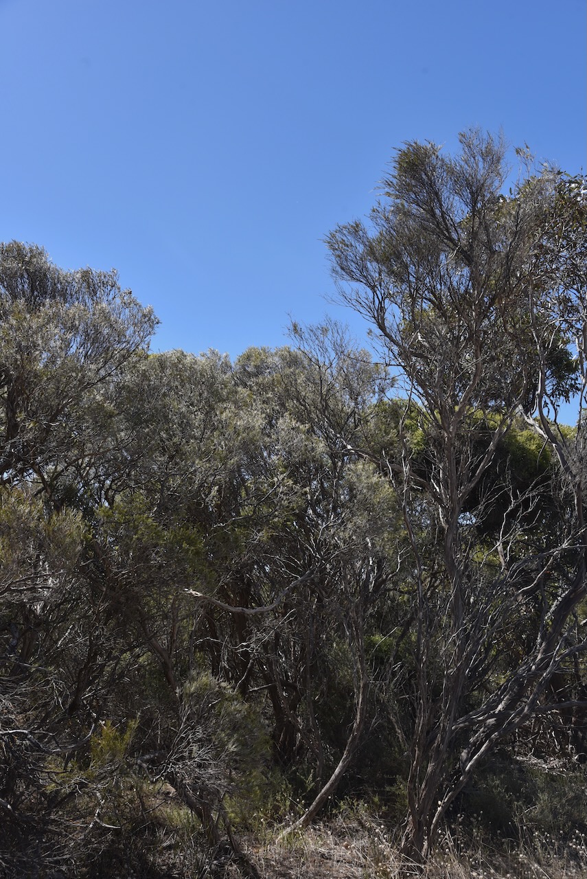
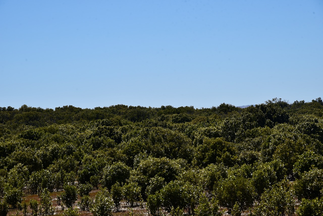
The park consists of a small piece of remnant mallee/broombush vegetation and conserves a number of significant plant species including the nationally and state-vulnerable Winter Spider orchid.
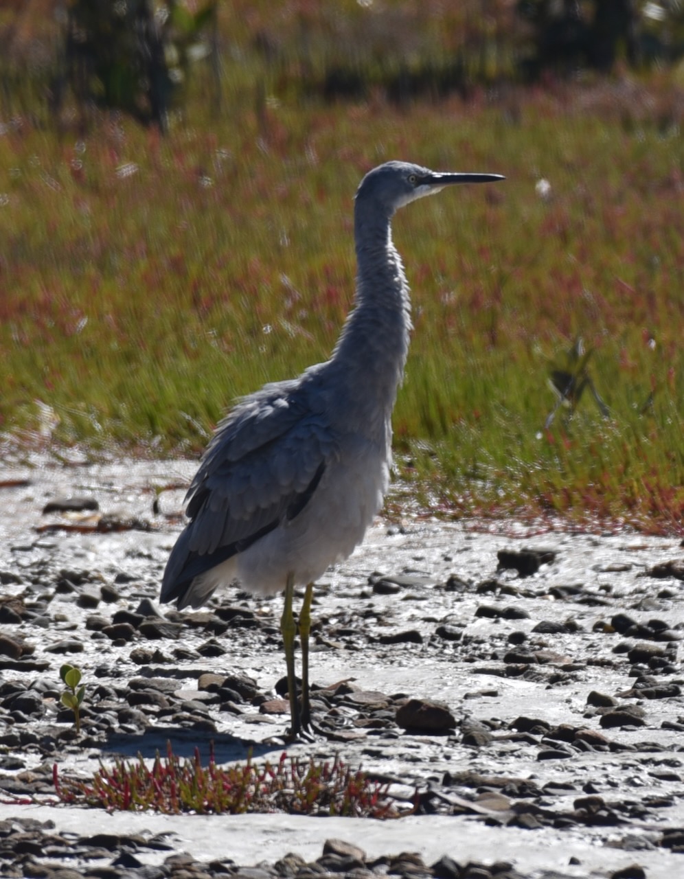
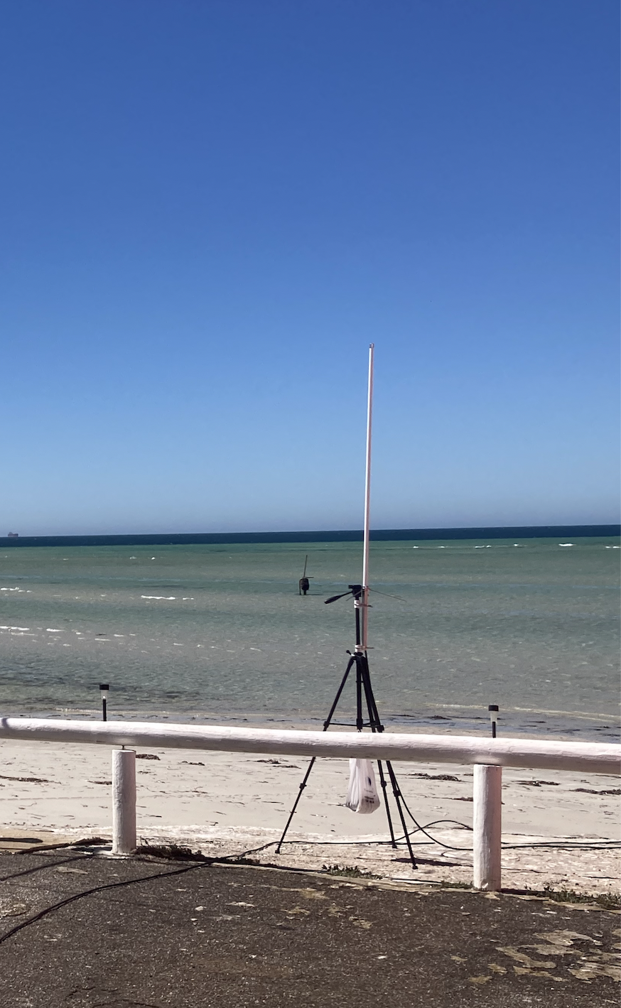
There are no walking trails and no 4WD tracks in this park. The scrub is also very thick. So we had no option but to pull into a small clearing in the scrub on Savage Hut Road and operate from the 4WD. We ran the Icom IC-7000, 100 watts, and the Codan antenna mounted on the rear of the 4WD
Above:- An aerial view of the park showing our operating spot.
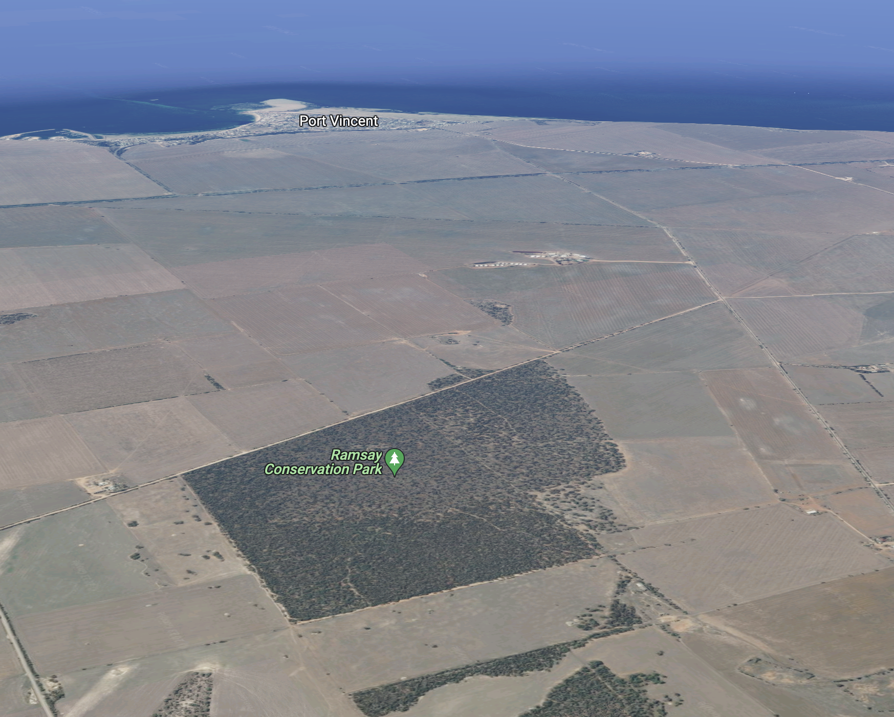
After leaving Port Vincent, Marija and I headed to the Ramsay Way Conservation Park VKFF-0815. I have previously activated this park.
Above:- Map showing the location of the Ramsay Way CP. Map c/o Google maps.
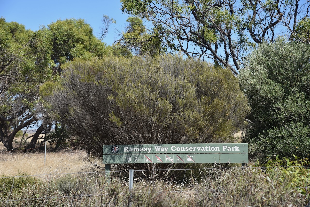
The Ramsay Way Conservation Park (often just referred to as Ramsay Conservation Park) is about 147 hectares in size. It is located on the western side of Power Line Road, about 7 km west of the town of Port Vincent.
Above:- An aerial view of the Ramsay Way CP looking west towards Port Vincent. Image c/o google maps.
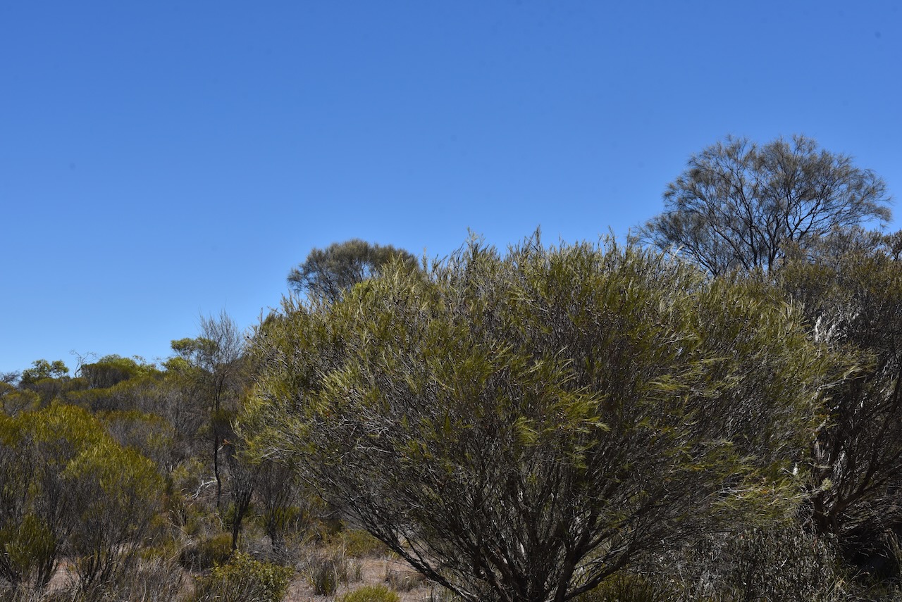
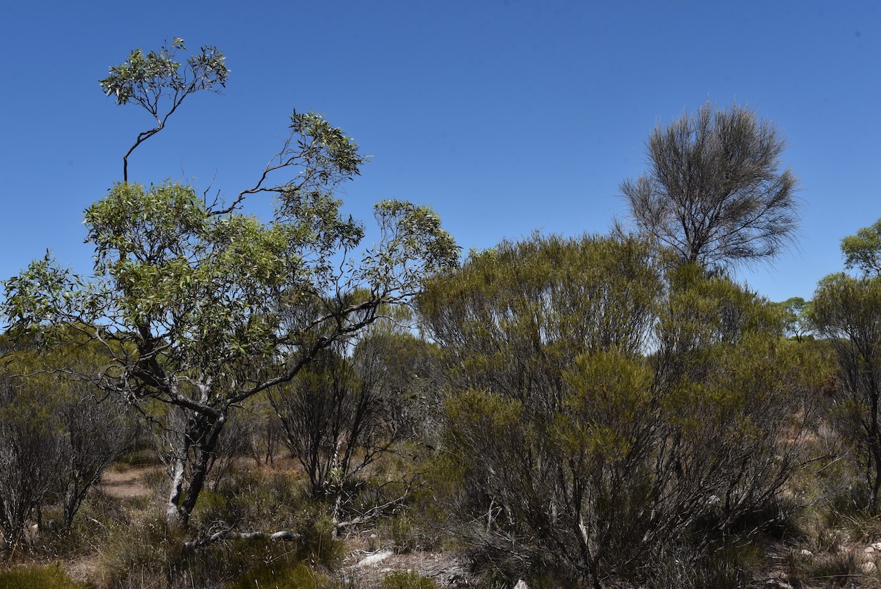
The park was proclaimed on the 14th day of February 2008 and is located in the Minlaton Curramulka Threatened Habitat Area. The primary vegetation in the park is sheoak and mallee, with very low woodlands and a grassy understorey. The nationally and State endangered Jumping-Jack Wattle can be found in the park. This plant is not located in any other park on the Yorke Peninsula.
eBird has recorded a total of 60 species of bird in the park including Common Bronzewing, Yellow-plumed honeyeater, Striated Pardalote, and Wedge-tailed eagle.
Marija and I found an unlocked gate on Power Line Road and we drove a short distance into the park as there were no defined tracks. We operated from the vehicle running the Icom IC-7000, 100 watts, and the Codan 9350 antenna mounted on the rear of the 4WD. Despite the power lines running along the aptly named Power Line Road, we had no noise.
Unfortunately, I fell 4 contacts short of the 44 required to qualify the park for the global World Wide Flora Fauna Program.
Marija worked the following stations on 4m SSB:-
VK5TRM
VK5IS
VK5FANA
VK5BJE
VK5GY
VK3PF
VK5WRJ
VK2YK
VK5GA
VK5FR/m
I worked the following stations on 40m SSB:-
VK5TRM
VK5IS
VK5FANA
VK5BJE
VK5GY
VK3PF
VK5WRJ
VK2YK
VK5GA
VK5FR/m
Vk3TBR
I worked the following stations on 20m SSB:-
VK4TJ
VK4HAT
VK1AO
VK2MET
VK2IO
VK3SQ
I worked the following stations on 15m SSB:-
VK1AO
VK2MET
VK4TJ
VK8DNT
VK2NP
VK3PF
VKL2LEE
VK3UH
VK2VW
Vk2HFI
VK2IO
I worked the following stations on 10m SSB:-
VK4TJ
VK2IO
VK1AO
VK2MET
VK2FADV
VK2LEE
VK2NP
VK5KHZ
VK5LA/m
VK5HS/m
VK5ZSA
VK5KVA
References.
Department for Environment and Heritage, 2009, Mainland Conservation Parks of Yorke Peninsula
It was now Monday 6th February 2023, and Marija had planned some sightseeing and some park and silo activations during the day.
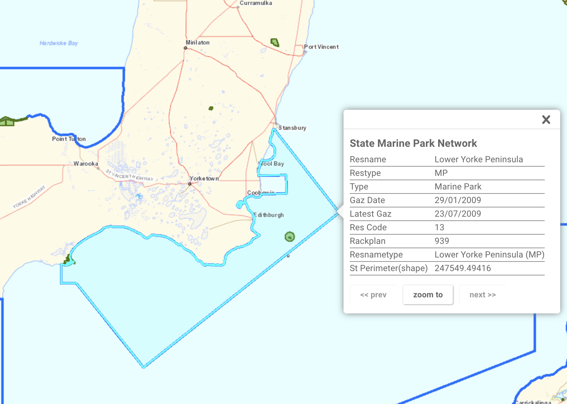
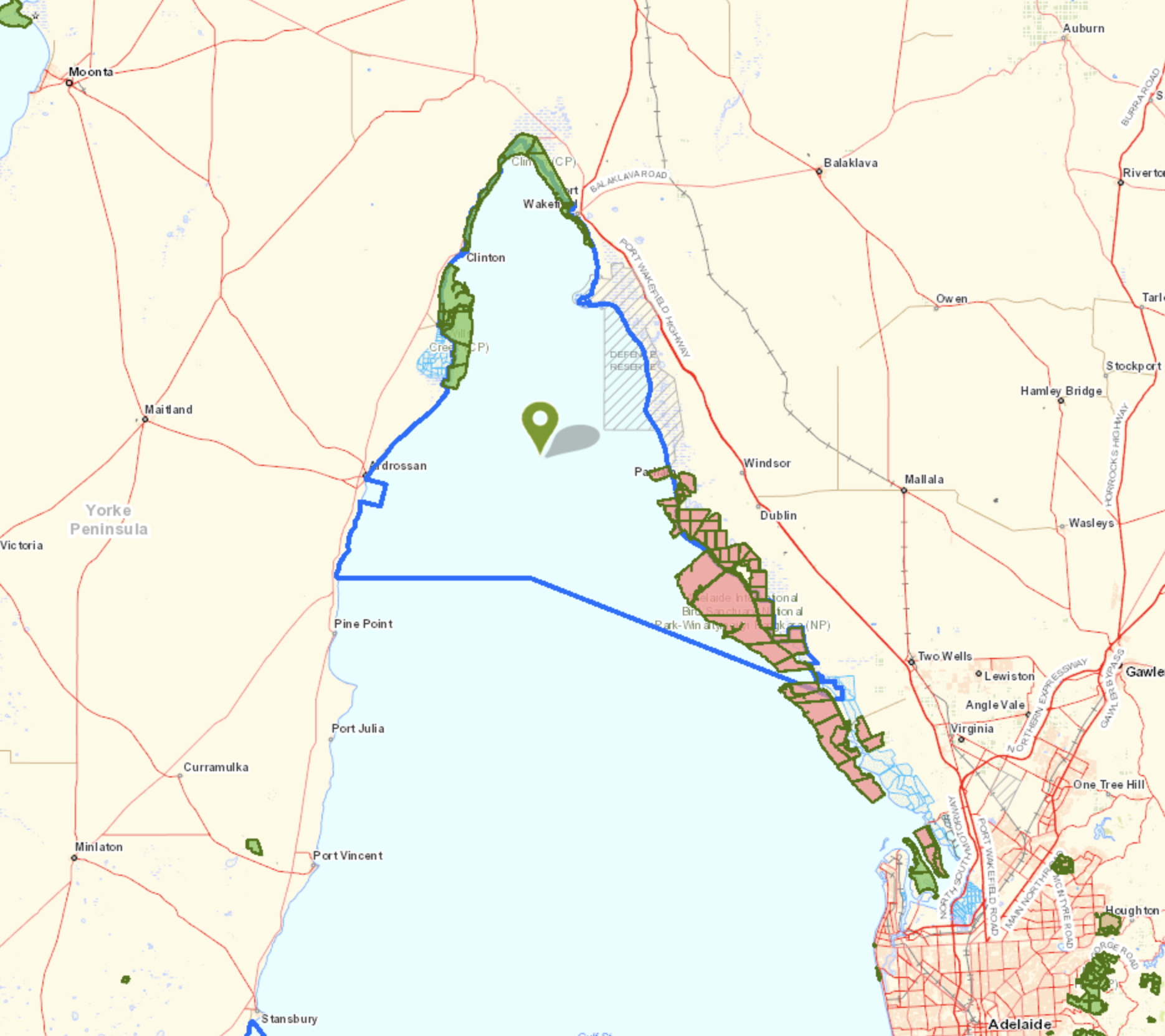
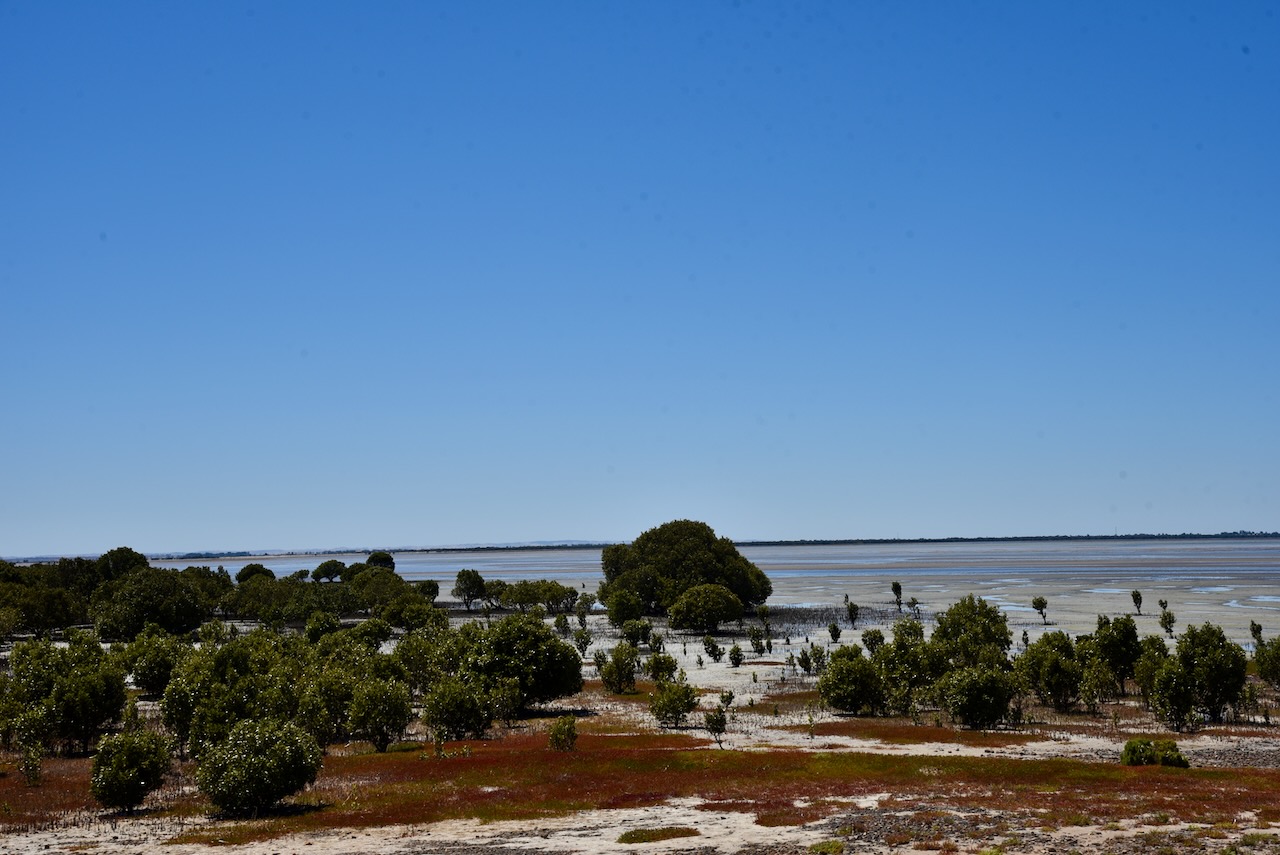
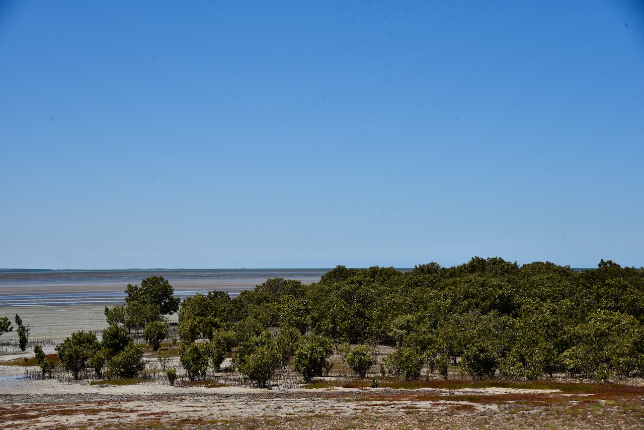
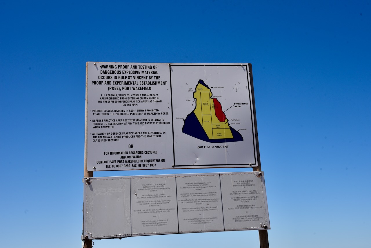
After breakfast, we headed to our first activation of the day, the Lower Yorke Peninsula Marine Park VKFF-1726.
Above:- Map of the Yorke Peninsula, showing the location of the Marine Park. Map c/o Google maps.
The park stretches from just south of Stansbury around the heel of the Yorke Peninsula to the Point Davenport Conservation Park. The park includes Troubridge Island Conservation Park and the surrounding shoals. It excludes an area around Klein Point and also Port Giles. The park covers an area of about 850 km2.
Above:- Map of the Lower Yorke Peninsula MP. Image c/o Location SA Map Viewer.
The Marine Park contains the only two estuaries where freshwater meets the open ocean on the Yorke Peninsula: Salt Creek and the nationally-listed wetland, Point Davenport. Both of these areas provide nursery areas for numerous fish species including King George Whiting and Yellow-eyed mullet.
The Marine Park’s coastline consists of sandy beaches and sections of cliff, and rocky coast.
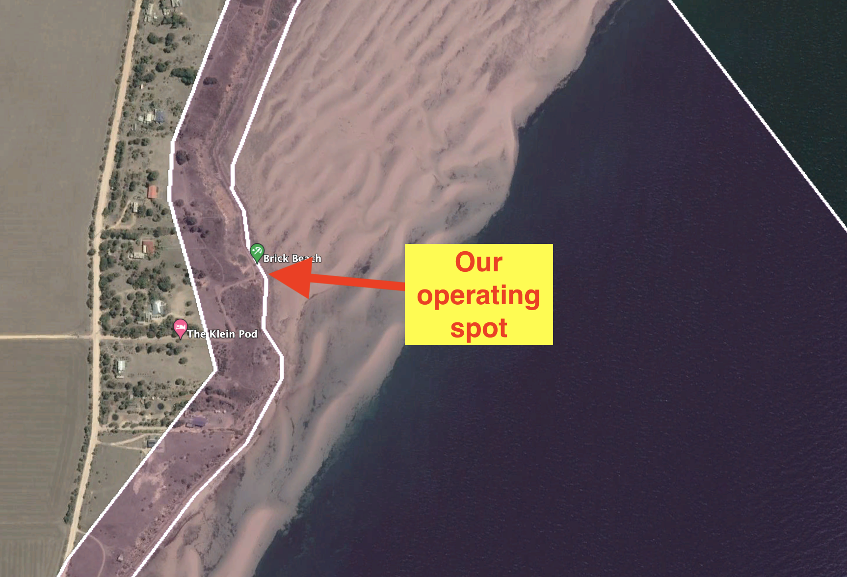
Marija and I drove to Brick Beach, off Klein Point Road. We operated from the 4WD for this activation, running the Icom IC-7000, 100 watts, and the Codan 930 antenna mounted on the rear of the 4WD.
After packing up we headed north to Port Vincent. Marija had been told not to miss the donoughts at the Port Vincent Cafe.
On the way, we stopped to have a look at the old Continuos shaft kiln on the side of the Yorke Highway. If you did not know what this was, you would just drive straight passed it. The kiln was lined with firebricks and commenced operations in 1963. The kiln was capable of burning lime to almost any quality.
Port Vincent is a beautiful little town and is very popular with holidaymakers.
Port Vincent takes its name from the ‘Port Vincent Special Survey’ of 1839. In 1839, the Adelaide Survey Association organized the surveying of two towns on the Yorke Peninsula: Port Vincent and Port Victoria. Unfortunately, neither survey resulted in any land being taken up. Numerous large sheep runs were subsequently established including Gum Flat Station operated by George Anstey and Thomas Giles, and Stephen Goldsworthy’s run which ran from Black Point to Port Vincent Bay.
The point on which Port Vincent stands was originally known as Surveyors Point. The town was named by the South Australian Government Auctioneer Robert Cock (b. 1801 d. 1871).
Above:- Robert Cock. Image c/o Wikipedia.
It was a beautiful sunny and warm afternoon and there was lots of activity on the water, including sailing and kayaking.
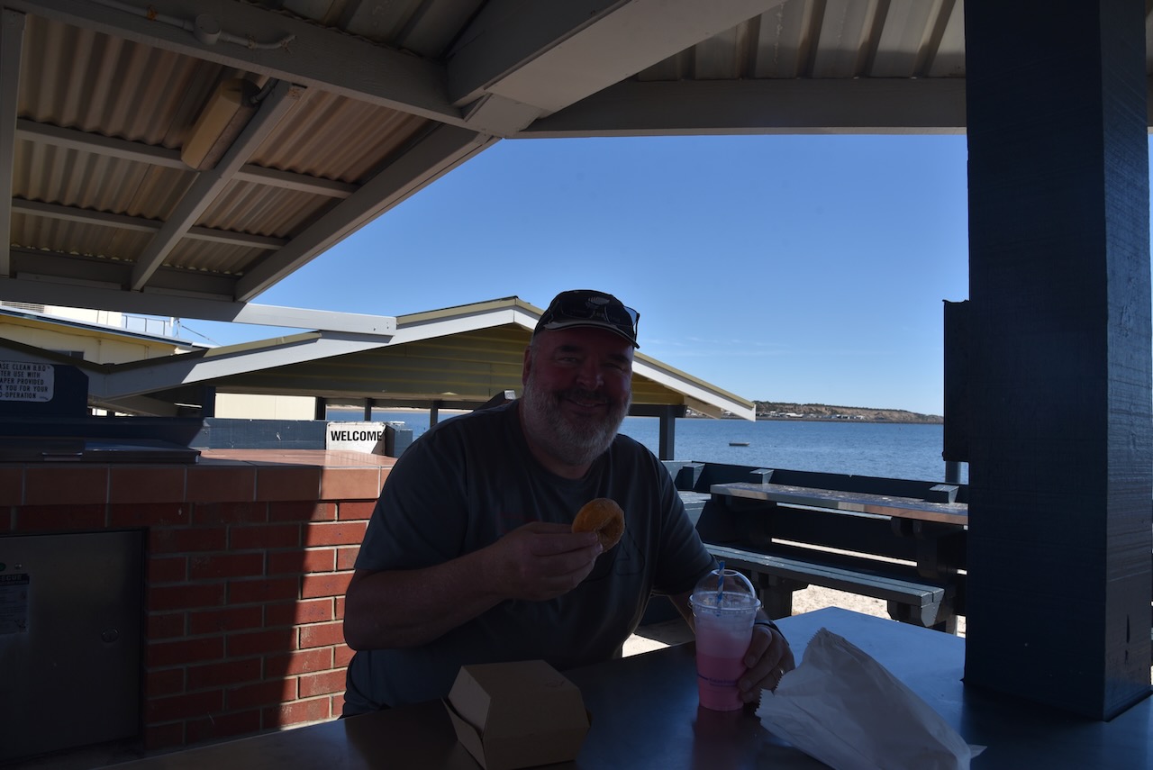
The Port Vincent Kiosk lived us to its reputation. I had a steak sandwich and some donoughts and a milkshake. It was all absolutely delicious.
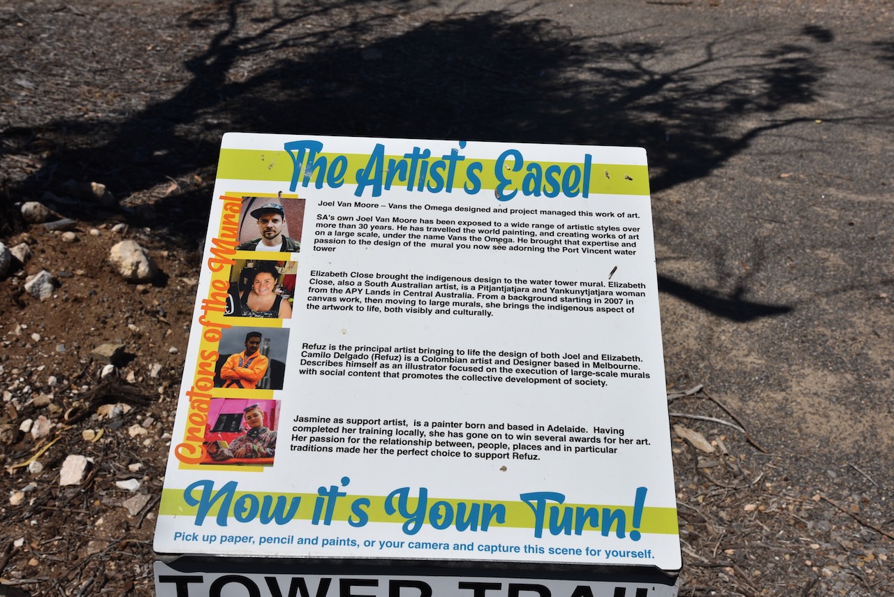
We then headed out to the Port Vincent silo which is part of the Southern Yorke Peninsula Water Tower Mural Trail. The old water tower was painted by Camilo Delgardo & Jasmine Crisp. It took them about 300 litres of paint and was completed on the 17th day of May 2021. The mural includes sailing boats, snapper, and a fisherperson.
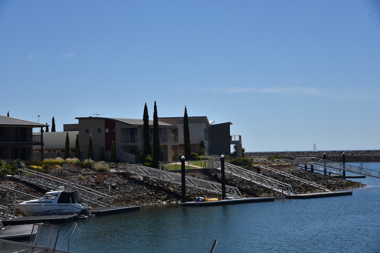
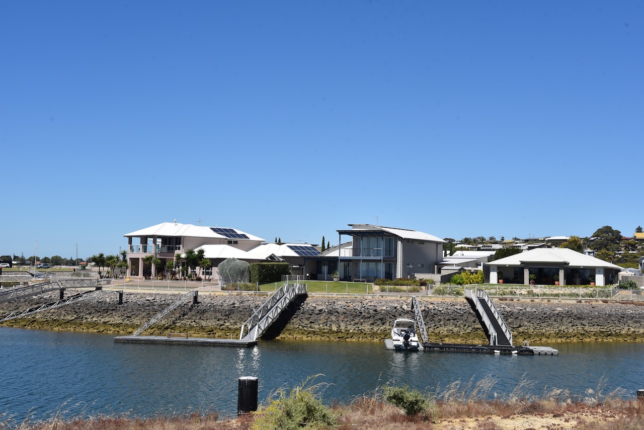
We then drove out to the Port Vincent Marina and new housing development to admire some of the very large houses.
Marija and I drove a short distance from Ardrossan to our next park activation of the day (5th February 2023), the Upper Gulf St Vincent Marine Park VKFF-1755.
As the name suggests, the park encompasses the upper section of Gulf St Vincent. On the eastern side of the gulf, the park commences from near Middle Beach and then across to the south of Ardrossan.
Above:- Map showing the location of the Upper Gulf St Vincent Marine Park. Map c/o Location SA Map Viewer.
The Upper Gulf St Vincent Marine Park features wetlands that are of national importance. This includes the Light River DElta which is considered one of the most ecologically-intact mangrove and saltmarsh systems in South Australia. The park overlays Wills Creek Conservation Park and Clinton Conservation Park. The port of Ardrossan is excluded from the park.
Gulf St Vincent was named Gulph of St Vincent by explorer Matthew Flinders on the 30th day of March 1802. The gulf was named in honour of Admiral John Jervis, 1st Earl of St Vincent who was victorious in a naval battle off Cape St Vincent in Portugal.
On the 8th day of April 1802, following his meeting with Matthew Flinders at Encounter Bay, French explorer Nicholas Baudin mapped the gulf and named it Golfe de la Mauvaise or Golfe de la Misanthrophie. In 1803 he renamed it Golphe Josephine in honour of Josephine Bonaparte.
Above:- John Jervis, 1st Earl of St Vincent. Image c/o Wikipedia.
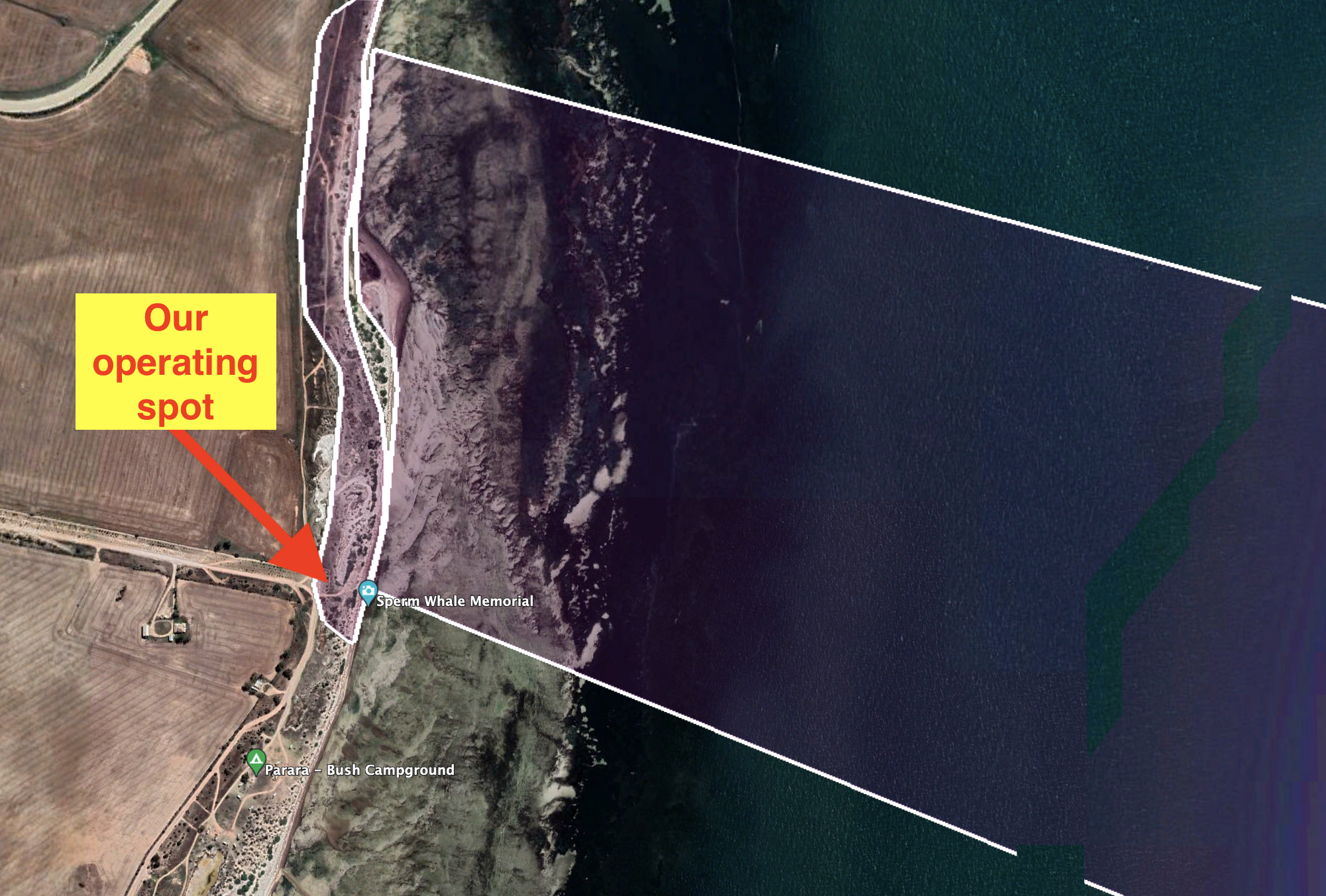
Marija and I set up at the end of Parara Road near the Sperm Whale Memorial. This is at the southernmost point of the park on the western side of the park.
Above:- Aerial view showing our operating spot at the end of Parara Road. Image c/o Google Earth.
We operated from the vehicle for this activation using the Icom IC-7000, 100 watts, and the Codan 930 self tuning antenna.
Marija worked the following stations on 40m SSB:-
VK5WU
VK3VIN
VK4FW
VK8MM
VK2YK
VK5HS
VK3GJG
VK2IO
VK3ZPF
VK3OAK
VK5FANA
I worked the following stations on 40m SSB:-
VK5WU
VK3VIN
VK4FW
VK8MM
VK2YK
VK5HS
VK3GJG
VK2IO
VK3ZPF
VK3OAK
VK5FANA
VK2MOE/m
VK3YAR
VK5MOS
VK3MTT
VK1CHW
VK3CBP
VK2NP
VK7PSJ
VK5YX
VK2EXA
VK2RO
VK3BBB
VK2CCP
VK5NM
VK2LEE
I worked the following stations on 20m SSB:-
VK2IJS
VK3OAK
VK2NP
VK4TJ
VK3ZPF
VK2IO
VK4SMA
VK6NU
VK3JW
VK3SQ
VK3UH
VK3GJG
VK6NTE
ZL3MR
I worked the following stations on 15m SSB:-
VK2NP
VK4SMA
VK1IO
VK1CHW
VK4FDJL
VK4WAB
VK4TJ
JH1OLB
VK4KTW
VK5HS
I worked the following stations on 10m SSB:-
VK4FDJL
VK4WAB
VK4KTW
VK4SMA
VK4TJ
VK4HTE
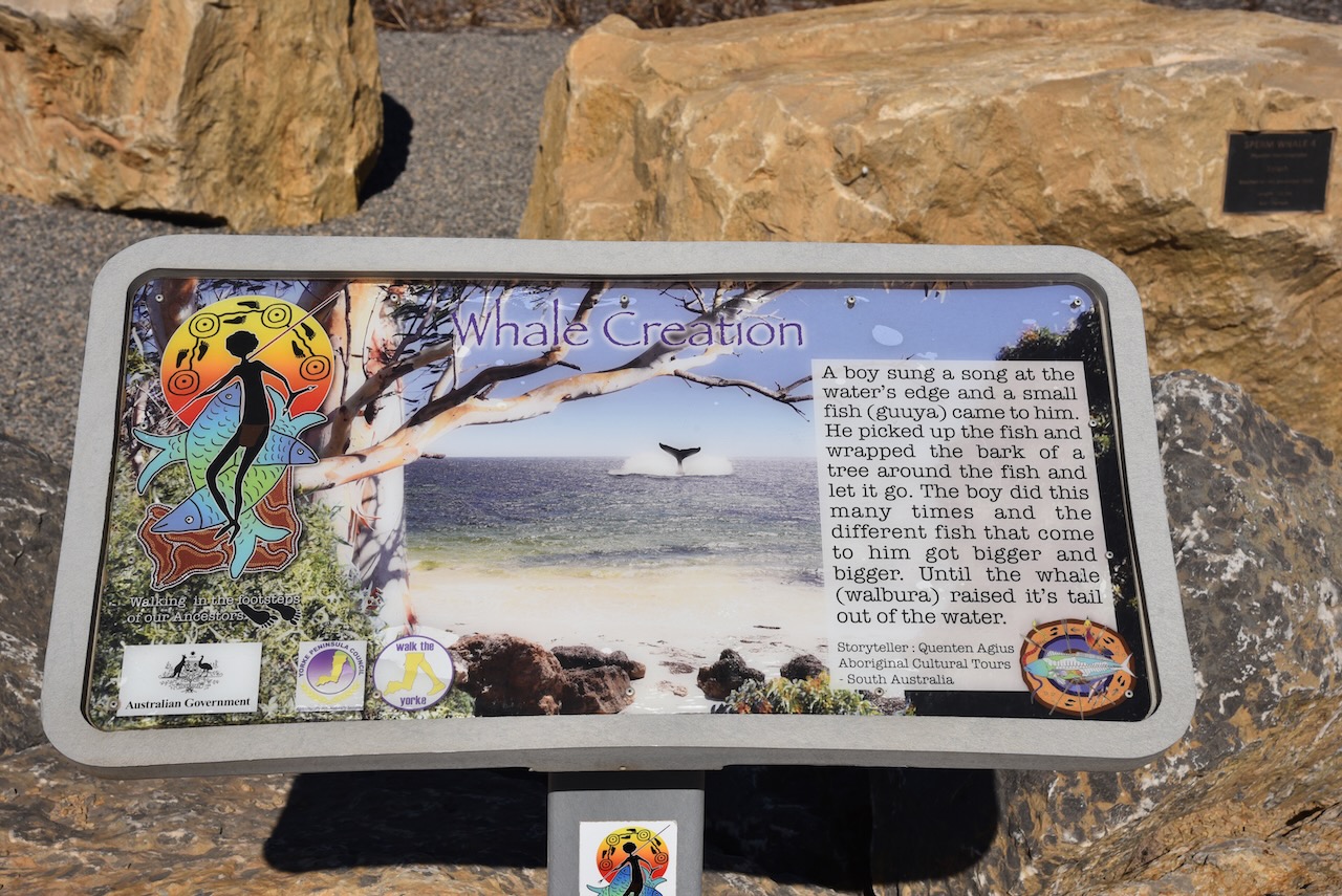
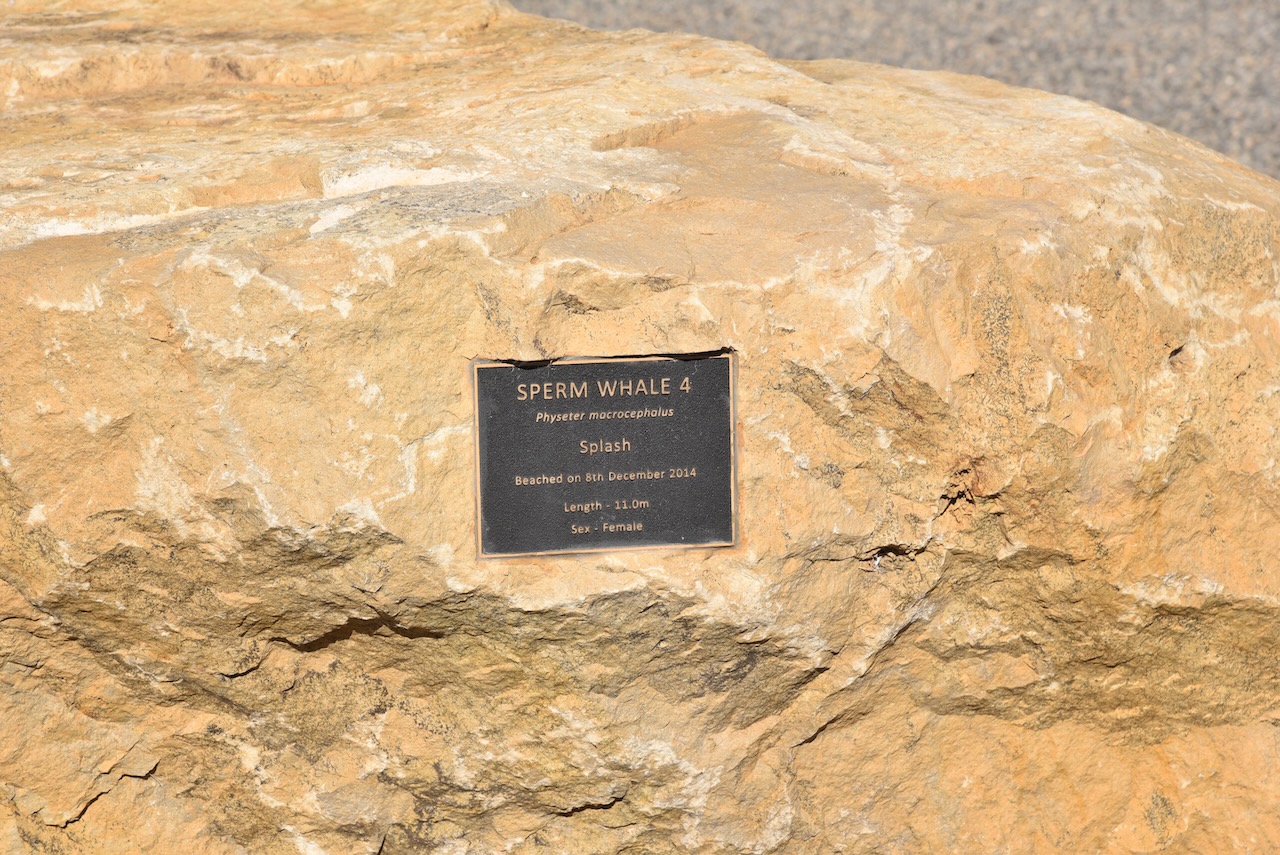
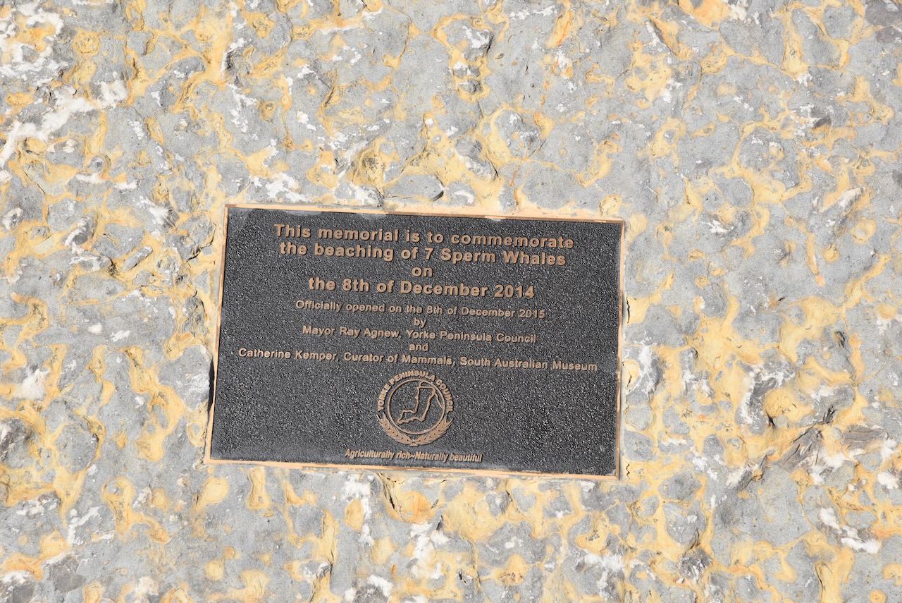
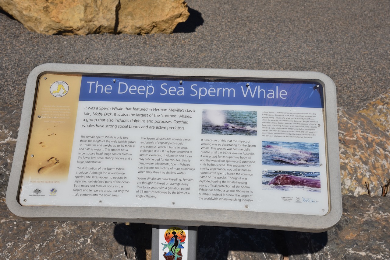
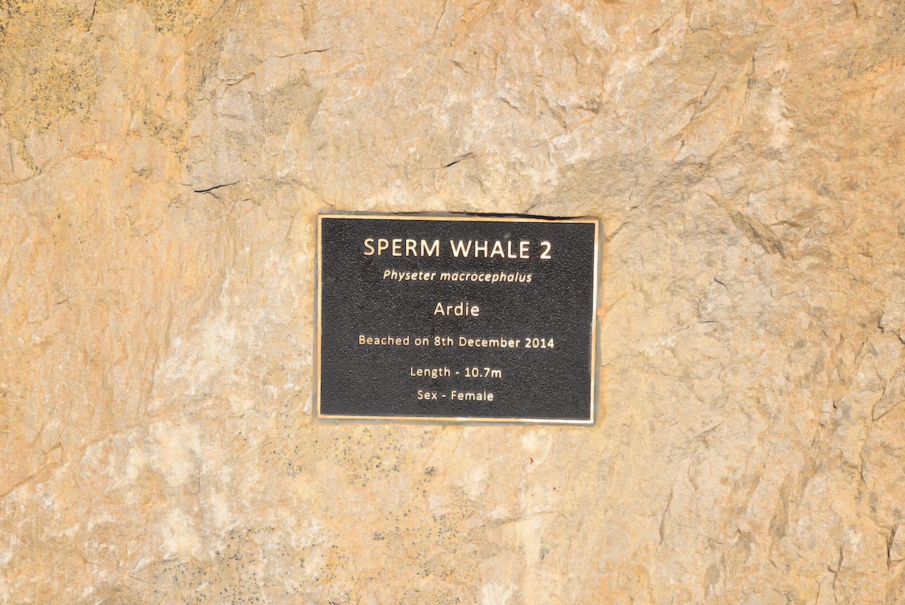
After packing up we had a look at the Sperm whale Memorial which commemorates the beaching of seven sperm whales on the 8th day of December 2014.
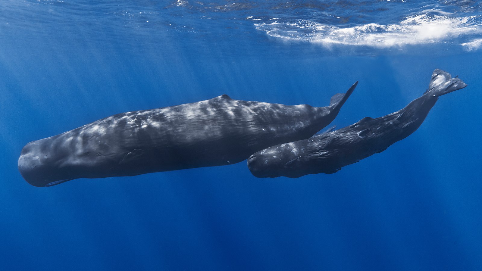
The Sperm whale is the largest of the toothed whales and is the largest toothed predator. Its conservation significance is listed as vulnerable. Mature males average 16 metres (52 ft) in length, with the head representing up to one-third of the animal’s length.
The memorial consists of a series of dolomite boulders which were donated by Arrium Mining, The boulders are placed in the pattern in which the whales were stranded.
The remains of the old Parara school can be seen opposite the whale memorial.
Also located nearby is the old Parara homestead which was one of the numerous properties owned by the pioneering Bowman brothers.
Marija and I then continued north on the Yorke Highway and soon reached the little town of Pine Point which overlooks the bay of Port Alfred.
The name of the town comes from the aboriginal word narnuworti meaning ‘pine point’. Resin from the trees called narnujako was used by the local aboriginal people for shafting their stone knives.
Pine Point was once one of the numerous small ports on the Yorke Peninsula where sketches would be loaded directly from drays. A small wharf was subsequently built at Pine Point and this enabled the sketches to remain in deeper water. In 1927 a chute was installed which assisted in the loading of the sketches. In October 1967 the ketch Yongala, conveyed the last cargo of grain from Pine Point to Port Adelaide. The bulk grain facilities at Ardrossan, Wallaroo and Port Giles had replaced the use of the ketches.
Above:- a ketch at Pine Point waiting to be loaded with grain, c. 1927. Image c/o State Library SA.
We continued on to Stansbury where we had booked into the Stansbury Caravan Park in a self-contained cabin. Below are some views of the cabin and the ocean which was directly behind our cabin.
After booking in and unpacking, Marija and I headed to the local hotel where we enjoyed a very nice meal.
The area which is now known as Stansbury was originally known as Oyster Bay from around 1846. The town was proclaimed on the 31st day of July 1873 and was named Stansbury by South Australian Governor Anthony Musgrave (b. 1828. d. 1888) in honour of a friend. In October 1877 the foundation stone for the Stansbury Public School was laid.
Above:- Governor Anthony Musgrave. Image c/o Wikipedia.
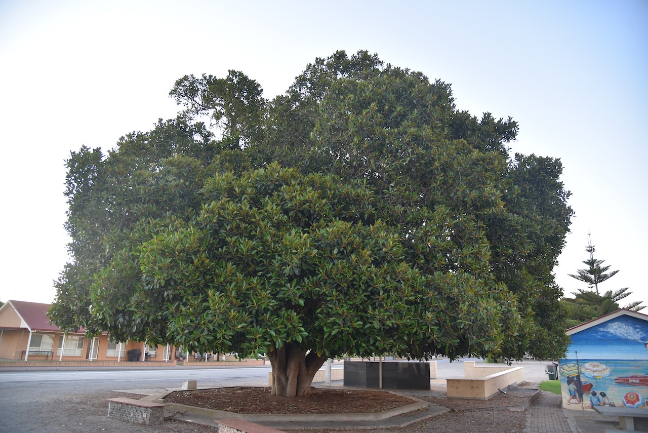
Following dinner, we decided to have a look around Stansbury as it was such a beautiful warm evening.
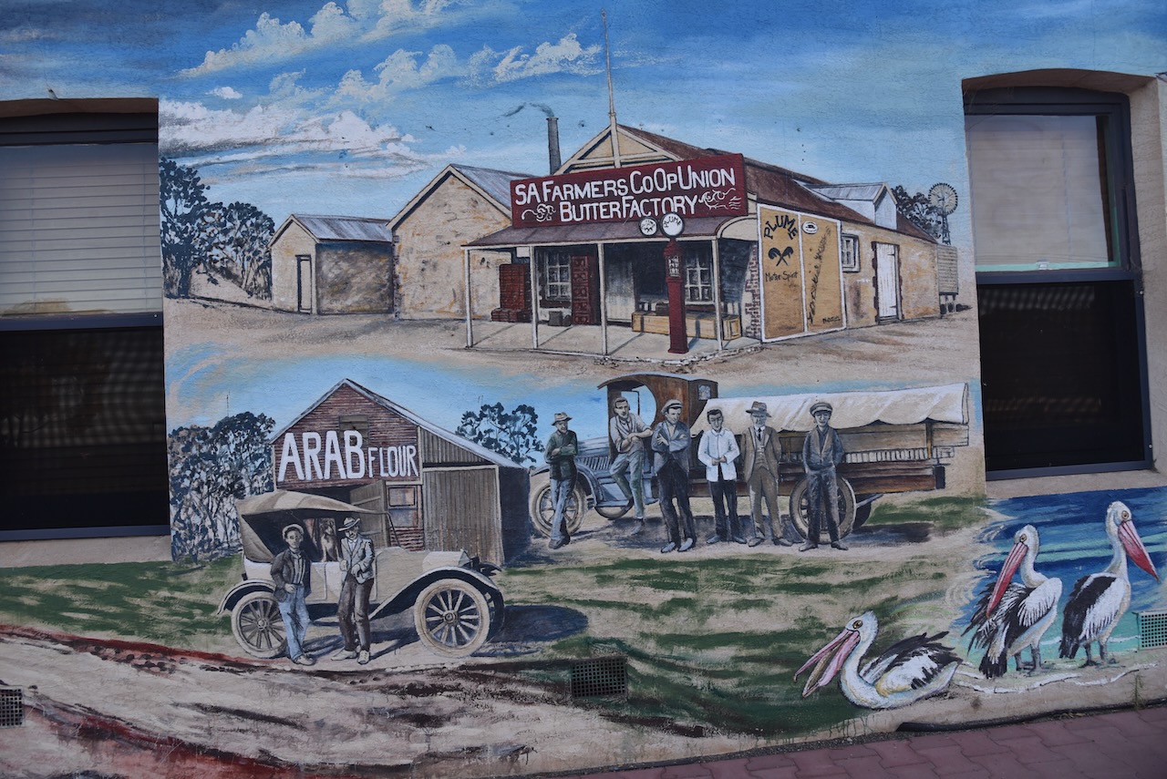
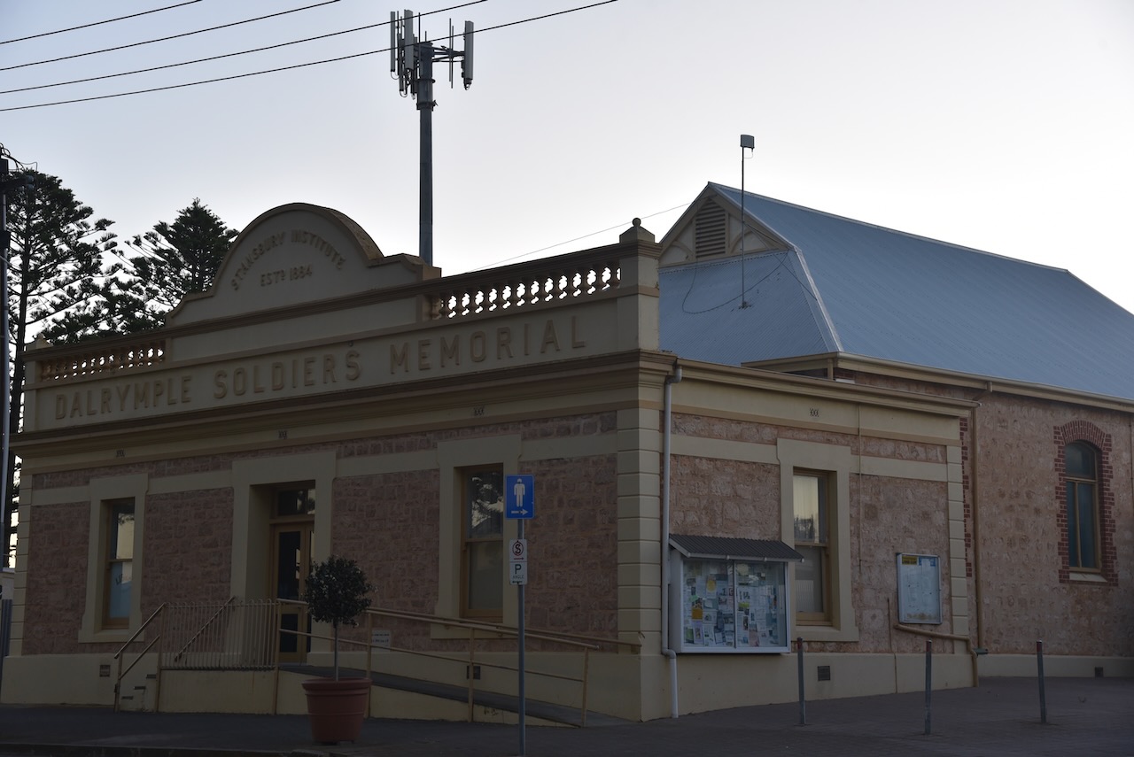
On the corner of St Vincent Street and Anzac Parade (the Blue Lime Cafe), there is a brilliant mural painted on the building. It is the work of local artist Anne Harris. It depicts the historical use of building and Stansbury life.
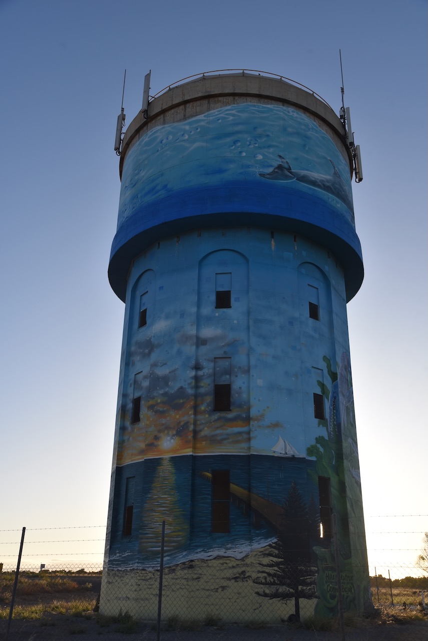
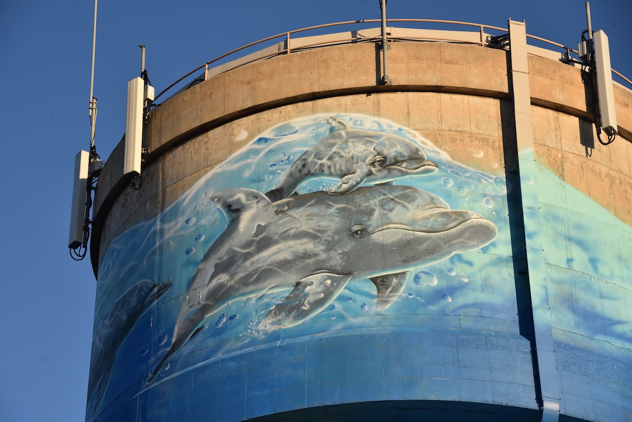
We then drove out to the Stansbury water tower mural. In 2020 the Yorke Peninsula Council in partnership with various Progress Associations gained funding that allowed the Southern Yorke Peninsula Water Tower/Tank Mural Trail. The Stansbury water tower was completed on the 29th day of May 2021. It was the work of Mike Makatron and Conrad Bizjak and took 13 days to complete. It consists of a mixture of spray guns and hand painting. It features notable fauna and the natural landscape of Stansbury, including Blue Swimmer crabs, Pelican, Dolphins, Norfolk Island Trees, jetty, coastline, and Ribbon Seaweed and Oysters.
We then had a look at the Stansbury jetty and harbour.
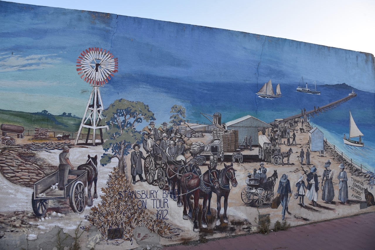
And on our way back to the caravan park we had a look at some of the historic buildings in Stansbury and the murals on the foreshore. In 2014 the Stansbury Progress Association commissioned Anne Harris, a local artist, to paint three murals on the foreshore changerooms.
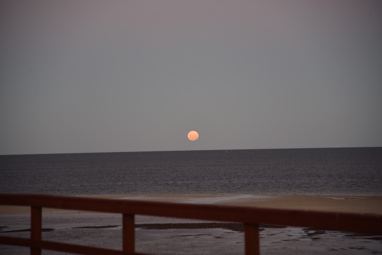
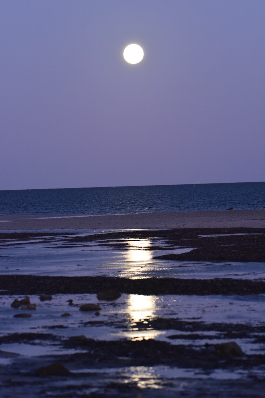
We returned to our cabin where we enjoyed a magnificent sunset and the moon glistening across the water.
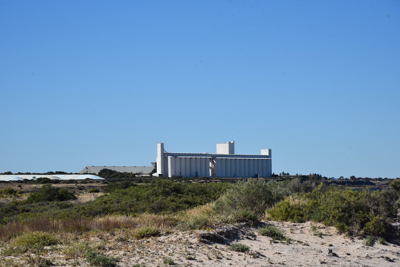
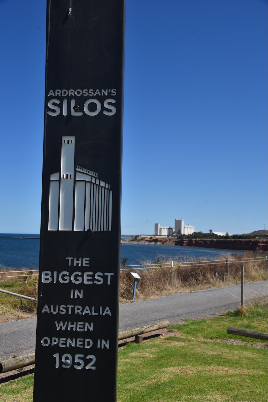
After leaving Price, Marija and I drove south along the Yorke Highway for about 21 km and we soon reached the town of Ardrossan, where we planned on activating the Ardrossan silo VK-ARN5 for the Silos On The Air (SiOTA) program..
Ardrossan is about 153 km (by road) from the city of Adelaide, and is located on the eastern coast of the Yorke Peninsula.
Above:- Map showing the location of Ardrossan. Map c/o Google maps.
Prior to European occupation, the area around Ardrossan was occupied by the Narungaa aboriginal people. The Narungaa people comprised four distinct clans on the Gurranda (the Yorke Peninsula. They being the Kurnara in the north, Dilpa in the south, Wari in the west, and Windarra in the east.
The town of Ardrossan was proclaimed on the 13th day of November 1873. It was named by South Australian Governor Sir James Fergusson (b. 1832. d. 1907) in honour of a seaport in Ayrshire, Scotland. Ardrossan is derived from the Celtic words ardross – ‘high’ and rosan – ‘cape’. The town was chosen due to its potential for shipping infrastructure which allowed wheat farmers to ship their produce across Gulf St Vincent to Port Adelaide.
Above:- Governor Sir James Fergusson. Image c/o Wikipedia.
The area was originally known as ‘Clay Gully’ or ‘Parara’. Parara was the name of a property taken up in 1852 by William Sharples. Parara was a Narungaa aboriginal word meaning ‘middle’. The Parara homestead was situated about 3 km south of Ardrossan.
On the 19th day of June 1873, the Hundred of Cunningham was proclaimed, and surveying of the land commenced. By 1878 Ardrossan township had six houses, a post office, a flour mill, a Methodist church, a hotel, and a school which had 53 pupils.
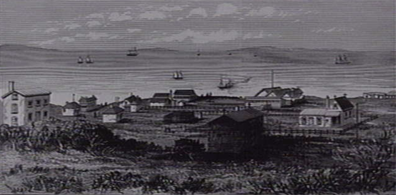
Above:- Ardrossan, c. 1879. Image c/o State Library of Victoria.
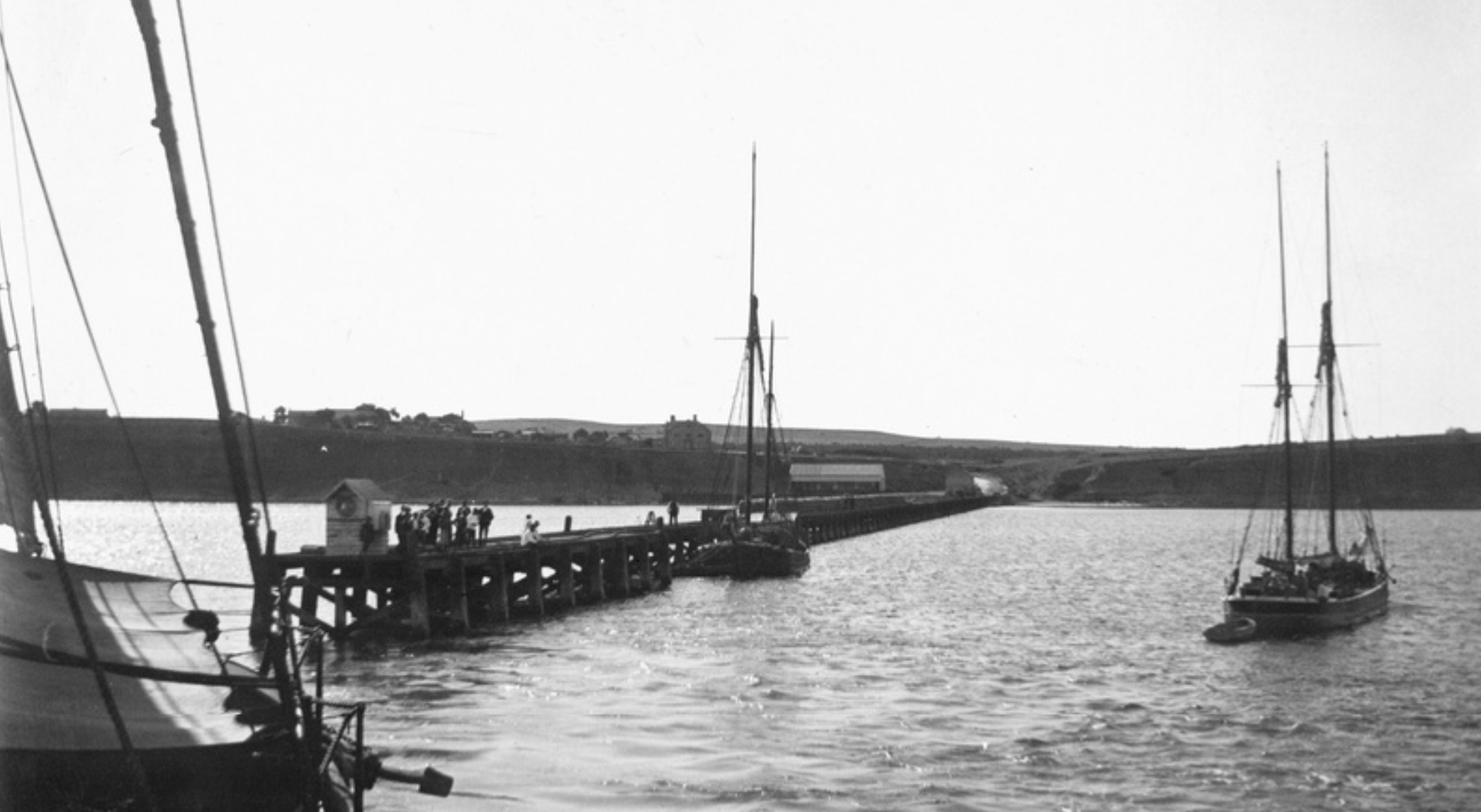
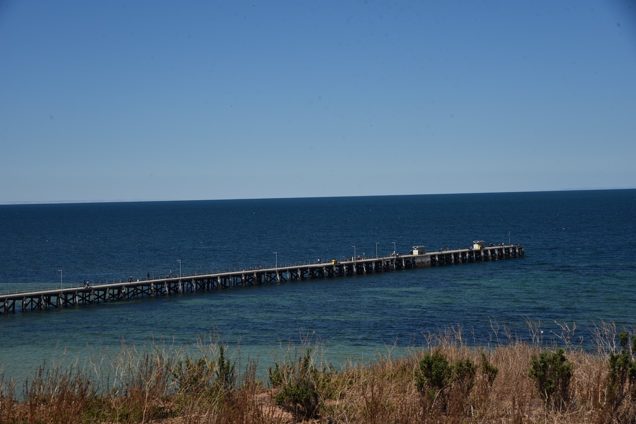
In 1874 the residents of Ardrossan petitioned the South Australian government for a jetty. The jetty was completed in 1877, and was subsequently extended to better accommodate the larger steamships and windjammers used to export grain overseas.
Above:- the Ardrossan jetty, c. 1903. Image c/o State Library SA.
In 1880 at Ardrossan, Richard Bowyer Smith (b. 1837. d. 1919) and Clarence Herbert Smith (b. 155. d. 1901) invented the stump jump plough.
Above:- Clarence Herbert Smith. Image c/o Wikipedia.
This special plough solved the particular problem of preparing mallee lands for cultivation. At one time about fourteen ploughs were manufactured each week.
Above:- A stump jump plough in use, c. 1922. Image c/o State Library SA.
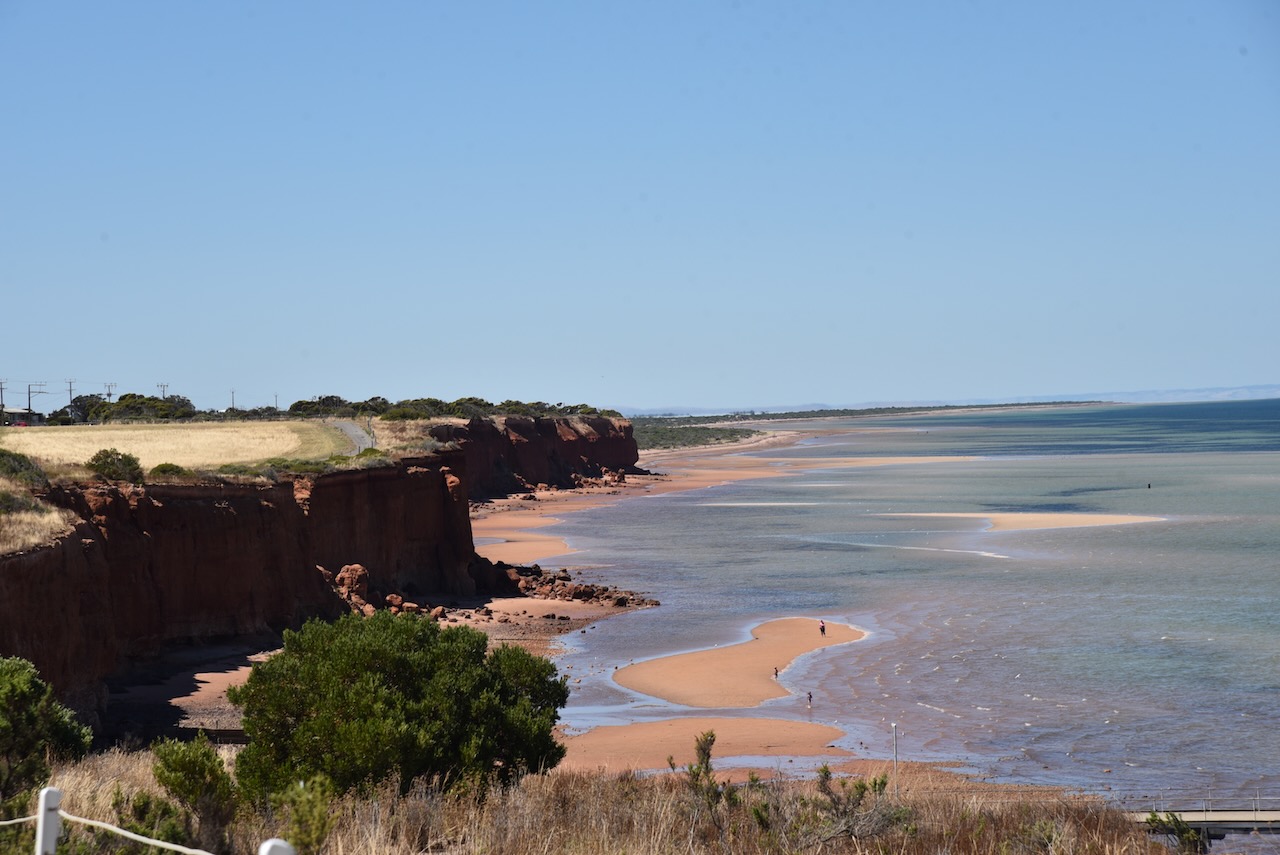
Ardrossan has a population of about 1,269 people and is a popular destination for holidaymakers. Ardrossan is well known for its coastal cliffs of red clay and its deepwater shipping port.
At the top of First Street (Ardrossan’s main street), there is a small park and playground. From here you can view the Ardrossan silos and get your photo taken at the ‘Hell from Arrdrossan’ sign.
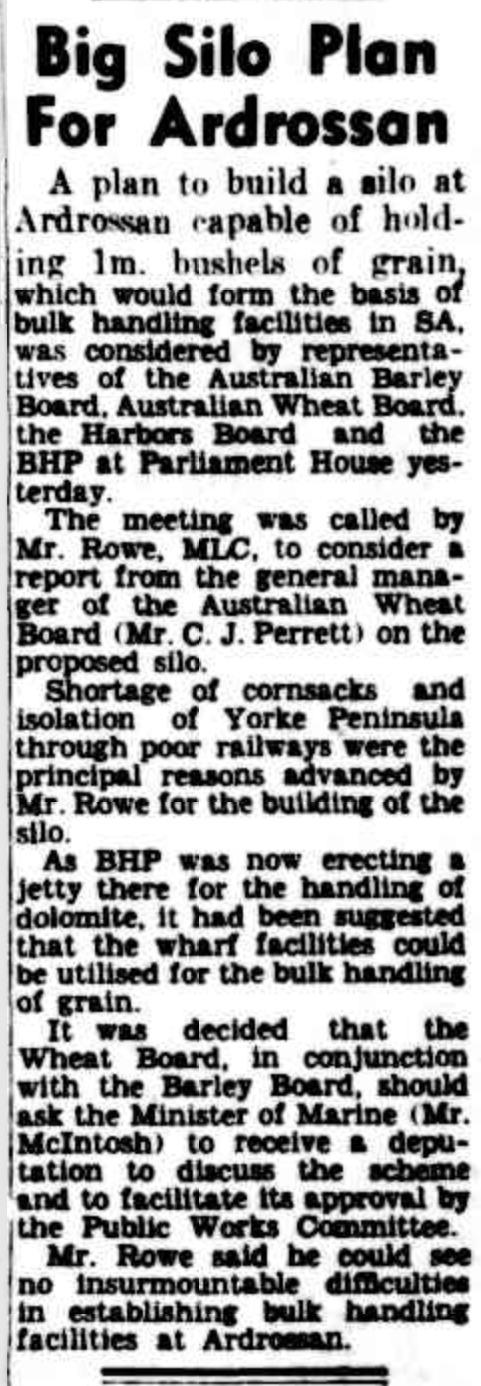
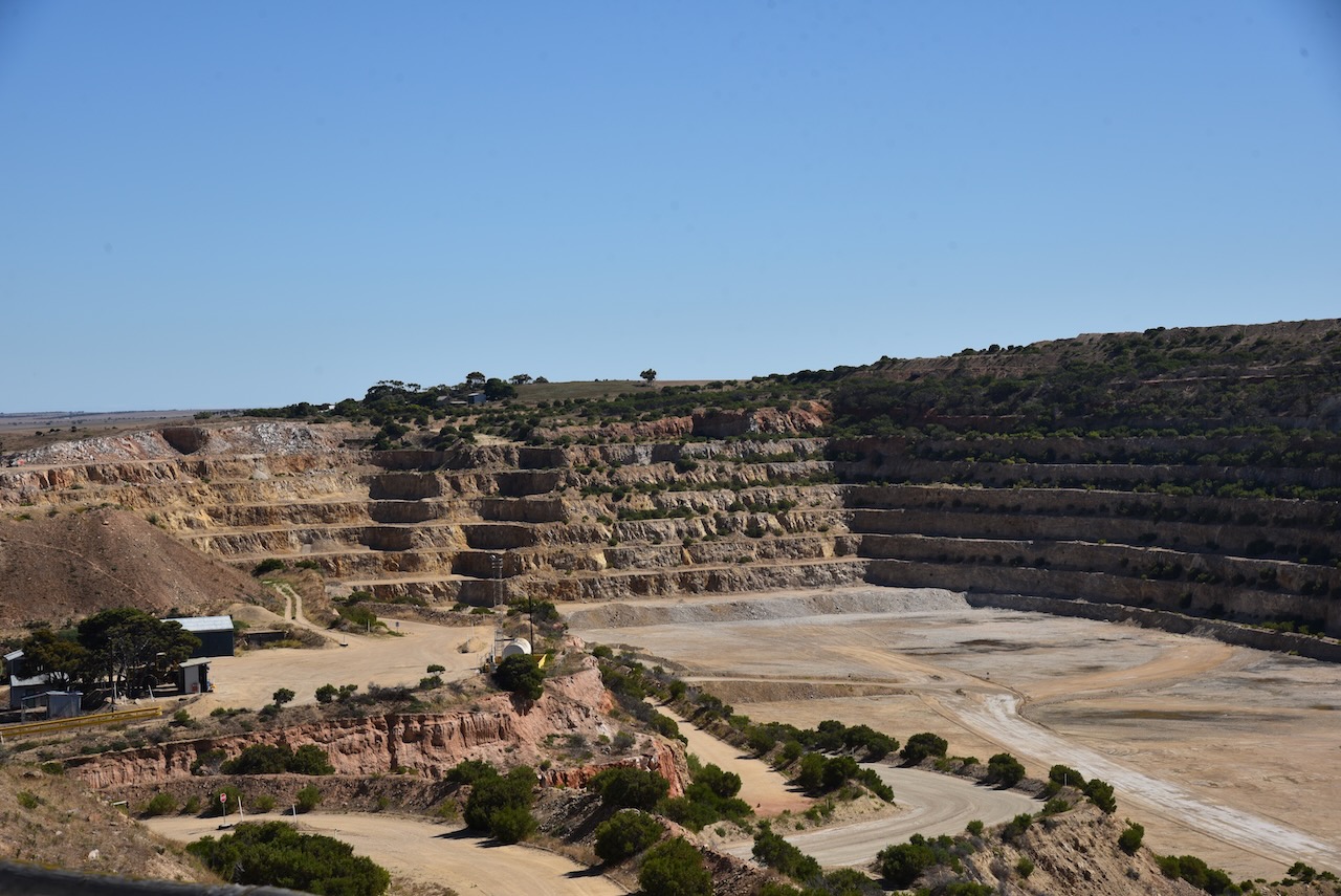
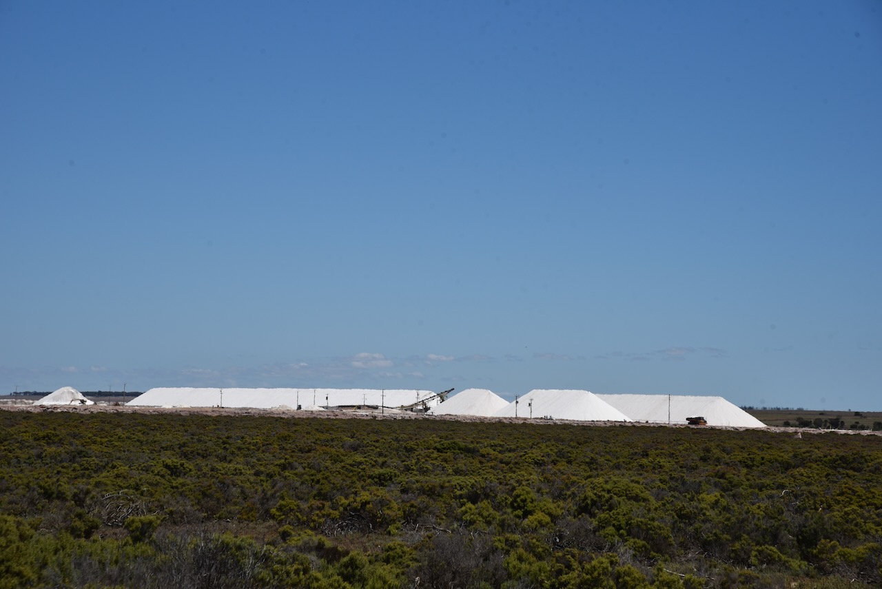
In the 1950s a large open-cut fine-grade dolomite mine was opened by Broken Hill Proprietary Ltd (BHP) at Ardrossan for use at its Whyalla steelworks and Port Kembla in New South Wales. BHP applied to the South Australian State Government for the construction of a crushing plant, hetty, and conveyor belt facility at Ardrossan. The SA Government gave permission on the proviso that that conveyor and jetty also be made available for the shipment of wheat and barley from the Yorke Peninsula region and salt from the salt mines at Price.
Above:- Article from The Advertiser, Wed 28 Jun 1950. Image c/o Trove.
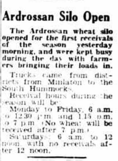
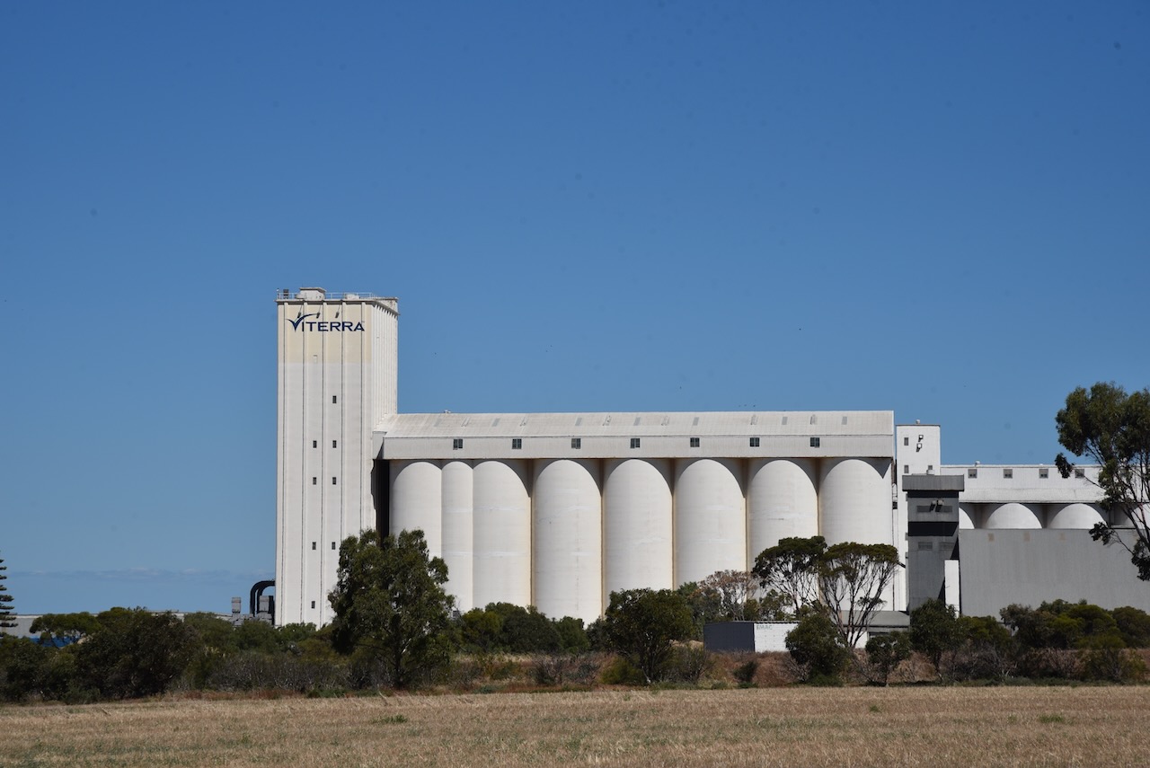
Construction commenced and this included grain silos and bulk handling facilities. The new jetty was constructed several kilometres south of the old jetty. The first shipment using these facilities was on 21 January 1953. The bulk handling facilities at Ardrossan were the first in South Australia and are now the third largest in South Australia. When the Ardrossan silos were first opened in 1952, they were the largest silos in Australia.
Above:- Article from The Pioneer, Yorketown, Fri 4 Dec 1953. Image c/o Trove.
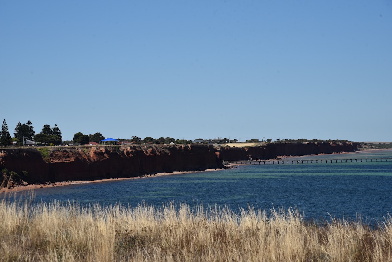
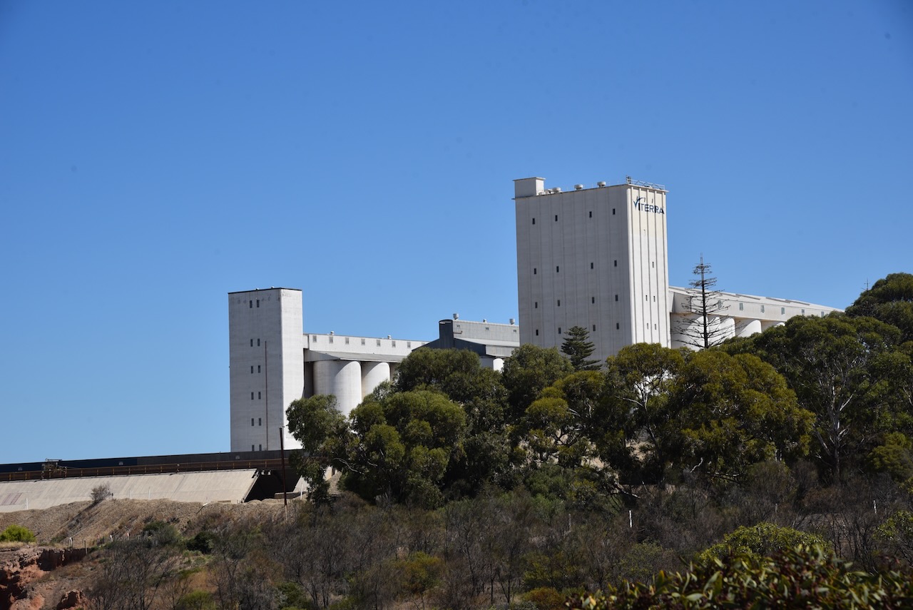
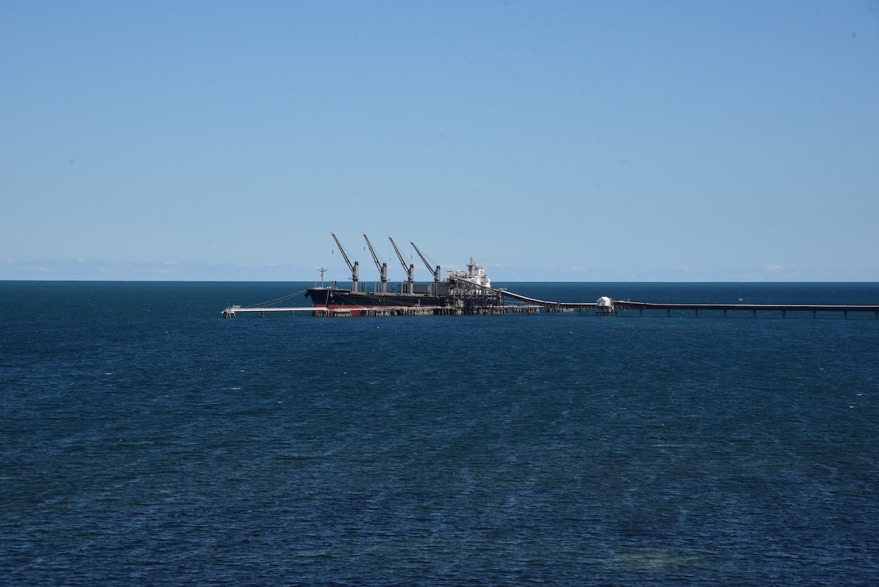
The jetty adjacent to the silos currently services ships loading dolomite, grain and salt from the salt pans at Price. The jetty is 931 metres long with a ‘T’ head. The grain elevator tower is 74 metres and is the largest in the state. The conveyor belt can load 2,400 tonnes of dolomite, 900 tonnes of grain or 750 tonnes of salt per hour.
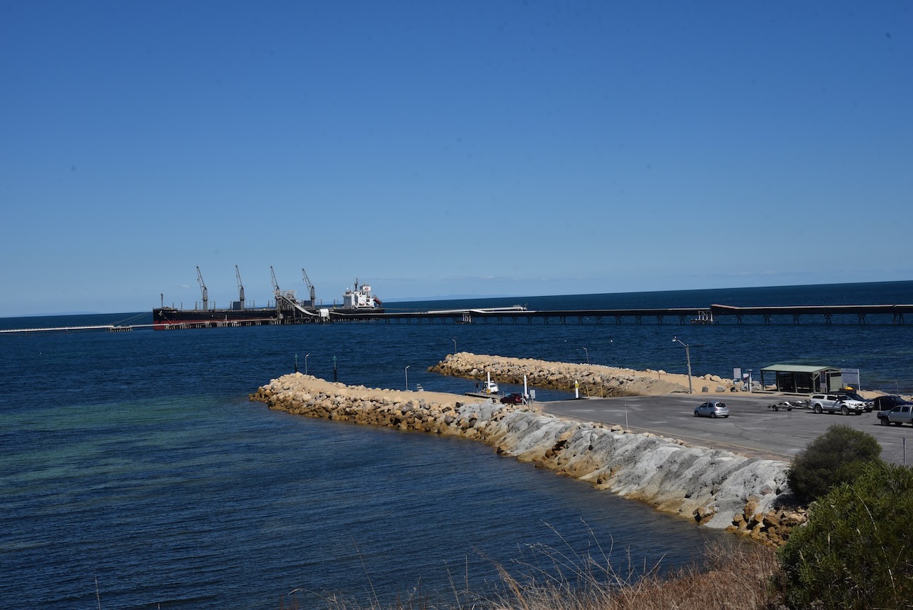
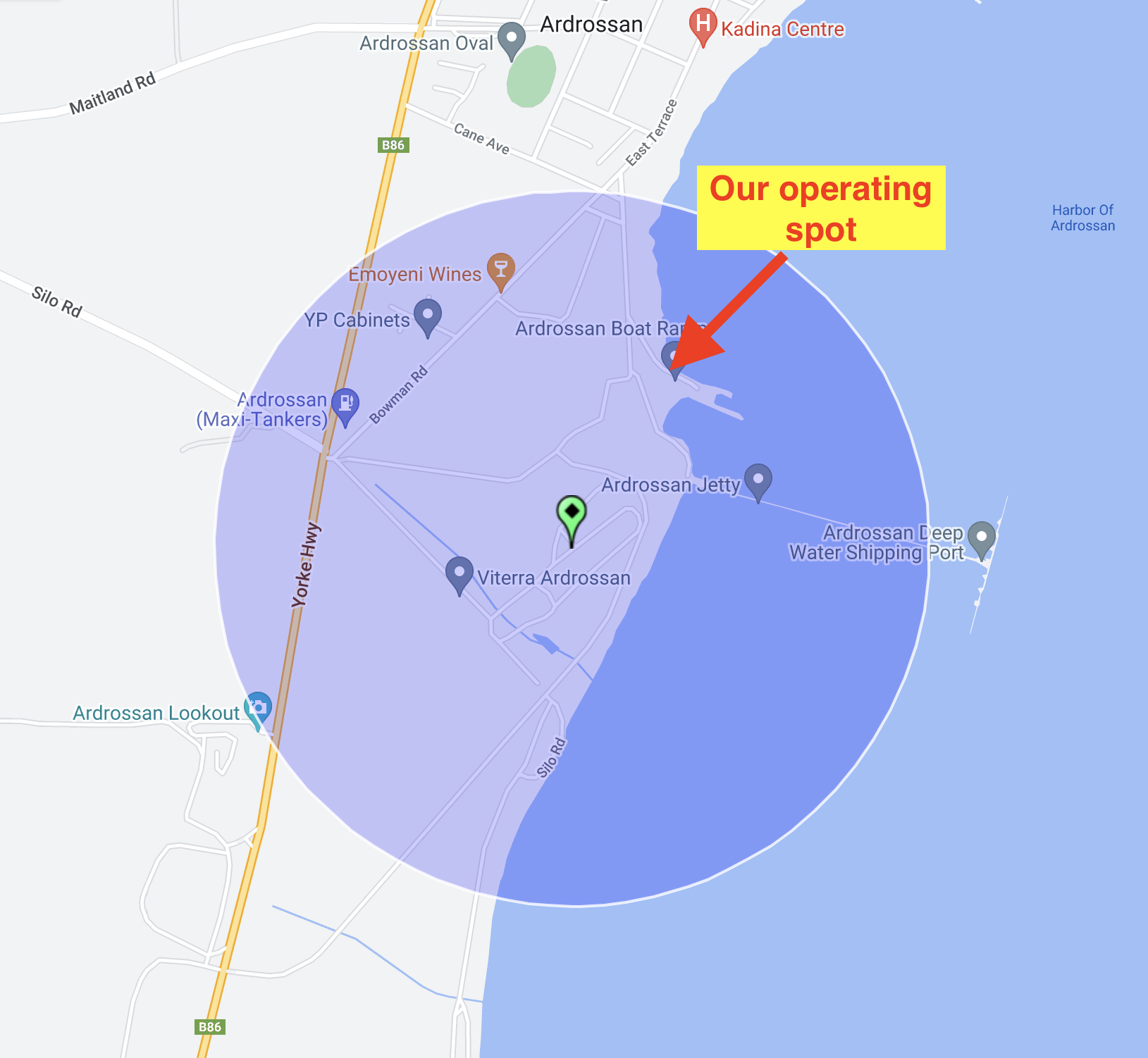
Marija and I operated from near the Ardrossan boat ramp within the 1km activation zone. We operated from the vehicle, using the Icom IC-7000,100 watts, and the Codan 9350 self tuning antenna.
Above:- The activation zone at the Ardrossan silo, showing our operating spot. Image c/o SiOTA website.
Marija and I made a total of 36 contacts on 40m SSB and 20m SSB.
Marija worked the following stations on 40m SSB:-
VK1AO
VK2MET
VK3PF/m
VK5HS
VK5FANA
VK3TUN/p (SOTA VK3/ VC-018)
Marija worked the following stations on 20m SSB:-
VK2NP
VK2IO
VK5HS
VK4SYD
VK5MRD
VK7XX
VK2YES
VK6NTE
VK4SMA
VK2EG/p
VK2IJS
VK3OAK
I worked the following stations on 40m SSB:-
VK1AO
VK2MET
VK3PF/m
VK5HS
VK5FANA
VK5DW
VK3OHM
VK5GY
VK3GJG
VK3TUN/p (SOTA VK3/ VC-018)
VK5TN
VK3OAK
VK2VH
VK4AAC
VK2YK
VK5NM
VK5KVA
I worked the following station on 20m SSB:-
VK5HS
At the conclusion of the silo activation, we drove up to the Ardrossan lookout where we enjoyed some brilliant views of the silo, the town of Ardrossan, and the coastline. There are also some good views of the mine.
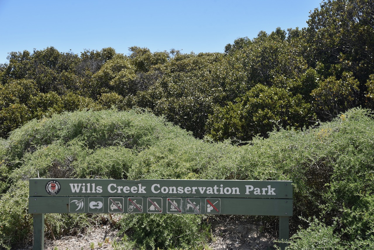
After leaving Clinton Conservation Park, Marija drove a short distance down the Yorke Highway to our next park for the day (Sunday 5th February 2023), the Wills Creek Conservation Park VKFF-0819.
Above:- Map showing the location of the Wills Creek Conservation Park. Image c/o Location SA Map Viewer.
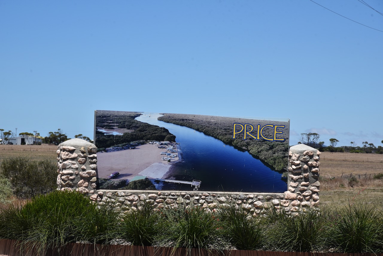
To get to the park we had to drive through the little town of Price.
The town was named by Governor William Jervois (b. 1821. d. 1897) after Florence Annie Price who married the governor’s eldest son. Florence was the daughter of Henry Strong Price, a pioneer pastoralist of the Flinders Ranges.
Above:- Governor WIlliam Jervois. Image c/o Wikipedia.
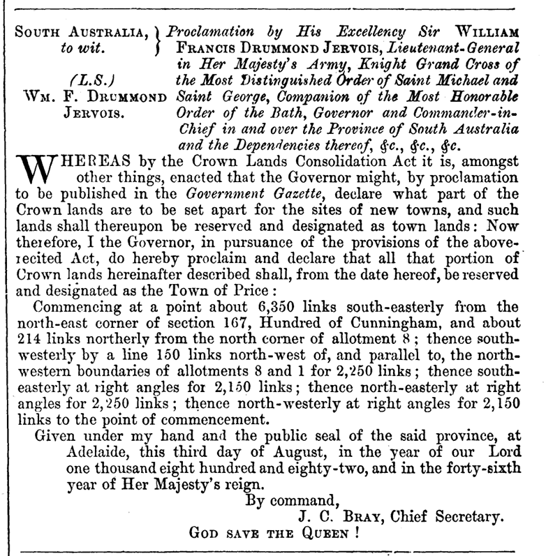
The town was proclaimed on the 3rd day of August 1882.
Above:- Proclamation of the town of Price. c/o The SA Govt Gazette, 3rd Aug 1882.
In that same year, a small wharf was erected on Wills Creek which is a sheltered anchorage for boats. In the early days of Price, it was from here that bagged salt and grain were loaded onto ketches for export. By 1964 the port was virtually closed and the wharf has now been demolished. In 1911 the Adelaide Advertiser newspaper (see below) reported that most of the ketches visiting Price via Wills Creek had at various times been stuck in the creek at low tide. In 1885 the Price school was opened.
Above:- Article from The Advertiser, Thu 12 Oct 1911. Image c/o Trove.
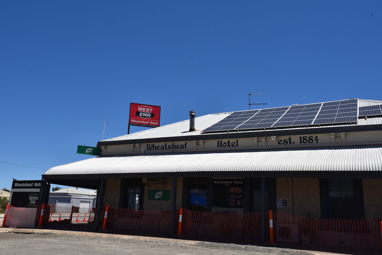
Price is a small town with a population of about 256 people. In the town, you can find the Wheatsheaf Hotel built in 1886, and a caravan park.
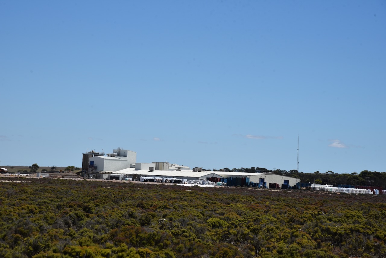
On the southern side of the town of Price, you will find Cheetham Salt Limited. It is the largest salt refinery in the southern hemisphere, with an average of 150,000 tonnes of salt harvested each year.
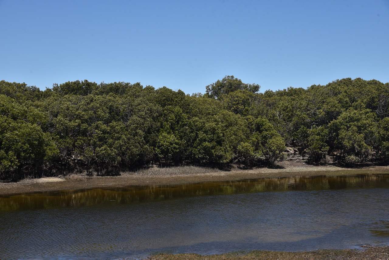
The Wills Creek Conservation Park is located on the eastern side of the Yorke Peninsula. It runs from south of the town of Clinton, along the coastline to south of the town of Price. The park is about 2,298 hectares in size.
Above:- An aerial view of the park looking south. Image c/o Google maps.
The park was proclaimed on the 14th day of December 2006.
The park is a significant coastal wetland and estuary area which supports mangroves and intertidal habitats. There are three major flora habitats in the park: Mangrove woodland, Low (Samphire) shrubland, and Low woodland.
Birds SA have recorded about 103 bird species in the park including Common Greenshank, White-faced Heron, Singing Honeyeater, White-browned Scrubwren, Chestnut Teal, Grey Teal, and Willie Wagtail.
Numerous reptiles can be found in the park including the Southern Grass skink, the Four-toed Earless skink, and the Dwarf skink.
Marija and I drove to the end of the Causeway Road to the car park at the boat ramp. We set up just to the north of the shelter shed.
On our way to Troubridge Island, Marija and I stayed for 2 nights at Stansbury and activated a number of parks and silos. The first (Sunday 5th February 2023) was the Clinton Conservation Park VKFF-0813.
The park is located at the top of Gulf St Vincent, about 116 km north of the city of Adelaide.
Above:- Map showing the location of the Clinton Conservation Park. Map c/o Google maps.
The Clinton Conservation Park run s around the top of Gulf St Vincent from south of Port Wakefield to Port Clinton. The total area of the park is about 2,072 hectares.
Above:- An aerial view of the park looking north. Image c/o Google maps.
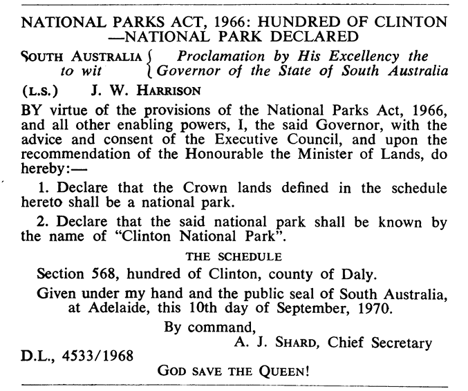
On the 10th day of September 1970, Section 568 was proclaimed as the Clinton National Park. It was proclaimed on the 27th day of April 1972 as the Clinton Conservation Park on 27 April 1972. Further sections were added on the 14th day of October 1976., the 28th day of July 1983, the 9th day of March 1989, and the 23rd day of Juner 2016.
Above:- The SA Govt Gazette, Sept 10 1970.
The park takes its name from the Hundred of Clinton which was proclaimed on the 12th day of June 1862. It was named Clinton by Governor Dominick Daly in honour of the Duke of Newcastle, Henry Pelham Fiennes Pelham-Clinton who was Secretary of State for the Colonies from 1859 until his death in October 1864.
Above:- Henry Pelham-Clinton, 5th Duke of Newcastle. Image c/o Wikipedia
The first known European settler in the area was John Bowman who, in May 1853, took up lease no. 270. The town of Clinton was surveyed in 1862 and was offered for auction on the 14th day of August 1862. The Clinton School opened in 1881 and closed in 1889. The Clinton Centre School operated from 1886 until 1950, while the Clinton North School opened in 1886. The Port Clinton School opened in 1892 and closed in 1947.
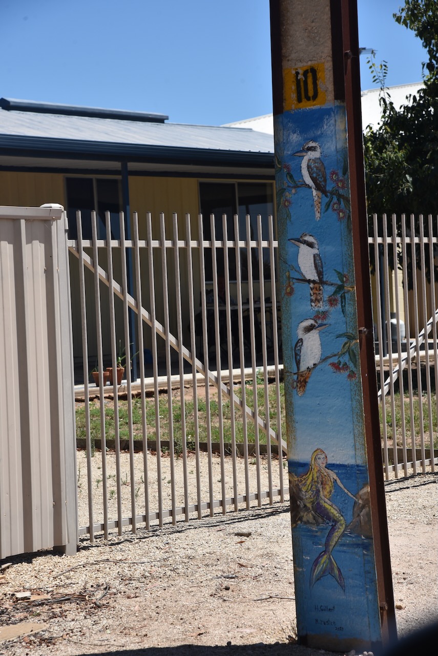
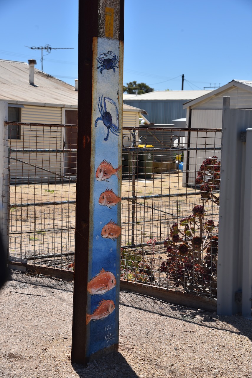
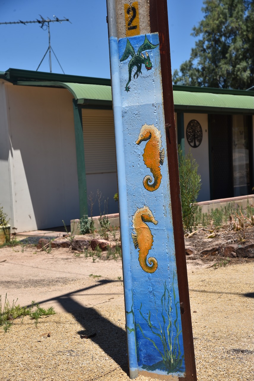
Port Clinton is a small town which we had a quick look at. All of the stobie poles in the town are painted with artwork. What is a stobie pole? It is a power line pole made of two steel joists held apart by a slab of concrete. The stobie pole was invented by James Cyril Stobie (B. 1895. d. 1953) who was an engineer with the Adelaide Electric Supply Company.
Above:- James Cyril Stobie. Image c/o South Australia, Australia’s best secret Facebook page.
Vegetation in the Clinton Conservation Park includes Mangrove woodland, Low (Samphire) shrubland, Open scrub, Low woodland, and Low scrubland.
Birds SA have recorded 92 bird species in the park including Grey Teal, White-faced Heron, Far Eastern Curlew, Common Greenshank, Crested Pidgeon, Singing Honeyeater, and White-browned Scrubwren.
We set up at the end of a dirt track off the eastern side of the Yorke Highway near Dhanu’s relaxation park. This took us right down to the water’s edge.
Marija and I ran out the 20/40/80m linked dipole and used the Yaesu FT-857. For 10m and 15m we used the Icom IC-7000 and the Codan 9350 self-tuning antenna on the back of the 4WD.
Above:- Map showing the park and our operating spot. Map c/o Location SA Map Viewer.
With 101 contacts in the log it was time for us to pack up and head off to our next activation.
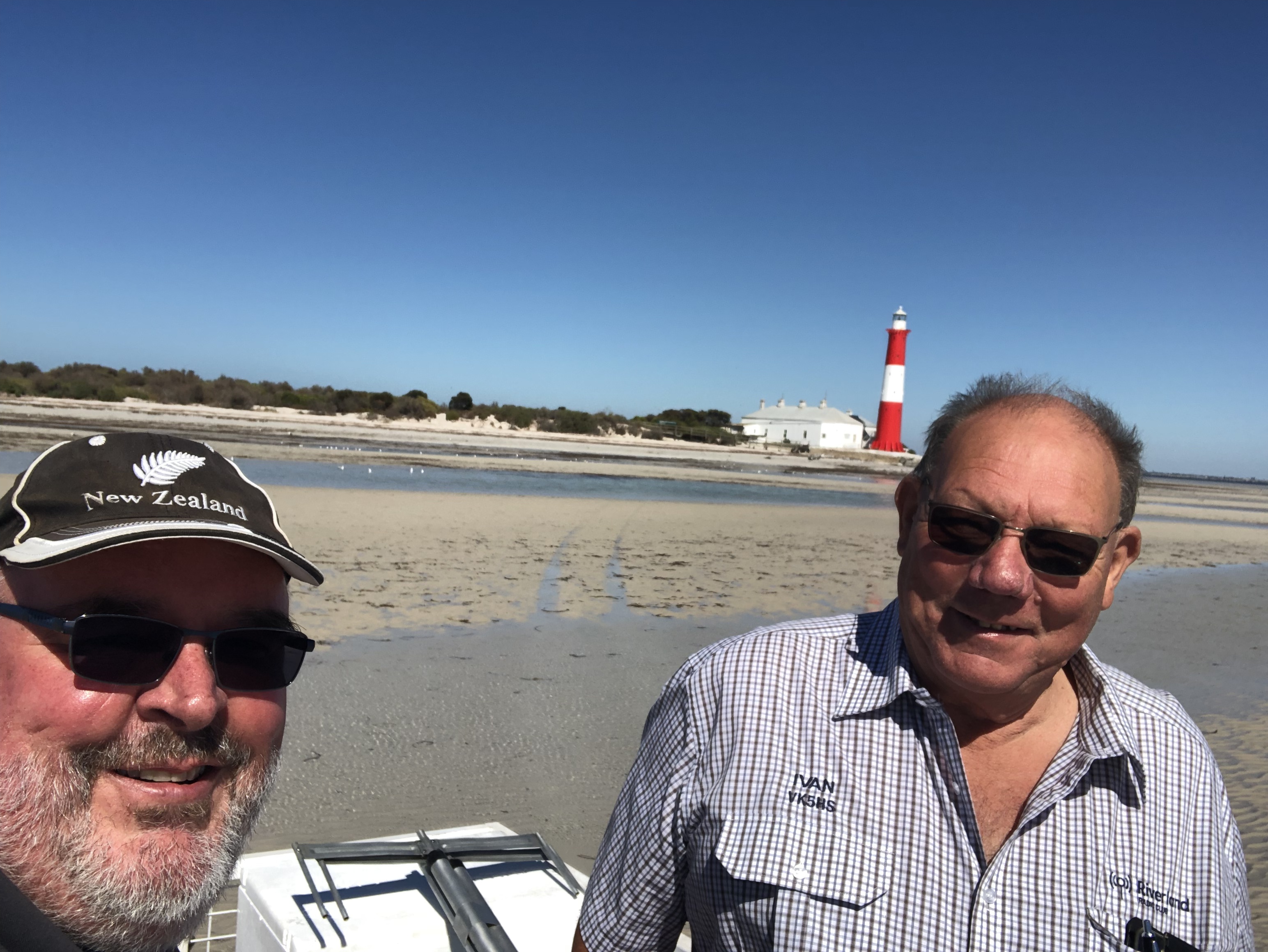
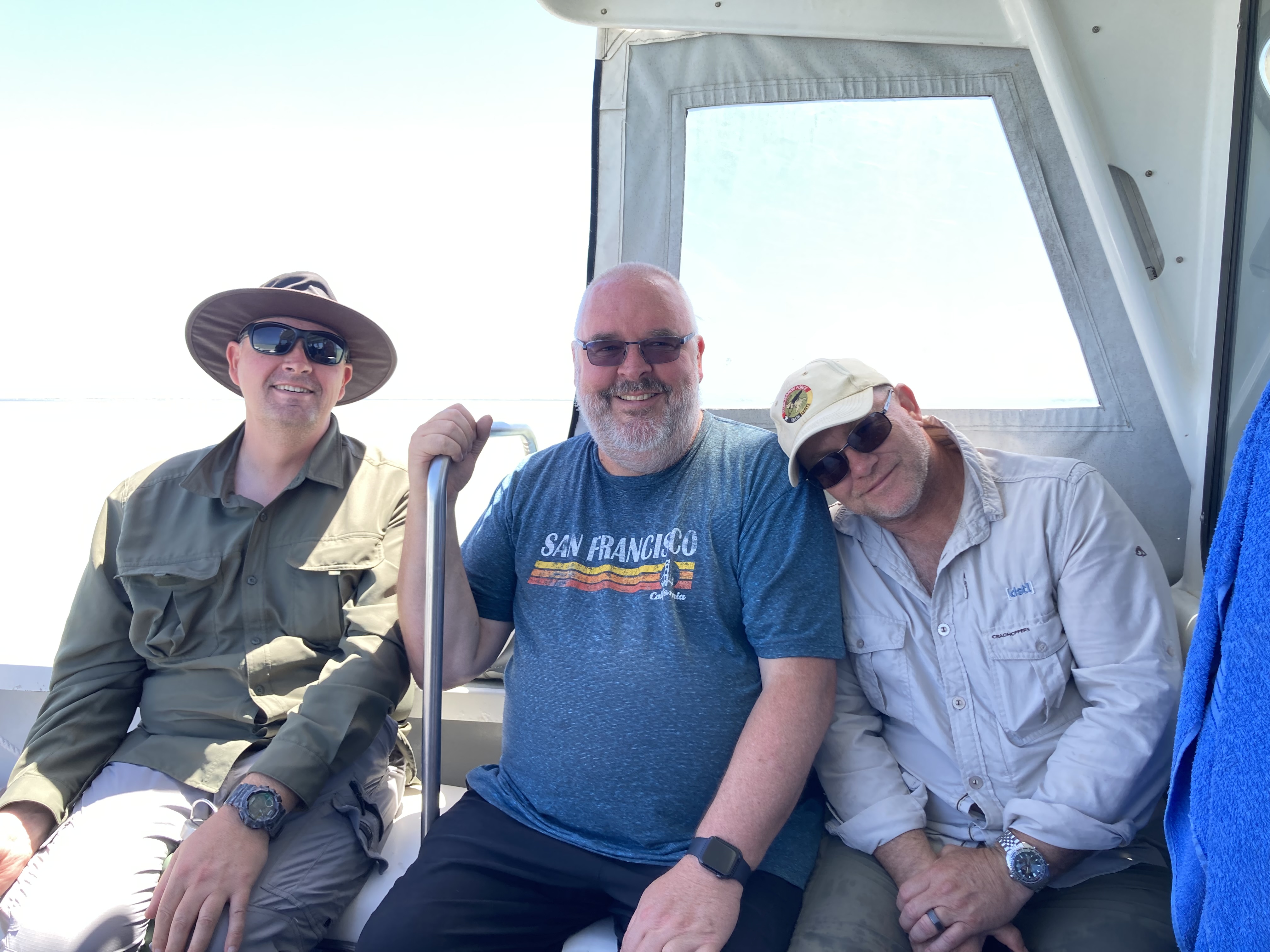
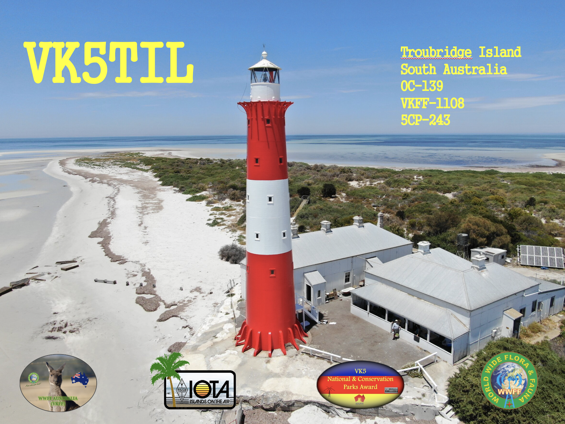
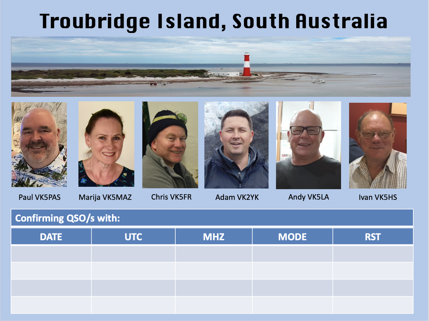
On Tuesday the 7th day of February 2023, I travelled to Troubridge Island with Marija VK5MAZ, Adam VK2YK, Andy VK5LA, Chris VK5FR, and Ivan VK5HS. We spent three nights on the island and operated as VK5TIL (Troubridge Island Lighthouse) ona mini amateur radio DXpedition.
This was our first trip away together as a group and we were definitely displaying ‘Learners plates’ when it comes to DXpeditions. We all know each other socially and we all had our own particular areas of expertise and interests in the hobby of amateur radio.
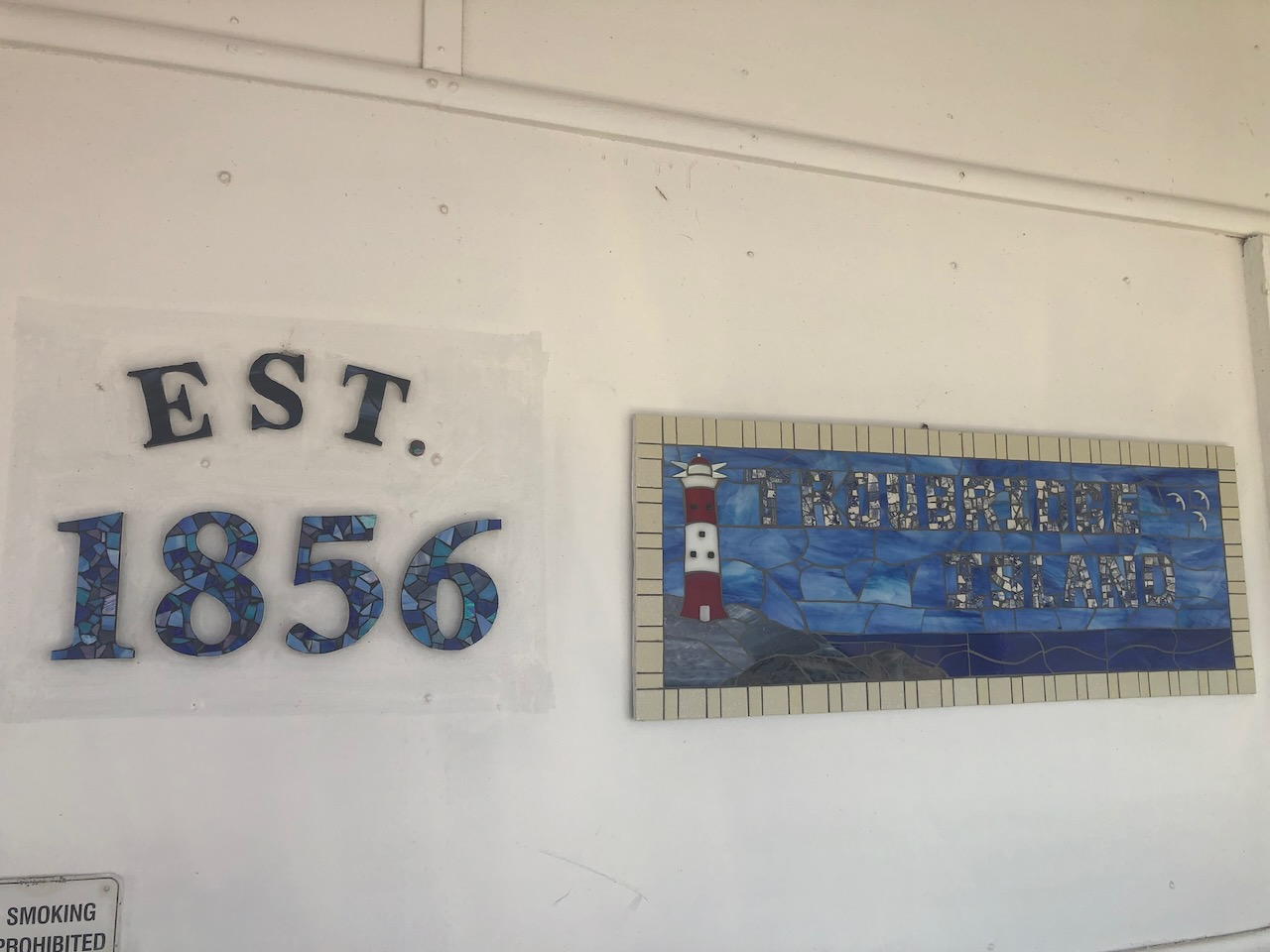
WHERE IS TROUBRIDGE ISLAND?
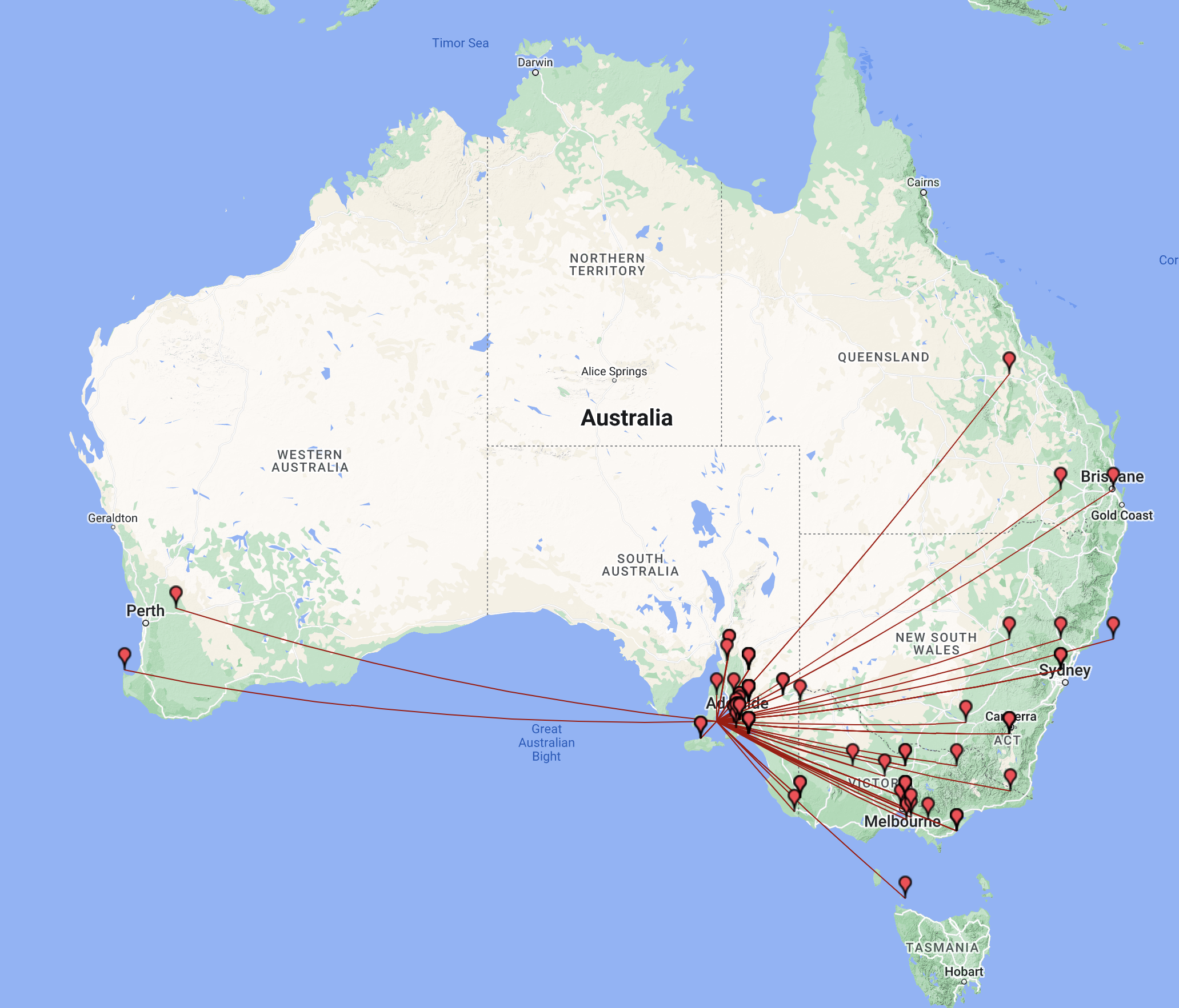
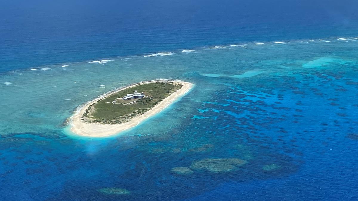
Troubridge Island is located in the southwestern corner of Gulf St Vincent in South Australia. It is a small sand atoll and is only 2 hectares in size.
Above:- Map of Australia showing the location of Troubridge Island. Map c/o Google maps.
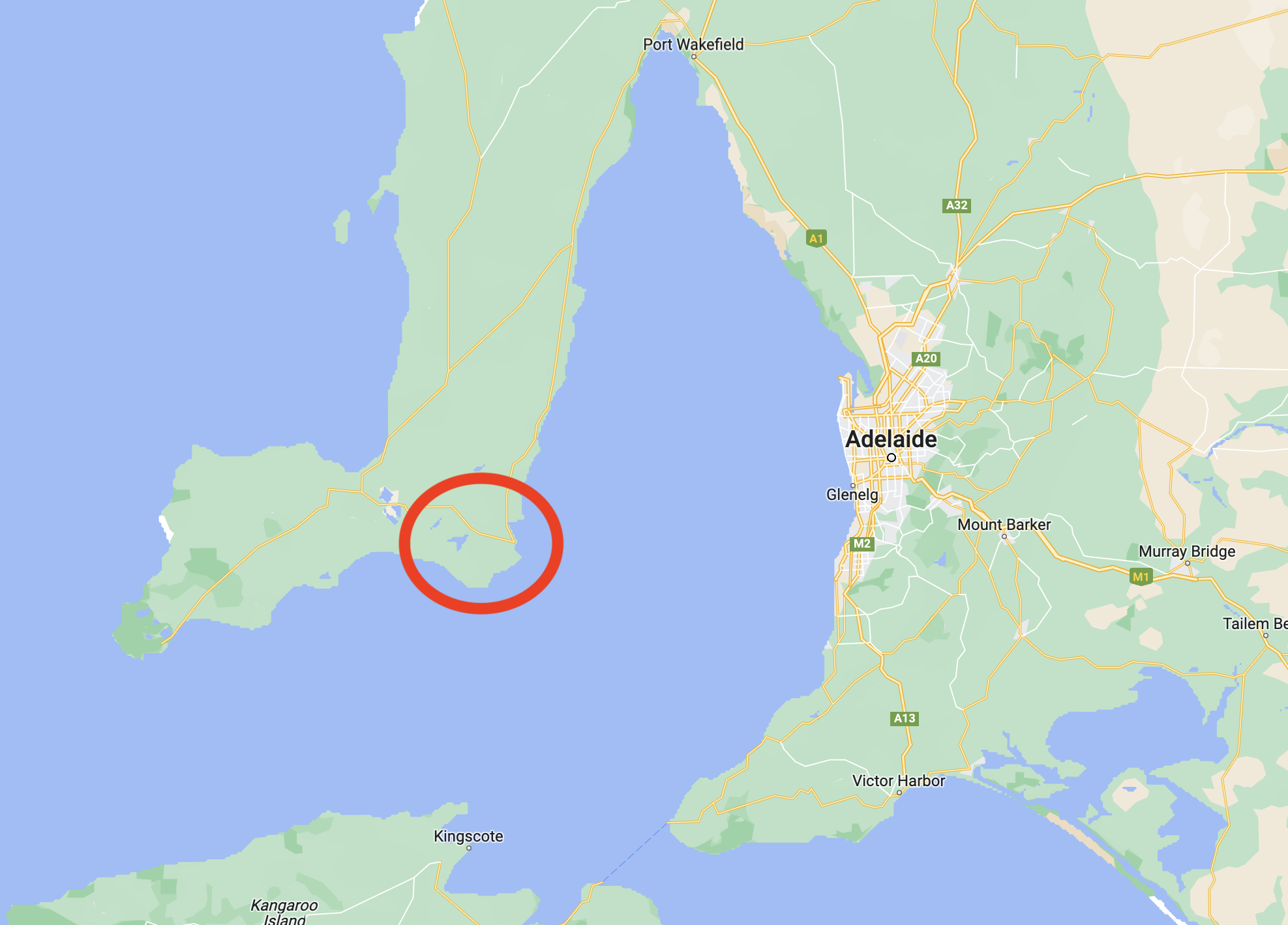
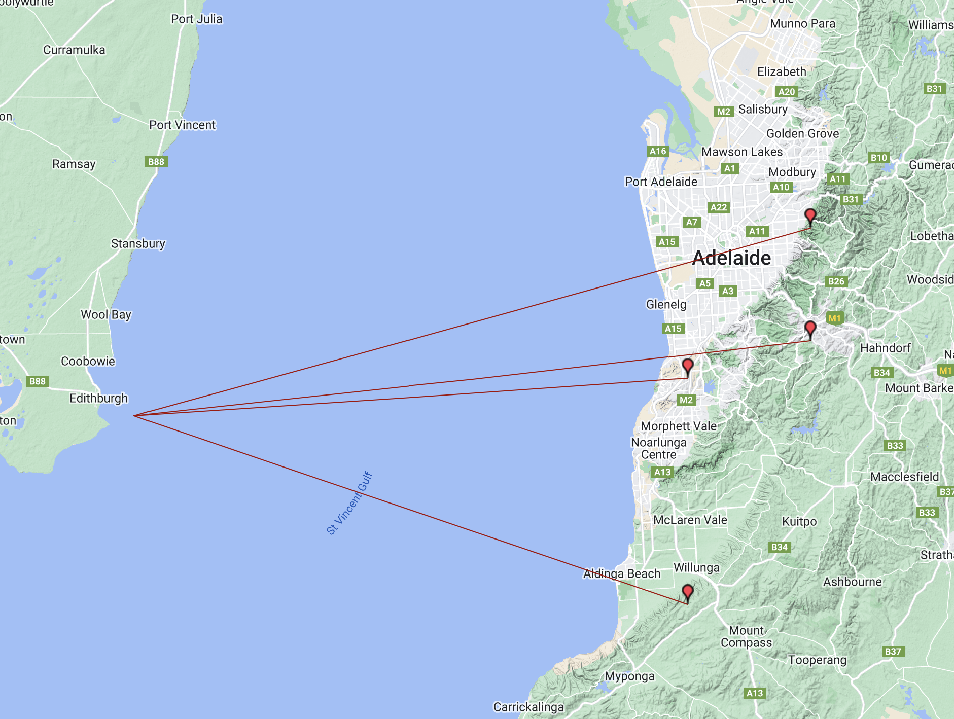
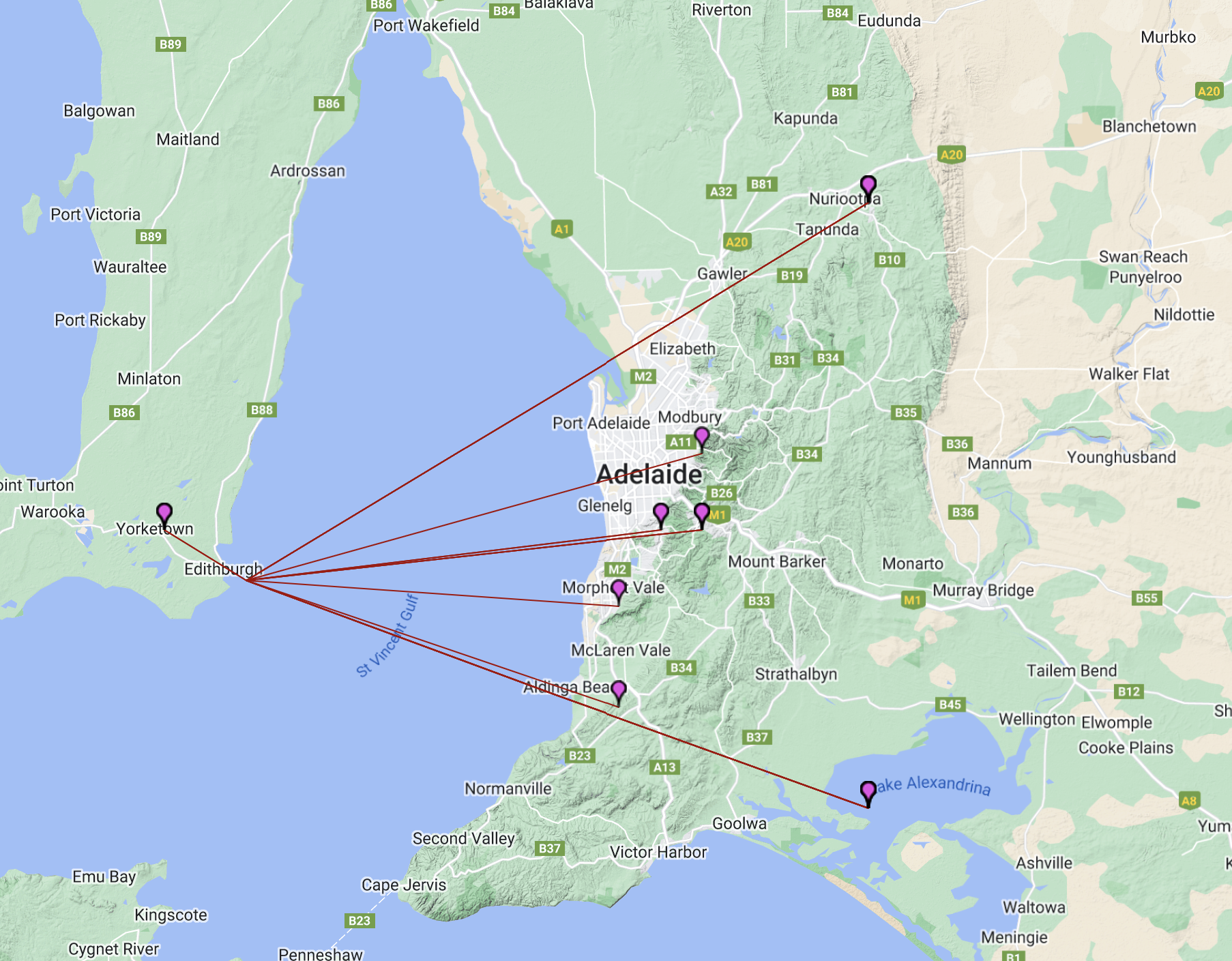
The island is about 8 km offshore from the town of Edithburgh on the Yorke Peninsula, and about 80 km southwest of the city of Adelaide across the water.
Above:- Map of Adelaide and the lower Yorke Peninsula, showing the location of Troubridge Island. Map c/o google maps.
WWFF and IOTA.
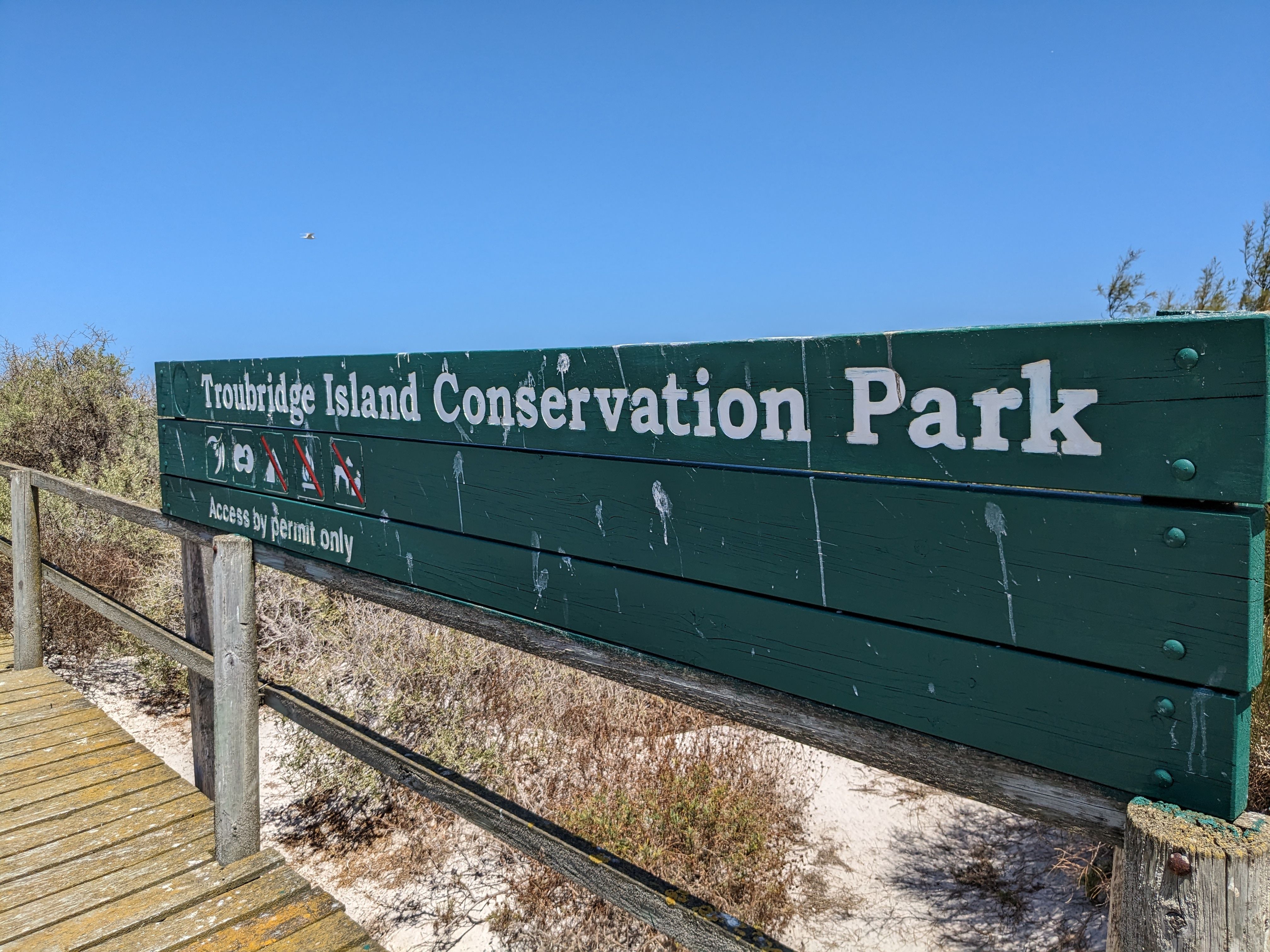
Troubridge Island qualifies for the World Wide Flora Fauna (WWFF) program and Islands On The Air (IOTA). The island is the Troubridge Island Conservation Park VKFF-1108 (WWFF) and IOTA OC-139. This was our reason for travelling to Troubridge Island – to activate it for WWFF and IOTA, and at the same time have a lot of fun.
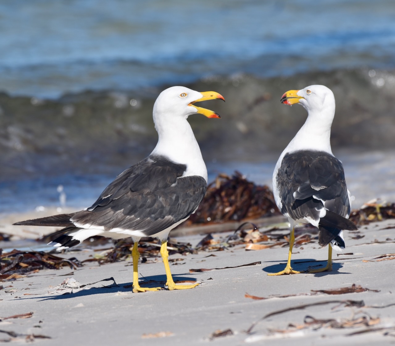
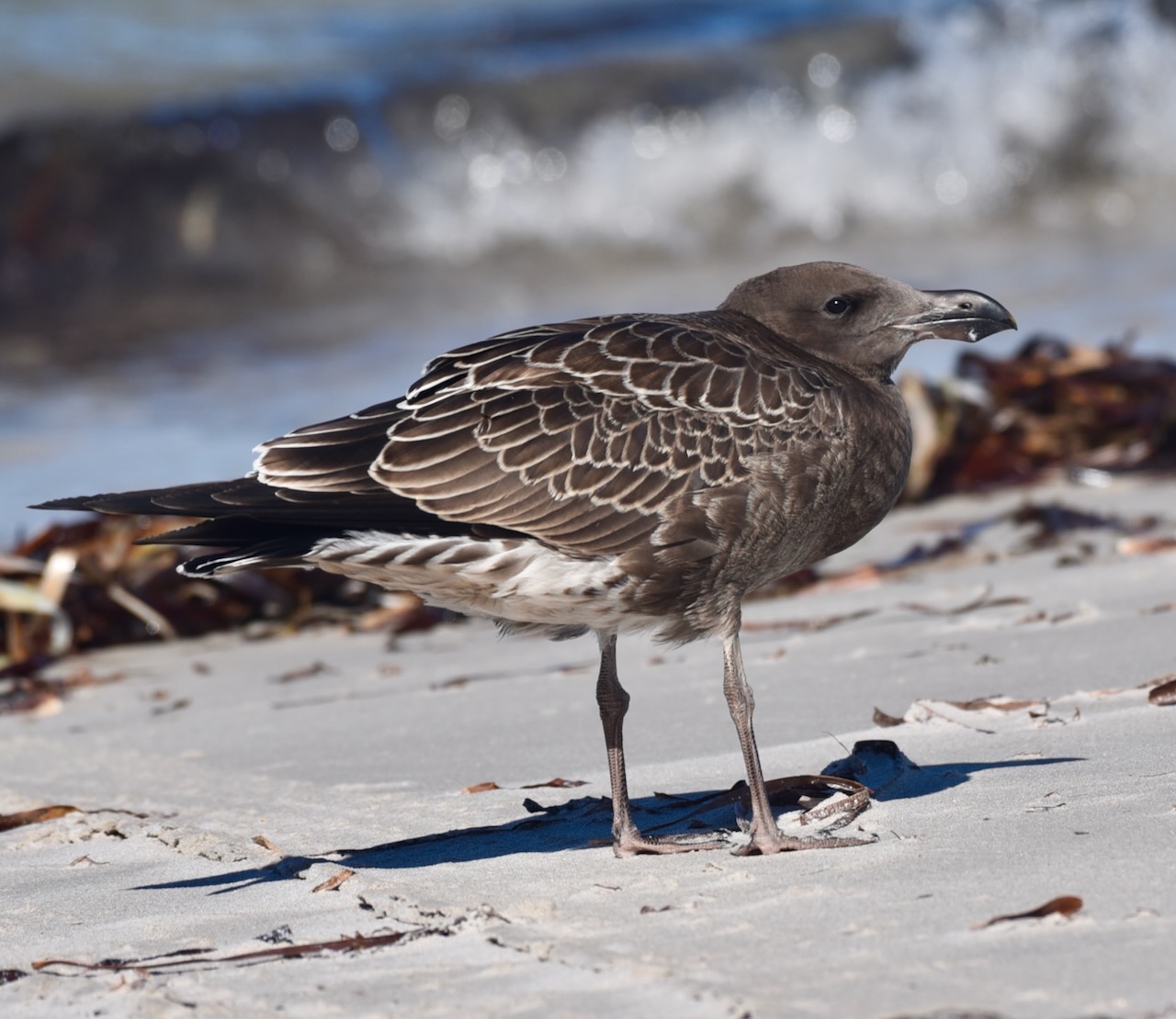
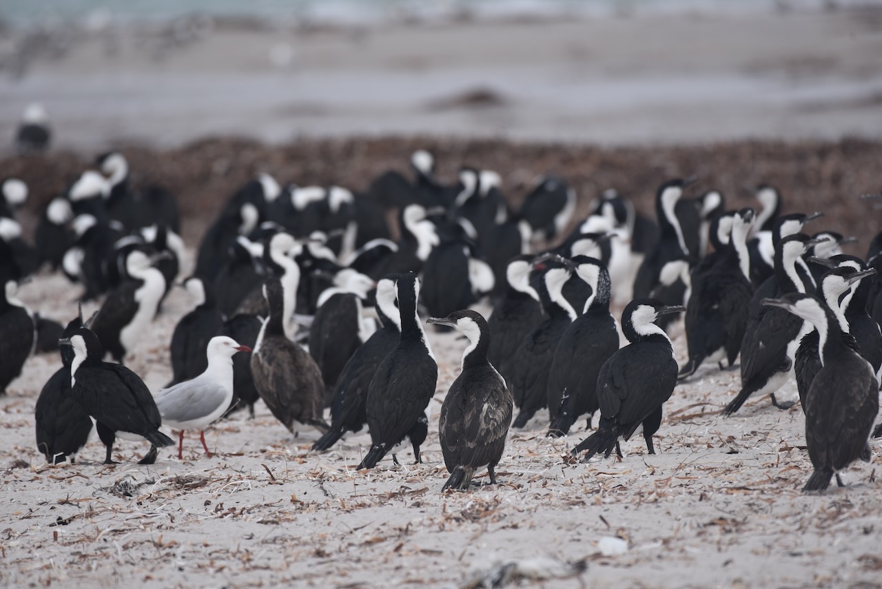
The island is part of the Troubridge Island Conservation Park. The park was proclaimed in 1982 to conserve sea-bird rookeries and to preserve the heritage values of the lighthouse and the associated keepers’ cottages. About 60 native bird species have been recorded on Troubridge Island. This includes 21 species of conservation significance and 22 species listed as migratory.
Troubridge Island has been nominated as an Important Bird Area (IBA) known as the Troubridge Island Important Bird Area by BirdLife International. The area supports over 1% of the world’s populations of both black-faced cormorants (with up to 4000 individuals) and silver gulls (with up to 10,000 breeding pairs) as well as supporting significant numbers of the vulnerable Fairy Tern.
HISTORY OF THE ISLAND.
The Narungga aboriginal people have a traditional association with Troubridge Island and other islands in the area. The island and shoal were first named by British navigator and cartographer Captain Matthew Flinders on the 24th day of March 1802, after Admiral Sir Thomas Troubridge.
Troubridge was a Royal Navy officer, who served during the Anglo-French War, the French Revolutionary Wars and Napoleonic Wars.
Above:- Captain Matthew Flinders (left) and Sir Thomas Troubridge (right). Images c/o Wikipedia.
Numerous ships were wrecked or grounded prior to the installation of the lighthouse on Troubridge Island. Official records state that 33 crews travelling west from Adelaide became shipwrecked in the early 1800s. It is believed there were many more.
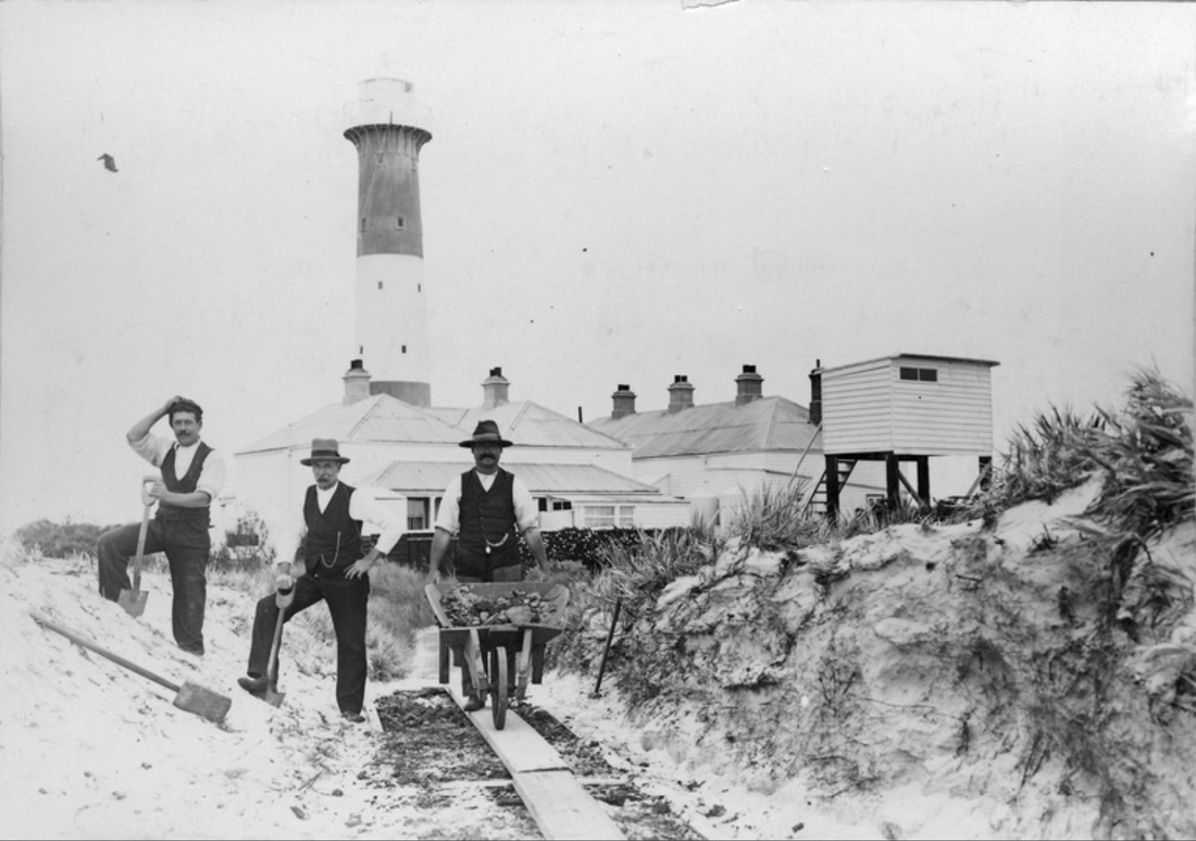
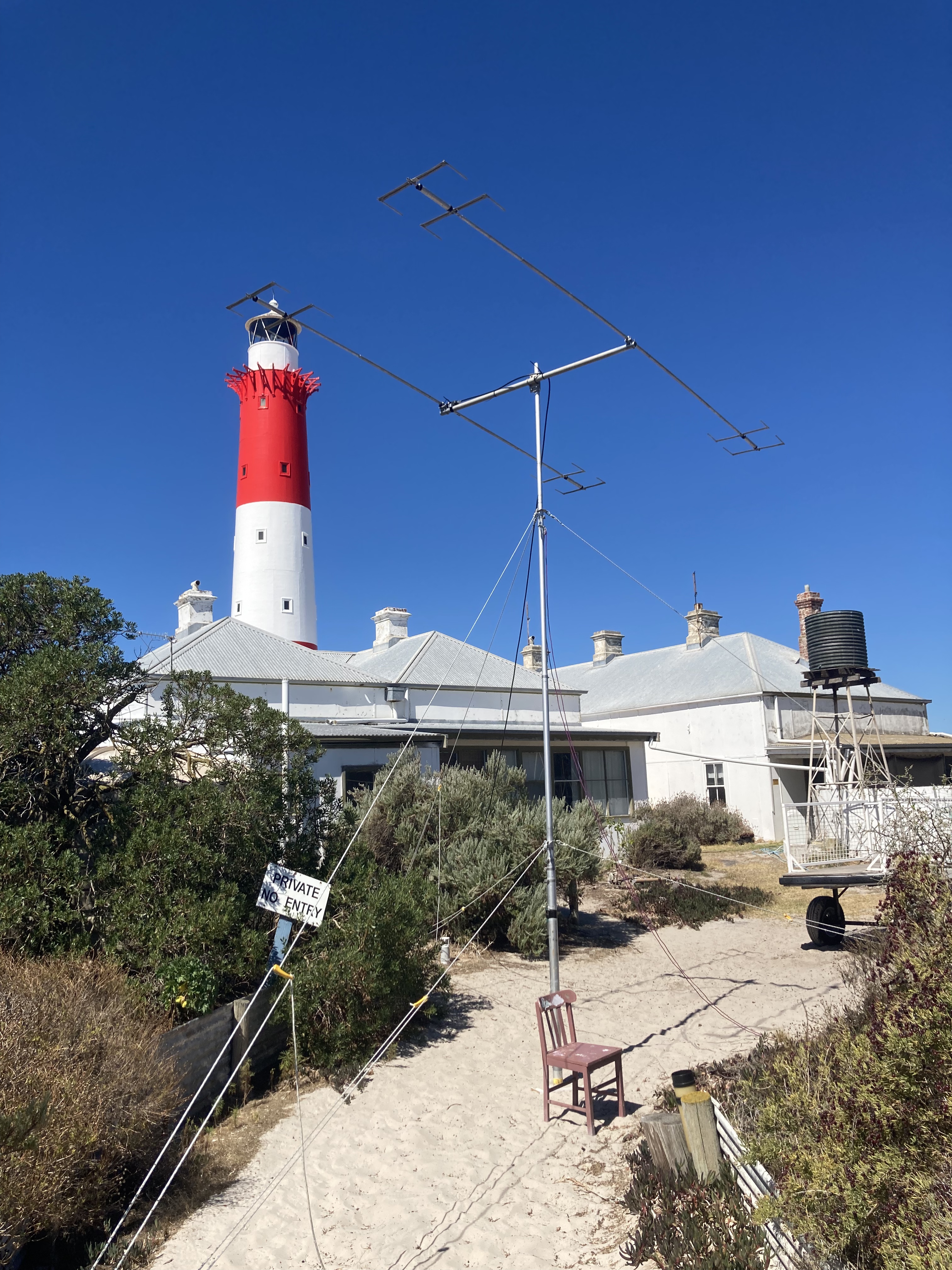
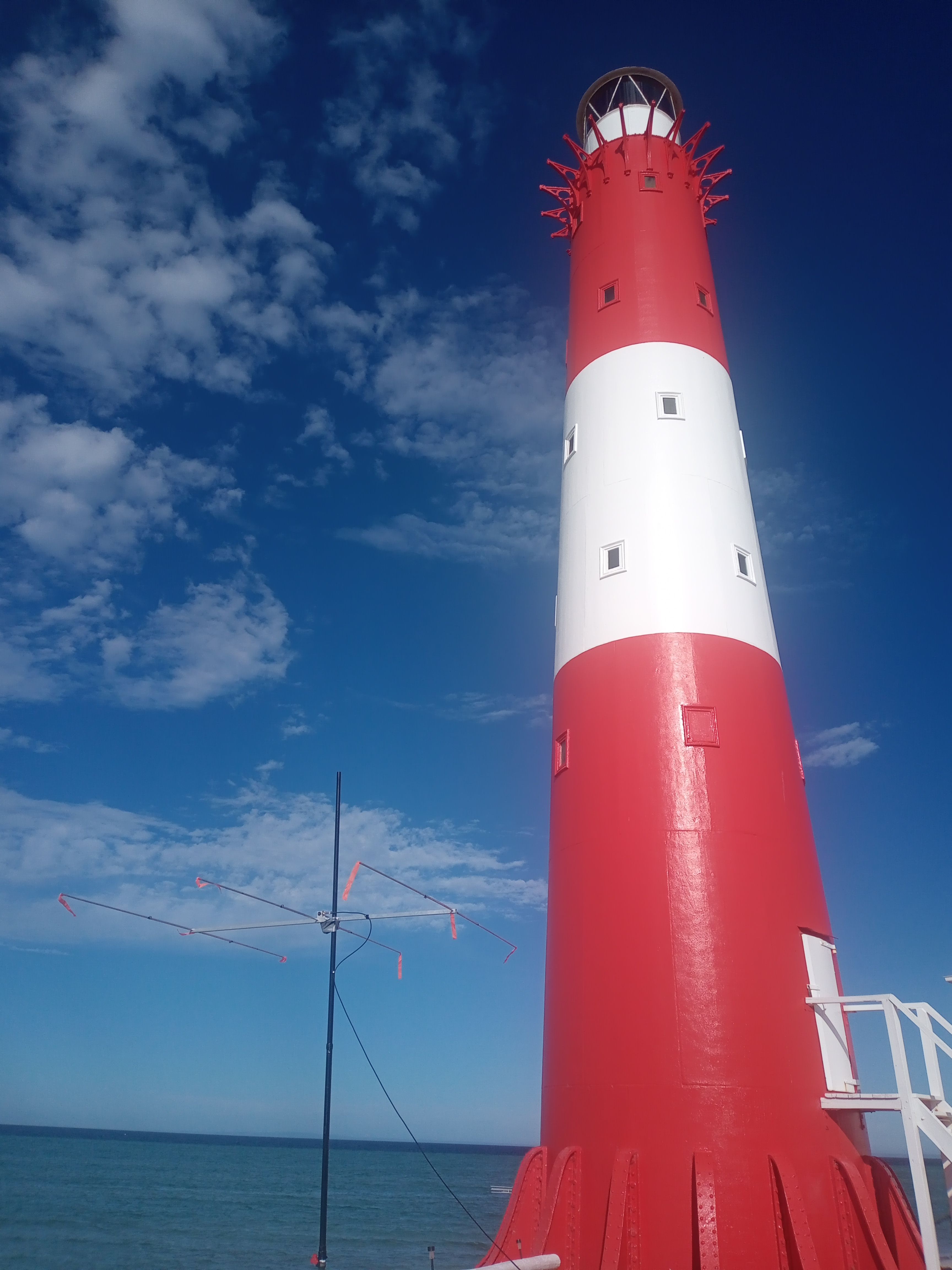
In 1855, the lighthouse was constructed.
The lighthouse was constructed of ten cylindrical cast iron segments which were shipped out from Britain and were bolted together on site. It is believed that Troubridge Island lighthouse is only one of two towers of this type constructed in Australia. The lighthouse is 24 metres (79 feet) in height and is 340 tons. A cast iron spiral staircase runs between the outer and inner walls connecting five rooms at its core.
Above:- c. 1910. Three men working with spades and a wheelbarrow outside Troubridge Island lighthouse, South Australia. Image c/o State Library South Australia.
GETTING TO THE ISLAND.
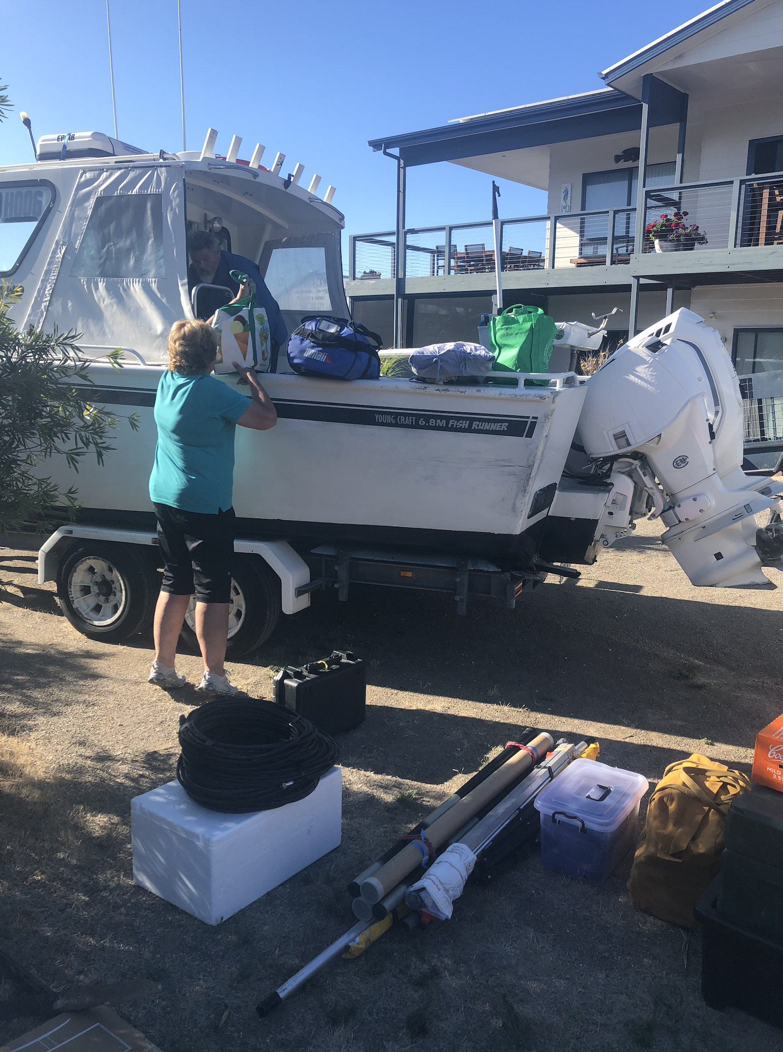
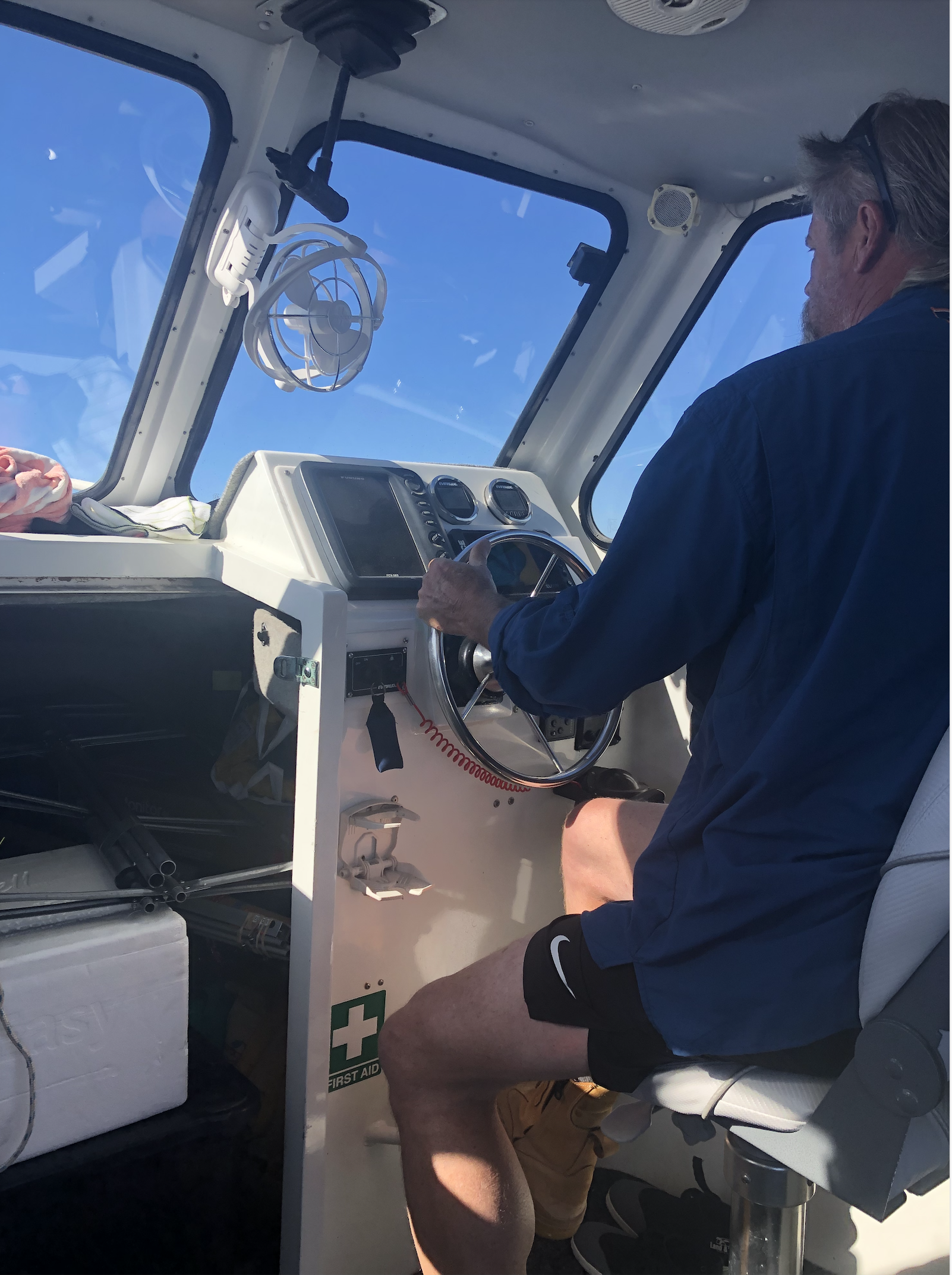
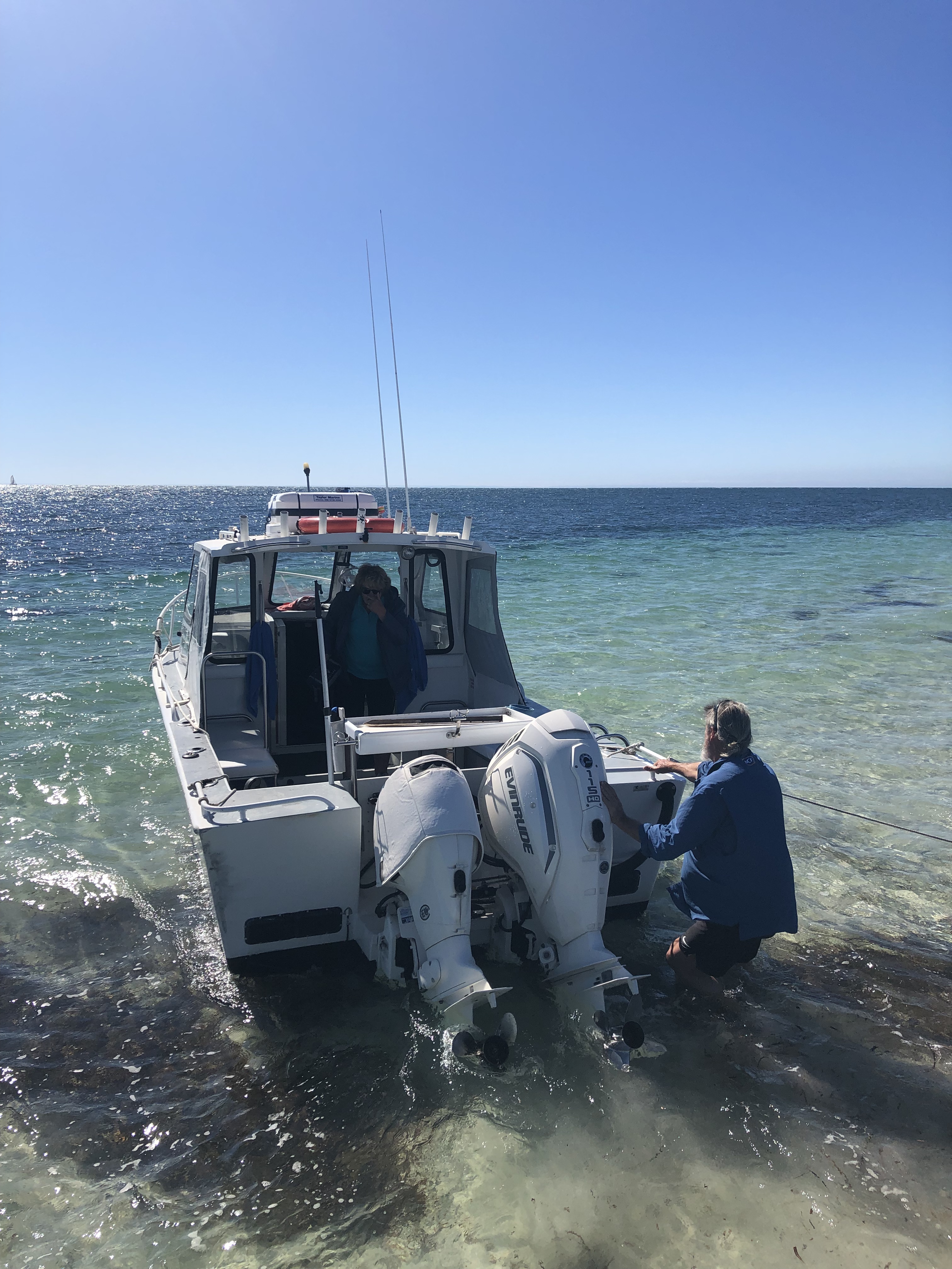
To get to the island we travelled by boat from Edithburgh with Mark and Lois of Troubridge Island Escape. We met Mark and Lois at their property at Wool Bay where we loaded the boat.
We then travelled down to Edithburgh in one vehicle towing the boat and the remainder of the team in a courtesy vehicle. We cannot speak highly enough of Mark and Lois. They were extremely friendly and helpful, not only during the trip but leading up to the trip.
Once we arrived in Edithburgh Ivan and I boarded the boat with Mark and Lois and headed to the island. The remaining four team members, Marija, Chris, Adam, and Andy headed off to get a coffee.
It takes just 15 minutes to get out to the island from Edithburgh. It was a beautiful sunny day and the water was quite calm.
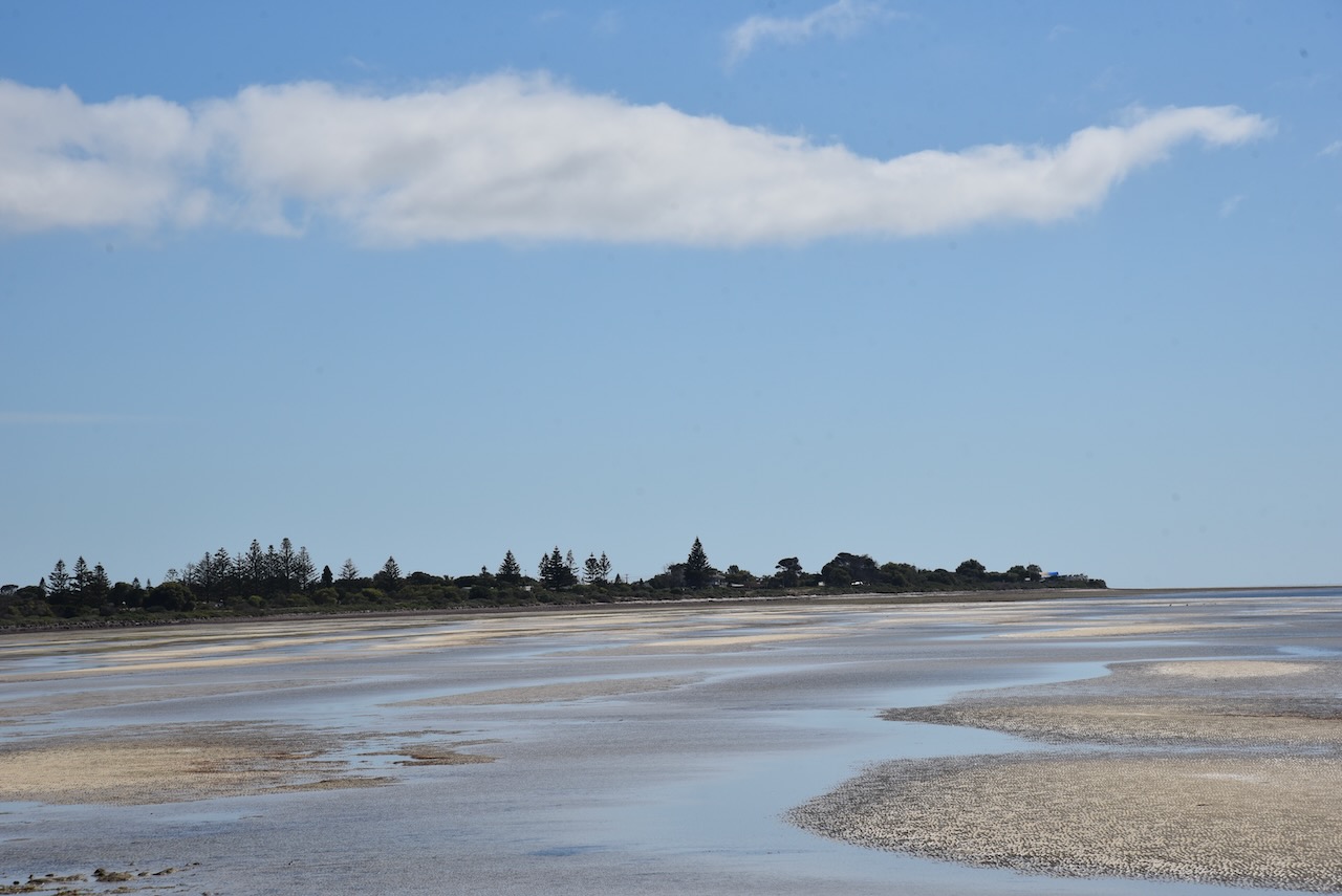
Below is a view of Troubridge Island from the boat as we approached the sandbar. What a beautiful view!
WE HAVE LANDED.
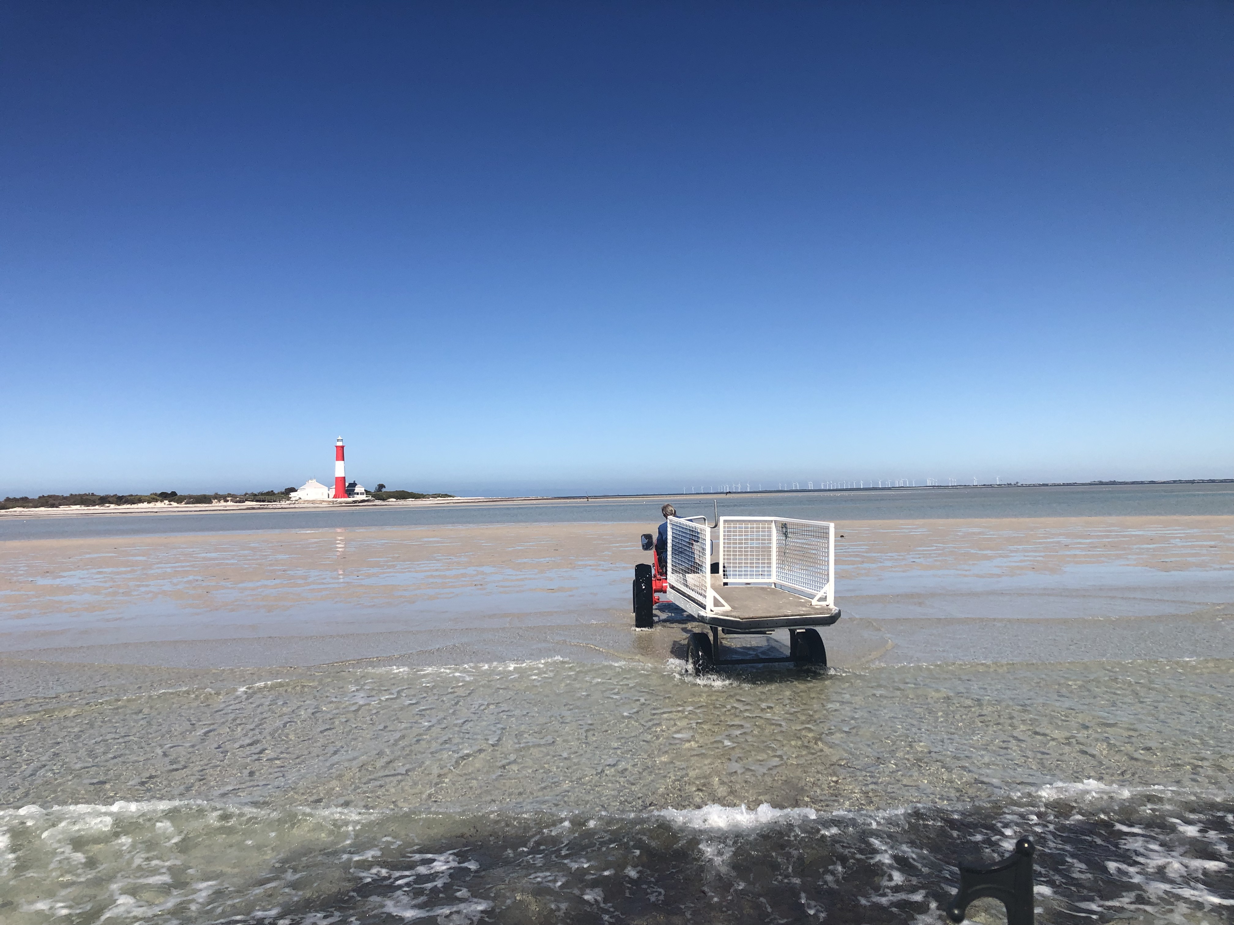
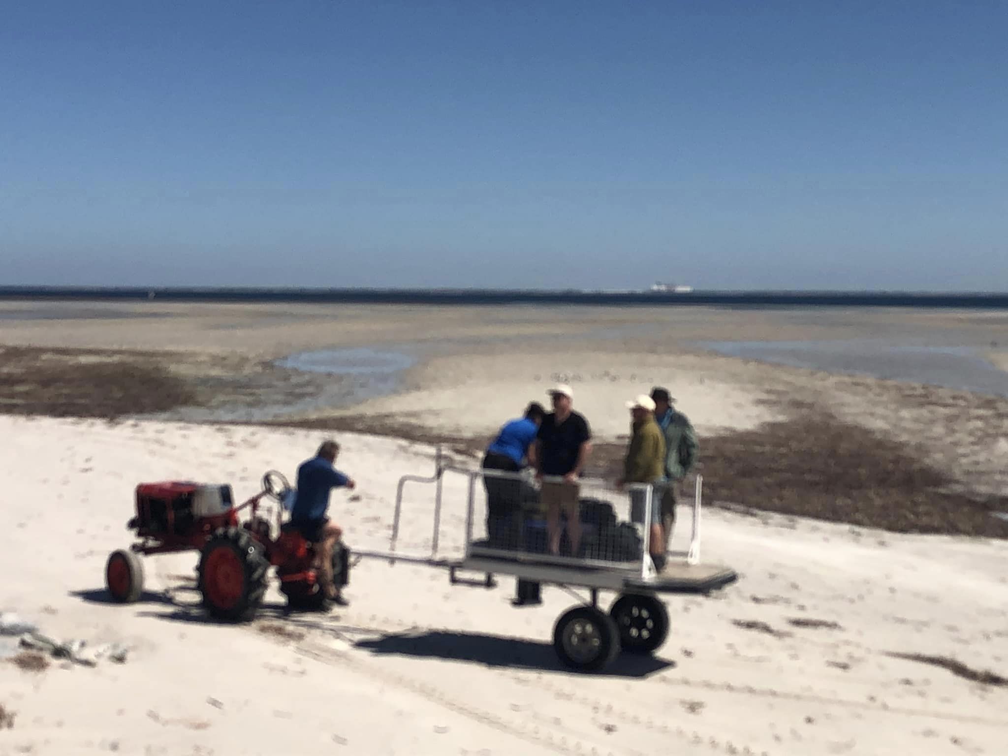
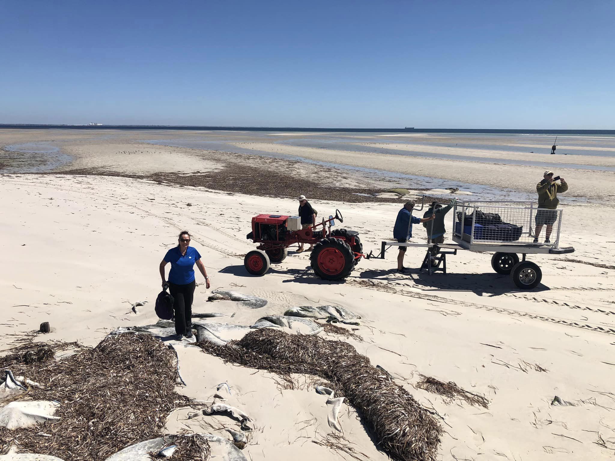
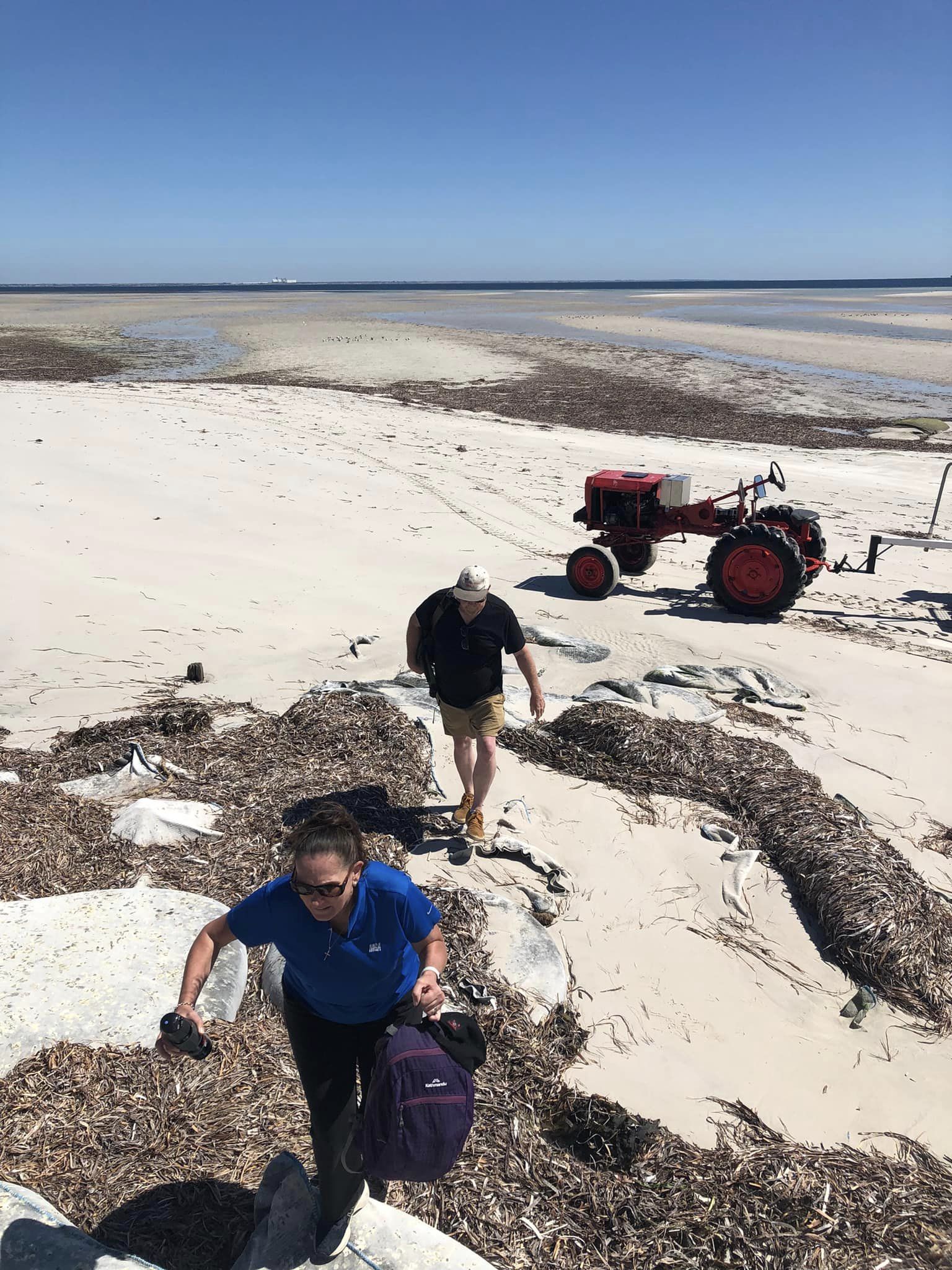
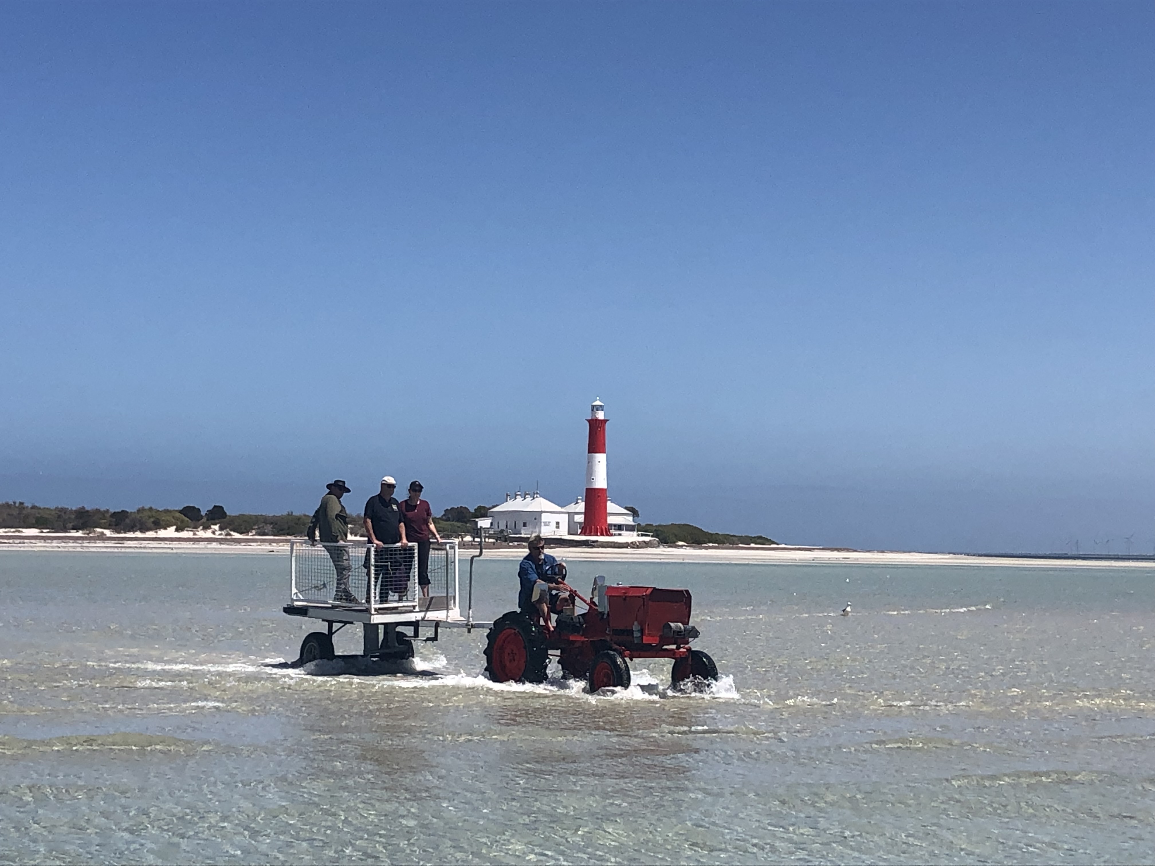
Once the boat was anchored, Mark walked to the island and collected a tractor and trailer and drove back to the boat. We loaded all of our gear onto the trailer and Lois drove us across the shallow water and sandbar to the island while Mark headed back to Edithburgh with the boat to collect the remainder of our team.
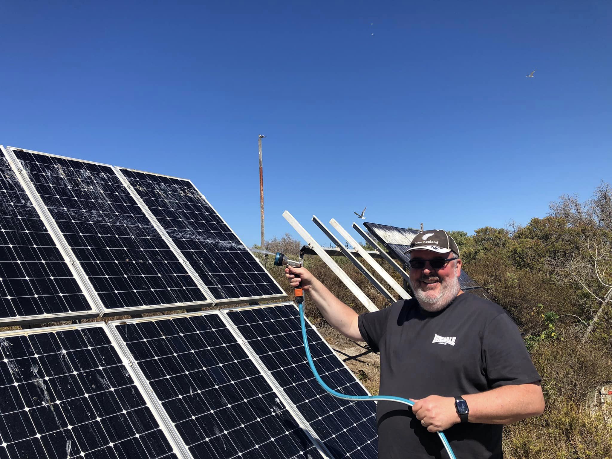
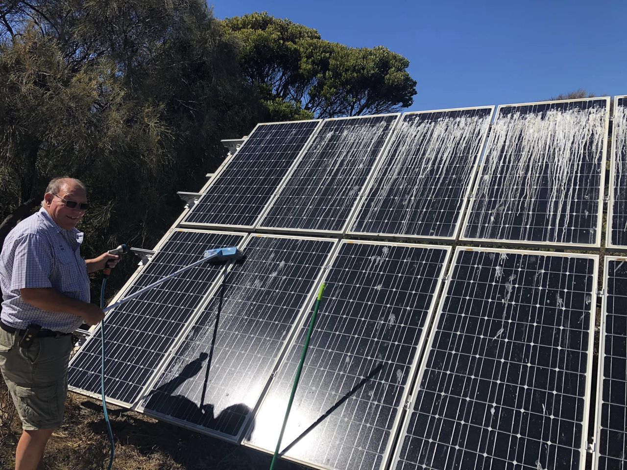
Upon arriving on Troubridge Island, Ivan and I offloaded the radio gear. Lois also took us for a tour around our accommodation. One of our first jobs on the island was to clean all the bird poo from the solar panels. Solar is the only power on the island.
It is about a 15-minute boat ride from Edithburgh to Troubridge Island. So after about an hour, the remaining four team members Marija, Adam, Andy, and Chris arrived safely on the island.
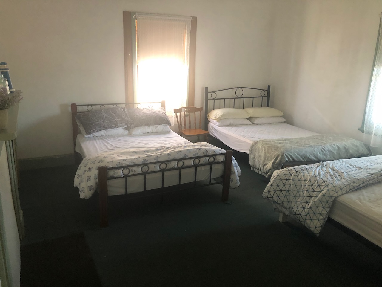
ACCOMMODATION.
Our accommodation on the island was one of the old lighthouse keepers’ cottages.
SETTING UP ANTENNAS AND STATIONS.
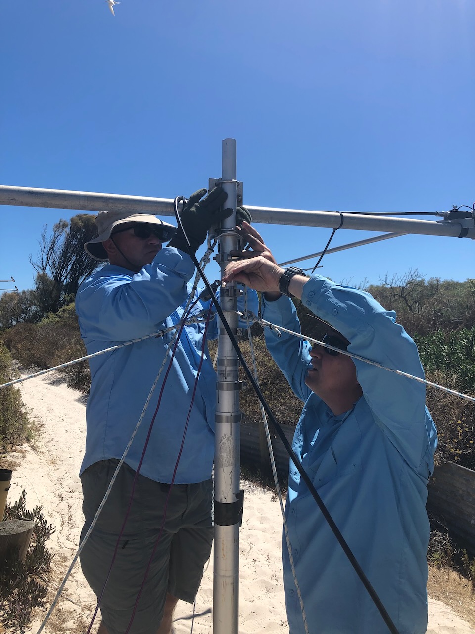
Once on the island, we commenced setting up. We set up four operating stations.
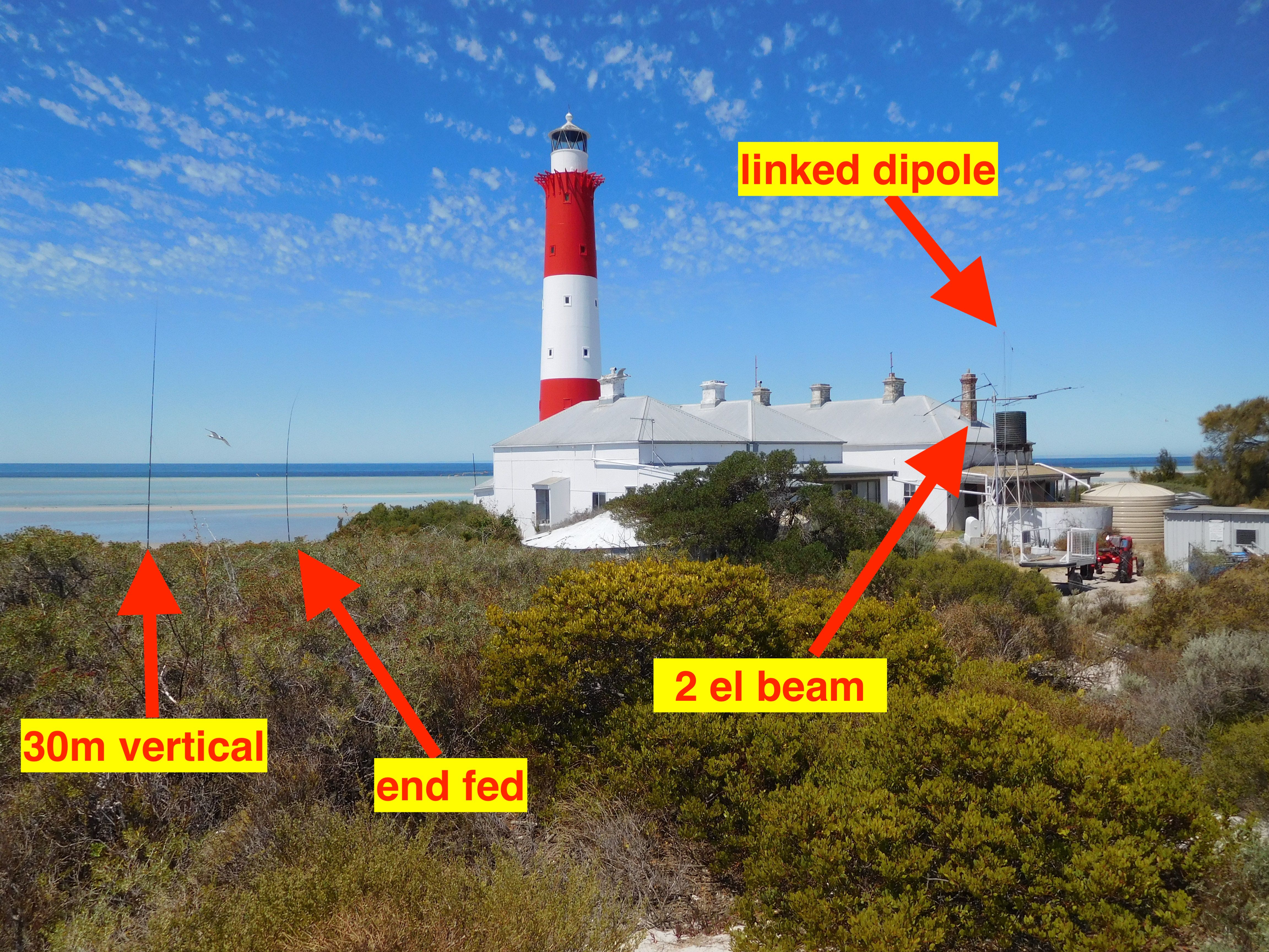
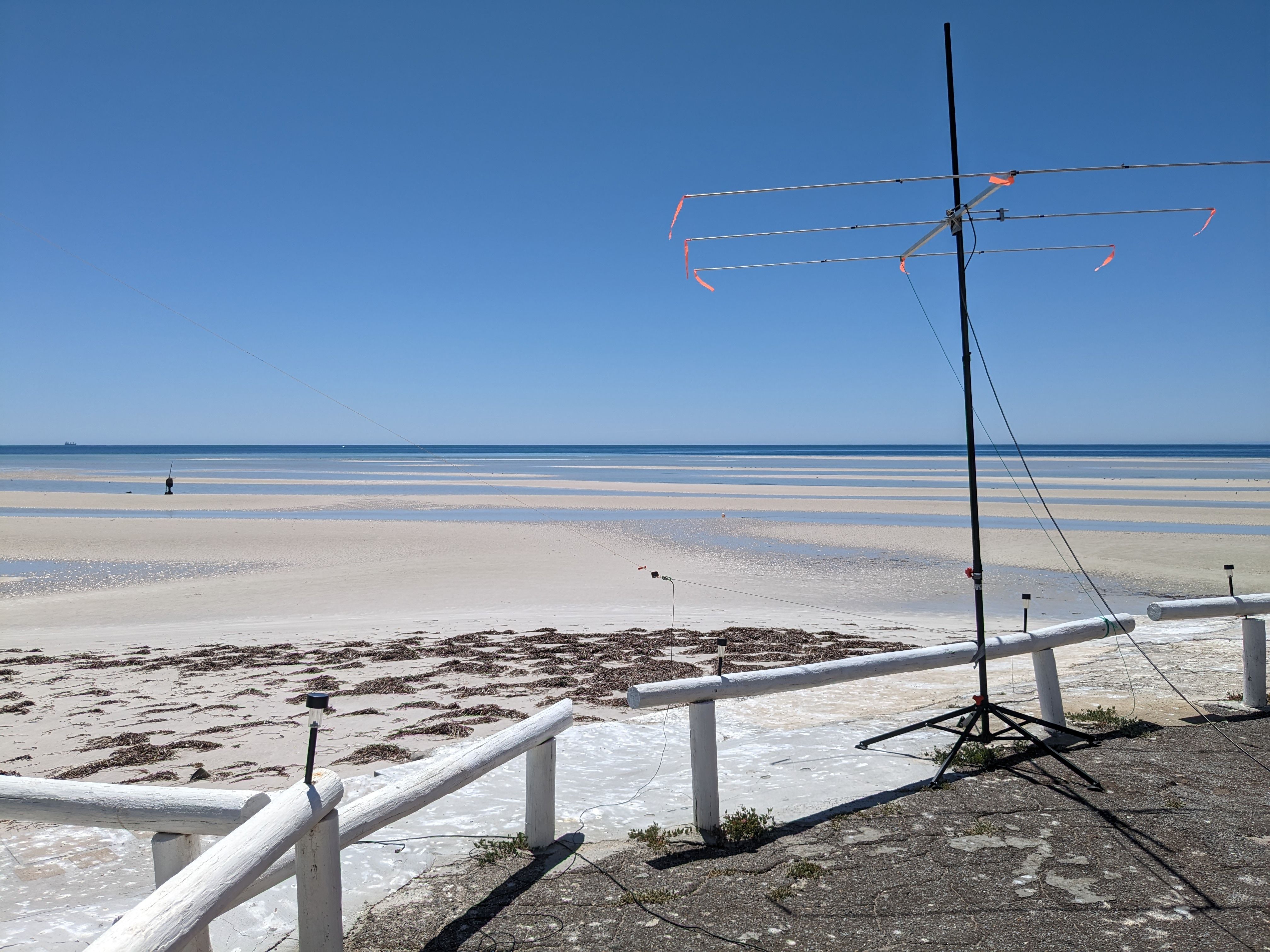
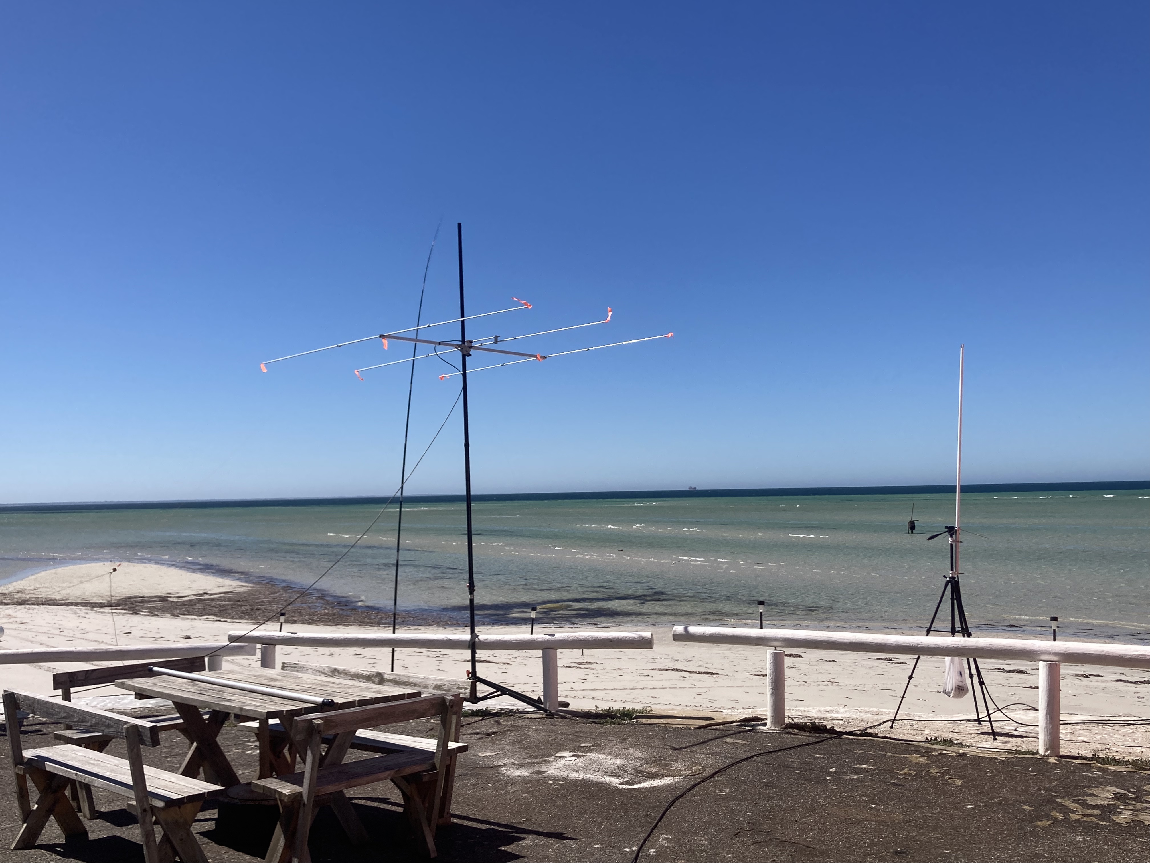
We established four separate stations located in both of the cottages and erected an array of antennas including linked dipoles, a vertical, an end fed, and a small 2-element beam.
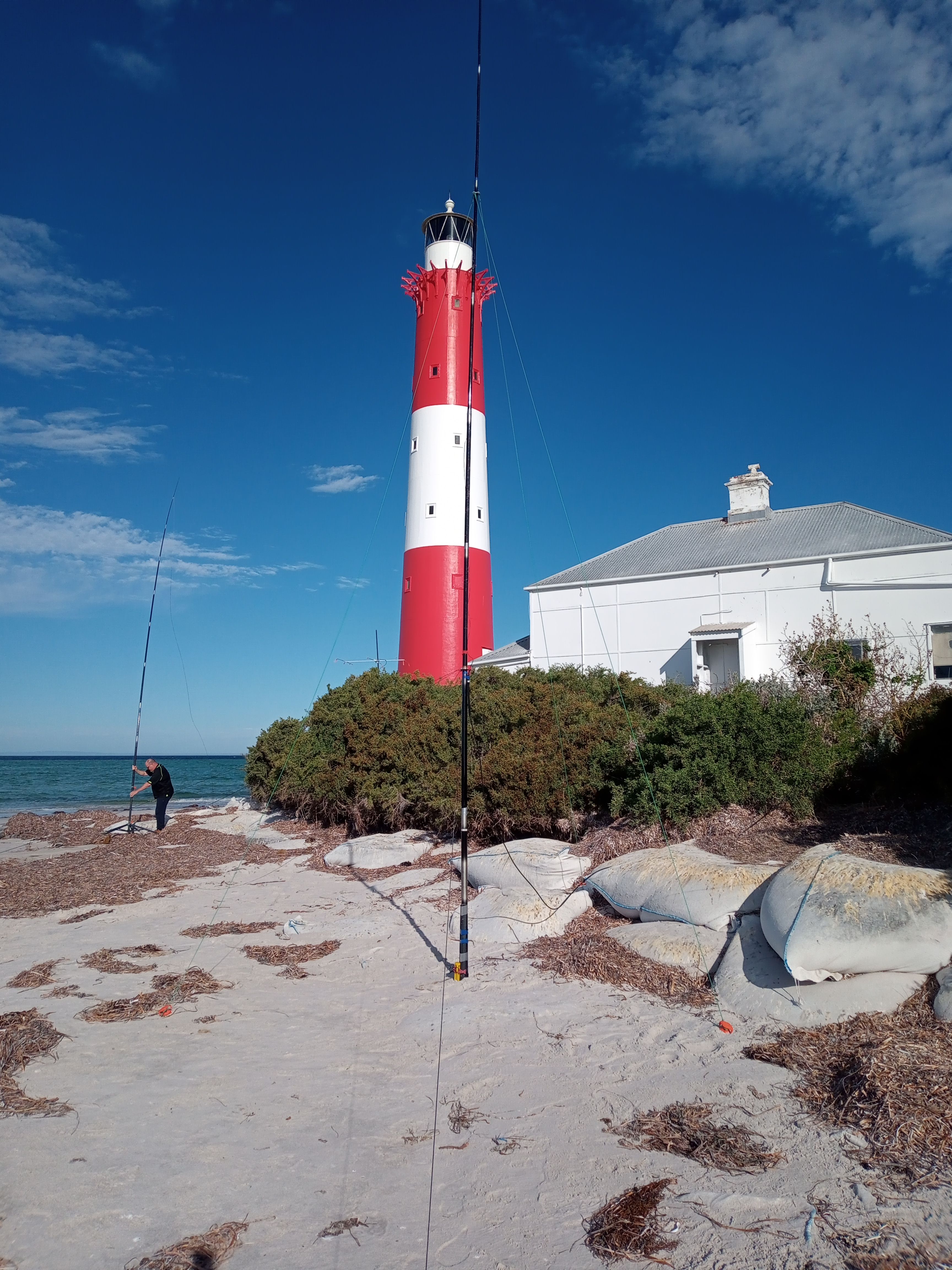
Below is a photo of the end fed and the 30m vertical on the beach.
Above:- the end fed and the 30m vertical on the beach – at sunset.
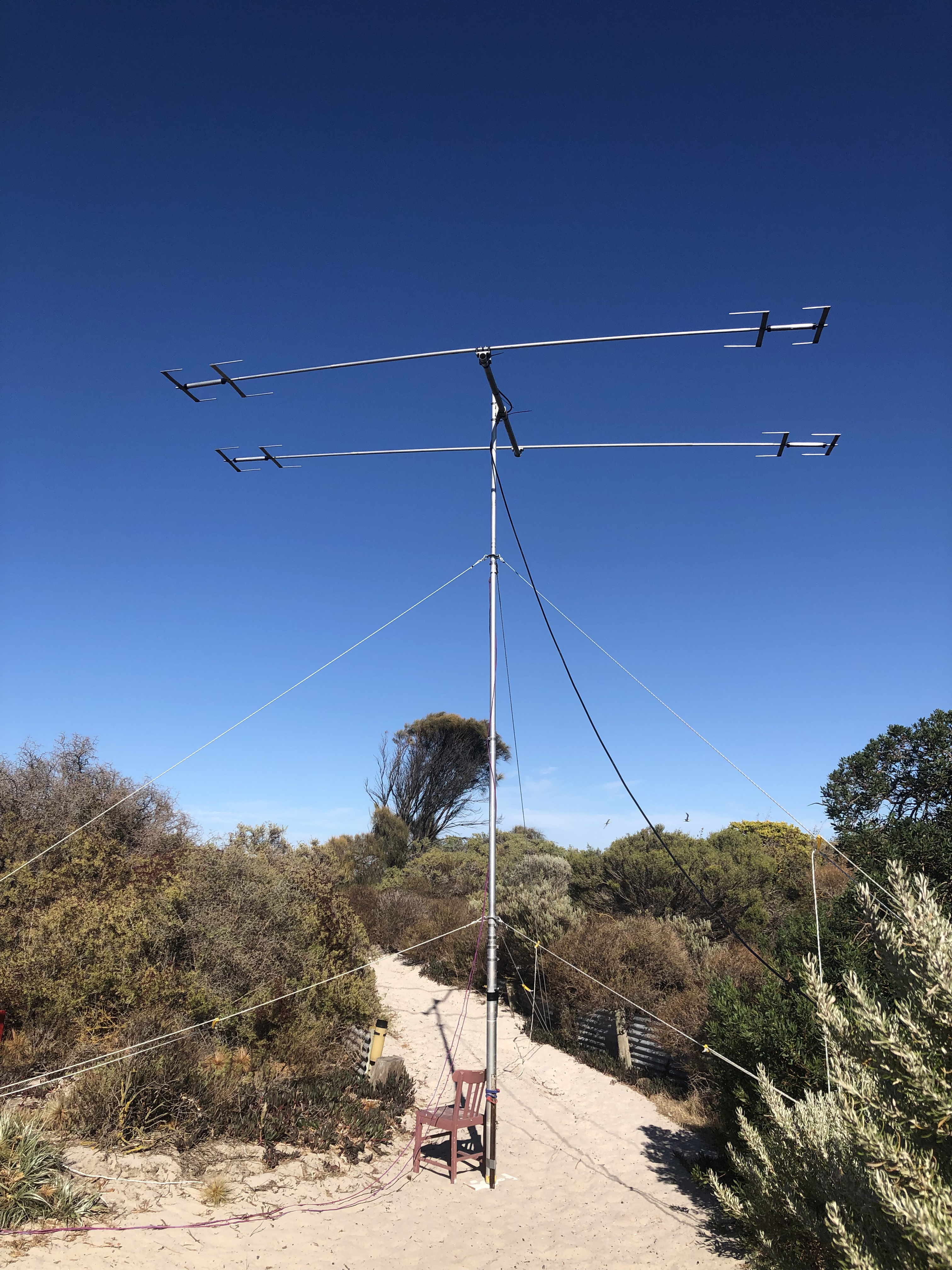
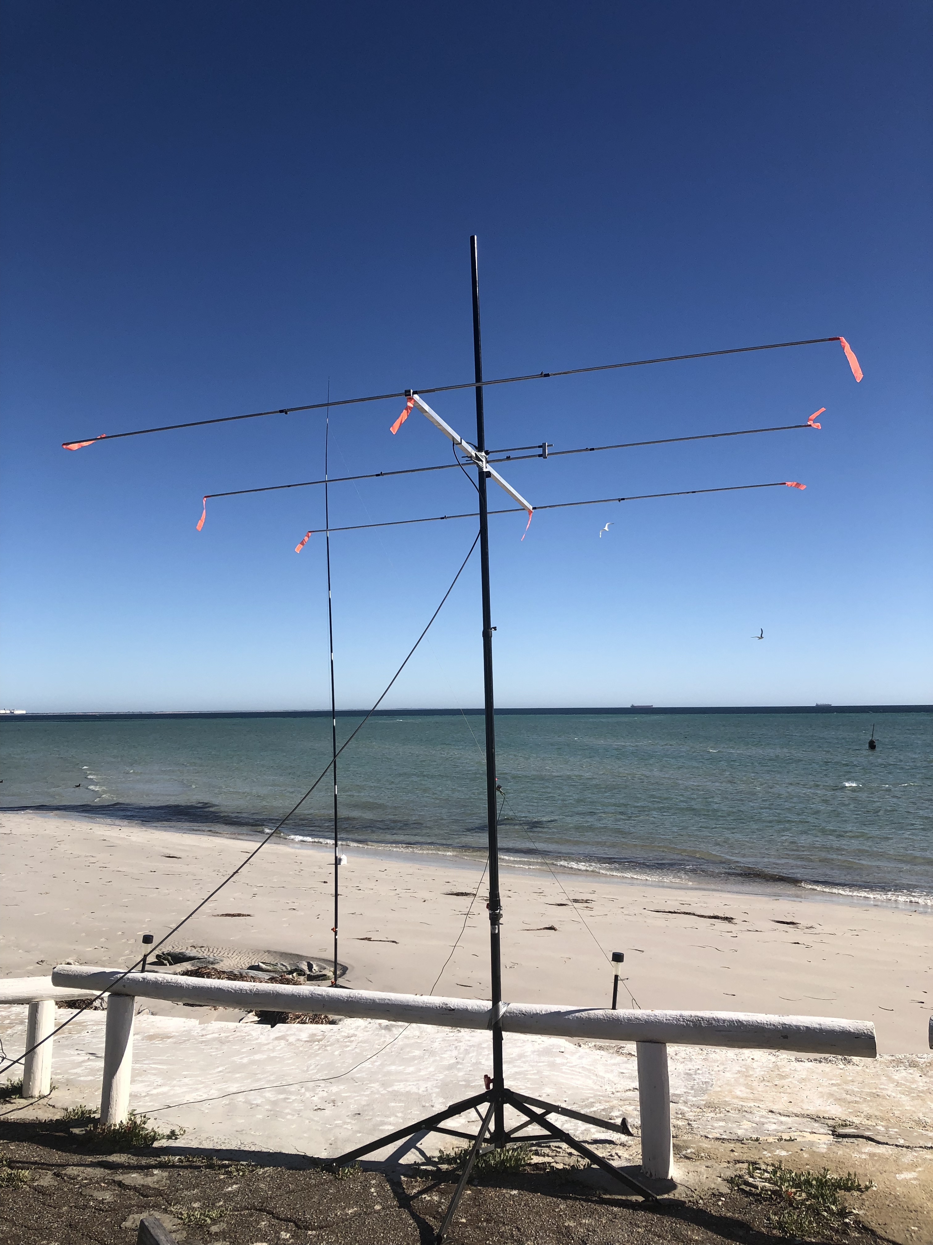
Below are some photos of the 2 element yagi.
Below is a photo showing the 20/40/80m linked dipole.
Improvisation was the name of the game. We had not been to the island before so we had to play everything by ear. The lighthouse keeper’s cottage that we slept in was clean and tidy. But the second cottage which is normally used for storage was not ideal, so we just set up one station in there.
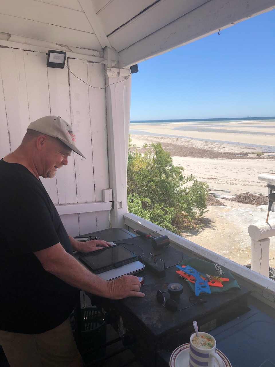
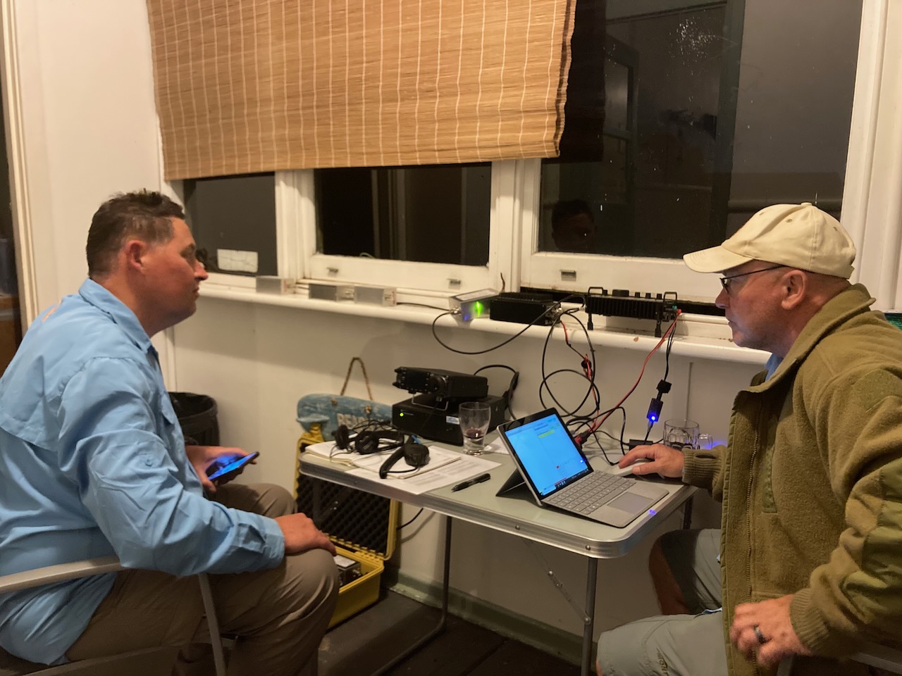
Above:- One of the stations set up on the front verandah of the lighthouse keeper’s cottage.
HOW MANY QSOS DID WE MAKE?
Our first QSO was with Peter VK3PF.
Our final QSO was with Ted VK6NTE.
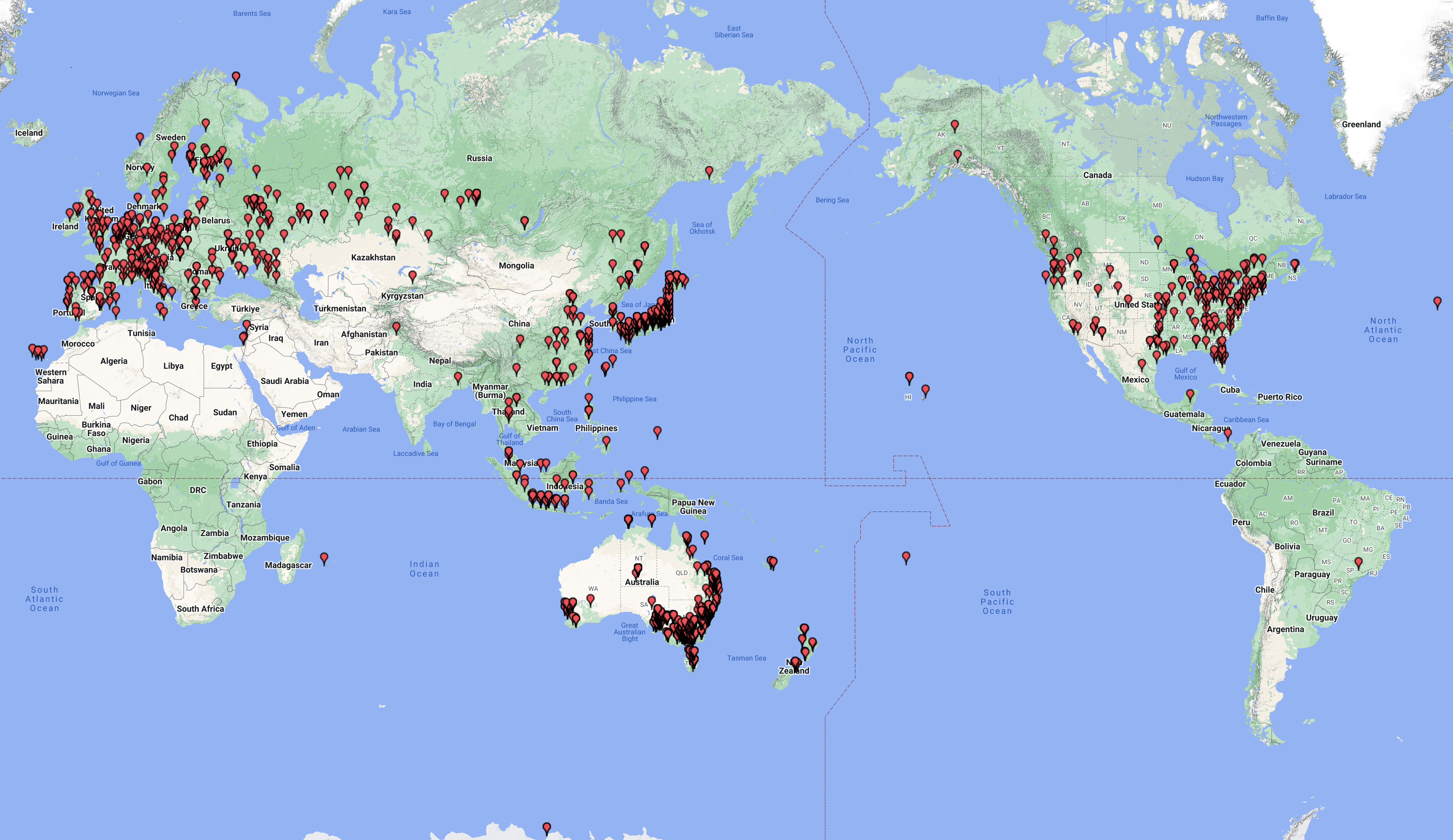
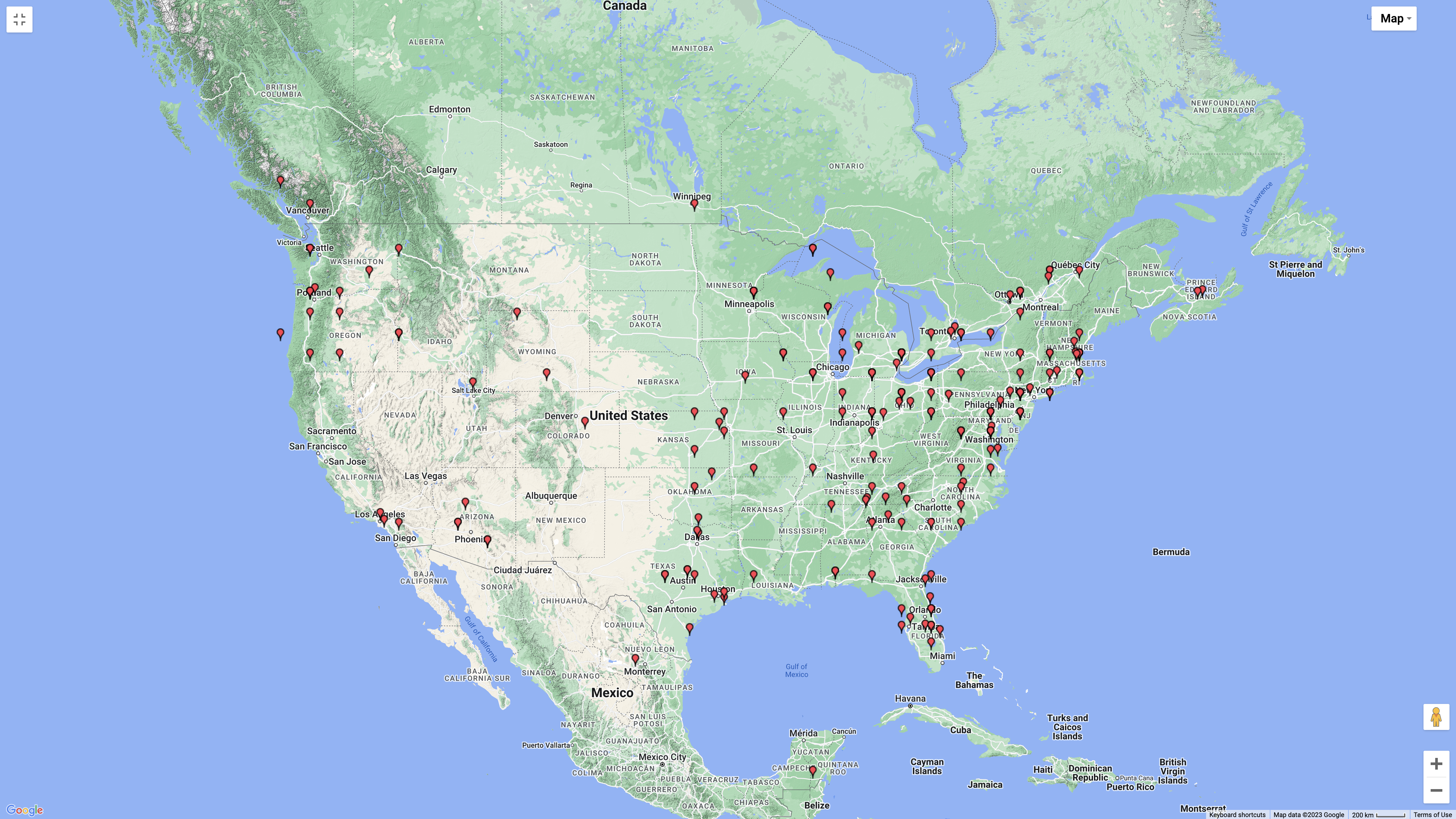
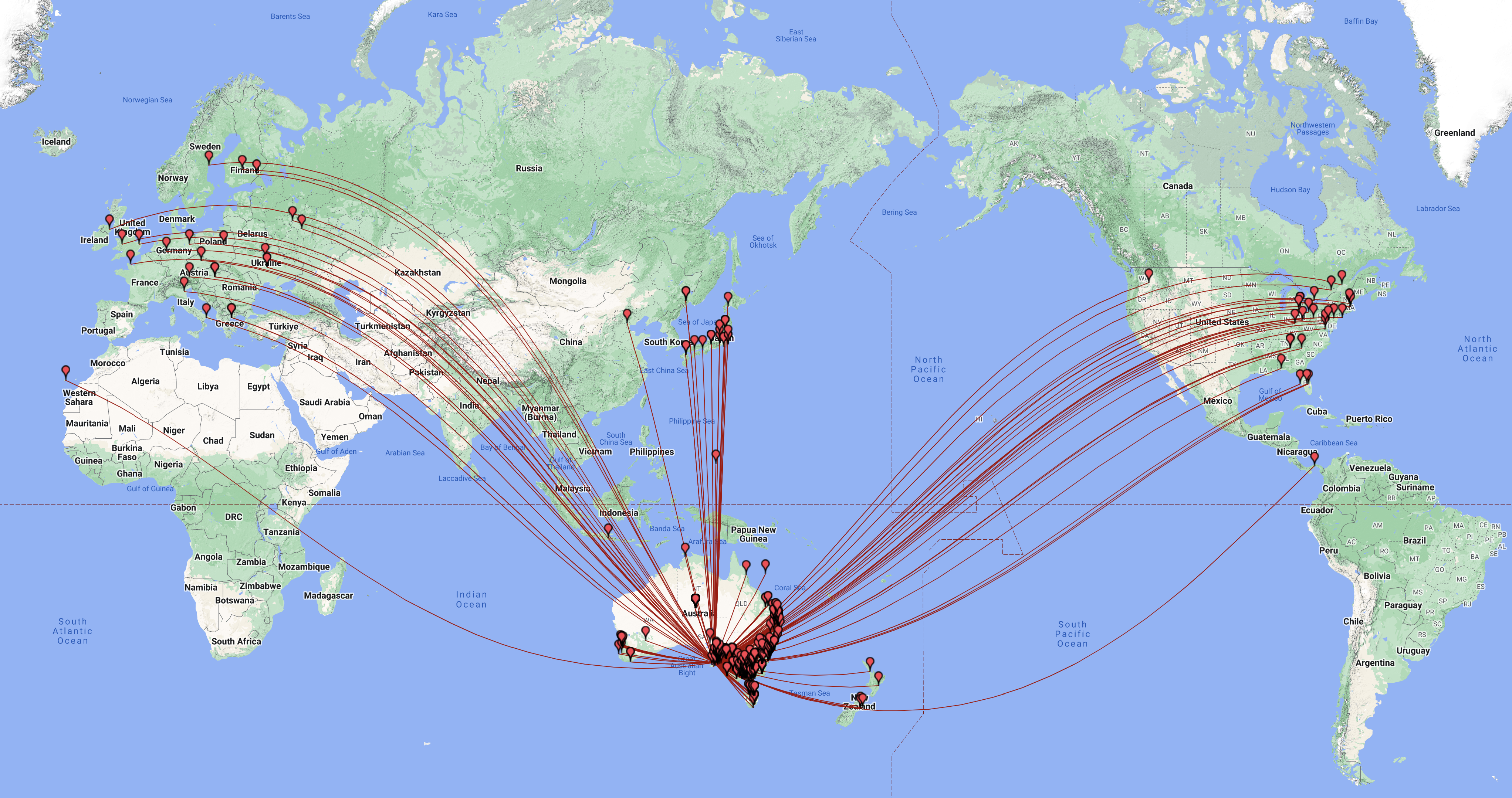
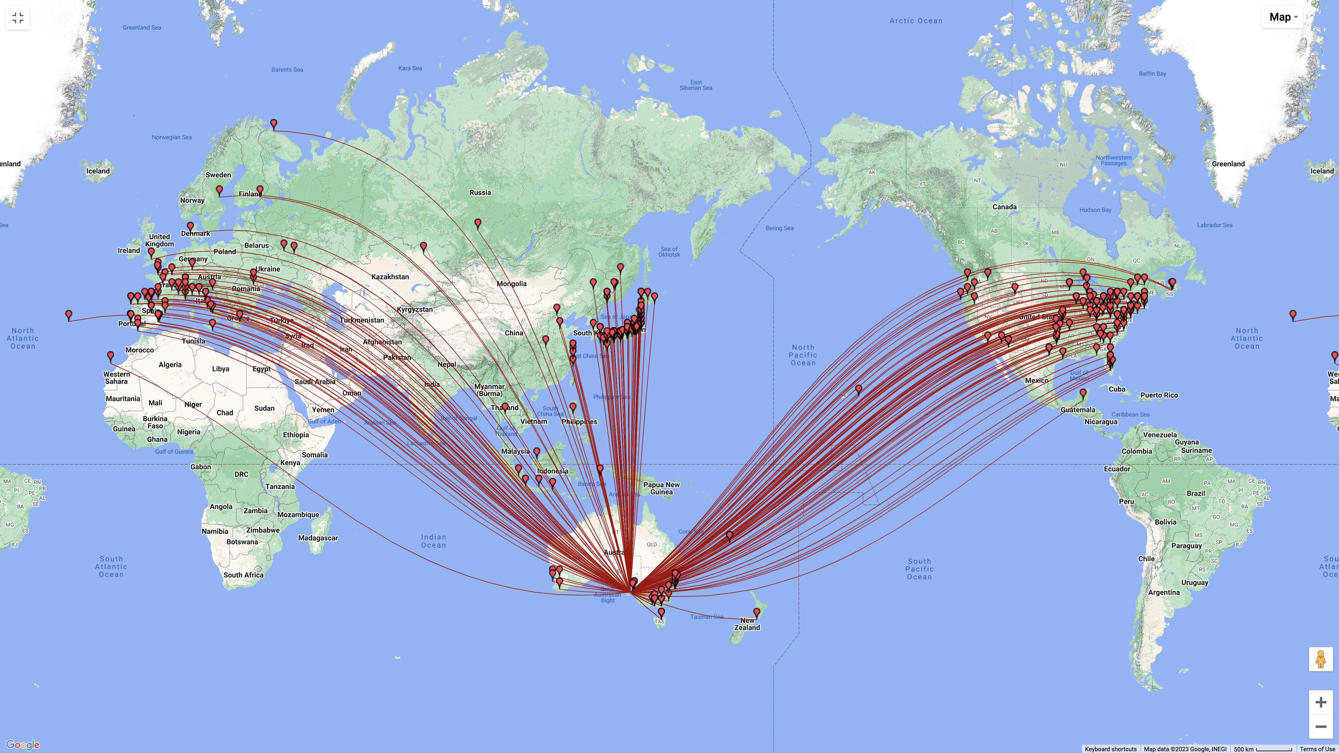
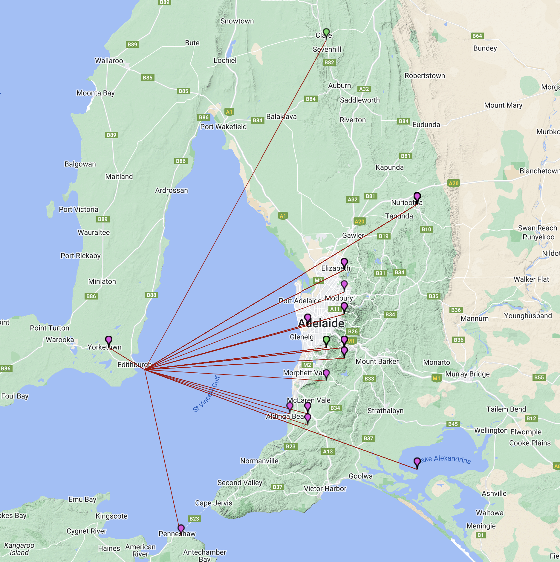
During our stay on the island, we made a total of 2,123 QSOs and worked 65 different DXCC entities. Below is a map showing our contacts around the world.
Above:- Map showing our contacts around the world. Map c/o QSOMAP.org
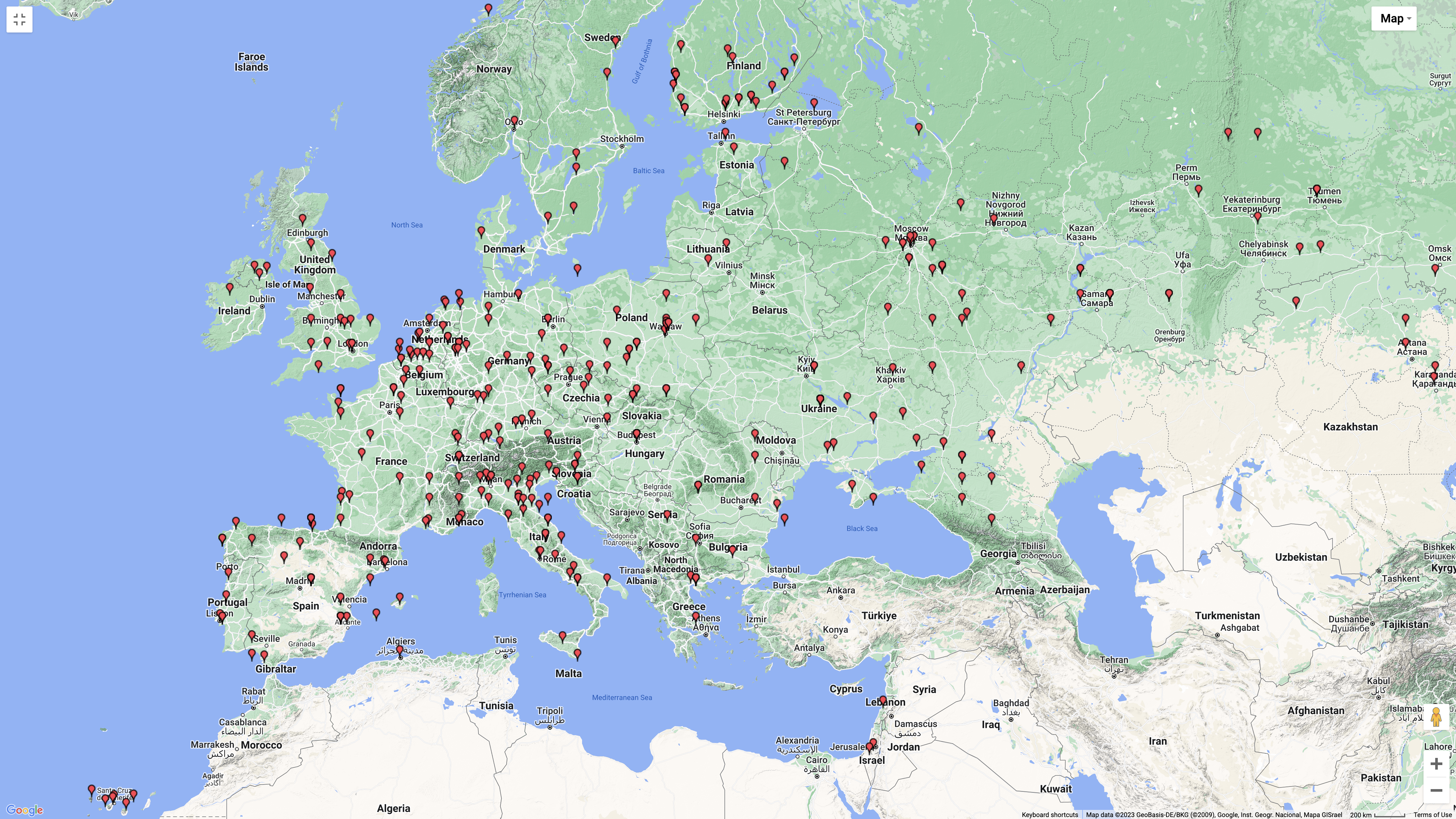
We had some nice openings into Europe and the United Kingdom on Wednesday and Thursday on the long path on SSB, along with numerous FT8 & CW contacts into Europe.
Above:- Map showing our contacts into Europe. Map c/o QSOMAP.org
We also made numerous contacts into North America.
Above:- Map showing our North American contacts. Map c/o QSOMAP.org
And of course we made numerous contacts around Australia.
The majority of our contacts were on the 40m band (594), followed by 20m (582) and then 30m (328).
Above:- Graph showing our contacts per band. Graph c/o meta-chart.com
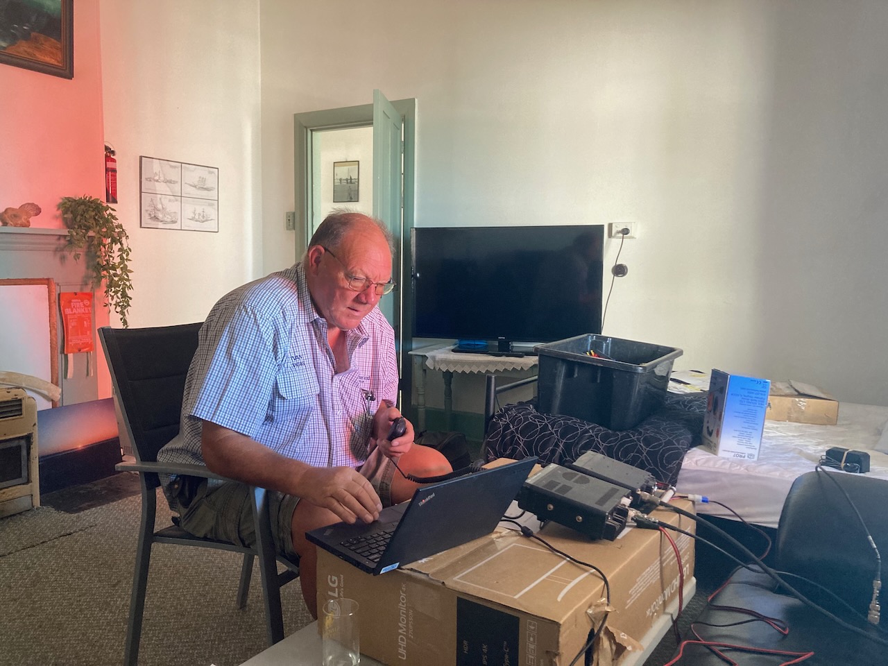
We operated on SSB, CW and FT8 during our time on Troubridge. The majority of our contacts were on FT8 (974), followed by SSB (926), and then CW (133). We also made contacts on AM, 70cm DMR, 70cm FM, 70cm SSB, 2m DMR, 2m FM, and 2m SSB.
Above:- Graph showing our contacts per mode. Graph c/o meta-chart.com
WE ARE UNDERWATER.
In the early hours of Wednesday morning (our first night on the island) I was awoken by a large bang. A few of us went out to investigate to note that the wind had significantly picked up and had knocked over the 6m yagi. But worse, our 30m vertical was lying on its side flapping about in the water, and the end fed was also underwater, but was still standing. The tide had come in a lot further than we had believed it would. Fortunately, no damage was caused to the antennas.
Above:- The end fed. Take note of the seaweed up the top. The tide had started to go out when this photo was taken.
BANDS WORKED & MODES.
We operated on 70cm, 2m, 6m, 10m, 15m, 17m, 20m, 30m, 40m, 80m, & 160m.
We operated on SSB, FT8 & CW.
Below is a video showing one of our FT8 stations.
SUMMARY OF EACH BAND USED.
Below is a breakdown of our activity per band.
160M BAND.
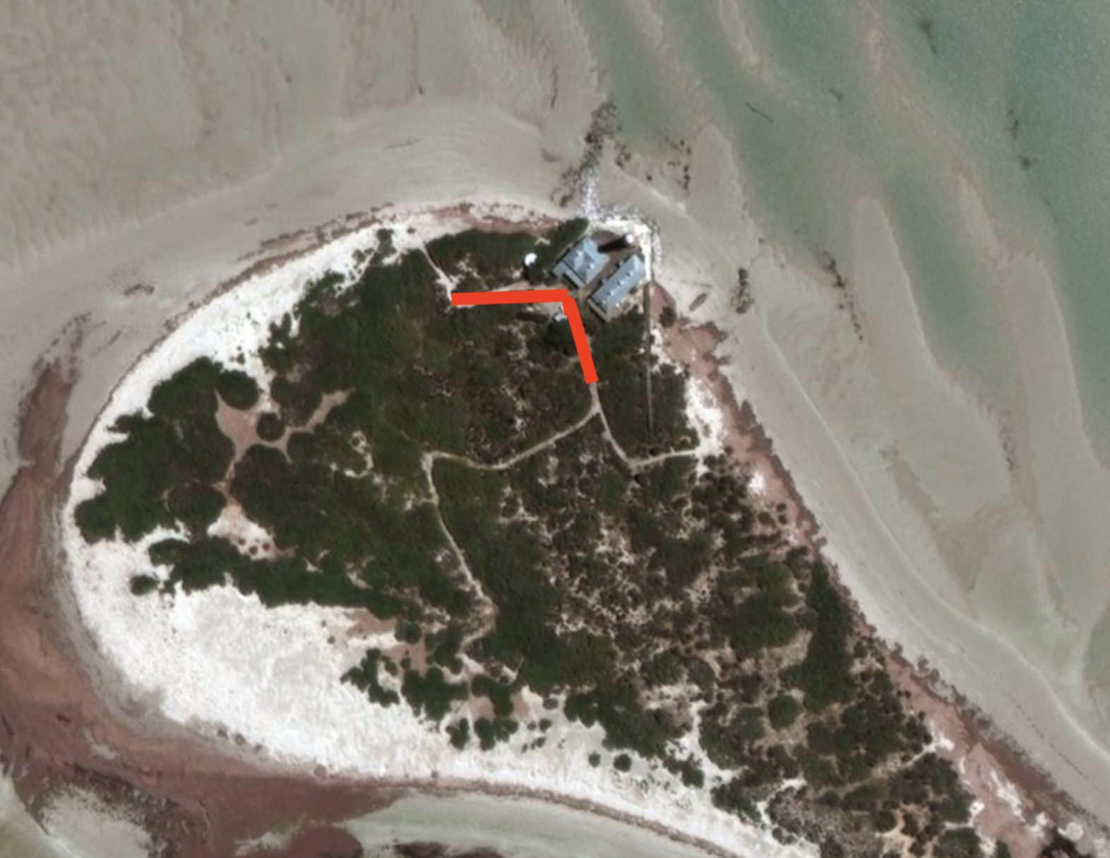
On Wednesday afternoon (8th February) we set up a linked dipole that Ivan VK5HS had put together. It included the 160-metre band.
We ran the legs of the 160m dipole along two sandy paths at the rear of the cottages. The legs of the dipole ran west and southeast.
Above:- Aerial shot of Troubridge Island, showing the 160m antenna.
A total of 29 QSOs were made on the 160m band into VK2, VK3, VK5, and VK6. Our longest distance QSO on 160m was with Brian VK6LO in Western Australia.
The majority of our contacts on 160m were on SSB. But we also made a handful of contacts on AM and FT8.
3 – AM
3 – FT8
23 – SSB
Above:- Map of Australia showing the location of the 160m band contacts. Image c/o Log Analyzer.
The video below shows Ivan VK5HS on 160m.
80M BAND.
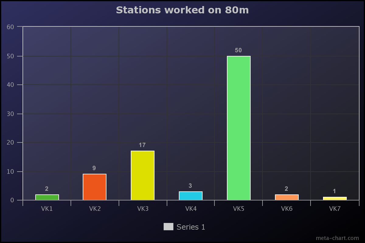
We made a total of 84 contacts on the 80m band into VK1, VK2, VK3, VK4, VK5, VK6, and VK7. All of these contacts were on LSB, excluding one AM contact with John VK5BJE in the Adelaide Hills.
Above:- Map of Australia showing our 80m contacts. Image c/o Log Analyzer.
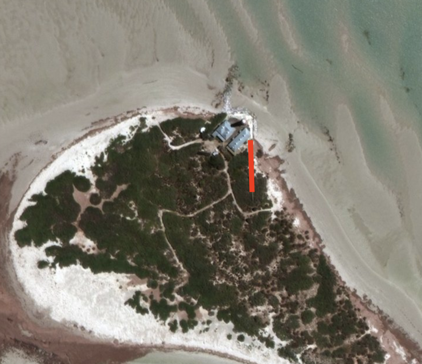
Our 80m SSB station consisted of a Yaesu FT857, 100 watts, and a linked dipole which ran north-south along a wooden boardwalk. The antenna was in an inverted vee configuration and was supported by a 7-metre telescopic heavy-duty squid pole.
Above:- The linked dipole, supported on a 7m squid pole.
There were times when the high tide came in, and half of one leg of the 80m section of the dipole was underwater, and yet it still seemed to perform well.
Above:- Aerial shot showing the orientation of the linked dipole, running north-south. Image c/o Google maps.
The 80m station was set up in a room in the second lighthouse keeper’s cottage. The room had a lot of echo, so we had to improvise and use some old mattresses to dampen the echo effect.
Above:- Adam VK2YK and Marija VK5MAZ on air on 80m SSB.
The majority of our contacts on the 80m band were around South Australia (VK5) – a total of 50. This was followed by Victoria (VK3) with 17 and then New South Wales (VK2) with 9.
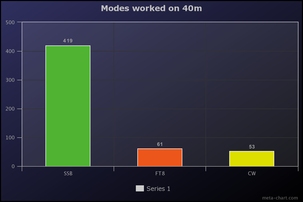
We made a total of 593 QSOs on 40m. The majority of those were on SSB (419), followed by FT8 (61), and then CW (53).
Above:- Graph showing the number of contacts made on 40m per mode. Graph c/o meta-chart.com
x
We worked the following 25 DXCC on the 40m band:-
Asiatic Russia (FT8)
Australia (SSB, CW, FT8)
Austria (FT8)
Canada (SSB, FT8)
Canary Islands (SSB)
China (FT8)
Czech Republic (FT8)
England (FT8)
European Russia (SSB)
Federal Rep of Germany (SSB)
Finland (CW, FT8)
France (FT8)
Greece (FT8)
Hungary (FT8)
Indonesia (FT8)
Italy (SSB, FT8)
Japan (SSB, CW. FT8)
New Zealand (SSB, FT8)
Northern Ireland FT8)
Panama (SSB)
Poland (SSB)
Sweden (SSB)
Ukraine (SSB, FT8)
United States of America (SSB, CW, FT8)
Willis Island (SSB)
The map below shows our contacts around the world on the 40m band.
Above:- Map of the world showing our 40m band contacts. Image c/o QSOLOG.org
A highlight on 40m was working Sands VK9WX on Willis Island on SSB. Willis Island is a tiny sand atoll and is ranked as 36 on the DXCC Most Wanted List.
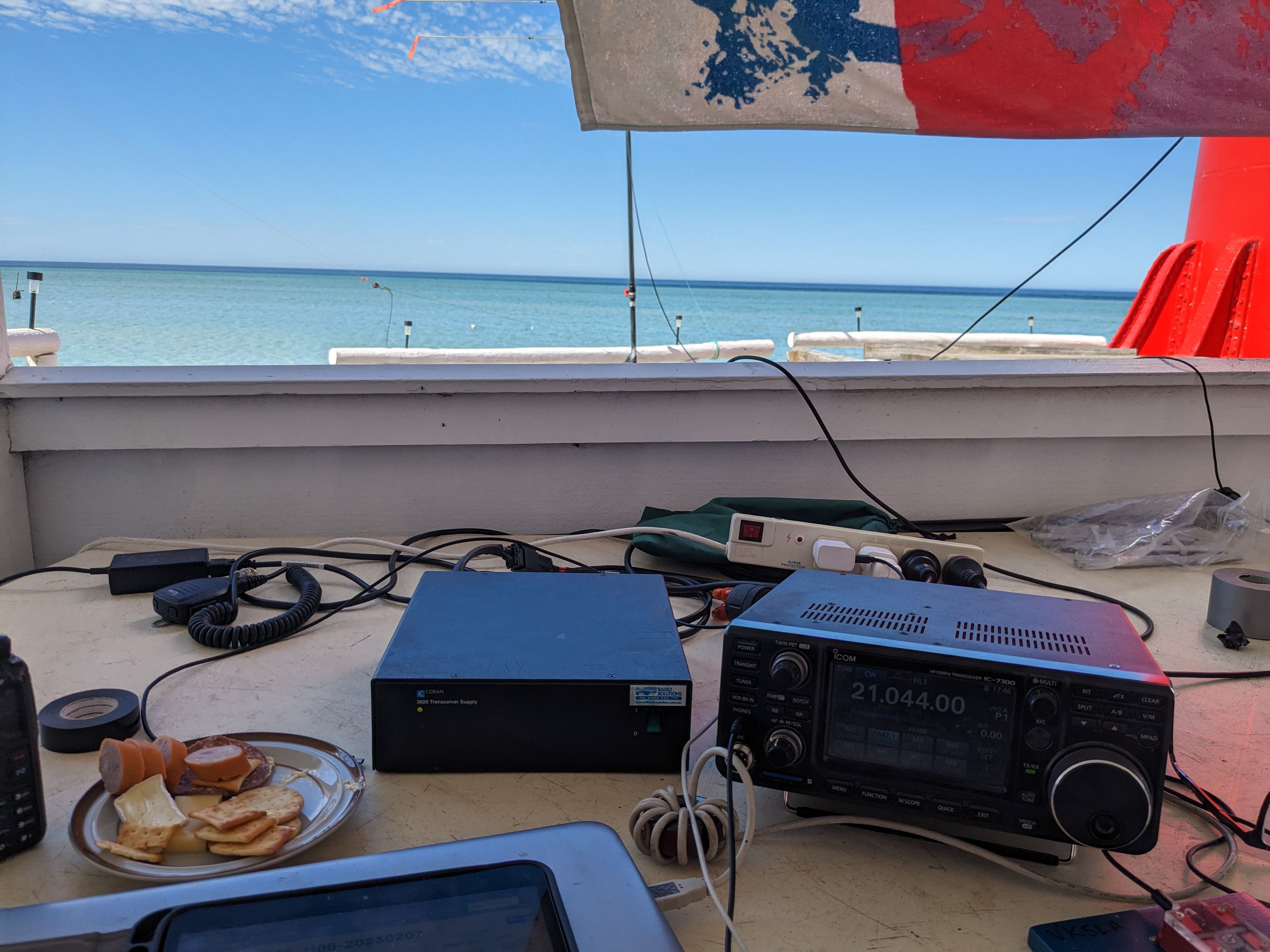
Our 40m SSB station was in the same operating spot as our 80m SSB station, in one of the rooms of the second lighthouse keeper’s cottage.
Above:- Paul VK5PAS on the mic at the 40m SSB station.
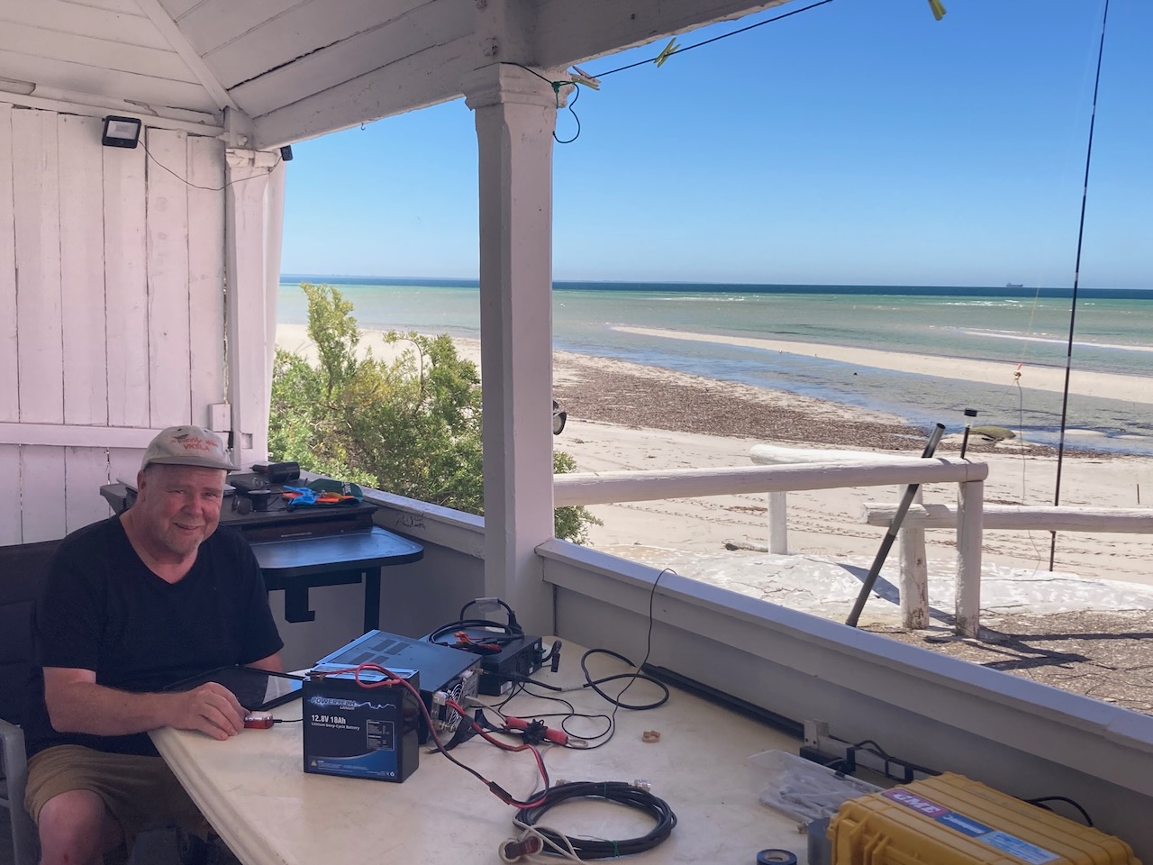
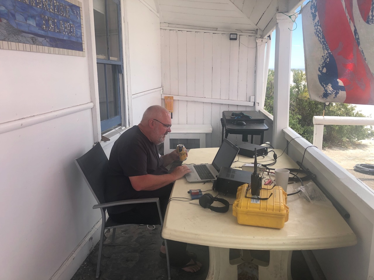
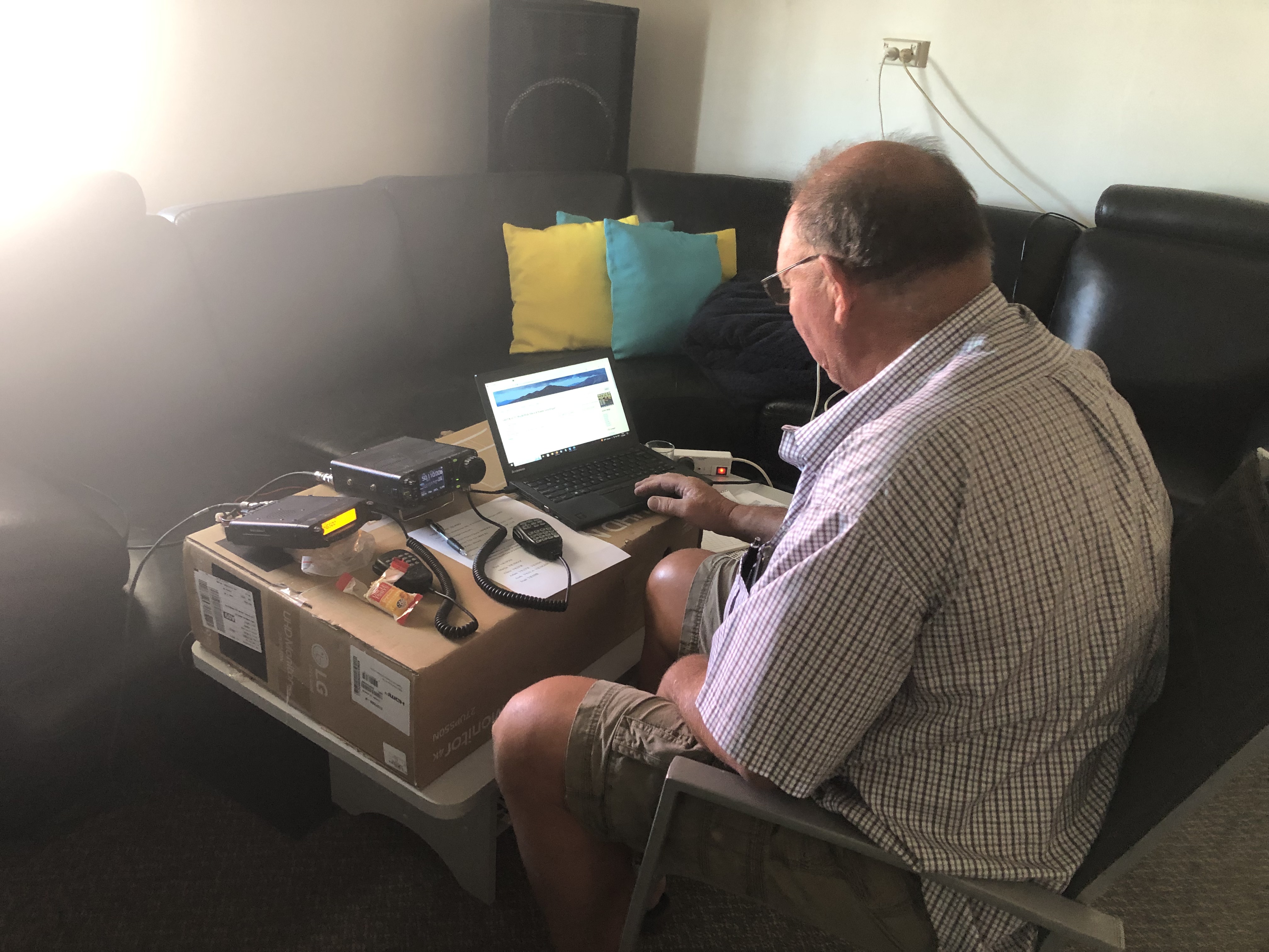
The 40m CW and FT8 station was set up under the front verandah of the cottage in which we were staying. This was the pick of the operating spots as it overlooked the ocean.
Above:- Andy VK5LA on CW making contacts and Paul VK5PAS on FT8.
30M BAND.
We made a total of 328 QSOs on the 30m band. These were all on FT8.
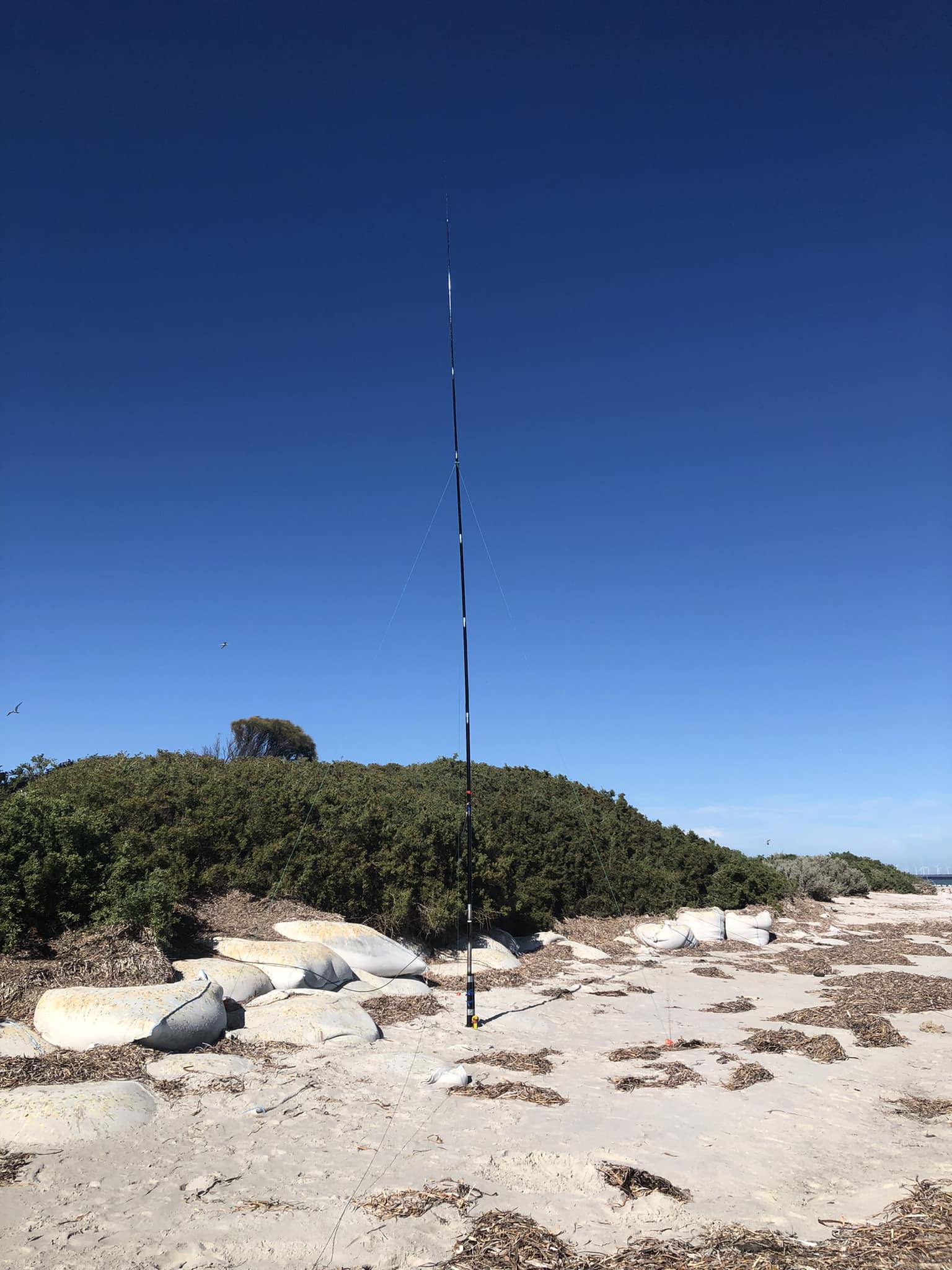
Our 30m station consisted of a 30m vertical kindly provided to us by Grant VK5GR. It was erected on the beach in front of the lighthouse keeper’s cottage.
The 30m station was set up in the back room of the lighthouse keeper’s cottage. It consisted of an Elecraft KX3.
Above:- Adam VK2YK (left) and Chris VK5FR (right) at the 30m FT8 station.
We worked a total of 58 DXCC entities on 20m.
Asiatic Russia
Australia
Azores
Belize
Canada
Canary Islands
China
Denmark
East Malaysia
England
European Russia
Fed Rep of Germany
Finland
France
Greece
Hawaii
Indonesia
Italy
Japan
Kazakhstan
New Caledonia
New Zealand
Philippines
Portugal
Rep of Korea
Romania
Slovenia
Spain
Sweden
Switzerland
Thailand
USA
The map below shows our contacts around the world on 30m FT8
Above:- Map showing our 30m FT contacts. Map c/o QSOMAP.org
20M BAND
We worked a total of 583 QSOs on the 20m band. A total of 301 of those were on SSB, 252 on FT8, and 30 on CW.
Above:- Graph showing the number of QSOs per mode on the 20m band. Graph c/o meta-chart.com
We worked a total of 58 DXCC entities on 20m.
Algeria (FT8)
Asiatic Russia (FT8)
Australia (SSB, FT8, CW)
Austria (SSB)
The Balearic Islands (SSB, FT8)
Belgium (SSB, FT8)
Brazil (FT8)
Bulgaria (FT8)
Canada (FT8)
Canary Islands (SSB)
China (FT8)
Croatia (FT8)
Czech Republic (SSB, FT8)
Denmark (FT8)
England (SSB, FT8)
Estonia (SSB, FT8)
European Russia (SSB, FT8, CW)
Federal Rep of Germany
Finland (SSB, FT8, CW)
France (SSB, FT8)
Greece (SSB)
Hong Kong (FT8, CW)
Hungary (FT8)
India (FT8)
Indonesia (SSB, FT8)
Ireland (SSB)
Israel (FT8)
Italy (SSB, FT8, CW)
Japan (SSB, FT8, CW)
Kazakhstan (FT8)
Lebanon (FT8)
Lithuania (SSB)
Netherlands (SSB, FT8)
New Caledonia (SSB)
New Zealand (SSB, FT8)
Northern Ireland (SSB)
Norway (FT8, CW)
Pakistan (FT8)
Philippines (SSB, FT8)
Poland (SSB, FT8, CW)
Portugal (SSB)
Republic of Korea (FT8)
Reunion Island (FT8)
Romania (SSB, FT8)
Scotland (SSB, FT8)
Serbia (SSB)
Slovak Republic (SSB, CW)
Slovenia (SSB)
South Cook Islands (SSB)
Spain (SSB, FT8)
Sweden (CW)
Switzerland (SSB, FT8)
Thailand (FT8)
Ukraine (SSB, FT8, CW)
United States of America (SSB, FT8, CW)
West Malaysia (FT8)
Willis Island (SSB)
The graph below shows our contacts per country on 20m. The big yellow spike is Australia (VK) with 140 QSOs. This is followed by Japan (blue Line) with 64 QSOs, and then the USA with 46 QSOs(the blue line to the right of the graph).
Above:- Graph showing our contacts per country on the 20m band.
The map below shows our contacts around the world on the 20m band.
Above:- Map of the world showing our 20m band contacts. Image c/o QSOLOG.org
On Wednesday 8th and Thursday 9th, there was a nice opening into Europe/United Kingdom on 20m SSB. The short video below shows Paul VK5PAS working some of the pile-up.
One of the highlights on 20m was working Dave G4AKC bicycle mobile, Steve G4NVF backpack mobile, and David M0DAD pedestrian mobile. Below is a short video of those contacts.
Another highlight on 20m was working Sands VK9WX on Willis Island on SSB for a second band. We also worked Sands on 40m SSB.
We made just three (3) contacts on the 17m band. Two on SSB with Paul VK2HV and Gerard VK2IO, and one on FT8 with Daryl VK3AWA.
15M BAND.
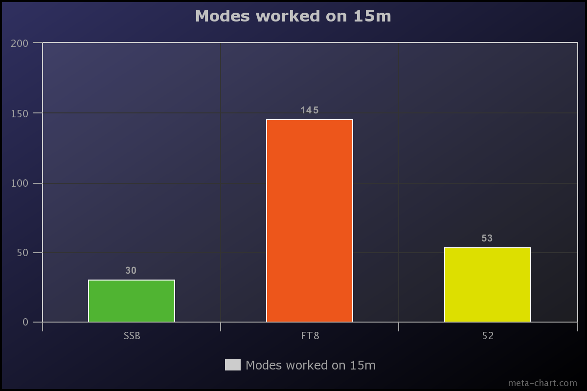
We made a total of 227 QSOs on the 15m band. Thirty (30) of those were on SSB, 145 on FT8, and 52 on CW. The majority of the 15m SSB contacts were made using the 2-element beam, while the CW and FT8 contacts were made using the end-fed antenna.
Above:- Graph showing the number of QSOs made per mode on 15m. Graph c/o meta-chart.com
We worked a total of 15 different DXCC entities on 15m.
Asiatic Russia (FT8, CW)
Australia (SSB, FT8, CW)
China (FT8)
France (CW)
Hong Kong (CW)
Indonesia (FT8, CW)
Italy (CW)
Japan (SSB, FT8, CW)
New Caledonia (SSB)
New Zealand (SSB)
Philippines (FT8, CW)
Republic of Korea (FT8)
Thailand (FT8)
Ukraine (CW)
United States of America (FT8, CW)
The graph below shows our contacts per country on 15m.
Above:- Graph showing our contacts per country on the 15m band.
The map below shows our contacts around the world on the 15m band.
Above:- Map of the world showing our 15m band contacts. Image c/o QSOLOG.org
We were a little surprised that we did not work more Japanese stations on 15m SSB. We certainly worked numerous JA on 15m on FT8 (88).
10M BAND.
We made a total of 179 QSOs on the 10m band. The vast majority of those were made on FT8 (180). We made just 3 contacts on SSB, 2 on CW, and 1 on FM.
Above:- Graph showing the number of QSOs made per mode on 10m. Graph c/o meta-chart.com
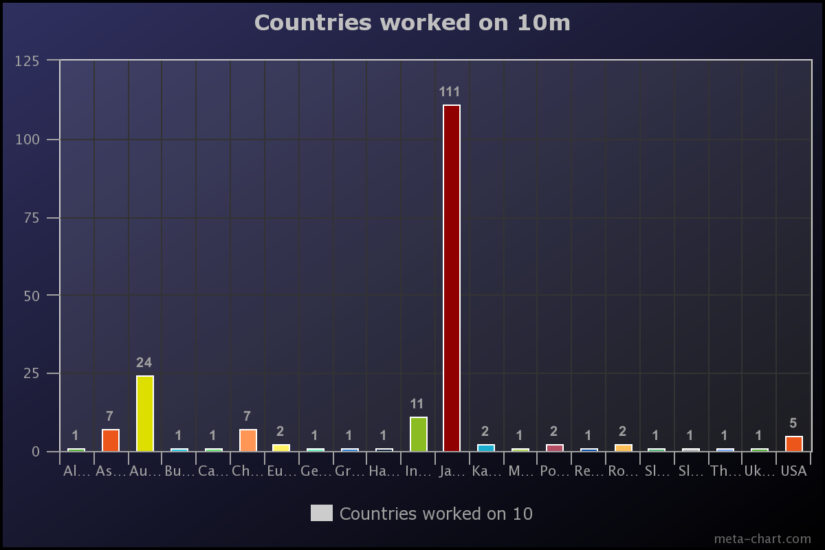
We worked a total of 22 different DXCC entities on 10m.
Alaska (FT8)
Asiatic Russia (FT8)
Australia (SSB, FT8, CW)
Bulgaria (FT8)
Canada (FT8)
China (FT8)
European Russia (FT8)
Federal Republic of Germany (FT8)
Greece (FT8)
Hawaii (FT8)
Indonesia (FT8)
Japan (FT8, CW)
Kazakhstan (FT8)
Mexico (FT8)
Poland (FT8)
Republic of Korea (FT8)
Romania (FT8)
Slovak Republic (FT8)
Slovenia (FT8)
Thailand (FT8)
Ukraine (FT8)
United States of America (FT8)
The graph below shows our contacts per country on 10m.
Above:- Graph showing our contacts per country on the 10m band.
The map below shows our contacts around the world on the 10m band.
Above:- Map of the world showing our contacts on the 10m band. Map c/o QSOMAPS.org
We were a little surprised that we did not make more contacts on 10m SSB. However, this may have been due to us being busy on other modes and other modes, and not dedicating enough time to 10m SSB.
6M BAND.
We made a total of 4 QSOs on the 6m band.
Above:- Map showing our 6m contacts back into Adelaide. Map c/o Log Analyzer.
The 6m station was set up in the loungeroom of the lighthouse keeper’s cottage where we were sleeping. It was coupled with the 2m/70cm station.
Above:- Ivan VK5HS on the 6m band.
The 6m antenna used was a home-brew 3-element yagi put together by Ivan Vk5HS.
The video below shows Adam on 6m in contact with Barry VK5KBJ.
2M and 70CM BANDS.
We made a total of 58 QSOs on 2m SSB and FM. Our 2m and 70cm station was set up in the lounge room of the lighthouse keeper’s cottage where we were sleeping.
The map below shows our 2m contacts. The green dots are the SSB contacts. The purple dots are the FM contacts.
We were very happy to work John VK5BJE on 2m SSB and 2m FM on Wednesday. John was activating the Scott Creek Conservation Park VKFF-0788. Some nice Park to Park contacts on 2m with John.
Above:- John VK5BJE in the Scott Creek CP. Image c/o John VK5BJE.
We also worked John VK5HAA on Thursday on 2m FM. John was activating the Cleland National Park VKFF-3185 & SOTA Mount Lofty VK5/ SE-005.
SATELLITES.
Adam VK2YK made 3 contacts on the satellites using his handheld and the Arrow antenna. Those worked were Dallin VK2USA, Damien VK2XDL, both in New South Wales, and Mark VK5QI.
Contacts were made via SO-50 and one ISS crossband repeater QSO.
MEALS AND DRINKS.
We did not starve on the island. Meals were all part of the planning before the trip. We had three meetings together on Skype to discuss logistics.
Marija prepared some beautiful chilli con carne and a pasta meal and brought those over to the island with us. On the remaining night we had a BBQ.
A significant amount of red wine and other beverages were consumed.
HEADING HOME.
It was now Friday 10th February and it was time for us to leave beautiful Troubridge Island. We were able to make a handful of contacts using a battery on Friday morning on the 40m and 15m bands, before packing up all of our gear and awaiting the arrival of the boat.
We enjoyed three fantastic nights on Troubridge Island and we will be back!
Mark and Lois arrived with the boat at about 1.00 p.m. and we loaded all of our gear onto the trailer. Ivan and I made the first trip out to the boat and loaded our luggage and radio gear onto the boat.
Mark then returned to the island and collected Marija, Chris, Andy, and Adam. Below is a short video showing of them arriving at the boat.
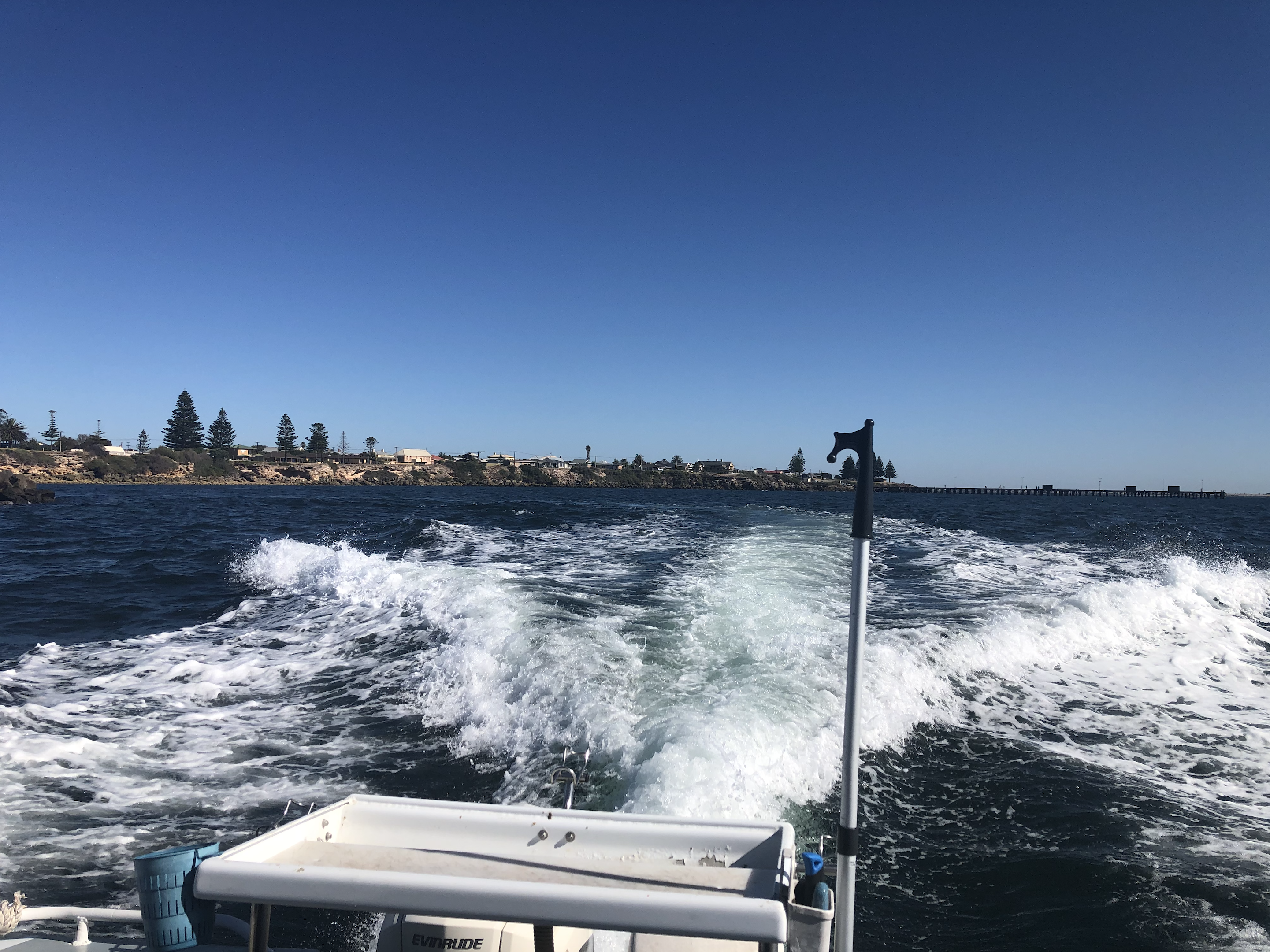
We headed back to Edithburgh enjoying another beautiful sunny day.
Once back at Edithburgh, we drove back to Wool Bay and loaded our vehicles. We all then drove down to Port Vincent where we had something to eat at the Port Vincent Cafe, which we highly recommend. We then all made our own way back home.
Thanks also to Grant VK5GR who loaned us the 30m vertical and bandpass filters.
LESSONS LEARNED.
As this was our first trip, we learnt a lot. This includes improving our logging system, better antennas, and various other issues We plan to have a debrief in the coming weeks.
QSL CARD.
Remember that we QSL via our QSL Manager Charles M0OXO (Direct and Bureau), and Logbook Of the World (LOTW) and eQSL.
Our hard copy QSL card is a full-colour 4-page foldable card.
MORE INFORMATION.
More information can be found on our website at…….