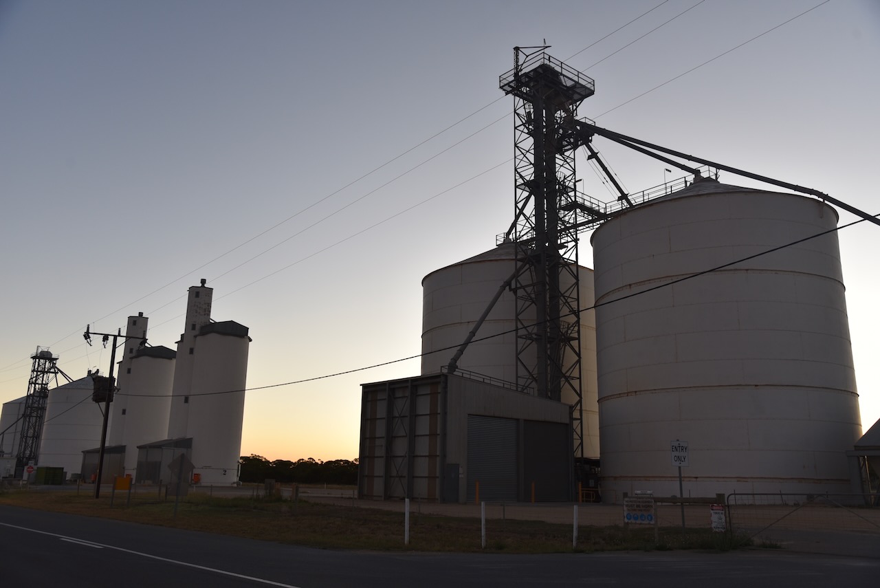
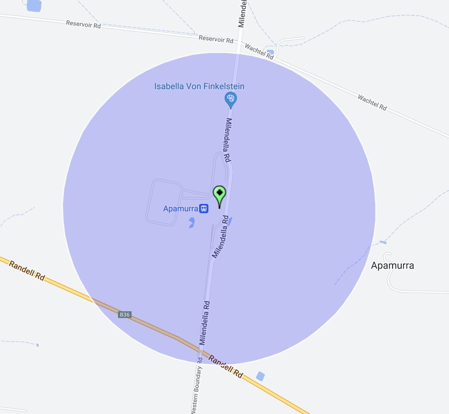
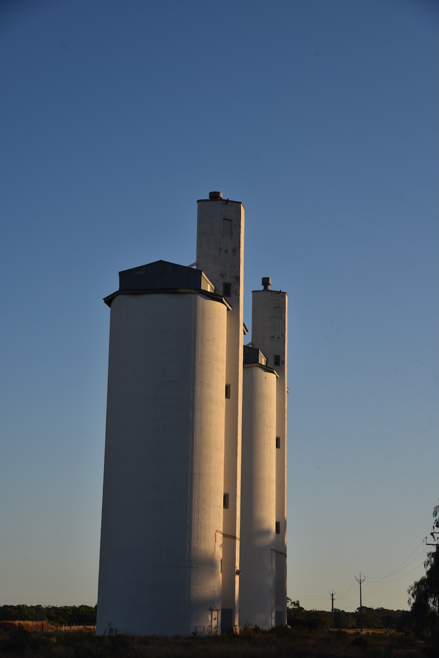
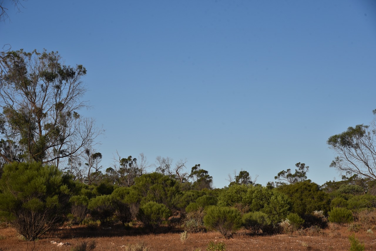
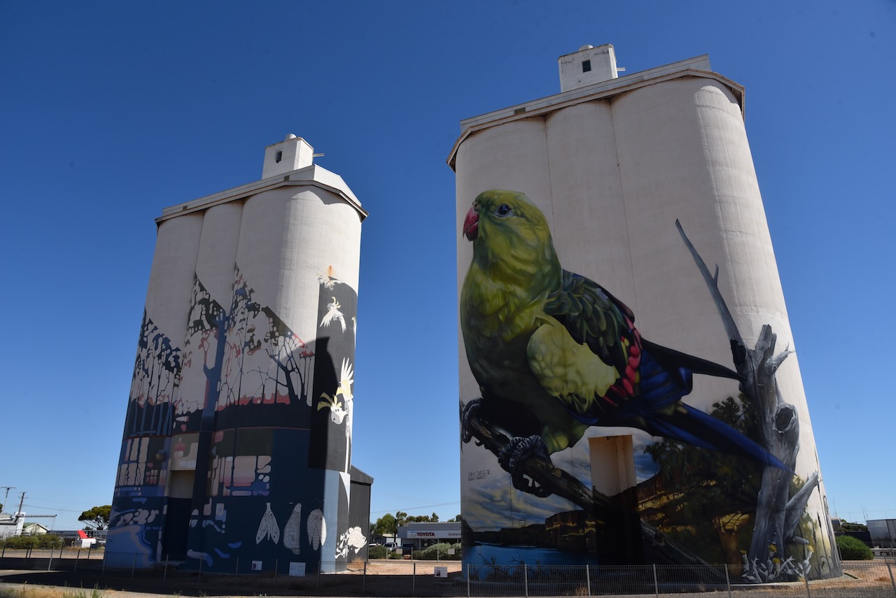
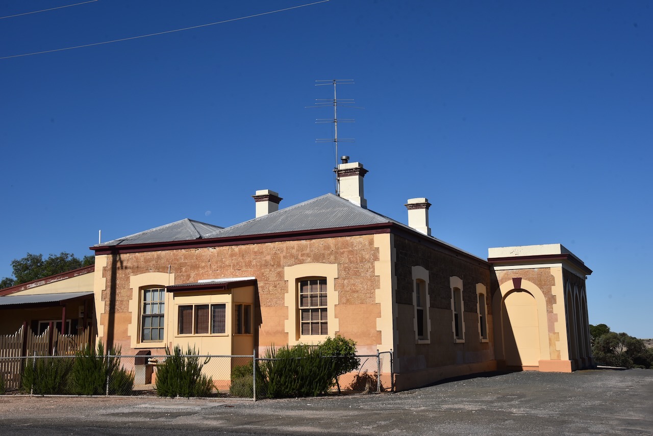
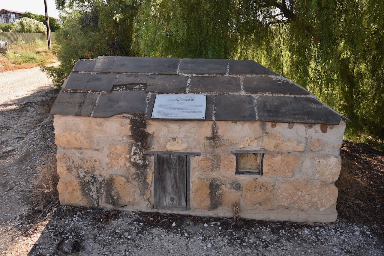
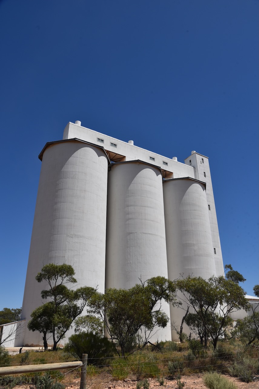
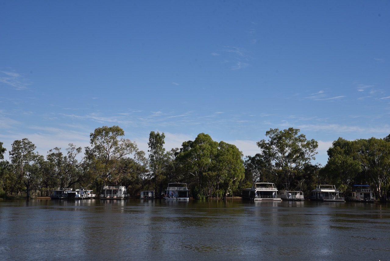
My final activation for my Riverland trip was the Apamurra silo VK-APA5.
Apamurra is located about 77 km east of Adelaide, and about 38 km north of Murray Bridge.
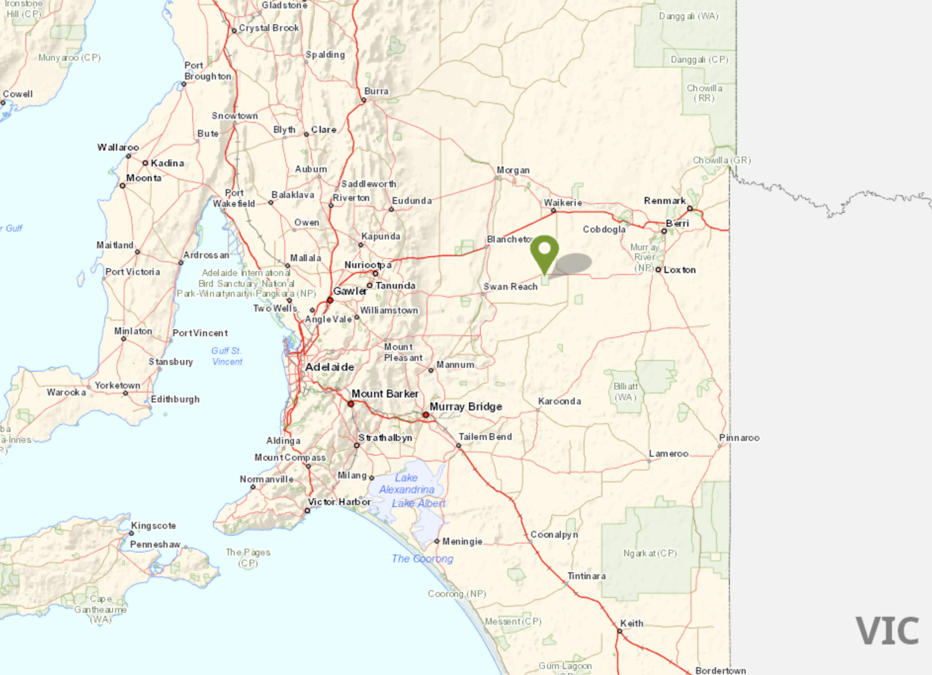
Above:- Map showing the location of Apamurra. Map c/o Google maps.
Apamurra is a railway siding on the former Monarto-Sedan railway. Apamurra is an aboriginal word meaning ‘fresh water’. The township of Apamurra was laid out in 1921 on part sections 30-31, Hundred of Finniss, by Johann Gottfried Hartmann. It comprised 19 allotments contiguous to the railway station. On the 17th day of February 1922, the Apamurra Post Office opened. It closed on the 31st day of July 1971.
I operated from the 4WD on the side of the road opposite the silos.
Above:- The activation zone at the Apamurra silo. Image c/o SiOTA website.
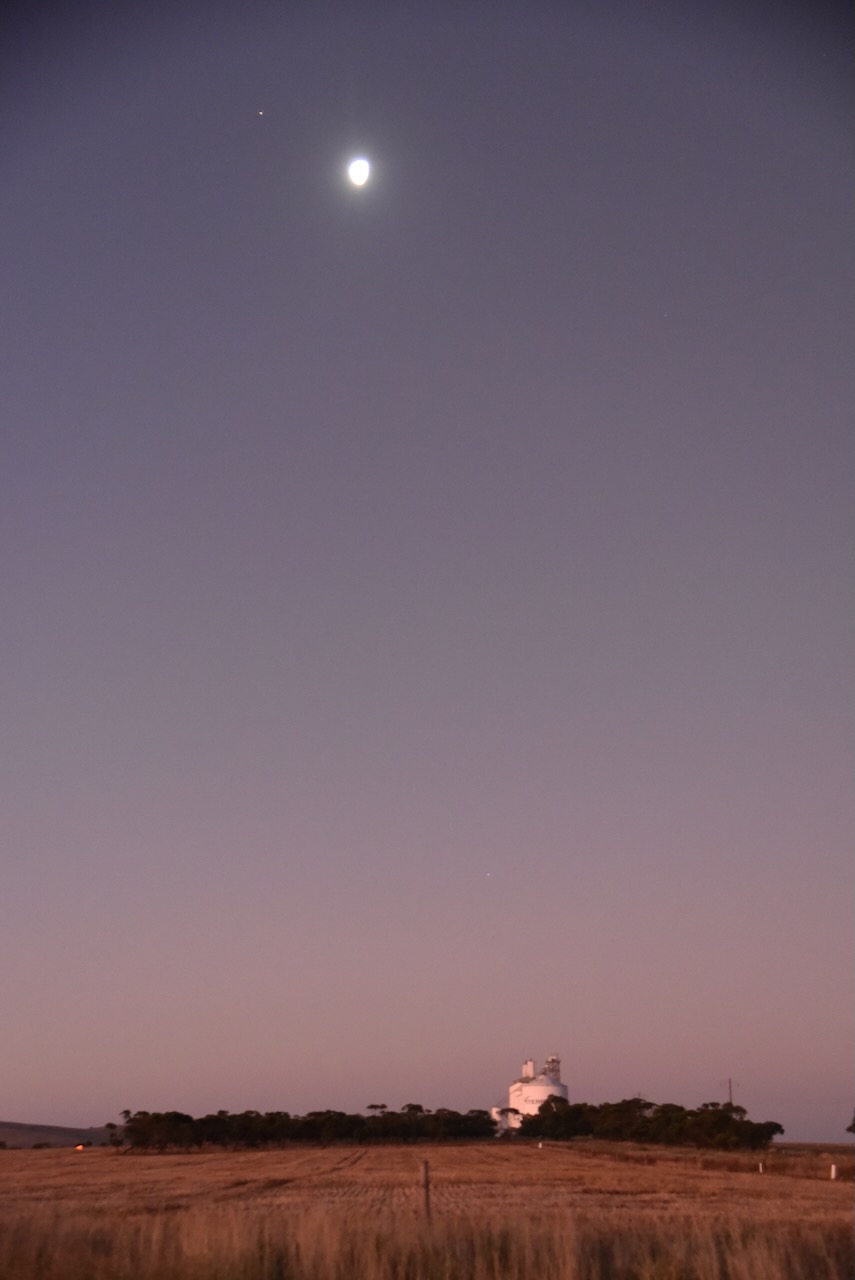
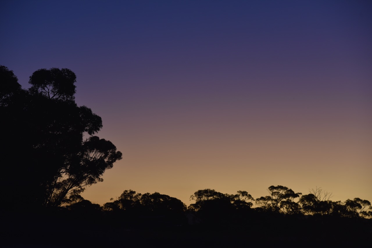
As I operated I enjoyed a beautiful sunset.
I made the following contacts on 40m SSB:-
VK3PF
VK4SMA
VK1AO
VK2MET
VK2IO
VK3OHM
VK5MAZ
VK3WMF
VK5FANA
VK4GNG
VK2BED
VK3PWG
VK1CHW
VK5FB
VK3APJ
VK3MCA
I made the following contacts on 80m SSB:-
VK5MRE
VK3TCT
It was the end of a great couple of days in the Riverland and the Murray Mallee.
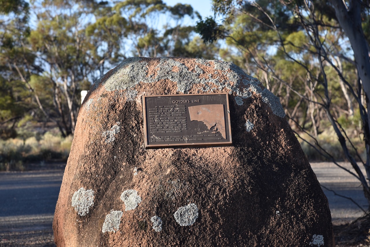
After leaving the Brookfield Conservation Park, I continued west on the Sturt Highway and then turned to travel south on Halfway House Road. Prior to that, I stopped briefly to have a look at the Goyders Line monument on the Sturt Highway. I have spoken about Goyders Line previously in other posts. But in summary, it is a boundary line across South Australia corresponding to a rainfall boundary believed to indicate the edge of the area suitable for agriculture.
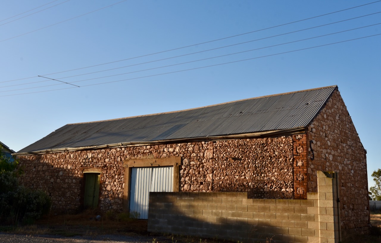
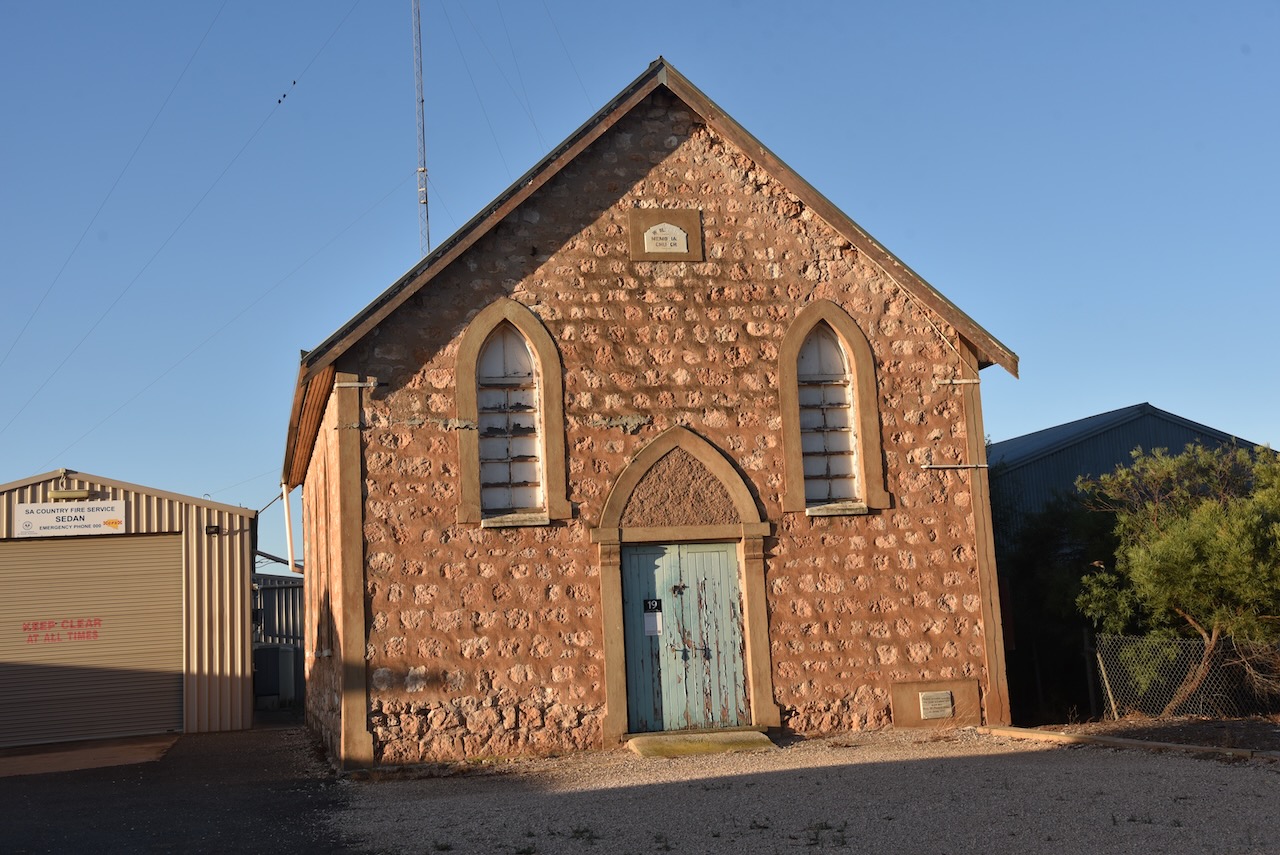
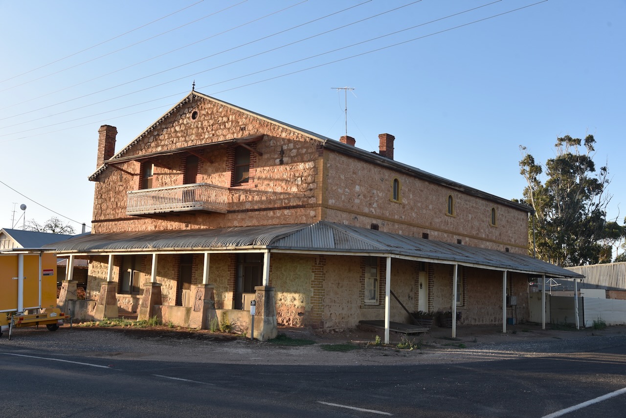
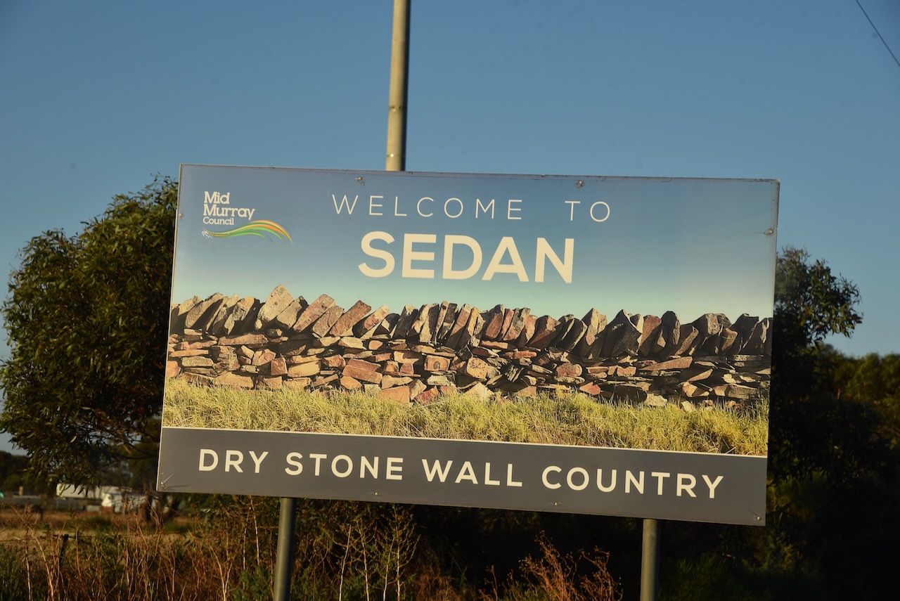
After travelling about 25 km along Halfway House Road, I reached the small town of Sedan. It is known as ‘Dry stone wall country’ due to the numerous dry-stone walls built by early settlers that can be found in the area.
The first known European settlement in the area was from 1845 when ‘Rhine Run’ was taken up by George Melrose (b. 1806. d. 1894), following his arrival in South Australia in 1839.
In 1872 the Sedan Post Office was opened. In 1873, portion of section 52 Hundred of Bagot, was granted to J.W. Pfieffer (b. 1825. d. 1910). He had arrived in South Australia aboard the Zebra in 1838. He subdivided the land in 1875 as the township of Sedan. It was extended in 1883, with the creation of Sedan East on part section 46, surveyed by C. Von Bertouch.
The Sedan School was opened in 1912 and was closed in 1980.
The town takes its name from the battle of Sedan in Europe and its affiliation with the German population in South Australia.
The town has a number of historic buildings.
Just 10km down the road I reached the little town of Cambrai. It was originally laid out in 1882 by Abel Pollard Skinner as Rhine Villa. It was one of the numerous Australian towns which were re-named by the Nomenclature Committee during the First World War to remove any connection with German names. It was renamed Cambrai after the Battle of Cambrai. The original proposal was Pongaree Villa, but the government opted for Cambrai. Pongaree is an aboriginal word meaning ‘shade reflection in the water’.
The Rhine Villa school was opened in 1888, with the school being closed in 1916, along with all German schools. It reopened in 1935 and permanently closed in 1955.
Cambrai was located on the Sedan railway line and served as the terminus of the line from 1964 until the 1980s.
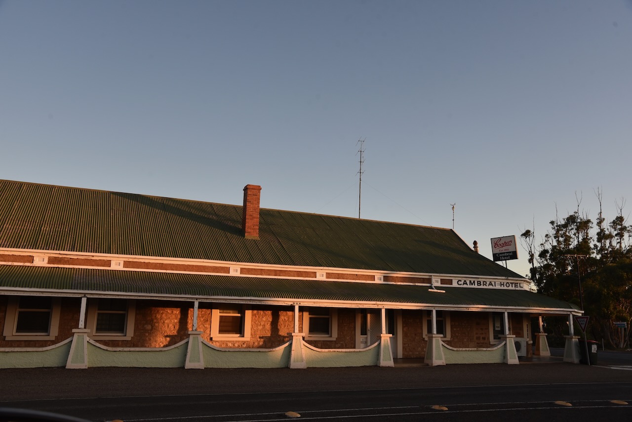
Sadly the old Cambrai hotel is closed. Marija and I enjoyed a very nice meal there a number of years ago on our way back from the Riverland. Like many towns, with the death of the railway….so to brought the death of the town.
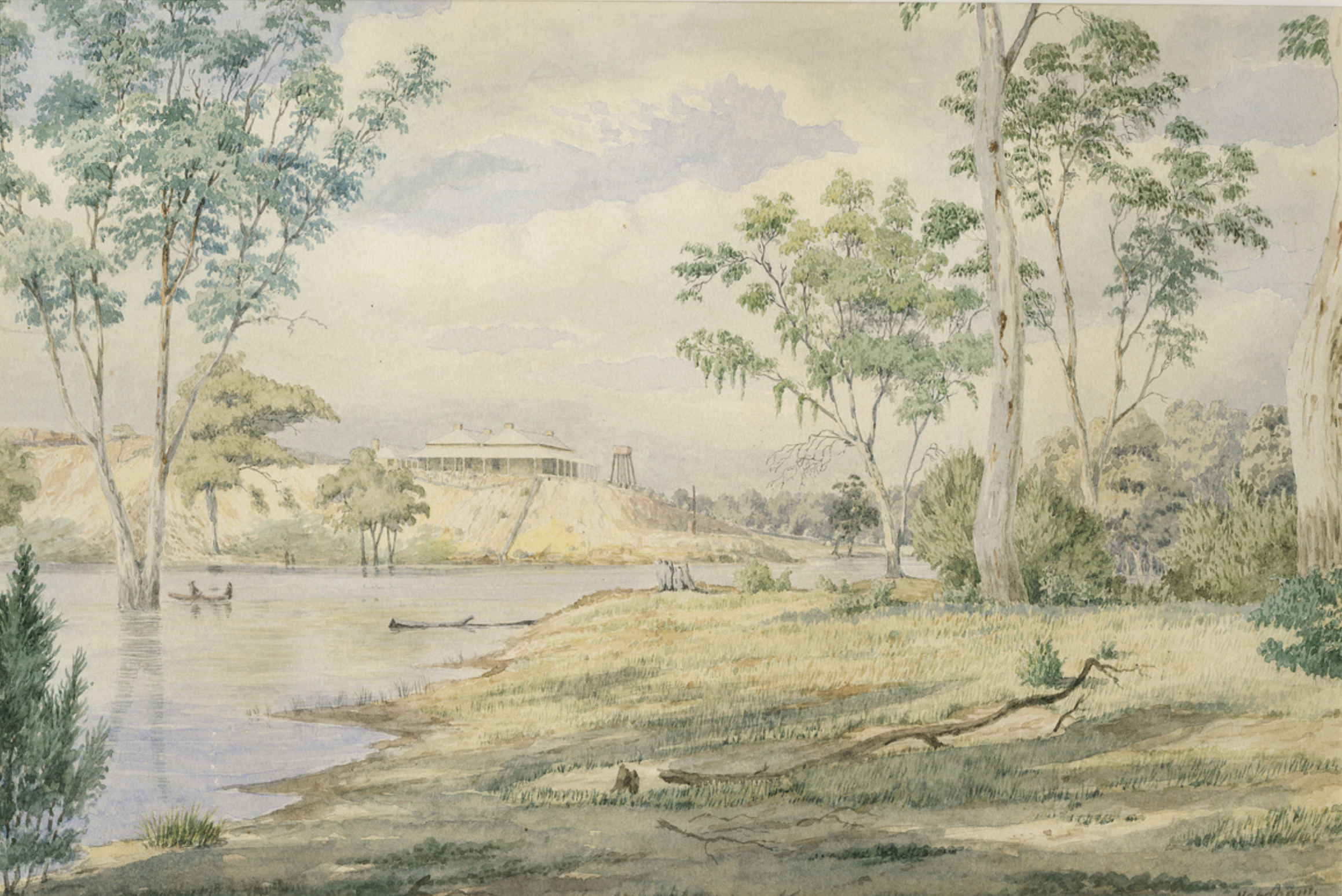
Above:- the Rhine Villa Hotel, c. 1905. Image c/o State Library SA.
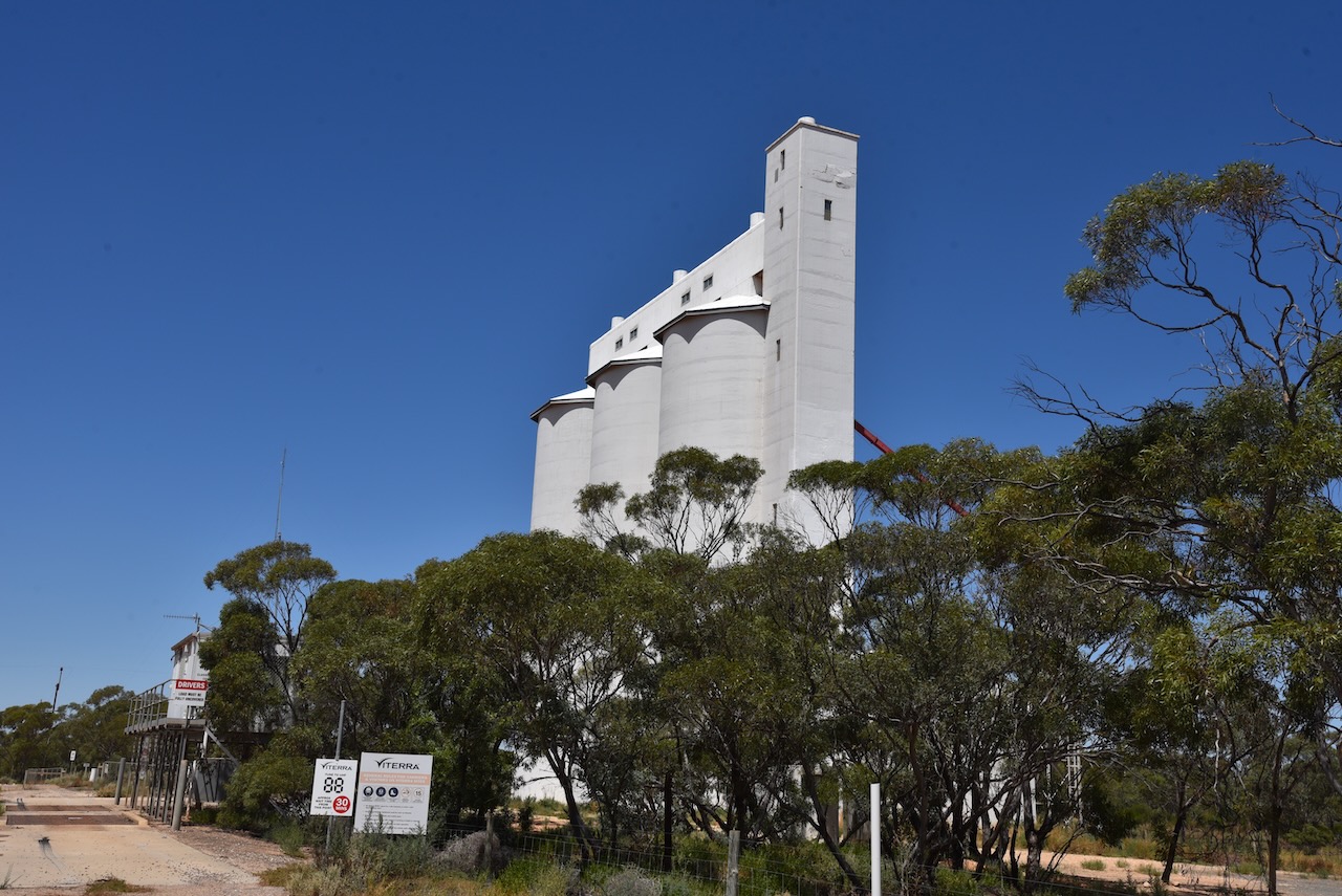
The Cambrai silos can be located on Silo Road which runs of Black Hill Road on the eastern side of the town.
I operated from the 4WD in the parking area adjacent to the silos. I ran the Icom IC-7000, 100 watts, and the Codan 930 self-tuning antenna mounted on the rear of the 4WD>
Above:- the activation zone at Cambrai for the silos. Image c/o SiOTA website.
I made the following QSOs on 40m SSB:-
VK3ACU
Vk5MAZ
VK2IO
VK3OHM
VK3PF
VK5FANA
VK1CHW
VK1AO
VK2MET
VK2NA
VK4SMA
VK3ACZ
VK1ARQ
VK3PWG
It was starting to get dark and I was hoping to active one more silo at Apamura, and I still had some way to go before reaching home. So with 14 QSOs in the log I hit the road and headed to Apamura.
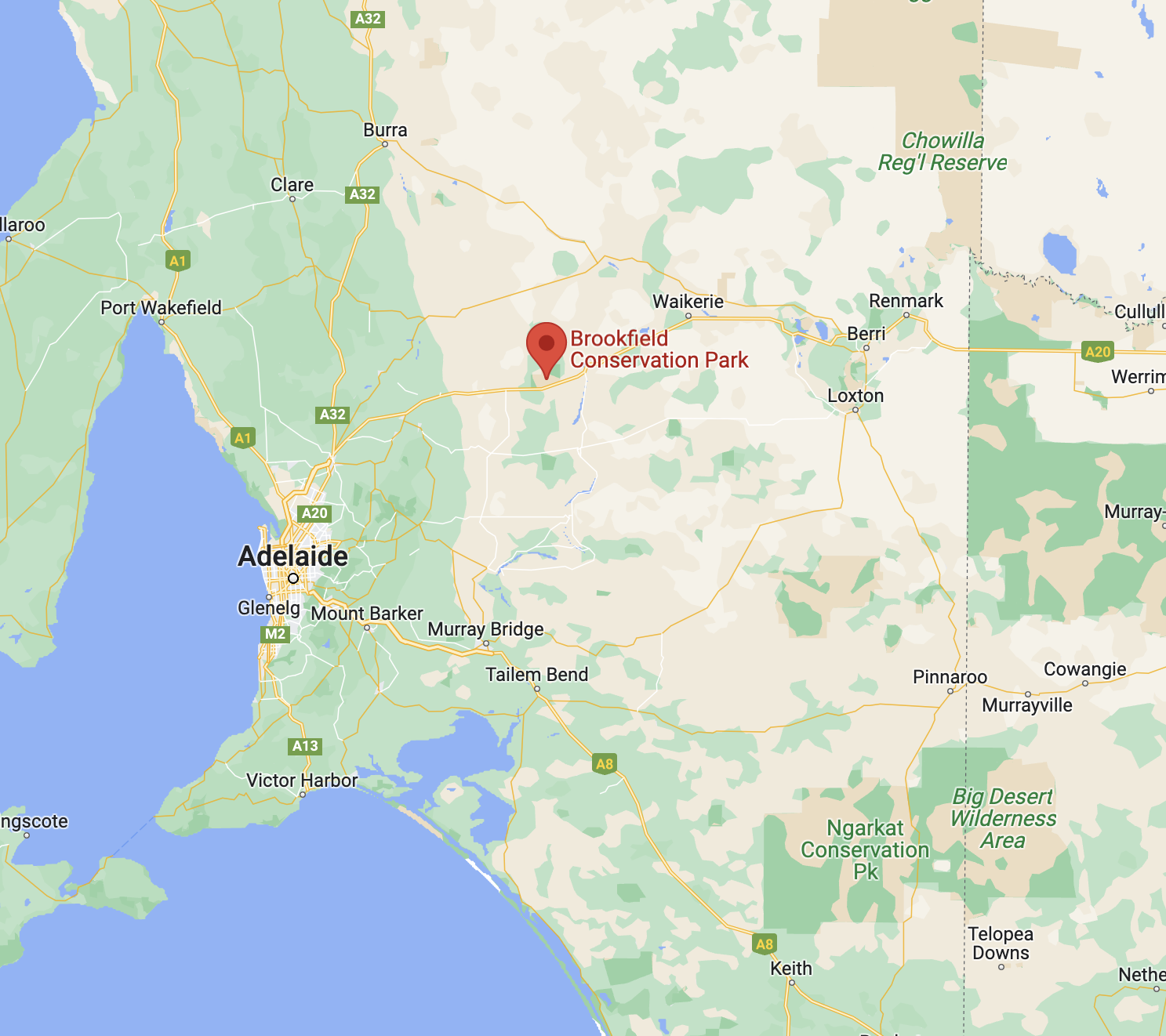
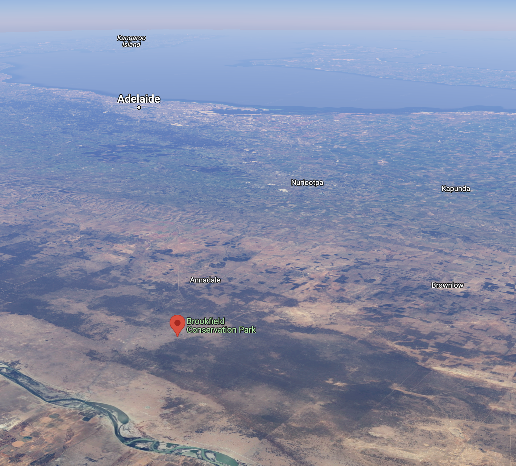
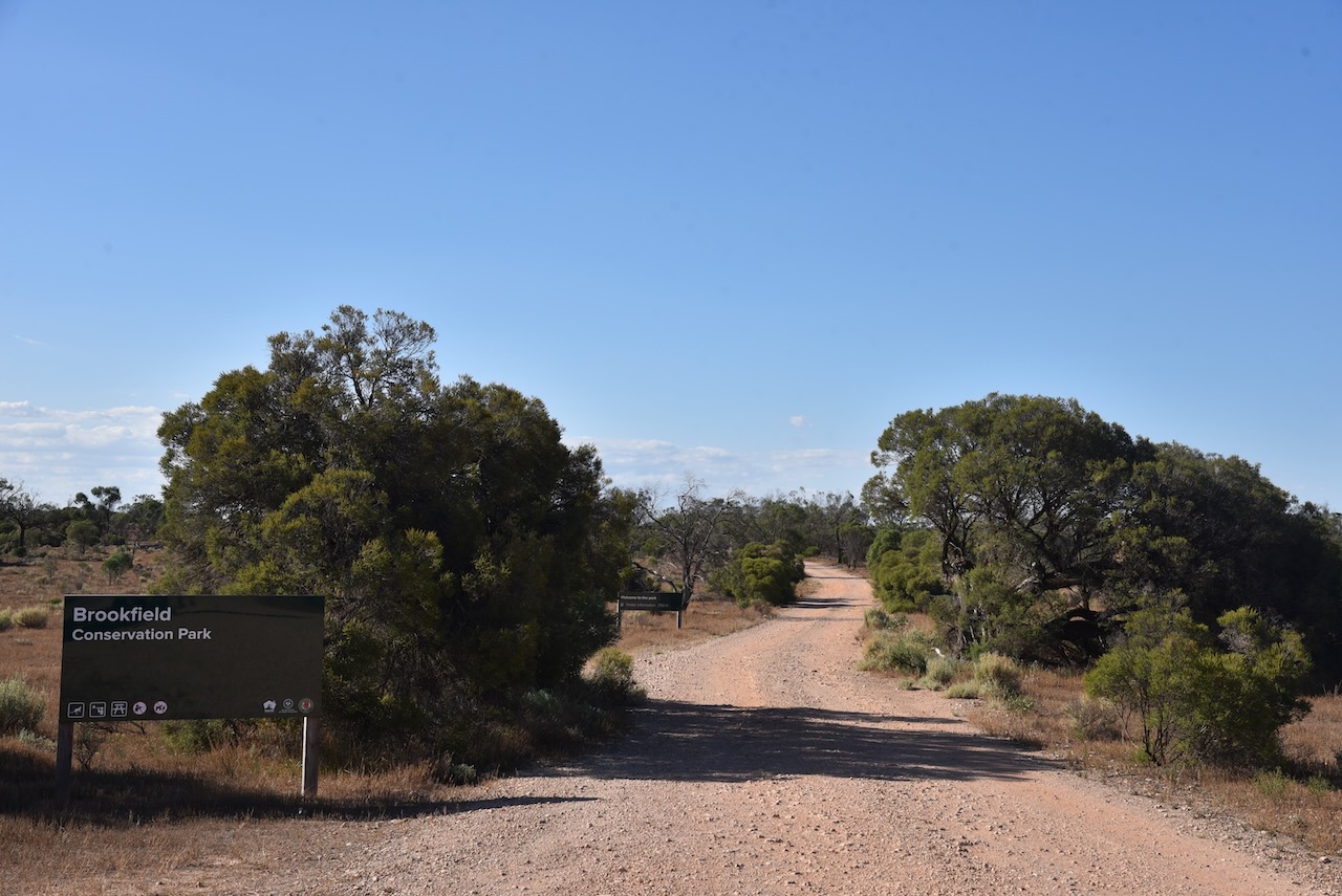
After leaving Blanchetown I continued west on the Sturt Highway and soon reached the Brookfield Conservation Park VKFF-0922.
The park is located about 130 km northeast of the city of Adelaide, and about 14km west of Blanchetown.
Above:- Map showing the location of the Brookfield CP. Map c/o Google maps.
Prior to European settlement of the area around Brookfield, the Ngaiawang aboriginal people occupied the area. The Ngaiawang nation consisted of about 388,000 hectares on the Western Murray Plains.
By 1836 the area was settled by Europeans who held pastoral leases with large holdings of sheep. In later years the area was known as Glen Leslie Station with about 1,800 to 2,00 sheep being grazed during good years. Timber was also cut on the station which was used for wood and for charcoal. Today, the charcoal pits and shearing sheds still remain in the park.
During the early 1970s, moves to purchase a reserve for the conservation of the Southern Hairy-nosed Wombat were initiated by the Director of the Brookfield Zoo in Chicago, Dr William Peter Crowcrof (b. 1922. d. 1996). Crowcroft was the former Director of the South Australian Museum.
Above:- Professor Peter Crowcroft. Image c/o Toronto Public Library.
In 1971, the Chicago Zoological Society purchased Glen Leslie Station, an area of 5,527 hectares. At this time it was named the Brookfield Zoo Wombat Reserve. The Reserve was administered by a committee of management funded by the Chicago Zoological Society, with the former landholder, Mr. Raymond Clifton Dorward, employed as full-time resident warden. One of the aims was:
“to achieve a wombat population of optimum size and structure consistent with the maintenance of an intact habitat.”
Due to rising costs, in 1977 the Chicago Zoological Society gifted Brookfield Zoo Reserve to the Southern Australian State Government. One of the conditions was that ‘the reserve would be proclaimed a Conservation Park‘. In August 1977 the then Department for the Environment assumed financial and managerial responsibility for the reserve. The Brookfield Conservation Park was proclaimed on the 6th day of July 1978.
The video below explains the history of the park.
There is a Restricted Access Zone over the majority of the park with prohibited entry to all except for the relevant authorities. Please ensure that you do not encroach into this area.
Above:- Map of the park showing the Scientific Research areas. Map c/o NPWS SA.
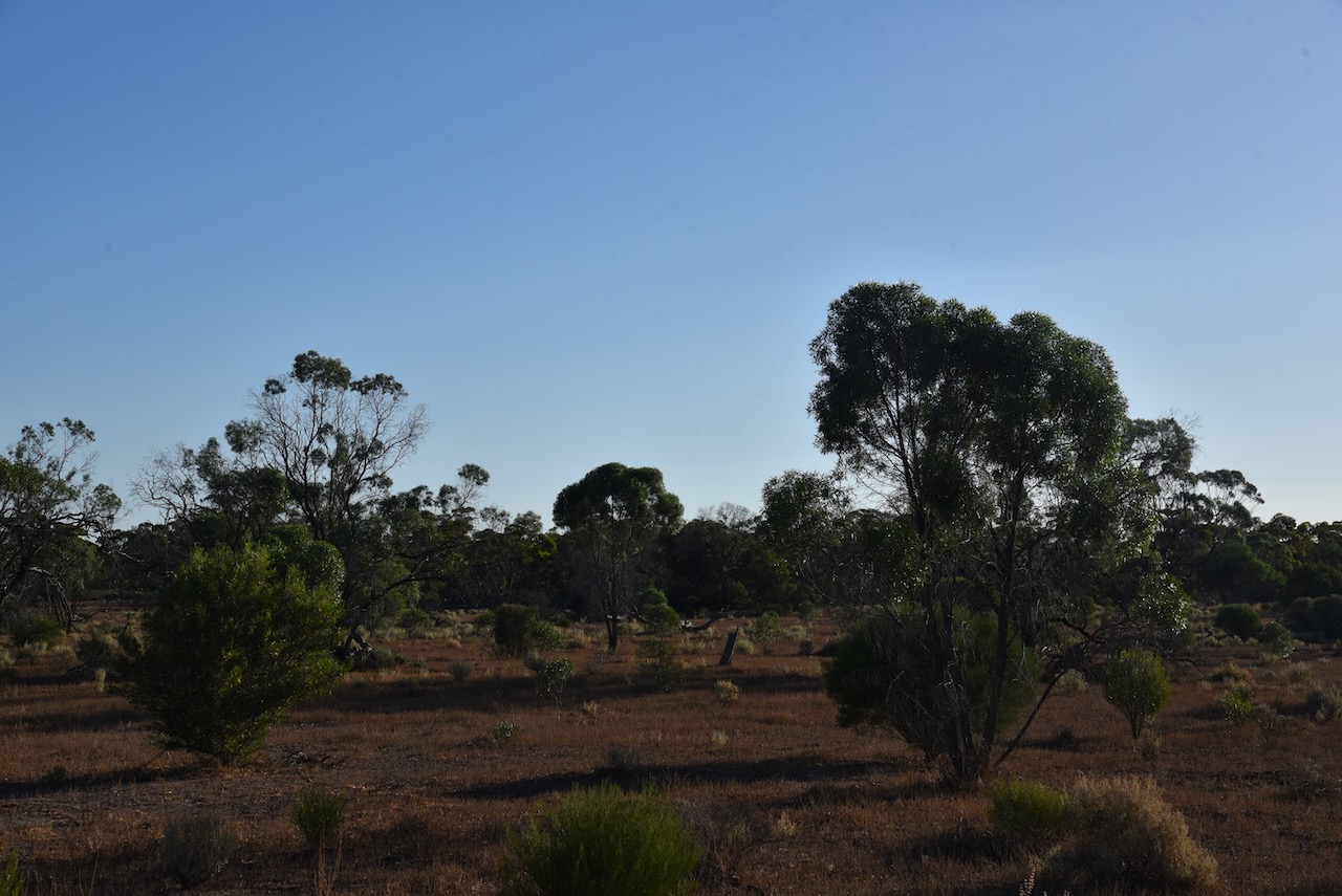
The vegetation in the park comprises on the ridge in the northern section of the park, and extending north into the adjacent area, ridge-fruited mallee, red mallee, and narrow-leaved mallee over porcupine grass and sparse bitter saltbush. The northwestern corner of the park is dominated by yorrell open mallee over sparse bitter saltbush and pearl bluebush. In the southeastern section of the park the understorey consists of a large expanse of regenerating pearl bluebush. The central areas of the park are covered by low woodland and tall shrubland typically dominated by sheep bush and sugarwood. Dryland tea-tree can be found around the claypans in the park. The understorey is characterised by Australian boxthorn, bullock bush, caustic weed, and heron’s bill.
Other than the Southern hairy-nosed Wombat, other native mammals found in the park include the fat-tailed dunnart, common dunnart, red & western grey kangaroos and emus.
Birds SA have recorded about 147 species of bird in the park including the vulnerable malleefowl and the rare stone curlew. Other bird species include Purple-backed Fairywren, Splendid Fairywren, Australian Magpie, Crested Pigeon, Chestnut-rumped Thornbill, Brown Treecreeper, Southern Whiteface, and Weebill.
I drove into the park via the entrance off the Sturt Highway and I set up opposite the information board. I ran the Yaesu FT-857, 40 watts, and the 20/40/80m linked dipole for this activation. For 15m and 10m, I used the Codan 9350 self-tuning antenna mounted on the rear of the 4WD.
I made the following contacts on 20m SSB:-
Vk3PF
ZL2WG
VK2IO
ZL3MR
VK1AO
VK2MET
VK4EMP
VK4TI
OH6GAZ
OH5EP
OE9WPV
VK4TJ
OH1MM
IW2BNA
VK4SMA
IW2NXI
F4ICM
OH1XT
ZL1TM
I made the following contacts on 15m SSB:-
VK1CHW
VK2IO
VK3PF
ZL1TM
VK4TJ
VK4SMA
VK4EMP
VK4TI
IW2NXI
VK4IDK
YL2BJ
VK1AO
VK2MET
VK2GMC
VK4KC
VK4MAD VK4DOG
I made the following contacts on 10m SSB:-
VK1AO
VK2MET
VK4OTZ
VK2IO
VK4HAT
VK4TJ
VK2MTZ
VK2JJM
I made the following contacts on 40m SSB:-
VK4HAT
Vk3CWF
VK5MAZ VK3PF
VK4SMA
VK2MOE
VK3MCA
VK5PHR
VK5FANA
VK4KTW
VK3PWG
VK3APJ
VK3DET
VK5WU
VK5TS
VK3AMO
VK2XB/m
VK4EMP
VK4TI
VK7EE
VK3PAX
VK3PAB
VK5MOS
VK3ACZ
VK2MTZ
VK5GY
With 70 QSOs in the log, it was time to move on to the Cambrai silo for a SiOTA activation.
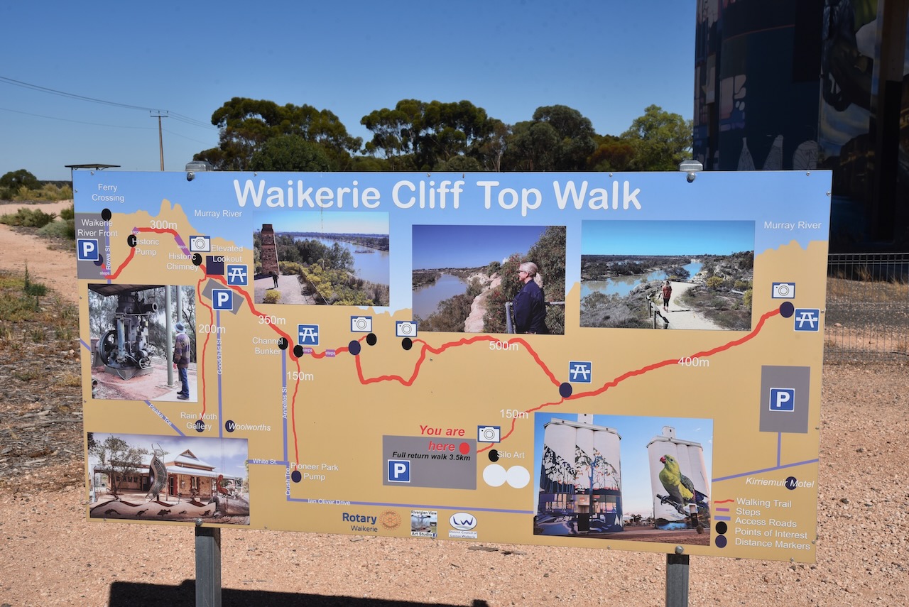
After leaving Bakara I drove north to Waikerie. Due to the recent Murray River floods, the ferry at Swan Reach was closed. This meant that I had to drive 44 km north to Waikerie and then over the bridge at Blancheown. It was fortuitist though, as I was able to activate the silo at Waikeries for the Silos On The Air (SiOTA) program.
I drove north on New Well Centre Road and then turned right on the Stuart Highway back towards Waikerie. I knew that I was back in the Riverland region of South Australia due to all of the orange orchards.
Waikerie is a rural town in the Riverland region of South Australia about 173 km northeast of the city of Adelaide. It sits on the south bank of the mighty Murray River. Waikerie is known for its citrus growing, stone fruit, and grapes.
The Ngawait aboriginal people inhabited the area prior to European settlement. They called the giant swift moth, “wei kari” meaning “many wings’. It is from this that the town of Waikerie derives its name.
The first European to visit the Waikerie area was the famous explorer Captain Charles Sturt. In late 1929 he rowed a whale boat down the Murrumbidgee River in an attempt to answer the question as to why rivers flowed westward from the Great Dividing Range. On the 14th day of January 1830, he reached the junction with the Murray River. He continued rowing down the Murray River, passing the site of current-day Waikerie. Sturt comments on the ‘grandeur of the cliffs’ in the Waikerie area. Sturt reached Lake Alexandrina on the 9th day of February 1830.
Above:- Captain Charles Sturt. Image c/o Wikipedia.
By 1880 the Shepherd brothers had settled the land around Waikerie. In 1882 W.T. Shepard established the Waikerie station.
Waikerie commenced as a village settlement in 1894 and was part of a government scheme to open up land along the upper Murray River. Steamers along the Murray brought 281 settlers to the area. The steamers brought the settlers rations of tea, sugar, flour and milk. Waikerie was one of nine such farming communities. Each settler was allotted land, tools, and a horse, including funds for food. The scheme eventually failed and in 1910 land was allotted to the first group of private settlers. They grew oranges, peaches, sultanas and other fruits on irrigated blocks.
Above: the Main Street of Waikerie, 1910. Image c/o State Library SA.
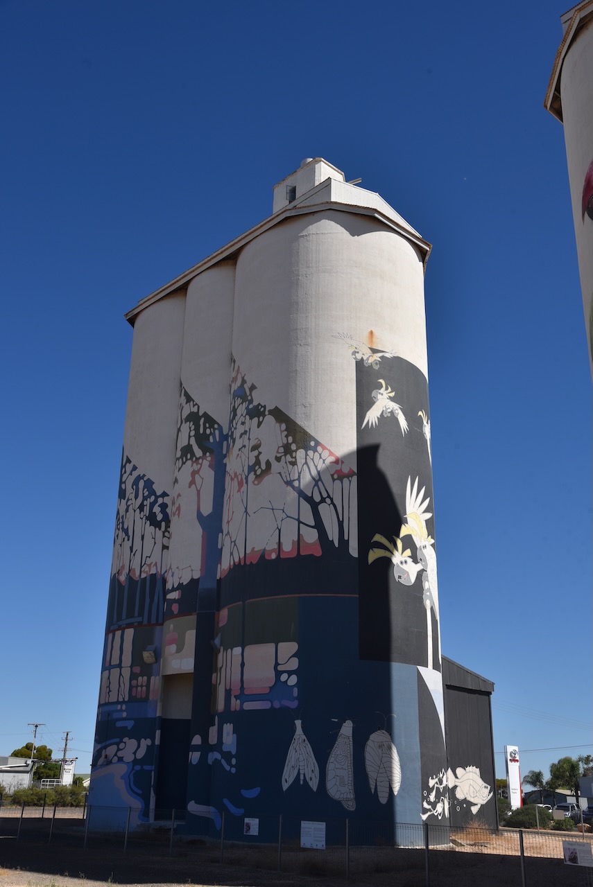
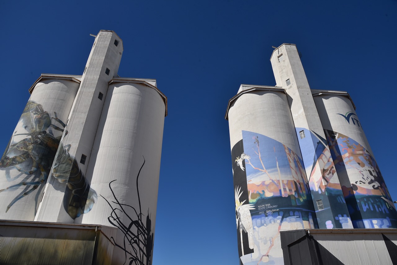
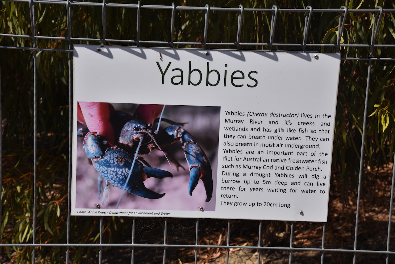
The Waikerie silos are part of the Australian Silo Art Trail and are non-working Viterra silos. They were the fifth silos in South Australia to have silo art/murals painted on them. They were completed in March 2019. South Australian artist Garry Duncan painted one silo with a semi-abstract river landscape. It includes pelicans, ducks, frogs and rain moths. The second silo was painted by Jimmy Dvate from Melbourne. It features a Regent parrot, a yabby and the endangered Murray hardyhead fish.
Exterior enamel paints were used by both artists and the work took 16 weeks to complete, with about 500 litres of paint used.
I set up in the car park right alongside of the silo and made a few contacts, but the noise floor was so high that I decided to move. I found a car park south-east of the silo overlooking the Murray River.
Above:- the activation zone for the Waikerie silo. Image c/o SiOTA website.
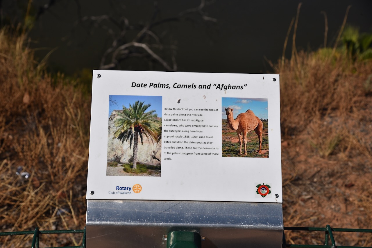
There were a number of interpretive signs at this location and some brilliant views of the Murray River.
I made the following contacts on 40m SSB:-
VK5MAZ
VK5GY
VK3OHM
VK5FB
VK5FANA
VK3PWG
VK5WY/m
I made the following contacts on 20m SSB:-
VK1AO
VK2MET
VK2IO
I made the following contacts on 15m SSB:-
VK6AV/2
VK1AO
VK2MET
VK4EW
VK7IAN
VK4FSC
VK2ADI
VK2MI
VK3PF
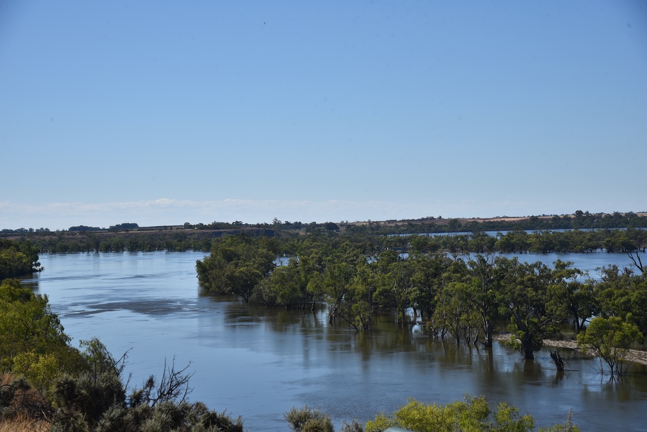
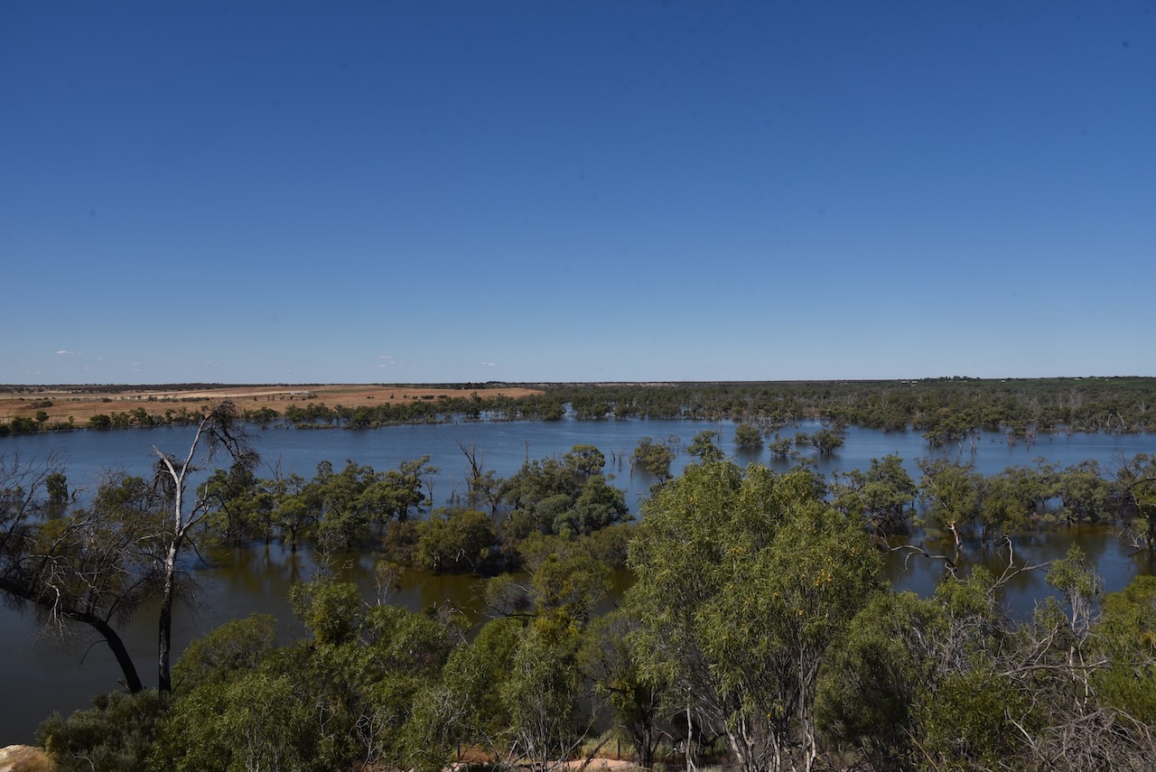
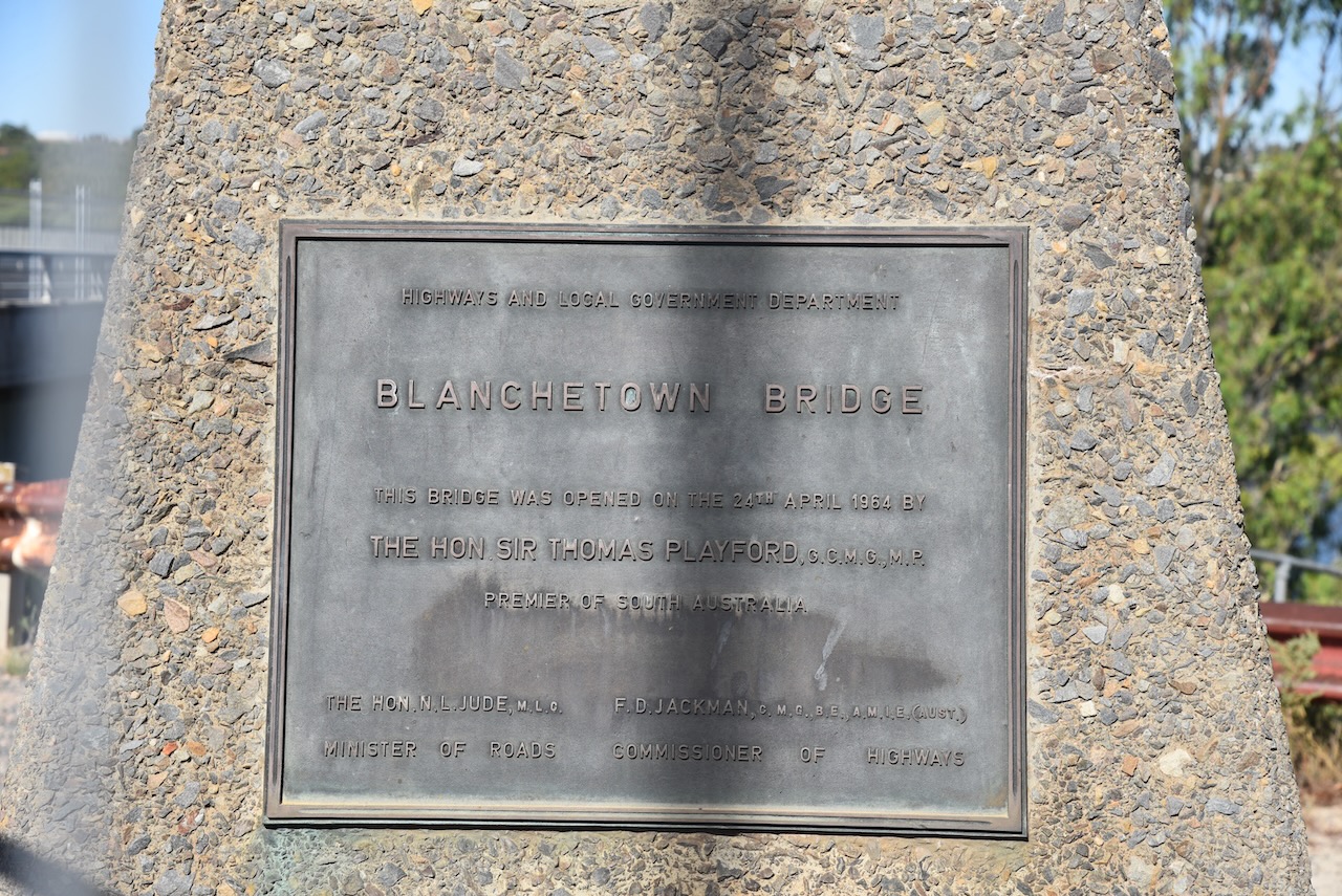
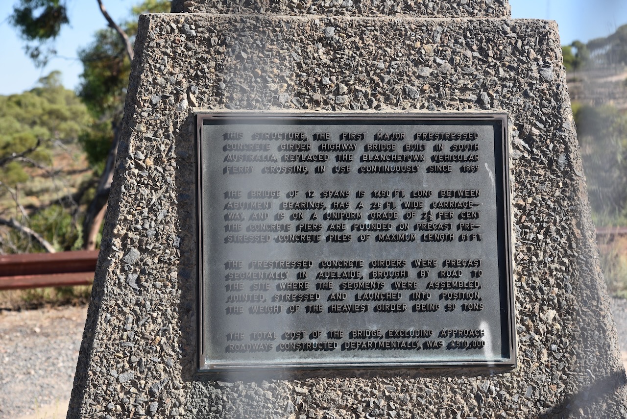
I left Waikerie and headed west on the Sturt Highway and stopped briefly at the town of Blanchetown.
Blanchetown was surveyed in 1855 and on the 27th day of August 1857, the land was offered for sale.
In 1855, Governor MacDonnell was in the area and ‘directed a convenient and beautifully situated rising ground about 5 miles north of Moorundie to be laid out as a township. It is his Excellency’s intention to remove there the quarters of the Native Police and of the Protector of Aborigines, as the houses now inhabited by them are annually subject to inundations.’
The lock at Blanchetown was still submerged due to the Murray River flooding.
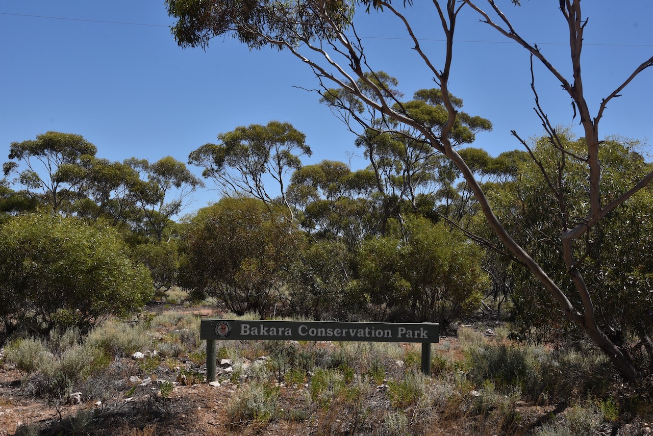
After packing up at Mantung Conservation Park (31st January 2023) I headed to the Bakara Conservation Park VKFF-0868. It was just a short 30 km drive to get to Bakara from Mantung.
The Bakara Conservation Park is located about 205 km northeast of Adelaide.
Above:- Map showing the location of the Bakara Conservation Park. Map c/o Location SA Map Viewer.
The park is located on the southern side of the Stott Highway at the junction of Start Road.
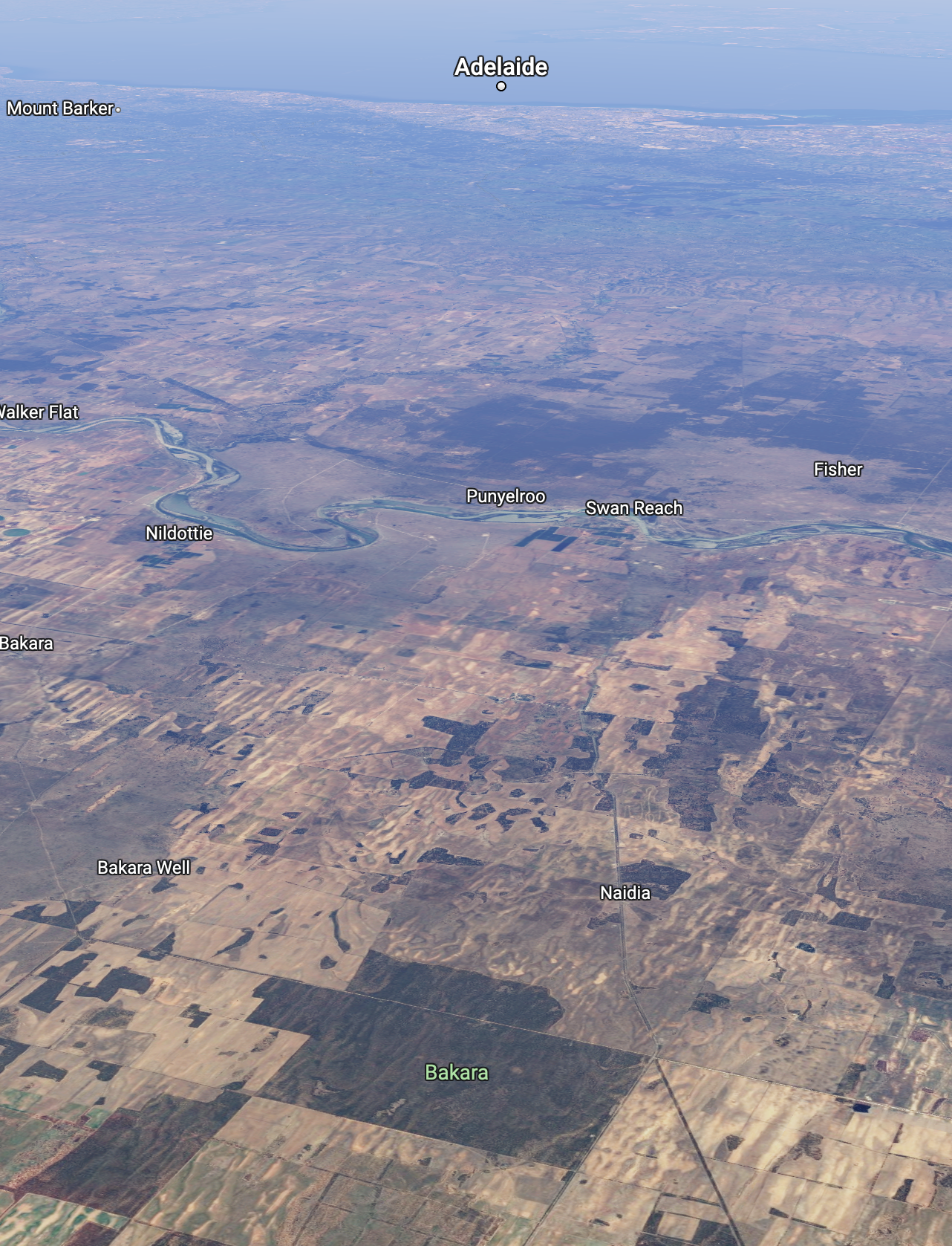
Above:- An aerial shot of the Bakara CP looking southwest towards Adelaide. Image c/o Google maps.
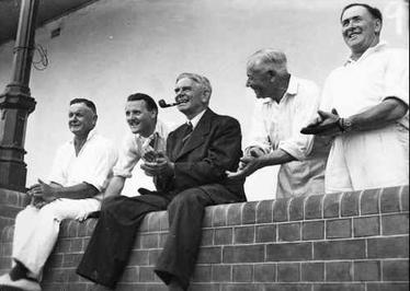
The Stott Highway runs from Angaston in the Barossa Valley, through Sedan and Swan Reach and on to Loxton in the Riverland region of South Australia. In 2008 the highway was named in honour of Tom Cleave Stott (b. 1899. d. 1976) who was a farmer and member of State Parliament from 1933 to 1970. The Stott family farm was at Mindarie in the Murray Mallee.
Above:- Tom Stott (far right) at a “Press v Parliament” cricket match, 1947. Image c/o Wikipedia.
The name Bakara was given by the aboriginal people to a native camp on a track from Swan Reach to Loxton. The word derives from either bakarra meaning ‘hot wind’ or balkara meaning ‘native dove.
In 1864 the Bakara Run was established by W.P. Barker (b. 1845. d. 1914) and D. McLean. The land was originally held by Messrs Lucas and Reid from February 1860. The Hundred of Bakara, County of Albert, was proclaimed on the 15th day of June 1893. The Netherleigh school was opened in 1909 as ‘Bakara’ and was closed in 1935. The Bakara Post Office was closed on the 30th day of June 1979.
The Bakara Conservation Park was proclaimed on the 15th day of May 1986.
Above:- from the SA Govt Gazette, 15 May 1986. Image c/o Wikipedia.
The park comprises land in sections 54 and 55 in the cadastral unit of the Hundred of Bakara. In 1983 the South Australian State Government compulsorily acquired Section 55 and this was proclaimed as the park. Section 54 was added on the 6th day of August 2009. The park currently covers an area of about 2,030 hectares.
The park provides valuable habitat for the Malleefowl.
I drove into the park via one of the tracks off the Stott Highway. It was a hot afternoon so I chose some shade underneath a tree to get out of the sun.
Band conditions on 10m and 15m were very good and this helped me to easily get over the 44 QSO line for the global World Wide Flora Fauna (WWFF) program.
It was also nice to pick up a couple of Park to Park contacts with Andy VK5LA and Daryl VK3BEZ.
After leaving the Wunkar silo (31st January 2023), I drove south along Curtis Road and then west on Farr Road. It wasn’t long before I reached the northeastern corner of the Mantung Conservation Park VKFF-1055.
Above:- Map showing the location of the Mantung Conservation Park. Map c/o Google maps.
Mantung is aboriginal for ‘water on a native road’. Nomadic aboriginal people who followed sandhills from Jadko north of Swan Reach to Loxton, via Bakara, obtained water from mallee trees. Needle bush roots also yielded water. When the Hundred of Mantung, County of Albert, was proclaimed on the 15th day of June 1893, the name was shown as an Aboriginal waterhole on an 1864 land tenure plan.
The town of Mantung was proclaimed on the 8th day of July 1915. The post office was opened in September 1915. The Mantung school opened in 1921 and closed in 1944. The school was reopened in 1961 and was conducted in the Mantung Hall.
Early in 1914 a meeting was called to arrange for the inauguration of an agricultural show when ‘a strong committee was formed’: Subsequently, owing to the dryness of the season, the committee deemed it wise to postpone the show and hold a farmers’ picnic instead… Thanks largely to the untiring energy of the capable secretary, Mr A.E. Solly, everything went with a swing… Before the folk dispersed in the evening three rousing cheers were given for ‘King and country’…
Above:- Article from the Observer, Adelaide, Sat 10 Oct 1914. Image c/o Trove.
The Mantung Conservation Park is about 1,695 hectares in size and was created on the 16th day of October 2014. The park is part of an extensive area of native vegetation containing the largest intact remnants of deep sand habitat in the Northern Murray Mallee, supporting numerous rare plant species including the rasp daisy bush.
The park can be located on the southern side of Farr Road. The northwestern corner of the park is located at the junction of Farr Road and Evans Road.
Above:- An aerial view of the Mantung Conservation Park. Image co Google maps
The park is important for the conservation of the following bird species – malleefowl, southern scrub robin, shy heathwren, inland thornbill, white-browed babbler and purple-gaped honeyeater.
I pulled into one of the dirt tracks leading off Farr Road. It was a hot afternoon and the flies were out in force, so I operated from the 4WD.
Above:- An aerial view of the Mantung CP showing my operating spot. Image c/o Location SA Map Viewer.
I ran the Yaesu FT857, 40 watts, and the 20/40/80m linked dipole. For 10 & 15m SSB I ran the Icom IC-7000, and the Codan 9350 self tuning antenna.
I made the following QSOs on 40m SSB:-
VK3PF
VK5NIG
VK3SQ
VK5CZ
VK1AO
VK2MET
VK5PET
VK5FANA
VK3GRK
VK5MAZ
VK5BJE
VK3SMW
VK3BEL
I made the following QSOs on 20m SSB:-
VK1AO
Vk2MET
VK4FW
VK8MM
VK2IO
VK4EMP
VK4TI
VK3PF
VK4TJ
VK3MB
I made the following contacts on 15m SSB:-
VK4FW
VK8MM
VK3PF
Vk2IO
VK1AO
VK2MET
VK3MCA
VK7QP
VK2FR
VK4EMP
VK4TI
VK4TJ
VK3JLS
VK3UAO
VK4ABF
I made the following QSOs on 10m SSB:-
VK2FR
VK4TJ
VK2IO
VK4FW
VK8MM
WH6LU
VK3LVH
VK2FADV
With 46 QSOs in the log, I packed up and headed off to the Bakara Conservation Park.
After activating the Pike River Conservation Park (Tuesday 31st January 2023) I headed to the Wunkar silo. I turned off the Sturt Highway and travelled southwest on Stanitzki Road and into Loxton. I then took Kingston Road and detoured down to Milich’s Landing.
Milich’s Landing was named after early pioneers Johannes and Ernstine Pauline Milich. It was a regular stop for paddle steamers. Johannes and his oldest sons arrived and set up camp in 1899. Ernstine Paule and the remainder of the family arrived in 1902. The family lived in a kerosine tin hut near the site before moving into their new home at Pyap which was completed in 1913.
Ernstine Pauline was a midwife and at that time was the only medical assistance for Loxton and surrounding districts.
Wunkar is a tiny town in the Murray Mallee region of South Australia, about 27km west of Loxton.
Above:- Map showing the location of Wunkar. Map c/o Google maps.
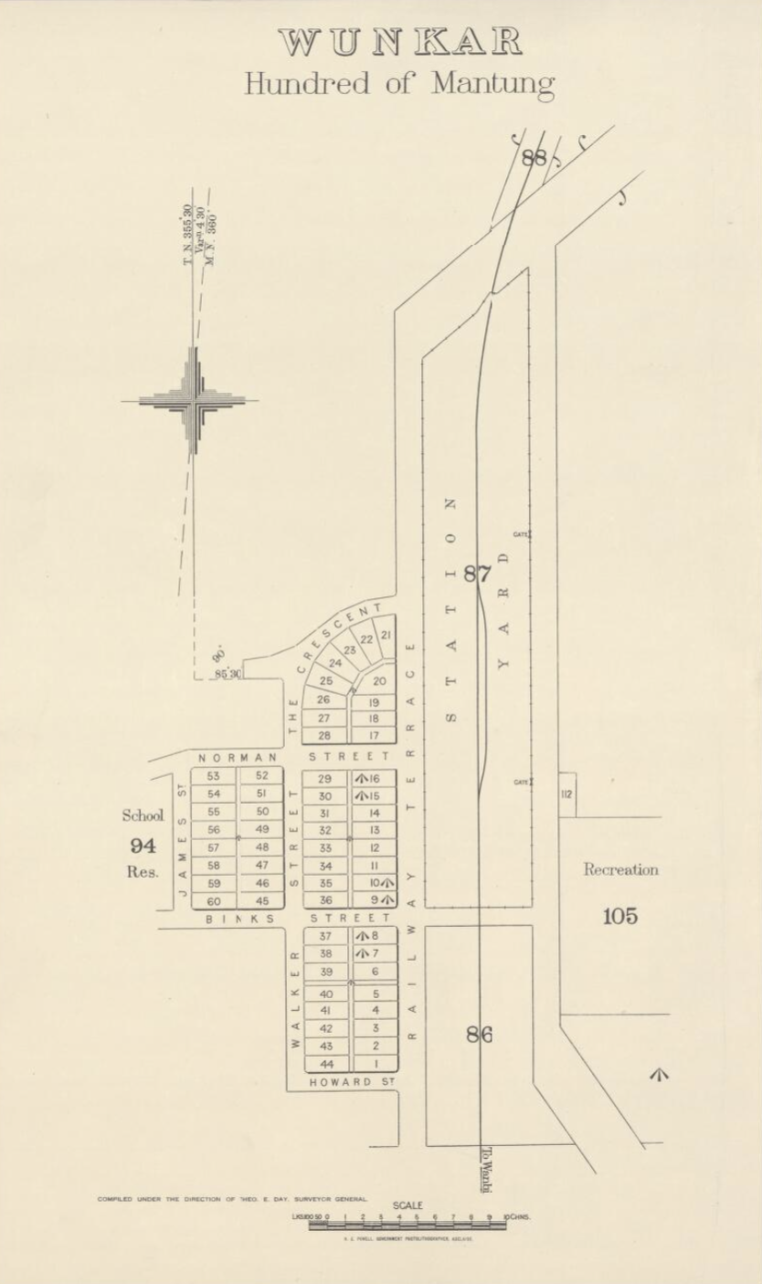
It was originally a station on the Moorook railway line. The township of Wunkar was surveyed in 1926 after the railway station name was approved in 1925. The railway closed in 1971. The Wunkar school opened in 1925 and closed in 1973.
Above:- Surveyor map of Wunkar. Image c/o Trove.
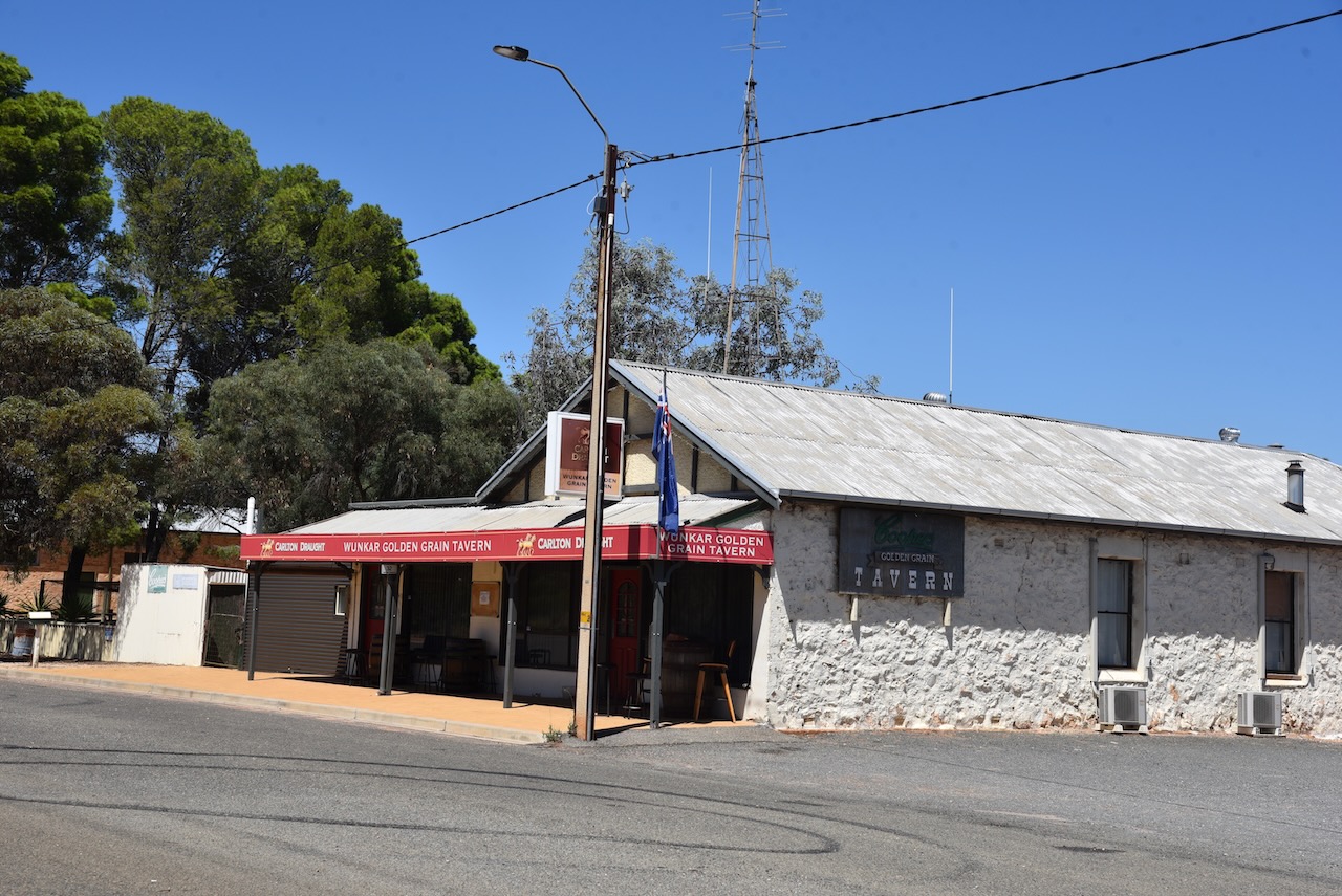
Wunkar’s population as of 2021 was 51 people. There are a few dozen homes, a hall, and the Golden Grain Hotel. Wunkar is an aboriginal word meaning ‘grass’.
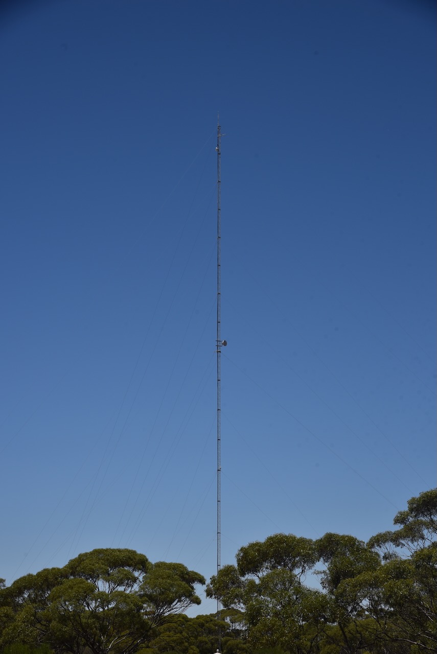
Adjacent to the silo was another very impressive tower that I would like to have at home with my antennas on top of.
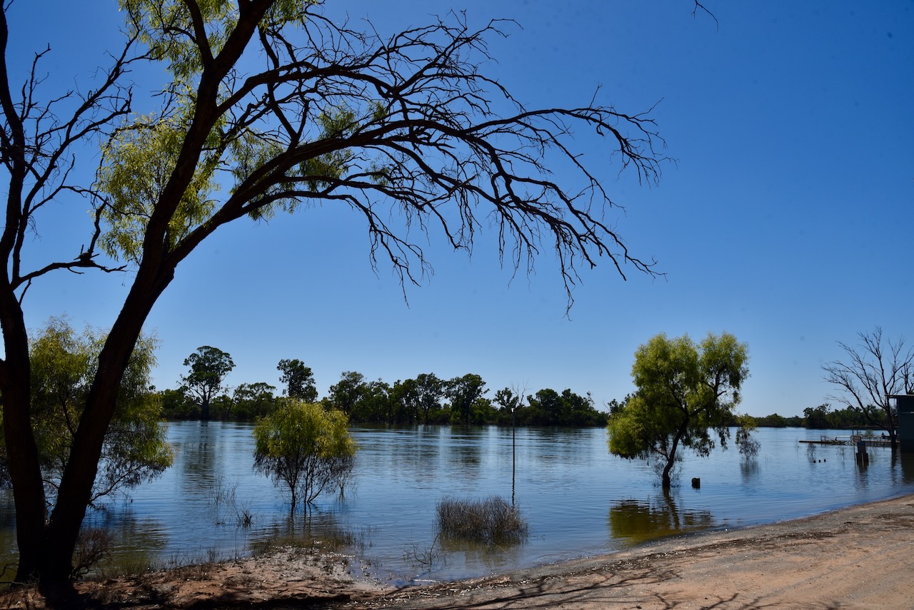
The Wunkar silos are located in Snograss Road. They are located alongside of the old railway line.
I operated from the 4WD for this action and ran the Icom IC-7000, 100 watts, and the Codan 9350 self-tuning antenna.
Above:- the activation zone at the Wunkar silo. Image c/o SiOTA website.
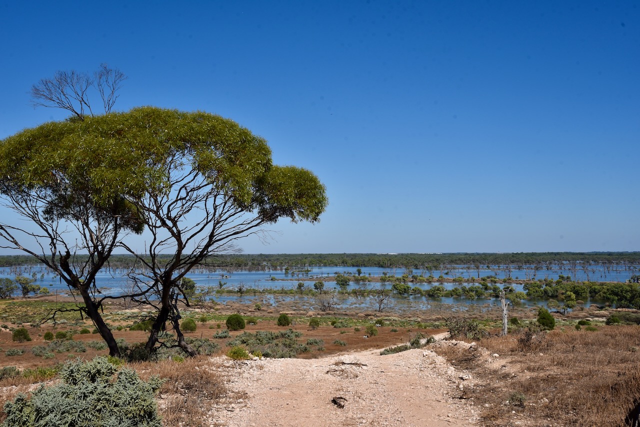
I packed up at the Paringa silo and headed to my next activation, the Wunkar silo. I stopped briefly at Paringa to look across the Pike River floodplain which was covered in water.
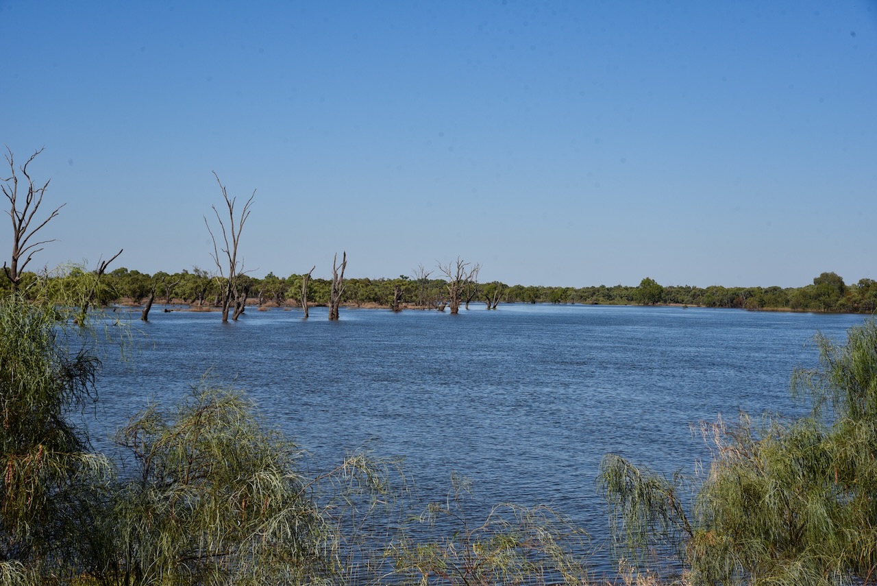
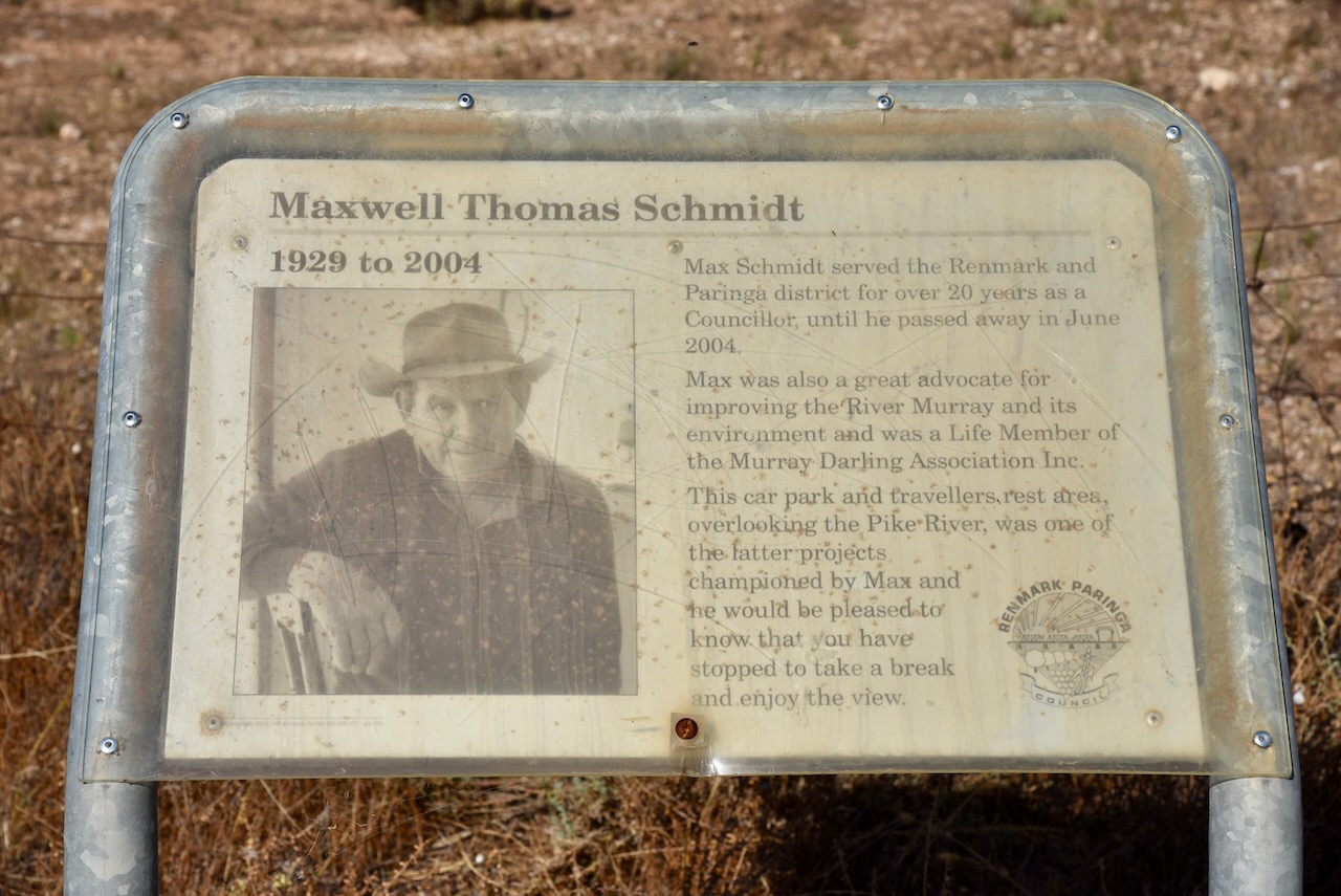
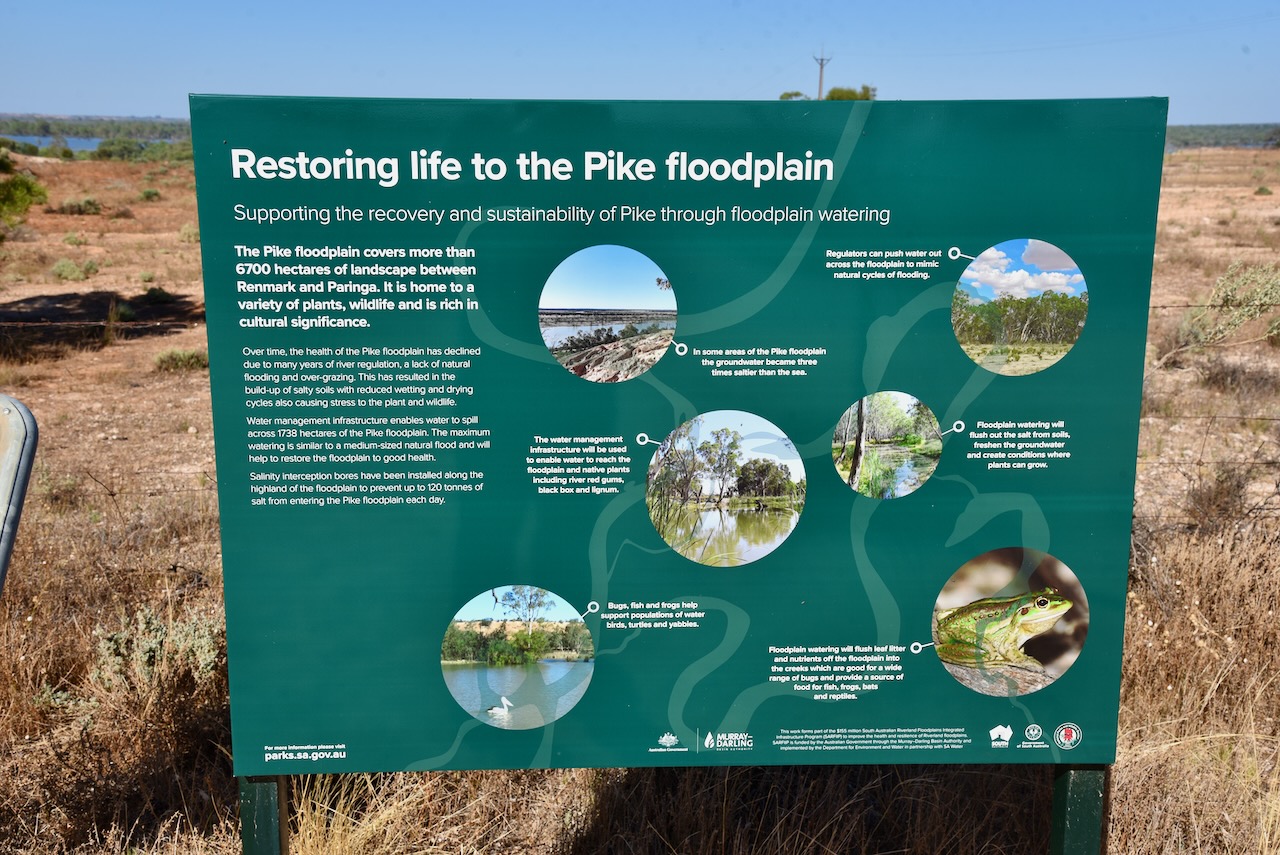
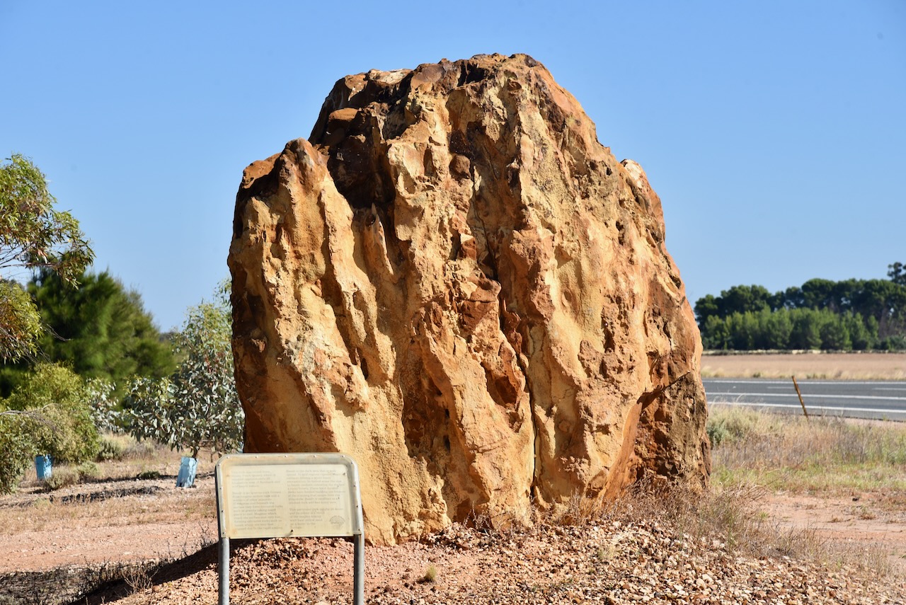
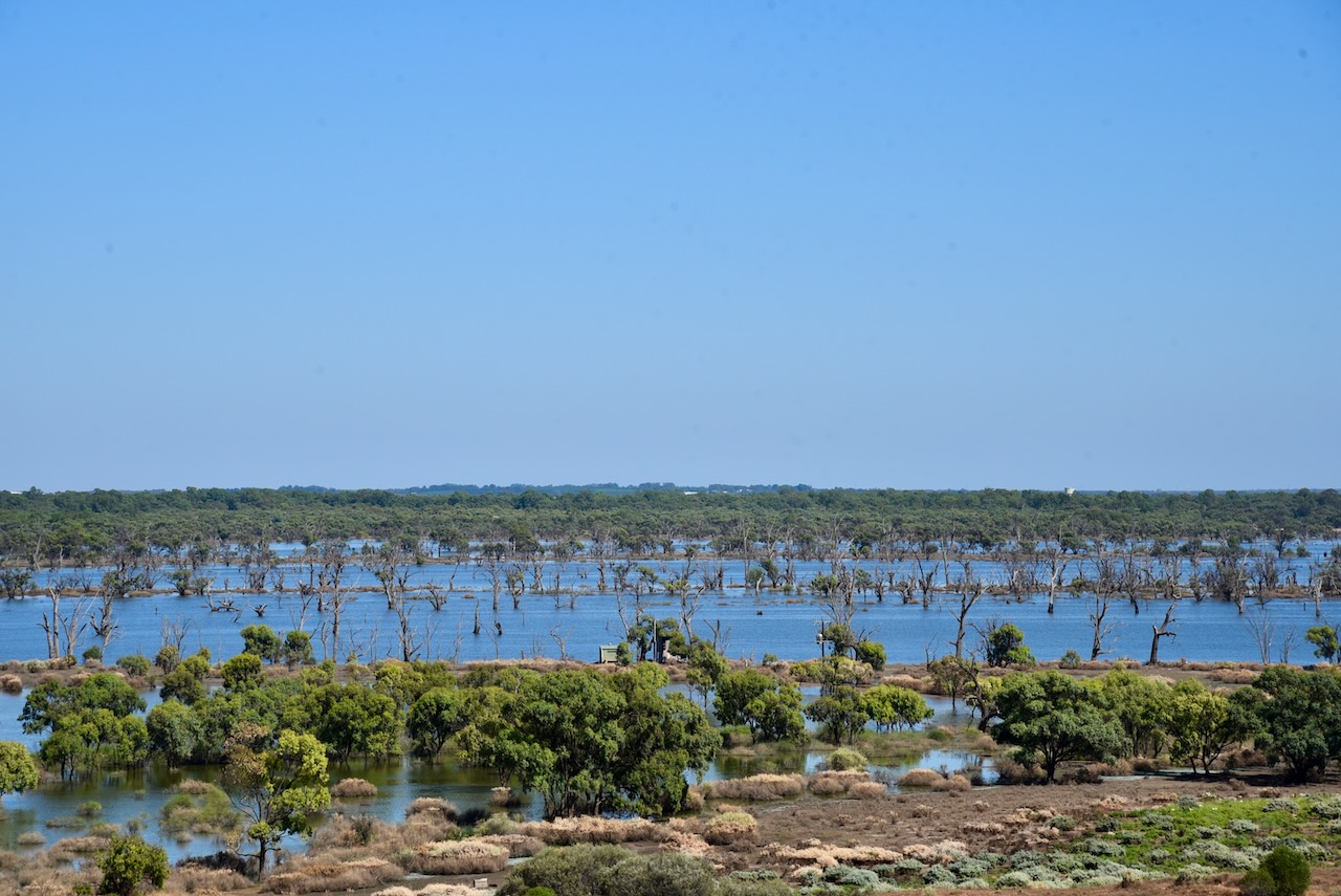
I then headed south on the Sturt Highway and stopped briefly at the roadside rest stop just outside of Paringa. There are some information boards here on the Pike floodplain, an old timber jinker, an information board from Maxwell Schmidt, and a large rock mined from Pinch Quarry.
The timber jinker was used in the 1930s at the Renmark Irrigation Trust’s No. 1 pumping station to haul red gum logs into the irrigation settlement for various purposes including pylons in culverts over the irrigation channels. It was hauled by a crawler tractor.
Maxwell Thomas Schmidt (b. 1929. d. 2004) served the Renmark and Paringa district for over 20 years as a Councillor, until he passed away in June 2004. He was a great advocate for improving the Murray River and its environment and was a Life Member of the Murray Darling Association Inc.
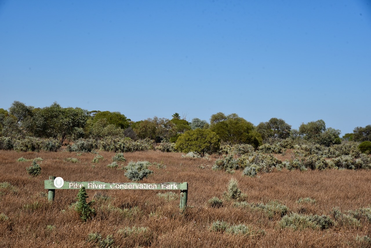
Although I had activated and qualified the park previously, I decided to drive into the Pike River Conservation Park VKFF-0831, and activate it for the World Wide Flora Fauna (WWFF) program.
Above:- Map showing the location of the Pike River CP. Map c/o Google maps.
The park is about 2.88 km2 in size and was established on the st day of February 1979.
Access to the park is via the Sturt Highway.
Above:- An aerial view of the Pike River Conservation Park. Image c/o Google maps
The park is named after Pike River, a stream that flows through the park’s eastern end. On the 10th day of December 2009, crown land in section 84 of the Hundred of Paringa which was formerly the Mundic Forest Reserve was added to its extent.
An 1865 map held at the South Australian Library refers to the ‘Billy Bong Pike River’. In 1910 it was reported that ‘adjacent to the Pyke for a distance of five or six miles was a perfect forest of tobacco trees so dense and vigorous that nothing but bare soil is seen between… On the other side of the road are several farms, fallow land, fair looking crops and an abundance of feed…’
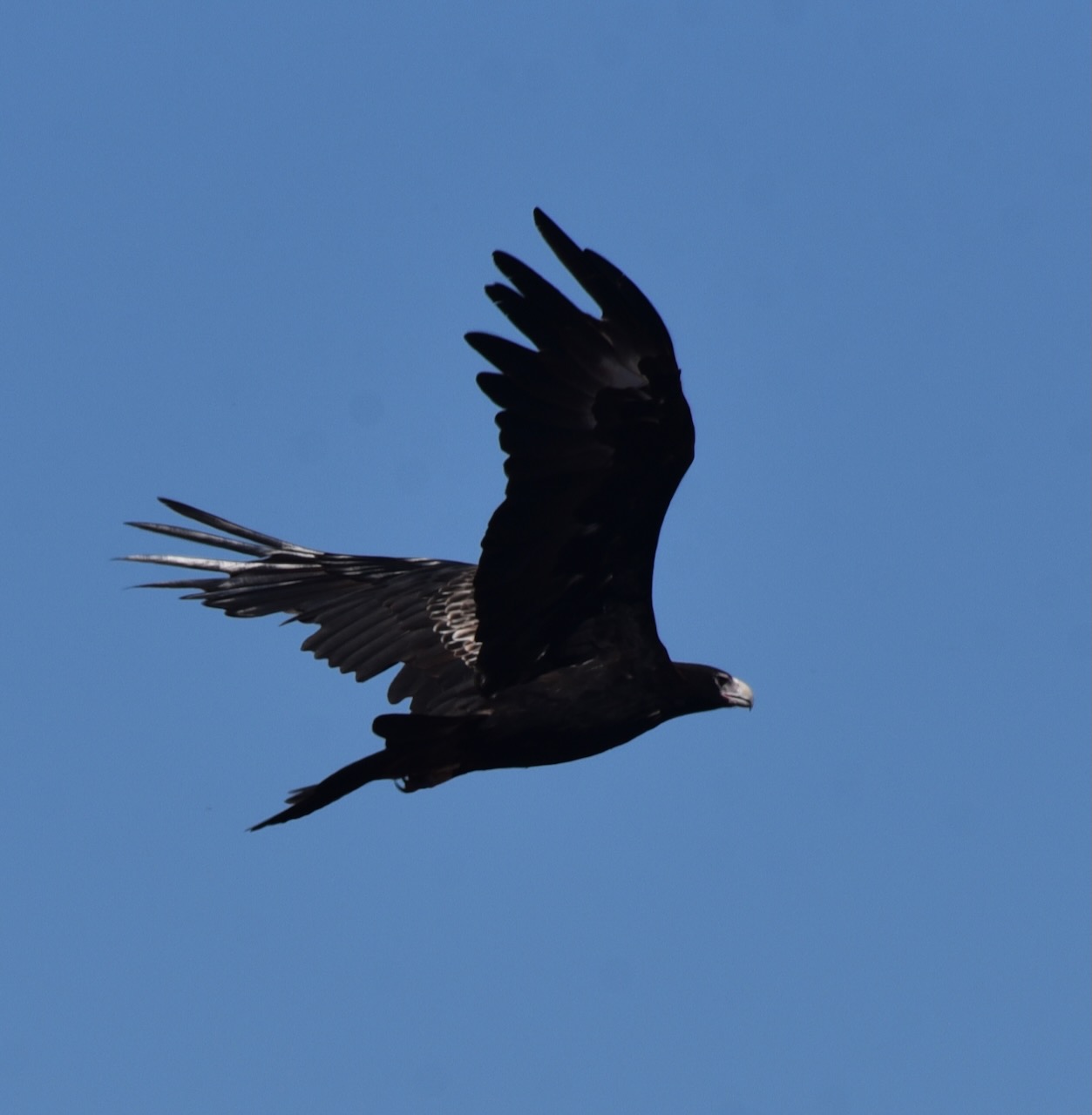
During my visit to the park, I had a pair of Wedge-tailed eagles soaring above. A brilliant sight!
I entered the park via the Sturt Highway and set up in the high section of the park. I operated from the 4WD running the Icom IC7000, 100 watts, and the Codan 9350 self tuning antenna.
Above:- map of the Pike River CP showing my operating spot. Map c/o Location SA Map Viewer.
I worked the following stations on 40m SSB before the UTC rollover:-
VK3AHR
VK5MAZ
VK3PF
VK1AD/p (HEMA VK1/ HCT-040 & VKFF-0837)
VK1DA/p (HEMA VK1/ HCT-045)
VK5BJE
VK5FANA
VK3MCA
VK3SQ
VK2IO
I worked the following stations on 40m SSB after the UTC rollover:-
VK2EXA
VK3VAR
VK5BJE
VK5KSW
I worked the following stations on 20m SSB:-
VK2IO
VK3PF
VK4TJ
ZL3MR/p (SOTA ZL3/ CB-416)
VK1DA/p (HEMA VK1/ HCT-045)
VK2MET
VK1AO
KG5CIK
VK4HAT
VK4FW
VK8MM
I worked the following stations on 15m SSB before the UTC rollover:-
VK4FW
VK8MM
VK4HAT
VK4FFAB
VK1AO
VK2MET
VK2IO
ZL1TM
VK4HMI
VK2DJP
I worked the following stations on 15m SSB after the UTC rollover:-
On Tuesday 31st January 2023, I was on the road by about 7.30 a.m. The first stop was Mcdonald’s for a coffee and some breakfast. I then headed to the Paringa silo.
Above:- Map showing the location of Paringa. Map c/o Google maps.
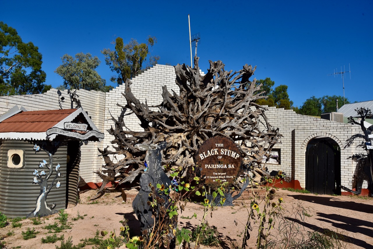
Paringa is a small town just over the Murray River to the east of Renmark. Paringa is well known for its vineyards, almond, citrus and stone fruit orchards, and the Paringa bridge. You can also find the Black Stump in Paringa. It is the largest of eleven known black stumps in Australia and is about 600 years old.
The exact origin of the name Paringa is not known. Horace Cobden Talbot (H.C. Talbot) who was employed in the Lands Department in the 1860s and who authored nomenclature books suggested that Paringa was taken from a large waterhole opposite the original homestead and means ‘whirlpool’. It represented the boundary between the Erawirung and Ngintait Aboriginal people.
Other sources contend that Paringa means ‘land near or about the river’. H.M. Cooper, formerly of the SA Museum, believes it means ‘place at the river’.
Daniel Michael Paul Cudmore (b. 1811. d. 1891) arrived in South Australia from Tasmania in October 1837 with his wife and son. By 1858 he owned a property on the Murray River called ‘Paringa’. The property had originally been leased by Frederick C. Hayes in April 1851. Cudmore moved the homestead to higher ground due to regular flooding. It was reported that Cudmore owned a piano and he was concerned about it getting damaged due to the flooding.
Above:- Daniel Michael Cudmore. Image c/o People Australia.
The Hundred of Paringa, County of Alfred, was proclaimed on the 15th day of June 1893. The Paringa Post Office opened in 1912. The Paringa school opened in 1913. The town of Paringa was laid out in 1917.
Above:- Paringa Station, c. 1890. Image c/o State Library South Australia.
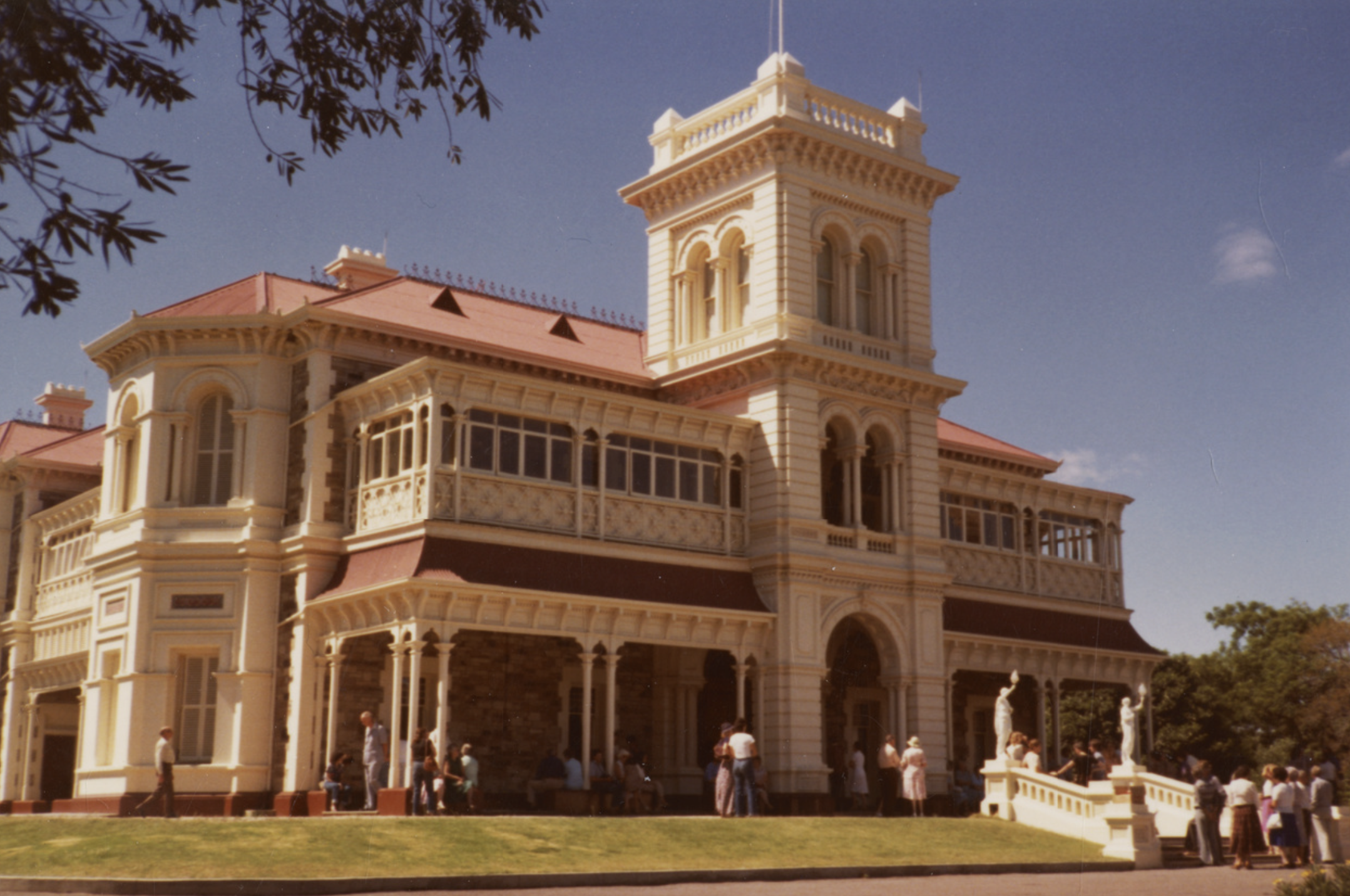
In 1880, Daniel Cudmore’s son, James Francis Cudmore, commenced construction of a mansion called ‘Paringa Hall’ at Somerton south of Adelaide. Construction took two years and it was not until 1882 that the family moved into the property. ‘Paringa Hall’ had 30 rooms and was renowned for its woodwork, elaborate fittings, and stained glass windows at the entrance hall that depicted the Cudmore coat of arms.
‘Paringa Hall’ had a clock at the stables and this maintained the correct time for South Australia. A large ell which hung in a belfry outside, summoned the men on the property.
Following the death of Mr and Mrs Cudmore in 1912 and 1914, the property was sold to the Marist Brothers who transformed the property into Sacred Heart College.
Above:- Paringa Hall. Image c/o State Library South Australia.
The water levels in the Murray River were still quite high at Paringa with lots of levees and sandbagging evident.
Many of the roads in the Paringa area were also closed.
One of Paringa’s attractions is the historic Paringa bridge which was opened on the 31st day of January 1927. It was designed to carry a single railway line in the centre of the bridge, with a road lane on each side. The bridge is on the South Australian Heritage Register. The railway closed in December 1990, however, the bridge continues to carry numerous traffic as part of the main road link between Adelaide and Sydney.
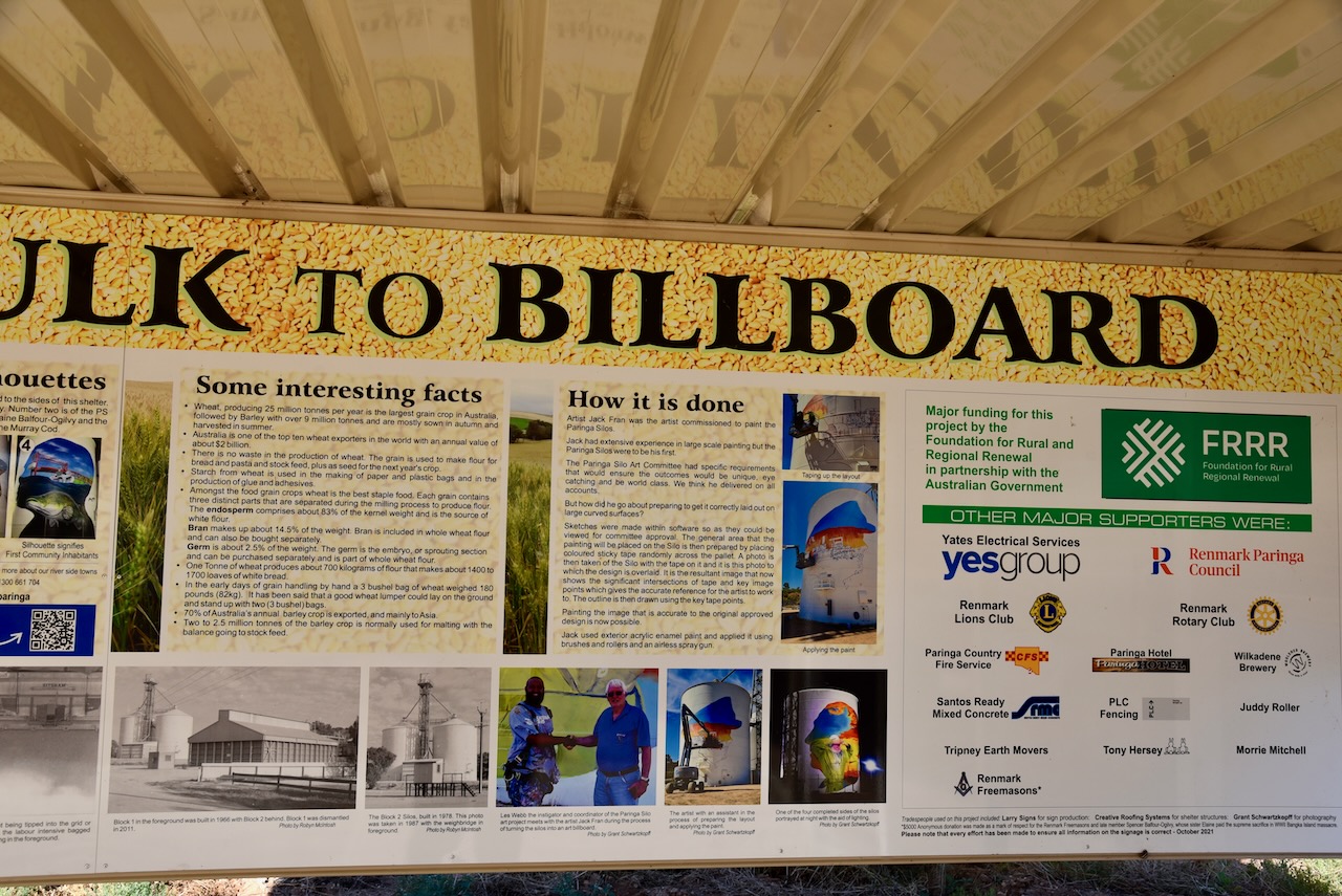
The Paringa silos are located on the northern side of the Sturt Highway just after crossing the Paringa bridge. Prior to bulk handling through silos and other grain storage facilities, grain was bag handled. The bagged grain weighed about 82 kg per bag. The bags were then loaded onto wagons or trucks and carted to the nearest railway siding or wharf for transport.
It was not until the late 1950s and early 1960s that South Australia moved into bulk handling through the South Australian Co-operative Bulk Handling Ltd. In 1966 a shed-type construction was built at Paringa. Following lobbying in 1978 two silos were built. In 1982 rail transport ceased to the Riverland region and transport from the silos was by road. The Paringa silo was closed in 2012.
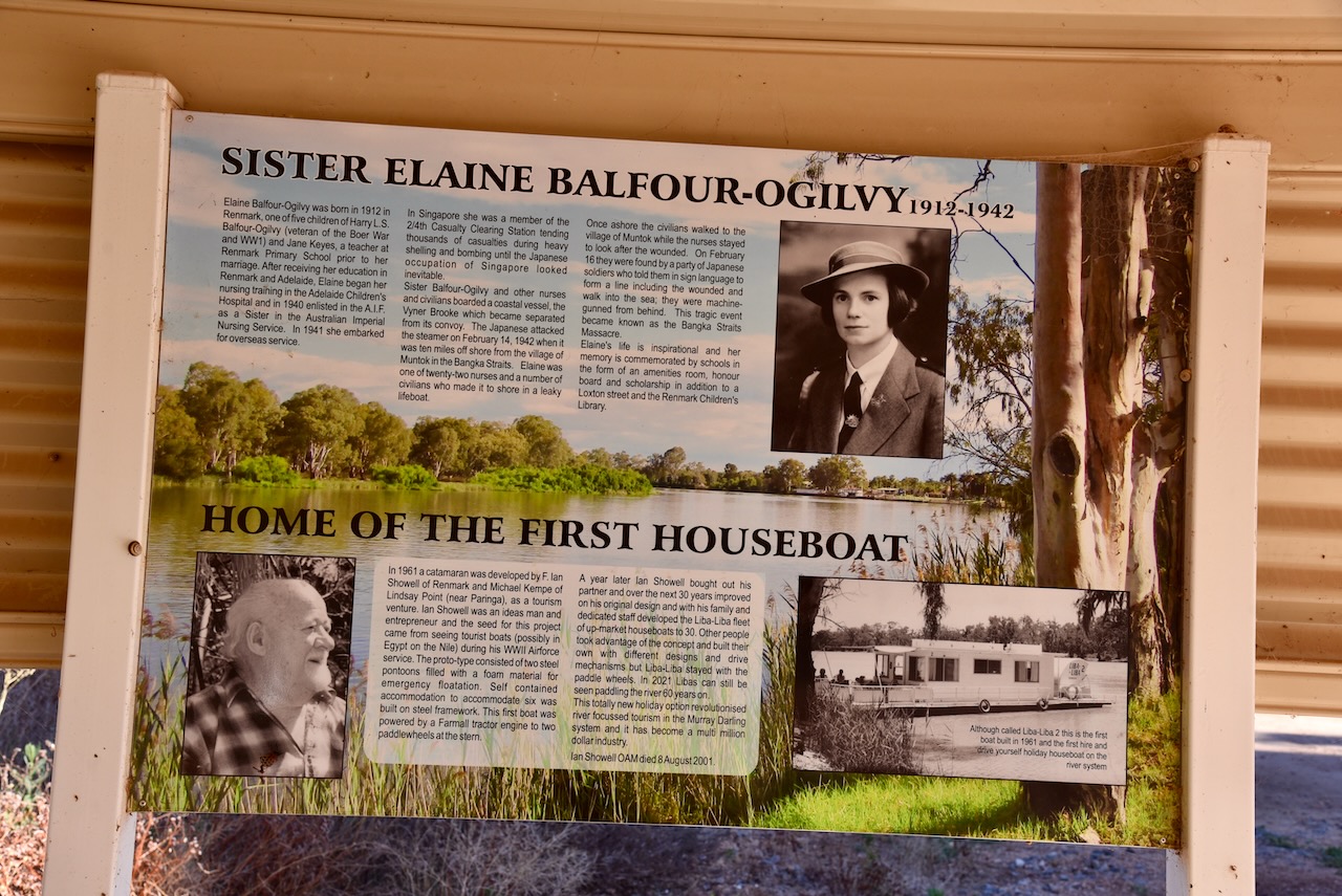
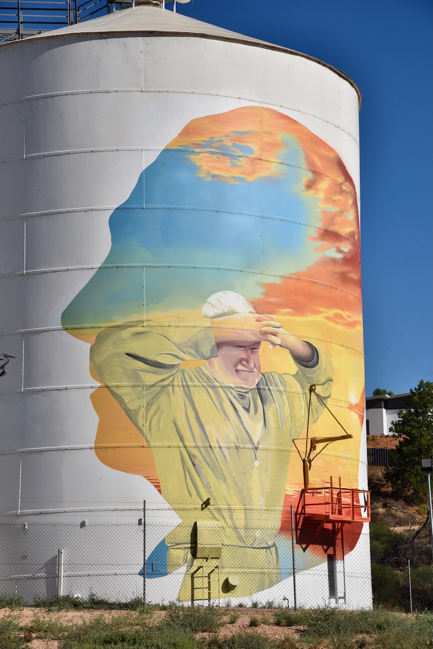
There is an excellent information board at the silos explaining who and what is featured on the silo murals.
The Paringa silo murals were painted by Jack Fran and Sam Brooks. Each of the 4 silos features a local hero to the Paringa region.
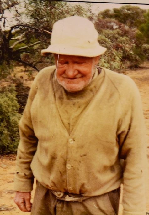
This includes David James Jones @ Possum. He was born in 1901 at Ruapuna, New Zealand. In 1924 he came to South Australia where he was employed as a shearer. By 1928 his Australian Workers Union ticket had expired and in 1929 during the Depression he was turned away from the shearing shed at Lake Victoria Station in NSW. Jones was too proud to borrow money so he walked into the bush and remained there for over 50 years until his remains were discovered in 1982 by woodcutters near Lock 8.
Elaine Balfour-Ogilvy was born in 1912 in Renmark. In 1940 she enlisted in the A.I.F. as a Sister in the Australian Imperial Nursing Service. She embarked for overseas service in 1941. She was a member of the 2/4th Casualty Clearing Station in Singapore, tending to thousands of casualties. In February 1942 she was one of a number of nurses and civilians aboard the coastal vessel Wyer Brooke. It was attacked by the Japanese in the Bangka Straits. Elaine was one of 22 nurses who made it to shore in a leaky lifeboat. On the 16th day of February 1942, they were found by a party of Japanese soldiers. They were forced o form a line and walk into the sea where they were machine-gunned from behind.
I made the following QSOs on 40m SSB:-
VK5HS
VK5AYL
VK5MAZ
VK7ALH
VK2EXA
VK3AG
VK1DA/p (HEMA VK1/ HCT-045)
VK3PF
VK7LH
VK5EE
I made the following QSO on 80m SSB:-
VK5MAZ
I made the following QSOs on 20m SSB:-
VK3BCM
VK3PF
VK2IO
With 14 contacts in the log, I packed up and headed off to my next activation for the day.
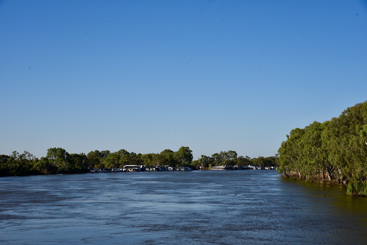
After leaving Mal’s house I headed towards Renmark where I had booked some accommodation for the night. Prior to leaving Berri, I had a look at the Murray River which was in full flow.
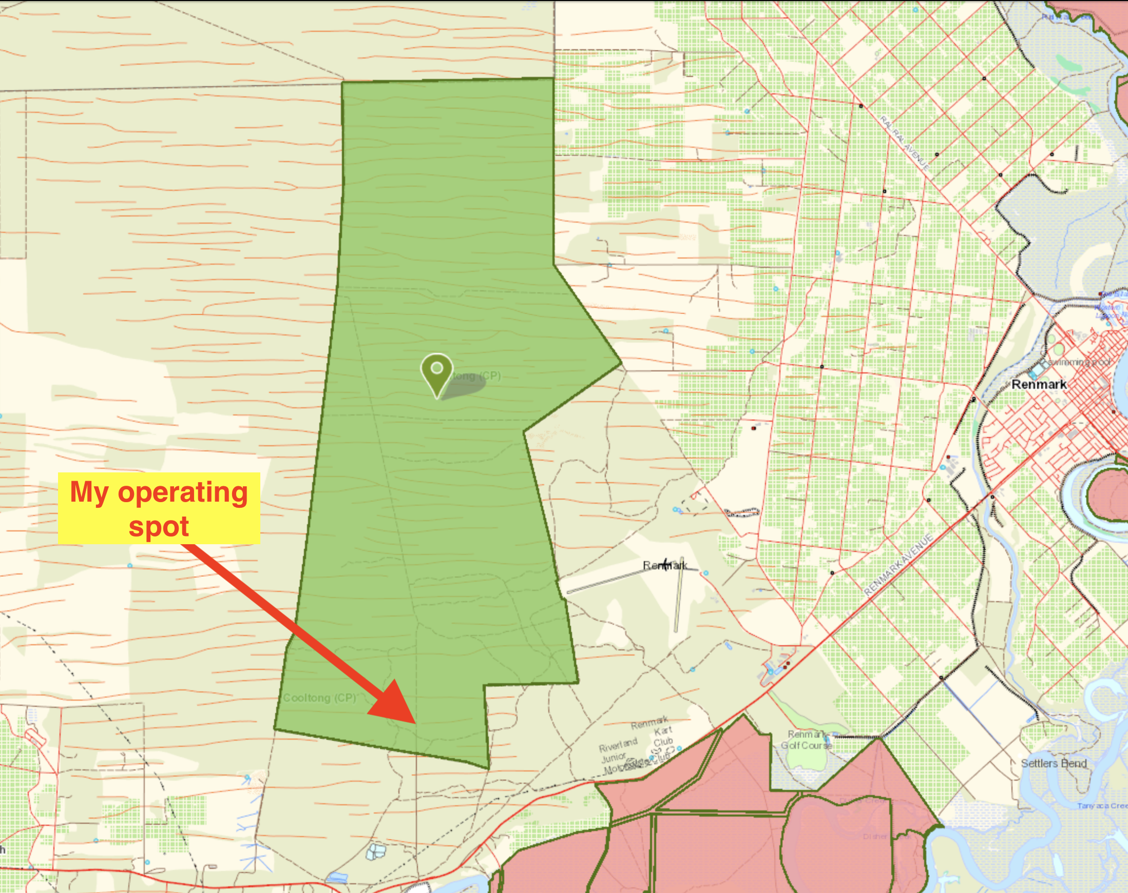
Upon arriving in Renmark I headed to the Cooltong Conservation Park VKFF-0823 for a quick activation. It would have to be quick as I had arranged to go out for dinner that night with Ivan VK5HS and Danny VK5DW.
I have activated and qualified Cooltong Conservation previously. The park is located about 282 km (by road) northeast of the city of Adelaide.
Above:- Map showing the location of the Cooltong CP. Map c/o Location SA Map Viewer.
The Cooltong Conservation Park is 3,710 hectares in size and is located on the northern side of the Sturt Highway. The eastern side of the park adjoins the Renmark airport. The park was proclaimed on the 8th day of April 1983.
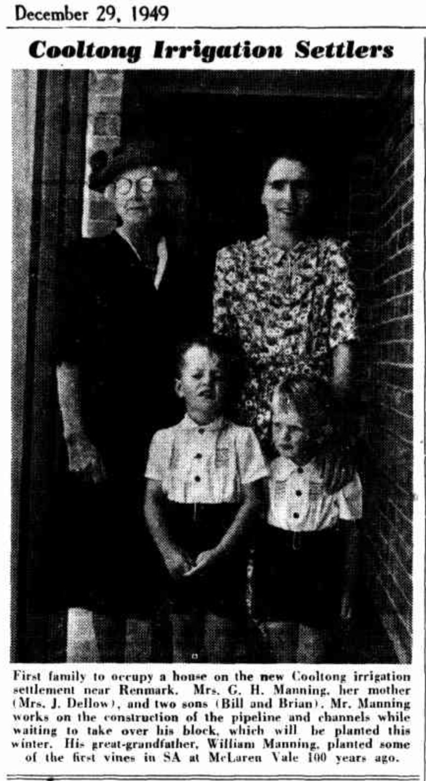
Cooltong is an aboriginal word meaning lizard place’. The name Cooltong was applied to a division of the Chaffey Irrigation Area on the 5th day of June 1925. The town of Cooltong was proclaimed on the 1st day of March 1951.
Above:- Article from the Chronicle, Adelaide, Thu 29 Dec 1949. Image c/o Trove
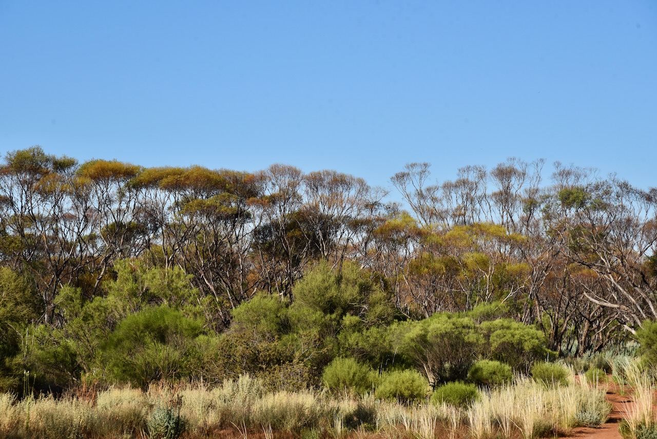
The park’s main vegetation is mallee, with undulating dunes and shales. Mallee species found in the park include Blue-leaf Mallee, White Mallee, Narrow-leaf Red Mallee, and Red Mallee.
Birds SA have recorded 109 species of birds in the park including Malleefowl, Mulga Parrot, Spiny-cheeked Honeyeater, Purple-backed Fairywren (Variegated Fairywren), Southern Whiteface, Weebill, Grey Butcherbird, and Chestnut Quailthrush.
I set up just off Santos Road which travels through the park. I ran the Yaesu FT857, 40 watts, and the 20/40/80m linked dipole and the Codan 9350 antenna for this activation.
Above:- Map showing my operating spot in the park. Map c/o Location SA Map Viewer.
I worked the following stations on 40m SSB:-
VK3PF
VK5BJE
VK3GRX
VK4FW
VK8MM
VK5DW
VK2IO
VK1AO
VK2MET
VK3CWF
VK5AYL
VK3GJG
VK3UAO
VK4TJ
I worked the following stations on 20m SSB:-
VK2IO
VK4EHI
VK4FW
VK8MM
IK4IDF
VK4EMP
VK4TI
ZL3MR
VK4TJ
VK5HS
SO5CAL
ZL2WE
VK1AO
VK2MET
OH1MM
IW2NXI
VK6XN
OH1XT
Iw2BNA
I worked the following stations on 15m SSB:-
VK4FW
VK8MM
VK6XN
VK5HS
I had 37 QSOs in the log, 7 short of the 44 for the global WWFF program. However I was really cutting it fine for time, so I packed up and headed to my motel, the Citrus Valley Motel at Renmark.
I had a shower and then walked to the motel’s restaurant “Ashley’s” and caught up with Ivan and Danny. We had a great night and a terrific meal.