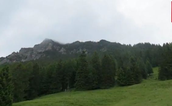
On Saturday morning (18th April 2015) after a nice hot coffee in the motel room at Barmera, Marija and I got on the road and headed off to the historic Overland Corner Hotel where the Riverland Radio Club were holding a get together. It was a very cold morning, but fortunately there was no rain. We had a nice view out across Lake Bonney from our motel room which was the Barmera Lake Resort. We were quite refreshed as we had a relatively early night on Friday night. We had dinner at the Barmera Hotel which we can highly recommend, and then spent the remainder of the night in the motel room watching the AFL footy on TV.
This slideshow requires JavaScript.
It is a short 29 km drive out to Overland Corner from Barmera. We travelled out of Barmera along the Morgan Road and then turned on to the Goyder Highway and headed west. We then took the turn off to the hotel which is Old Coach Road, and travelled along the dirt down towards the hotel. As it was early in the morning (7.00 a.m.) the kangaroos were out in force, so it was pretty slow going. In fact at one stage we had a Western Grey kangaroo bounding alongside of the 4WD who then decided to jump in front of us and slipped on the road surface directly in front of us. No damage done to the vehicle or the kangaroo I am pleased to report.

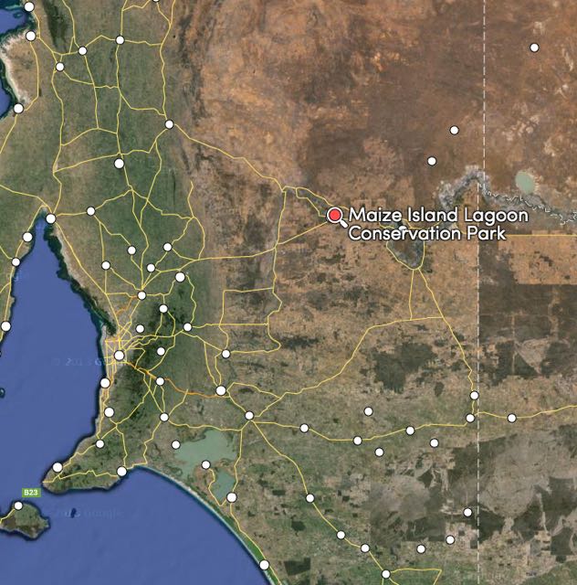
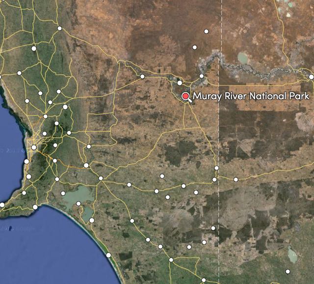
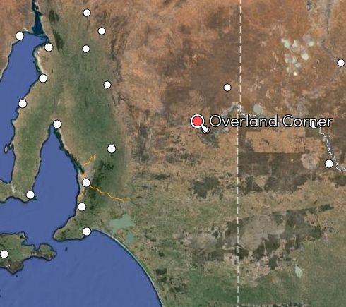
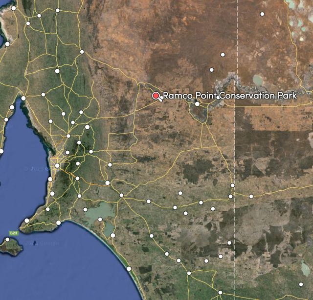
Above:- Map showing the location of the Overland Corner Hotel in the Riverland. Map courtesy of mapcarta.com
The New South Wales gold rush struck in 1851 and there was a large movement of people heading north to the goldfields via the Overland Corner area. And then two years later, river trade commenced with the first wood fueled paddle steamers coming through. It wasn’t long before a large woodpile was being maintained at Overland Corner.
Due to the increasing population in the area, a number of cattle duffers, escaped convicts and a handful of bushrangers, the South Australian Government established a small police post at Overland Corner in 1855.
The Overland Corner Hotel was built in 1859 and is the oldest surviving building in the Riverland region of South Australia. The pub’s original construction was almost entirely of locally available materials, including limestone, red gum and native pine timbers, a dirt floor and thatched roof of river reeds. The hotel was initially a little rough bush inn and was situated on a vital stock route from New South Wales. It catered to drovers, explorers and other travellers. The limestone used for the construction of the hotel was 15 million year old limestone from the nearby quarry.
The Brand Brothers, Henry, William, George, and James, who emigrated to Australia from Kent in England in 1851, were commissioned by John Chambers, the enterprising pastoralist, to build the Overland Corner.
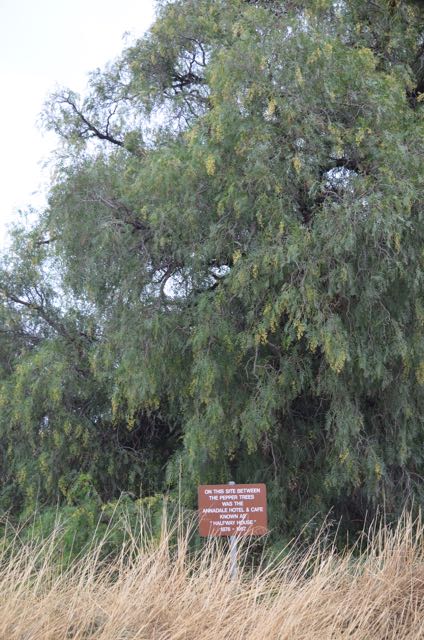
The hotel became a staging point for mail coaches on the run between Wentworth in New South Wales, and South Australia. The first publicans licence was issued in April 1860. By the mid 1860’s, grape vineyards and garden produce was being grown on the rich alluvial river flats, and Cobb & Co coaches stopped at Overland Corner. Business was booming, and during the 1870’s a number of other buildings were established, including a wheelwright and blacksmith, a post and telegraph office, and a new police station.
In about 1879 an underground tank was dug and it was discovered that there was an old aboriginal burial ground 3 metres beneath the building.
The Overland Corner Hotel was purchased by the National Trust of South Australia in 1965.

Above:- The location of the Overland Corner Hotel in close proximity to the River Murray. Image courtesy of mapcarta.com
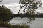
There is a very interesting marker on one of the outside walls of the hotel showing the water level during the 1956 Murray River flood. This flood occurred due to higher than average rainfalls in Western Queensland and heavy rains in the proceedings three months in Murray catchment areas. The river peaked 12.3 metres at nearby Morgan. Some areas were flooded up to 100 km from the natural flow of the river. peaked at 18.01 metres at Overland Corner.
There is a very good walking trail that takes in the hotel and many of the historic areas nearby, but unfortunately Marija and I didn’t have enough time to do this. But we will be back.
This slideshow requires JavaScript.
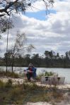
When we arrived at the hotel at about 7.15 a.m, there was already a small but very keen gathering of amateurs and their wives. Ivan VK5HS had the BBQ going and was cooking up some sausages and bacon and eggs. So after some introductions to those that were already present, we enjoyed a very nice bacon and egg sandwich and a nice hot coffee. We then took the opportunity of getting a group photograph of this keen early morning bunch.
This slideshow requires JavaScript.
As the morning progressed, more and more amateurs and their wives arrived at the Overland Corner Hotel. There was also a wedding planned later for that day. None of our group either! So there was quite a bit of activity getting the marquee at the back of the hotel prepared.
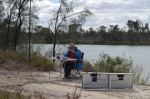
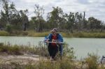
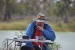
At 8.30 a.m. local time, Ron VK5MRE fired up the radio and kicked off the Saturday morning net for the Riverland Radio Club on 7.078 on 40m. A small marquee had been erected just on the western side of the hotel and this is where Ron ran the net from. A number of us who were at the gathering had the mic handed over to us for a round on the net.
This slideshow requires JavaScript.
At the conclusion of the net, I fetched myself another cup of coffee. It was still pretty chilly. I also took the opportunity of having a bit of a walk around the hotel which certainly contains a lot of history. It was particularly interesting to view the marker on the hotel’s outside wall for the 1956 flood. If we had been there back in 1956, we would all be underwater and blowing bubbles.
This slideshow requires JavaScript.
Shortly after the conclusion of the net, a small car boot sale was held. Marija was closely watching me to ensure that I wasn’t spending any $$$. Although I was very tempted by an old Communications receiver being sold by Adrian VK5AJR. Ron VK5MRE also had a very well kept Yaesu FRG7 communications receiver up for bids as well.
This slideshow requires JavaScript.
We then had a bit more of a chat with more arrivals at the get together, and at 11.00 a.m. the hotel opened up, so Marija and I took the opportunity of having a look through this very historic hotel. There is a small room which contains a large amount of memorabilia. There was even an olf CW key in there. After we had finished looking through the hotel, I broke the ‘midday rule’ and ordered a can of Bundy and coke.
This slideshow requires JavaScript.
A lot of people had arrived by this time, and with some significant amount of organisational skills by Ron VK5MRE and Marija, we managed to get everyone in place for a group photograph in front of the hotel.
This slideshow requires JavaScript.
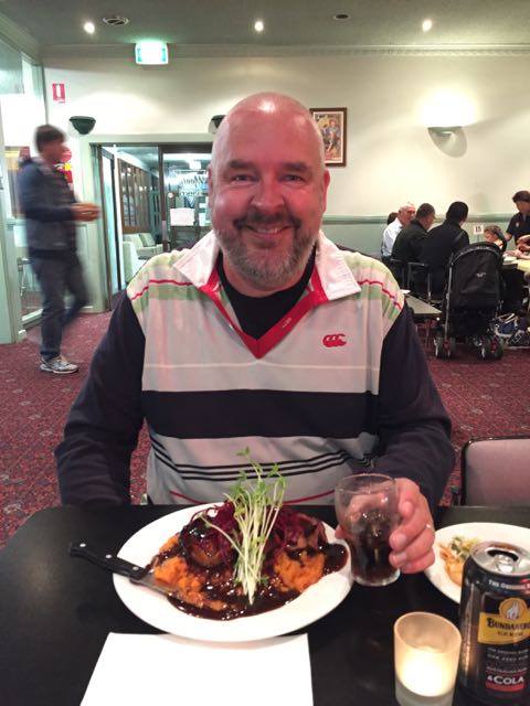
We all then enjoyed a very nice meal out in the beer garden alongside of the hotel. I had a schnitzel which I must stay was one of the nicest ‘Schnitties’ I had in a long time. It was a beautiful sunny late morning/early afternoon at times, and in fact I had to choose a nice shady spot to get out of the sun.
This slideshow requires JavaScript.
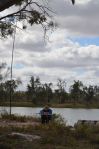
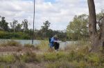
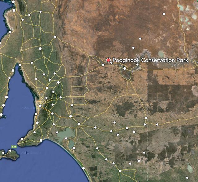
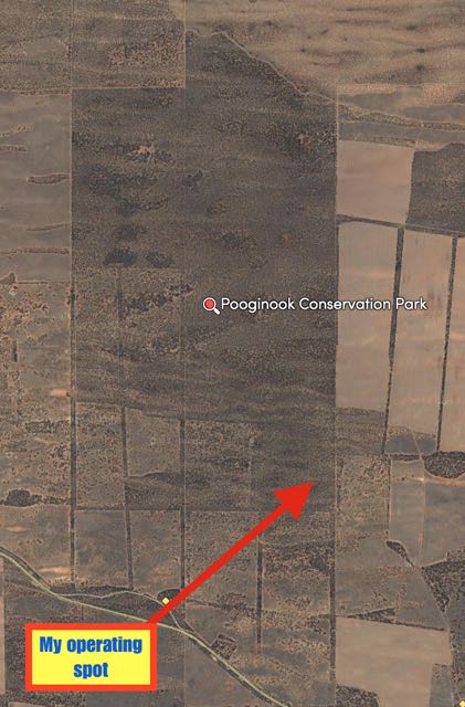
Time was marching on and it was almost 1.30 p.m. I had posted on parksnpeaks and the VK5 Parks Yahoo group that I was going to activate the Pooginook Conservation Park and the Murray River National Park that afternoon. So it was time for Marija and I to say our goodbyes and hit the road. Pooginook Conservation Park, was about 23 km west of Overland Corner, along the Goyder Highway, so as much as I would have liked to have stayed a bit longer, we really needed to make a move.
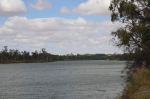
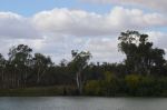
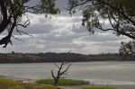
After leaving the hotel, we took a quick photo opportunity stop on the dirt road. It was a nice view back to the south west overlooking the hotel itself and the Murray River. When we hit the bitumen on the Goyder Highway, we took a quick stop to have a look at the old Overland Corner cemetery, and from there, briefly stopped again on the southern side of the Goyder Highway to view the hotel and Murray River. This spot sits up quite high, so the view to the south was quite spectacular.
This slideshow requires JavaScript.
This get together was a very enjoyable morning and afternoon. It was great to put a face to the call sign of many amateurs that I had spoken to many times over the years. I certainly hope this is going to be an annual event held by the Riverland Radio Club.
References
Barmera Visitor Information Centre, ‘Historic Overland Corner’.


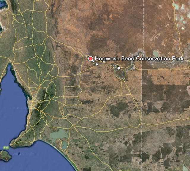
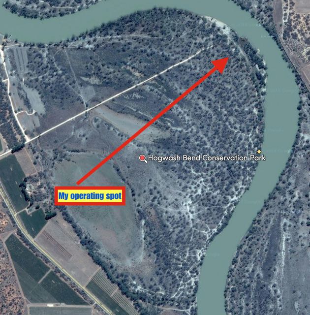
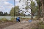
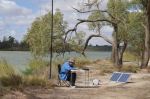
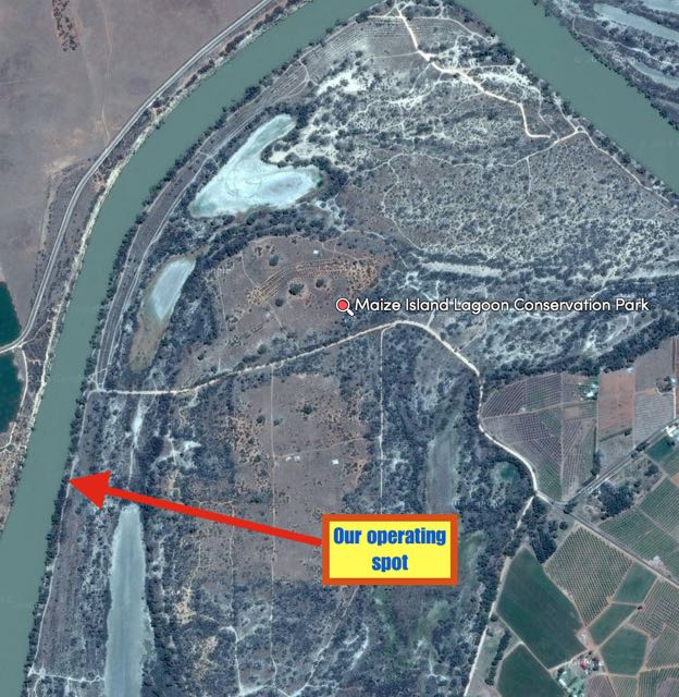
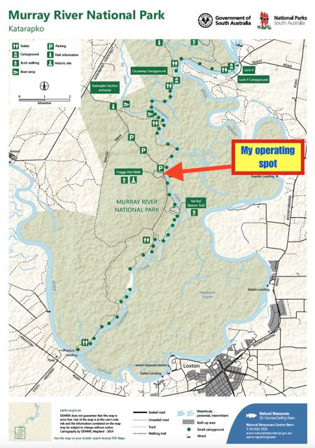
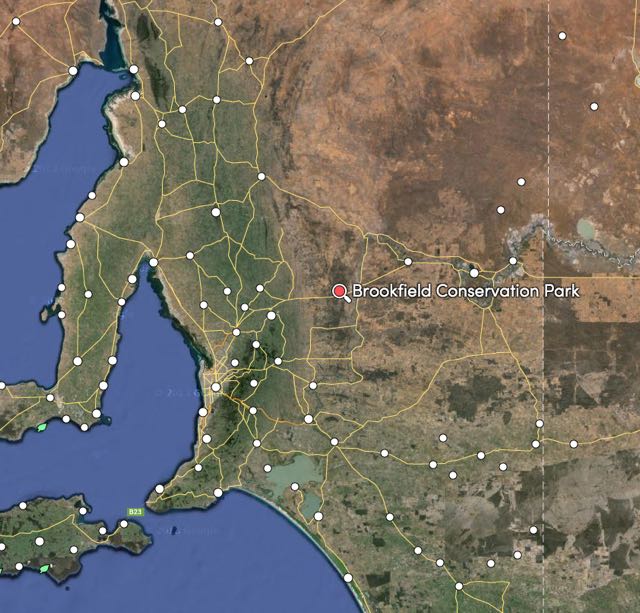
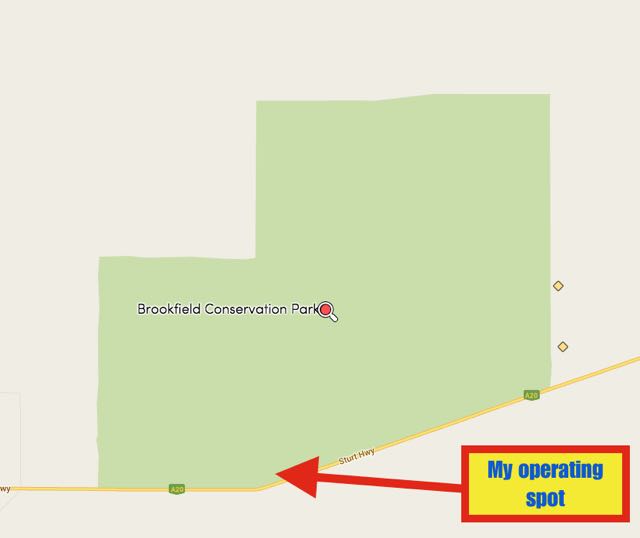
 Above:- Our operating spot. Image courtesy of mapcarta.com
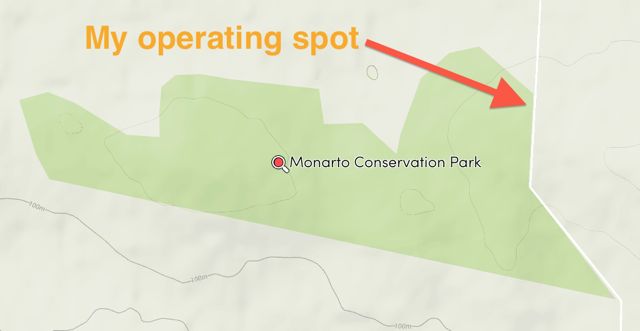
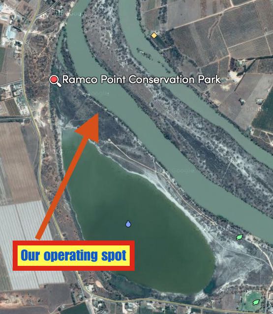