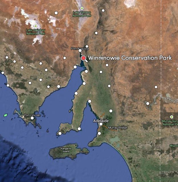
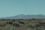
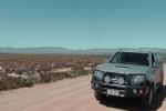
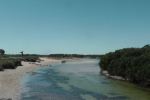
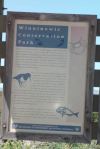
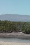
On Thursday afternoon, 5th February 2015, I headed north to the Winninowie Conservation Park, which is located on the Upper Spencer Gulf, about 25 km south of Port Augusta and about 270 km north of Adelaide.
map courtesy of mapcarta.com
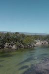
I had arranged to meet Les VK5KLV at the park to do a joint activation. We had agreed to meet at the end of the road leading through the park to Chinaman Creek.
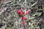
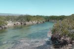
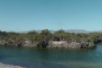
Winninowie Conservation Park was proclaimed in 1990 as recognition of its biological and ecological importance. The park, which covers an area of 7,847 hectares, is a coastal area located between Port Augusta and Port Pirie, which has unique physical and biological conditions including large tidal range and extremes of water temperature. The park supports mangrove, samphire and sea grass communities. The Yatala Harbor Aquatic Reserve overlaps a portion of the Winninowie Conservation Park. The park has 28 km of coastline.
It is believed that the termination ‘-owie’ in various place names throughout the region was widely used by the Nukunu aboriginal people, referring in general to a watering place.
The park was previously part of local pastoral holdings. Much of the area was used for sheep grazing. During the 1920’s, B.H.A.S. smelters extracted large quantities of shell-grit from coastal dunes in the area, for smelter operations at nearby Port Pirie.
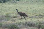
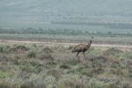
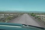
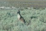
As I travelled along the dirt road cutting through the park, I encountered numerous emus. They didn’t seem to be too preturbed by the presence of a motor vehicle. But I didn’t see any kangaroos. It was probably a little too hot for them to be venturing out yet.
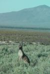
A total of 10 native mammals have been recored in the park including the Euro, Red kangaroo, Western grey kangaroo, Fat-tailed dunnart, Common dunnart, Mitchells Hopping mouse, Echidma, and Gould’s wattle bat.
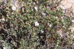
About 124 species of birds have been recorded in the park. A total of 32 species of reptiles call the park home, including the rare Spiny-tailed gecko and the Mallee worm-lizard.
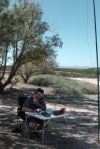
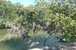
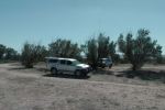
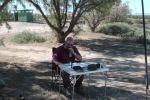
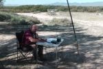
Les and I set up at Chinamans Creek and we used my Yaesu FT-817nd and the SOTA Beams 40m/20m linked dipole. It was a job keeping the 7 metre squid pole upright, as it was very windy. But at the same time it was also very warm, so the shelter provided by the trees was welcomed. Les operated first and filled up half a page of his log with contacts on 40m SSB.
There are four shacks here at Chinamans Creek that are located on Crown land, and are held under life tenure. When the leases expire, the land will be incorporated into the park.
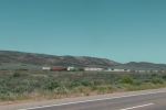
Freight train on the Adelaide-Darwin line
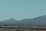
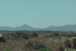
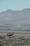
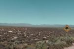
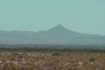
The devils Peak, VK5/ NE-080
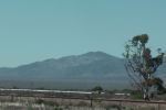
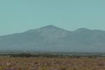
Mt Brown, VK5/ NE-014
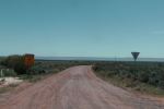
The road leading to Chinamans Creek
There was an abundance of Emus
The Devils Peak
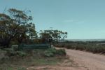
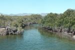
Chinaman’s Creek
Les Vk5KLV on air
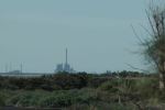
The Port Augusta power station in the distance
Our operating spot
It was very windy, the squid pole on a lean
Looking east back towards the Ranges
Western Grey kangaroos
I then took the reigns of the mic and made a total of 15 contacts into VK2, VK3, and VK5 on 40m SSB and 20m SSB. My first contact was with Tony VK3VTH/2 who was portable in the Warrumbungle National Park, north of Dubbo in New South Wales. This was followed by a call from Adrian VK5FANA on the Yorke Peninsula running QRP 5 watts.
My first activation for Thursday 5th February 2015, was Brownhill Range, VK5/ SE-004, which is located about 27 km by road south east of Jamestown, and about 220 km north of Adelaide.
map courtesy of mapcarta.com
I had planned on activating The Bluff, VK5/ NE-065, but the hike to New Campbell the day before, had really taken it out of me. So I called the land owner for Brownhill Range, first thing on Thursday morning, and got permission from him to access the summit (owner details can be found on the SOATA database).
I made an early start from Crystal Brook, and headed west along the Goyder Highway through Narridy. I then took the Gulnare-Spalding Road, until I reached RM Williams Way, where I turned left and headed north towards Jamestown. I then travelled out to Bellalie East and from there to Seven Trees Road.
I stopped off at the John Ainsworth Horrocks monument just outside of Gulnare. Horrocks was a pastoralist and explorer, who passed through the district in August 1846 on his expedition to the north west of Mount Arden. I then travelled up into the BrownHill Range. It was a slow drive at times, as there were numerous Western Grey kangaroos on the roads.
This slideshow requires JavaScript.
As I got higher up into the Brownhill Range, the views back to the west were excellent. You were able to see clearly back to Jamestown and the Bundaleer Forest Reserve, and New Campbell Hill where I had activated the day before. And there was no shortage of kangaroos in this area either. It was slow going.
This slideshow requires JavaScript.
Brownhill Range is 755 metres above sea level and is worth 4 SOTA points. It is located amongst the Brown Hill (Hallett 1) windfarm.
Access to the summit is off Seven Trees Road. Just down from the power plant is a set of double gates with various signsl on the gates including ‘Unauthorised access. Trespassers will be prosecuted‘. Please do NOT enter the property unless you have been given permission to do so.
I travelled up the dirt road, through a number of gates, until I reached the trig point at Brownhill Range. The trig point consists of three blue painted metal poles, about 1.5 metres in height. I parked the car down the dirt road, and walked up the road for a short distance and then up the ridgeline to the summit.
For this activation I ran the Yaesu FT-817nd and 5 watts output. The antenna was the SOTA Beams 40m/20m linked dipole, which I supported on the 7 metre telescopic squid pole. I secured the squid pole to one of the trig point poles, with the assistance of some octopus straps.
It was a beautiful sunny day, but it was incredibly windy on the summit. There is a large outcrop of rocks at the summit, and I sheltered behind a large moss rock out of the northerly winds.
image courtesy of google maps.
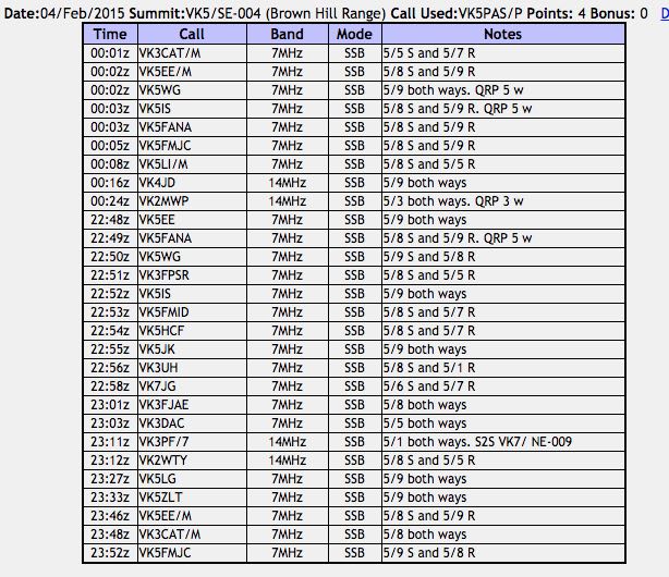
I was on air by 2250 UTC (9.20 a.m. SA local time). My first contact was with Tom VK5EE in Mount Gambier, followed by Adrian VK5FANA on the Yorke Peninsula who was running QRP 5 watts (5/8 sent and 5/9 received). My next caller was Nev VK5WG at Crystal Brook, and my fourth and qualifying contact was with Peter VK3FPSR. I worked a total of 12 stations on 40m in VK3, VK5 & VK7. Prior to heading over to 20m I was called by a station who was very very weak, and who I was just unable to pull out of the noise. The wind turbines were generating an S1 noise on the band, and this combined with the wind, made it very difficult to copy. Fred Vk3DAC, who was my last contact, informed me that it was Peter Vk3PF/7 who was trying to get through to me.
I told Fred that I would QSY to 20m and try Peter on 14.310. I quickly lowered the squid pole and removed the links and headed for 14.310. I asked if the frequency was in use and an American voice replied, ‘yes the frequency is in use, thankyou’. I listened a little longer and found that it was some USA stations in QSO, but I could not hear the other station. I was amazed that at this time of the day, that my 5 watt signal was being heard in the United States.
I then found that 14.305 was clear and I started calling CQ. My CQ call was answered by Peter VK3PF/7. He had found me. Peter’s signal was not all that strong, but he was very readable (5/1 both ways). Peter was on SOTA peak, East Tower, VK7/ NE-009, in the Ben Lomond National Park. My next contact was with David VK2WTY. I called CQ a number of times after this, with no response. So I decided to head back to 40m to pick up some more chasers before the UTC rollover. It was now 2327 UTC.
This slideshow requires JavaScript.
My first contact after returning to 40m was Greg Vk5LG in the Adelaide Hills, followed by Alan VK5ZLT. I was then called by Tom VK5EE who was mobile at the Blue Lake at Mount Gambier, and then Tony VK3CAT who was mobile at the Sandringham Yacht Club. My final caller before the UTC rollover was John VK5FMJC at Crystal Brook.
I then took the opportunity of stretching my legs. I came back on air just after the UTC rollover, and asked for any mobile and portable stations first. This call was answered by Tony VK3CAT and then Tom VK5EE. I then asked for any QRP stations and this was answered by Nev VK5WG running 5 watts from his little X1M transceiver, followed by Ian VK5IS also running 5 watts and then Adrian VK5FANA again running 5 watts. I went on to work John VK5FMJC and Craig VK5LI who was mobile on the South Eastern Freeway neat Mount Barker.
I decided to give 20m one last go after the UTC rollover. So down came the squid pole again, and the links on the dipole were removed. I called CQ on 14.310 and this was answered by Peter VK4JD and then Andrew VK2MWP running QRP 2 watts. I put out a few more CQ calls but there were no takers.
So after 90 minutes on the summit, I had a total of 28 contacts in the log.
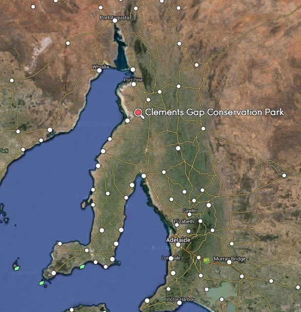
After my steak sandwich and a cleansing ale at Port Broughton, I headed back to the Clements Gap Conservation Park. The park is situated about 22 km south west of Crystal Brook and about 200 km north of Adelaide.
map courtesy of mapcarta.com
Clements Cap is a largely undisturbed 11 square km of remnant bushland. It is believed that the area is named after an old shepherd employed in the locality. This park is sometimes referred to on maps as the Mundoora Conservation Park.
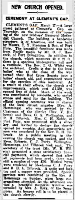
Clements Gap was once a thriving community. The only surviving building at Clements Gap is the Soldiers Memorial Methodist Church, which is still used today for monthly services and weddings. The church was officially opened on the 11th March 1926. It was free of debt, due in part to the effort of the local ladies who at the end of the war turned their Red Cross Society into a ladies church aid for the erection of the memorial. The architect of the church was Reverend T.G. White.
I found the following article re the opening of the church, from The Register, Friday 19th March 1926.
image courtesy of trove.nla.gov.au
The Clements Gap windfarm is located nearby in the Barunga Range. It was opened in 2010, and consists of 27 wind turbines with a total generating capacity of 57 MW. It provides enough electricity for up to 33,000 homes and is estimated to avoid the emission of 150,000 tonnes of greenhouse gases each year.
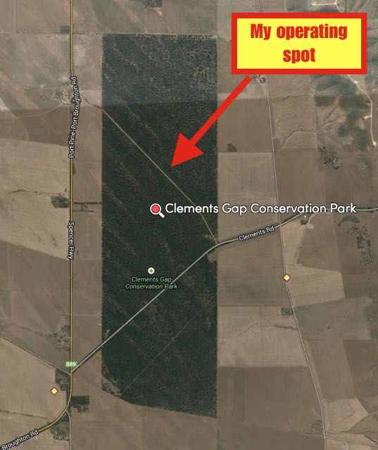
I set up on the northern side of the dirt road that runs through the park, between the Spencer Highway and Clements Road. There are a number of dirt tracks that run off this dirt road. I found a small clearing and set up the fold up table and deck chair.
image courtesy of mapcarta.com
I was planning on using the Yaesu FT-857d for this activation, but when I connected the radio to the 44 amp hour power pack, I found I had no power being delivered to the transceiver. Some careful checks were made and this revealed that one of the 25 amp fuses had fallen out of the cable that I connect between the radio and the power source. I had an open circuit. So I resorted to using the smaller Yaesu FT-817nd and 5 watts output.
I started calling CQ on 7.095 and the first taker was Adrian VK5FANA, and then Richard VK5ZRY. Both of whom are on the Yorke Peninsula. I then spoke with Jeff VK5JK at Victor Harbor and then Geoff VK5HEL at Murray Bridge. I had a little bit of QRM on the frequency from an EA1 on Spain, but it was not causing any major problems. However, three VK2’s came up on 7.095 and completely took over the frequency. There was no ‘is the frequency in use?’, they just completely took over. No doubt they couldn’t hear me, but how they didn’t hear the higher powered stations I was working, I do not know. And they also totally ignored the numerous ‘the frequency is in use’ calls that were made by other stations waiting to work me.
I gave up and moved up to 7.100 where I spoke with Ivan VK5HS in the Riverland. Sadly, our VK2 friends from 7.090 then came up on 7.098 and were bleeding over badly. I decided it wasn’t worth pursuing, and decided to go for a bit of a walk to soothe my nerves.
I returned to the radio about 15 minutes later and tuned up and down the 40m band and found an old friend, John VK3HJD in QSO with some other VK3’s. So I called in to the group and spoke with John, Steve VK3MSC, Colin VK3COL, and Colin VK3ZZS/p.
It was at this time that I heard a vehicle travelling down the road. I then saw a 4WD travel passed slowly and then come to a halt. The vehicle then reversed up, back towards the track I had travelled down. Oh no! I thought to myself. This is either a park ranger, or a trouble maker. I was hoping it was not the latter. Fortunately it was neither. It was Nev VK5WG and John VK5FMJC.
This slideshow requires JavaScript.
After a bit of a chinwag with Nev and John, we tuned across the 40m band and found Andrew VK1DA who was portable on SOTA peak, Spring Hill, VK2/ ST-036. All three of us spoke with Andrew.
I had intended on packing up by this time, but with Nev and John arriving, it was now 8.00 p.m. and it was time for the 7130 DX Net. I booked in to the net and worked a total of 13 stations including William FO5JV, Brian ZL2ASH, and Caleb ZL2ML.
After a few rounds of the net, I moved up to 7.135 where I called CQ. My CQ call was answered by Steve Vk3NSC who was running QRP 5 watts (5/8 both ways). But during our QSO, a JA moved in right alongside of us and this made continuing the contact, very difficult.
I moved up to 7.141 where I again called CQ, and much to my surprise, the CQ call was answered by Peter VK3PF/7 who was portable in the Freycinet National Park in Tasmania. I then spoke with Peter VK7LCW at Penguin in Tasmania. Peter was my last contact. It was getting late and I was a bit tired. So it was time to head back to Crystal Brook.
I had a total of 27 contacts in the log. Not bad, considering that I was running QRP 5 watts.
The following stations were worked:-
Adrian VK5FANA
Richard VK5ZRY
Jeff VK5JK
Geoff VK5HEL
Peter VK5FLEX
Ivan VK5HS
John Vk3HJD
Steve VK3NSC
Colin VK3COL
Colin VK3ZZS/p
Ian VK1DA/p (SOTA)
Roy VK7ROY
Rod VK3OB
William FO5JV
Brian ZL2ASH
Caleb ZL2ML
Doug VK2FMIA/p
Colin VK4FAAS
Greg VK7FGGT
Kevin VK7VEK
John VK2FALL
VK7GG
Craig VK6VCK/m
Adam VK7VAZ
Steve VK3NSC/qrp
Peter VK3PF/7 (Freycinet NP)
Peter VK7LCW
References.
Cockburn, R, 1908, ‘South Australia. What’s in a Name?’, Axiom Publishing.
Late on the Wednesday afternoon (4th February 2015), after things had wrapped up at John VK5FMJC’s home, myself, Les VK5KLV and Peter VK5KPR, headed out to the Clements Gap Conservation Park.
Map courtesy of mapcarta.com
We set up near the old Methodist church, which is the only surviving building in the area. Les used his SOTA Beams linked dipole, and his Yaesu FT-817. Peter and I enjoyed sitting back, listening to Les weave his magic on the bands.
As we sat at this rather remote location, we had some inquisitive visitors, in the form of an English couple. They were in a motorhome in a parking area across from where we were operating. As it turned out, the gentleman concerned was G0JDP, who was on holiday in Australia. Amazing. Here we were in the bush, really in the middle of nowhere. And a holidaying English ham had stumbled across us.
This slideshow requires JavaScript.
After a few hours in the park, I headed off to Port Broughton, where I enjoyed a steak sandwich on the foreshore, before returning back to activate Clements Gap Conservation Park myself.
After my activation of New Campbell Hill I headed into Jamestown and stopped off at the Jamestown Bakery, which I can highly recommend.
I then travelled back to Crystal Brook and went to the home of John VK5FMJC. We had planned a gathering of some of the Mid North amateurs and for me to deliver a quick powerpoint presentation on the VK5 National and Conservation parks Award and the World Wide Flora Fauna (WWFF) program.
The following attended:
John VK5FMJC
Les VK5KLV
Peter VK5KPR
Nev Vk5WG
Ian VK5CZ
Roger VK5NWE
Bill VK5MBD
Ian VK5IS.
We all enjoyed about 3 hours of general chit chat and shared quite a few laughs and a few war stories.
I also gave the 45 minute presentation on the two parks programs.
It was a very enjoyable afternoon. And it was great to catch up with a number of hams that I had spoken to many times on the radio, but had never met in person.
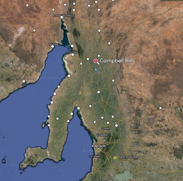
My first activation for Wednesday 4th February 2015, was New Campbell Hill, VK5/ SE-007, which is situated about 11km south of Jamestown, and about 206 km north of Adelaide.
image courtesy of mapcarta.com
New Campbell Hill is 714 metres above sea level and is worth 4 SOTA points. It is located in the ‘South East’ Region of the South Australian SOTA Association, and is located in the Bundaleer Forest Reserve.
I have activated this summit once before, with Ian VK5CZ. For information on that activation please have a look at my previous post at…..
New Campbell Hill is part of the Campbell Range. It is not to be confused with Campbell Hill which is located further to the south.
This slideshow requires JavaScript.
I had an early start from Crystal Brook and I headed north along RM Williams Way towards Jamestown. I turned left onto Bundaleer Gardens Road, and stopped briefly to have a look at the memorial for Pioneers of the Bundaleer District. I continued on up Bundaleer Gardens Road, and parked the car at Neindorf Road, where I packed my backpack, and commenced the @5 km walk to the summit.
This slideshow requires JavaScript.
Bundaleer is regarded as the birthplace of forestry in Australia. It covers an area of about 3,200 hectares. It is still home to Curnow’s Hut, the original residence built for the district’s first nursery worker, William Curnow (see below). The name Bundaleer is derived from an aboriginal word, meaning ‘stony place’.
Map courtesy of Forestry SA.
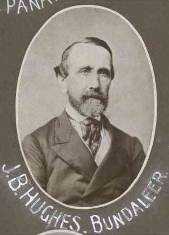
Bundaleer Forest was originally part of the Bundaleer Run, which was a vast pastoral station established in 1844 by John Bristow Hughes (b. 1871 – d. 1881). Hughes was born in England in 1817 and arrived in South Australia in 1841 aboard the Porter, following his arrival in Tasmania in 1840. He was married in 1847 in Adelaide, and established Bundaleer shortly after arriving in South Australia, with sheep he had brought across from Tasmania.
In 1875, a Forest Board was appointed by the South Australian Government, and Forest Reserves were created, mainly in the South East. However, some sections were created in the north of South Australia. In c. 1876 the Forest Board commenced work at Bundaleer Springs when a nurseryman, William Curnow was sent to establish a nursery and prepare 400 hectares for lanting. Curnow commenced planting asmanian Blue gums, local Red gums and Sugar Gums adjacent to the Jamestown to Spalding Road (RM Williams Way).
I followed the Bore Track up to the summit. The walk starts off very easy, but don’t get too excited. Worse is to come. The initial walk took me passed beautiful pine forest, along a very easy access track. There were quite a few Western Grey kangaroos out, enjoying the morning sunshine. But unlike last time I activated the summit, I did not see any native deer.
The Bundaleer Forest Reserve was devastated by fire in early 2013. Around 23,000 hectares of forest and scrubland were destroyed. Over 30 % of the pine plantations were wiped out. Leith Cooper, who is a local farmer stated: ‘It was one of the worst fires I’ve ever seen, there were reports that the flames were 100 feet above 50 foot pine trees, it was pretty intense’. For more information on the fire, including some audio, please have a look at…..
There are some excellent views once you reach the top of the summit. And the amazing dry stone walls which follow the ridgeline, are really quite a sight. They are mentioned in a book called ‘those dry-stone walls’ written by Bruce Munday, which I have a copy of. Many of these old walls were created by Patrick O’Grady (1838-1906), who was a ‘waller’ on Bundaleer Station. Munday is remembered as bing ‘a little old man with long ringlets who always wore green ribbon in his coat’. He is buried with his wife Annie at the Jamestown cemetery. Local photographer, Mary-Anne Young made the following comment: ‘For someone who created such magnificent stone work, it is a disapointing grave’.
This was not one of my most memorable SOTA activations. After setting up the linked dipole, I discovered that I had a very high VSWR. Numerous checks were undertaken on the antenna, and this revealed that the likely source of the problem was the coax crimping on the BNC connector. Not much I could do about it, as I didn’t have the required tools, and I had left the spare antennas back in the car.
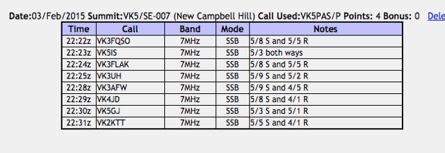
Anyway I pressed on and called CQ on 7.090. My first contact was with Amanda VK3FQSO (5/8 sent and 5/5 received), followed by Ian VK5IS (5/3 both ways), Bob Vk5FLAK (5/8 sent and 5/5 received), and my fourth and qualifying contact was with VK3UH (5/9 sent and 5/2 received).
Much to my surprise I was called by VK4JD who have me a 4/1 signal report, and Paul VK2KTT who also gave me a 4/1 signal report.
This slideshow requires JavaScript.
So felling very frustrated, I packed the gear up and headed down the hill back to the car. Just 8 contacts in the log, but thankfully the summit had been qualified.
I think the next time I active this summit I will try parking near Curnows Hut and walking north along the Heysen Trail to the summit. Easier? I’m not sure. At the current time this section of the forest is closed due to restoration work after the 2013 bushfire.
After the activation I headed in to Jamestown, where I went to the Jamestown bakery for a pastie. Jamestown is a beautiful little town and certainly worth a look. There is an interpretice centre for RM Williams, who was an Australian bushman and entrepreneur who rose from a swagman, to a millionaire. Fore more information on RM Williams, please have a look at the following…..
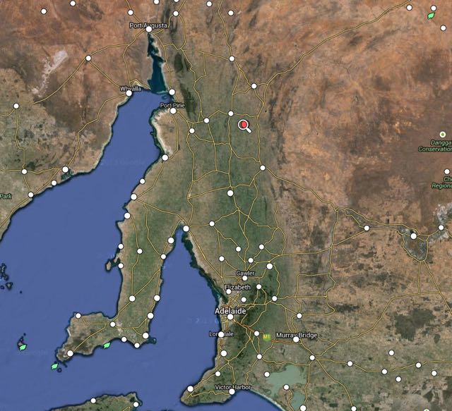
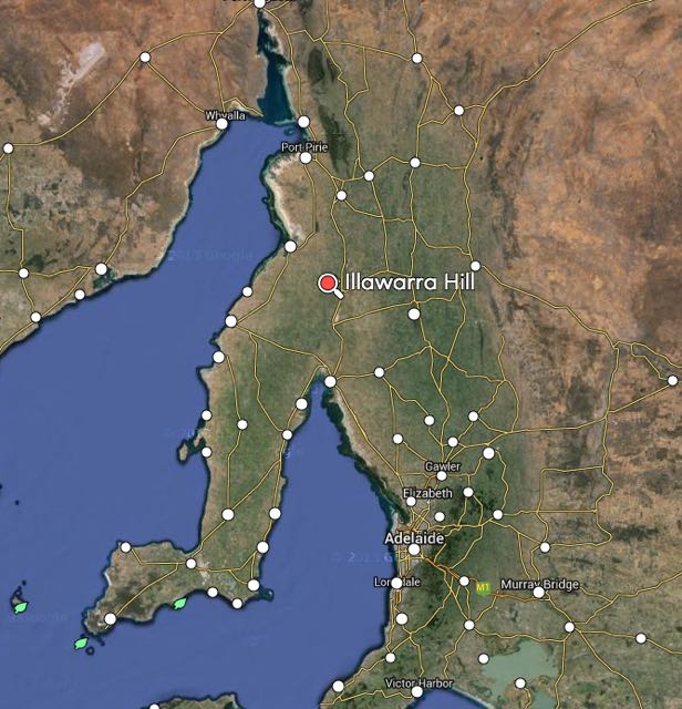
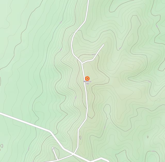
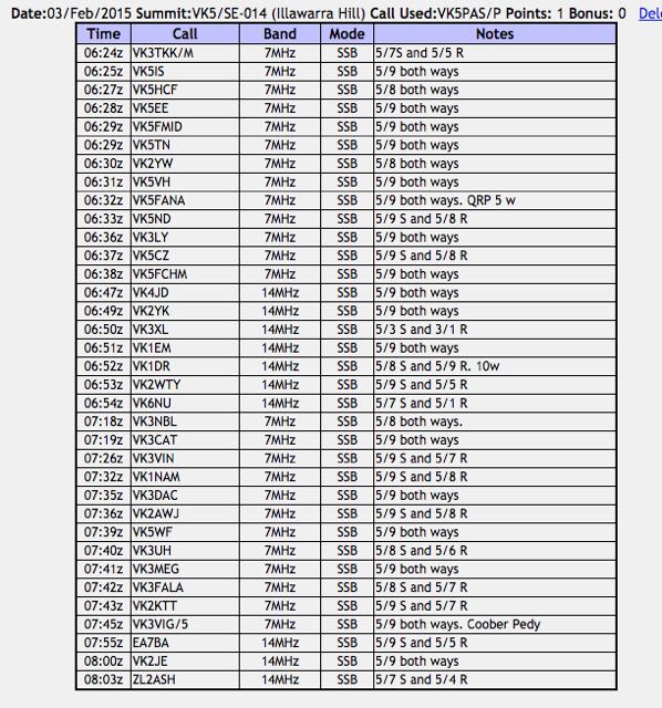
My third and final activation for Tuesday 3rd February, 2015, was Illawarra Hill, VK5/ SE-014, which is located about 11 km by road from the town of Snowtown, and about 155 km north of Adelaide.
image courtesy of mapcarta.com
Illawarra Hill is 434 metres above sea level, and is worth 1 SOTA point. It is located in the Barunga Range, west of Snowtown. The town of Snowtown became infamously known for the Snowtown murders. This is rather sad, because the vast majority of the murders were not even committed in the town. However the bodies of many of the victims were stored in barrels in an old bank in the main street. Snowtown is located in the wheat belt area of the Mid North of South Australia, and has a population of about 500 people.
In 2008, a monument called ‘The Big Blade’ in the form of a 44 metre wind turbine was installed in Snowtown. There are a number of interpretive signs there, telling you all about the nearby Snowtown wind farm which is situated on the Hummock and Barunga Ranges to the west of the town. It is well worth a look.
This slideshow requires JavaScript.
The first stage of the Snowtown wind farm was commissioned in September, 2008 with 47 Suzlon S88 2.1 MW turbines. In 2011, an additional prototype Suzlon S95 2.1 MW turbine was installed and commissioned. Since 2008, Stage 1 of the Snowtown wind farm has provided reliable electricity into the South Australian electricity network delivering a long term capacity factor of 43%, one of the highest wind farm outputs in Australia. Final approvals for Stage 2 of the Snowtown Wind Farm were secured in August 2012 to install a further 90 Siemens 3.0 MW turbines, with a combination of 101 metre and 108 metre blade diameters, with an output of up to 270 MW. With the completion of Snowtown 2, the total output of the combined Snowtown wind farm will be 370.8 MW, making it the biggest single wind farm in South Australia. Over 230,000 homes can be powered by the Snowtown Wind Farm.
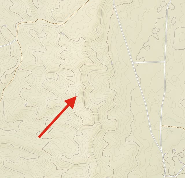
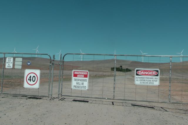
After leaving Snowtown, I headed west along Shadwells Gap Road. About 5 km along this road, you will reach a gate on your right. There are a number of signs here including ‘Snowtown Wind Farm Stage II” and ‘Private Property. Trustpower Windfarm. Tresspassers Prosecuted’.
This slideshow requires JavaScript.
The summit is located on private property and is situated amongst the windfarm. I had spoken with the landowner a few days prior, and had sought approval to access the summit. PLEASE do NOT access the summit without the approval of the land owner.
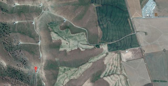
image courtesy of http://www.openstreetmap.org/
I drove along the dirt road after entering via the gate and headed north up towards the telecommunications tower and the trig point. It was a very warm afternoon, so I set up underneath a small sheoak tree and an adjacent dead tree stump. It was not the most comfortable of ‘shacks’, but it did provide a little bit of shelter from the very hot afternoon sun. As you would expect, it was extremely windy on the top of the summit. There aren’t too many other options on a hot day on this summit. The only over cover are the two rainwater tanks a little closer to the trig point.
For this activation, I used the Yaesu FT-857d and ran 20 watts. My antenna was the SOTA Beams 40m/20m linked dipole, which I supported on a 7 metre telescopic squid pole. I secured the squid pole to the squid pole holder with an octopus strap. Because it was so windy, I used the guying rope which I tied off to a fallen tree limb.
My first contact was with Peter VK3TKK who was mobile, followed by Ian VK5IS at Beetaloo Valley, Col VK5HCF in Mount Gambier, and then Tom VK5EE, also in Mount Gambier. Signals were very good, and there was no man made noise on the summit.
After working 13 stations on 40m, I headed up to 20m hoping to work some DX. But I was to be sadly disapointed. I did work a total of 7 Australian stations in VK1, VK2, VK3, VK4, and VK6, but did not have a single European caller. I have mentioned it before, but I guess we take distances for granted here in Australia. My contact with Peter VK4JD was over a distance of about 1,900 km. My contact with John Vk6NU was over a distance of about 2,500 km. In some parts of the world, this is a DX contact. But here in Australia we call it a ‘local’ QSO.
I moved back to 40m and placed another CQ call on 7.090, and this was answered by Ray VK3NBL, and then Tony VK3CAT, followed by Ian VK3VIN, and then Andrew VK1NAM. All had excellent signals. I went on to work a further 8 VK stations.
This slideshow requires JavaScript.
I decided to try my luck again on 20m, so I again lowered the squid pole and removed the links and tuned across the 20m band. But sadly, the European signals I was hearing, were low down. I headed up to 14.156 where I made contact with John EA7BA in Almeria in Spain, Brian VK2JE, and Brian ZL2ASH in Wellington in New Zealand.
I had a total of 35 contacts in the log. It was time to pack up and get back on the road and head back to Crystal Brook, about 60 km away.
Upon arriving in Crystal Brook I headed to the Crystal Brook Hotel, where I enjoyed a very nice Schnitzel, chips and salad, and a few cold Bundies and coke. I then returned to the Crystal Brook Caravan Park, where I enjoyed the sunset and the almost full moon.
This slideshow requires JavaScript.
I highly recommend the Crystal Brook Caravan Park. The caretaker was very friendly and the cabin which I stayed in was very clean & tidy.
This slideshow requires JavaScript.
The following stations were worked on Illawarra Hill:-
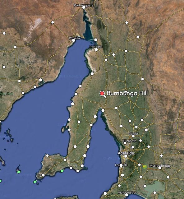
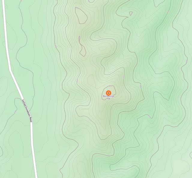
My second activation for Tuesday 3rd February, 2015, was Bumbunga Hill, VK5/ SE-015, which is located about 8 km by road from the little town of Lochiel, and about 141 km north of Adelaide.
Image courtesy of mapcarta.com
Bumbunga Hill is 413 metres ASL and is worth just 1 SOTA point. The summit is located on private property. I had sought permission from the land owner a few days before (contact details can be found on the SOTA database). Access to the summit is via Landslide Road.
If you are on the A1, take Robert Street at the northern end of the town of Lochiel and travel west. You will then reach Landslide Road. Turn right here and travel a few km up Landslide Road. On your right, you will see some double gates which have numerous locks on them. Alongside, on both the left and right of these gates, are some ‘cocky’s gates’. This is where you enter the private property. PLEASE ensure you have permission prior to entry. And please close the gates behind you. You will know that you are in the right spot, because there is a large shed on the right of the main dirt track behind the gates, and a house ruin on the left of the track.
But for me, after leaving South Hummocks, I continued north along Pump Station Road, V. Taylors Road, and then Lochiel Road, until I reached Landslide Road. It saved me having to travel back to the bitumen.
This slideshow requires JavaScript.
The main double gates were locked. There is a plethora of padlocks on the gates. Each stakeholder of the communications tower at the top has a padlock on the gates. I entered via the ‘cocky’s gate’ on the left, which consisted of a rusty star dropper and some mesh. The links were quite rusty, and in the end one of them snapped on me.
I followed the fenceline up passed the dam and stopped for a short time to have a chat to one of the farmhands. He then pointed out a gate on the other side of the dam, which in turn leads to the track which takes you up to the summit. Don’t attempt this track in a conventional vehicle. You will make it to the ridgeline above the shed and ruin, but from there the track is definitely 4WD territory. It is very rough with lots of washaways and large rocks.
Once you have negotiated the rockiest part of the track, you will reach another gate. Today, it was closed. Please leave all of the gates as you find them. Even before you reach the very top of Bumbunga Hill, you will be rewarded with some excellent views of the surrounding countryside, the little town of Lochiel, and Bumbunga Lake.
This slideshow requires JavaScript.
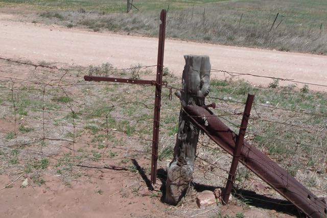
The dirt track from the top gate to the summit is good from here. Follow the fenceline until you reach another gate. On the other side of this gate you will find the telecommunications tower, the Lochiel repeater, and what is left of the trig point. When I first activated this summit back in April, 2013, the trig point was lying on its side on the ground. Nowadays it has gone, and the trig is marked with three upright poles, which are painted blue. They make an excellent anchor point for a squid pole.
image courtesy of http://www.openstreetmap.org/
The town of Lochiel lies below the summit, just to the south east. Governor Fergusson named it Lochiel after Lochiel Forest, near Inverness in Scotland. Lochiel is also the name of one of the titles of the chief of the Cameron Clan, while the Scottish ‘Lochiel’ comes from the Gaelic ial – ‘gleam of sunshine’. Salt has been mined at nearby Bumbunga Lake since 1912. A coal mine was also in operation, a few km east of the lake, between the 1980s and 1990s.
The earliest reference to Lake Bumbunga is to be found in a little book entitled ‘Reminicences of a Sojourn in South Australia’ by ‘A Squatter’, published in 1849. The author talks about a chance meeting with two tired travellers at a camp fire, at the head of St Vincents Gulf, not far from the Lake. One of the travellers told the squatter that he had come from Lake ‘Bambunga’, which he claimed to have discovered. The traveller went on to say, ‘The name is one that the natives formerly gave it and, as being the discoverer and licenced occupier, I conceived I had a right to apply what name I pleased to it’. It appears that name has since elapsed over time into Bumbunga.
According to anthropologist Norman Tindale, the name was derived from the local Parnpangka aboriginal people and means ‘rain water lake’. However, in 1967, H.M. Cooper of the SA Museum stated that the word Bumbunga meant ‘by, near or at the lake’.
The squatter goes on to say “the ‘Bambunga country’ was carrying 10,000 sheep and eighteen perpetural springs”. The area was part of Hummocks Run. Bumbunga was one of two substations for this very large sheep and cattle station, which by 1864 had 70,000 sheep, 200 bullocks and horses. The Bumbunga station consisted of a pine house, store, men’s kitchen, sleeping rooms, woolshed, yards, sweating shed, fenced paddocks, three wells troughs, and one pump.
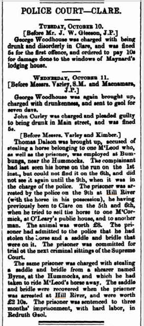
I found the following from the Adelaide Observer, dated Saturday 1st October 1864.
And also the following from the Northern Argus, Clare, dated Friday the 13th October, 1871.
I set up at the trig point, and secured the 7 metre squid pole to one of the trig point poles, with two octopus straps. It was a warm day, but it was also incredibly windy. And the flies were out in force. The Aerogard did not seem to be having any affect. For this activation I ran the Yaesu FT-817 and 5 watts output.
Before calling CQ, I tuned across the 40m band and found Ian VK3TCX on 7.095 calling CQ from SOTA summit, Mount Cann, VK3/ VG-133, which is located in the East Gippsland area of Victoria. Ian’s signal was pretty weak, but very readable (5/2). So I waited a little while for the multitude of callers to slow down, and then gave Ian a call. We exchanged 5/2 signal reports with each other. A good start to the activation at Bumbunga Hill….a Summit to Summit contact.
I then went down to 7.090 and put out a CQ call and this was answered by Larry VK5LY in The Riverland, followed by John VK2YW in Wagga Wagga, and Rob VK3EK. As it was a weekday, I had a steady flow of callers, but certainly not the ‘pile ups’ that can be expected on weekends.
Whilst on Bumbunga Hill, I worked a few QRP stations. They included Adrian VK5FANA, who was running just 5 watts from the Yorke Peninsula (5/8 sent and 5/9 received). Thanks to Adrian for spotting me. Also, Gary VK5FGAZ, running 5 watts, from north of Adelaide (5/8 sent and 5/9 received).
And I also worked a few mobile stations. The first being Tom VK5EE who was mobile in Mount Gambier, followed by Brian VK3YFL mobile near Kaniva in Western Victoria.
This slideshow requires JavaScript.
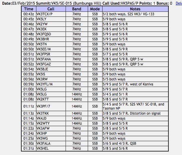
After working a total of 16 stations on 40m I lowered the squid pole and removed the links and headed up to 14.310 where I put out a CQ call. This was immediately answered by Greg VK5LG in the Adelaide Hills, who had been my last contact on 40m and had followed me up here to 20m. I worked a total of 6 stations on 20m SSB, including another Summit to Summit. This time with Peter VK3PF/7 who was on Macgregor Peak, VK7/ SC-018, which is also located within the Tasman National Park (5/4 sent and 5/7 received).
I then returned to 40m for a short time where I worked another 5 stations in VK3 & VK5.
Once I got down off the summit, I drove down to Lochiel and found a shady spot under a tree alongside of Bumbunga Lake and had some morning tea. I then jumped back into the 4WD, and headed north to Crystal Brook.
This slideshow requires JavaScript.
The following stations were worked:-
References.
Cockburn, S, 1908, ‘South Australia. What’s in a Name?’
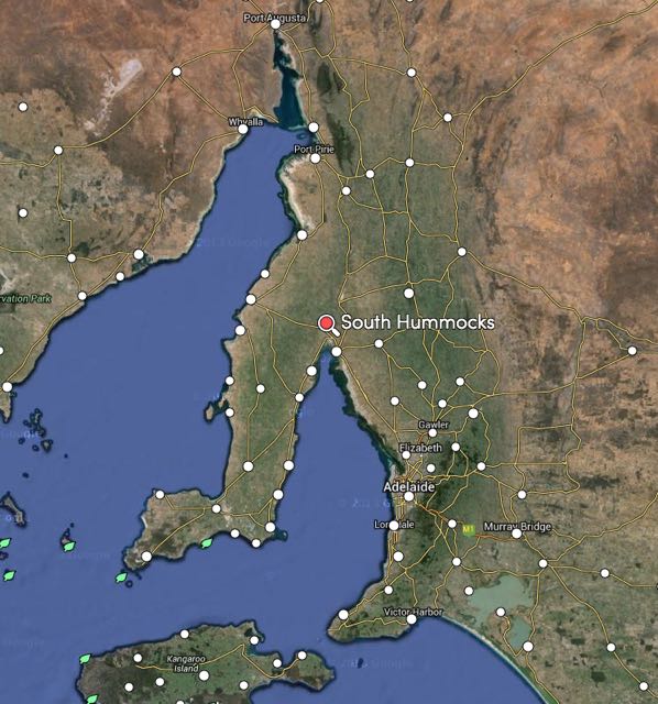
Early on Tuesday morning (3rd February 2015) I headed north towards Crystal Brook, which is about 200 km north of Adelaide. I had booked in to stay for 3 nights at the Crystal Brook Caravan Park. My main reason for heading there was to meet up with a number of the amateurs from the Mid North of South Australia, and deliver a presentation on the VK5 National and Conservation Parks Award and also the World Wide Fora Fauna (WWFF) program. Along the way on the first day, I had planned to activate three summits for the Summits on the Air (SOTA) program. The first was South Hummocks, VK5/ SE-017, which is located about 29 km by road from Port Wakefield, and about 126 km north of Adelaide.
image courtesy of mapcarta.com
South Hummocks is 330 metres above sea level and is worth 1 SOTA point. The summit is located on private property, so a few days before heading there, I sought approval from the land owner, Colwyn Millard (his contact details can be found in the SOTA database). The summit is clearly visible as you travel towards Port Wakefield along the Port Wakefield Road (A1). It may not be the tallest of summits, but it is certainly very prominent after travelling the vast flat plains north of Adelaide, as you head towards Port Wakefield.
This was to be my second activation of South Hummocks. I first activated the hill back in April, 2013 with Andy VK5AKH. In fact, South Hummocks was one of my first ever SOTA activations. For more information on that activation, please have a look at my previous post at…..
The summit is located in the Hummocks Range, which is a range of hills which commence just north of the apex of Gulf St Vincent, near the little settlements of South Hummocks and Kulpara. The Hummocks Range stretches to its northern end where it merges with the Barunga Range at Barunga Gap, about 10 km west of Snowtown. The Hummocks and Barunga Ranges form part of a number of low lying ridgelines occurring in the Mid North region of South Australia.
This southern part of the Hummocks Range has not yet been impacted by windfarms. The Hummocks Range is the primary source of water catchment for Lake Bumbunga, which is located a little further north, near the town of Lochiel. The primary land use for the surrounding area is stock grazing and cereal cropping.
Although much of the surrounding area has been cleared for grazing and cereal production, there are still patches of scrub to be found. In fact, quite a bit of remnant scrub remains on the summit itself. A variety of native animals, birds, and reptiles can be found including Western grey kangaroos, the Flinders Worm lizard, and the Peregrine Falcon. Whilst I was on the summit I observed a number of Euros, but they were just too quick to catch on camera. I also observed a Wedge Tailed eagle sailing along the ridgeline, obviously in search of breakfast.
image courtesy of http://www.openstreetmap.org/
The South Hummocks region has a rich agricultural history, and at one stage had a large population. Some of the early pastoralists included Charles Burney Young and Edmund Bowman. South Hummocks had a railway station, and even had its own football team back in the early 20th century.
above:- Charles Burney Young. Image courtesy of Pastoral Pioneers of South Australia
above:-Edmund Bowman. Image courtesy of Pastoral Pioneers of South Australia
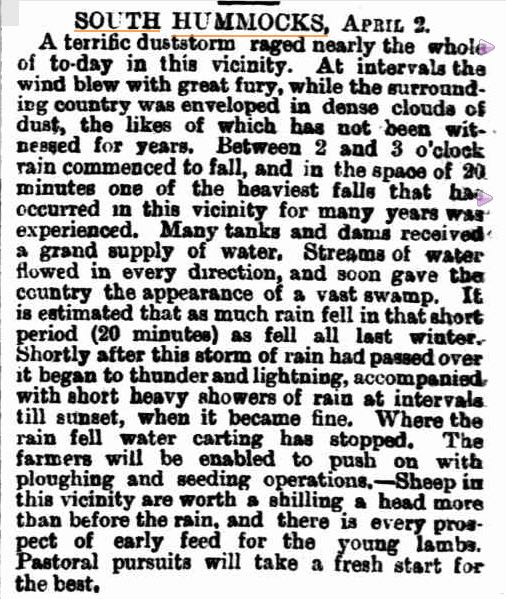
I found the following from the South Australian Weekly Chronicle, dated the 9th April, 1887.
image courtesy of trove.nla.gov.au
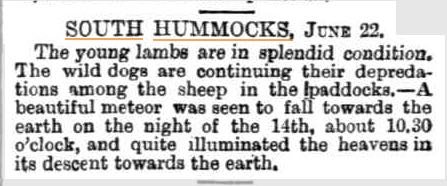
And this one from the South Australian Weekly Chronicle, dated the 2nd day of July 1887.
How do you get to the summit? If you are travelling north, enter Port Wakefield, and then after leaving the town, take the turnoff to the Yorke Peninsula just out of town. This is the Copper Coast Highway. Continue along the Copper Coast Highway for a number of km, and then turn right onto Balaklava Road. A short distance up you will reach Pump Station Road. Turn left here and continue for a number of km north on Pump Station Road. Before you reach Millards Road (on your left), you will see some double gates on your right. The gate has ‘Private Sanctuary’ written on it. This is where you enter the private property. PLEASE ensure you have permission prior to entry. And please close the gates behind you if you find them closed.
I followed the fenceline up through the paddock. The first part of the drive through the paddock can be undertaken using a conventional vehicle. But you will then reach a sign which says ‘Engaged 4WD only’. Please take notice of the sign, and engage 4WD if you have it. You will never make it up the track if you don’t, as it becomes very rocky and slippery. If you don’t have a 4WD, leave your car here at this point and walk the rest of the way. It is about a 20 minute walk up the track from here to the trig point. I continued on up the track and went all the way to the communications tower at the end of the track, where I had a photo stop. I then drove back down the track and parked the 4WD, and then walked uphill again, over the fenceline and into the scrub to the trig point.
This slideshow requires JavaScript.
You will need to keep a good eye out for the trig point for South Hummocks, as it is not easy to spot. As you travel north along the track, keep an eye out for a star dropper which is painted blue at the top. There is also a piece of yellow tape attached to the top strand of barbed wire on the fence at this point, and another piece of yellow tape tied around a nearby tree.
The original trig is no longer at the site. It was there when I last activated the summit in April 2013, but sadly, as is the case with many trigs around South Australia, it is no longer in existence. All that remains of the trig are some of the pieces of rusty metal, lying amongst the scrub. There are two blue poles at the trig site. There is also a small pile of rocks, no doubt attributed to visitors to the summit.
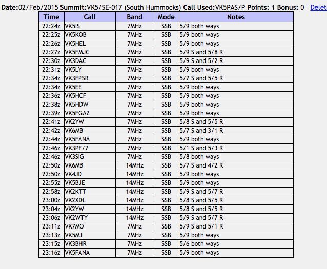
I ran the Yaesu FT-817 and 5 watts for this activation, and the SOTA Beams 40m/20m linked dipole. By the time I had set up the gear, I was just 20 minutes later than my estimated time of activation of 2200 hours UTC (8.30 a.m.). I tuned to 7.090, which was my nominated starting point, and called CQ and this was immediately answered by Ian VK5IS in Beetaloo Valley (5/9 both ways), then Jim VK5KOB in Elizabeth (5/9 both ways), and then Geoff VK5HEL in Murray Bridge (5/9 both ways). My fourth and qualifying contact for the summit, was with John VK5FMJC in Crystal Brook (5/9 sent and 5/8 received). Propagation locally seemed to be very good.
My next contact, was my first interstate contact for the summit. It was Fred VK3DAC, north east of Melbourne, who was a good 5/9 signal to South Hummocks. Fred reciprocated with a 5/2 signal report for me. I went on to work 16 stations on 40m SSB before heading off to 20m. Those stations worked were in VK3, VK5, VK6 & VK7. It was very pleasing to get Mike VK6MB from Perth in the log on 40m (5/7 sent and 4/2 received). And also John VK2YW in Wagga Wagga (5/8 sent and 5/5 received). I often struggle with Mike and John on 40m at this time of the day. But this day we made it easily. And to top it off, I made contact with Peter VK3PF/7, on holidays down in Tasmania. Peter was on his way to activate a summit. Peter was very weak, 5/1, but very readable, due to the non existant man made noise floor on the summit.
I then lowered the squid pole and removed the links in the 40m/20m linked dipole, and called CQ on 14.310. Larry VK5LY was kind enough to spot me on SOTA Watch before I QSY’d, so by the time I had got to 20m, there were a few stations there waiting for me. It highlights the benefit of spotting! My first contact on 20m was with Mike VK6MB. He was the same signal strength here on 20m (5/7) as he was on the 40m band. My signal report had also remained the same (4/2), but Mike reported that the 20m band was a lot quieter for him than 40m. My next caller was Peter VK4JD in Jimboomba with a very strong 5/9 signal, and then to my surprise, John VK5BJE in the Adelaide Hills, who was 5/9. John gave me a 5/8-9 signal report. This contact surprised me a bit, as we were only @ 120 km apart, and normally this is far too close for good propagation on 20m.
This slideshow requires JavaScript.
After working 7 stations on 20m SSB in VK2, VK4, VK5, & VK6, I moved back to 40m where I put out a few final CQ calls. My first taker upon returning to 40m was Rex VK7MO, with a very nice 5/9 signal from near Hobart in Tasmania. This was followed by Mal VK5MJ in The Riverland, Phil VK3BHR and finally Adrian VK5FANA on the lower Yorke Peninsula, running QRP 5 watts (5/9 both ways).
After activating the summit for about 45 minutes, I had a total of 27 contacts in the log on 40m SSB and 20m SSB. It was time to pack up and head off to my next summit, Bumbunga Hill.
Although South Hummocks is worth just 1 SOTA point, for me the summit highlights the fun that SOTA is. South Hummocks is an easy summit to access, and despite being only 330m ASL, it offers sensational views of the surrounding countryside. The wildlife is also well worth the trip.
The following stations were worked:-
References.
Aldersley, D, 1923, ‘Pastoral Pioneers of South Australia’.
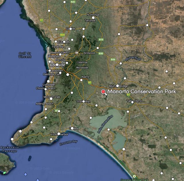
Late yesterday afternoon (Friday 30th January 2015) I ventured up to the Monarto Conservation Park (CP) for the second Summer afternoon/evening activation event for the VK5 National and Conservation Parks Award. I have activated Monarto a number of times previously, but it is close to home, just 30 km east of my home qth in the Adelaide Hills. So access time to the park is good. And it is a great park for night time activation, as there is a good carpark off the road, and some good options for setting up a table and chairs and stretching out the dipole.
map courtesy of mapcarta.com
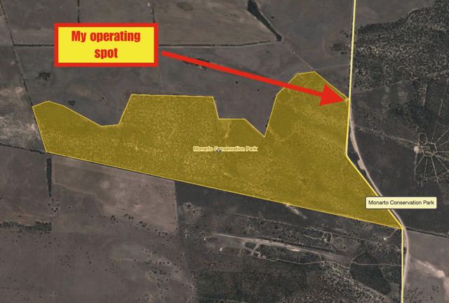
I set up in my usual spot, which is the carpark in the north eastern corner of the park, just off Ferries McDonald Road. You need to keep a close eye out for the park sign as you travel south, as it can be easily missed. The entrance is a few km from the South Eastern Freeway Monarto interchange. As I’ve mentioned, this is a great little spot to set up, and if you are inclined, there is a fantastic ring route around the park, that you can walk from this location, to get a feel for the park and its many native fauna inhabitants.
image courtesy of wikimapia
Monarto CP is a typical mallee park and contains some gums, sheoaks, and native pines. A number of native orchids can be found in the park. The best time to see the native plants out in flower is late Winter and Spring.
The park is home to the vulnerable Mallefowl (or Lowan). For more information on Malleefowl in the Monarto area, please have a look at the Malleefowl Monarto website at…..
For this activation, I used the regular equipment…..my Yaesu FT-857d, 40 watts, and the 40m/20m linked dipole supported on the 7 metre squid pole. I used the permapine fence in the carpark as an anchor point for the squid pole, which I secured with 2 octopus straps, as it was a little windy at times.
Prior to calling CQ I had a quick look around the 40m band to see if I could find some of the other park activators. There were a planned 8 parks to be activated around South Australia that afternoon/evening (as it turned out there were 9). It wasn’t long before I heard Arno VK5ZAR, calling CQ on 7.100. Arno was my first contact and a ‘park to park’ to boot. Signal reports of 5/8 were exchanged both ways. I then found Col VK5HCF in QSO with a VK3 station, on 7.085, with a lovely 5/9 signal from the Naracoorte Caves National Park, VKFF-380. Col was my second contact (5/9 both ways). Two parks down.
But at this point I didn’t hear any other park activators, so I moved up to 7.105 where I put out a CQ call and this was immediately answered by Jim VK5TR with his normal 5/9 + signal, and this was followed by Terry VK3UP and then David VK5LSB. There was quite a pile up of stations calling, so I thought I would take a break from the general home callers, and I asked for any QRP, mobile, or portable stations, and this call was answered by Les VK5KLV who was portable in The Dutchmans Stern Conservation Park near Port Augusta in the north of South Australia. Although Les was running QRP, he was an excellent 5/8-9 signal to Monarto. This was followed by another ‘park to park’ QSO. This time with David VK5NQP, who was portable in the Sandy Creek Conservation Park, north of Adelaide. David’s signal was very strong, 5/9 +. This was followed by a third ‘park to park’ contact, and this time it was John VK5BJE, who was portable in the Scott Creek Conservation Park.
I then called CQ again for any QRP, mobile, and portable, and this was answered by Greg VK5GJ at Meadows, running his usual QRP, and then Bernard VK3AV who was mobile in the Kinglake National Park in Victoria.
I then went back to calling CQ for general callers. I always try to give the QRP, mobiles, and portables a shot. I know how hard it is sometimes to break through the plethora of callers running higher power in generally ideal conditions from the comfort of home.
I worked a number of other home stations in VK3 & VK5, and then again called for any QRP, mobile and portable, and that call was answered by Greg VK5ZGY who was mobile in the South East of South Australia, with a nice 5/8 signal. I then worked Derek VK3FAFC who was running QRP, just 2.5 watts. Derek was portable in western Victoria, and although was low down (5/1), was very readable in Monarto.
This was followed by a contact with Ian VK5IS in Beetaloo Valley in the Mid North who was running just 5 watts. This was followed by a contact with Peter VK3TKK who was mobile. This was a real struggle for Peter who was copying me just 4/1. However, with the non existant man made noise in the park, I was able to hear Peter very well. A few QSOs later I worked another mobile station. This time it was Robin VK5TN, who was mobile at Mount Gambier in the South East, running a 1/4 wave loaded whip on the front of his car.
My next caller was Larry VK5LY, who was operating portable in the Cooltong Conservation Park in the Riverland region of South Australia. Larry had with him, Peter VK5FLEX, who was out and about for his first ever park activation. Larry and Peter had terrific 5/9 signals. Congratulations Peter. Welcome to the world of portable operation.
A few QSOs later I was called by Bob VK5FO who was operating portable in the Morialta Conservation Park in the Adelaide Hills. Bob had a very nice 5/8 signal to the Murray Mallee.
My last QSO before heading over to 20m was with Colin VK3ZZS, who was portable at Moe in a motor home, using a long wire antenna. I have often been called whilst in a park or on a summit, by Colin in his journeys around eastern Australia. It wasn’t worth pursuing things on that frequency on 40m, as some VK4’s had moved in to 7.106, just 1 kc above me, for an apparent sched. Two were very strong, and how they couldn’t hear the other stations that were working me is beyond me. Perhaps they did, and just didn’t bother. It seems to be a bit of a pattern with some scheds, that they are not prepared to move despite who might be operating close by.
This slideshow requires JavaScript.
I then QSYd to 20m, and tried for 14.310, my nominated operating frequency. But this was going to be impossible. There were the regular German speaking nets, Over the Horizon Radar, and a station operating on LSB. Absolutely no point calling CQ there, so I had a quick listen across the band. Although there were some Europeans and Japanese present on the bands, signals were still a little low. The local time was coming up to 6.30 p.m., so long path Europeans signals were still building. I put out a few CQ calls on 14.263, but no takers, sadly.
I headed to 14.156 where the normal daily sched is held between a number of VK’s, ZL’s and G’s. The group is generally run by John EA7BA, who lives in Almeria in Spain. John was there, and his signal was very good (5/9). It took me two goes, but I managed to book in. Some people are incredibly quick on the mic and don’t leave pauses between overs, which makes it difficult to chime in, particularly if you are not running high power. But I made it, and had a chat to John who gave me a 5/8 signal report. Alain F4GHB gave me a 5/5 signal report from France.
I then tuned across the band and spoke with EA3BDE in Spain (5/9 sent and 5/5 received), Fred IK4JPK in Italy (5/9 sent and 5/7 received), Hardy DL2HRT (5/8 sent and 5/2 received), and Michael IZ4ZZB (5/9 sent and 5/6 received). I even managed a QSO with my very good friend Marnix OP7M (5/7 sent and 4/5 received).
I then went back to 40m as I had received an SMS message from Andy VK5AKH to say that he was out and about, portbale. I found Andy on 7.090 calling CQ with a very nice 5/9 signal from the Horsnell Gully Conservation Park. This made number 8 park, and my 9th park to park contact for this activation. I was very pleased to get all of the park activators in the log.
I then called CQ on 7130 until just before 0930 UTC when the 7130 DX Net commenced. During that 20 minute period I made a total of 11 QSOs into VK2, VK3, VK5, & ZL. I stuck around for one round on the 7130 DX Net and worked Roy VK7ROY (Net control), William FO5JV in French Polynesia, Adrian ZL1GBG and Caleb ZL2ML.
I then moved up to 7.155 where I called CQ and this was answered by Bill ZL2BGX in Alexandra in New Zealand. Bill had a very strong 5/9 signal and I received a 5/8 signal report from the South Island. I was also called by Maurice ZL2MF mobile, about 120 km south of Auckland (5/8 both ways). I also spoke with Andrew VK5MR who was mobile near Mount Bryan in the Mid North of South Australia, using an IC7000 and a Terlin antenna. Andrew activated a few parks last year for the 1st anniversary of the VK5 Parks Award, and we spoke about his improved portable operating set up, and the fact that he was going to activate some parks again this year for the 2nd year anniversary. Great stuff Andrew.
It was about this time that Jeff VK5HEL arrived. Jeff lives just down the road at Murray Bridge, and until recently lived in Tasmania. Jeff and I had spoken on 40m a little earlier in the night, with Jeff indicating that he might pop out. It was good to catch up with Jeff and put a face to the name, and show him my operating conditions. I got Jeff behind the mic just once. And that was to talk to his old mate from Tasmania, Greg VK7FGGT. Otherwise, Jeff sat back, and had a listen while I worked the park hunters.
I worked a few more QRP hunters including Nev VK5WG, Matt VK3FORD running 5 watts, and Tony VK3CAB running 8 watts from a Chinese transceiver. I also spoke with Craig VK6VCK mobile in Western Australia, and my old mate Ted VK6NTE. I made the mistake of telling Ted I was a bit hungry and thirsty. Ted went on to tell me that he was sipping on a nice cold beer and had just finished a mixed grill. Thanks Ted! My last contact for the evening was with Peter VK4PQ in Townsville in Far North Queensland (5/9 both ways).
The band was in excellent shapr, but it was getting late. In fact 10.00 p.m. So I packed up the gear and got back on the road, heading for home, after saying ‘see ya later’ to Jeff. I was very pleased with a total of 79 contacts in the log. This was another great Summer afternoon/activation event. The next fortnightly event will be held on FRIDAY 13th FEBRUARY 2015.
The following stations were worked on 40m SSB:-
Arno VK5ZAR/p (Black Hill CP)
Col VK5HCF/p (Naracoorte Caves NP)
Jim VK5TR
Terry VK3UP
David VK5LSB
Fred VK3DAC
Peter VK3ZPF
Les VK5KLV/p (The Dutchmans Stern CP)
David VK5NQP/p (Sandy Creek CP)
John VK5bJE/p (Belair NP)
Greg VK5GJ
Bernard VK3AV/m
Adrian VK5FANA
John VK5FMJC
Mick VK3FAFK
Derek VK3FAFC/p
Jeff VK5JK
Tony VK3CAT
Greg VK5ZGY/m
Andy VK2FBAC
Ian VK5IS
Peter VK3TKK/m
Amanda VK3FQSO
Daniel VK5DF
Keith VK5OQ
Damien VK5FDEC
Robin VK5TN/m
Larry VK5LY/p (Cooltong CP)
Peter VK5FLEX/p (Cooltong CP)
Peter VK5KPR
Brett VK3FLCS
Bob VK5FO/p (Morialta CP)
Tony VK5FTVR
Colin VK3ZZS/p
Andy VK5AKH/p (Horsnell Gully CP)
Errol VK5FEKH
Tim VK5AV
Doug VK2FMIS
Jeff VK5HEL
Rob VK4FFAB
Owen VK4FADW
Gordon VK5GY/m
Gavin VK3MLU
Brian ZL2ASH
Tom VK5FTRG/3
Brian VK5FMID
Roy VK7ROY
William FO5JV
Adrian ZL1GBG
Caleb ZL2ML
Bill ZL2BGX
Oscar VK4BOV
John VK3HJD
John VK5FTCT
Andrew VK5MR/m
Maurice ZL2MF/m
Steve VK5ST
Tony VK5KAT
George VK4GSF
Leigh VK5KLT
Greg VK7FGGT
Paul VK7CC
Peter VK3NAD
Adam VK7VAZ
Nev VK%WG
Matt VK3FORD
Tony VK3CAB
Cleeve VK2MOR
Craig VK6VCK/m
Ted VK6NTE
Russell VK2VK
Peter VK4PQ
The following stations were worked on 20m SSB:-
John EA7BAAlain F4GHB
Sal EA3BDE
Fred IK4JPK
Marnix OP7M
Hardy DL2HRT
Michael IZ4ZZB
Below is a video of the activation which I have placed on You Tube…..