Day seven, Yarra Ranges National Park VKFF-0556

We had now been away for one week, and it was day seven (Thursday 22nd November 2018).  As we had done the morning previously, we headed to Fragas Cafe for a cooked breakfast and coffee.  We can highly recommend Fragas…..great food and friendly service.

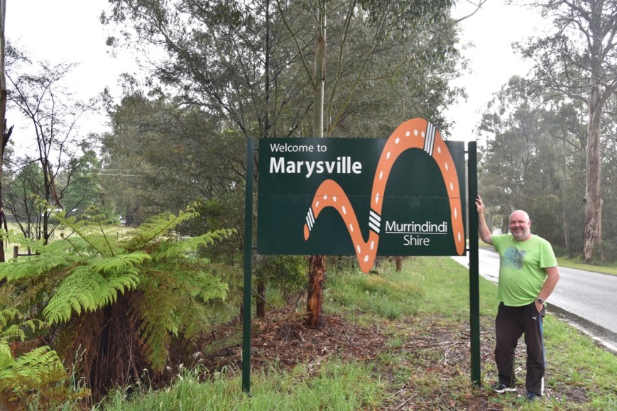
Marysville is a very pretty town which has recovered since the devastating 2009 Black Saturday bushfires.  The town was literally destroyed as a result of the fire, with the primary school, police station, and almost all of its houses being burnt to the ground.  The Murrindindi-Marysville bushfire killed 40 people and destroyed at least 500 properties.

DSC_4546

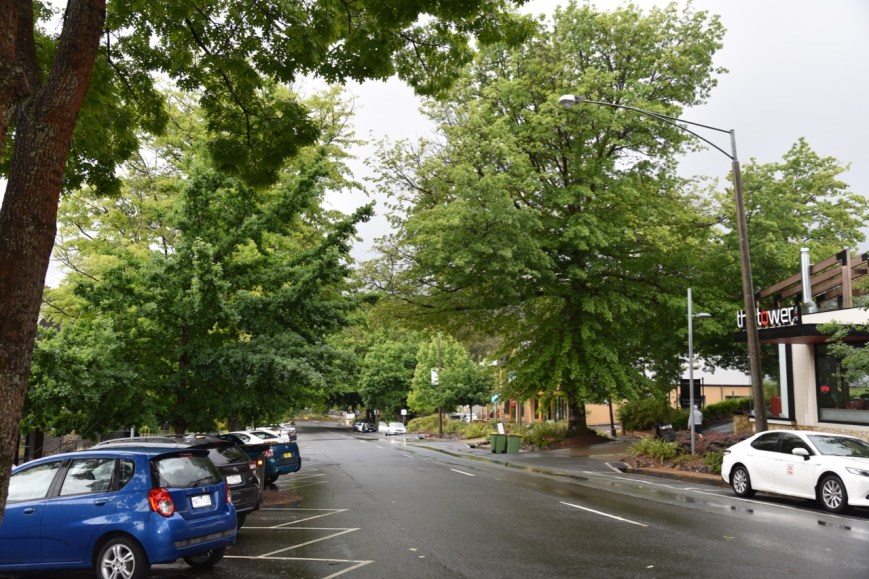
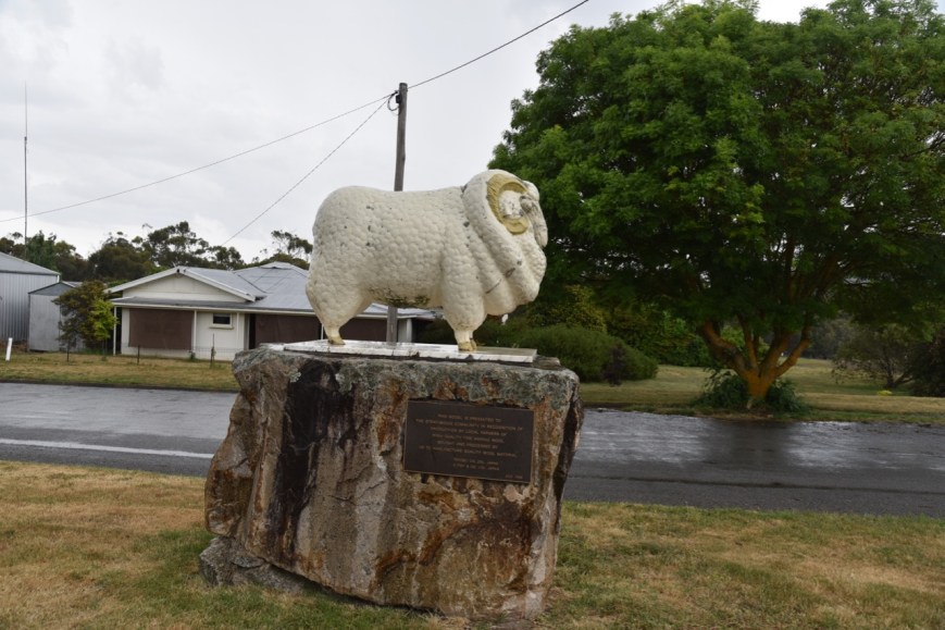
Above:- the main street of Marysville.

It was a pretty bleak morning with lots of shower activity.  We decided to visit the Lake Mountain Ski Resort, so we headed east out of Marysville on the Marysville-Woods Point Road.  We soon reached the Yarra Ranges National Park, and took the Lake Mountain Road.  As we travelled towards Lake Mountain, the outside temperature dropped to just 1 deg C.

DSC_4547

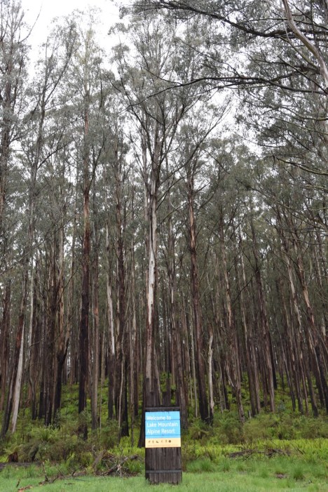
Above: Sign at the start of Lake Mountain Road.

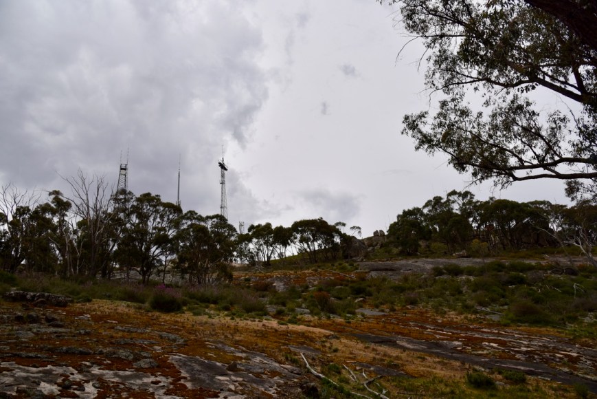
Once we got to Lake Mountain, it had dropped to nearly 0 deg C and was bitterly cold.  We spoke to one of the staff who told us that just 10 minutes earlier it had been a ‘white out’.  Amazing, considering this was late November.  There was quite a bit of snow still on the ground, the buildings, and vehicles parked in the carpark.

Lake Mountain is the closest Alpine resort to Melbourne.  It was named after George Lake, who was the Surveyor-General of the area.  Lake Mountain summit is 1,433 metres above sea level.  The highest point in the area is along the Hut trail and is 1,480 metres.

As it was quite wet and cool, we decided against the summit walk, and took a short walk along Leadbeaters Track towards Koala Creek.  The track is named after the elusive and critically endangered Leadbeaters Possum. Despite the weather, it was an enjoyable walk, with quite a bit of snow on the ground and the fronds of the ferns.  There were a number of Flame Robins along the track.

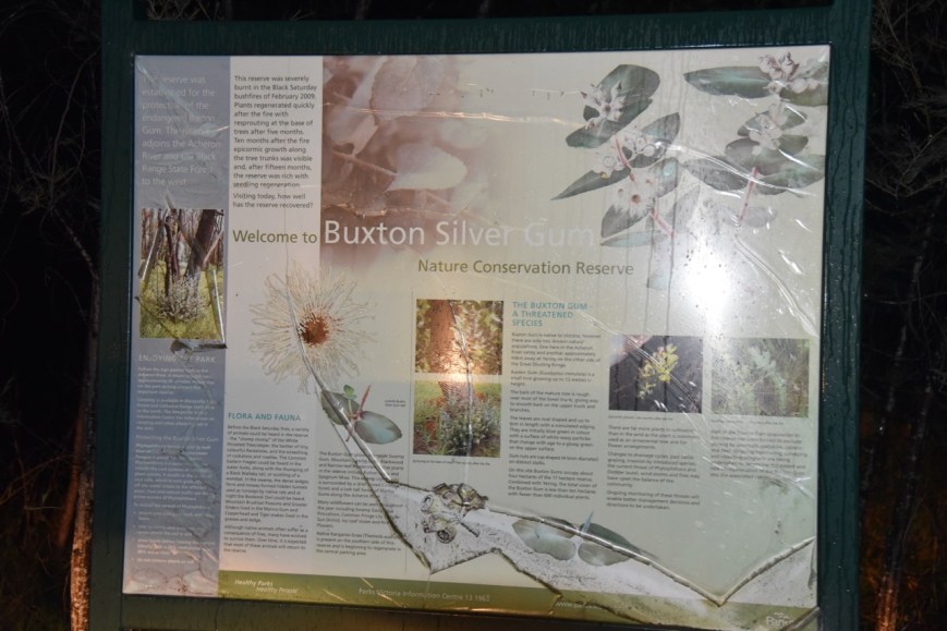
We then drove back down Lake Mountain Road and stopped off at the Bjarne K Dahl Memorial Boardwalk.  The boardwalk which was opened in March 2014, is dedicated to Bjarne K Dahl who had a passion for eucalypts and left his entire estate to support the establishment, cultivation and conservation of eucalpyts.  There are a number of information/interpretive boards along the walk which describe the surrounding bush and the history of skiing in the area.

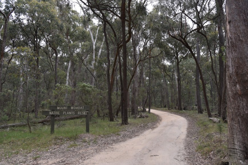
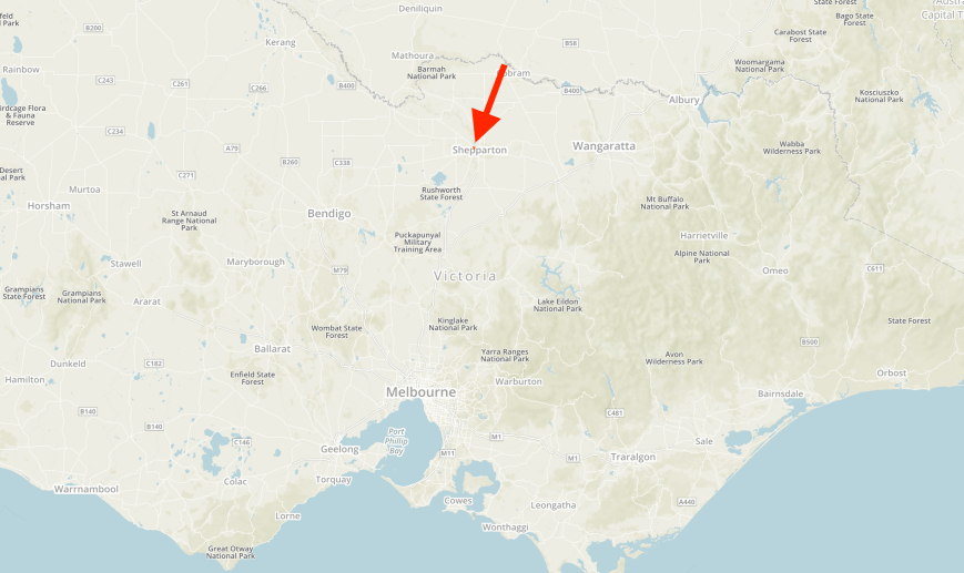
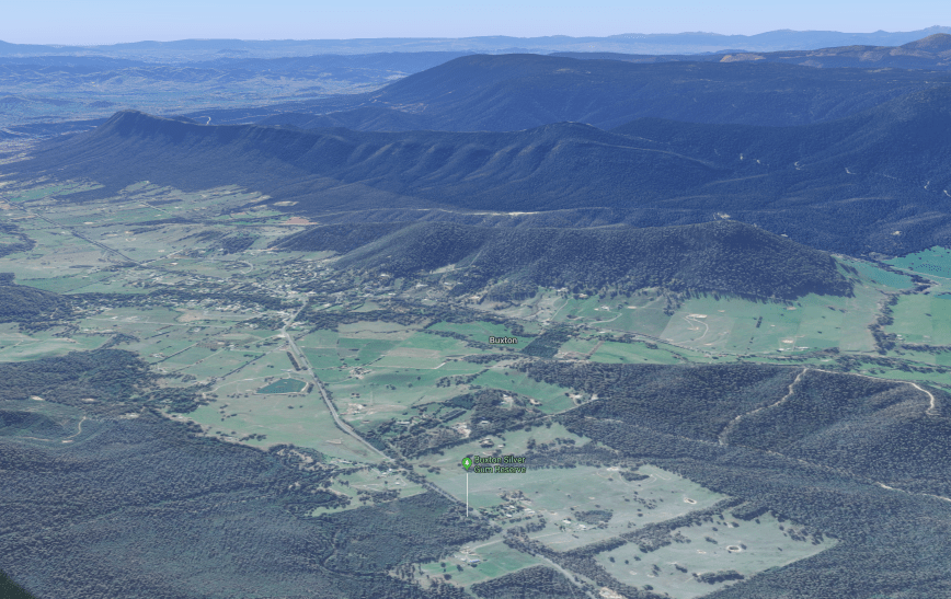
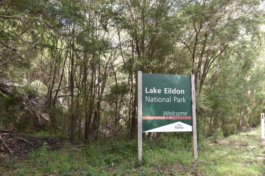
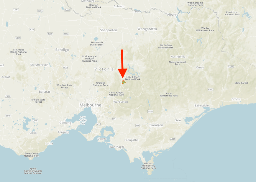
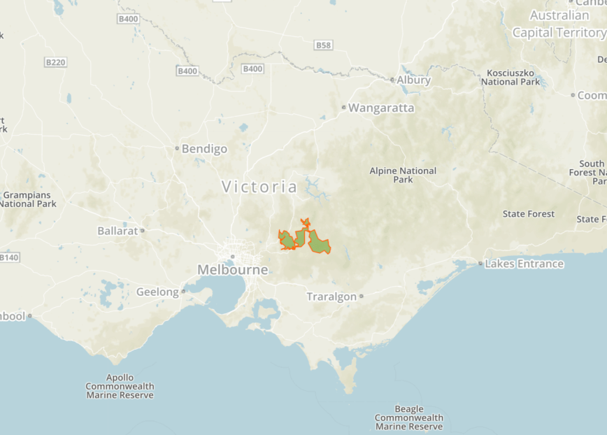
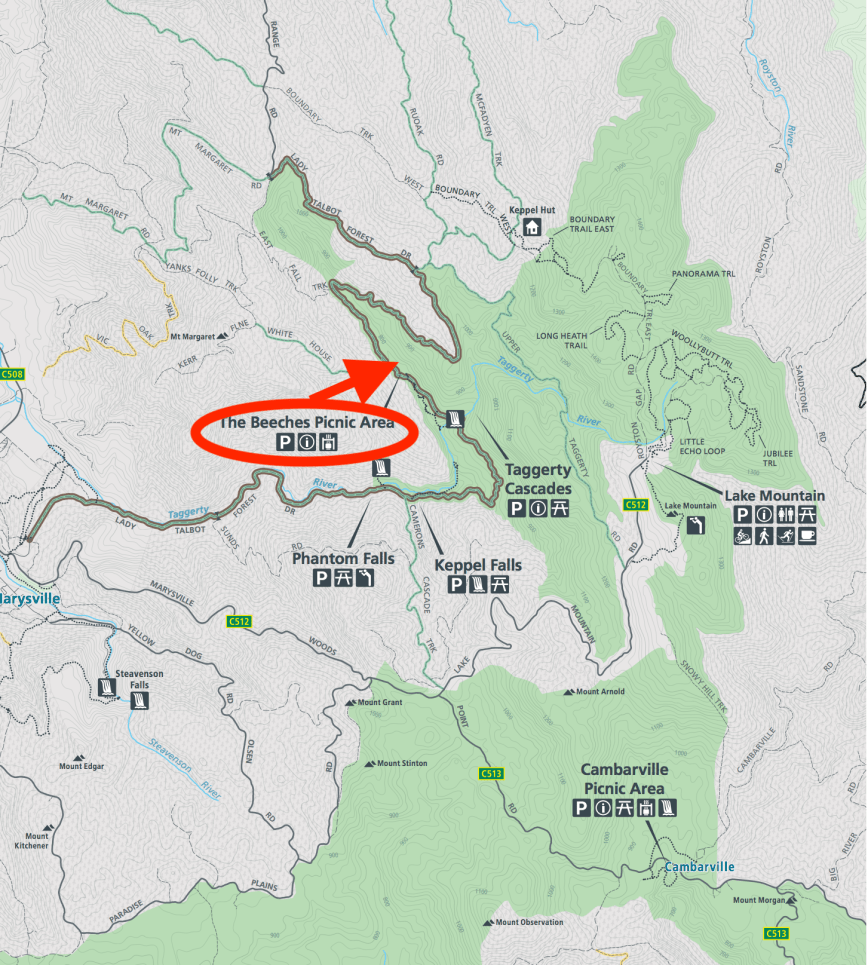
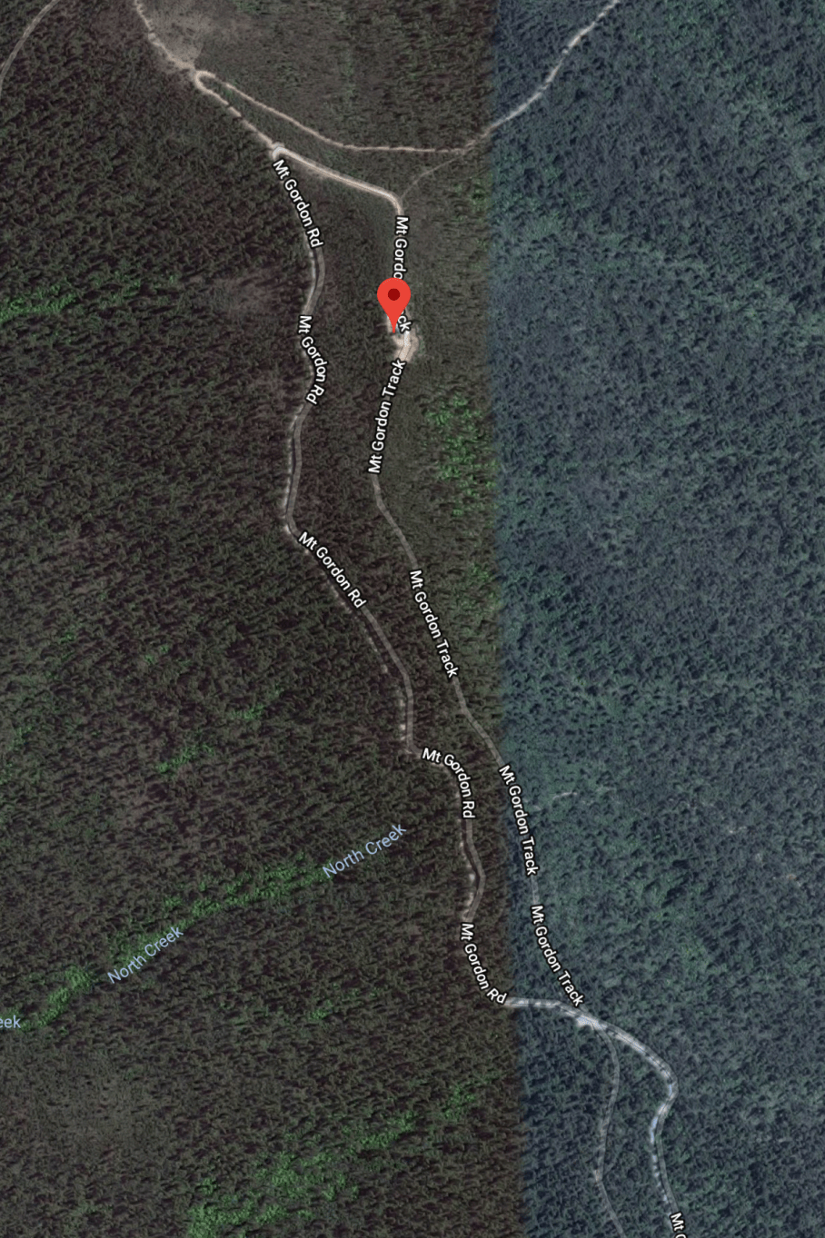
Our next planned stop was the historic area of Cambarville.  We continued along the Marysville-Woods Point Road, passing through the Yarra Ranges National Park.

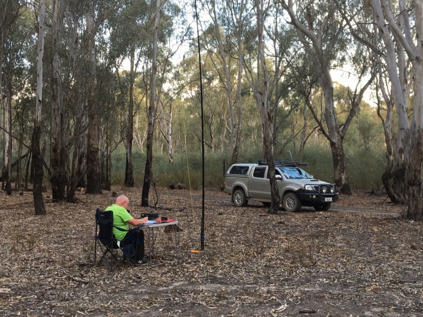
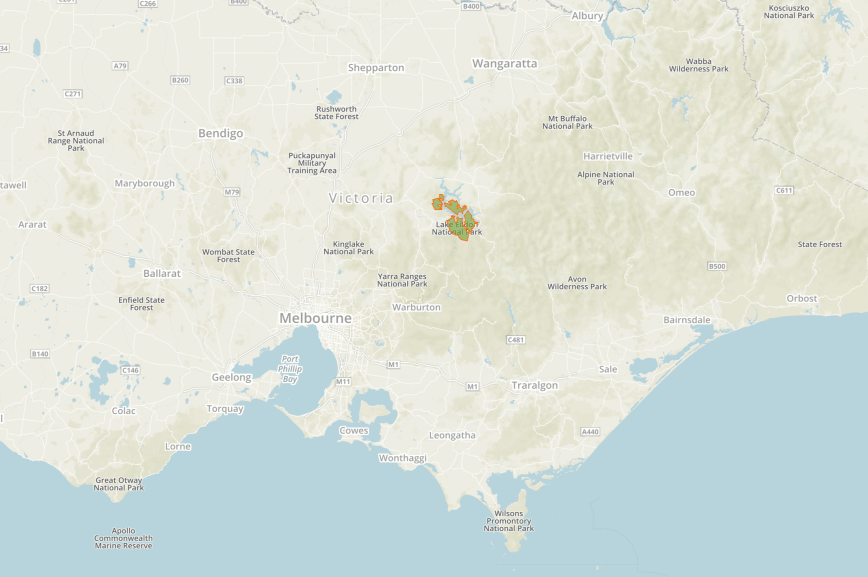
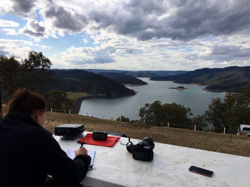
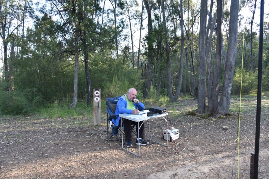
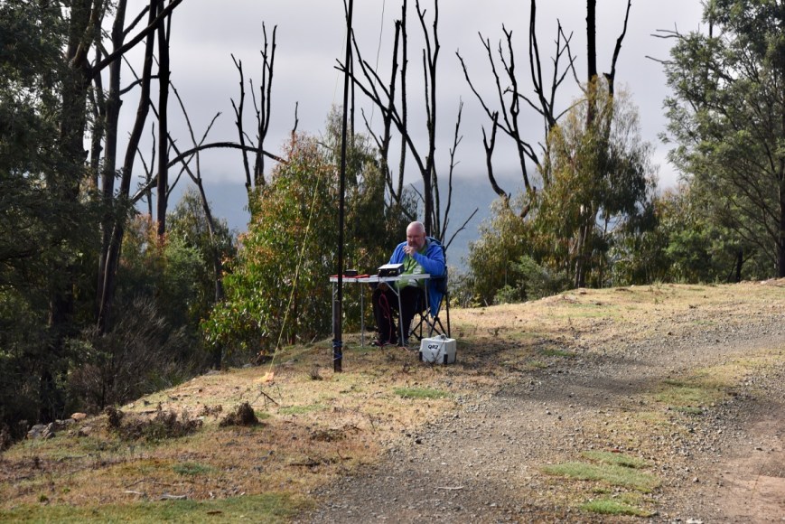
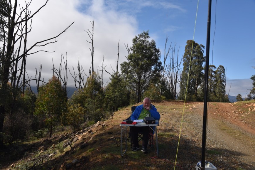
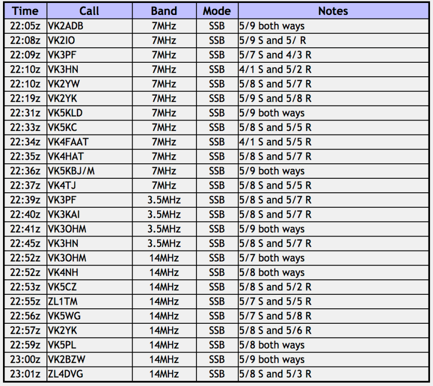
We soon reached the Cambarville Picnic area in the Yarra Ranges National Park.  As I was short of my 44 QSOs from my activation of this park the day before, we decided to put out a few CQ calls from the vehicle.  It was drizzling with rain outside and just too wet to operate from outside of the Hi Lux.

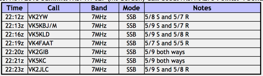
We had no internet coverage, so we were relying upon the good will of park hunters to spot us.  I called CQ on 7.144 for about 5 minutes with no takers.  Things were not looking good.  So I tuned across the band and found the 10AM Smoko Net in full swing.  Sadly the net control Paul VK5FUZZ could not hear me.  But I did log 3 stations on the net, Scott VK7NWT, Peter VK5NAQ, and Ron VK5MRE.

When the net concluded I continued to call CQ, and logged Andrew VK2UH and David VK3FDZE.  But they were my only callers on that frequency, so I moved up to 7.144 hoping that some of the park die hards who monitor that frequency, might pop up.  Adam VK2YK was first in the log, and he kindly spotted me on parksnpeaks.  I logged just a further 3 stations, David VK5PL, Ian VK5CZ, and finally Gerard VK2IO.

I had another 9 contacts in the log for the Yarra Ranges.  This was proving to be a difficult park to qualify.

I worked the following stations on 40m SSB:-

  1. VK7NWT
  2. VK5NAQ
  3. VK5MRE
  4. VK2UH
  5. VK3FDZE
  6. VK2YK
  7. VK5PL
  8. VK5CZ
  9. VK2IO

Marija and I then drove up the Cambarville Road to the ghost town of Cambarville, which was once a thriving small timber community.  Gold was discovered at nearby Woods Point in 1861, with logging commencing in about 1880.  Cambarville was established as a timber mill town in the 1940’s.  Two businessmen from Marysville, Alex Cameron and Fred Barton, constructed the Cambarville timber mill to harvest Alpine Ash which was vital to the economy of the town of Marysville.  In 1956 a fire at the mill temporarily forced its closure, however it soon re-opened and continued until its closure in 1971.

The town was once featured a school, numerous houses, and various buildings associated with the mill.  Very little remains today, however there are a number of information/interpretive signs detailing the history of the area.

This slideshow requires JavaScript.

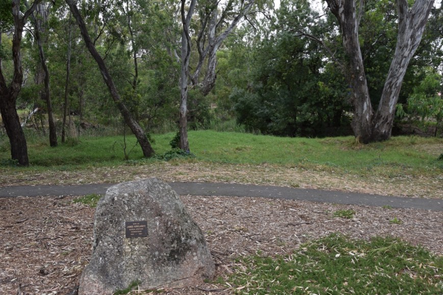
We then drove back towards Marysville, stopping briefly to have a look at the Big Culvert, a granite and bluestone arch culvert on the historic Yarra Track.  The culvert was constructed in the 1870’s as part of the improvements of the road between Melbourne and Woods Point, and the Jordan goldfields.

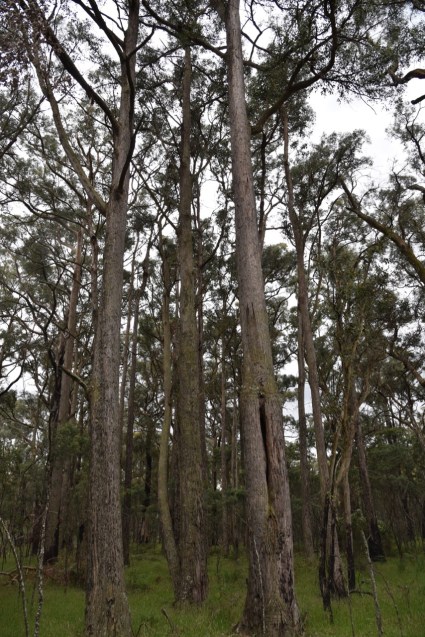
This is a truly pictureque drive, and we stopped every now and again to brave the wet weather and get a photo or two of the forest and ferns.

We had arranged to meet Tony VK3AN at Marysville, so we headed back that way, stopping briefly at Jock Lookout to admire the view of Marysville.

Once back in Marysville we met up with Tony and enjoyed a very nice meal and a few cold ales at The Duck Inn at Marysville.  I had spoken to Tony many times on air, so it was great to catch up with him in person for the very first time.

After lunch Marija and I headed next door to the Marysville Lolly Shop.  The shop was re-opened in 2012 after it was destroyed by the 2009 bushfires.  If you have a sweet tooth, like us, this is a very difficult shop to walk out of without bag full of lollies and chocolates.

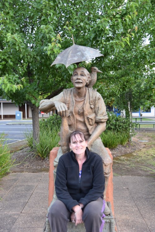
The weather had fined up a little, so Marija and I took a walk around Marysville, admiring some of the attractions including the old water wheel, the old police office, and the Steavenson River.

This slideshow requires JavaScript.


References.

Lake Mountain Alpine Resort, 2018, <https://www.lakemountainresort.com.au/summer/the-mountain/facts-and-figures/>, viewed 17th December 2018

Wikipedia, 2018, <https://en.wikipedia.org/wiki/Cambarville,_Victoria>, viewed 17th December 2018

Wikipedia, 2018, <https://en.wikipedia.org/wiki/The_Big_Culvert>, viewed 17th December 2018

Buxton Silver Gum Nature Conservation Reserve VKFF-2058

During our activation of Lake Eildon, we were encouraged by Peter to try to activate the Buxton Silver Gum Nature Conservation Reserve VKFF-2058, on our way back to Marysville.  The park is located on the western side of the Maroondah Highway, about 5 km south of the town of Buxton, and about 104 km north east of the city of Melbourne.

Screen Shot 2018-12-17 at 10.40.22 am.png

Above:- Map showing the location of the Buxton Silver Gum Nature Conservation Reserve.  Map courtesy of Protected Planet.

The little town of Buxton contains a general store, a fishing & outdoors store, a town hall, a primary school, a number of bed and breakfast accomodation, and a Trout & Salmon Farm.  The area around Buxton was severely impacted by the 2009 Black Saturday bushfires.  The town itself was isolated for several days with no power or telephone.  The Marysville Police Station was temporarily relocated in the town of Buxton, after it was destroyed during the bushfires.

The Buxton Silver Gum Nature Conservation Reserve is about 17 hectares in size, and adjoins the Acheron River.  It was established to protect the endangered Buxton Gum, a native to Victoria, however there are only two known populations.  One of those is here in the park along the Acheron River, and the other being about 64 km away at Yering.  The Buxton Gum is a small tree growing to about 12 metres on height.

Screen Shot 2018-12-17 at 11.21.16 am.png

Above:- An aerial view of the Buxton Silver Gum NCR, with the town of Buxton and the Cathedral Range in the background.  c/o google maps

The park was severely impacted by the Black Saturday bushfires, however the native plants regenerated quickly following the fire.  Within 5 months, many of the trees were resprouting at the base.

Prior to the fires, a large amount of fauna called the park home, including Mountain Brushtail Possums, Greater Gilders, Black Wallaby, Wombat, Boobook Owl, and White Throated Treecreeper.  It is believed that these have slowly returned to the reserve.

Screen Shot 2018-12-17 at 10.39.25 am.png

Aerial view of the Buxton Silver Gum Nature Conservation Reserve.  Image courtesy of Protected Planet.

The shower activity had set in, so we operated from the vehicle for this activation.  Plus it was getting late, and we were keen to get back to Marysville, as it had been a long day.  I joined the 7130 DX Net on 40m and there logged a total of 7 stations from VK2, VK5, VK6, VK7, and New Zealand.

I then headed off to 3.610 on the 80m band, expecting to hear from Peter, who we had sent a quick SMS to advise we were in the park.  Sure enough, Peter was first in the log on 80m.  I logged a total of 13 stations on 80m from VK2, VK3, VK4 and VK5.

With 20 contacts in the log, and the local time now approaching 9.30 p.m., it was time to hit the road and travel the short distance back to Marysville.  This is a park we will have to revisit, so Marija can qualify it, and we can explore it during daylight hours.

DSC_4544.jpg

I worked the following stations on 40m SSB:-

  1. VK2HMV
  2. VK6VZZ/m
  3. ZL2ASH
  4. VK7ROY
  5. ZL3SV
  6. ZL4SY
  7. VK5MJ

I worked the following stations on 80m SSB:-

  1. VK3PF
  2. VK3KAI
  3. VK3GV
  4. VK3UH
  5. VK3ANL
  6. VK5LA
  7. VK4TJ
  8. VK4/AC8QN
  9. VK4/VE6XT
  10. VK3ARH
  11. VK2IO
  12. VK5FANA
  13. VK5FMWW


References.

Melbourne’s Yarra Valley Official Visitor Site, 2018, <https://visityarravalley.com.au/activity/buxton>, viewed 17th December 2018

Wikipedia, 2018, <https://en.wikipedia.org/wiki/Buxton,_Victoria>, viewed 17th December 2018

Lake Eildon National Park VKFF-0625

Our final ‘intended’ activation for day six (Wednesday 21st November 2018), was the Lake Eildon National Park VKFF-0625.  The park is located about 148 km (by road) north east of the city of Melbourne.  This would be the first time that both Marija and I had activated this park for both the World Wide Flora Fauna (WWFF) program, and the Keith Roget Memorial National Parks Award (KRMNPA).

Screen Shot 2018-12-16 at 8.24.23 pm.png

Above:- Map showing the location of the Lake Eildon National Park.  Map courtesy of Protected Planet.

The Lake Eildon National Park was established on the 4th day of June 1997 and is 27,750 hectares (68,600 acres) in size.  It is located in the northern foothills of the Central Highlands of Victoria, and is adjacent to the shores of Lake Eildon.

The land in which the park is located is the home of Taungaurung aboriginal people.  But when they inhabited the area, Lake Eildon was not here.  It is a man made lake, with construction commencing in 1915.  Originally known as Sugarloaf Reservoir, the Eildon Dam and Weir was completed in 1929.  The impounded reservoir is known as Lake Eilson.  Its capacity is about 377,000 megalitres.  The dam wall is about 84.5 metres in height.

In 1957 an area of 2,670 hectares, which consisted of land along the Goulburn and Delatite Rivers was declared as the Fraser National Park.  In 1980, an area of 24,000 hectares of State Forest adjacent to Lake Eildon was declared as the Eildon State Park.  These two parks were combined in 1997, to form the Lake Eildon National Park.

About 34 species of native animals, 89 species of bird, 17 reptiles, 10 amphibians, and three freshwater fish are known to frequent the park.  This includes the threatened species of the Brush-tailed Phascogale and the Spotted Tree Frog.  During out visit we encountered a number of Sulphur Crested Cockatoos and King Parrots (see below).

Before activating the park, Marija and I drove in to the little town of Eildon, which is set on the banks of the Goulburn River and adjacent to Lake Eildon.  The name of the town, the lake, and the park, is taken from Eildon Station, a pastoral run of about 25,000 hectares which was taken up in 1846 by Mr and Mrs Archibald Thom.  The name was chosen due to the area reminding them of Mrs Thom’s birthplace of the Eildon Hills near Abbortsford in Scotland.

We took a drive out along Embankment Road which follows the southern edge of the lake and takes you past the spillway.  There is a monument here with a number of plaques recognising the ‘skill and labour of the men of many occupations who made possible the building of this great dam’.

We then drove our of Eildon on the Jerusalem Creek Road and soon reached the Lake Eildon National Park.

DSC_4493

We headed to Foggs/Mount Pinniger Lookout which is 543 metres above sea level and offers some nice views of nearby Eildon, and Lake Eildon.  It  is named after Wilkinson Pinniger, a surveyor involved in the Victorian Geodetic Survey completed in 1858.   During the late 1950’s the lookout was renamed as Foggs Lookout, after James D. Fogg, Project manager for UTAH Constructions during the building of the Big Eildon Dam.

We set up and I kicked off the activation with a contact with Compton VK2HRX, followed by Ken VK2HBO, and then Peter VK3PF.  I soon had my 10 contacts in the log, with a QSO with Steve VK5KSW on the Yorke Peninsula.

Marija then jumped on the mic, with her first contact being a QSO with Angela VK7FAMP, followed by Andrew VK2PEZ and then Andrew VK2UH.

IMG_1475

I then looked at Google maps and realised we may not be inside the park which set off the alarm bells.  Although other maps, and various websites indicated we were, and some assurances from certain amateurs, we decided to be absolutely sure, and packed up and moved to another location.  We stopped occasionally to admire the magnificent views of Lake Eildon.

We drove a short distance down the road to the Jerusalem Creek campground area and continued our radio activities.  Sorry to anyone if we went off air in a hurry.  We just wanted to make sure we were within the park boundaries.

Marija soon qualified the park with 10 contacts and ended up with a total of 13 contacts in the log from VK2, VK3, VK4, VK5 and New Zealand.

It was getting quite late, with the local time approaching 6.30 p.m. and the 40m band was opening up very nicely.  So it didn’t take me long to get my 44 contacts, to qualify the park for the global WWFF program.  Contact number 44 was John VK4TJ.

DSC_4512

Whilst I was on air Marija went for a short walk down to the water’s edge from the campground.  There is a marina here where a number of houseboats are moored.

So with the park qualified it was time to pack up and head into Eildon for a bite to eat.  It was now 7.15 p.m. and we were keen to get to the local pub which had been recommended to us by an amateur during our activation.

Marija worked the following stations on 40m SSB:-

  1. VK7FAMP
  2. VK2PEZ
  3. VK2ZEP
  4. VK2UH
  5. VK7LTD
  6. VK5FANA
  7. ZL1TM
  8. VK5PL
  9. VK2IO
  10. VK3SQ
  11. VK7JON
  12. VK5BJE
  13. VK4HNS

I worked the following stations on 40m SSB:-

  1. VK2HRX
  2. VK2BO
  3. VK3PF
  4. VK2NNN
  5. VK4BX
  6. VK5PL
  7. VK2HFC
  8. VK2PKT
  9. VK2JON
  10. VK5KSW
  11. VK2PEZ
  12. VK2ZEP
  13. VK7LTD
  14. VK2UH
  15. VK4HNS
  16. VK5BJE
  17. VK7JON
  18. VK7KT
  19. VK2HHA
  20. VK7GG

Sadly when we got back into Eildon we discovered that the Golden Trout Hotel was closed.  For a tourist town like this, Marija and I were very surprised to find very few options for food.  So it was off to the local take away for a steak sandwich, which was very nice indeed.

Directly outside the shop is the ‘Earl of Eildon’ statue, which is designed so that tourists can sit at the feet of the Earl and have their photograph taken.  We couldn’t resist.

DSC_4540


References.

Artworkz Lookouts, 2018, <http://www.esplash.me/pdf/etbook_district_lookouts.pdf&gt;, viewed 17th December 2018

Lake Eildon Tourism, 2018, <https://www.lakeeildon.com/history-of-lake-eildon/>, viewed 17th December 2018

Wikipedia, 2018, <https://en.wikipedia.org/wiki/Eildon_Dam>, viewed 16th December 2018

Wikipedia, 2018, <https://en.wikipedia.org/wiki/Lake_Eildon_National_Park>, viewed 16th December 2018

Cathedral Range State Park VKFF-0755

After leaving the Yarra Ranges National Park, Marija and I headed north on the Maroondah Highway.  Our next intended activation was the Lake Eildon National Park.  But along the way we decided to stop in quickly to the Cathedral Range State Park VKFF-0755, for a quick activation from the vehicle.

The park is located about 21 km north of Marysville, and about 120 km north east of Melbourne (by road).

Screen Shot 2018-12-12 at 1.57.26 pm.png

Above:- Map showing the location of the Cathedral Range State Park.  Map courtesy of Protected Planet.

The Cathedral Range State Park was declared a State Park on the 26th day of April 1979.  It comprises 3,577 hectares and includes the Cathedral Range, a spectacular 7 km ridge of sharply upturned sedimentary rock.  The Little River and Storm Creek flow through the park.  The Cathedral Range is a popular destination for bushwalkers, campers, rock climbers and abseilers.

The traditional land owners are the Aboriginal people from the Wurundjeri tribe.  European settlement commenced in 1839 when land was selected for the Acheron Run.  Seven years later in 1846, land was selected for the Acheron Run, which included the Cathedral Range area.

The difficult terrain discouraged settlers from building there.  The land was grazed until the 1930’s when wild dogs became destructive towards the stock.  Logging and milling occurred between the 1930’s to the 1970’s.  Remnants of Cooks Mill remain at the Cathedral Range State Park and is protected as a historic site.

The park contains a broad range of flora, ranging from Manna Gum Tall Open Forest to Myrtle Beech Closed Forest.  The park is home to a variety of native orchids, and is home to a number of rare species of flora including the Bristle-fern.

Fauna within the park includes the Common Wombat and the Eastern Grey Kangaroo.  Numerous birds call the park home including the Superb Lyrebird, the Peregrine Falcon, and the Satin Bowerbird.

The park was well signposted and we soon reached the northern section of the park via Cathedral Lane and Little River Road.

We drove down to Neds Gully and pulled over on the side of the road.  I used the Icom IC-7000 and the Codan 9350 antenna on the back of the Hi Lux for this activation.

Screen Shot 2018-12-12 at 1.57.11 pm.png

Above:- Map of the Cathedral Range State Park, showing our operating spot.  Map courtesy of Parks Victoria

This activation was to be really hard work.  It took me 16 minutes to eventually get my 10 contacts to qualify the park for VKFF.  And the Codan antenna did not like the canopy of vegetation and was very difficult to tune up on 40m.

First in the log was Karl VK2GKA, followed by Phil VK5NPP, and then Danny VK5DW.  I logged just 5 stations on 40m before deciding to give the 80m band a go.  It wasn’t much better there, with Just Peter VK3PF/VK3KAI calling in.

So with 7 contacts in the log, I headed back to 40m and called CQ on 7.144.  This was answered by Peter VK2UXO with a big signal, followed by Andrew VK2UH, who obliged with his second call of VK1DA/2.  I had qualified the park, but it had been a real struggle.

I worked the following stations on 40m SSB:-

  1. VK2GKA
  2. VK5NP
  3. VK5DW
  4. VK2XXM
  5. VK2IO
  6. VK2UXO
  7. VK2UH
  8. VK1DA/2

I worked the following stations on 80m SSB:-

  1. VK3PF
  2. VK3KAI


References.

Wikipedia, 2018, <https://en.wikipedia.org/wiki/Cathedral_Range_State_Park>, viewed 12th December 2018

Yarra Ranges National Park VKFF-0556

It had turned out to be quite a nice morning, and the wet weather was holding off.  We even had a bit of blue sky appearing every now and again.  So with that in mind, Marija and I decided to visit the Steavenson Falls.  The Falls have been a local Marysville attraction since the late 1800’s.  With a total drop of 84 metres and a catchment of about 16 sq km, Steavenson Falls is one of Victoria’s most imposing cascades.

Perhaps the overnight wet weather had worked in our advantage, as the Falls were flowing well and were quite magnificent during our visit.

Both the Falls and the river were named in the early 1860’s when the Victorian Assistant Commissioner of Roads and Bridges, John Steavenson, set up a base at Marysville (which he named after his wife) from which to supervise the construction of the road to the Woods Point goldfields.

After viewing the falls we took the lower track back to the carpark, stopping off occasionally to see if we could spot a platypus in the Steavenson River.  Unfortunately we were not so lucky.

We then headed to the Keppel lookout, which offers magnificent views of Marysville and the surrounding countryside.  The lookout is just a short distance out of Marysville and easily reached bia the Keppel Lookout Road.

It was approaching lunchtime, so Marija and I headed back into Marysville, and to the local bakery.  We enjoyed a couple of beautiful foccasias, and so did the local King Parrots.  Male Australian King-Parrots are the only Australian parrots with a completely red head. Females are similar to males except that they have a completely green head and breast. Both sexes have a red belly and a green back, with green wings and a long green tail.

They were exceptionally tame, and very game at times, even trying to pinch the foccacia off my plate.  The one below appeared to be partial to a cup of coffee.

DSC_4439

There was a bird feeding station here at the bakery, and along with the King Parrots, there were also Red Wattlebirds and Sulphur Crested Cockatoos.

After lunch, we headed to our next activation, the Yarra Ranges National Park VKFF-0556.   This was to be the first time that Marija and I had activated the park.  So it was to be a unique for us for both the World Wide Flora Fauna program (WWFF) and the the Keith Roget Memorial National Parks Award (KRMNPA)

Screen Shot 2018-12-12 at 10.26.46 am.png

Above:- Map showing the location of the Yarra Ranges National Park.  Map courtesy of Protected Planet

The Yarra Ranges National Park was declared in 1995 and stretches from Healesville to Warburton and beyond to the headwaters of the Yarra River and north to Lake Mountain.  The park is about 760 km2 in size.  The Yarra, O’Shaunessy and Taggerty Rivers flow through the Park, and with several reservoirs form an important source of drinking water for the City of Melbourne.  The park is home to kangaroos, wallabies, wombats, platypus, and about 120 species of native birds.

The park was severely impacted by the Black Saturday bushfires of February 2009.  This series of bushfires resulted in Australia’s highest ever loss of life from a bushfire, with 173 fatalities and 414 injured.

This is a large park, and we chose to head to The Beeches Picnic Area, along the Lady Talbot Drive.  The road follows the Taggerty River valley up under the western flanks of Lake Mountain, to the top of Mount Margaret Gap.  The road was named after the wife of Sir Reginald Talbot, Governor of Victoria from 1903 to 1908.

DSC_4446

Above:- The Taggerty River, along Lady Talbot Drive.

Our first stop was Phantom Falls.  This is a fairly easy walk, including stairs, to the viewing platform at the falls.  Don’t expect an imposing view of traditional waterfalls.  These falls are mostly hidden by the forest.  They were exposed during the 2009 bushfires which devastated this area, but are now mostly concealed by the forest.  The height of the falls is about 20 metres and their length is about 40 metres.

The walk up to the falls is well worth it.  It takes you across two bridges and through the amazing rainforest.  The walk is about 1.6 km in length, and takes 45 minutes return.

On our way down we found this snake basking in the afternoon sun.  It didn’t bother moving, and we didn’t annoy it.

We continued along Lady Talbot Drive, stopping every now and again to admire the amazing scenery that is the Yarra Ranges National Park.

We soon reached Keppel Falls which are a long set of cascades tumbling down the mountain side.  The falls are about 40 metres in height, with a length of about 70 metres.  This is a slightly longer walk of about 2km, taking 45 minutes return.

DSC_4458

Above:- Keppel Falls

We continued on to The Beeches Picnic Area, where we parked the vehicle and set up our station.  We ran the Yaesu FT-897 and the 20/40/80m linked dipole for this activation.

Screen Shot 2018-12-12 at 10.59.19 am.png

Above:- Map showing our operating spot at The Beeches Picnic Area.  Map courtesy of Parks Victoria.

There is a small secluded picnic area here with a table and bench.  But there was not enough area in the picnic area to string out the dipole, so we set up just off the road, which was not at all busy.  In fact we did not see another car.

Unfortunately this area was heavily impacted by the 2009 bushfires, and as a result there is a greatly increased tree hazard from trees killed during the fires.  As a result many of the trails, including the Beeches Rainforest Walk were closed.  The ancient rainforest features groves of Myrtle Beech trees, with many trees over 300 years old.  There are also stands of enormous Mountain Ash, one of the tallest trees in the world.  In the photos below you can see the dead trees from the fires, 9 years on.

We had no internet coverage at all, so we could not self spot on parksnpeaks, which made things particularly difficult during this activation.  We were relying upon the goodwill of the park hunters, and sadly not many spotted us on parksnpeaks.  This is an issue which has recently been discussed by the VKFF Team in a Skype hookup.  It is so vital that park hunters spot activators, rather than work them and then walk out of the radio shack.

I called CQ on 7.144 on the 30m band and first in the log was Geoff VK3SQ (who kindly spotted us), followed by Ron VK3ARH, Gerard VK2IO, and then Mike VK2MKE.  But it was very slow going, with long periods of unanswered CQ calls.  It took me 14 minutes to get contact number ten in the log, a QSO with Dave VK2BDR/m in his mobile.  After logging 11 stations, including a Park to Park with Andy VK5LA in the Mildura Flora & Fauna Reserve VKFF-2386, I swapped the microphone with Marija.

It was even harder for Marija, running her allowed 10 watts PEP.  First in the log was Andy VK5LA/p in VKFF-2386, followed by Dave VK2RP/VK2BDR mobile, and then Brett VK2VW.  So with just 4 contacts in the log for Marija, we lowered the squid pole and inserted the links for the 80m section of the dipole.  Marija called CQ on 3.610 and this was answered by Peter VK3PF, who kindly gave Marija his 2 other callsigns of VK3KAI and VK3GV.

Marija’s perseverance paid off, and after 20 minutes on air, had contact number ten in the log, a QSO with Tony VK3AN.

I then put a few calls out on 14.310 on the 20m band.  But I had two things up against me.  Number one, the lack of ability to place up a spot on parksnpeaks.  And two, the ever present Over the Horizon Radar.  To finish off the activation, I moved back to 40m and put out 5 minutes of CQ calls on 7.150, with just the one taker, Ivan VK2IJS.

Unfortunately I hadn’t got close to the 44 QSOs required to qualify the park for WWFF.  But, Marija and I had qualified the park for VKFF, and also the KRMNPA.

Marija worked the following stations on 40m SSB:-

  1. VK5LA/p (Mildura Flora & Fauna Reserve VKFF-2386)
  2. VK2RP/m
  3. VK2BDR/m
  4. VK2BOR
  5. VK2VW

Marija worked the following stations on 80m SSB:-

  1. VK3PF
  2. VK3KAI
  3. VK3GV
  4. VK3OHM
  5. VK3PAT
  6. VK3AN

I worked the following stations on 40m SSB:-

  1. VK3SQ
  2. VK3ARH
  3. VK2IO
  4. VK2MKE
  5. VK2FF
  6. VK2KNV/m
  7. VK2MG
  8. VK2VW
  9. VK2RP/m
  10. VK2BDR/m
  11. VK5LA/p (Mildura Flora & Fauna Reserve VKFF-2386)
  12. VK2IJS

I worked the following stations on 80m SSB:-

  1. VK3PF
  2. VK3UH


References.

Birds in Backyards, 2018, <http://www.birdsinbackyards.net/species/Alisterus-scapularis>, viewed 12th December 2018

Marysville Tourism, 2018, <http://www.marysvilletourism.com/things_to_do/lady-talbot-trails/>, viewed 12th December 2018

Parks Victoria, ‘Yarra Ranges National Park Visitor Guide’

Waterfall Seasons of Australia-The Waterfall Guide, 2018, <https://waterfallseasons.com/waterfalls-in-victoria-phantom-falls-marysville.htm>, viewed 12th December 2018

Wikipedia, 2018, <https://en.wikipedia.org/wiki/Yarra_Ranges_National_Park>, viewed 12th December 2018

Wikipedia, 2018, <https://en.wikipedia.org/wiki/Black_Saturday_bushfires>, viewed 12th December 2018

Day six, Mount Gordon VK3/ VN-027

It was now day six, Wednesday 21st November 2018.  Marija and I headed out for breakfast to Fraga’s Cafe in Marysville and enjoyed some nice poached eggs on toast with bacon, and some refreshing coffee.  It was a cloudy morning, with occasional light drizzle, and it provided some more opportunities for a bit of bird photography.

We then headed to Mount Gordon VK3/ VN-027, our first activation for the day.  Mount Gordon is situated about 6 km (by road) west of Marysville, and about 96 km north east of the city of Melbourne.

Screen Shot 2018-12-11 at 9.30.11 pm.png

Above:- Map showing the location of Mount Gordon VK3/ VN-027.  Map courtesy of Google maps.

Mount Gordon is 764 metres above sea level and is worth 4 points for the Summits on the Air (SOTA) program.  This would be a first time activation of this summit by Marija and I.  It had been activated a total of 55 times previously, so it is a popular summit.  Most likely due to its easy access and relatively close proximity to Melbourne.

Screen Shot 2018-12-11 at 9.35.46 pm.png

Above:- Mount Gordon, c/o Open Topo Map

We drove south out of Marysville on the Marysville Road, with the summit soon coming into view.  Fortunately the rain was holding off.  It had rained quite heavily the night before, and Marija and I were hopeful that it would remain relatively clear for the day.

DSC_4353

A short distance out of Marysville we turned right onto Mount Gordon Road.  This is a dirt track, but in good condition, and easily passable in a conventional vehicle.  We soon reached the summit which was dominated by a number of communication towers.

Maps showed that the Mount Gordon Track formed a loop up to, and down from the summit.

Screen Shot 2018-12-11 at 9.29.52 pm.png

But this was not the case.  The road was closed.  It was one way up and one way down.

DSC_4369

On the way up to the summit there were some reasonable views through the trees of the surrounding countryside.  But once up on the summit, the only clear view was north back down Mount Gordon Road.

DSC_4363

There was the occasional view through the trees to Marysville, which was partially clouded over.

There weren’t a huge lot of options here on the summit for operating spots.  We were hoping that as it was a chilly morning there wouldn’t be too many visitors to the summit.  We set up on the side of the track, below the fire spotting tower.

Marija threw up a spot for me on parksnpeaks and I started calling CQ on 7.098.  There was a net on 7.093, so we couldn’t get on to the normal SOTA frequency of 7.090.  First in the log was Karl VK2ADB, then Gerard VK2IO, Peter VK3PF, and then Paul VK3HN.  I had qualified the summit.  I logged 1 more station, Adam VK2YK, before handing the microphone to Marija.

DSC_4354

Marija’s first contact was with John VK2YW, followed by Barry VK5KBJ/m mobile, Les VK5KLD, and then Tony VK4FAAT.  Marija had also qualified the summit.  Marija logged a further 3 stations, before I jumped back on the mic again, ramping the power back up from 10 watts to 40 watts.

I logged a further 6 stations on 40m from VK4 and VK5, before heading to 3.610 on the 80m band.  There I logged 4 stations, all Victorian (VK3) stations.  To complete the activation I moved to 14.310 on the 20m band where I experienced strength 5 noise.  However, I managed to log 9 stations on 20m including two New Zealand stations: Andrei ZL1TM, and Daniel ZL4DVG.

DSC_4358

We had quite a few things planned for the day, so with the summit qualified, Marija and I packed up and headed off.

Marija worked the following stations:-

Screen Shot 2018-12-11 at 9.21.53 pm.png

I worked the following stations:-

Screen Shot 2018-12-11 at 9.21.37 pm.png

But before leaving the summit we drove to a point near the Woods Lookout Track.  This offered the best views of the surrounding countryside.


References.

Summits on the Air, 2018, <https://www.sota.org.uk/Summit/VK3/VN-027>, viewed 11th December 2018

Seven Creeks Wildlife Reserve VKFF-2435

After leaving Mount Wombat, Marija and I drove to the little town of Strathbogie, which was named after the Strathbogie pastoral run (1843) which was subdivided from the Seven Creeks run (1838).  The town is surrounded by the Strathbogie Ranges, once a notorious hideout for Ned Kelly and his gang of bushrangers.  Wool production has become the main industry in the area.

We stopped to have a look at the Merino Sheep monument.  The model was presented to the Strathbogie community by Toyobo Co Ltd of Japan, and C. Itoh & Co Ltd of Japan, in recognition of production by local farmers of high quality fine merino wool bought and process by the Japanese to manufacture quality wool material.

DSC_4301

Above:- The Merino Sheep monument.

Marija and I then headed to the Seven Creeks Wildlife Reserve VKFF-2435, for a quick activation from the vehicle, as it was continuing to drizzle with rain.  The reserve is located about 4 km south east of Strathbogie, and about 122 km north of the city of Melbourne.

Screen Shot 2018-12-11 at 8.19.43 pm.png

Above:- Map showing the location of the Seven Creeks Wildlife Reserve VKFF-2435.  Map courtesy of Protected Planet.

The park is located in the scenic Strathbogie Ranges, and features a unique system of granite outcrops, and year-round cascading waterfalls and deep pools.  Seven Creeks, which originates on the Strathbogie plateau above the township of Strathbogie, flows through the reserve.  The river is the habitat of numerous native fish species, including the nationally endangered Trout Cod, and Macquarie Perch.

The Seven Creeks Wildlife Reserve forms part of the traditional land of the Taungurung aboriginal clans.  The people of Yaran-yilam and Yiran-yilam bulock clans occupied the vast area around the Sven Creeks region prior to European colonisation.  The rich resources of the permanent rivers, creeks, tributaries, and assocated floodplains of the area enabled the Taungurung people to access an abundance of fish and other wildlife.

We activated the reserve from the Polly McQinns Weir picnic area.  Polly Mcquinns Weir is one of Euroa’s five water storages.  In 1933 the tender was accepted for the construction of the 30 million gallon weir.

Screen Shot 2018-12-11 at 8.19.33 pm.png

Above:- Map of the Seven Creeks Wildlife Reserve, showing our operating spot.  Map courtesy of Protected Planet.

It is from here that Seven Creeks descends a steep granite escarpment, and eventually cascading over Gooram Falls, which we would later visit.  Sven Creeks then flows through a confined valley to the town of Euroa, emerging onto the riverine plain.  It then joins the Goulburn River south of Shepparton.

Who was Polly McQuinn?  There is much local folklore as to how this area was named.  The most commonly accepted version is that the name derives from a nearby resident who was named Polly because he did not have a beard.  Apparently McQuinn accidentally drove his wagon and team of horses into the watering hole whilst attempting to cross the rocks, prior to the construction of the first bridge.  It is said that McQuinn and his horses all tragically perished in the 9m deep water.

Despite the shower activity and our disapointment that we could not operate from outside of the vehicle, the rain did work in our favour as the water was running well across the granite outcrop.  It was a beautiful spot.

It was also an opportunity for me to take a few bird photographs.  The park is also home to a variety of native wildlife including microbats, possums, gliders, koalas, kangaroos, echidnas, snakes, and lizards.

Unfortunately we had no internet access in the park, so we were unable to place a self spot on parksnpeaks.  I called CQ on 7.144, competing with the strength 9 + static crashes, due to the unstable weather.  After a few minutes, Dave VK7LG came back to my call with a strong 5/9 signal.  This was followed by Grant VK2LX , Rod VK7FRJG, and then Al VK7AN.  But that was the extent of callers on 40m.  It wasn’t looking good, getting to my 10 contacts.

I then moved to 3.610 on the 80m band and called CQ.  Peter VK3PF came back to my call, and kindly gave me his 2 other calls of VK3KAI and VK3GV.  Geoff VK3SQ then called in from Beechworth, but as quick as 40m, callers on 80m dried up.  Sadly the rain wasn’t though.

I was now just 1 short, so I headed back to 40m and called CQ on 7.144.  Gerard VK2IO was my saviour, being contact number 10.  I then logged Andy VK5LA, and it was at this time that the heavens really opened up and we started to experience some lightning.  It was time to go QRT and hit the road.

Sorry to anyone else who would have liked this park.  It is one that Marija and I will definitely be re-visiting.

I worked the following stations on 40m SSB:-

  1. VK7LG
  2. VK2LX
  3. VK7FRJG
  4. VK7AN
  5. VK2IO
  6. VK5LA

I worked the following stations on 80m SSB:-

  1. VK3PF
  2. VK3KAI
  3. VK3GV
  4. VK3SQ

We then drove along Galls Gap Road and then south on the Euroa-Mansfield Road.  Although it was drizzling, Marija and I decided to do the walk at Gooram Falls, which features a system of granite outcrops, year round cascading waterfalls and deep pools.  The name Gooram is derived from the Taungurung aboriginal word for hunting ground, spelt Guram in the Taungurung language.

And despite getting totally soaked, it was a very rewarding walk, with terrific views of the gorge and the cascading waterfalls.

We then drove into the town of Alexandra, which was settled during the late 1860’s.  Our first stop here was to have a quick look at the Monument for explorers Hume and Hovell, who passed through the area on 3rd December 1824.

We then had a look at the replcia of The Red Gate.  The town of Alexandra was originally known as the Red Gate by early settlers and Red Gate Diggings by gold miners in late 1866.  The Red Gate situated on the banks of the Ultima Thule Creek marked the break in the boundary fence between two pastoral runs.

We then stopped to look at the Princess Alexandra marble statue, the work of English sculptor Charles Somers, commissioned in 1878.  It was originally located in the National Gallery in Melbourne, until offered to and accepted by the Shire of Alexandra in 1939.

We continued south on the Maroondah Highway, and soon reached our destination of the town of Marysville, where we had booked in to stay three nights.

DSC_4344

Our accomodation was the Vibe Hotel in Marysville.

After freshening up we headed out for tea to the restaurant at the Vibe, and enjoyed a nice (but expensive) meal.

IMG_1472


References.

Goulburn Broken Catchment Management Authority, 2018, <https://www.gbcma.vic.gov.au/projects/macquarie-perch/seven-creeks>, viewed 11th December 2018

Parks Victoria, 2018, <https://parkweb.vic.gov.au/explore/parks/seven-creeks-w.r>, viewed 11th December 2018

Victorian Places, 2018, <https://www.victorianplaces.com.au/strathbogie>, viewed 11th December 2018

Mount Wombat-Garden Range Flora and Fauna Reserve VKFF-2403 and Mount Wombat VK3/ VU-002

After leaving Arcadia, Marija and I continued south on the Euroa-Shepparton Road, heading for the town of Euroa.  We stopped briefly to have a look at the Major Thomas Mitchell Expedition monument.  It marks the site where Major Mitchell and his expedition party passed on their ‘Australia Felix’ expedition in 1836.  Australia Felix is Latin for ‘fortunate Australia’ or ‘happy Australia’, and is the name given by Mitchell to the lush pasture area of western Victoria he explored in 1836.

We then drove in to the historic town of Euroa.  Urowa, or Euroa, is thought to be derived from an Aboriginal word meaning push or joyful.

Our first stop was the Victoria Cross Memorial which was opened in 2014.  It commemorates three Victoria Cross recipients from Euroa, Leslie Maygar, Fred Tubb and Alex Burton.  Eurioa is the only town in the Commonwealth, to have this many citizens granted the Victoria Cross.

Nearby is a memorial for the site of James Kirkland’s Euroa Station Homestead  on the Urowa Pastoral Run(1844-1851).  Kirkland was the resident squatter at the time that the original town survey was made in 1850.

DSC_4226

We had hoped to visit the museum in Euroa, however it was closed.  The museum is contained within the old Farmers Arms Hotel.  In 1876 John Shelswell was granted the first licence for the hotel.  It served as a hotel with various licences for about 40 years, after which is became a boarding house run by the widow of a local policeman.  Edith Smith ran it as such for about 50 years before the then Shire of Euroa purchased the building for the Historical Society.

We then had a look at the Hume and Hovel monument which stands opposite Burton’s Bridge.  Who were Hume and Hovel?  In 1824, Hamilton Hume and William Hovell led an expedition of discovery to find new grazing land for the colony.

DSC_4229

We also stopped to have a look at the locally named Swaggy Tree, which is a large River Red Gum hundreds of years old.  It is believed people sheltered here during the 1930s Depression. Major Thomas Mitchell passed nearby in 1836 during the Australia Felix expedition and, not long after, the township of Euroa was established on the banks of the Seven Creeks.

DSC_4231.jpg

We then undertook a section of the Euroa Heritage Trail.  A Trail Guide can be downloaded from http://euroa.org.au/heritage/.  Euroa contains many historic buildings dating back to the late 1800’s.

This slideshow requires JavaScript.

One of the more infamous sites in Euroa, is the former site of the second Euroa National Bank.  This is the bank which was robbed by the notorious Ned Kell Gang in 1878.  The bank no longer stands, but there is an information board here. The present day building was built in 1974 with bricks from the original bank building.

After a bite to eat, we left Euroa and headed to our second activation for the day, Mount Wombat VK3/ VU-002, which is located in the Mount Wombat-Garden Range Flora & Fauna Reserve VKFF-2403.  We drove out of Euroa, south east on the Euroa-Strathbogie Road, and then turned right onto Mount Wombat Road.

Screen Shot 2018-12-11 at 5.37.09 pm.png

Above:- Map showing the location of the Mount Wombat-Garden Range Flora and Fauna Reserve.  Map courtesy of Protected Planet

We soon reached the park, which was signposted as Mount Wombat Native Plants Reserve.  Presumably this was its previous name and no-one has bothered to change the sign.

DSC_4252

The Mount Wombat-Garden Range Flora & Fauna Reserve is 14.23 km2 in size and consists of Messmate Euc. obliqua forest.  Parks Victoria only have a map of this park on their website, and I was unable to find a lot of descriptive material on the internet about this park.

DSC_4296

There were numerous small wildflowers in bloom during our visit to the summit/park.

We followed the Mount Wombat Road up to the summit.  The road is dirt, but is in good condition, and is easily passable in a conventional vehicle.

DSC_4288

Mount Wombat is 802 metres above sea level and is worth 4 points for the Summits on the Air (SOTA) program.  Prior to our activation, the summit had been activated a total of 19 times, first by Wayne VK3WAM in May 2012.

Screen Shot 2018-12-11 at 7.50.04 pm.png

Above:- Aerial shot of Mount Wombat’Garden Range FFR.  Image courtesy of google maps

At the top of the summit you will find a fie spotting tower (which was manned during our visit), various communications towers, and a trig point.  The original timber fire spotting cabin was destroyed by fire in 1980, as a result of a lightning strike.  The current tower was built during the 2010-11 fire season.  The VK3RGV repeater is located on the summit.

The summit offers sensational 360 degree views of the surrounding countryside.  Despite is being overcast during our visit, we still enjoyed the magnificent views.  The Waranga Basin and Goulburn Weir at Nagambie are both visible from the lookout.

This slideshow requires JavaScript.

We set up to the south of the trig point and fire spotting tower, alongside one of the enclosures for one of the telecommunications towers.  There was just enough room here to stretch out the 20/40/80m linked dipole, without encroaching on the carpark.

Screen Shot 2018-12-11 at 5.36.57 pm.png

The weather was quite threatening on the summit, with dark and stormy conditions, and as a result strength 9 static crashes on the band.  And it was humid and warm.  So I was just hoping that we would beat the rain, and qualify the summit for SOTA, and hopefully the park for the VKFF program.

Marija placed a spot up for me on parksnpeaks, and I started calling CQ on 7.147.  First in the log was Craig VK3WAR, followed by Peter VK3PF, Barry VK5KBJ/m mobile, and then Alan VK2MG.  I had qualified the summit.  I pushed on and soon had contact number 10 in the log, qualifying the park for VKFF.  QSO number 10 was with Fred VK3DAC.  I logged a further 2 stations, Grant VK2LX and Compton Vk2HRX, before swapping the mic with Marija.

Marija’s first contact was with Compton VK2HRX, followed by Marc VK3OHM, and then Ray VK4NH/VK4DXA.  Marija had qualified the summit as well.  Marija was proving to be quite popular, and soon had contact number 10 in the log, a QSO with Grant VK2LX.  A further 5 stations were logged before Marija, before handing the mic back to me.

IMG_1468

I continued to log stations on 7.147 until callers dried up.  With 25 stations in the log, I decided it was time to try the 80m band.  I called CQ on 3.610 and this was answered by Geoff VK3SQ in Beechworth, followed by Peter VK3PF/VK3KAI.  Unfortunately they were my only callers on 80m.  I suspect it was just too noisy with the static crashes for some people to hear me.

I then lowered the squid pole and removed the links, and headed to 14.310 on the 20m band.  Despite Peter placing a spot up for me on 20m (Thanks Peter), I had no callers and just started to experience a few drops of rain.  So it was quickly back to 40m and more CQ calls on 7.147.  I moved through the callers quickly, and within 14 minutes I had the magical number 44 in the log, a QSO with Gary VK2ZKT.

The rain was starting to get a little heavier, and rather than deploy the bothy bag, we packed up hurriedly.  Marija and I had both qualified the SOTA summit, the park for VKFF, and I had qualified the park for WWFF.  I’m sorry to anyone else who might have been there, but we were getting wet.

Marija worked the following stations:-

Screen Shot 2018-12-11 at 5.31.33 pm.png

I worked the following stations:-

Screen Shot 2018-12-11 at 5.31.14 pm.png


References.

Business Enterprise Euroa, 2018, <http://euroa.org.au/honouring-our-heroes/>, viewed 11th December 2018

Fire Lookouts Australia, 2018, <http://www.firelookoutsdownunder.com/Victoria/mtwombat.html>, viewed 11th December 2018

Monument Australia, 2018, <http://monumentaustralia.org.au/themes/landscape/exploration/display/100708-major-thomas-mitchell-expedition>, viewed 11th December 2018

Protected Planet, 2018, <https://www.protectedplanet.net/mount-wombat-garden-range-f-f-r-nature-conservation-reserve>, viewed 11th December 2018

State Library New South Wales, 2018, <https://www.sl.nsw.gov.au/stories/hume-and-hovell>, viewed 11th December 2018

Summits on the Air, 2018, <https://www.sota.org.uk/Summit/VK3/VU-002>, viewed 11th December 2018

Victorian Places, 2018, <https://www.victorianplaces.com.au/euroa-and-euroa-shire>, viewed 11th December 2018

Day five, Arcadia Bushland Reserve VKFF-2036

It was quite amazing how quick the holiday was going, and it was now already day five, Tuesday 20th November 2018.  Our time in Shepparton had come to an end and it was time to head south to Marysville, a journey of about 153 km.

Screen Shot 2018-12-09 at 10.04.12 pm.png

Above:- Map showing our travel route on day give, from Shepparton to Marysville.  Map courtesy of Plotaroute.

Before leaving Shepparton, Marija and I paid a visit to Monash Park to view the ‘Mooving Art’, a public art exhibition of life size 3D cow, painted in various costumes and colours.  In 1999, Shepparton’s CBD marketing committee Shepparton Show Me introduced Moooving Arts predecessor – the Merry Moos, for a Christmas campaign.  The Merry Moos were so successful it was decided to expand the concept and Moooving Art was born.  They certainly are a very interesting attraction in Shepparton.

This slideshow requires JavaScript.

We then climbed the Shepparton Telstra Communications Tower which is located off the Maude Street Mall.  The tower was constructed in 1967-1968 and is 76 metres tall.  There is an observation deck at 35 metres high accessed by 160 steps, which offers magnificent views over Shepparton and the surrounding countryside.

This slideshow requires JavaScript.

Marija and I were feeling a bit hungry and keen for some breakfast, so we headed for Noble Monks, which had been recommended to us by Jason VK3FNQS.  And we were not disappointed.  We enjoyed a great cooked breakfast, coffee, and freshly squeezed orange juice.

IMG_0124

We then hit the road and off to our first park activation for the day, the Arcadia Bushland Reserve VKFF-2036, which is located just 22 km south of Shepparton.

Screen Shot 2018-12-09 at 9.59.29 pm.png

Above:- Map showing the location of the Arcadia Busland Reserve VKFF-2036.  Map courtesy of Protected Planet.

There are three parks by the name Arcadia.  There is the Arcadia Streamside Reserve, the Arcadia H59 Bushland Reserve, and the Arcadia Bushland Reserve which is also referred to as the Arcadia Nature Conservation Reserve.  This is the one park of the three, which at this stage qualifies for the World Wide Flora Fauna (WWFF) program.  The Parks Victoria website refers to the park as the Arcadia Nature Conservation Reserve, however the park sign indicates the Arcadia Bushland Reserve.

Screen Shot 2018-12-09 at 9.59.13 pm.png

Above:- An aerial view of the Arcadia Bushland Reserve.  Courtesy of Protected Planet. 

The park is located at the intersection of Arcadia Road and the Euroa-Shepparton Road.   It is located about 12 km (by road) from the little town of Arcadia.   The name came from the Arcadia pastoral run, established in 1839 and consisting of about 32,400 hectares, on the Goulburn and Broken Rivers.  It is believed the run was named after Arcadia in Greece, a place with plentiful pasture and water.  In 1848 William Snow Clifton of the Arcadia Run had 5517 sheep, 28 head of cattle and 11 horses.

In 1869 Arcadia was recorded in Bailliere’s Victorian gazetteer as a small pastoral hamlet, set in rich grassy flats, well timbered with box, cherry and woolly gum.

After the area was opened for farm selection schools were opened at Arcadia (1877), Arcadia East (1883) and Arcadia South (1889).  Arcadia was described in the 1903 Australian handbook:

Arcadia1903.jpg

In about 1910, the town of Arcadia was at the height of its activity.  It had two stores, a hotel, wine shop, butter factory, butcher, bootmaker, blacksmith, Anglican, Presbyterian and Catholic churches and a railway station.  In 1926 a hall was constructed, but by the 1980’s very few of these buildings existed.  In 1924 Arcadia’s school population was 55, and by 1955 it was just 11.  In 1982 the school closed.  Arcadia South schools closed in 1892 and 1919 respectively.

For more information on Arcadia, check out the Arcadia District Progress Association website at……

http://arcadia.org.au/default.asp?ID=38

The park protects a small area (8 hectares) of Grey Box-Buloke grassy woodlands.

As we had a big day ahead of us, so we decided to operate from the vehicle for this action.  The gear used was the Icon-IC-7000 and the Codan 9350 self tuning antenna mounted on the rear of the Toyota Hi Lux.

I threw up a quick spot on parksnpeaks and started calling CQ on 7.144.  First in the log was Gerard VK2IO, then Ken VK3UH, Adrian VK5FANA, and Alan VK2MG.  Considering we were using the equipment from the vehicle, all signals were quite good, ranging from strength 5 to strength 9.

Within 8 minutes I had qualified the park for the VKFF program, with contact number 10 being a QSO with Kieran VK2QK.  I then spoke with Peter VK4CAL, and with the park qualified, I swapped the mic with Marija, lowering the power output down to 10 watts PEP.

Marija’s first contact was with Adrian VK5FANA, followed by Adam VK2YK, Grant VK2LX, and then Alan VK2MG.  Contact number 10 for Marija came 8 minutes into the activation, with a QSO with Kieran VK2QK.

Marija logged a further 4 stations on 40m, before I moved off to 3.610 on the 80m band.  I there logged just 2 stations, Geoff VK3SQ, and Peter VK3PF.

The park had been qualified for VKFF for both Marija and I, and it was time to hit the road once again.

Marija worked the following stations on 40m SSB:-

  1. VK5FANA
  2. VK2YK
  3. VK2LX
  4. VK2MG
  5. VK4TJ
  6. VK4/AC8WN
  7. VK4/VE6XT
  8. VK3UH
  9. VK2FF
  10. VK2QK
  11. VK4NH
  12. VK4DXA
  13. ZL4TY/VK4
  14. VK2KNV/m
  15. VK7FJFD

I worked the following stations on 40m SSB:-

  1. VK2IO
  2. VK3UH
  3. VK5FANA
  4. VK2MG
  5. VK2YK
  6. VK7FJFD
  7. VK4TJ
  8. VK4/AC8WN
  9. VK4/VE6XT
  10. VK2QK
  11. VK4CAL/2

I worked the following stations on 80m SSB:-

  1. VK3SQ
  2. VK3PF


References.

Arcadia & District Progress Association, 2018, <http://arcadia.org.au/default.asp?ID=59&gt;, viewed 10th December 2018

Department of Sustainability and Environment, 2006, ‘Site 14-Arcadia Bushland Reserve’.

Victorian Places, 2018, <https://www.victorianplaces.com.au/arcadia>, viewed 10th December 2018

Visit Melbourne, 2018, <https://www.visitmelbourne.com/regions/The-Murray/Things-to-do/Nature-and-wildlife/Scenic-Lookouts/Shepparton-Tower.aspx>, viewed 9th December 2018

Visit Shepparton, 2018, <http://visitshepparton.com.au/moooving-art/about-moooving-art>, viewed 10th December 2018

Gemmill Swamp Wildlife Reserve VKFF-2318

As we were struggling with contacts at the Lower Goulburn National Park, Marija and I decided to pack up and head off to another park, the Gemmill Swamp Wildlife Reserve VKFF-2318.  The park is located just to the west of the town of Shepparton, and borders the smaller town of Mooroopna.

Screen Shot 2018-12-09 at 9.20.18 pm.png

Above:- Map showing the location of the Gemmill Swamp Wildlife Reserve.  Map courtesy of Protected Planet.

Marija and I travelled down McFarlane Road at Mooroopna, and soon reached the park, which was to our surprise, signposted.

DSC_4171

The Gemmill Swamp Wildlife Reserve is about 170 hectares in size and consists of Goulburn River floodplain forest and wetland between Mooroopna and Shepparton.  The park includes Gemmill Swamp, a high conservation value wetland of State significance, and a surrounding area of relatively natural River Red Gum forest and Tall Spike Rush wetlands.

The park provides habitat for a number of Victoria’s rare and vulnerable mammals, birds and reptiles, including the Squirrel Glider, Turquoise Parrot, and Superb Parrot.

EBird have recorded a total of 208 species of bird in the park including Blue-faced Honeyeater, Crimson Rosella, Buff-rumped Thornbill, Rainbow Bee-eater, and Musk Lorikeet.

Screen Shot 2018-12-09 at 9.24.59 pm.png

Above:- An aerial view of the Gemmill Swamp Wildlife Park, with the town of Shepparton bordering it.  Image courtesy of Google maps

We set up in a clearing, just off one of the 4WD tracks that travel through the park.  We ran the Yaesu FT-897 and the 20/40/80m linked dipole for this activation.  Sadly there was a lot of rubbish scattered around the park.

Screen Shot 2018-12-09 at 9.18.23 pm.png

Above:- Aerial view of the Gemmill Swamp Wildlife Reserve, showing our operating spot.  Image courtesy of Protected Planet.

I kicked off the activation by calling CQ on 3.610 on the 80m band.  As it was now 7.15 p.m. local time and the sun was starting to set, we decided to start off on 80m.  First in the log was the ever keen Peter VK3PF, followed by Andy VK5LA, Geoff VK3SQ, and then Adrian VK5FANA.  Many thanks to Adrian for spotting me on parksnpeaks.

The band conditions on 80m were quite good, despite the rather loud static crashes at times.  We also had the cicadas singing in the background in the park.

Within 9 minutes I had qualified the park for VKFF, with contact number 10 being a QSO with John VK4TJ in Queensland.  I logged a further 5 stations before swapping the mic with Marija.

IMG_1464

Marija’s first contact logged was John VK5BJE in the Adelaide Hills, followed by Geoff VK3SQ, Tony VK3TNL, and then Ken VK3UH.  Marija also qualified the park for VKFF in quick time, with her 10th contact being a QSO with Adrian VK5FANA.  Marija logged a total of 16 stations from VK2, VK3, VK4, and VK5, before we again swapped the microphone.

The 40m band was in pretty good shape, and things were looking promising that I might be able to get the 44 QSOs required to qualify the park for the global WWFF program.  I logged a further 5 stations on 80m before heading over to 7.130 on the 40m band.  It was now 0856 UTC and the 7130 DX was co commence in 30 minutes time.  So I thought calling CQ on that frequency might stir up some activity with people waiting for the net.  And it paid off, as I soon had 44 contacts in the log.  The magical contact number 44 was a QSO with Andrew VK7DW in Tasmania.

I ended up logging a total of 52 contacts from VK2, VK3, VK4, VK5, VK6, VK7 and New Zealand.  It was amazing how the band had come alive from our activation at the Lower Goulburn National Park.

DSC_4172.jpg

It was now 8.30 p.m. and dark and time for us to pack up and head off to the pizza bar in Mooroopna.  But not before enjoying some amazing views of the moon.

DSC_4184

Marija worked the following stations on 80m SSB:-

  1. VK5BJE
  2. VK3SQ
  3. VK3TNL
  4. VK3UH
  5. VK2KYO
  6. VK4TJ
  7. VK4/AC8WN
  8. VK4/VE6XT
  9. VK3ANL
  10. VK5FANA
  11. VK3CBP
  12. VK4NH
  13. VK4DXA
  14. ZL4TY/VK4
  15. VK3PF
  16. VK2IO

I  worked the following stations on 80m SSB:-

  1. VK3PF
  2. VK5LA
  3. VK3SQ
  4. VK5FANA
  5. VK3TNL
  6. VK4NH
  7. VK4DXA
  8. ZL4TY/VK4
  9. VK4TJ
  10. VK4/AC8WN
  11. VK4/VE6XT
  12. VK3VRA
  13. VK3FLJD
  14. VK3UH
  15. VK5BJE
  16. VK4HNS
  17. VK2IO
  18. VK3TKK
  19. VK5FMLO
  20. VK3PJM

I worked the following stations on 40m SSB:-

  1. VK2FALL
  2. VK2KEL
  3. VK5MJ
  4. VK4NH
  5. VK4DXA
  6. ZL4TY/VK4
  7. VK5TT
  8. VK4ME
  9. ZL3TV/m
  10. VK5FAKV
  11. VK4SMA
  12. VK2FMJW
  13. VK4TJ
  14. VK4/AC8WN
  15. VK4/VE6XT
  16. VK5KLV
  17. VK2ELO
  18. VK4HNS
  19. VK4HAT
  20. VK2PEP/m
  21. VK5LA
  22. VK3ZPF
  23. VK7KT
  24. VK7DW
  25. VK4FFAB
  26. ZL1XS
  27. VK3NQS
  28. VK6NTE
  29. VK4FARR
  30. VK4GSF
  31. VK2KRN
  32. VK7FRJG

To top off the night we met up with Jason VK3FNQS who joined us for some pizza and a few well earned bundy and cokes.  It was terrific to catch up with Jason.

DSC_4193

We then headed back to the motel room for a well earned rest.  It had been a long day.


References.

ebird, 2018, <https://ebird.org/hotspot/L1253664?yr=all&m=&rank=mrec>, viewed 9th December 2018

Melbourne Playgrounds, 2018, <http://www.melbourneplaygrounds.com.au/melbourneplaygrounds-info.php?id=52447>, viewed 9th December 2018

Visit Melbourne, 2018, <https://www.visitmelbourne.com/regions/the-murray/things-to-do/nature-and-wildlife/national-parks-and-reserves/gemmill-swamp-wildlife-reserve, viewed 9th December 2018