Leven Beach Conservation Park, VKFF-814

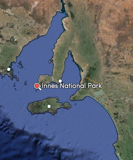
Our first activation for Sunday morning (29th March 2015) was the Leven Beach Conservation Park (CP), which is located just north of the little town of Corny Point on the Yorke Peninsula, and about 258 km by road from Adelaide.

Screenshot 2015-04-08 09.16.34

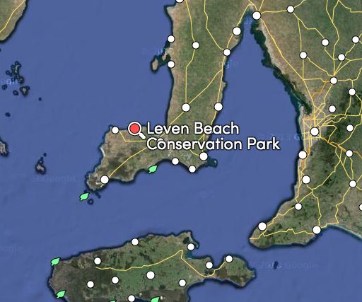
Above:- The location of Leven Beach CP.  Map courtesy of mapcarta.com

We last activated the Leven Beach CP back in 2013 for the 6 month anniversary of the VK5 Parks Award.  For full information on the park and details on that activation, please have a look at…..

https://vk5pas.org/2013/10/21/leven-beach-conservation-park/

Marija and I set up in the same spot as the previous activation which was at the end of Roe Road, on the beachfront.  Roe Road runs off the Corny Point Road and travels down passed the shacks to the beach.  At the end of Roe Road there is a carpark, with plenty of room to park.  You will clearly see the park on your right as you travel down Roe Road.

Screenshot 2015-04-08 09.16.21

Above:- Map showing my operating spot.  Map courtesy of mapcarta.com

The Leven Beach Conservation Park is 502 hectares in size and was proclaimed in 198.  It is a coastal reserve located on Hardwicke Bay, part of the northern coastline on the upper ‘foot’ of Yorke Peninsula.  It has a six kilometre beach frontage backed by low cliffs and a hinterland of undulating, vegetated dunes.  The park conserves sheoak woodland and provides habitat for a nationally endangered species of butterfly, the Yellowish Sedge-skipper Butterfly.

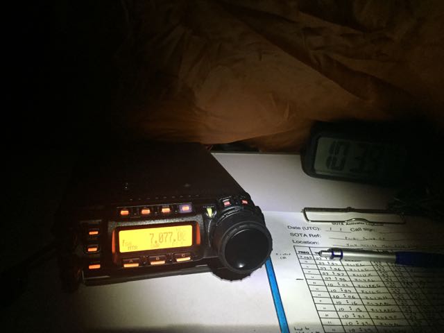
The operating gear for this activation was the Yaesu FT-857d, 40 watts and the 40m/20m linked dipole.  We set up the deck chair and the fold up table on the sand just in front of all the coastal vegetation from the park.  It was a beautiful morning weather wise.  The ocean (Spencer Gulf) was very flat and calm, and I sat back and watched a few fisherman taking their boats out into the water with their tractors, and heading off for a morning of fishing.

The Europeans were absolutely belting in on 40m with the CQ WW DX Contest, so it was quite difficult to find a clear spot on the 40m band.  Finally I found 7.092 clear and put out a CQ call and this was answered by Steve VK3NSC, followed by David VK5KC, John VK5BJE, and then Allen VK3HRA.

My first park to park contact was about 4 QSO’s later and it was with Peter VK5KX who was activating the Hogwash Bend Conservation Park in the Riverland (5/9 both ways).

My next contact was with Doug VK2FMIA who was portable in the Horton Falls National Park in New South Wales.  Doug had a nice 5/6 signal on the Yorke Peninusla.  Doug has an excellent WordPress site, which can be found at…..

http://vk2fmia.com/

It was pleasing to hear a steady flow of callers from VK1, VK2, VK3, VK5, and VK6.  And a few QRP callers as well including Peter VK3PF, and Peter VK3TKK.  I even managed to get Mike VK6MB in the log on 40m with a nice 5/8 signal (5/6 received).

While I was enjoying the sunshine and on air, Marija took a walk along the beach, and through the park, and had a chat with some of the locals.  I had one local approach me who was walking her dog on the beach, and was very curious as to what I was doing.

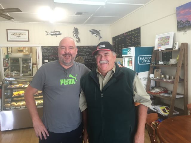
I also received a call from Yorke Peninsula local and regular park hunter, Richard VK5ZRY, and we arranged to meet at my next park, the Warrenben Conservation Park to do a joint activation.  I had spoken with Richard a number of times on the radio, but we had never met in person.  So I was looking forward to the ‘eyeball’.

This slideshow requires JavaScript.

My next park to park contact was with David VK5NQP who was portable in the Whites Dam Conservation Park in the Riverland (5/9 both ways), and then 2 QSOs later I also spoke with Chris VK4FR/5 who was portable on Kangaroo Island in the Kelly Hill Conservation Park (5/9 both ways).

I went on to work a total of 36 stations on 7.092 until things started to slow down, so I then had a quick tune around the band and found Andrew VK1NAM on SOTA peak Mount McDonald, VK1/ AC-048.

I then lowered the squid pole and took out the links and re-erected the squid pole and headed for 14.309 and started calling CQ.  This was answered by Mike VK6MB (5/8 both ways), followed by Adam VK2YK, and then Daniel VK6LCK.  But that was the end of callers, so I headed back to 40m.

My first contact upon returning to 40m was with Andy VK5AKH who was portable in the Coorong National Park on 7.098 (5/9 both ways).  I then found Andrew VK5KET on 7.092 calling CQ from the Penola Conservation Park in the South East (5/9 both ways).  And the park to park activity kept rolling on.  I next spoke with Greg VK5ZGY in the Kungari Conservation Park in the South East (5/9 both ways) on 7.085.

I put out a few CQ calls on 7.080 and was called by Tom VK5FTRG who was portable in the Gower Conservation Park in the South East (5/9 both ways).  A few QSOs later I was called by David VK5HDW who was portable in the Beachport Conservation Park in the South East.  There were certainly a lot of activators out and about in the South East of South Australia.  The SERG boys are certainly great supporters of the VK5 Parks Award.

My last contact from Leven Beach was with Chris VK4FR/5 who had now moved to the Mount Taylor Conservation Park on Kangaroo Island (5/9 both ways).

It was time to pack up and head off to the Warrenben Conservation Park and meet up with Richard VK5ZRY.

I had a total of 49 contacts in the log from Leven Beach Conservation Park.

The following stations were worked:-

  1. VK3NSC
  2. VK5KC
  3. VK5BJE
  4. VK3HRA
  5. VK5HCF
  6. VK5ZAR
  7. VK5FMID
  8. VK5KX/p (Hogwash Bend Conservation Park)
  9. VK2FMIA/p (Horton Falls National Park)
  10. VK3PF
  11. VK5FANA
  12. VK3MCX
  13. VK3FQSO
  14. VK6MB
  15. VK3PMG
  16. VK3DAC
  17. VK5ZRY
  18. VK5GY
  19. VK3TKK
  20. VK3FCOE
  21. VK2YK
  22. VK1DI
  23. VK5KLV
  24. VK2PKT
  25. VK5NQP/p (Whites Dam Conservation Park)
  26. VK5JK
  27. VK4FR/5 (Kelly Hill Conservation Park)
  28. VK3AFW
  29. VK5STU
  30. VK5MLB
  31. VK5LSB
  32. VK5TW
  33. VK5FDEC
  34. VK6KY/5
  35. VK5FJEN/m
  36. VK5AV
  37. VK1NAM/p (SOTA VK1/ AC-048)
  38. VK5AKH/p (Coorong National Park)
  39. VK5KET/p (Penola Conservation Park)
  40. VK5ZGY/p (Kungari Conservation Park)
  41. VK5FTRG/p (Gower Conservation Park)
  42. VK5HEL
  43. VK5NQP/p (Whites Dam Conservation Park)
  44. VK3VCE
  45. VK5HDW/p (Beachport Conservation Park)
  46. VK4FR/5 (Mount Taylor Conservation Park)

The following stations were worked on 20m SSB:-

  1. VK6MB
  2. VK2YK
  3. VK6LCK

References.

Department for Environment and Heritage, Management Plan Mainland Conservation Parks of Yorke Peninsula 2009

Innes National Park

From Carribie Conservation Park (afternoon of Saturday 28th March) we travelled in to the little town of Corny Point, where stopped to have lunch at the Howling Dog Tavern.  What a great name for a pub.  Marija and I had eaten here before, back in 2013, during out visit to the Yorke Peninsula for the 6 month anniversary of the VK5 Parks award.  The food is good.  And the Bundy was nice and cold.  We also did some running repairs on the Toyota Hi Lux.  One of the spot lights on the bullbar had come loose.  In fact I had lost the theft proof bolt holding it in place.  It had obviously not been tight enough and had jarred loose on the corrugated roads.

This slideshow requires JavaScript.

After lunch we took a scenic drive down to the Corny Point lighthouse and then followed the West Coast Road, stopping off regularly to view the coastline.  We highly recommend this detour.  The West Coast Road will take you all the way down to Point Annie.  From there we headed back inland along the Point Annie Road until we reached the Marion Bay Road and then travelled south.  A number of kms south, we turned right onto Browns Beach Road and headed down to Gym Beach.  The views here are truly amazing.  We travelled into the Innes National Park from here and found a little car park all to ourselves.  We set up the radio gear there, overlooking the ocean (the Spencer Gulf).

Screenshot 2015-04-07 11.35.14

Above: the location of Gym Beach on the north western side of the park.  Image courtesy of mapcarta.com

Screenshot 2015-04-07 11.35.00 Above: Our operating spot at Gym Beach, close to the ocean.  Image courtesy of mapcarta.com

Before calling CQ I had a look around the 40m band and found Andrew VK5MR calling CQ on 7.105 from the Caroona Creek Conservation Park in the Mid North.  Andrew was my first contact and my first park to park contact for this activation (5/9 both ways).  I then found Hans VK5YX operating portable from the Hallett Cove Conservation Park south of Adelaide (5/9 both ways), and then Richard VK5ZRY operating portable from the Minlacowie Conservation Park on the Yorke Peninsula (5/9 both ways).

I then went up to 7.120 and started calling CQ and this was answered by David VK5KC and Roy VK5NRG who were activating the Mark Oliphant Conservation Park in the Adelaide Hills (again 5/9 both ways).  This was followed by a contact with Mark VK5QI in the Coorong National Park.  A few QSOs later I was called by Nigel VK5NIG activating the Sandy Creek Conservation Park north of Adelaide in the Barossa, followed by Arno VK5ZAR in the Port Gawler Conservation Park, and then Greg VK5GJ and Norm VK5GI in the Mount Magnificent Conservation Park on the Fleurieu Peninsula.

But that wasn’t the end of the park to park action.  I then received a call from David VK5NQP in the Red Banks Conservation Park, followed by Tim VK3MTB/5 in the Naracoorte Caves National Park, and then Greg VK5ZGY in the Paranki Lagoon Conservation Park in the South East, Gary VK5FGRY in the Morialta Conservation Park in the Adelaide Hills, and then Peter VK5KX in the Hogwash bend Conservation Park in the Riverland.  All with 5/9 signals.  Wow, the park to park activity was great.

But wait, there’s more, as that guy who sold steak knives used to say.  I also worked Bill VK5MBD in the Clements Gap Conservation Park in the Mid North, Peter VK5FLEX in the Danggali Conservation Park in the Murray Mallee.

This slideshow requires JavaScript.

When the callers slowed down I took the opportunity of looking around the band and found Matt Vk1MA portable on SOTA peak VK2/ ST-006 (5/5 sent and 5/7 received).

I then lowered the squid pole and removed the links and headed off to 20m.  I started calling CQ on 14.346 and this was answered by Andy VK5AKH in the Coorong National Park.  And from there a steady flow of European park hunters called me from Italy, Spain, Hungary, Germany, Russia, Slovenia, France, Belgium, Slovak Republic, Austria, England, and the Czech Republic.  Thankyou to everyone that spotted me.  This clearly helped in the Europeans finding me.  I also received a call from Andrew VK1NAM amongst the European pile up.

I then headed back to 40m and called CQ on 7.115 and my first taker there was another park to park contact, Andrew VK5MR this time in the Mokota Conservation Park.  Soon after this was followed by another park to park, this time with Ian VK5CZ activating the Spring Gully Conservation Park up in the wine growing region of the Clare Valley.  A handful of QSO’s later, Arno VK5ZAR gave me a shout from the Port Gawler Conservation Park.

But perhaps the highlight of the activation for me, was a contact with Peter VK3YE who was operating true QRP, 100 milliwatts.  Peter’s signal was weak (5/3) as you would expect, but perfectly readable.  Amazing what you can do with QRP!

This was another successful activation, with a 72 contacts in the log on 40m and 20m SSB in 2 & 1/2 hours.

The following stations were worked:-

  1. VK5MR/p (Caroona Creek Conservation park)
  2. VK5YX/p (Hallett Cove Conservation Park)
  3. VK5ZRY/p (Minlacowie Conservation Park)
  4. VK5KC/p (Mark Oliphant Conservation Park)
  5. VK5NRG/p (Mark Oliphant Conservation Park)
  6. VK5QI/p (Coorong National Park)
  7. VK5BW
  8. VK5NIG/p (Sandy Creek Conservation Park)
  9. VK5ZAR/p (Port Gawler Conservation Park)
  10. VK5GJ/p (Mount Magnificent Conservation Park)
  11. VK5GI/p (Mount Magnificent Conservation Park)
  12. VK3ARR
  13. VK5NQP/p (Red Banks Conservation Park)
  14. VK3MTB/5 (Naracoorte Caves National Park)
  15. VK5ZGY/p (Paranki Lagoon Conservation Park)
  16. VK5FGRY/p (Morialta Conservation Park)
  17. VK5LSB
  18. VK5KX/p (Hogwash bend Conservation Park)
  19. VK5FPAC
  20. VK5FMJC
  21. VK5MBD/p (Clements Gap Conservation Park)
  22. VK5FMID
  23. VK5AV
  24. VK5BB
  25. VK5HEL/p
  26. VK5FLEX/p (Danggali Conservation Park)
  27. VK5BJE
  28. VK3OHM
  29. VK3PF
  30. VK3JP
  31. VK3PMG
  32. VK1MA/2 (SOTA VK2/ ST-006)
  33. VK5MR/p (Mokota Conservation Park)
  34. VK5FBFB
  35. VK5FANA
  36. VK5CZ/p (Spring Gully Conservation Park)
  37. VK5TD
  38. VK3TAL
  39. VK3AV
  40. VK5FUZZ
  41. VK5KPR
  42. VK5JDS
  43. VK5APR
  44. VK5ZAR/p (Port Gawler Conservation Park)
  45. VK3TKK
  46. VK5KX/p Hogwash Bend Conservation Park)
  47. VK3FLCS
  48. VK7FGGT
  49. VK7NWT
  50. VK3YE/p (qrp 100mw)
  51. VK2PKT

The following stations were worked on 20m SSB:-

  1. VK5AKH/p (Coorong National Park)
  2. IK1GPG
  3. EA2KV
  4. I5FLN
  5. VK1NAM
  6. HA6OB
  7. DL2ND
  8. DL1EBR
  9. RA3PCI
  10. S52KM
  11. F1BLL
  12. DL4PT
  13. EA3RP
  14. DL6NDW
  15. DK4RM
  16. ON7AB
  17. OM7OM
  18. OE3PRU
  19. G0RBD
  20. F2YT
  21. OK1ES


Carribie Conservation Park

On Saturday morning, 28th March, Marija and I awoke to the sounds of noisy galahs and a beautiful sunrise.  We cooked up a hot breakfast of bacon and eggs, and enjoyed a nice hot cup of coffee and sat outside on the verandah of the old Post Office at Inneston, taking in the view.  We then packed the 4WD and got on the road and headed for my first proposed activation of the day, Point Davenport Conservation Park.  However, everything went downhill from here.

This slideshow requires JavaScript.

We could not find the park.  In fact we drove around aimlessly for numerous hours trying to find our way in.  What we did find was that the GPS in the Toyota Hilux and the mapping system on our i-phones were unreliable.  Many roads were marked on the maps, but when we reached that particular location, no road existed.  Also, a number of the roads had totally different names on the actual road sign, to what appeared on the maps.  And many marked roads were obviously Government roads that were now either very poorly maintained dirt tracks that were fenced off, or totally covered in scrub.  The upshot was that we just could not get into Point Davenport.  The closest we got would have been a few kms, and we were not sure whether we would have to walk across private property, so we cancelled this activation.

Instead we headed for my 2nd planned activation, the Caribbie Conservation Park, which is located south of Corny Point and about 266 km by road from Adelaide.  The park is 19.5 hectares in size and was gazetted in 1972.  It is located beneath the ‘toe’ of the Yorke Peninsula.  It contains a small area of remnant sheoak and mallee vegetation.  The park’s vegetation comprises of open scrub dominated by Coastal White Mallee and Red Mallee.  It has an understorey that includes Acacia and Correas.  Some sections of the park also contain Drooping Sheoak woodland.  There are 81 native plant species recorded from this park.  The only known species of conservation significance is the Western Dady-long-legs.  Carribie is native aboriginal meaning ’emu flat’.  And there are certainly plenty of emus down here at the bottom of the Yorke Peninsula.

Screenshot 2015-04-07 09.45.18

Map courtesy of mapcarta.com

Marija and I travelled along the Marion Bay Road and then turned right onto Gleesons Road.  The park was a few kms up on our right.  We set up just over the fenceline, just to the east of Rockleigh Road.  This is in the south western corner of the park.  The last time we activated the park we were set up in the south eastern corner of the park.

For more information on my initial activation back in 2013, please see…..

https://vk5pas.org/2013/10/21/carribie-conservation-park/

Screenshot 2015-04-07 09.45.46


Map courtesy of mapcarta.com

What was very pleasing about this particular activation was the lack of flies.  When we activated this park back in 2013, the bush flies were out in force and it was almost impossible to be out in the open without a head netting.  But this time around, they were few and far between I am pleased to report.

As per usual, for this activation I ran the Yaesu FT-857d, 40 watts and the 40m/20m linked dipole, supported on the top of my 7 metre telescopic squid pole.

Unlike the previous night’s activation at the Innes National Park, there was absolutely no noise at all on the band here in Carribie.  It was dead quiet.  I called CQ on 7.095 and this was immediately answered by Adrian VK5FANA who was portable on the western side of the Yorke Peninsula in the Bird Islands Conservation Park.  Not a bad start, a park to park contact.  This was followed by Tim VK5AV at Mount Gambier, and then another park to park contact, this time with Tom VK5FTRG who was portable in the Reedy Creek Conservation Park in the South East.  Signals were very good and the 40m band seemed to be in very good condition.

My next park to park contact was with David VK5NQP who was portable in the Mid North of South Australia in the Mokota Conservation Park (5/9 both ways).  This was immediately followed by another park to park contact, with Peter VK5PET operating portable in the Bullock Hill Conservation Park on the Fleurieu Peninsula, south of Adelaide (also 5/9 both ways).  And this was followed by a call from Arno VK5FO in the Angove Conservation Park in the north eastern suburbs of Adelaide (5/9 both ways), and then David VK5AAH portable in the Cleland Conservation Park in the Adelaide Hills.  David was also doing a Summits on the Air activation from Mount Lofty, VK5/ SE-005 (5/9 both ways).

This slideshow requires JavaScript.

A few QSO’s later I was called by Richard VK5ZRY who was portable in the Ramsay Way Conservation Park on the eastern side of the Yorke Peninsula (5/9 both ways as you would expect).

I had a steady flow of callers from VK3 and VK5, and I was then called by Tim VK3MTB who was portable in the Grampians National Park in western Victoria.  Tim was on his way to South Australia to activate some VK5 Parks for the anniversay weekend.  As was the case with the VK5 activators, Tim had a lovely 5/9 signal from the Grampians.

About half a dozen QSOs later, I had my eighth VK5 Park to Park contact in the log from Carribie.  This time it was with Greg VK5ZGY who was operating portable from the Martin Washpool Conservation Park in the Mallee (5/9 both ways).  And what an interesting history that park has.  It is named after Malachi Martin, who was convicted murderer.  For more information please see…..

https://vk5pas.org/2013/09/12/martin-washpool-conservation-park/

A few QSOs later I was called by Chris VK4FR/5 who was portable on Kangaroo Island in the Beyaria Conservation Park (5/9 both ways).

When things started to slow down a little, I took the opportunity of QSYing from 7.095 and tuning around the 40m band.  I found Tony VK3CAT calling CQ on 7.100 from SOTA peak Basalt Knob, VK3/ VE-074 (5/7 both ways).

I then propped on 7.090 and called CQ and this was answered by Mike VK6MMB (5/2 sent and 4/8 received).  This was my first VK6 park hunter for Carribie.  Mark VK5QI then called in from the Coorong National Park with a very strong 5/9 signal.  Next up was Matt VK1MA, my first VK1 hunter.  I went on to work a further 3 VK5 stations, before lowering the squid pole and removing the links in the dipole, so I could operate on 20m.

I put out numerous CQ calls on 14.314 but there were no takers.  I had no phone coverage so I was unable to spot myself on parksnpeaks.  But my CQ call was finally answered by Dane VK2LDF (5/9 both ways), followed by Wayne VK3XF and then Brian VK3BBB.  But this was the end of callers on 20m, so I headed back to 40m.

First up I worked Tom VK5FTRG who was portable in the Furner Conservation Park (5/9 both ways).  Tom was calling CQ on 7.090.  I then settled on 7.095 and called CQ and this was answered by Peter VK3TKK, followed by Nick VK3ANL, and then Mick VK3PMG.  Peter, Nick and Mick are all very active park activators and hunters.  I then bagged my 13th park to park contact, this time with David VK5NQP, who had now moved to the Caroona Creek Conservation Park in the Mid North of South Australia.

Again, when things slowed down, I cruised around the band and found David VK5HDW calling CQ on 7.060 with a very very big signal, from the Lake Frome Conservation Park in the South East.  David was certainly the strongest activator signal on the band.

I then went back to 7.095 and put out a few final CQ calls and worked a further 8 stations, including another two park to park contacts.  The first was with Tony VK5ZAI who was portable in the Mount Scott Conservation Park in the South East (5/9 both ways), and then Tony VK3VTH/5 who was portable in the Far North of South Australia in the Gammon Ranges National Park (5/9 sent and 5/7 received).  My last caller was Ron VK3JP, who is a regular park hunter.

Whilst I was activating, one of the locals arrived at the scene.  He had seen our 4WD parked on the side of the road and wanted to check on our welfare.  But it was clear that this old fella also liked a chat.  Whilst I hid behind the radio, Marija spoke to this old timer for over an hour, even being introduced to his dog Molly on the back of the Ute.  And the local Constabulary also arrived.  They had a report of a crashed car a little further up the road, which we went to have a look at after we had packed up.

IMG_0949 So after about 2 and 1/2 hours in the park I had a total of 54 stations in the log.  It was time to pack up and head back to the Innes National Park.

The following stations were worked on 40m SSB:-

  1. VK5FANA/p (Bird Islands Conservation Park)
  2. VK5AV
  3. VK5FTRG/p (Reedy Creek Conservation Park)
  4. VK3AFW
  5. VK3FQSO
  6. VK5TN/m
  7. VK4FR/5
  8. VK5NQP/p (Mokota Conservation Park)
  9. VK5PET/p (Bullock Hill Conservation Park)
  10. VK5FO/p (Angove Conservation Park)
  11. VK5AAH/p (Cleland Conservation Park & SOTA VK5/ SE-005 Mt Lofty)
  12. VK3JAP/m
  13. VK5ZRY/p (Ramsay Way Conservation Park)
  14. VK5GJ
  15. VK3ARR
  16. VK3PF
  17. VK3OHM
  18. VK3MTB/p (Grampians National Park)
  19. VK5ZAR
  20. VK5FMID
  21. VK5JK
  22. VK5SFA
  23. VK5HEL
  24. VK5HCF
  25. VK5ZGY/p (Martin Washpool Conservation Park)
  26. VK3DAC
  27. VK3JP
  28. VK4FR/5
  29. VK3CAT/p (SOTA Basalt Knob VK3/ VE-074)
  30. VK6MMB
  31. VK5QI/p (Coorong National Park)
  32. VK1MA
  33. VK5FBFB
  34. VK5KAA
  35. VK5FMJC
  36. VK5FTRG/p (Furner Conservation Park)
  37. VK3TKK
  38. VK3ANL
  39. VK3PMG
  40. VK5NQP/p (Caroona Creek Conservation Park)
  41. VK5STU
  42. VK5TD
  43. VK5HDW/p (Lake Frome Conservation Park)
  44. VK5IS
  45. VK5MBD
  46. VK5FBUD
  47. VK5TR
  48. VK5ZAI/p (Mount Scott Conservation Park)
  49. VK5APR
  50. VK3VTH/5 (Gammon Ranges National Park)
  51. VK3JP

The following stations were worked on 20m SSB:-

  1. VK2LDF
  2. VK3XF
  3. VK3BBB


References.

Department for Environment and Heritage Management Plan, Mainland Conservation Parks of the Yorke Peninsula 2009


Innes National Park VKFF

My first park activation for the 2nd year anniversary was the Innes National Park, on Friday 27th March 2015.  Marija and I had a 315 km drive ahead of us from the Adelaide Hills down to the bottom of the Yorke Peninsula.  We initially drove through the bushfire devastated area of the Mount Lofty Ranges ‘Adelaide Hills’.  This is the area around Kersbrook which was severely affected by the bushfires back in January 2015, with 30 homes being destroyed.  We were very pleased to see a lot of regrowth with the scrub, but there is a long, long way to go.

We continued north on to the little town of Ardrossan on the western side of the Yorke Peninsula.  Ardrossan is a beautiful little town of about 1,200 people, which faces the Gulf St Vincent.  Prior to arriving there, Marija and I had arranged to meet Adrian VK5FANA at the local cafe.  Adrian is a very keen park activator and hunter.  I had spoken with Adrian many times on air, but I had never met him in person.  So we headed for the ‘Stump Jump Cafe’ in the main street of Ardrossan.

IMG_0831

After having a coffee and a morning hotdog, and a chat with Adrian, we had a quick look around Ardrossan.  I mentioned the ‘Stump Jump Cafe’ above.  I hear you saying now, ‘what a strange name for a cafe’.  Well it was named after the stump jump plough.  Ardrossan was the home of Clarence Smith’s plough factory where he manufactured the stump jump plough between 1880 to 1935,  This South Australian invention was vital in opening mallee country throughout Australia to the plough.  Ploughing was difficult using a single furrow plough.  These were satisfactory where land had been adequately cleared, but were mallee roots and rocks were found, the ploughs would jump off course.  In 1876, Richard Bowyer Smith was ploughing on his farm when one of the bolts on the plough broke.  He discovered that it worked much better as it rode over the stumps.  This accident produced the concept of the stump jump plough.  If you would like some more information on this very unique South Australian invention, have a look at…..

http://en.wikipedia.org/wiki/Stump-jump_plough

IMG_0838

After leaving the town of Ardrossan, we took the quick detour up to the dolomite mine lookout where we enjoyed some great views of Ardrossan and along the coastline.  We then hit the road again and continued south down the Yorke Peninsula.

This slideshow requires JavaScript.

Our next stop was the little inland town of Minlaton which is another very interesting little town on the Yorke Peninsula.  Minlaton has a population of about 800 people and is known as the “Barley capital of the world”.  Minlaton was the home town of Harry Butler, a World War flying ace, who also flew an air mail run from Adelaide across Gult St Vincent to Minlaton back in 1919.  His mail run was the first over-water flight in the Southern Hemisphere.  Butler’s Bristol M1C monoplane has been restored and is on display in the town.  There is also a wildlife park here which is worth a look, which is exactly what we did, whilst we had morning tea.  We also called in to the Minlaton Tourist Information Centre which is located in the old Harvest Corner building, which was originally a fuel and fodder store, and a saddlery.  The building later became the district’s main shoe store, and in the 1930’s a cafe and delicatessen.

This slideshow requires JavaScript.

We then headed down to Yorketown, a small town of about 685 people, again with a very interesting history.  Yorketown was built on the junction of five roads, and this rather unique junction remains today.  Many of the original buildings exist, including the Yorke Hotel built in 1876, and the Melville Hotel built in 1872.  Here is how the intersection looks today…..

IMG_0876

And here is how the intersection looked at the turn of the century…..

B42056-1


Image courtesy of the State Library South Australia.

After leaving Yorketown, we continued south through the town of Warooka and then on to Marion Bay, which is the gateway to the Innes National Park.  Marion Bay is set at the foot of the Yorke Peninsula and has some excellent surf and fishing beaches.  It is a very popular tourist destination and its population swells during the holiday periods.

Screenshot 2015-04-06 22.15.47

Above:- the lcoation of Innes National Park.  Image courtesy of mapcarta.com

We drove into the park and after a short photo stop, we headed for the Innes National Park Tourist Centre, where we needed to collect our accomodation key.  Marija and I had visited Innes back in 2013 for the 6 month anniversary of the parks award, and we had fond memories of the park and the visitor centre which had quite a bit to see.  However we were saddened to see that the Visitor Centre was closed ‘Until Further Notice’.  Now, I normally do not like getting political.  But I am going to here.  Innes National Park is one of the most popular park in South Australia, with tens of thousands of visitors each year.  And the Visitor Centre would not have been cheap to construct.  And here it is closed until further notice.  My own personal experience with DEWNR is that they are sadly lacking in funds.  All I can say is that the South Australian State Government should hang their head in shame.

This slideshow requires JavaScript.

And further, to enter the park, you are no longer blessed with a friendly ‘ranger’ to provide you with a permit and advice on where to go and what to see.  Now you book on line prior to entry to the park.  Clearly a cost cutting exercise.  Recently whilst up at the Mount Remarkable National Park, we were viewing an information board at the entrance to the park, when a Victorian couple drove in and asked us where they were to pay.  We told them about the on-line booking system, and because there was no internet coverage, they drove off.  Perhaps our friends in Parliament are trying to disuade visitors to our parks?  See the interesting story below about visitors to Innes.

http://www.adelaidenow.com.au/news/new-park-rules-deter-visitors-to-innes-national-park/story-e6frea6u-1226550718598

Enough of the negative comments.  As we drove towards Inneston, there were some spectacular photo opportunities.  Initially we took a detour to Stenhouse Bay to view the historic jetty and the beautiful blue waters of the Bay.  We then headed to the Cape Spencer lighthouse, and also enjoyed the amazing views of Chinamans Hat Island, Cable Bay, Althorpe Islands, and across the water to Kangaroo Island.

This slideshow requires JavaScript.

After settling in at the old Post Office, Marija helped me set up my radio gear.  Initially I set up my station at the back of the Post Office as it was a nice sheltered and enclosed area, but after turning on the radio I was saddened to hear that the noise floor was S8.  It was pretty much impossible to operate, so down came the antenna and I moved location, amongst the scrub, about 30 metres from our accommodation, close to some of the Inneston ruins.  Unfortunately the noise level was not much better.  Nearby was an ETSA power line running through the park, to supply power to the accomodation.  I suspect this is where the noise was coming from.

I called CQ on 7.088 and this was answered by park stalwart, Peter VK3TKK who was mobile (5/9 both ways).  This was followed by Doug VK2FMIA who was portable in the Somerton National Park, VKFF-607, in New South Wales (also 5/9 both ways).  So despite the high noise I was experiencing, the band seemed to be in very good condition.

A few calls later I was called by my first VK5 park for the weekend, Chris VK4FR/5 who was in the Dudley Conservation Park, VKFF-809, on Kangaroo Island OC-139.  Chris had a great 5/9 signal.  Chris was not to be my last park to park contact for this activation.  About 15 QSO’s later I was called by Greg VK5ZGY who was portable in the Mount Boothy Conservation Park in the Mallee region of South Australia.  Greg also had a nice 5/9 signal.

About a dozen contacts later I was called by Glenn VK6KY/5 who was mobile at Moonta at the top of the Yorke Peninsula.  I found out that Greg was travelling with a group of other VK6 amateurs and their wives, and in fact they had been at Inneston earlier in the day and had been standing right outside the old Post Office, reading the information board.  It is a small world.

Soon after I took a break for dinner, and when I returned my second caller was Steve VK5RU.  I was quite surprised when Steve told me that many years earlier he had lived at Inneston.  What is the chance of that?  A VK6 who had visited this remote location earlier in the day, and now an amateur who had actually lived at Inneston.  It was starting to get dark after quite a beautful sunset, and the Tamar wallabies were out in force.  Tamar wallabies were classed as extinct in the Australian wild until recently, and have now been reintroduced to Innes National Park.


This slideshow requires JavaScript.

I went on to work a dozen or so VK3, VK5 & VK7 stations, and I was then called by Owen ZL2OPB in New Plymouth on the South Island of New Zealand (5/9 both ways).

At about 0935 UTC (8.05 p.m.) I headed off to 7.130 for the 7130 DX Net, run by Roy VK7ROY.  I worked a total of 15 stations on the Net including William FO5JV in French Polynesia, John ZL2BH in Blenheim, and Brian ZL2ASH in Wellington.

Following the net, I headed to 7.135 and called CQ and this was answered by Mike VK3AUR, followed by Dennis VK5LDM with a huge signal.  I worked a further 3 stations, until I decided it was time to head inside and enjoy a bottle of red.

I had a total of 69 contacts on 40m SSB which I was very pleased with.

The following stations were worked on 40m SSB:-

  1.  VK3TKK/m
  2. VK2FMIA/p (Somerton National Park)
  3. VK3PF
  4. VK5EE
  5. VK5GJ
  6. VK5FANA
  7. VK5KLV
  8. VK4FR/5 (Dudley Conservation Park)
  9. VK4CPS
  10. VK5ND
  11. VK7NWT
  12. VK5FMID
  13. VK5FLEX
  14. VK3FQSO
  15. VK2YK
  16. VK5KPR
  17. VK3OHM
  18. VK5NAQ
  19. VK2LEE
  20. VK3FLCS
  21. VK5BMC
  22. VK3DAC
  23. VK3FMOL
  24. VK5ZGY/p (Mount Boothby Conservation Park)
  25. VK1DI
  26. VK3PMG
  27. VK5ZAR
  28. VK3VIN
  29. VK5CZ
  30. VK5NPP
  31. VK5HOS
  32. VK5GW
  33. VK3FSPG
  34. VK5FTRG/m
  35. VK3ANL
  36. VK6KY/5
  37. VK5YX
  38. VK5WG
  39. VK5FADS
  40. VK7VAZ
  41. VK5RU
  42. VK5FDEC
  43. VK3JP
  44. VK5JK
  45. ZL2OPB
  46. VK4NAI/p
  47. VK5ZRY/m
  48. VK3HK/5
  49. VK3KHZ
  50. VK5PET
  51. VK5TR
  52. VK2HFS
  53. VK3ADD
  54. VK7XX
  55. FO5JV
  56. ZL2BH
  57. VK6LCK
  58. VK2PKT
  59. VK3FMHY
  60. ZL2ASH
  61. VK7VEK
  62. VK5FAKV
  63. VK1AT/3
  64. VK5FMID
  65. VK3AUR
  66. VK5LDM
  67. VK7FGGT
  68. VK5WG
  69. VK5SFA


References.

Wikipedia, 2015, <http://en.wikipedia.org/wiki/Ardrossan,_South_Australia&gt;, viewed 7th April 2015

Wikipedia, 2015, <http://en.wikipedia.org/wiki/Minlaton,_South_Australia&gt;, viewed 7th April 2015

2nd year anniversary VK5 Parks Award

The weekend of Saturday 28th & Sunday 29th March 2015, was the special activation weekend for the 2nd anniversary of the VK5 National and Conservation Parks Award.

Screenshot 2015-04-06 21.23.04

Marija and I headed out to the Yorke Peninsula, west of Adelaide.  We stayed 3 nights (Friday, Saturday & Sunday) in the old Post office at Inneston in the Innes National Park, right down the bottom of the Yorke Peninsula.  We highly recommend this accommodation, which is run by the Department of Environment Water and Natural Resources (DEWNR).

Screenshot 2015-04-06 22.15.47 Above: – Location of Innes NP.  Image courtesy of mapcarta.com

Inneston is an old gypsum mining town and is now a ‘ghost town’.  However DEWNR have renovated a number of the old buildings, including the post office which is where we stayed.  Inneston is a very interesting place, and I will put up a separate blog all about Inneston.

This slideshow requires JavaScript.

I activated the following parks…..

Friday 27th

  • Innes National Park – 69 contacts

Saturday 28th

  • Carribie Conservation Park – 54 contacts
  • Innes National Park – 72 contacts

Sunday 29th

  • Leven Beach Conservation Park – 49 contacts
  • Warrenben Conservation Park – 29 contacts
  • Point Davenport Conservation Park – 38 contacts
  • Innes National Park – 15 contacts

Monday 30th

  • Minlacowie Conservation Park – 20 contacts

I am still awaiting some more facts and figures from some activators, but at this stage here are some preliminary stats for the weekend:

  • total of 41 activators ventured out
  • total of 111 parks activated
  • 81 unique parks (in other words different parks)
  • over 3,000 QSOs.

This exceeds the 98 park activations from last year’s, 1st anniversary weekend.

I would like to personally thank all of the activators, and especially to Tony VK3VTH and Tim VK3MTB who crossed the border into South Australia and conducted multiple activations here in VK5.

And also thank you to all the park hunters.

Coorong NP and the John Moyle Field Day 2015

For the 2015 John Moyle Memorial Field Day Contest I headed down to Parnka Point at the Coorong National Park, about 170 km south east of Adelaide.

The Coorong National Park qualifies for the World Wide Flora and Fauna program (it is VKFF-115) and also qualifies for the VK5 National and Conservation Parks Award.

Screenshot 2015-03-23 12.17.09

Map courtesy of wikimapia

The park’s name is thought to be a corruption of the local aboriginal word kurangh, meaning ‘long neck’, which is a reference to the shape of the lagoon system.  The name is also thought to be from the Aboriginal word Coorang, “sand dune”, a reference to the sand dunes that can be seen between the park and the Southern Ocean.

More information on the Coorong National Park can be found at…..

http://www.environment.sa.gov.au/parks/Find_a_park/Browse_by_region/Limestone_Coast/Coorong_National_Park

Screenshot 2015-03-23 12.16.48  map courtesy of wikimapia

I drove to the end of Parnka Point and set up in a little shelter shed on the western side of the point.  Parnka Point is  the narrowest part of The Coorong as the water is less than 100 metres wide.  Parnka Point is where the northern and southern lagoons of The Coorong meet each other.  The water at this point is often referred to as Hells Gate.

The northern lagoon is partly fed by the waters of the River Murray, and varies in salinity from brackish to hyper saline.  In contrast the southern lagoon is always hyper saline.  While this narrow channel often appears calm, a change in wind direction or water levels can create treacherous currents through this narrow but deep channel.

Parnka Point was a significant meeting site for the five aboriginal tribes that formed the Ngarrindjeri clan.  Parnka is a Ngarrindjeri word meaning ‘sandy beach’.  As you look out across the lagoon, you can see wooden poles in the seater.  These are the remains of a ferry built last century to access the Younghusband Peninsula.

It was a very beautiful outlook, overlooking the lagoons.  The weather was sensational…..28 degrees C.

Screenshot 2015-03-23 12.19.18

map courtesy of mapcarta.com

I took part in the 6 hour section and I managed a total of 238 contacts.  Most of those were on 40m SSB (222), but I did squeeze in 26 on 20m SSB.  Most of the contacts on 20m were with other VK’s, but a few Europeans and Japanese gave me a call, and exchanged numbers.  They were obviously aware of the JMMFD.

For the contest I used my Yaesu FT-857d and 40 watts on 40m and 80 watts on 20m.  The antenna was a 40m/20m linked dipole supported by a 7 metre telescopic squid pole (inverted vee).  The radio was powered by a 44 amp hour power pack(2 x 22 amp hour SLAB batteries) which I topped up with the use of some solar panels.

I used my laptop for this activation and Mike’s VK Contest Log.  But the inverter which I had purchased to connect the laptop to via the power pack, threw off S8 noise.  So I had to take some breaks from the radio, to charge the laptop.

I probably ‘gasbagged’ a bit for the first few hours, telling people a bit about my location and what equipment I was using.  This is what I like about the JMMFD.  You can take it easy or take it very seriously.

At tea time, I sat back and enjoyed the magnficent sunset and a glass or 2 of red with my evening meal.  And then back into it until about 9.00 p.m. SA local time when I packed up and headed home.

This slideshow requires JavaScript.

Charleston Conservation Park

Friday the 13th March 2015 was another ‘Summer’ activation event, so I headed over to the Charleston Conservation Park (CP), which was recently added to the World Wide Flora Fauna (WWFF) program.  Charleston CP is now allocated as VKFF-777.

Charleston CP is located about 46 km east of Adelaide.  It is located near the little township of Charleston.  The town was named after Charles Newman, who left Sommersetshire in England in July 1837 under engagement to the South Australian Company as a shepherd.  In 1843 he took up land in the vicinity of Mount Charles and built a home there.  To this day, the Newman homestead remains on Newman Road at Charleston.

main

I managed to find a video of the homestead, from Adcock Real Estate when it was up for sale back in 2012.

And here is an extract from The Advertiser, Wednesday 3rd October 1990 re the death of Newman.

Screenshot 2015-03-23 11.37.20

I have activated Charleston CP a number of times previously, but this was the first time I had activated the park as part of WWFF, so it was quite exciting.

For more information on my previous activations, click on the links below…..

https://vk5pas.org/2015/01/12/charleston-conservation-park-3/

https://vk5pas.org/2014/04/28/charleston-conservation-park-2/

https://vk5pas.org/2013/07/24/charleston-conservation-park/

Screenshot 2015-03-20 20.32.54

Above: Map showing the location of Charleston Conservation Park in the Adelaide Hills.  Map courtesy of mapcarta.com

Charleston CP is just a short distance from my home.  It is a very pleasant drive through Nairne, and on towards Woodside.  I then travelled along Pfeiffer Road passed the Country Fire Service Air base.  Six (6) single engine AT802 ‘Air Tractors’ are based at Woodside.  These aircraft are manufactured by Air Tractor Inc in the United States and have a cpacity to carry 3,200 litres of water/fire retardant.  A number of helicopters are also based at Woodside.

This slideshow requires JavaScript.

I set up just inside Gate 1 on Bell Springs Road, at the north western corner of the park.  There is another entrance to the park at the north eastern corner, however it is a little heavier wooded at that location.  So I chose to set up at Gate 1 again as per my previous activations.  This is a track here which runs along the northern boundary and another track which runs along the eastern boundary.  The scrub is quite thick, so I walked about 30 metres inside the boundary fence and found a clearing and set up the 40m/20m linked dipole, my deck chair and fold up table.  For this activation I again ran the Yaesu FT-857d at 40 watts.

Screenshot 2015-03-20 20.33.38

Above: Map showing my operating spot in the park.  Map courtesy of mapcarta.com

This slideshow requires JavaScript.

My first contact was with Andrew VK1NAM who was portable on SOTA peak Isaacs Ridge, VK1/ AC-041.  Andrew had a nice strong 5/8 signal coming in from eastern outskirts of Canberra.

After working Andrew I tuned around the 40m band and found my first VK5 Park.  It was John VK5BJE who was portable in the Scott Creek Conservation Park, another recently added park to the WWFF program.  John had a very good 5/9 signal coming in from Scott Creek CP, VKFF-788.

I then found Arno VK5ZAR on 7.105.  Arno was in the Ferguson Conservation Park in the eastern suburbs of Adelaide near the foothills of the Mount Lofty Ranges.  Arno was running QRP 5 watts and a linked dipole and had a strong 5/9 signal.  Arno is one of the regulars who always gets out on a Friday evening.

I then tuned up the band and found Peter VK5FLEX calling CQ on 7.115 from the Pike River Conservation Park near Renmark in the Riverland region along the Murray River.  Peter has recently been bitten by the ‘parks bug’ thanks to Larry VK5LY.

My next park contact was with Geoff VK5HEL who was portable in the Ettrick Conservation Park in the Murray Mallee.  Ettrick CP is a recently gazetted South Australian Conservation Park.  Geoff has also recently become a regular park activator.

I then spoke with Peter VK5PET who was operating from the Ferries McDonald Conservation Park in the Murray Mallee.  I was very pleased to make contact with Peter as this was his first ever park activation.  Well done on getting out there Peter.

I then propped on 7.110 and started calling CQ.  It wasn’t long before I had a small pile up of ever keen park hunters.  My first taker was Peter VK5KPR, followed by Doug VK2FMIA who was in the Horton Falls National Park, VKFF-594.  If you would like to see Doug’s excellent blog and read about his activation at Horton Falls, please click on the following link….

http://vk2fmia.com/2015/03/15/horton-falls-national-park-vkff-594-2/

A few QSOs later I was called by David VK5NQP who was operating portable from the Cromer Conservation Park near Birdwood in the Adelaide Hills.  And a number of QSOs later I was called by Les VK5KLV in the Mount Remarkable National Park in the north of South Australia.

When things got a little quiet, I tuned around the band and found Adrian VK5FANA operating portable from the Bird Islands Conservation Park on the Yorke Peninsula.  Adrian was running QRP, just 5 watts, but nether less had a beautiful 5/9 signal.  Adrian is another amateur who has recently renewed his interest in the hobby by activating from South Australian parks.  It is great to see the Foundation calls getting involved.

I then settled on 7.100 and started calling CQ and this was answered by Gordon VK5GY who was operating portable from the Kenneth Stirling Conservation Park in the Adelaide Hills.  Gordon was also running QRP 5 watts and was a good strong 5/8-9 signal.

I worked a further 6 stations in VK2 and VK5, but when things slowed down a little I took the time to try 20m but conditions there were not at all good.  I put out a number of CQ calls but had no takers.

So I headed back to 40m and put out a CQ call on 7.105 and this was answered by Brian VK5FMID in Mount Gambier, followed by Adam VK2YK with a very strong 5/9 signal, and then Rob VK4FFAB.  A steady flow of callers from VK3, VK4, & VK5 followed.  I spoke with Peter VK3PF who advised that there was a VK6 SOTA station a bit further up the band on 7.130.

So I headed up to 7.130 where I made contact with Phil, VK6ADF who was portable on SOTA peak Mount Desmond, VK6/ SG-011, north of Hopetoun in Western Australia.  Phil was quite a good signal, however there were some Japanese stations on frequency which caused me to loose the occasional word (4/6 sent and 5/7 received).

I then returned back down the band to 7.105 where I spoke with Colin VK4FAAS and Mike VK6MB.

This slideshow requires JavaScript.

At 0936 UTC (7.06 p.m. South Australian local time) I booked in to the 7.130 DX Net where I worked into VK3, VK5, VK7, French Polynesia, and New Zealand.

Whilst I was on the net, the sun was setting in the west, and the native bats had come out.  There were a number of them flying in very close proximity to where I was set up.  I was certainly hoping that their eyesight was good as they quickly darted through the air.

This slideshow requires JavaScript.

After a few rounds on the Net I headed up to 7.150 where I put out a few CQ calls and this was responded to by Steve VK3NSC, Steve VK3FSPG, and Shaun VK5FAKV.  But despite conditions being very good, it was very quiet on the band.  So I had one final tune around the band and found Steve VK5SFA calling CQ.  Steve’s signal was very strong and was literally lifting the FT-857d off the table.

This slideshow requires JavaScript.

I was happy.  I had reached the 44 QSO threshold for the WWFF program, and had a total of 59 contacts in the log.

The following stations were worked:-

  1. Andrew VK1NAM/p (SOTA)
  2. John VK5BJE/p (Scott Creek CP)
  3. Arno VK5ZAR/p (Ferguson CP)
  4. Peter VK5FLEX/p (Pike River CP)
  5. Geoff VK5HEL/p (Ettrick CP)
  6. Peter VK5PET/p (Ferries McDonald CP)
  7. Peter VK5KPR
  8. Doug VK2FMIA/p (Horton Falls NP)
  9. Peter VK3FPSR
  10. Fred VK3DAC
  11. Marc VK3OHM
  12. Greg VK5GJ
  13. David VK5NQP/p (Cromer CP)
  14. Peter VK5NAQ
  15. Amanda VK3FQSO
  16. Garry VK2GAZ
  17. Mick VK3PMG
  18. Peter VK3PF
  19. Nick VK3ANL
  20. Ian VK1DI
  21. Les VK5KLV/p (Mount Remarkable NP)
  22. Paul VK3DBP
  23. Andrew VK3ARR
  24. Bill VK5MBD
  25. Adrian VK5FANA/p (Bird Islands CP)
  26. Gordon VK5GY/p (Kenneth Stirling CP)
  27. Peter VK2TTP
  28. Greg VK5ZGY
  29. Tom VK5EE
  30. Hans VK5YX
  31. Col VK5FCDL
  32. Ron VK5VH
  33. Brian VK5FMID
  34. Adam VK2YK
  35. Rob VK4FFAB
  36. Ian VK3VIN
  37. Tom VK5FTRG
  38. Nev VK5WG
  39. Ian VK5CZ
  40. Jim VK5JW
  41. Chris VK5FCHM
  42. Colin VK3NCC
  43. Brendon VK5FBFB
  44. Owen VK5HOS
  45. Chris VK2UW
  46. Brian VK7ABY
  47. VK6ADF/p (SOTA)
  48. Colin VK4FAAS
  49. Mike VK6MB
  50. Roy Vk7ROY
  51. Rod VK3OB
  52. William FO5JV
  53. Brian ZL2ASH
  54. Mal VK5MJ
  55. Steve VK3NSC
  56. Steve VK3FSPG
  57. Shaun VK5FAKV
  58. Steve VK5SFA
  59. Frank VK3FADI


References.

Cockburn, R, 2002, ‘South Australia.  What’s in a Name?’

Country Fire Service, 2015, <http://www.cfs.sa.gov.au/site/about/aerial_firefighting/firefighting_aircraft.jsp&gt;, viewed 23rd March 2015

Wikipedia, 2015, <http://en.wikipedia.org/wiki/Air_Tractor_AT-802&gt;, viewed 23rd March 2015

Logging contacts in the field

I have received a few queries as to how I log contacts in the field.

I use a handwritten log when I am out portable in a park or on a summit.  It is A4 in size and fits onto a plastic clip board folder.  I use a bulldog clip down the bottom to stop the paper from flapping around in the breeze.

IMG_0743

I have tried electronic logging with my laptop and my tablet.  However I find the handwritten way the easiest as I can also quickly scribble down call signs, names, and notes, etc.

I also started off using small notebooks but I soon found that these were too small in size.

When I return home I use Fast Log Entry (FLE) to enter those contacts and create an ADIF file.  I have mentioned FLE many times before, and I highly recommend it.  You can find FLE at…..

http://www.df3cb.com/fle/

I then upload that ADIF file to my electronic log which is MacLogger DX.

John M0UKD has a page on his website dedicated to printable amateur radio logbooks.  A selection of these can be found on M0UKD’s website can be found at…..  

http://www.m0ukd.com/other-stuff/printable-amateur-radio-logbooks/

Logsheet067

I have placed a copy of the sheet that I use in the Files section of the VK5 Parks Yahoo group.

Ridley Conservation Park

My second park for Sunday 8th March 2015 was the Ridley Conservation Park, which is situated about 120 km north east of Adelaide and 10km south of the little town of Swan Reach on the Murray River.

Screenshot 2015-03-11 20.53.52map courtesy of mapcarta.com

I had intended activating the Ngaut Ngaut Conservation Park on the Murray River, which would have been a unique park, but my request to access this park was declined by the Mannum Aboriginal Community Association.  I will be writing a letter seeking future access and I will keep everyone posted of progress.

So after leaving Marne Valley, I headed east out along the Black Hill Road, which follows the Marne River.  This is quite a pretty drive.  I encountered quite a few Western Grey kangaroos and a paddock of goats.  I couldn’t help but stop to take a photo of the SOTA mascots.

This slideshow requires JavaScript.

I have activated the Ridley Conservation Park a number of times previously.  For more information on those activations, please click on the links below…..

https://vk5pas.org/2013/05/11/ridley-conservation-park/

https://vk5pas.org/2014/12/07/ridley-conservation-park-2/

Ridley Conservation Park is a long narrow park.  It is 10 km in length and about 400 metres in width.  It covers an area of about 414 hectares and .  The southern boundary of the park is on the edge of the valley of the Marne River.  At this location is Hayward’s Hill, which is the highest point in the park.  The remainder of the park comprises flat country typical of the limestone plains of the Murray River.

Screenshot 2015-03-12 09.28.51


Image courtesy of National Parks and Wildlife.

The park is home to a large variety of native mammals and birdlife.  This includes the Southern Hairy-nosed Wombat, Western Grey kangaroos, Echidnas, Mallee Ringneck parrots and Mulga parrots.

The park was originally part of a Travelling Stock Reserve (TSR) which ran for roughly 5-10 kms parallel to the Murray River.  The reserve linked the stock market of Burra to the north with Murray Bridge to the south.  By 1878, the TSR became obsolete with the completion of the Morgan to Adelaide railway.  By 1901, an approach was made to the Department of Lands by local land owners to resume the TSR land and for it to be made open for allotment.  In 1901 and 1907, proposals to this effect went before Parliament but were declined.

In 1934, the then District Council of Caurnamont contacted the Director of Lands and requested that the TSR be resumed for allotment.  The council claimed tat the Reserve ‘harboured vermin’ and was a ‘drain on council funds’.  And then in 1937 further requests were made for the Reserve to be used for grazing.  Inspector Klau of the Crown Lands Department inspected the Reserve in 1939, and following his inspection, recommended that the area not be resumed.

Between 1938 to 1940 there were numerous requests to cut wood in the Reserve for charcoal burning.  One of these proposals was to clear 28 hectares of the Reserve, north of Haywards Hill.  The Ranger at the time, described the Reserve as ‘an asset to the State‘ and he declined these requests and stated that the land should remain in its uncleared condition.

During the mid to late 1950’s, following further requests, Annual Licences were granted for grazing purposes within the Reserve.

And then in 1966, land was being resumed and purchased for the purpose of National Parks.  It was at this time that the Land Board proposed that portions of the TSR ‘be retained and dedicated as a Wildlife Reserve under the control of the Commissioners of the National Parks and Wildlife Reserves at the expiration of the current Annual Licences’.

Mr. G.C. Cornwall, a field officer for the National Parks Commission, inspected the TSR and submitted the following very favourable report:

Although a long narrow strip of land such as this is not the ideal shape for a National Park, the idea of preserving natural vegetation and bird habitats by setting aside portions of the Travelling Stock Reserve is an excellent one and the area under investigation is suitable for this purpose‘.

The park was officially dedicated as the Ridley National Parks Reserve in May 1968.  It was later gazetted as the Ridley Conservation Park.

Although it is outdated (1984), there is an excellent description of the park and the history of the area in the publication entitled ‘Conservation Parks of the Murraylands (Western Plains) Management Plans’.  Please see below…..

PARKS_PDFS_CP_MURRAYLNDS_WP_MP (2)

I set up on the western side of the Murraylands Road, between Sunnydale Road and Sleeper Track.  I ran the Yaesu FT-857d, 40 watts and the 40m/20m linked dipole for this activation.

Screenshot 2015-03-11 20.54.57

map courtesy of mapcarta.com

After setting up I called CQ on 7.095 and this was answered by ever reliable parks hunter, Mick VK3PMG in Stawell in Western Victoria.  This was followed by another keen park hunter, Adrian VK5FANA, then Arno VK5ZAR, followed by Greg VK5ZGY.

The 40m band was in excellent condition and a steady flow of callers followed, from all across Australia: VK2, VK3, VK4, VK5, and VK7.  The local time was about 6.45 p.m. (0815 UTC).  There is no doubt that this is when the 40m band is at its very best.  I went on to work 32 stations around Australia.

At 8.00 p.m. local time (0930 UTC) I booked in to the 7130 DX Net where I worked a total of 6 stations including Andy VK4TH/8, William FO5JV, Gary ZL3SV, Brian ZL2ASH, and Adrian ZL1GBG.

At times the net can run a little slow, so I took the opportunity of having a quick look around the band, and I found Greg W8GAP calling CQ on 7.180.  I decided to give Greg a shout and surprisingly got through without much difficulty.  Greg was an excellent 59 signal to the park.  Initially my signal was 44, but it came up to a 55 and Greg was able to copy all of my information without any difficulty.

After a few rounds on the net I checked out, and went up to 7.135 and called CQ.  My CQ call was answered by Drew VK2FROX, followed by Ian VK3FIAN, and then Bob VK3FLAK running QRP from his EFE40 transceiver.

It was during this time that a tour bus came through, with the driver operating a spot light.  Obviously looking for native wildlife.  But what they found was some crazy guy sitting out in the middle of nowhere in a deck chair alongside a squid pole.  I wonder what the tourists were thinking?

I had one final tune around the band and found John K1GUN in Maine, calling CQ on 7.140.  I gave John a call and had a good QSO (5/9 sent and 5/5 received).

This slideshow requires JavaScript.

So after a very pleasant evening in the Ridley Conservation Park it was time to head home.  I still had an hours drive ahead of me.  I had a total of 48 contacts in the log, including some good DX QSOs on 40m.

The following stations were worked:-

  1. Mick VK3PMG
  2. Adrian Vk5FANA
  3. Arno VK5ZAR
  4. Greg VK5ZGY
  5. Tim VK5AV
  6. Peter VK5FLEX
  7. Greg VK7FGGT
  8. Gavin VK3MLU
  9. Bernard VK3AV
  10. Peter VK3PF
  11. Peter VK3TKK
  12. Andrew VK3ARR
  13. Chris VK4FR/5
  14. Fred VK3DAC
  15. Damien VK5FDEC
  16. Marc VK3OHM
  17. Les VK5KLV
  18. Rob VK4FFAB
  19. Richard VK5ZRY
  20. Doug VK2FMIA
  21. Jim VK5JW
  22. Bob VK3BWZ
  23. Matthew VK3FMDS
  24. Keith VK5FEKH
  25. Andrew VK2UH
  26. Tom VK5FTRG
  27. Kym VK5FKYM
  28. David VK5LSB
  29. Bob VK2OD
  30. David VK5HYZ
  31. Nev VK5WG
  32. Ron VK5VH
  33. Andy VK4TH/8 (Kakadu National Park)
  34. William FO5JV
  35. Gary ZL3SV
  36. Daniel VK6LCK
  37. Chris VK2UW
  38. Brian ZL2ASH
  39. Adrian ZL1GBG
  40. Greg W8GP
  41. Ted VK6NTE
  42. Drew VK2FROX
  43. Ian VK3FIAN
  44. Bob VK3FLAK
  45. Graham VK7ZGK
  46. Ron VK3JP
  47. Andrew VK3FADS
  48. John K1GUN


References.

National Parks and Wildlife Service, ‘Conservation Parks of the Murraylands (Western Plains) Management Plans’, 1984

Marne Valley Conservation Park

On Sunday (8th March 2015) I was left all alone.  My wife Marija and her mum left early that morning for 3 nights at Broken Hill.  So while the girls are away, the boy can play radio.  I headed to the Marne Valley Conservation Park, which is situated about 30 km north of Mannum, and about 10km south east of Sedan.

Screenshot 2015-03-11 19.34.32

map courtesy of mapcarta.com

I reached the park by travelling from home to the historic town of Mount Torrrens, and then through to Birdwood.  I then travelled to Cambrai, which is a little town just to the west of the park.

This slideshow requires JavaScript.

The Marne Valley Conservation Park covers an area of about 105 hectares and it is bisected by the Marne River.  The park was dedicated in 1976 and consists of gently undulating land, with much of the park comprising of low lying, seasonally inundated river red gum flats.  The surrounding countryside was cleared of most of its gum trees during the late 1880’s and a saw mill existed in the area.  The local red gum was considered ‘superior’ to many other varieties of gum for use as railway sleepers.

The park is home to a large amount of wildlife including Western Grey kangaroos and waterfowl.  It was certainly alive with kookaburras during my activation.

The Marne River which passes through the park was once part of the main Adelaide to Sydney stock route.  The River was previously known as the South Rhine River.  However, as was the case with many place names here in South Australia, the name was changed in 1917 as Australia was at war with Germany.  The River’s name was changed to Marne after the Marne River of France, where the German advance was halted in 1914.  The South Australian Marne River’s headwaters are centres around the Eden Valley and Springton areas, and it passes through Cambrain before flowing into the Murray River at Wongulla.

Prior to being called the South Rhine and then the Marne, the river was originally known by the local Ngarrindjeri aboriginal people as Taingappa, meaning ‘foot track-trading road’.  The Aborigines used the river as a route up into the hills to trade with the Peramangk aboriginal people in the Barossa Valley, and to cut bark canoes from the River Red Gums in the hills which had thicker bark than those near the Murray.

The nearby town of Cambrai was also known as Rhine Villa.  It is reported that there was once a house or hut with a comical villa front in the area and a person named Skinner occupied it and called it ‘The Villa’.  The little township grew up around it and got the name of Rgine Villa, due to the proximity of the Rhine River.  The name was changed to remove any connection with German place names and it was named after the Battle of Cambrai in France during WW1.

Last year, two elderly bushwalkers became lost in this park and a major search was launched.  See the article below….

http://www.adelaidenow.com.au/news/south-australia/police-find-two-hikers-missing-in-marne-valley-conservation-park-south-of-cambrai-in-mt-lofty-ranges/story-fni6uo1m-1227022552108

Prior to heading to the park I referred to the Marne Valley Conservation Park Management Plan which is dated 1994 and is horribly out of date.  It refers to a visitor access track running along the western boundary from the south to the picnic and camping area.  I was unable to locate this.  The gate which I did find on the southern side of the park, off Black Hill Road, was locked.  A familiar find at most South Australian Conservation Parks.  Locked gates.

I set up on the southern side of the park.  Access here is very easy.  The boundary fence is in very poor condition and can easily be stepped over.  There is even an old National Parks and Wildlife ‘Reserve’ sign on the gate which appears to have been there since the dim dark ages.

Screenshot 2015-03-11 19.34.58

Map courtesy of mapcarta.com

I set up the fold up table and deck chair and ran the Yaesu FT-857d and 40 watts for this activation.  I used the 40m/20m linked dipole supported on the 7m squid pole.  I used a wooden fence post to secure the squid pole to, with the assistance of an octopus strap.

I could not get on to my nominated operating frequency of 7.095 due to the Kandos Net still going, so I headed up to 7.105 and called CQ.  This was immediately answered by Mick VK3PMG in Stawell, followed by Phil VK5XR, Marc VK3OHM, and then Adrian VK5FANA on the Yorke Peninsula who was running QRP 5 watts (5/8 sent and 5/9 received).  I worked 9 stations in VK3 and VK5 and it then went very quiet.  So I took the opportunity of going for a 20 minute walk through the park.

After coming back from my walk I called CQ again on 7.105 and this was answered by Arno VK5ZAR, followed by Peter VK3PF and then Gary VK5PCM who was running QRP 2 watts (5/7 both ways).  I went on to work a further 18 stations in VK2, VK3, & VK5 until it slowed down again.   I tuned around the band and found Rod VK2TWR who was portable on as part of the Summits on the Air (SOTA) program.

After working Rod, I heard a few stations asking me to QSY up the band.  So I headed back to 7.105 where I was called by Bernard VK3AV, Grant VK2LX, Phil VK5RM and then Andrew VK3ARR.  I worked a further 4 stations, before deciding it was time to pack up and head off to the Ridley Conservation Park.

This slideshow requires JavaScript.

The following stations were worked on 40m SSB:-

  1. Mick VK3PMG
  2. Phil VK5XR
  3. Phil VK3OHM
  4. Adrian VK5FANA
  5. Amanda VK3FQSO
  6. Les VK5KLV
  7. Fred VK3DAC
  8. David VK5NQP
  9. Peter VK3TKK
  10. Arno VK5ZAR
  11. Peter VK3PF
  12. Gary VK5PCM
  13. Greg VK5ZGY
  14. Graham VK3DOG
  15. Gavin VK3MLU
  16. Marshall VK3MRG
  17. Rob VK4AAC/5
  18. John VK5DJ
  19. David VK5ADO
  20. Chris VK4FR/5
  21. Tim VK5AV
  22. Jeff VK5JK
  23. Ian VK3VIN
  24. Tom VK5EE/m
  25. David VK5HYZ
  26. John VK5FTCT
  27. Michael VK2KBC/3
  28. Joe VK3YSP
  29. Peter VK5FLEX
  30. Peter VK5KPR
  31. Rod VK2TWR/p (SOTA)
  32. Bernard VK3AV
  33. Grant VK2LX
  34. Phil VK5RM
  35. Andrew VK3ARR
  36. Nev VK5WG
  37. Brett VK3FLCS
  38. Andrew VK5FADS
  39. Garry VK5RN


References

Cockburn; R, ‘South Australia.  What’s in a Name?’, 1999

National Parks and Wildlife, Marne Valley Conservation Park Management Plan, August 1994

Wikipedia, 2015, Marne River, <http://en.wikipedia.org/wiki/Marne_River_%28South_Australia%29&gt;, viewed 10th March 2015.